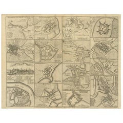
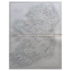
Antique Map of the Principal Towns, Ports and Harbours in Ireland by Seale, 1745
View Similar Items


Want more images or videos?
Request additional images or videos from the seller
1 of 2
Antique Map of the Principal Towns, Ports and Harbours in Ireland by Seale, 1745
About the Item
- Creator:R.W. Seale (Artist)
- Dimensions:Height: 16.46 in (41.8 cm)Width: 20.67 in (52.5 cm)Depth: 0.02 in (0.5 mm)
- Period:
- Date of Manufacture:1745
- Condition:Please study image carefully.
- Seller Location:Langweer, NL
- Reference Number:Seller: D-00681stDibs: LU305438912963
About the Seller
5.0
Platinum Seller
These expertly vetted sellers are 1stDibs' most experienced sellers and are rated highest by our customers.
Established in 2009
1stDibs seller since 2017
1,947 sales on 1stDibs
More From This SellerView All
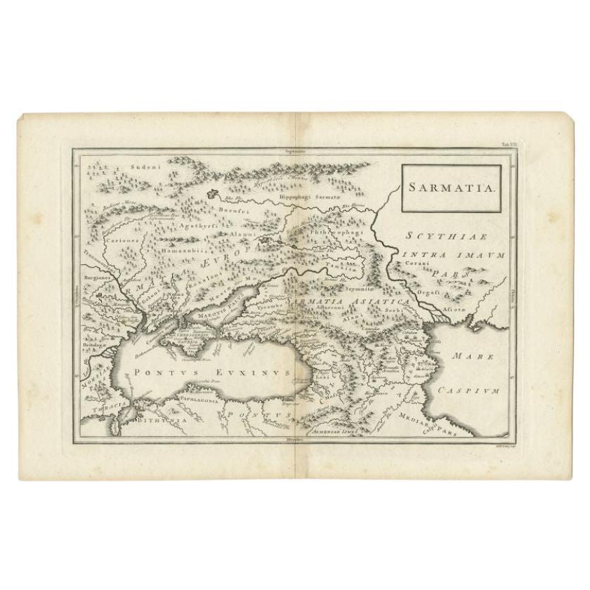
- Antique Map of the Caucasus by Seale, 1799Located in Langweer, NLAntique map titled 'Sarmatia'. Old map of the Caucasus with the Caspian and Black Sea. Originates from 'Geographia Antiqua (..)'. Artists and Engravers: Richard William Seale (1703-1...Category
Antique 18th Century Maps
MaterialsPaper
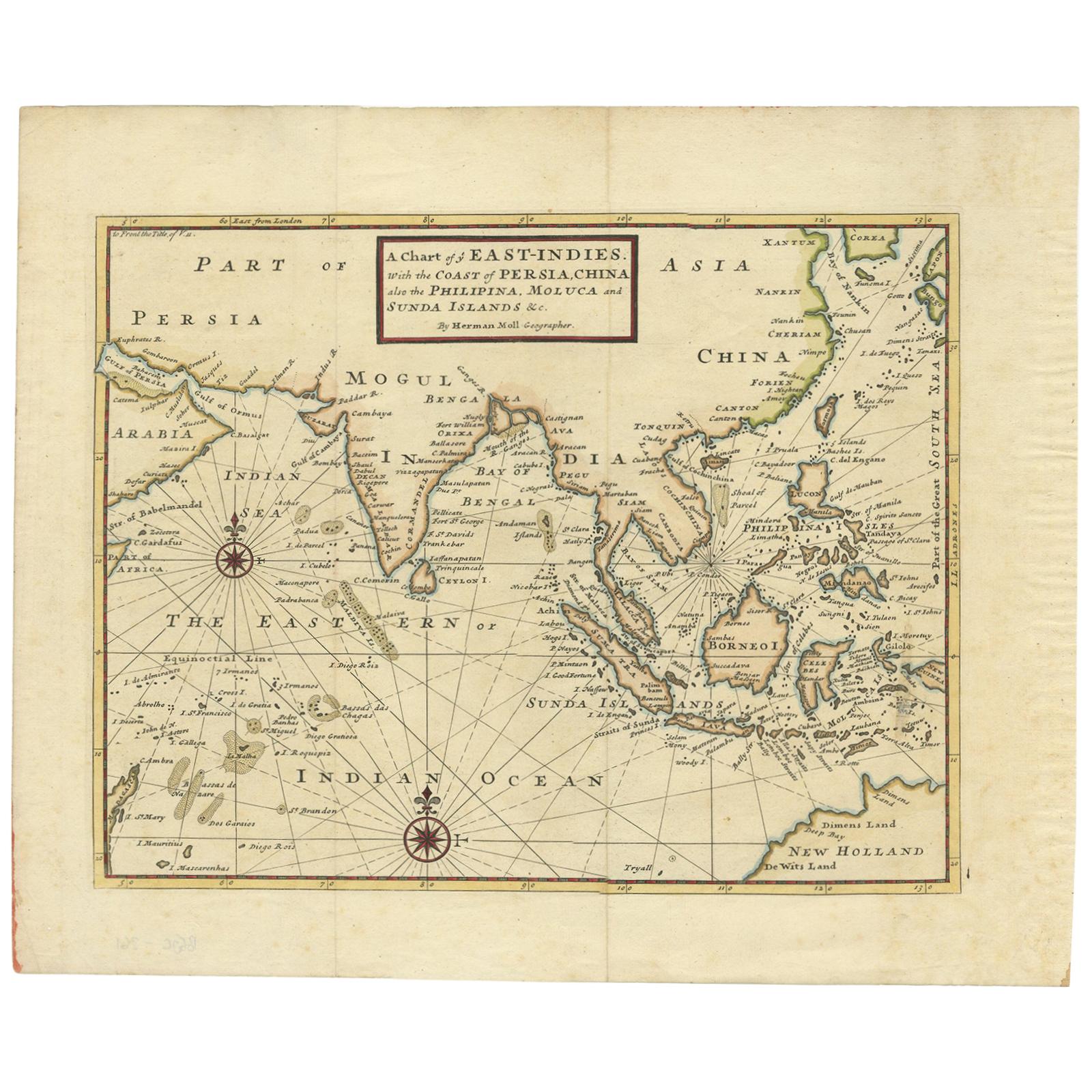
- Antique Map of the East Indies by Moll '1745'Located in Langweer, NLAntique map titled 'A Chart of ye East-Indies. With the Coast of Persia, China also the Philipina, Moluca and Sunda Islands'. Detailed map of the Indian Ocean, Southeast Asia, China,...Category
Antique Mid-18th Century Maps
MaterialsPaper
 $643 Sale Price35% Off
 - Antique Map of the Low Countries by Seutter, c.1745Located in Langweer, NLAntique map titled ‘XVII Provinciae Belgii sive Germaniae Inferioris (..)’. Detailed hand colored map of the Low Countries. Includes colored decorative cartouche, compass rose and co...Category
Antique 18th Century Maps
MaterialsPaper
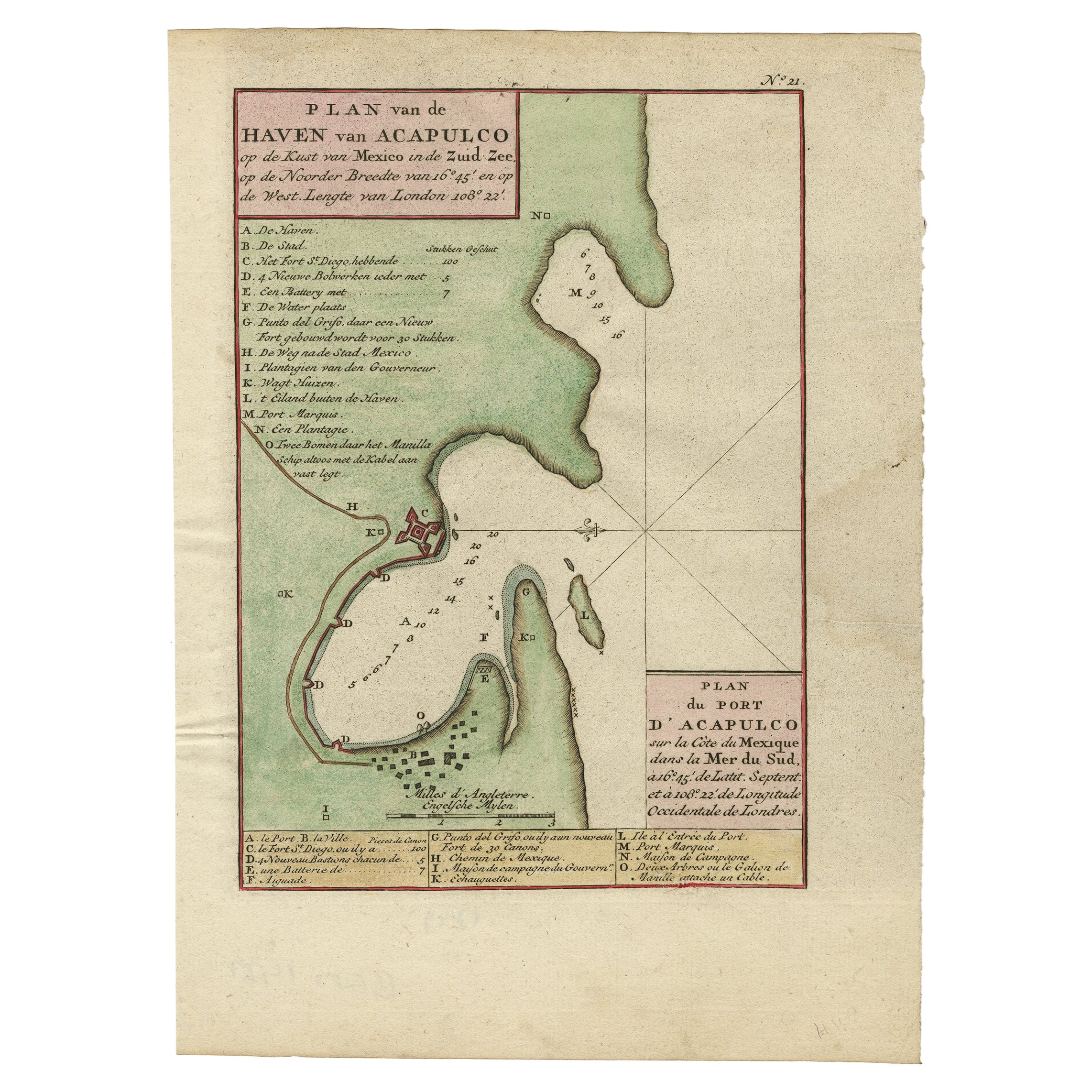
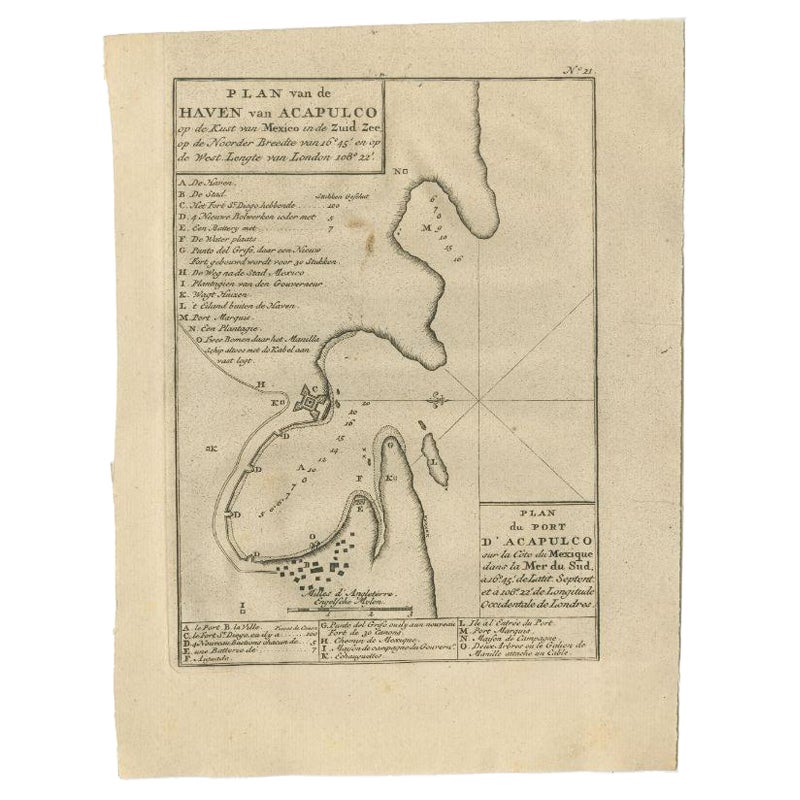
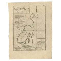
- Antique Map of The Harbour of Acapulco in Mexico, 1749Located in Langweer, NLDescription: Antique map titled 'Plan van de Haven van Acapulco (..) - Plan du Port d'Acapulco (..)'. Original antique map of the Port of Acapulco on the coast of Mexico in the South...Category
Antique 1740s Maps
MaterialsPaper
- Antique Map of the Port of Acapulco in Mexico, 1749Located in Langweer, NLAntique map titled 'Plan van de Haven van Acapulco (..) - Plan du Port d'Acapulco (..)'. Original antique map of the Port of Acapulco on the coast of Mexico in the Southern Sea, at 1...Category
Antique 18th Century Maps
MaterialsPaper
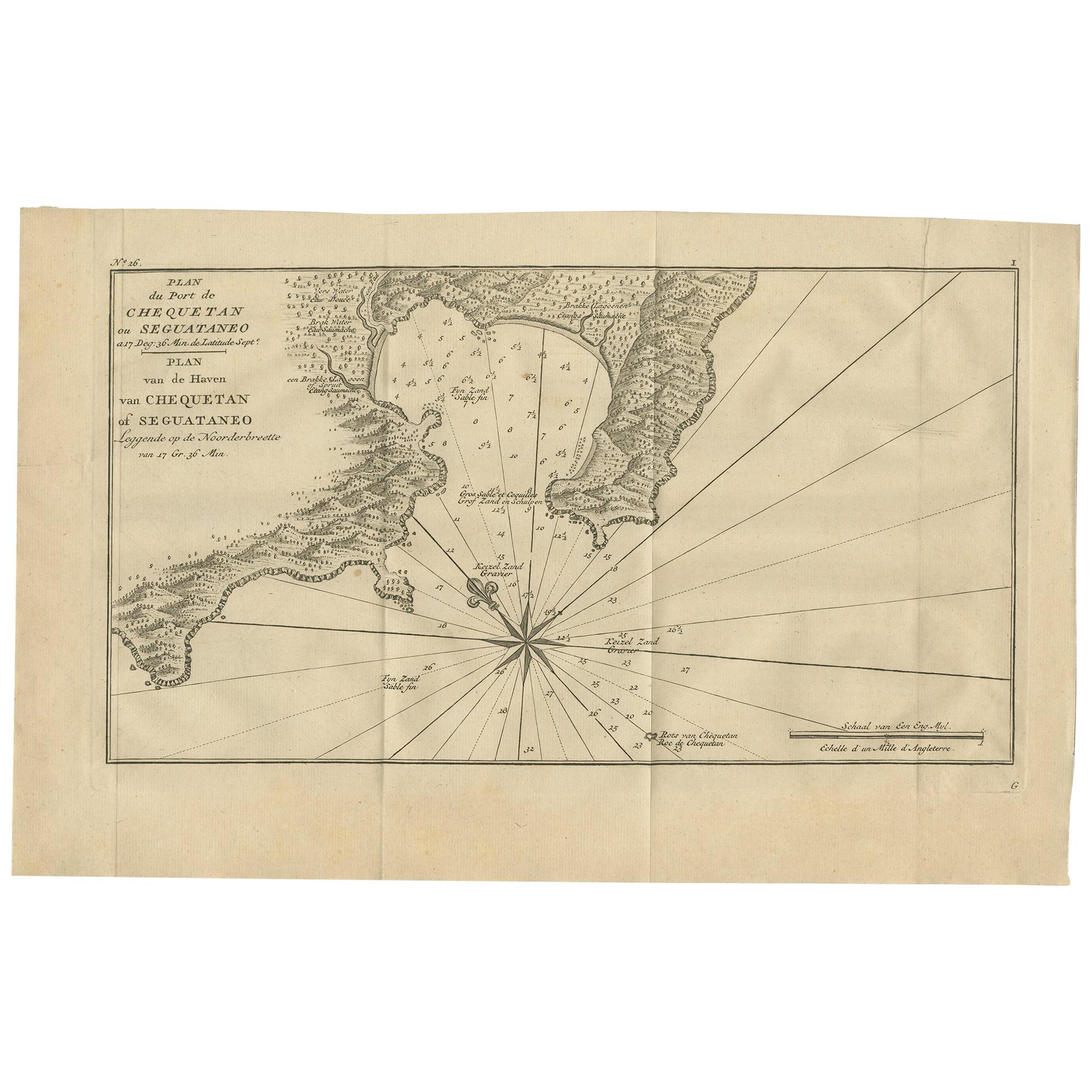
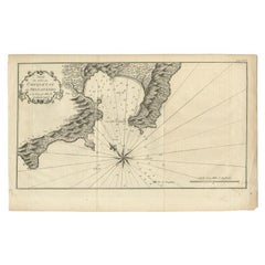
- Antique Map of the Port of Zihuatanejo in Mexico, c.1740Located in Langweer, NLAntique map titled 'Plan du Port de Chequetan ou Seguataneo'. Map of the Mexican port of Zihuatanejo. This area was originally named Cihuatlán in Aztec, which means 'Place of Women,'...Category
Antique 18th Century Maps
MaterialsPaper

You May Also Like
- Map of Boston and Surrounding TownsLocated in Norwell, MALater copy of a nineteenth century map of Boston and surrounding towns. Showing parts of Quincy, Milton, Hyde Park, Winthrop and Revere. Showing all of B...Category
Antique 19th Century North American Maps
MaterialsPaper
- Large Original Antique Map of The Environs of Dublin, Ireland, circa 1880Located in St Annes, LancashireGreat map of The Environs of Dublin Published circa 1880 Unframed Free shipping.Category
Antique 1880s Scottish Maps
MaterialsPaper
- Large Original Antique Map of the Environs of Cork, Ireland, circa 1880Located in St Annes, LancashireGreat map of The Environs of Cork Published circa 1880 Unframed Free shipping.Category
Antique 1880s Scottish Maps
MaterialsPaper
- Large Original Antique Map of Ireland by Sidney Hall, 1847Located in St Annes, LancashireGreat map of Ireland Drawn and engraved by Sidney Hall Steel engraving Original colour outline Published by A & C Black. 1847 Unframed Free shipping.Category
Antique 1840s Scottish Maps
MaterialsPaper
- 1861 Topographical Map of the District of Columbia, by Boschke, Antique MapLocated in Colorado Springs, COPresented is an original map of Albert Boschke's extremely sought-after "Topographical Map of the District of Columbia Surveyed in the Years 1856 ...Category
Antique 1860s American Historical Memorabilia
MaterialsPaper
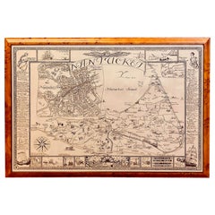
- Vintage Map of Nantucket Town by Ruth Haviland Sutton, 1946Located in Nantucket, MAVintage Map of Nantucket Town by Ruth Haviland Sutton, 1946, a classic vintage tourist map of Nantucket Island showing historic landmarks and geogr...Category
Vintage 1940s American Other Maps
MaterialsPaper


Recently Viewed
View AllMore Ways To Browse
Map Of Dublin
Asian Centric World Map
Jackson Hole Map
Map Of German
Vintage Map World
Vintage Maps World
Antique Map Copenhagen
Scan Globe
Antique Maps Singapore
Johannes Janssonius On Sale
Antique Maps Of Ukraine
Ukraine Antique Map
Antique Map Nova Scotia
Ecuador Antique Map
Antique Chinese Rob
Map Of Puerto Rico
Map Oxford England
Papua New Guinea Antique Map