Items Similar to Antique Map of Southern Germany by F. de Wit, circa 1680


Want more images or videos?
Request additional images or videos from the seller
1 of 9
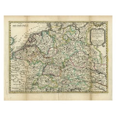
Antique Map of Southern Germany by F. de Wit, circa 1680
$661.91
$827.3820% Off
£491.98
£614.9720% Off
€556
€69520% Off
CA$913.91
CA$1,142.3920% Off
A$1,013.46
A$1,266.8320% Off
CHF 532.50
CHF 665.6220% Off
MX$12,382.78
MX$15,478.4720% Off
NOK 6,662.29
NOK 8,327.8620% Off
SEK 6,253.70
SEK 7,817.1220% Off
DKK 4,233.66
DKK 5,292.0820% Off
About the Item
This antique map depicts a portion of southern Germany that included the historic regions of Bavaria, the Palatinate, Prussia-Brandenburg, the Rhineland and Saxony. Regensberg, Freising and Munich are at the center of the image with areas shown east to Linz, south to Innsbruck, west to Kempten, north to Amberg. An inset of "Palatinatus Bavariae" appears in the upper right surrounded by decorative colored engravings of the putti, garlands and shields displaying the crests of major cities.
- Dimensions:Height: 20.79 in (52.8 cm)Width: 25.6 in (65 cm)Depth: 0.02 in (0.5 mm)
- Materials and Techniques:
- Period:Late 17th Century
- Date of Manufacture:circa 1680
- Condition:Please study image carefully.
- Seller Location:Langweer, NL
- Reference Number:Seller: BG-091621stDibs: LU305439931991
About the Seller
5.0
Recognized Seller
These prestigious sellers are industry leaders and represent the highest echelon for item quality and design.
Platinum Seller
Premium sellers with a 4.7+ rating and 24-hour response times
Established in 2009
1stDibs seller since 2017
2,609 sales on 1stDibs
Typical response time: <1 hour
- ShippingRetrieving quote...Shipping from: Langweer, Netherlands
- Return Policy
Authenticity Guarantee
In the unlikely event there’s an issue with an item’s authenticity, contact us within 1 year for a full refund. DetailsMoney-Back Guarantee
If your item is not as described, is damaged in transit, or does not arrive, contact us within 7 days for a full refund. Details24-Hour Cancellation
You have a 24-hour grace period in which to reconsider your purchase, with no questions asked.Vetted Professional Sellers
Our world-class sellers must adhere to strict standards for service and quality, maintaining the integrity of our listings.Price-Match Guarantee
If you find that a seller listed the same item for a lower price elsewhere, we’ll match it.Trusted Global Delivery
Our best-in-class carrier network provides specialized shipping options worldwide, including custom delivery.More From This Seller
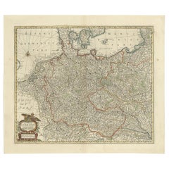
View AllAntique Map of the Saxony Region 'Germany' by F. de Wit, circa 1680
Located in Langweer, NL
A detailed map of a region in eastern Germany. Cartouches depict coat of arms surrounded by cherubs. The map is fully engraved with towns, political boundaries, rivers and forests. P...
Category
Antique Late 17th Century Dutch Maps
Materials
Paper

Decorative Antique Map of Austria – Frederick de Wit, Amsterdam c.1690
Located in Langweer, NL
Antique Map of Austria – “Circuli Austriaci pars Septentrionalis” by F. de Wit, c.1670
This finely engraved map, titled “Circuli Austriaci pars Septent...
Category
Antique Late 17th Century Dutch Maps
Materials
Paper

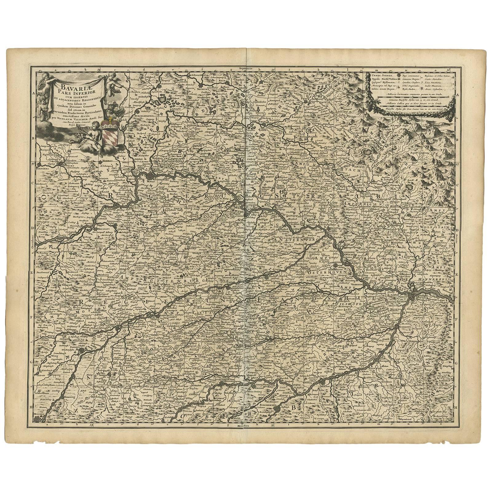
Antique Map of Bavaria ‘Bayern, Germany’ by N. Visscher, circa 1700
Located in Langweer, NL
Antique map titled 'Bavariae pars inferior cum insertis et adjacentibus regionibus (..)'. Published circa 1700 in N. Visscher's World Atlas.
The map "Bavariae pars inferior cum inse...
Category
Antique Early 18th Century Dutch Maps
Materials
Paper
$580 Sale Price
20% Off
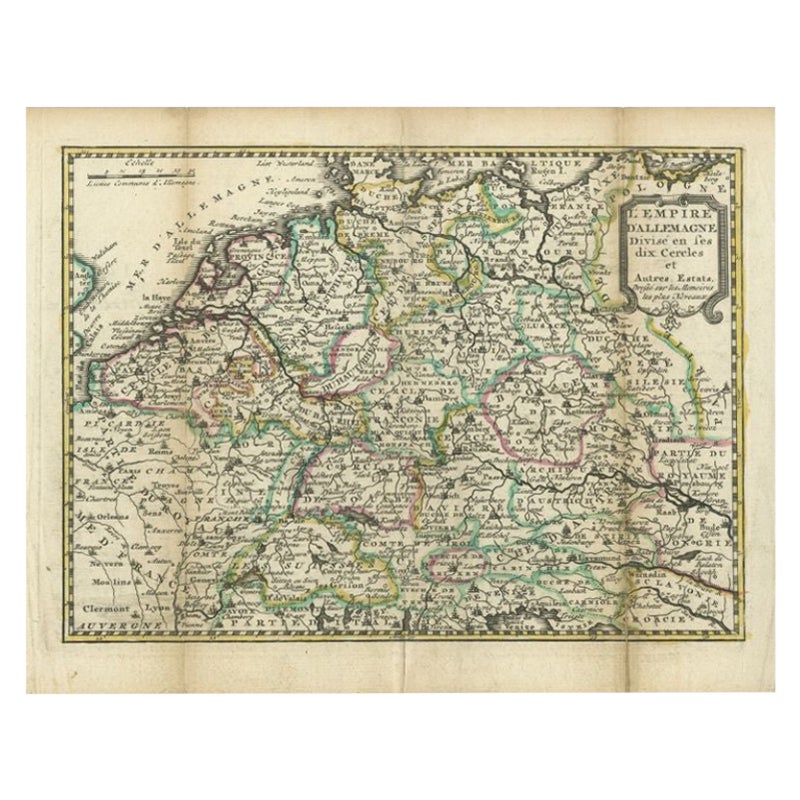
Antique Map of the German Empire by De Leth, 1749
Located in Langweer, NL
Antique map Germany titled 'L'Empire d'Allemagne divisé en ses dix cercles et Autres Estats'. Detailed map of the German Empire divided in the ten ...
Category
Antique 18th Century Maps
Materials
Paper
$160 Sale Price
20% Off
Antique Map of Germany of German in Roman Times, c.1660
Located in Langweer, NL
Antique map Germany titled 'Germaniae Veteris Typus'. Antique map probably by Blaeu or based on an earlier state by W. Blaeu.
Minor differences shown in the cartouches. Top left ha...
Category
Antique 17th Century Maps
Materials
Paper

$809 Sale Price
20% Off
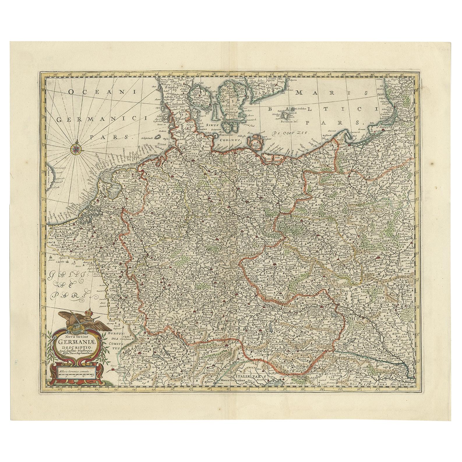
Antique Map of the German Empire, Johannes Janssonius van Waesbergen, circa 1670
Located in Langweer, NL
Antique map titled 'Nova Totius Germaniae Descriptio'. Uncommon map of the German Empire including the Netherlands, Germany, Switzerland, Austria, Bohemia,...
Category
Antique Late 17th Century Maps
Materials
Paper
$666 Sale Price
20% Off
You May Also Like
West Germany: Original Hand Colored 17th Century Map by Johannes Janssonius
By Johannes Janssonius
Located in Alamo, CA
An original hand colored copperplate engraved map entitled in Latin "Archiepiscopatus Maghdeburgensis et Anhaltinus Ducatus cum terris adjacentibus", published in Amsterdam in 1640 i...
Category
Mid-17th Century Old Masters More Prints
Materials
Engraving

1640 Joan Bleau Map Entitled"Diocecese de rheims et le pais de rethel, " Eic.a011
Located in Norton, MA
1640 Joan Bleau map entitled
"Diocecese de rheims et le pais de rethel,"
Ric.a011
OAN BLAEU
Diocecese de Rheims, et le pais de Rethel.
Handcolored engraving, c.1640.
...
Category
Antique 17th Century Dutch Maps
Materials
Paper

17th Century Nicolas Visscher Map of Southeastern Europe
Located in Hamilton, Ontario
A beautiful, highly detailed map of southeastern Europe by Nicolas Visscher. Includes regions of Northern Italy (showing the cities Bologna, Padua, and Venice), Bohemia, Austria (sho...
Category
Antique 17th Century Dutch Maps
Materials
Paper

$1,350 Sale Price
38% Off
1657 Janssonius Map of Vermandois and Cappelle, Ric. A-004
Located in Norton, MA
1657 Janssonius map of
Vermandois and Cappelle
Ric.a004
Description: Antique map of France titled 'Descriptio Veromanduorum - Gouvernement de la Cappelle'. Two detailed maps o...
Category
Antique 17th Century Unknown Maps
Materials
Paper

1752 Vaugoundy Map of Flanders : Belgium, France, and the Netherlands, Ric.a002
Located in Norton, MA
Large Vaugoundy Map of Flanders:
Belgium, France, and the Netherlands
Colored -1752
Ric.a002
Description: This is a 1752 Didier Robert de Vaugondy map of Flanders. The map de...
Category
Antique 17th Century Unknown Maps
Materials
Paper

1640 Willem Blaeu Map Entitled "Contado di molise et principato vltra, " Ric.a003
By Willem Blaeu
Located in Norton, MA
1640 Willem Blaeu map entitled
"Contado di molise et principato vltra,"
Colored
Ric. a003
Measures: 38 x 49.6 cm and wide margins
DBLAEU.
Cou...
Category
Antique 17th Century Dutch Maps
Materials
Paper

More Ways To Browse
17th Century German Engravings
Carved Cabriole Table
Dark Antique Table
Antique Wall Table
1960 Chair Wood Danish
Unusual Dining Table
Antique Dutch Plates
Mdf Table
Showcase Coffee Table
Space Age Orange
Vallauris France
Silver Ladle
Scalloped Table
Brazil Wood Chairs
Vintage Art Deco Side Tables
Window Display
1960s Cushion Chair
Green Brown Oriental Rug