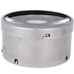
English Steel Map Case
View Similar Items


1 of 6
English Steel Map Case
About the Item
- Dimensions:Height: 2.5 in (6.35 cm)Diameter: 4.25 in (10.8 cm)
- Materials and Techniques:Steel
- Place of Origin:
- Period:
- Date of Manufacture:1930-1950
- Condition:Test Wear.
- Seller Location:Stamford, CT
- Reference Number:Seller: Hadley Antiques1stDibs: LU86239592693
You May Also Like
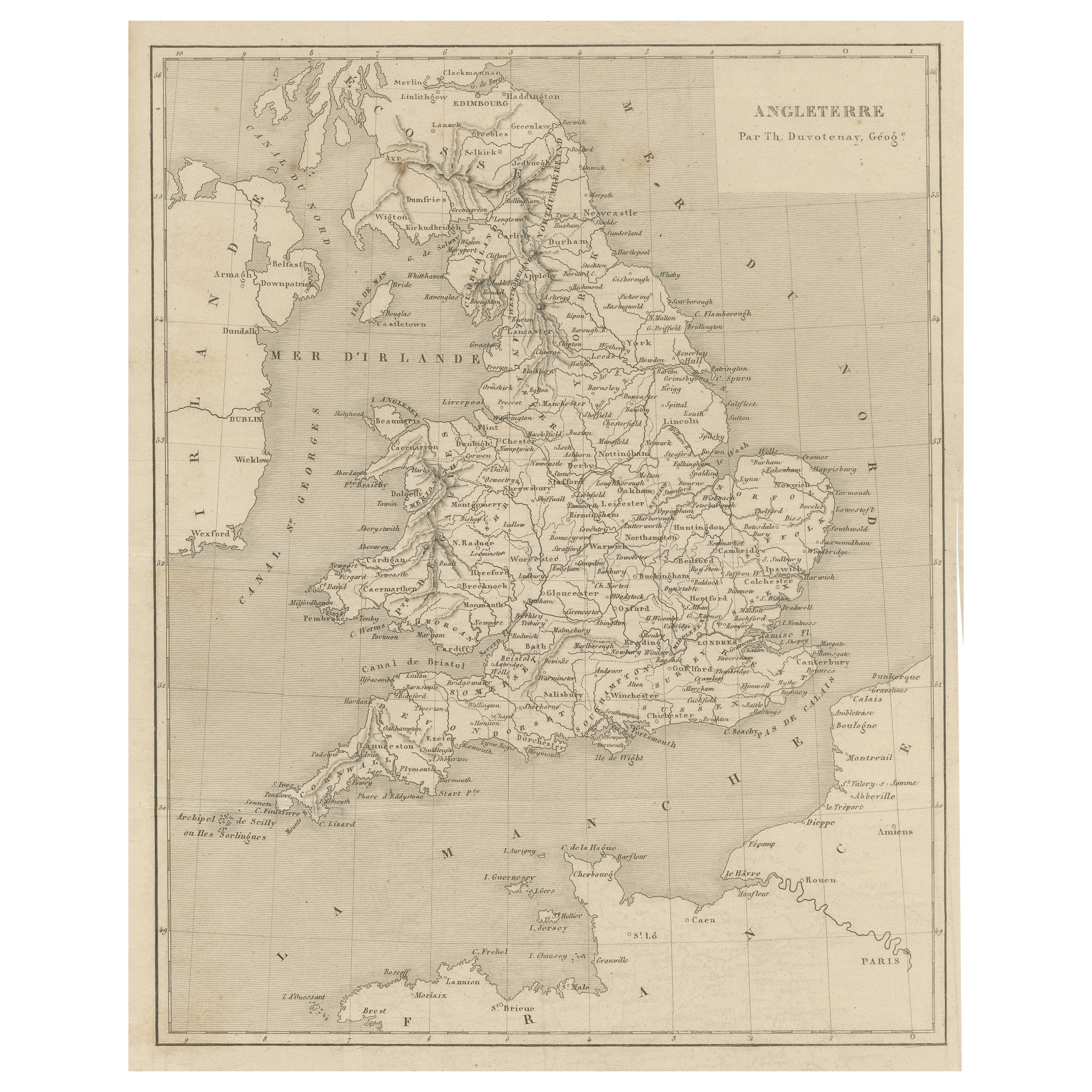
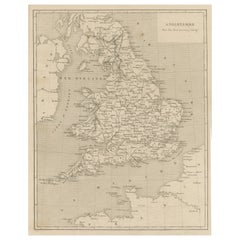
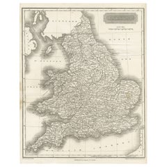
- Steel Engraved Antique Map of EnglandLocated in Langweer, NLAntique map titled 'Angleterre'. Original antique map of England. Engraved by Th. Duvotenay. Originates from 'Complement de L'Encyclopedie Mode...Category
Antique Late 19th Century Maps
MaterialsPaper
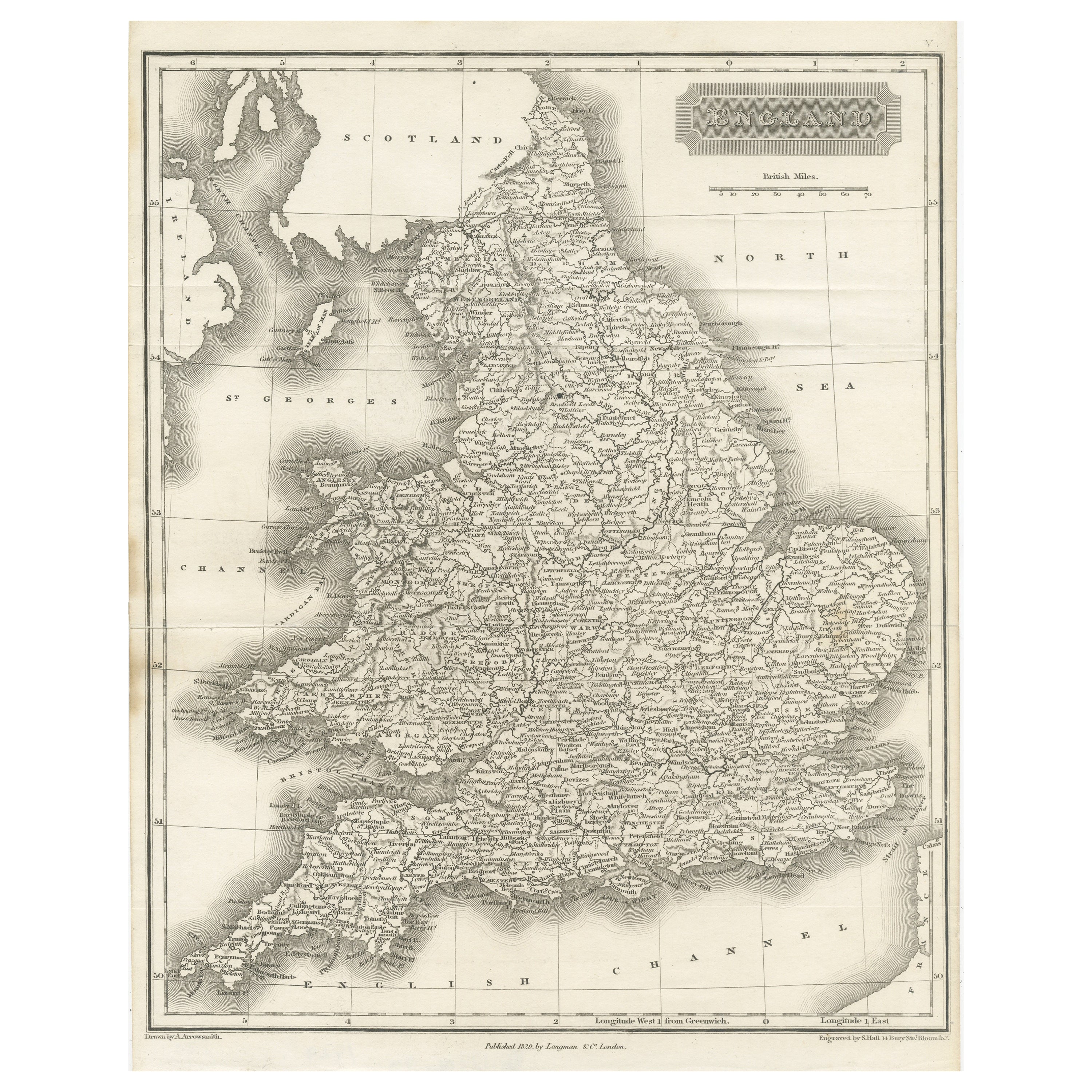
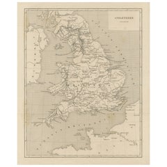
- Small Steel Engraved Map of EnglandLocated in Langweer, NLAntique map titled 'England'. Original steel engraved map of England. Drawn by A. Arrowsmith, engraved by S. Hall. Published 1829 by Longman & Co, London.Category
Antique Mid-19th Century Maps
MaterialsPaper
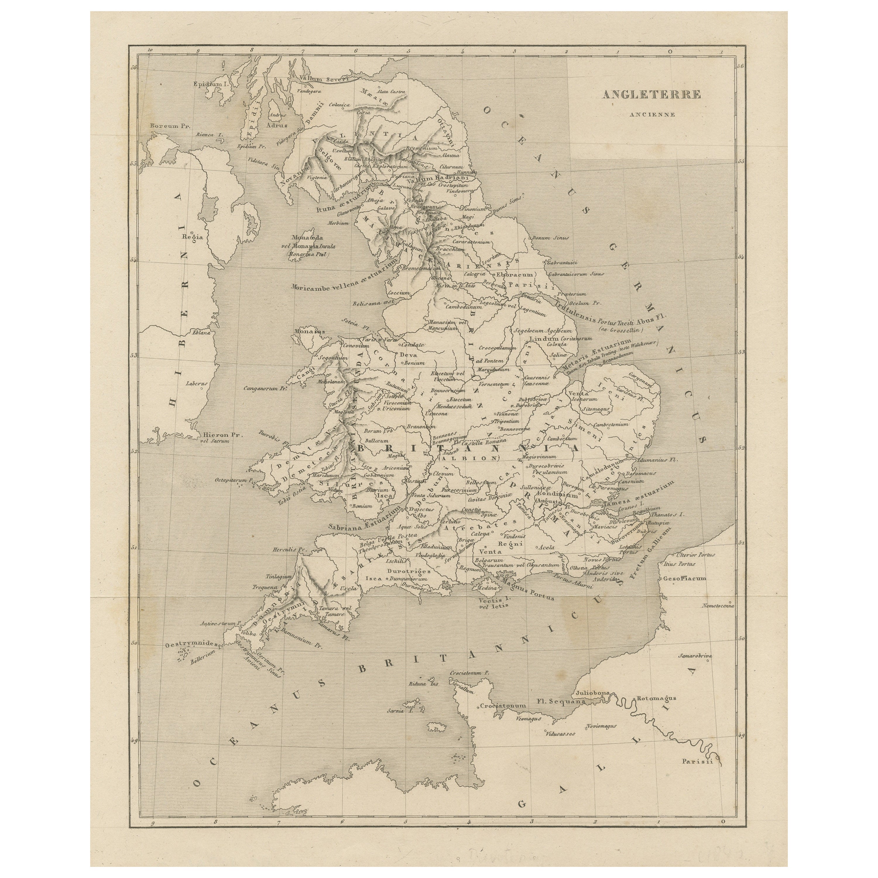
- Steel Engraved Map of Ancient BritainLocated in Langweer, NLAntique map titled 'Angleterre Ancienne'. Original old map of Ancient Britain. Source unknown, to be determined. Published circa 1880.Category
Antique Late 19th Century Maps
MaterialsPaper
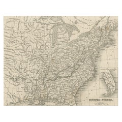
- Steel Engraved Map of the United States with Inset Map of FloridaLocated in Langweer, NLAntique map titled 'United States'. Steel engraved map of the United States. With small inset map of the continuation of Florida. Source unknown, to be determined. Published circa 1843.Category
Antique Mid-19th Century Maps
MaterialsPaper
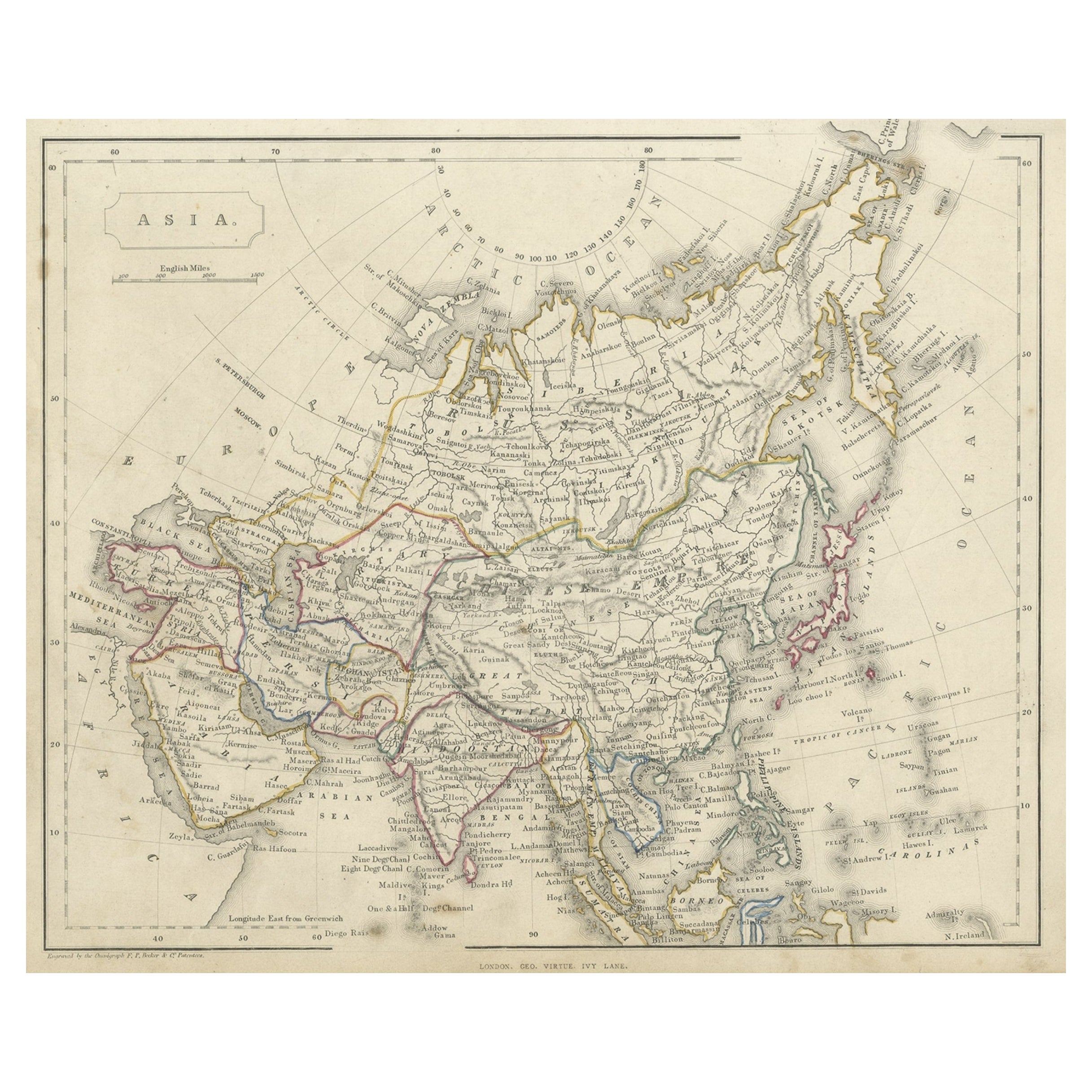
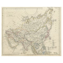
- Antique Steel Engraved Map of Asia, c.1860Located in Langweer, NLAntique map titled 'Asia'. Steel engraved map of Asia by F. P. Becker & Co. Artists and Engravers: Engraved by F.P. Becker & Co. Published in London. Condition: Very good, gen...Category
Antique 19th Century Maps
MaterialsPaper
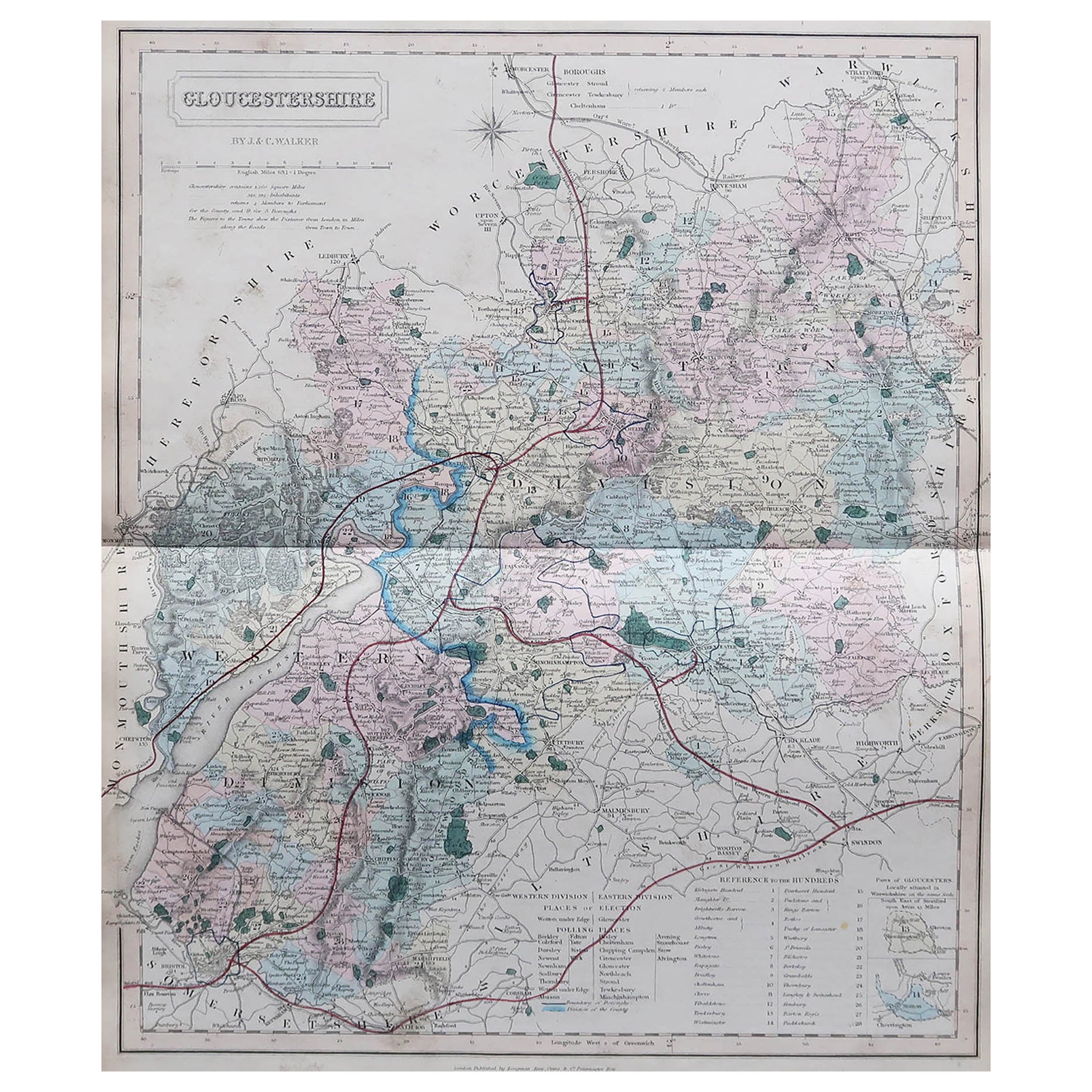
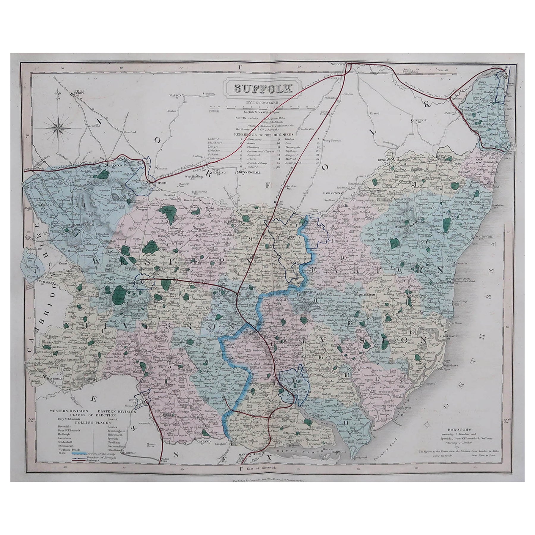
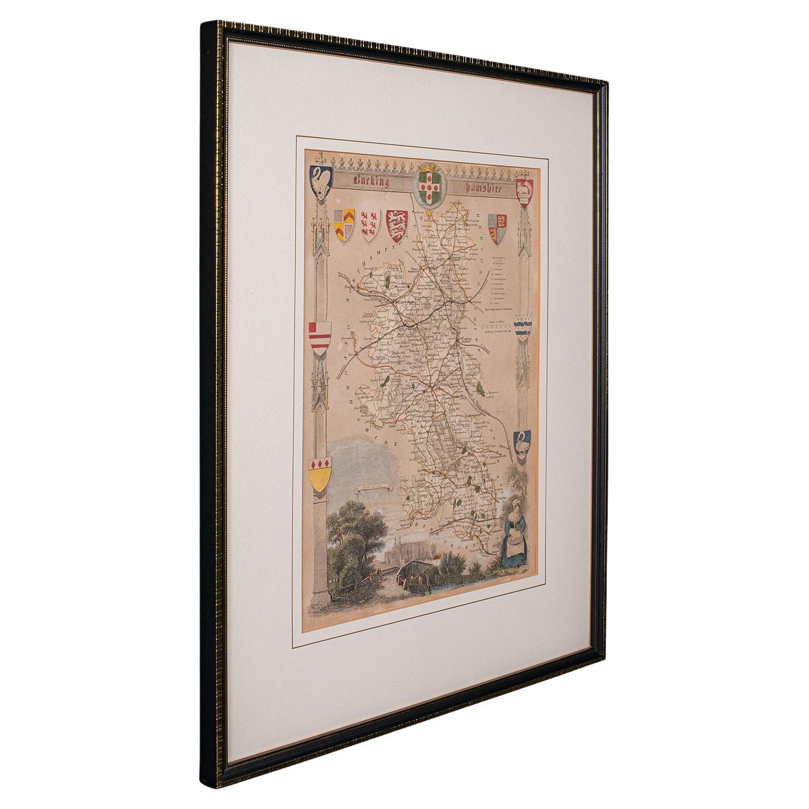
- Antique Lithography Map, Bedfordshire, English, Framed Engraving, CartographyLocated in Hele, Devon, GBThis is an antique lithography map of Bedfordshire. An English, framed atlas engraving of cartographic interest, dating to the mid 19th century and...Category
Antique Mid-19th Century British Victorian Maps
MaterialsWood

Recently Viewed
View AllMore Ways To Browse
Antique Map Case
George Fleet
Antique Railroad Maps
Map Of New Zealand
Antique Map Art Collectibles
Antique Maps Art Collectibles
James Cook Map
Nautical Charts
Old Antique Compass
Map New Holland
World Maps Antique Style
World Map Antique Style
Antique Style Map Of The World
Map Sweden
Maritime Map
Vienna Map
Map Of Vienna
Map Arabia