Items Similar to Islands of Diversity: Portugal's Atlantic Archipelagos in 1903


Want more images or videos?
Request additional images or videos from the seller
1 of 12
Islands of Diversity: Portugal's Atlantic Archipelagos in 1903
$325.30
$502.3135% Off
£239.98
£370.5635% Off
€272
€42035% Off
CA$450.33
CA$695.3635% Off
A$488.29
A$753.9835% Off
CHF 259.13
CHF 400.1335% Off
MX$6,013.92
MX$9,286.2135% Off
NOK 3,211.76
NOK 4,959.3335% Off
SEK 3,031.16
SEK 4,680.4735% Off
DKK 2,070.88
DKK 3,197.6835% Off
About the Item
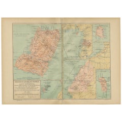
The image is an original historical map from 1903 depicting Portuguese possessions in the Atlantic Ocean, specifically the islands of Cape Verde and the islands of São Tomé and Príncipe. The map is divided into multiple panels, each showing a different island, including São Vicente, Santo Antão, Sal, Boa Vista, Maio, São Nicolau, Santiago, Fogo, Brava, and the islands of São Tomé and Príncipe.
Cape Verde is an archipelago located off the west coast of Africa known for its Creole Portuguese-African culture, morna music (closely associated with Cesária Évora), and its significant role in the Atlantic slave trade. The islands of São Tomé and Príncipe, situated near the equator in the Gulf of Guinea, are known for their biodiversity, cocoa production, and colonial architecture.
Each island is detailed with its topographical features such as mountain ranges, valleys, and coastlines, as well as human-made features including towns and roadways. The maps utilize a color-coding system to indicate elevation, and maritime details are also provided, suggesting their importance in navigation and trade during that time.
The islands depicted on the historical map you provided, particularly the Cape Verde archipelago and São Tomé and Príncipe, are remarkable for several reasons:
**Cape Verde:**
1. **Cultural Fusion**: Cape Verde is a melting pot of African, Portuguese, and Brazilian cultures, reflected in its music, dance, and customs. Morna, a genre of music symbolized by Cesária Évora, is especially emblematic of the nation's rich cultural heritage.
2. **Strategic Location**: Historically, Cape Verde's location made it an essential stopover point for transatlantic shipping and the slave trade, which has deeply influenced its demographics and culture.
3. **Volcanic Landscapes**: The islands are known for their striking volcanic landscapes, particularly the active volcano on Fogo island.
4. **Maritime Climate**: The archipelago enjoys a temperate maritime climate with a warm, dry summer and a moderate rainy season, making it a year-round destination.
5. **Economic Development**: Despite its limited natural resources, Cape Verde has one of the more stable and developed economies in Africa, due in part to its tourism industry.
**São Tomé and Príncipe:**
1. **Biodiversity Hotspot**: These islands are part of the Gulf of Guinea biodiversity hotspot and boast a large number of endemic species, particularly birds and plants.
2. **Colonial History**: São Tomé and Príncipe were uninhabited prior to being discovered by the Portuguese in the 15th century and subsequently became important centers for sugar and then cocoa production.
3. **Chocolate Production**: The islands are known for high-quality cocoa production, which is still a significant part of their economy.
4. **Natural Beauty**: The lush rainforests, stunning beaches, and clear waters are ideal for eco-tourism, with activities like bird watching, hiking, and diving.
5. **Cultural Identity**: The São Toméan culture is unique, with a blend of Portuguese and African influences, seen in the São Toméan Creole language, traditional dances, and music.
These islands' unique combination of cultural richness, natural beauty, and historical significance makes them special and fascinating to both visitors and scholars alike.
- Dimensions:Height: 14.77 in (37.5 cm)Width: 20.08 in (51 cm)Depth: 0 in (0.02 mm)
- Materials and Techniques:
- Period:1900-1909
- Date of Manufacture:1903
- Condition:Good condition. Central vertical folding lines as issued. Aged paper with typically warm, yellowish-brown hue, especially around the edges and folding lines, adding to its patina. Check the images carefully.
- Seller Location:Langweer, NL
- Reference Number:Seller: BG-13642-561stDibs: LU3054338034592
About the Seller
5.0
Recognized Seller
These prestigious sellers are industry leaders and represent the highest echelon for item quality and design.
Platinum Seller
Premium sellers with a 4.7+ rating and 24-hour response times
Established in 2009
1stDibs seller since 2017
2,622 sales on 1stDibs
Typical response time: <1 hour
- ShippingRetrieving quote...Shipping from: Langweer, Netherlands
- Return Policy
Authenticity Guarantee
In the unlikely event there’s an issue with an item’s authenticity, contact us within 1 year for a full refund. DetailsMoney-Back Guarantee
If your item is not as described, is damaged in transit, or does not arrive, contact us within 7 days for a full refund. Details24-Hour Cancellation
You have a 24-hour grace period in which to reconsider your purchase, with no questions asked.Vetted Professional Sellers
Our world-class sellers must adhere to strict standards for service and quality, maintaining the integrity of our listings.Price-Match Guarantee
If you find that a seller listed the same item for a lower price elsewhere, we’ll match it.Trusted Global Delivery
Our best-in-class carrier network provides specialized shipping options worldwide, including custom delivery.More From This Seller
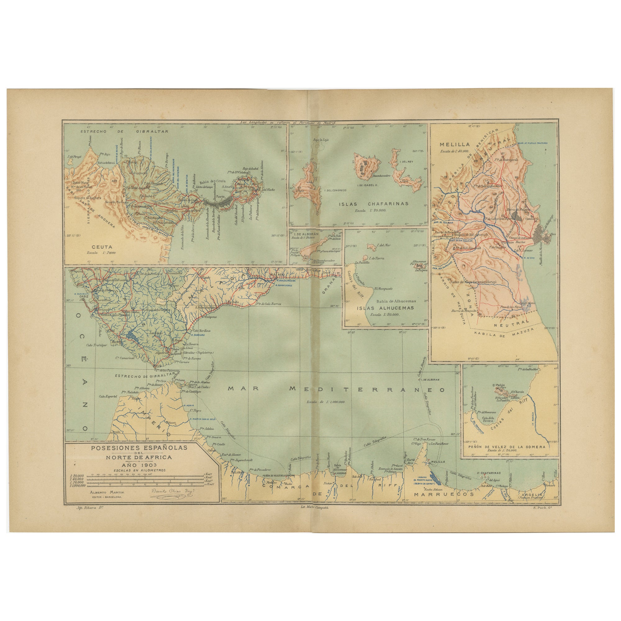
View AllCrossroads of Continents: Spain's North African Enclaves in 1903
Located in Langweer, NL
The image for sale is a historical map of Spanish possessions in North Africa, dated 1903. The map includes the enclaves of Ceuta and Melilla, the Chafarinas Islands, the Alhucemas I...
Category
Antique Early 1900s Maps
Materials
Paper
Empire's Tapestry: Mapping Portugal's Global Legacy in 1903
Located in Langweer, NL
This map is an original antique map that showcases Portuguese possessions around the turn of the 20th century, with a focus on Guinea-Bissau (referred to on the map as "Guiné Portugu...
Category
Antique Early 1900s Maps
Materials
Paper
Echoes of Empire: Spanish Territories in West Africa, 1903
Located in Langweer, NL
This is a historical map showing Spanish possessions in West Africa from the year 1903. The map includes the islands of Fernando Póo (now known as Bioko), part of the modern-day country of Equatorial Guinea, Annobón Island, and the Elobey Islands, along with the Spanish-controlled areas on the continental region near Rio Muni.
These territories were part of Spain's colonial empire and are situated in the Gulf of Guinea, off the coast of Central Africa. Fernando Póo (Bioko) is particularly notable for its volcanic origins and as a center of cocoa production during the colonial period. Annobón, lying further southwest of Bioko, is a small volcanic island. The Elobey Islands are very small and located near the coast of Gabon.
Here's a brief overview of their significance:
1. **Bioko Island (Fernando Póo)**: The island has a rich biodiversity and is known for its unique flora and fauna, including several endemic species. Malabo, the capital city of Equatorial Guinea, is located here.
2. **Annobón Island**: This remote island has a small population and is known for its isolation and distinctive Creole culture, which has developed independently from the mainland.
3. **Elobey Islands**: These consist of Elobey Grande and Elobey Chico and are situated near the mouths of the Muni and Campo rivers. They were historically important as transit points in river trade...
Category
Antique Early 1900s Maps
Materials
Paper
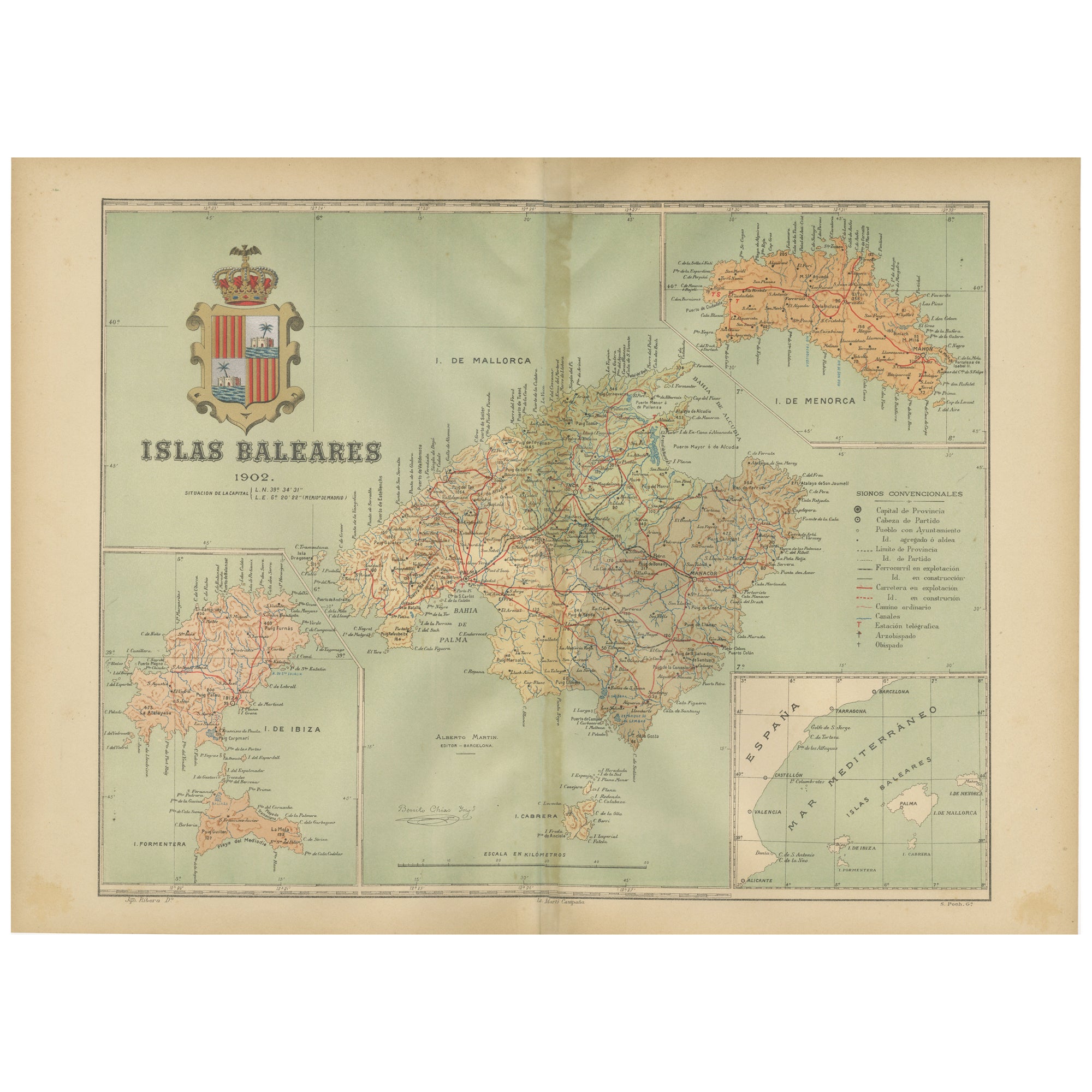
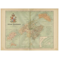
Isles of Enchantment: The Balearic Archipelago in 1902
Located in Langweer, NL
The Balearic Islands, Spain, from the year 1902. The title on the map is "ISLAS BALEARES 1902." This map illustrates the Balearic archipelago in the Mediterranean Sea, highlighting t...
Category
Antique Early 1900s Maps
Materials
Paper
Antique Map of the Islands of the Atlantic by J. Tallis
Located in Langweer, NL
A highly decorative and detailed mid-19th century map of the Islands of the Atlantic -- including the Azores, Madeira, Bermuda, the Canary Islands and the Cape Verde Islands -- which...
Category
Antique Mid-19th Century Maps
Materials
Paper

$287 Sale Price
20% Off
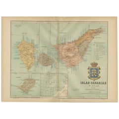
Islands of Fire and Whispers: The Canary Islands in 1902
Located in Langweer, NL
This is a authentic historical map of the Canary Islands, specifically the "1A HOJA" or first sheet, from the year 1902. The title on the map is "ISLAS CANARIAS 1902." This map featu...
Category
Antique Early 1900s Maps
Materials
Paper
You May Also Like
Large Original Antique Map of The Canary Islands. 1894
Located in St Annes, Lancashire
Superb Antique map of The Canary Islands
Published Edward Stanford, Charing Cross, London 1894
Original colour
Good condition
Unframed.
Free shipping
Category
Antique 1890s English Maps
Materials
Paper

Large Original Antique Map of The Greek Islands. 1894
Located in St Annes, Lancashire
Superb Antique map of The Greek Islands
Published Edward Stanford, Charing Cross, London 1894
Original colour
Good condition
Unframed.
Free shipping
Category
Antique 1890s English Maps
Materials
Paper

Original Antique Map of US Possessions In The Pacific Ocean, C.1900
Located in St Annes, Lancashire
Fabulous map of US possessions in the Pacific Ocean
Original color.
Engraved and printed by the George F. Cram Company, Indianapolis.
Published, C.1900.
Unframed.
Free shipping.
Category
Antique 1890s American Maps
Materials
Paper

1898 Chart of Boston Bay
Located in Norwell, MA
Original 1898 chart showing Massachusetts Bay with the coast from Cape Ann to Cape Cod. This is a U.S. Navy Geodetic survey chart. All towns are noted along the coast. Framed with gl...
Category
Antique 1890s Nautical Objects
Materials
Paper

$1,495
Large Original Antique Map of The Falkland Islands. 1894
Located in St Annes, Lancashire
Superb Antique map of The Falkland Islands
Published Edward Stanford, Charing Cross, London 1894
Original colour
Good condition
Unframed.
Free shipping
Category
Antique 1890s English Maps
Materials
Paper

Large Original Antique Map of the The Windward Islands. 1894
Located in St Annes, Lancashire
Superb Antique map of The Windward Islands
Published Edward Stanford, Charing Cross, London 1894
Original colour
Good condition
Unframed.
Free shipping
Category
Antique 1890s English Maps
Materials
Paper

More Ways To Browse
Used Dive Watch
Antique Plate Germany
Side Table Made In Denmark
England Antique Plates
19th Century Round Dining Table
Antique Thrones
Carved Chinese Tables
Italian Ceramic 1960s
Mid Century Modern Danish Teak Dining Tables
Rosenthal Century
Long Rug Runners
Pair Arm Chairs
Sterling Silver Dinner Sets
United Chair Company
British Antiques
Italian Beech Chairs
Shirvan Rugs
Spain Marble