Items Similar to Map of England and Surrounding Regions: Early 19th Century - 1802 Tardieu Atlas


Want more images or videos?
Request additional images or videos from the seller
1 of 6
Map of England and Surrounding Regions: Early 19th Century - 1802 Tardieu Atlas
$363.57
$454.4720% Off
£268.22
£335.2720% Off
€304
€38020% Off
CA$503.31
CA$629.1420% Off
A$545.74
A$682.1720% Off
CHF 289.62
CHF 362.0220% Off
MX$6,721.45
MX$8,401.8120% Off
NOK 3,589.61
NOK 4,487.0120% Off
SEK 3,387.77
SEK 4,234.7120% Off
DKK 2,314.51
DKK 2,893.1420% Off
About the Item
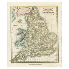
Title: Isles Britanniques. Troisieme Carte, Angleterre
Publication Details:
- **Atlas Title:** Nouvel Atlas Universel de Géographie Ancienne et Moderne
- **Purpose:** For the Nouvelle Edition de la Géographie de Guthrie
- **Mapmakers:** P. F. Tardieu, with contributions from various geographical works
- **Publisher:** Chez Hyacinthe Langlois, Libraire, quai des Augustins, n° 45
- **Year:** An X - 1802 (French Revolutionary Calendar)
**Geographical Scope:**
This antique map illustrates the British Isles, specifically focusing on England and parts of Wales, Scotland, and Ireland.
**Map Features:**
- **Regions Displayed:** England, parts of Wales, Scotland, and Ireland.
- **Notable Regions and Territories:** Detailed depictions of counties within England, as well as parts of Wales, the southern part of Scotland, and the eastern part of Ireland.
- **Seas and Bodies of Water:** Irish Sea (Mer d'Irlande), North Sea (Mer du Nord), English Channel (La Manche), Bristol Channel (Canal de Bristol), and St. George's Channel (Canal de St. George).
- **Topographical Details:** Includes mountain ranges, rivers, and other significant geographical features as understood in the early 19th century.
- **Cartographic Style:** Detailed engraving with hand-colored boundaries, emphasizing both historical accuracy and artistic presentation.
**Purpose and Use:**
This map serves as a detailed visual representation of the geographical and political landscape of England and its surrounding areas, reflecting the geographical understanding and cartographic style of the early 19th century. It is part of a larger atlas that includes 60 maps, providing a comprehensive view of both ancient and modern geography as known in 1802.
### Condition Report
The map is in good condition with minor age-related wear. Hand-colored boundaries are well-preserved, enhancing the clarity of regions and features. Slight fold lines and edge wear are visible, with some age spots.
Coloring
The hand-colored boundaries on the map highlight regions and territories, adding clarity and visual appeal, typical of early 19th-century cartographic practices.
- Dimensions:Height: 16.23 in (41.2 cm)Width: 22.25 in (56.5 cm)Depth: 0.01 in (0.2 mm)
- Materials and Techniques:Paper,Engraved
- Period:
- Date of Manufacture:1802
- Condition:Good condition with age-related wear. Hand-colored boundaries are well-preserved. Small tear in fold line, easy to repair. Fold lines and edge wear are visible, with some age spots, mostly in border. Study the scans carefully.
- Seller Location:Langweer, NL
- Reference Number:Seller: BG-13769-101stDibs: LU3054340559552
About the Seller
5.0
Recognized Seller
These prestigious sellers are industry leaders and represent the highest echelon for item quality and design.
Platinum Seller
Premium sellers with a 4.7+ rating and 24-hour response times
Established in 2009
1stDibs seller since 2017
2,620 sales on 1stDibs
Typical response time: <1 hour
- ShippingRetrieving quote...Shipping from: Langweer, Netherlands
- Return Policy
Authenticity Guarantee
In the unlikely event there’s an issue with an item’s authenticity, contact us within 1 year for a full refund. DetailsMoney-Back Guarantee
If your item is not as described, is damaged in transit, or does not arrive, contact us within 7 days for a full refund. Details24-Hour Cancellation
You have a 24-hour grace period in which to reconsider your purchase, with no questions asked.Vetted Professional Sellers
Our world-class sellers must adhere to strict standards for service and quality, maintaining the integrity of our listings.Price-Match Guarantee
If you find that a seller listed the same item for a lower price elsewhere, we’ll match it.Trusted Global Delivery
Our best-in-class carrier network provides specialized shipping options worldwide, including custom delivery.More From This Seller
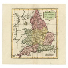
View AllOriginal Antique Map of England with Hand Coloring
Located in Langweer, NL
Antique map titled 'Engand'. Original old map of England. Engraved by W. Milton. Published by John Mc. Gowan, circa 1829.
Category
Antique Mid-19th Century Maps
Materials
Paper
$210 Sale Price
20% Off
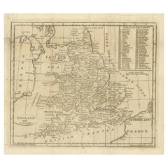
Antique Map of England and Wales, Also Showing the English Channel
Located in Langweer, NL
Antique map titled 'England and Wales'. Original antique map of England and Wales. Drawn and engraved by J. Dower. Originates from 'A General Descriptive Atlas Of The Earth, Containi...
Category
Antique Mid-19th Century Maps
Materials
Paper

$143 Sale Price
20% Off
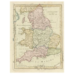
Original Antique Map of England and Wales with Large Cartouche
Located in Langweer, NL
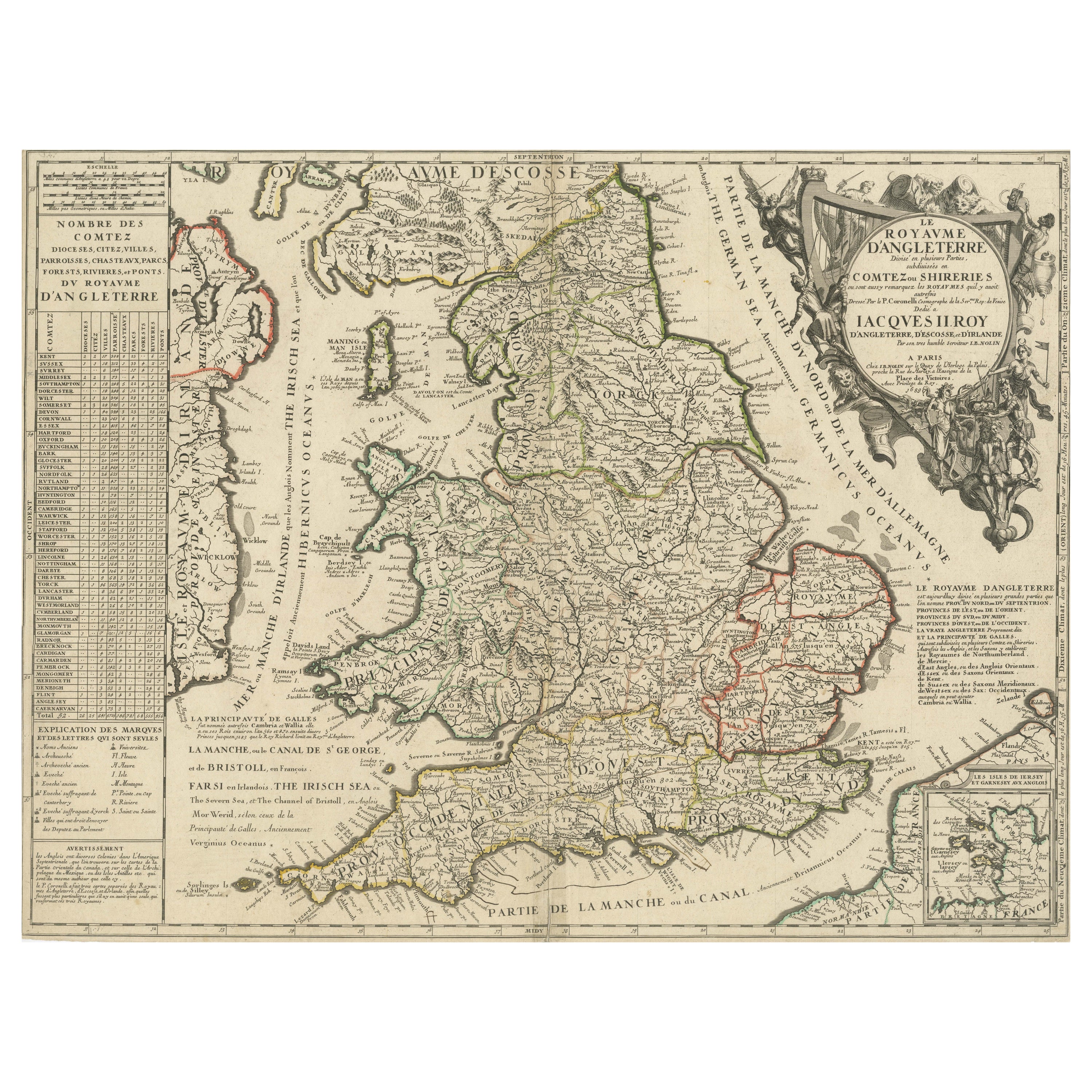
Antique map titled 'Le Royaume d'Angleterre divisé en plusieurs Parties (..)'. Large and rare map of England and Wales by J.B. Nolin after Coronelli. With decorative cartouche, table...
Category
Antique Late 17th Century Maps
Materials
Paper

$420 Sale Price
20% Off
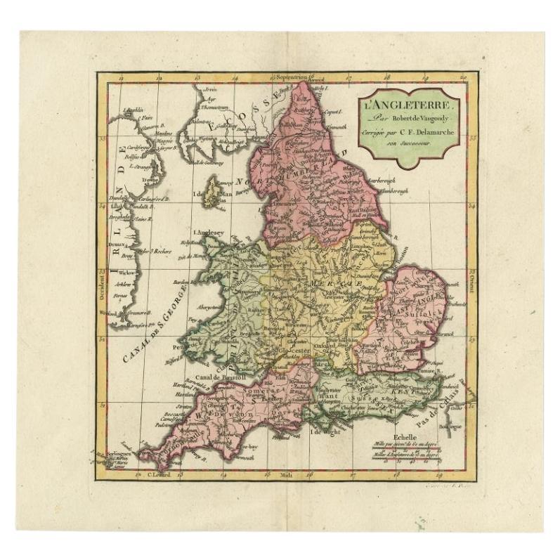
Antique Map of England with French Title, 1806
Located in Langweer, NL
Antique map titled 'L'Angleterre.' Map of England by Robert de Vaugondy, revised and published by Delamarche in 1806. Source unknown, to be determined.
...
Category
Antique 19th Century Maps
Materials
Paper
$287 Sale Price
20% Off
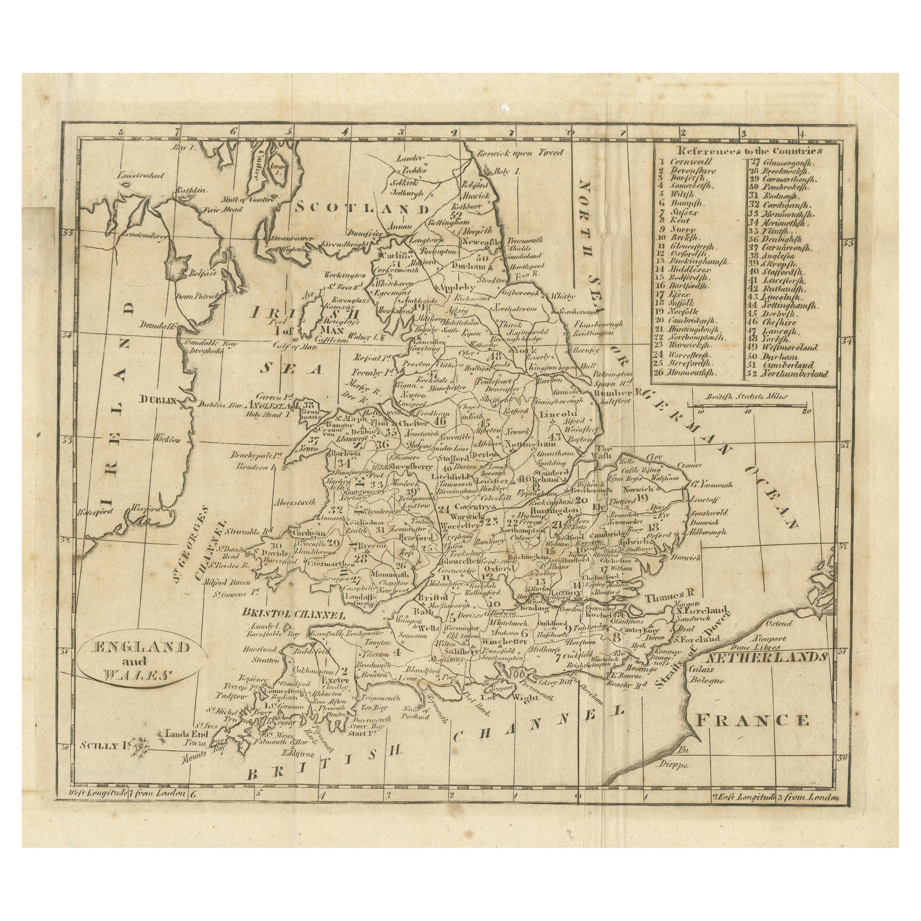
Antique Map of England and Wales, with References to the Counties
Located in Langweer, NL
Antique map titled 'England and Wales'. Original antique map of England and Wales, with references to the counties. Source unknown, to be determined. Published circa 1820.
Category
Antique Early 19th Century Maps
Materials
Paper
$133 Sale Price
20% Off
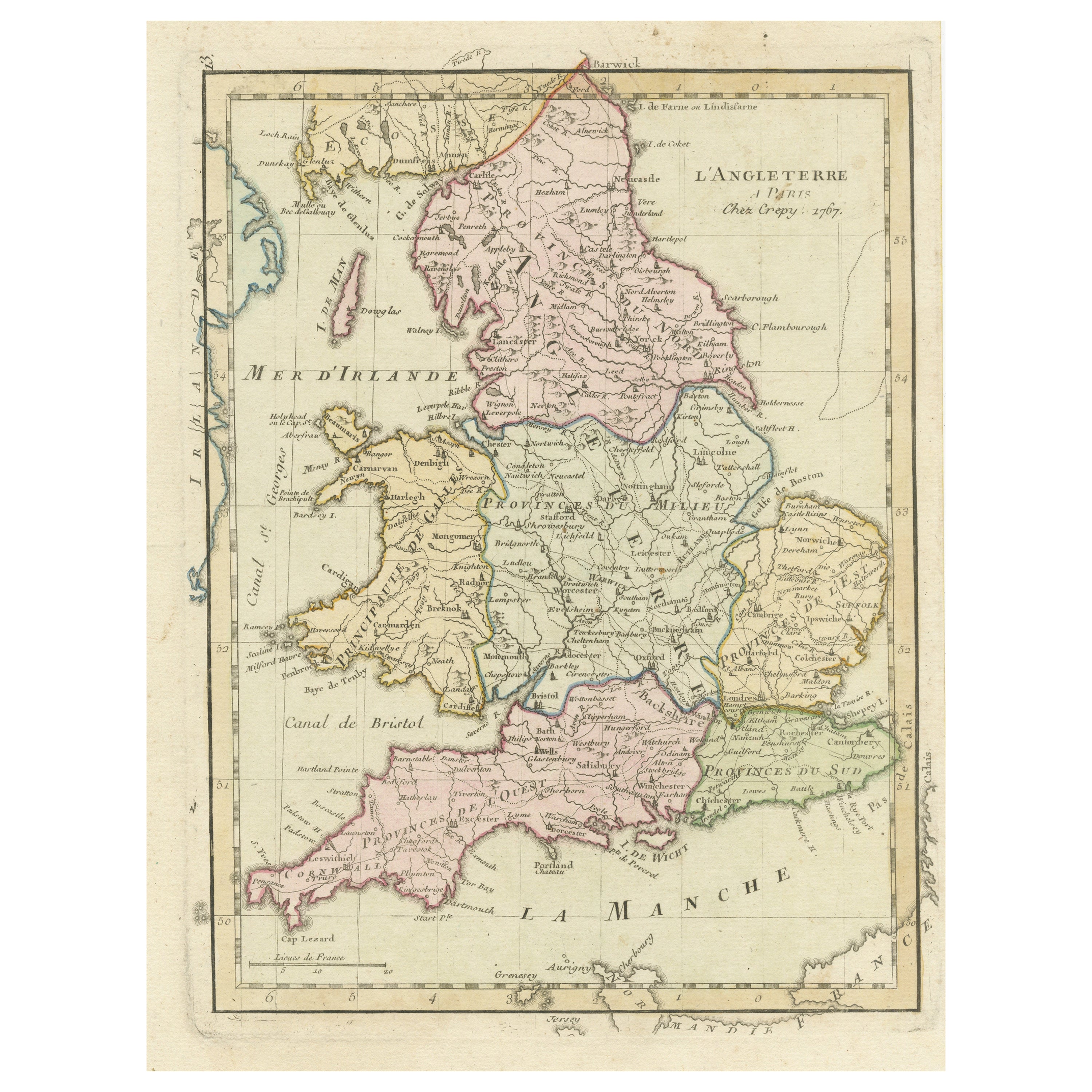
Antique Map of England with Contemporary Hand Coloring
Located in Langweer, NL
Antique map titled 'l'Angleterre'. Original antique map of England, with original/contemporary hand coloring. Published by Crepy, circa 1767.
Category
Antique Late 18th Century Maps
Materials
Paper
$248 Sale Price
20% Off
You May Also Like
Old Horizontal Map of England
By Tasso
Located in Alessandria, Piemonte
ST/520 - Old rare Italian map of England, dated 1826-1827 - by Girolamo Tasso, editor in Venise, for the atlas of M.r Le-Sage.
Category
Antique Early 19th Century Italian Other Prints
Materials
Paper

Map Southern Scotland Thomas Conder Alex Hogg 1795
Located in BUNGAY, SUFFOLK
A new map of the southern part of Scotland containing the counties of Stirling, Lanerk, Renfrew, Linlithgow, Edinburgh, Peebles, Haddingtoun, Berwick, Selkirk, Roxburgh, Dumfries, Wigtoun, Kirkudbright & Air
Published by Alex Hogg at the Kings Arms...
Category
Antique 18th Century English Georgian Maps
Materials
Paper

Large Original Vintage Map of the United Kingdom, circa 1920
Located in St Annes, Lancashire
Great map of The United Kingdom
Unframed
Original color
By John Bartholomew and Co. Edinburgh Geographical Institute
Published, circa 1920
Free shipping.
Category
Vintage 1920s British Maps
Materials
Paper

Great Britain, N. France: A Large 17th C. Hand-colored Map by Sanson and Jaillot
By Nicholas Sanson d'Abbeville
Located in Alamo, CA
This large hand-colored 17th century copperplate engraved map entitled "Le Royaume D Angleterre, distingué en ses Provinces. Par le Sr. Sanson. Geographe du Roy. Presenté A Monseigne...
Category
1690s Landscape Prints
Materials
Engraving

John Senex (1678-1740) - 18th Century Engraving, A New Map of Great Britain
By John Senex
Located in Corsham, GB
A New Map of Great Britain - Corrected from the Observations Communicated to the Royal Society at London. By John Senex F.R.S. A double-page engraved map on 2 sheets joined, with lat...
Category
18th Century More Prints
Materials
Engraving

England and Wales, Northern Part. Century Atlas antique vintage map
Located in Melbourne, Victoria
'The Century Atlas. England and Wales, Northern Part'
Original antique map, 1903.
Central fold as issued. Map name and number printed on the reverse corners.
Sheet 29.5cm by 40cm.
Category
Early 20th Century Victorian More Prints
Materials
Lithograph

More Ways To Browse
1960s Glass Top Coffee Table
Black Glass Coffee Tables
Mid Century Wrought Iron Chairs
Earth Toned Rug
Black Marble Table Vintage
Goblets
Mid Century Modern Yellow Chair
Paulin Pierre
Used Pianos Pianos
18th Century Engravings
Antique Carved Wood Chair
Black Scandinavian Modern Dining Chairs
Dutch Mid Century Modern Table
Gold Modern Coffee Table
Iconic Modern Furniture
Japanese Metal
Midcentury Modern Gray Glass Vase
Round Glass Coffee Tables