Linen Maps
to
7
16
8
24
1
1
1
1
1
11
12
9
1
2
1
10,979
5,704
127
59
35
8
4
4
3
2
24
24
24
1
Material: Linen
Large Decorative Colonial-Era Map of South India – Peninsula of India, 1800
Located in Langweer, NL
Antique Map of South India – “A Map of the Peninsula of India,” London 1800
This large and detailed antique map titled *A Map of the Peninsula of India* was published in London in 1...
Category
Early 19th Century English Antique Linen Maps
Materials
Linen, Paper
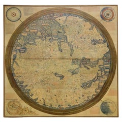
Monumental Framed Medieval Facsimile Map Of The World Fra Mauro Wood Wall Panel
Located in Forney, TX
A remarkable palatial nearly 7.5ft x 7.5ft facsimile of the important Map of the World (circa 1450) by Fra MauroFra Mauro (Italian; circa 1400–1464), featuring a solid wood framed hi...
Category
Early 20th Century Medieval Linen Maps
Materials
Linen, Wood, Paper
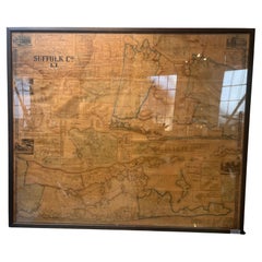
Framed Mid-19th Century Wall Map of Long Island, the Hamptons
Located in Sag Harbor, NY
A Framed museum quality find. This large wall map dates to the mid-1800s. Detailed inset maps of, Sag Harbor, East Hampton, Amagansett, Shelter Island and most villages in Long Island. It also has agriculture stats for 1855. Detailed prints of homes on Scuttle Hole in Bridgehampton as well as several other detailed prints. Lists of businesses, distance tables and railroad schedules and stops. The total amount of detailed information about Suffolk County Long Island is staggering. A unique rare New York map...
Category
Mid-19th Century American Antique Linen Maps
Materials
Linen, Paper
$7,100 Sale Price
20% Off
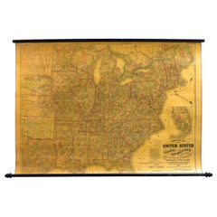
1863 "Lloyd's New Map of the United States, the Canadas, and New Brunswick"
Located in Colorado Springs, CO
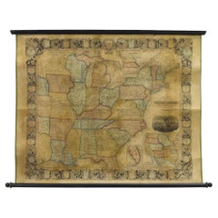
Presented is “Lloyd's New Map of the United States, the Canadas and New Brunswick, From the latest Surveys, Showing Every Railroad & Station Finished to June 1863, and the Atlantic and Gulf Coasts.” A large, Civil War-era hanging map of the United States and adjacent territories, this map covers the area from the Atlantic Ocean and extends as far west as the 103 meridian, to “Dacotah,” Nebraska, Kansas, "Indian Territory," and Texas. The southern continuation of Florida is shown in an inset map along the right margin. This map was published by J. T. Lloyd, in New York, in 1863. According to the publisher’s marking at lower right, this map was originally issued in two states: "in Sheets, Colored" for 50 cents, and "Varnished nicely, with Rollers" for $1.
Throughout the map, the counties are colored and the towns and cities well labeled. A reference key in the bottom margin provides symbols for railroads, turnpikes and wagon roads, state capitals, cities and towns, and village post offices. As emphasized in the map’s title, this map is especially notable for the countless railway lines and stations depicted, with distances noted between points, listing “every railroad and finished station to June 1863.” Additionally, two shipping agents and their routes are drawn out of New York City. The map includes details of the steamship routes into New York and Philadelphia from Liverpool and on to California and Oregon via an overland Nicaraguan trek, presumably to assist gold rush emigrants.
This expansive and impressive map depicts the eastern half of the United States in the third year of the Civil War. In order not to recognize the legitimacy of the Confederate States of America, each state is shown in the same manner as the Union states. The only indication that the American Civil War was in progress when this map was published is a printed notice that Gideon Wells, Secretary of the Navy, wishes to acquire a quote on 100 copies of Lloyd’s Mississippi River map...
Category
1860s American Antique Linen Maps
Materials
Linen, Wood, Paper
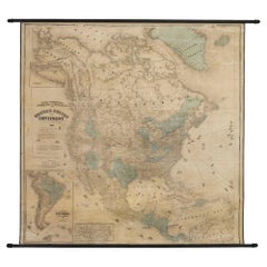
1868 "Lloyd's Topographical Railway Map of North America..." Hanging Wall Map
Located in Colorado Springs, CO
Presented is “Lloyd's Topographical Railway Map of North-America, or the United States Continent in 1900.” This map was published by J. T. Lloyd, in New York, in 1868. A large, hangi...
Category
1860s American Late Victorian Antique Linen Maps
Materials
Linen, Paper
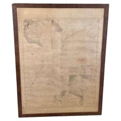
Large U.S. Coast and Geodetic Survey Chart A of the Atlantic Coast, 1877
Located in Nantucket, MA
Large U.S. Coast and Geodetic Survey Chart A of the Atlantic Coast, 1877, re-issued in February 1881, a printed paper laid down on linen navigational chart of the U.S. Atlantic coast...
Category
1880s American Other Antique Linen Maps
Materials
Linen
Vintage Swedish Topographic School Map of European Alps, Made in Sweden 1922
Located in Los Angeles, CA
Vintage Swedish Topographic School map of European Alps, Made in Sweden 1922
This vintage Swedish school map is so unique and a great example of why t...
Category
1920s Swedish Vintage Linen Maps
Materials
Linen, Wood, Paper
Large University Chart “Physical Map of Africa” by Bacon
Located in Godshill, Isle of Wight
Large university chart “Physical Map of Africa” by Bacon
W&A K Johnston’s Charts of Physical Maps By G W Bacon,
This is colorful Physical map of North America, it is large lithograph set...
Category
Early 20th Century Folk Art Linen Maps
Materials
Linen
University Chart “Black Map of North America
Located in Godshill, Isle of Wight
University Chart “Black Map of North America
W&A K Johnston’s Charts of Physical Maps By G W Bacon,
This is a Black Physical map of North A...
Category
Early 20th Century Industrial Linen Maps
Materials
Linen
Large Wall Map of Europe by George Philip & Son, circa 1920
Located in Langweer, NL
Antique map titled 'Philips' New Commercial Map of Europe'. Very large wall map of Europe including the North African coast and Turkey. Decorative bord...
Category
Early 20th Century Linen Maps
Materials
Linen, Paper
$2,074 Sale Price
30% Off
Antique Linen Anatomical School Poster from the Cow, 1950s
Located in Leuven, Vlaams Gewest
1950s didactical anatomical school poster of the cow.
Used to explain and show the anatomical aspect of a cow to the pupils.
Printed on linen.
Cool curio item to decorate a ...
Category
1950s Belgian Vintage Linen Maps
Materials
Linen
Antique Folding London Map, English, Cartography, Historic, Georgian, Dated 1783
Located in Hele, Devon, GB
This is an antique folding London map. An English, paper on linen cartographical study of the London metropolis and the surrounding area, published in the mid Georgian period, dated ...
Category
Late 18th Century British Georgian Antique Linen Maps
Materials
Linen, Paper
Antique Map of Italy by Andriveau-Goujon, 1843
By Andriveau-Goujon
Located in New York, NY
Antique Map of Italy by Andriveau-Goujon, 1843. Map of Italy in two parts by Andriveau-Goujon for the Library of Prince Carini at Palazzo Carini i...
Category
1840s French Antique Linen Maps
Materials
Linen, Paper
$3,350 / set
Antique Railroad Map of the United States by Rand, McNally & Co, 1900
Located in Langweer, NL
Antique map titled 'Rand, McNally & Co's New Official Railroad map of the United States with portions of The Dominion of Canada, The Republic of Mexico and the West Indies'. Large railroad map of the United States, sectionalised and laid on linen. Map shows state boundaries for the United States, Mexico, the West Indies, and lower portion of Canada; major cities and towns, military posts, Native American reservations, and railroads; Oklahoma and "Indian Territory." Inset: "Map of Alaska...
Category
20th Century Linen Maps
Materials
Linen, Paper
$2,222 Sale Price
25% Off
Antique Map of the Region of Wakayama, Nara and Osaka 'Japan'
Located in Langweer, NL
Geological folding map of the area with Wakayama, Nara, Osaka, Mie, and Shiga in Japan, circa 1880:
This map is a geological folding map, which means it was designed to be portable ...
Category
Late 19th Century Antique Linen Maps
Materials
Linen, Paper
$901 Sale Price
20% Off
Antique Map of the North-West Frontier by Stanford, 1895
By E. Stanford
Located in Langweer, NL
Antique map titled 'Stanford's Sketch Map of the North West Frontier of India from Peshawar to the Pamirs'. Linen backed folding map of the North-West Frontier of India from Peshawar...
Category
Late 19th Century Antique Linen Maps
Materials
Linen, Paper
$853 Sale Price
20% Off
Large 19th Century Map of France
Located in Pease pottage, West Sussex
Large 19th Century Map of France.
Remarkable condition, with a pleasing age worn patina.
Recently framed.
France Circa 1874.
Category
Late 19th Century French Antique Linen Maps
Materials
Linen, Paper
Antique Map of Scotland by Cary, '1811'
Located in Langweer, NL
Antique map titled 'A New Map of Scotland from the Latest Authorities':
**Title**: A New Map of Scotland from the Latest Authorities
**Publisher**: J....
Category
Early 19th Century Antique Linen Maps
Materials
Linen, Paper
$758 Sale Price
20% Off
Large Topographical and Geological Map of the Teshio Oil Field, '1936'
Located in Langweer, NL
Topographical and geological map of the Teshio oil field. Shows location of oil well, oil sand, natural gas, coal, Sulphur spring, anticlinal axis, prof...
Category
20th Century Linen Maps
Materials
Linen, Paper
$1,138 Sale Price
20% Off
Rare Set of 3 Map Samplers by A Charles. Italy, Spain & France
Located in Chelmsford, Essex
Set of 3 Map Samplers by A Charles. All depict countries, cities, seas and landmarks of the respective countries. The first entitled, 'SPAIN and PORTUGAL'. The second, 'MAP OF FRANCE...
Category
Early 19th Century English Antique Linen Maps
Materials
Linen
Vintage Swedish School Map of Vastergötland, Made in Sweden 1920
Located in Los Angeles, CA
Vintage Swedish School Map of Vastergötland, Made in Sweden 1920
Västergötland also known as West Gothland or the Latinized version Westrogothia in older literature, is one of the...
Category
1920s Swedish Vintage Linen Maps
Materials
Linen, Wood, Paper
Large University Chart “Political Map of North America” by Bacon
Located in Godshill, Isle of Wight
Large University Chart “Political Map of North America” by Bacon
W&A K Johnston’s Charts of Physical Maps By G W Bacon,
This is colourful Physical map ...
Category
Early 20th Century American Empire Linen Maps
Materials
Linen
Large University Chart “Political Map of North America” by Bacon
Located in Godshill, Isle of Wight
Large University chart “Political Map of North America” by Bacon
W&A K Johnston’s Charts of Political Maps by G W Bacon,
This is colorful Physical ...
Category
Early 20th Century American Empire Linen Maps
Materials
Linen
Large University Chart “Africa Physical ” by Bacon
Located in Godshill, Isle of Wight
Large University chart “Africa Physical ” by Bacon
W&A K Johnston’s charts of physical maps by G W Bacon,
This is a Physical map of Africa, it is lithograph set on Linen mounte...
Category
Early 20th Century Beaux Arts Linen Maps
Materials
Linen
Related Items
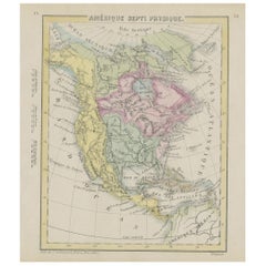
Small Map of the United States, circa 1870
Located in Langweer, NL
Antique map titled 'Amérique septe. Physique'. Small map of the United States. lithographed by C. Callewaert brothers in Brussels circa 1870.
Category
Mid-19th Century Belgian Antique Linen Maps
Materials
Paper
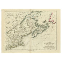
Antique Map of the Northeastern United States and Canada by Tardieu, 1802
Located in Langweer, NL
This antique map titled "Carte de la Partie Septentrionale des Etats Unis," created by Pierre Antoine Tardieu, depicts the northeastern part of the United States and parts of Canada....
Category
Early 1800s Antique Linen Maps
Materials
Paper
$531 Sale Price
20% Off
H 16.34 in W 22.25 in D 0.01 in
Antique Map of the Island of Tahiti, Polynesia, 1803
Located in Langweer, NL
Antique map Tahiti titled 'Kaart van het Eiland Otahiti'.
Antique map of the Island of Tahiti, Polynesia. Originates from 'Reizen Rondom de Waereld door James Cook (..)'.
Artists...
Category
Early 1800s Dutch Antique Linen Maps
Materials
Paper
$527 Sale Price
50% Off
H 11.42 in W 18.51 in D 0 in
1839-1877 The Works of Charles Dickens
Located in Bath, GB
A beautiful and very clean and bright set of works by renowned author Charles Dickens. In a tree calf Mansell binding.
Five volumes. From the renowned English writer and social crit...
Category
Mid-19th Century British Antique Linen Maps
Materials
Paper
Map Exploring The World, Midi Format
Located in New York, NY
A compelling exploration of the ways that humans have mapped the world throughout history - now in a compact new edition
Map: Exploring the World brings together more than 250...
Category
21st Century and Contemporary Linen Maps
Materials
Paper
Framed 1839 Hand Colored Map of the United States
Located in Stamford, CT
Framed hand colored map of the United States of America from 1839. Newly framed in a giltwood frame.
Category
1830s American American Classical Antique Linen Maps
Materials
Giltwood, Paper, Glass
1830 Mexico and United States Framed Map
Located in Stamford, CT
Map of North America published circa 1830. Map shows United States into Canada. Mexico extending into the upper California territory. Texas appears in name but prior to the period of...
Category
1830s American American Classical Antique Linen Maps
Materials
Glass, Wood, Paper
Antique Map of North America by Johnston, 1882
Located in Langweer, NL
Antique map titled 'North America'.
Old map of North America. This map originates from 'The Royal Atlas of Modern Geography, Exhibiting, in a Series of Entirely Original and Authen...
Category
19th Century Antique Linen Maps
Materials
Paper
Antique Map of North America, 1821
Located in Langweer, NL
Antique map of America titled 'Carte de l'Amerique septentrionale'. Scarce map of North America, shortly after the Louisiana Purchase and the first ...
Category
19th Century French Antique Linen Maps
Materials
Paper
Large 1848 North America & Territories Map
Located in Stamford, CT
Framed 1848 S. Augustus and Mitchell, Philadelphia , PA North America and territories map.
Featuring the United States, Canada (British Territory) and Mexican Territories.
As found...
Category
1840s American American Classical Antique Linen Maps
Materials
Glass, Wood, Paper
Antique Map of the United States by Titus '1871'
Located in Langweer, NL
Antique map titled 'The United States of America'. Original antique map of the United States. This map originates from 'Atlas of Prebl...
Category
Late 19th Century Antique Linen Maps
Materials
Paper
$758 Sale Price
20% Off
H 16.54 in W 26.78 in D 0.02 in
Framed 1838 North America & Recent Discoveries Map
Located in Stamford, CT
1838 map of North America & recent discoveries. Engraved color map by J. Wyld, London, England. This map shows Texas as a Republic without its panhandle.
Framed in brown carved wood...
Category
1830s American American Classical Antique Linen Maps
Materials
Glass, Wood, Paper
Previously Available Items
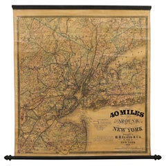
1870 "40 Miles Around New York" by H. H. Lloyd, Hanging Map on Original Rollers
Located in Colorado Springs, CO
This is an antique hanging map, “40 Miles Around New York,” published by H. H. Lloyd in New York in 1870. Presented on its original wooden rollers, this small-scale lithographed wall map is centered on Manhattan and its surrounding counties. Throughout the map, the counties are colored and the towns and cities well labeled. A reference key in the bottom margin provides symbols for railroads, railroad stations, proposed railways, aqueducts and canals, cemeteries, blacksmith shops, wheelwrights, grist mills, and sawmills. This map is especially notable for the countless railway lines and stations depicted, with distances in miles noted between stations. Lloyd’s “40 Miles Around New York” was first issued in 1867 as a folding pocket map.
This map offers interesting insight about the map trade of the times, revealing the competitive nature of print publishing. In the lower margin, Lloyd warns customers of another, similar sounding named map business, presumably map dealer and known rival J. T. Lloyd. He states, “reasons that are well known to many compel us to state that we have no relationship and never had any business connection whatever with another party who advertises ‘Lloyds Maps.’” He also reminds his customers against potential fraud, stressing “We do not collect money in advance for Maps which have never been, and can never be, published. Our agents are not allowed to collect before delivery in any case.”
Henry Huggins Lloyd was born in Blandford, Massachusetts, in 1828. With his brothers, James Lloyd and Myron Lloyd, he worked as H. H. Lloyd & Co., mapmakers and maps publishers based in New York City. H. H. Lloyd & Co. had an impressive map output, especially during the Civil War. He issued maps of coastal cities and harbors, military maps of the northern and southern states, maps of key battle states like Virginia and New York, as well as larger United States maps...
Category
1870s American Late Victorian Antique Linen Maps
Materials
Linen, Wood, Paper
H 31 in W 28.75 in D 1 in
1856 Hanging "Map of the United States from the Latest Authorities"
Located in Colorado Springs, CO
Presented is a scarce American wall map of the United States by Ensign, Bridgman, and Fanning in 1856. As the title suggests, the map covers the United States from the Atlantic Ocean, west to Minnesota, Nebraska, Kansas Territory, Indian Territory and Texas. Inset maps in the lower right include a “Map of the Western Portion of the United States” and the “Southern part of Florida.”
This is a classic map of the “Manifest Destiny” era, showing rapid westward expansion and new territories. Even the cartouche is symbolic of America’s evolution into a world superpower. A prominent bald eagle proudly perches atop the globe, implying dominance. Behind him, a bustling port city filled with trade ships...
Category
1850s American Antique Linen Maps
Materials
Linen, Wood, Paper
School Chart or Pull Down Map of Geography of the Netherlands, 1950s
Located in Hemiksem, VAN
A beautiful old school map of the Netherlands, painted on linen. The map shows the 3 different reliefs (low, middle, high) of the Netherlands. The beau...
Category
1950s Belgian Mid-Century Modern Vintage Linen Maps
Materials
Linen, Paint
Large Vintage Half-Inch Map Folio, Great Britain, Cartography Atlas, Bartholomew
Located in Hele, Devon, GB
This is a large vintage half-inch map folio of Great Britain. A Scottish, paper on linen bound compendium of cartographical interest by Bartholomew of Edinburgh, dating to the mid 20th century, circa 1965.
Of great interest to the collector of maps, covering Great Britain in the mid 20th century in fine detail
Displaying a desirable aged patina and in good archival order
Professionally bound in a British made Twinlock Loose Leaf folio
Each map in fine condition, fully legible and free of loss
Comprehensive coverage of England, Wales and Scotland (and Scottish Isles)
In full colour and detail across half inch scale, each sheet detailing regions or counties
Annotated for places, major roads and amenities/attractions
Scale and key detail to each page provides relevant information
Whilst several sheets are undated, two maps are reprinted from OS detail in 1962 and 1963
Earlier maps feature the Royal warrant for King George V (1910 - 1935)
Coverage of the Shetland Isles bears their former name Zetland, the change taking place in 1975
Imprint to lower edge for John Bartholomew & Son Ltd, Edinburgh
This is a fascinating large vintage map...
Category
1960s British Mid-Century Modern Vintage Linen Maps
Materials
Linen, Paper
H 2.17 in W 19.3 in D 23.63 in
La Galleria Delle Carte Geografiche in Vaticano, Maps in the Vatican, 3 Vols
By Fra Egnazio Danti
Located in Morristown, NJ
La Galleria delle Carte geografiche in Vaticano / The Gallery of Maps in the Vatican, Mirabilia Italiae / Franco Cosimo Panini, (3) vols. in black silk cloth, slipcase with golden ti...
Category
1990s Italian Renaissance Linen Maps
Materials
Linen, Paper
H 13 in W 5.5 in D 10 in
Vintage Swedish School Map of Europe, Large, Made in Sweden, 1905
Located in Los Angeles, CA
Vintage Swedish School Map of Europe - LARGE - Made in Sweden, 1905
This vintage Swedish school map is so unique and a great example of why these are so collectible.
Wooden pol...
Category
Early 1900s Swedish Antique Linen Maps
Materials
Linen, Wood, Paper
Antique Map of Asia by Stanford, 1862
Located in Langweer, NL
Antique map titled 'Stanford's Library Map of Asia'. Beautiful map of Asia in 4 sections, each segmented and mounted to original linen with marbled paper s...
Category
Mid-19th Century Antique Linen Maps
Materials
Linen, Paper
Georgian Map of UK Sampler by Elizabeth Kifft, 1797
Located in Chelmsford, Essex
1797 England & Wales Map Sampler by Elizabeth Kifft, Leacock School. The sampler is worked in silk on linen ground, in a variety of stitches. Meandering floral border. Titled, 'Map o...
Category
1790s English Folk Art Antique Linen Maps
Materials
Linen, Silk
Antique Map to Golf Links 30 Miles Around London by A. Gross '1913'
Located in Langweer, NL
Antique road map titled '30 Miles Round London: Golf Links in Area of 30 Miles Round London'. Large road map backed with linen and sectioned for foldi...
Category
20th Century Linen Maps
Materials
Linen, Paper
Leather Cased Set of Maps of England and Wales, circa 1920
By E. Stanford
Located in London, GB
A pigskin leather case with ‘fish-tail’ handle containing a complete series of Bartholomew's 2 miles to an inch scale, linen backed maps for England and Wales by Edward Stanford of L...
Category
1920s English Vintage Linen Maps
Materials
Metal
Antique Map of China and Japan by E. Stanford, 1900
By E. Stanford
Located in Langweer, NL
Antique map titled 'Stanford's Map of the Empires of China and Japan with the adjacent parts of the Russian Empire, India, Burma, &c.'. Large folding map of the Far East.
Category
Early 20th Century English Linen Maps
Materials
Linen, Paper
Antique Map of the London Region by G.F. Cruchley, 1838
By G.F. Cruchley
Located in Langweer, NL
Antique map titled 'New Map Extending 24 Miles Round London, showing all the Mail, Turnpike, and Cross Roads, Gentleman's Seats, parks etc. etc. Also all the Proposed Railways, &c.'....
Category
Mid-19th Century English Antique Linen Maps
Materials
Linen, Paper
Recently Viewed
View AllMore Ways To Browse
Antique Wellington Chests
Antonio Cassi Ramelli
Archimede Seguso Birds
Art Deco Coasters
Art Deco Footballer
Art Deco Music Cabinet
Art Deco Waterfall Bedroom Furniture
Art Deco Waterfall Bedroom
Art Deco Whisky
Art Foulard
Art Nouveau Sunflower
Arts And Crafts Silver Coffee Pot
Asian Pink Bowl
Avesn Vase
Baccarat Carafe
Bakelite Bird
Bakelite Cocktail Picks
Bamboo Ikebana Vase

