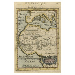
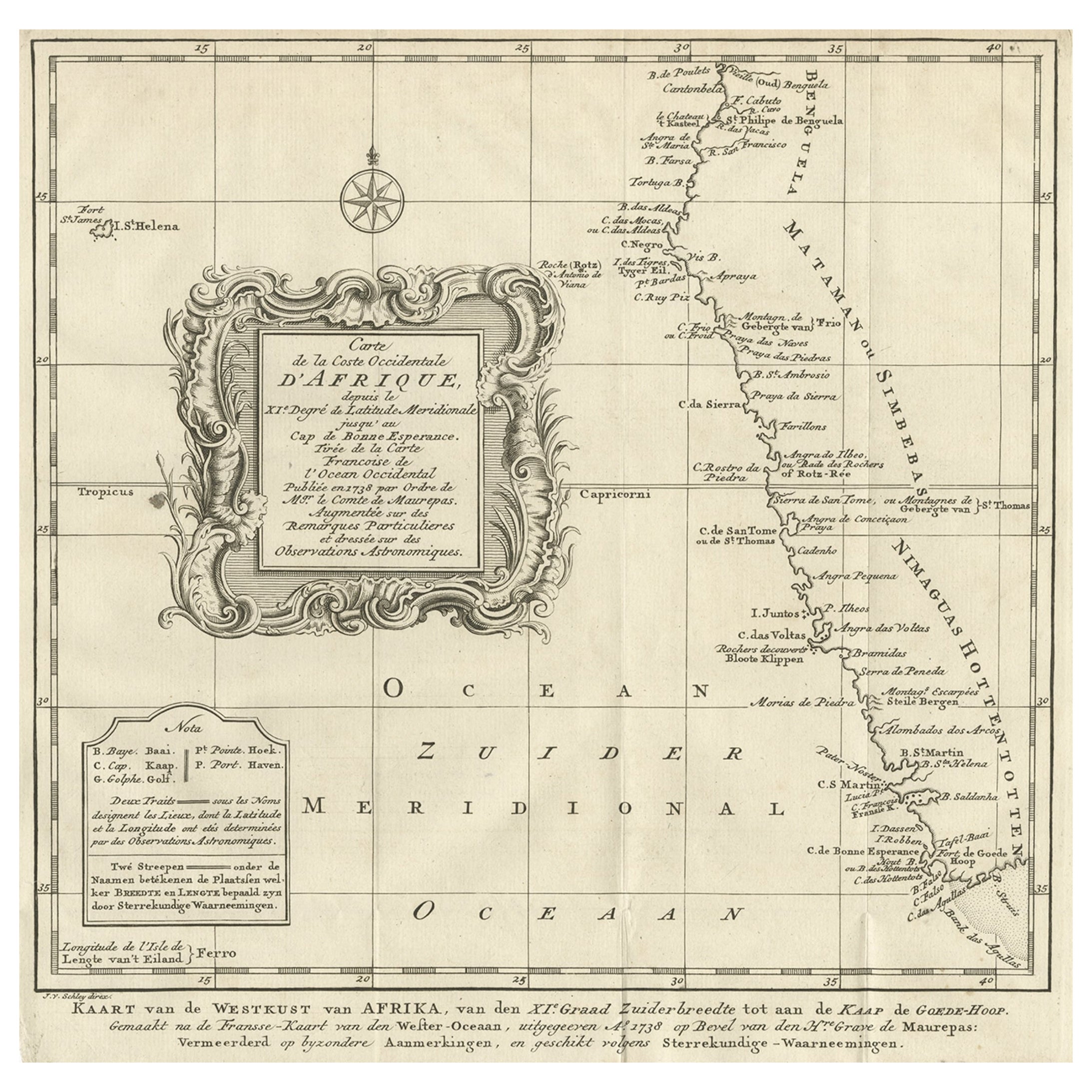
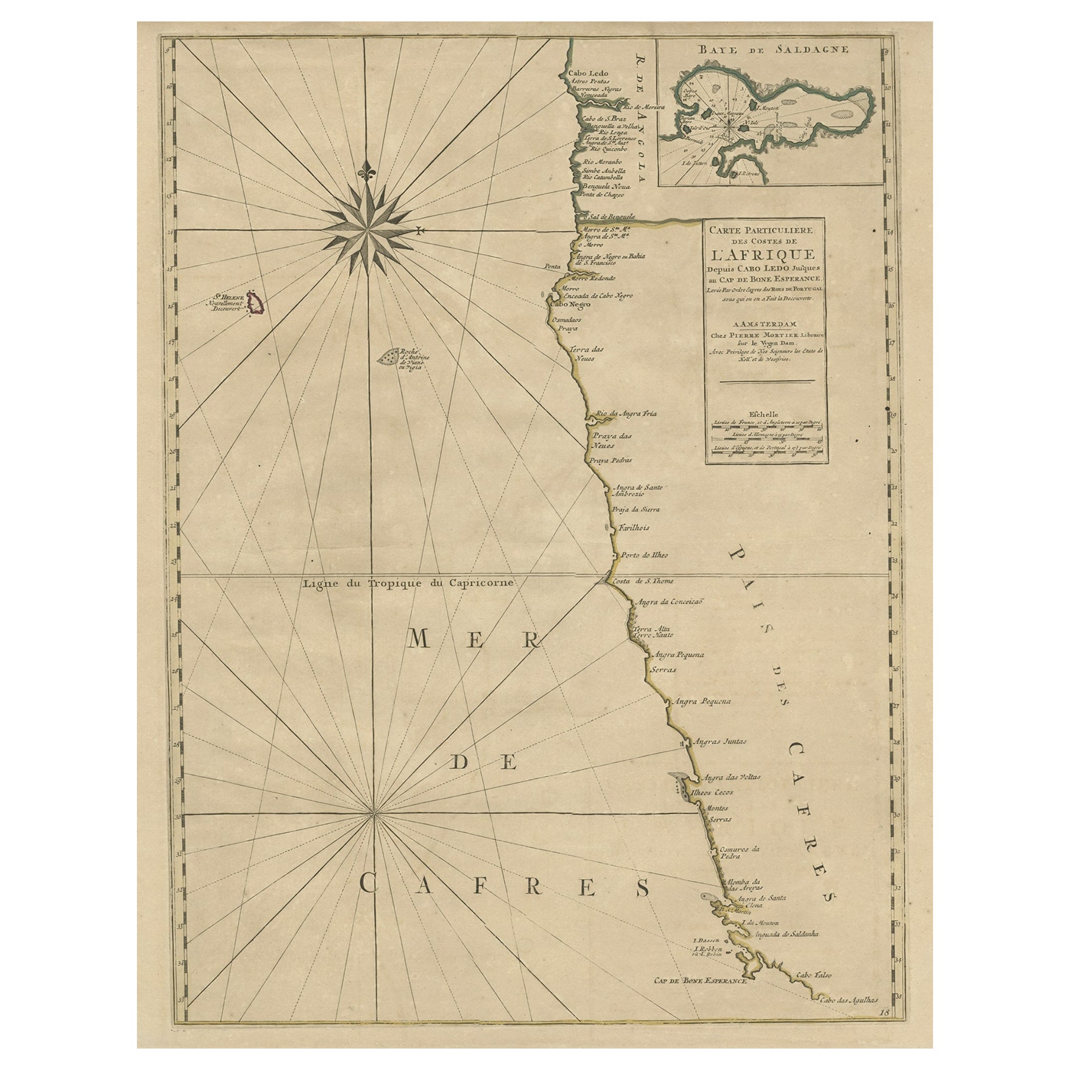
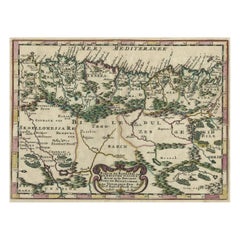
Old Small Map of Africa, from Barbary to the Congo, Mainly the Slave Coast, 1683
View Similar Items
Want more images or videos?
Request additional images or videos from the seller
1 of 5
Old Small Map of Africa, from Barbary to the Congo, Mainly the Slave Coast, 1683
About the Item
- Dimensions:Height: 8.47 in (21.5 cm)Width: 5.52 in (14 cm)Depth: 0 in (0.02 mm)
- Materials and Techniques:
- Period:1680-1689
- Date of Manufacture:1683
- Condition:Wear consistent with age and use. Condition: Good, some wear and French text on verso. General age-related toning with remains of tape in the corners, but all outside the image. Please study image carefully.
- Seller Location:Langweer, NL
- Reference Number:Seller: BG-09304 1stDibs: LU3054327171732
About the Seller
5.0
Platinum Seller
These expertly vetted sellers are 1stDibs' most experienced sellers and are rated highest by our customers.
Established in 2009
1stDibs seller since 2017
1,946 sales on 1stDibs
More From This SellerView All
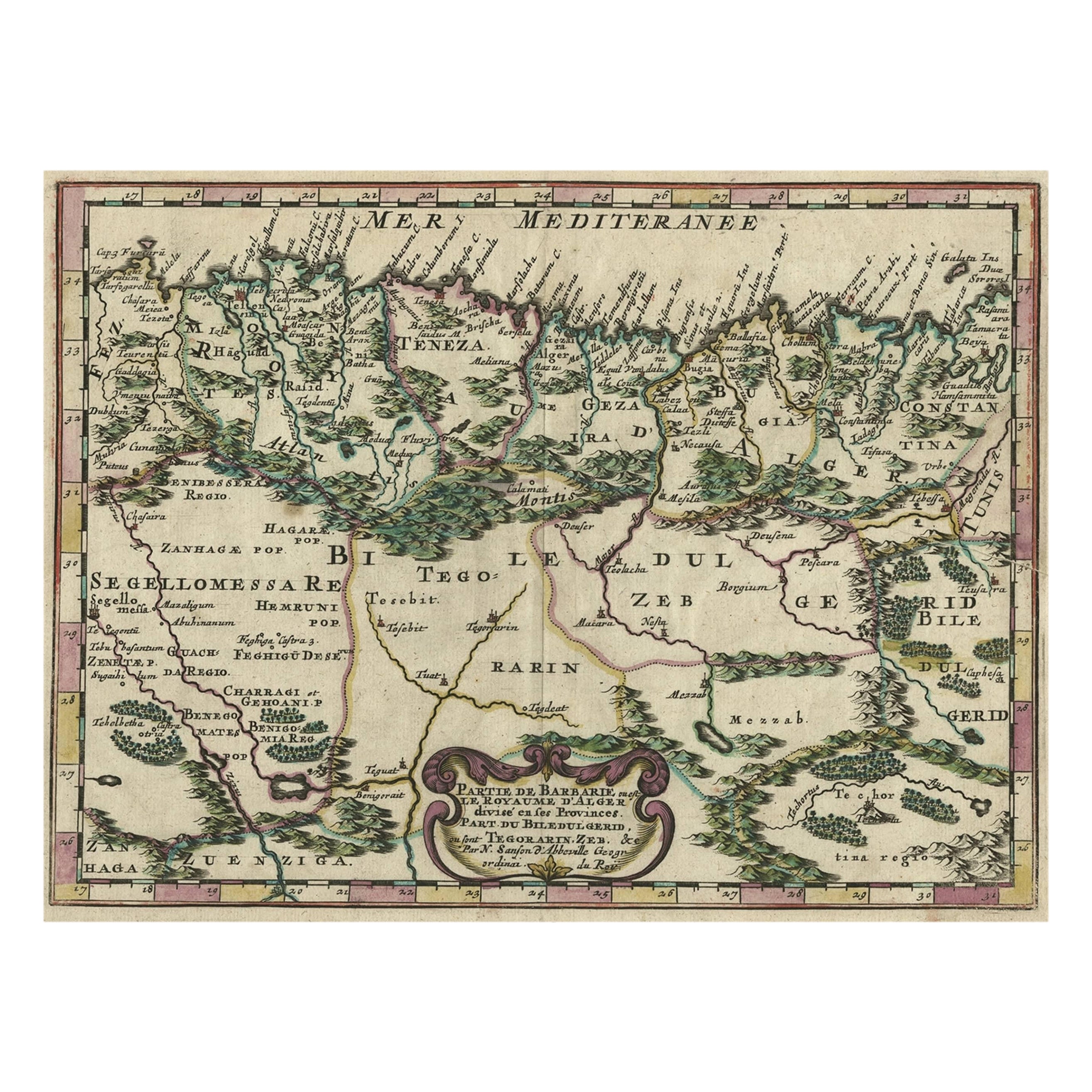
- Copper-Engraved Map Showing the Algerian Coast of North Africa, Published 1683Located in Langweer, NLAntique map titled 'Partie de Barbarie, ou est le Royaume d'Alger (..)'. Copper-engraved map showing the Algerian coast of North Africa. Published 1683. Artists and Engravers:...Category
Antique 1680s Maps
MaterialsPaper
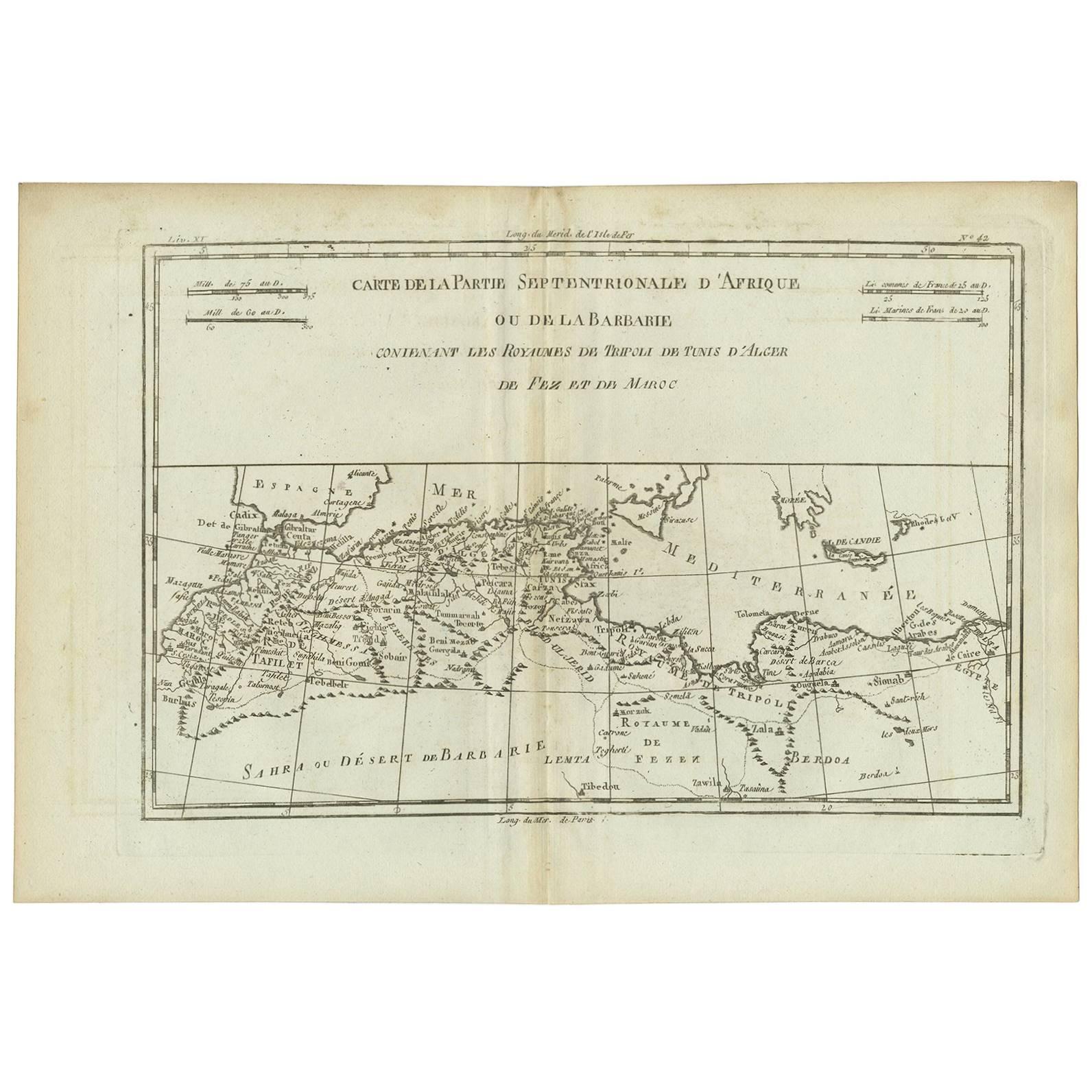
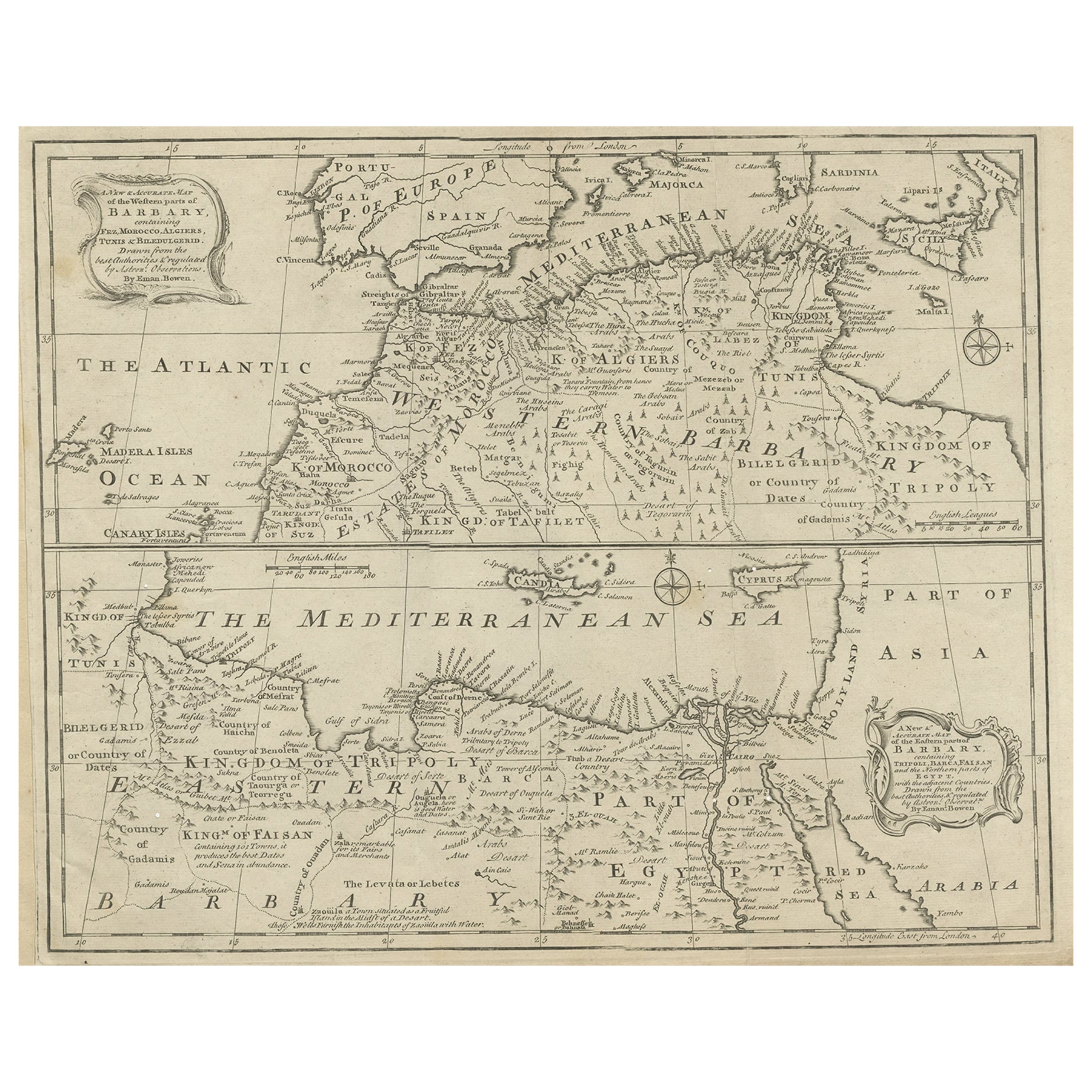
- Antique Map of Northern Africa "Barbary Coast" by R. Bonne, circa 1780Located in Langweer, NLA fine example of Rigobert Bonne and Guilleme Raynal’s 1780 map of northwestern Africa or the Barbary Coast. Includes the modern day countries of Morocco, Algeria, Tunisia, Libya, and parts of adjacent Spain, Italy and Greece. This map was made in response to European interest in the region due to coastal attacks and incursions by the Barbary Pirates...Category
Antique Late 18th Century Maps
MaterialsPaper
 $123 Sale Price20% Off
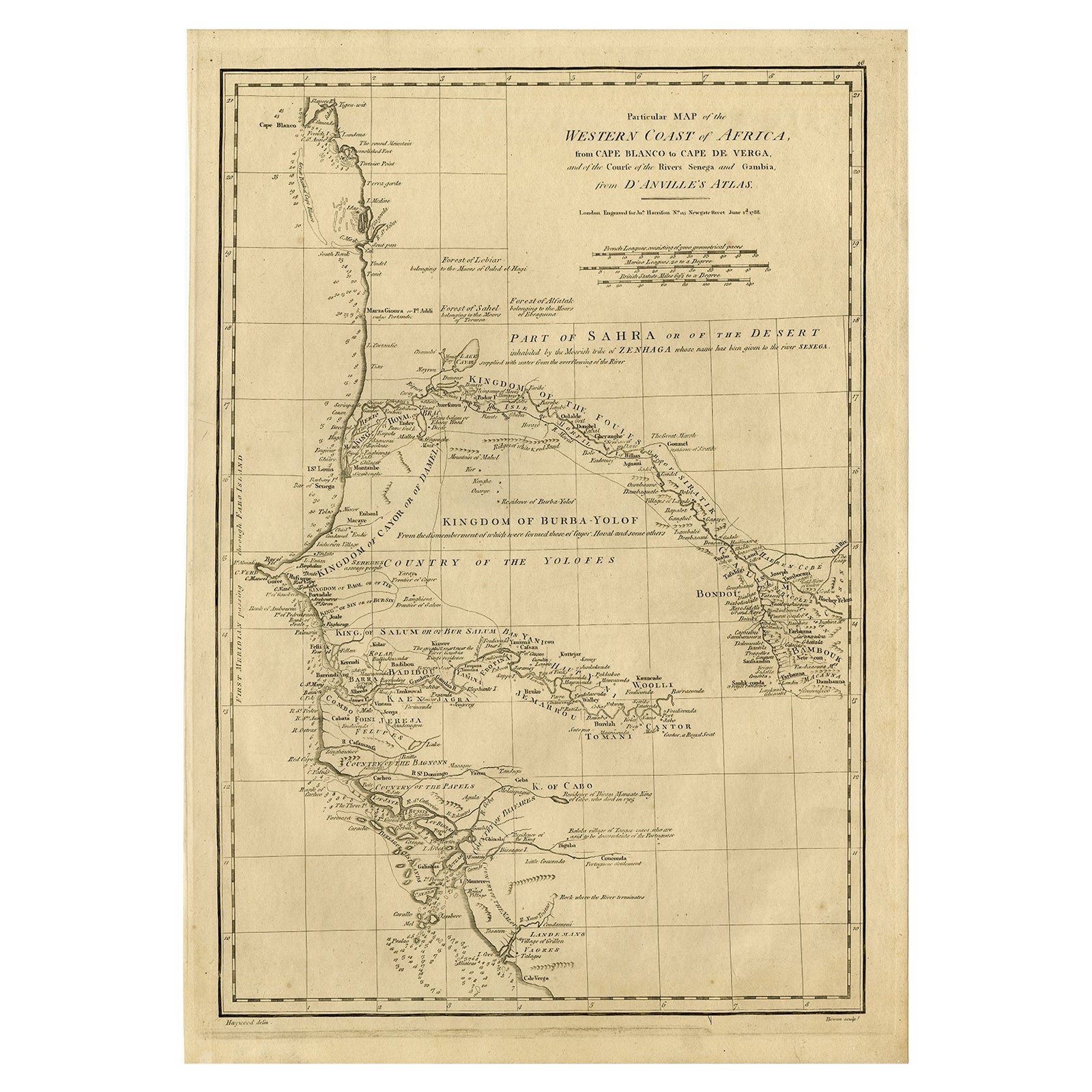
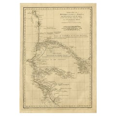
 - Map of the West African coast from the North of Mauretania to Guinee, 1788Located in Langweer, NLAntique map titled 'Particular Map of the Western Coast of Africa, from Cape Blanco to Cape de Verga, and of the Course of the Rivers Senega and Gambia.' Map of the African coast...Category
Antique 1780s Maps
MaterialsPaper
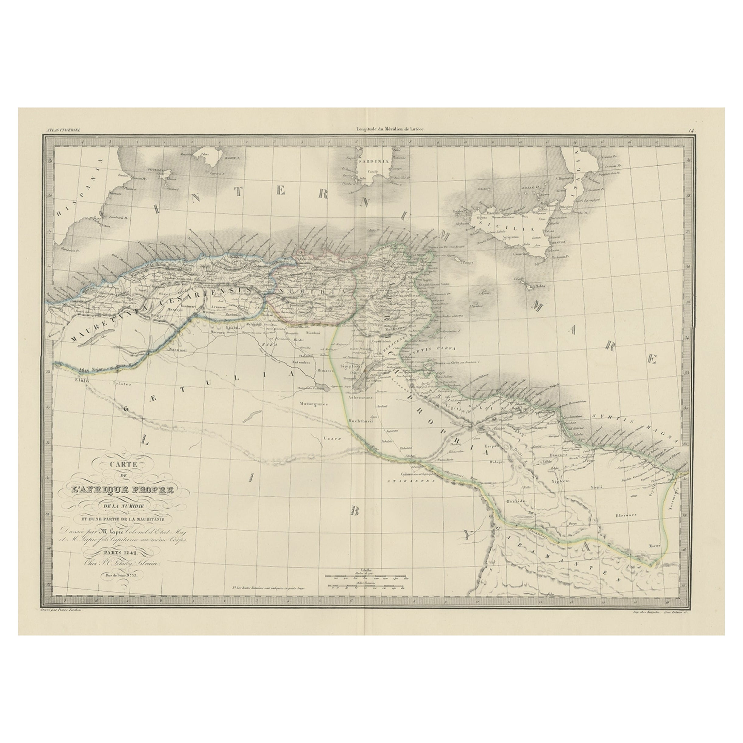
- The Empires of Mauritania, Carthage & Numidia 'Barbary Coast', Africa, 1842Located in Langweer, NLAntique map titled 'Carte de l'Afrique Propre de la Numidie (..)'. Map of the empires of Mauritania, Carthage and Numidia (Barbary Coast). This map originates from 'Atlas univers...Category
Antique 1840s Maps
MaterialsPaper
 $299 Sale Price20% Off
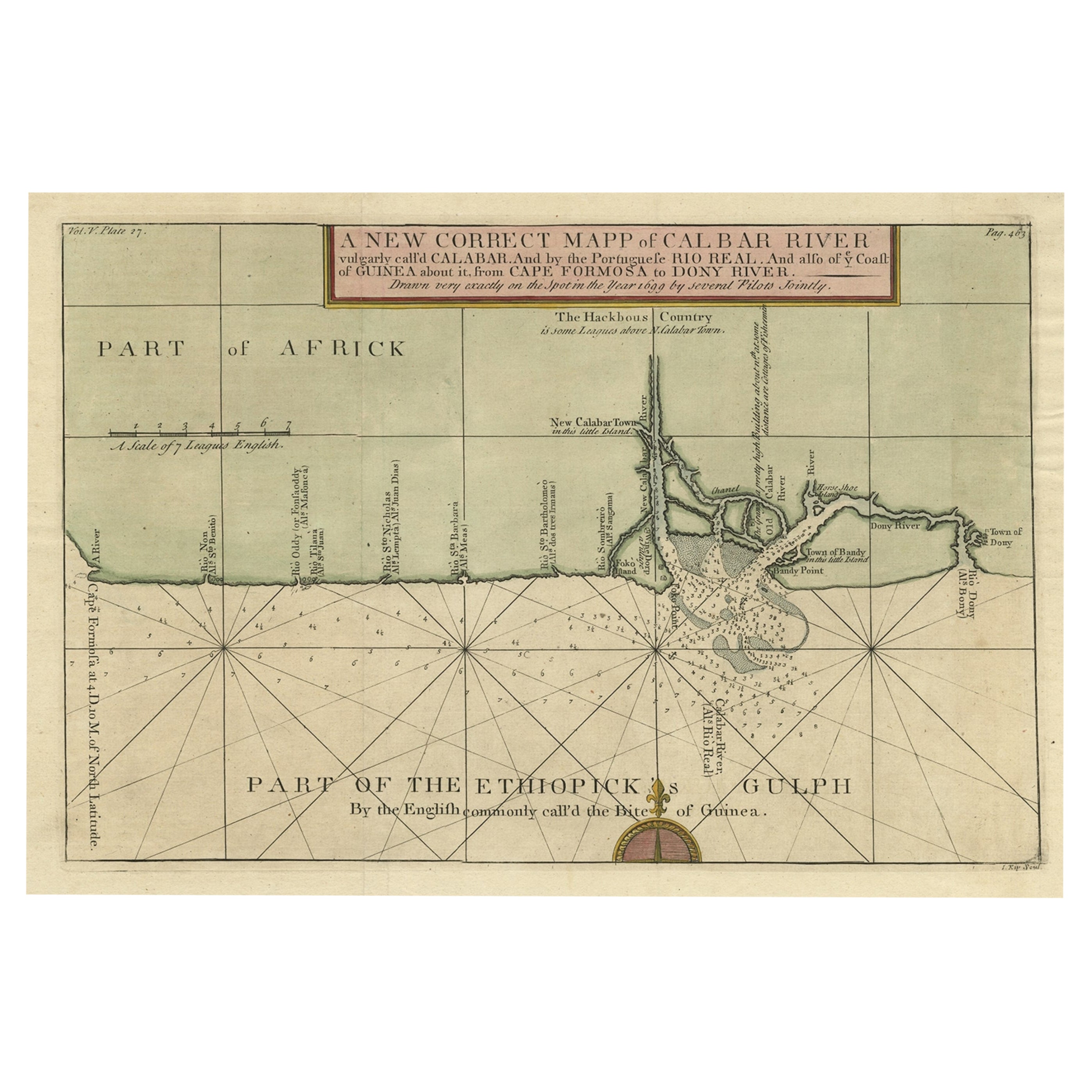
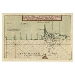
 - Authentic Map of the Coast from Cape Formosa to the Dony River, Africa, 1732Located in Langweer, NLAntique map titled 'The New Correct Mapp of Calbar River vulgarly call'd Calabar (..)'. An interesting map of the coast from Cape Formosa to the Dony River stated on the map to be ...Category
Antique 1730s Maps
MaterialsPaper
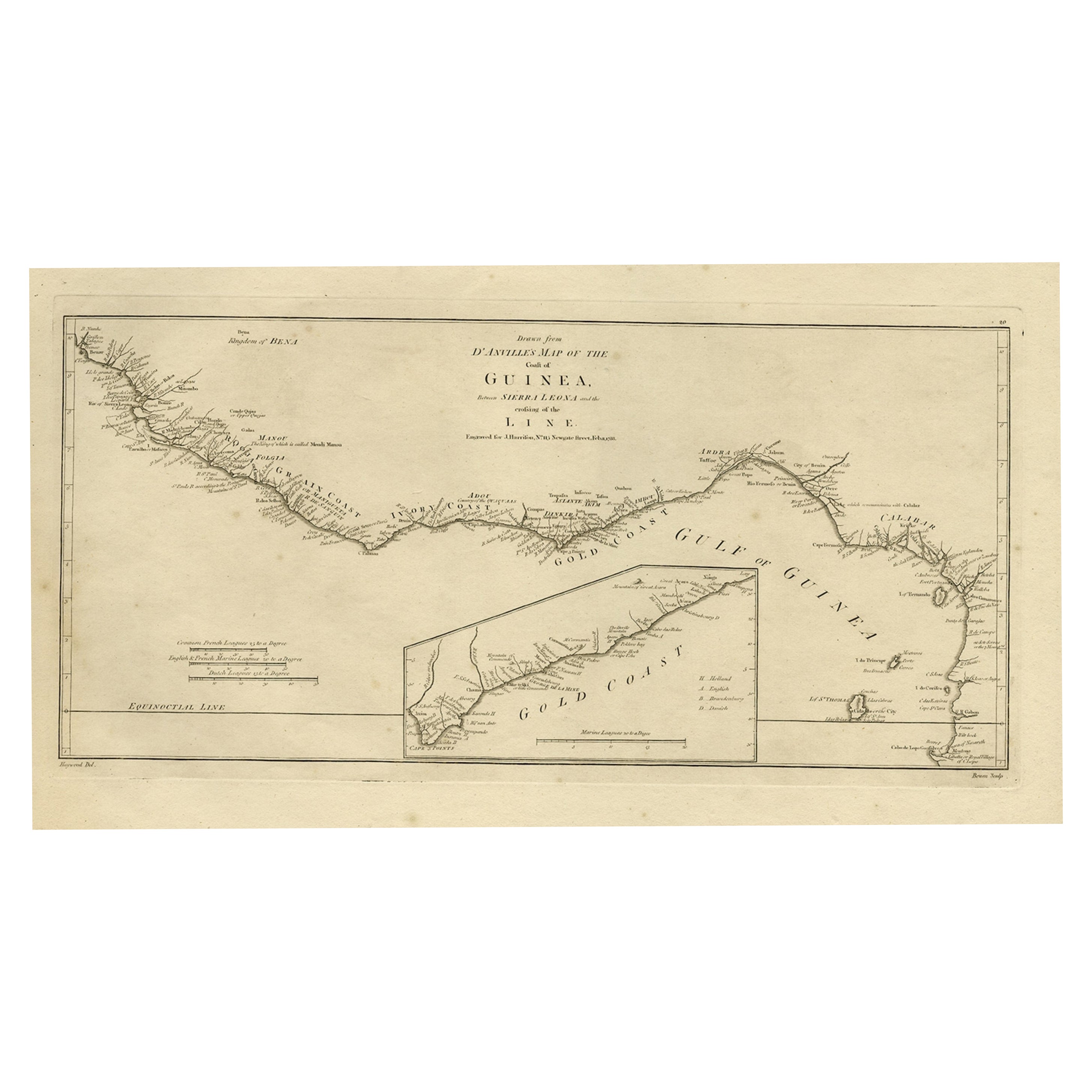
- Map of the African Coast, Gulf of Guinea, from Sierra Leone to Gabon, 1788Located in Langweer, NLAntique map titled 'Drawn from d'Anvilles Map of the Coast of Guinea, Between Sierra Leone and the crossing of the Line.' Map of the African coast, Gulf of Guinea, from Sierra Le...Category
Antique 1780s Maps
MaterialsPaper
 $404 Sale Price20% Off
You May Also Like
- West Coast of Africa, Guinea & Sierra Leone: An 18th Century Map by BellinBy Jacques-Nicolas BellinLocated in Alamo, CAJacques Bellin's copper-plate map entitled "Partie de la Coste de Guinee Dupuis la Riviere de Sierra Leona Jusquau Cap das Palmas", depicting the coast of Guinea and Sierra Leone in ...Category
Antique Mid-18th Century French Maps
MaterialsPaper
- Old Nautical Map of CorsicaLocated in Alessandria, PiemonteST/556/1 - Old map of Corsica isle, surveyed by Captain Hell, of the French Royal Navy in 1824, engraved and published on 1874, with additions and corre...Category
Antique Early 19th Century English Other Prints
MaterialsPaper
 $351 Sale Price20% Off
 - Old Horizontal Map of EnglandBy TassoLocated in Alessandria, PiemonteST/520 - Old rare Italian map of England, dated 1826-1827 - by Girolamo Tasso, editor in Venise, for the atlas of M.r Le-Sage.Category
Antique Early 19th Century Italian Other Prints
MaterialsPaper
 $237 Sale Price20% Off
 - New Map of North America from the Latest Discoveries, 1763Located in Philadelphia, PAA fine antique 18th century map of the North American seaboard. Entitled "A New Map of North America from the Latest Discoveries 1763". By the Cartographer/Engraver - John Spil...Category
Antique Mid-18th Century English Georgian Maps
MaterialsPaper
- Vintage "View of the Center of Paris Taken from the Air" Lithograph MapLocated in San Diego, CAA very stylish "View of the Center of Paris Taken from the Air" lithograph map published by the Paris Ministry of Tourism, circa early 1950s. The piece measures 27" x 43" and shows...Category
20th Century French Mid-Century Modern Prints
MaterialsPaper
 $680 Sale Price20% Off
 - Original Antique Map of South Africa, Arrowsmith, 1820Located in St Annes, LancashireGreat map of South Africa. Drawn under the direction of Arrowsmith. Copper-plate engraving. Published by Longman, Hurst, Rees, Orme and Br...Category
Antique 1820s English Maps
MaterialsPaper


Recently Viewed
View AllMore Ways To Browse
Antique Map Africa
Antique Map Of Africa
Antique Maps Of Africa
Antique Mallet
Miniature Maps
Miniature Map
Mallet Antiques
Map Of France Miniature
Congo Antique Map
Wood Carvings Of Ships
Compass Rose
Classroom Furniture Used
Fine Antique Maps
Orbis Map
17th Century World Map
Book Of Antique Maps
18th Century Southern Antiques
Antique French Globe