Items Similar to Original Antique Map of Egypt in Frame by C. Weigel, circa 1720


Want more images or videos?
Request additional images or videos from the seller
1 of 6
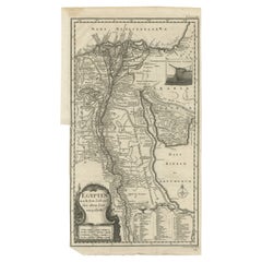
Original Antique Map of Egypt in Frame by C. Weigel, circa 1720
$935.95
$1,169.9420% Off
£690.23
£862.7820% Off
€780
€97520% Off
CA$1,292.54
CA$1,615.6720% Off
A$1,418.22
A$1,772.7720% Off
CHF 742.23
CHF 927.7920% Off
MX$17,453.48
MX$21,816.8520% Off
NOK 9,350.99
NOK 11,688.7420% Off
SEK 8,758.59
SEK 10,948.2420% Off
DKK 5,940.66
DKK 7,425.8220% Off
About the Item
The map is an antique depiction of ancient Egypt, divided into its regions and nomes, also including areas like Troglodytica, Marmarica, and Ethiopia above Egypt. Christophorus Weigelius -or Wiegel- curated the map, which was included in the atlas "Descriptio orbis antiqui in XLIV," around 1720.
It represents a detailed cartographic record from the early 18th century, illustrating the geographical understanding of Egypt and its surrounding territories at the time.
- Dimensions:Height: 27.56 in (70 cm)Width: 24.41 in (62 cm)Depth: 0.99 in (2.5 cm)
- Materials and Techniques:
- Period:
- Date of Manufacture:circa 1720
- Condition:General age-related toning. Frame included, please study image carefully.
- Seller Location:Langweer, NL
- Reference Number:Seller: BG-080561stDibs: LU3054310288333
About the Seller
5.0
Recognized Seller
These prestigious sellers are industry leaders and represent the highest echelon for item quality and design.
Platinum Seller
Premium sellers with a 4.7+ rating and 24-hour response times
Established in 2009
1stDibs seller since 2017
2,618 sales on 1stDibs
Typical response time: <1 hour
- ShippingRetrieving quote...Shipping from: Langweer, Netherlands
- Return Policy
Authenticity Guarantee
In the unlikely event there’s an issue with an item’s authenticity, contact us within 1 year for a full refund. DetailsMoney-Back Guarantee
If your item is not as described, is damaged in transit, or does not arrive, contact us within 7 days for a full refund. Details24-Hour Cancellation
You have a 24-hour grace period in which to reconsider your purchase, with no questions asked.Vetted Professional Sellers
Our world-class sellers must adhere to strict standards for service and quality, maintaining the integrity of our listings.Price-Match Guarantee
If you find that a seller listed the same item for a lower price elsewhere, we’ll match it.Trusted Global Delivery
Our best-in-class carrier network provides specialized shipping options worldwide, including custom delivery.More From This Seller
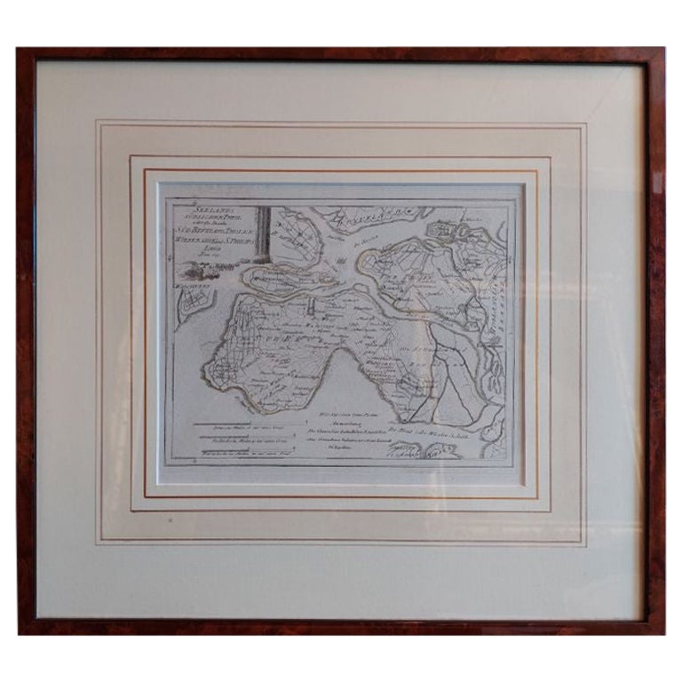
View AllAntique Map of Southern Zeeland by Von Reilly, 1790
Located in Langweer, NL
"Antique map titled 'Seelands südlicher Theil oder die Inseln Süd Beverland, Tholen, Wolfersdyk und S. Philipsland'. Original antique map of the southern portion of the province of Z...
Category
Antique 18th Century Maps
Materials
Paper
$190 Sale Price
20% Off
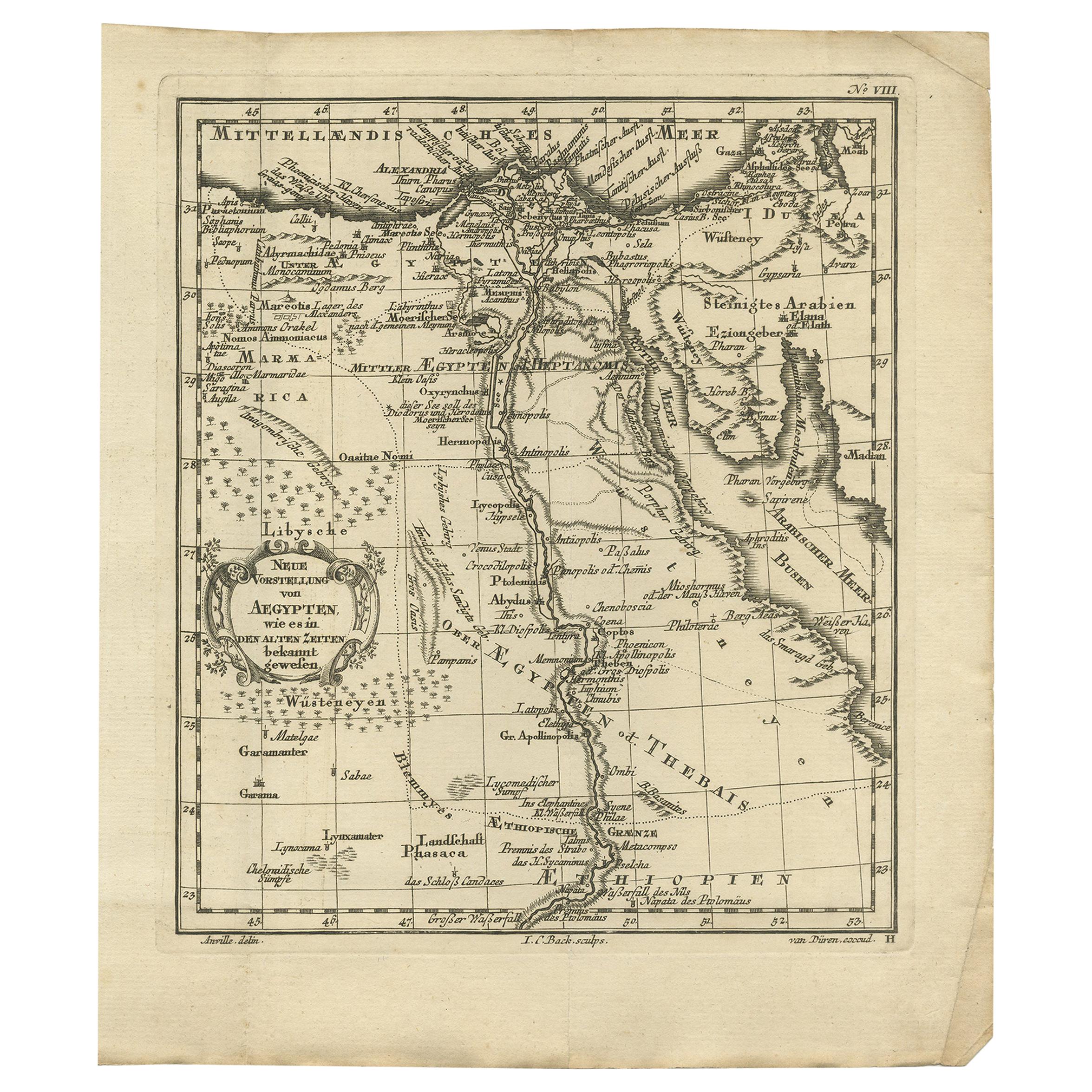
Antique Map of Ancient Egypt Also Depicting the Nile River and Red Sea, 1845
Located in Langweer, NL
Antique map Egypt titled 'General Karte von Alt Aegypten von A.H. Brué'. Large map of Egypt also depicting the Nile river and Red Sea. Source unknown...
Category
Antique 19th Century Maps
Materials
Paper

$239 Sale Price
20% Off
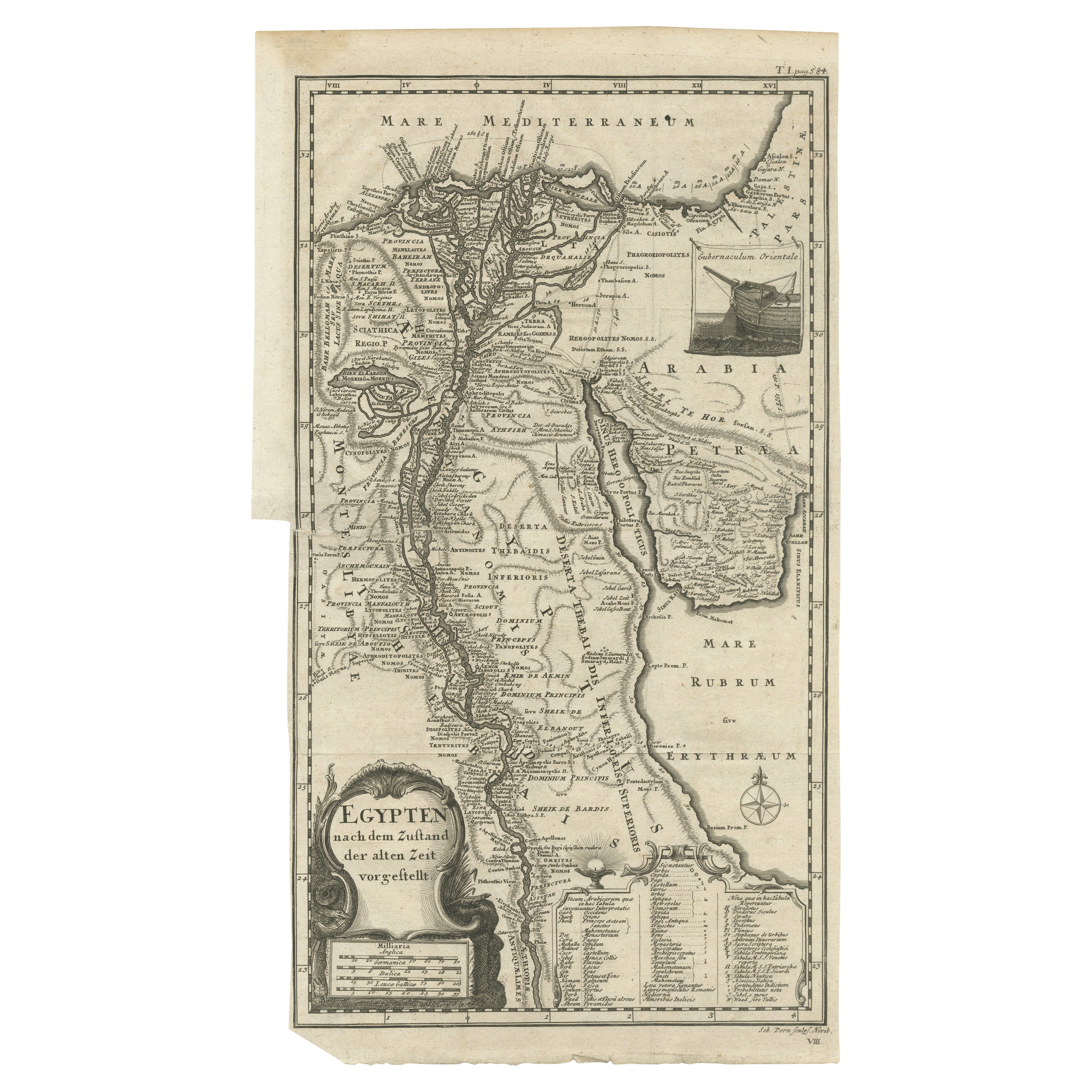
Original Antique Map of Egypt by Van Dùren '1749'
Located in Langweer, NL
Decorative German antique engraving with titled 'Neue Vorstellung von Aegypten (..)'. It concerns a rare original antique map of Egypt. This map o...
Category
Antique Mid-18th Century Maps
Materials
Paper

$247 Sale Price
25% Off
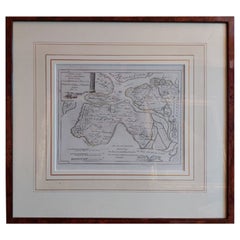
Antique Map of Egypt and the Nile River
Located in Langweer, NL
Antique map titled 'Egypten nach dem Zustand der alten Zeit vorgestellt'. This uncommon and richly detailed map of Egypt features hundreds of place names along the Nile. The Sinai Pe...
Category
Antique Mid-18th Century Maps
Materials
Paper
$326 Sale Price
20% Off
Antique Map of The Nile, Egypt and the Red Sea by Bachiene, 1765
Located in Langweer, NL
Antique map titled 'De XIde Landkaart verbeeldende Egypte en de Woestyne der Schelf-Zee (..).' Map of Biblical Egypt and the Red Sea. With title cartouche, compass rose and scale. Th...
Category
Antique 18th Century Maps
Materials
Paper

$167 Sale Price
20% Off
Antique Map of North Africa showing Egypt, Mauritania and Africa Minor, 1672
Located in Langweer, NL
Antique map titled 'Africa Minor, Mauritania , Aegyptus.' Charming miniature map of North Africa, showing Egypt, Mauritania and Africa Minor. This map originates from the pocket atla...
Category
Antique 17th Century Maps
Materials
Paper
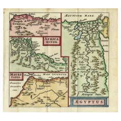
$215 Sale Price
20% Off
You May Also Like
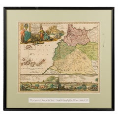
Framed Print of an Antique German Map of Morocco
Located in Queens, NY
Antique German map (print) of Morocco (circa 1728) featuring a central map above two city views depicted below and an upper scenic cartouche featur...
Category
Mid-20th Century German Biedermeier Paintings
Materials
Wood
London 1744 Published Watercolour Antique Map of East Africa by Eman Bowen
Located in West Sussex, Pulborough
We are delighted to offer for sale this New and Accurate Map of Nubia & Abissinia, together with all the Kingdoms Tributary Thereto, and bordering upon them published in 1744 by Emanuel Bowen
This is a decorative antique engraved map of East Africa...
Category
Antique 1740s English George III Maps
Materials
Paper

$919 Sale Price
30% Off
Antique Lithography Map, West Africa, English, Framed, Cartography, Victorian
Located in Hele, Devon, GB
This is an antique lithography map of Western Africa. An English, framed atlas engraving of cartographic interest by John Rapkin, dating to the early Victorian period and later, circ...
Category
Antique Mid-19th Century British Early Victorian Maps
Materials
Wood

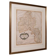
Antique Lithography Map, Oxfordshire, English, Framed Cartography, Robert Morden
Located in Hele, Devon, GB
This is an antique lithography map of Oxfordshire. An English, framed atlas engraving of cartographic interest by Robert Morden, dating to the late 17th century and later.
Superb l...
Category
Antique Late 17th Century British William and Mary Maps
Materials
Paper
Map of the Holy Land "Carte de la Syrie et de l'Egypte" by Pierre Lapie
By Pierre M. Lapie
Located in Alamo, CA
This is an early 19th century map of ancient Syria and Egypt entitled "Carte de la Syrie et de l'Egypte anciennes/dressée par M. Lapie, Colonel d'Etat M...
Category
1830s Landscape Prints
Materials
Engraving

Antique Lithography Map, Bedfordshire, English, Framed Engraving, Cartography
Located in Hele, Devon, GB
This is an antique lithography map of Bedfordshire. An English, framed atlas engraving of cartographic interest, dating to the mid 19th century and...
Category
Antique Mid-19th Century British Victorian Maps
Materials
Wood

More Ways To Browse
Framing Antique Maps
Antique Maps Framed
Map Of Egypt
Used Furniture In Egypt
Antique Map Of Egypt
Framing Antique Maps
Antique Navigation
Antique Map Of England
Antique Maps Framed
United States Map
Europe Map Antique
Portugal Antiques
Indonesia Map
Antique Maps Of Germany
Mississippi Furniture
19th Century German Collectibles
Swiss Antiques And Collectables
Map Of Japan