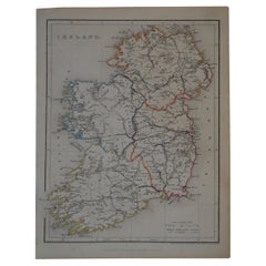
Original Antique Map of Ireland by Hughes, circa 1840
View Similar Items


Want more images or videos?
Request additional images or videos from the seller
1 of 5
Original Antique Map of Ireland by Hughes, circa 1840
About the Item
- Dimensions:Height: 8.25 in (20.96 cm)Width: 10.75 in (27.31 cm)Depth: 0.07 in (1.78 mm)
- Style:Other (In the Style Of)
- Materials and Techniques:Paper,Other
- Place of Origin:
- Period:
- Date of Manufacture:1840
- Condition:Wear consistent with age and use.
- Seller Location:St Annes, GB
- Reference Number:1stDibs: LU1836317065931
About the Seller
4.9
Platinum Seller
Premium sellers with a 4.7+ rating and 24-hour response times
1stDibs seller since 2016
3,080 sales on 1stDibs
Typical response time: 1 hour
Associations
International Confederation of Art and Antique Dealers' Associations
Authenticity Guarantee
In the unlikely event there’s an issue with an item’s authenticity, contact us within 1 year for a full refund. DetailsMoney-Back Guarantee
If your item is not as described, is damaged in transit, or does not arrive, contact us within 7 days for a full refund. Details24-Hour Cancellation
You have a 24-hour grace period in which to reconsider your purchase, with no questions asked.Vetted Professional Sellers
Our world-class sellers must adhere to strict standards for service and quality, maintaining the integrity of our listings.Price-Match Guarantee
If you find that a seller listed the same item for a lower price elsewhere, we’ll match it.Trusted Global Delivery
Our best-in-class carrier network provides specialized shipping options worldwide, including custom delivery.More From This Seller
View AllOriginal Antique Map of Ireland- Kerry. C.1840
Located in St Annes, Lancashire
Great map of Kerry
Steel engraving
Drawn under the direction of A.Adlard
Published by How and Parsons, C.1840
Unframed.
Category
Antique 1840s English Maps
Materials
Paper

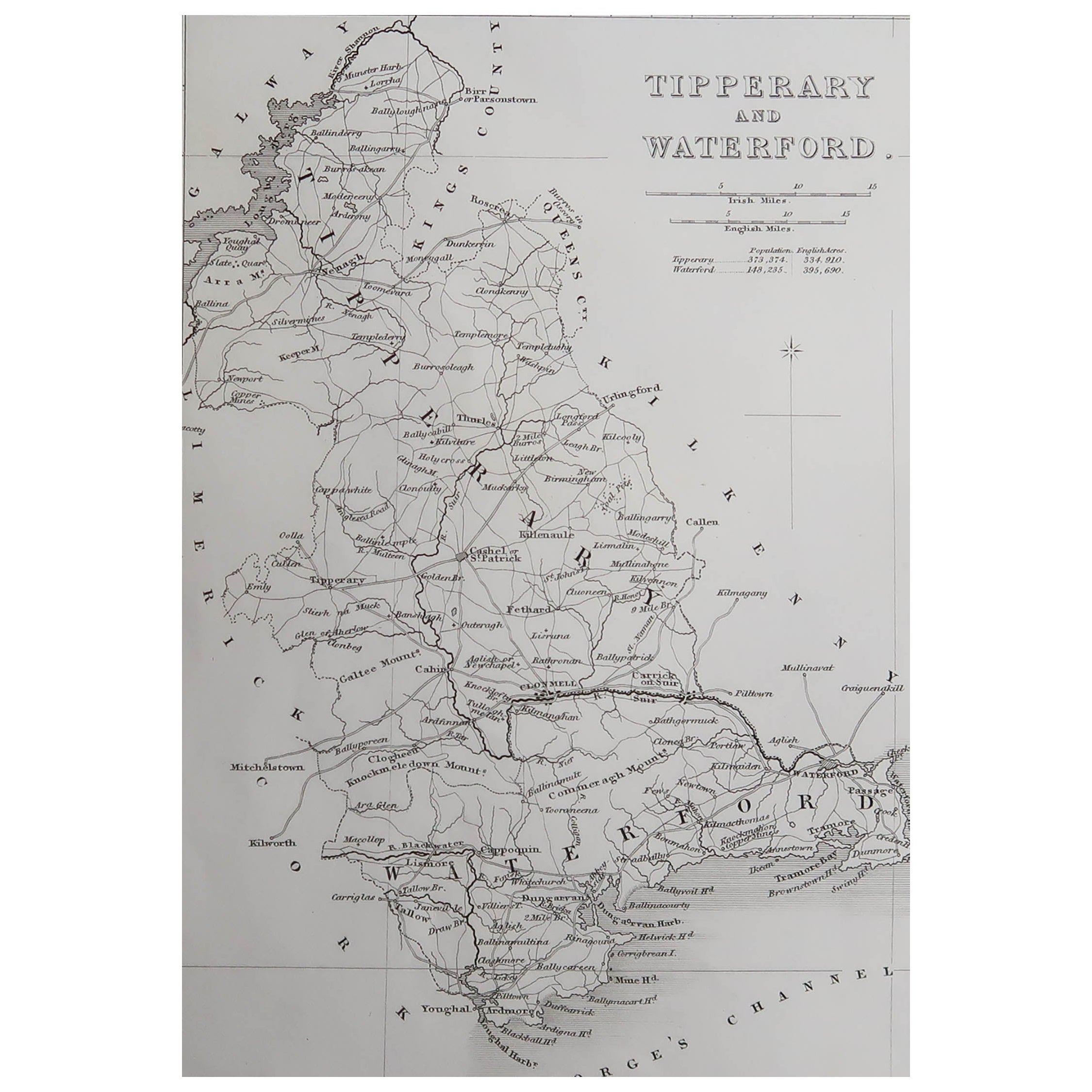
Original Antique Map of Ireland- Tipperary and Waterford. C.1840
Located in St Annes, Lancashire
Great map of Tipperary and Waterford
Steel engraving
Drawn under the direction of A.Adlard
Published by How and Parsons, C.1840
Unframed.
Category
Antique 1840s English Maps
Materials
Paper

Original Antique Map of Spain and Portugal, circa 1790
Located in St Annes, Lancashire
Super map of Spain and Portugal
Copper plate engraving by A. Bell
Published, circa 1790.
Unframed.
Category
Antique 1790s English Other Maps
Materials
Paper

Original Antique Map of Ancient Greece, Achaia, Corinth, 1786
Located in St Annes, Lancashire
Great map of Ancient Greece. Showing the region of Thessaly, including Mount Olympus
Drawn by J.D. Barbie Du Bocage
Copper plate engraving by P.F Tardieu
Original hand color...
Category
Antique 1780s French Other Maps
Materials
Paper

Original Antique Map of Ancient Greece- Boeotia, Thebes, 1787
Located in St Annes, Lancashire
Great map of Ancient Greece. Showing the region of Boeotia, including Thebes
Drawn by J.D. Barbie Du Bocage
Copper plate engraving by P.F T...
Category
Antique 1780s French Other Maps
Materials
Paper

Original Antique Map of Sweden, Engraved by Barlow, 1806
Located in St Annes, Lancashire
Great map of Sweden
Copper-plate engraving by Barlow
Published by Brightly & Kinnersly, Bungay, Suffolk. 1806
Unframed.
Category
Antique Early 1800s English Maps
Materials
Paper

You May Also Like
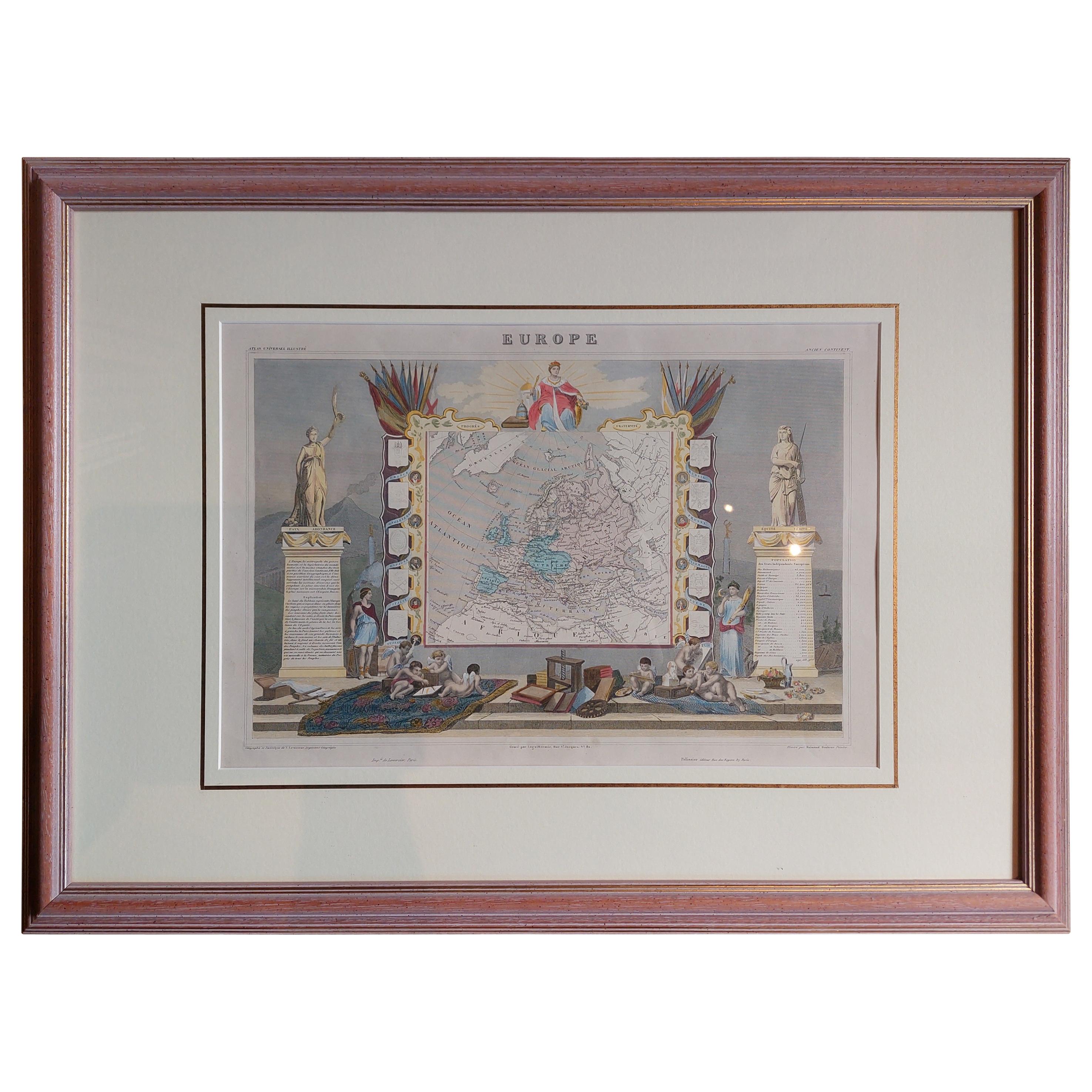
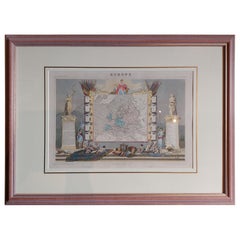
Antique Map of Europe by Levasseur 'c.1840'
Located in Langweer, NL
Antique map titled 'Europe'. Original antique map of Europe. Decorative map of the continent surrounded by allegorical vignettes. Engraved by Raimond Bonheur, father of the famous Fr...
Category
Antique Mid-19th Century Maps
Materials
Paper
$465 Sale Price
20% Off
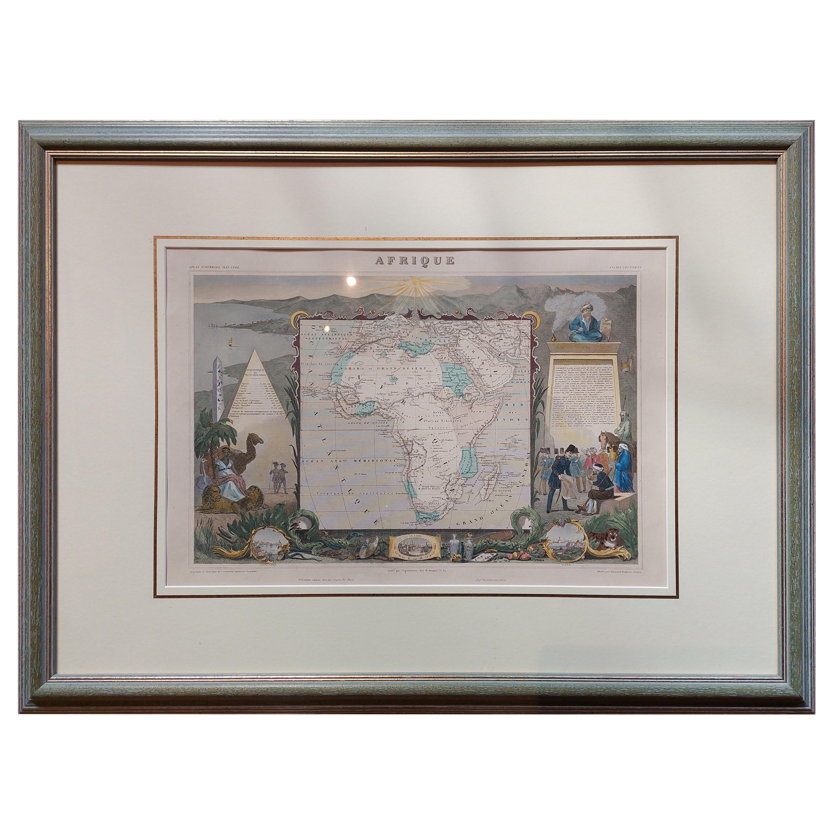
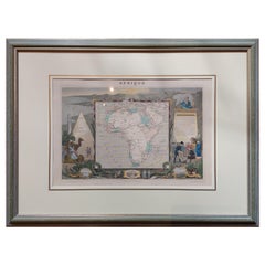
Antique Map of Africa by Levasseur 'c.1840'
Located in Langweer, NL
Antique map titled 'Afrique'. Original antique map of Africa. Decorative map of the continent surrounded by allegorical vignettes. Engraved by Raimond Bonheur, father of the famous F...
Category
Antique Mid-19th Century Maps
Materials
Paper
$465 Sale Price
20% Off
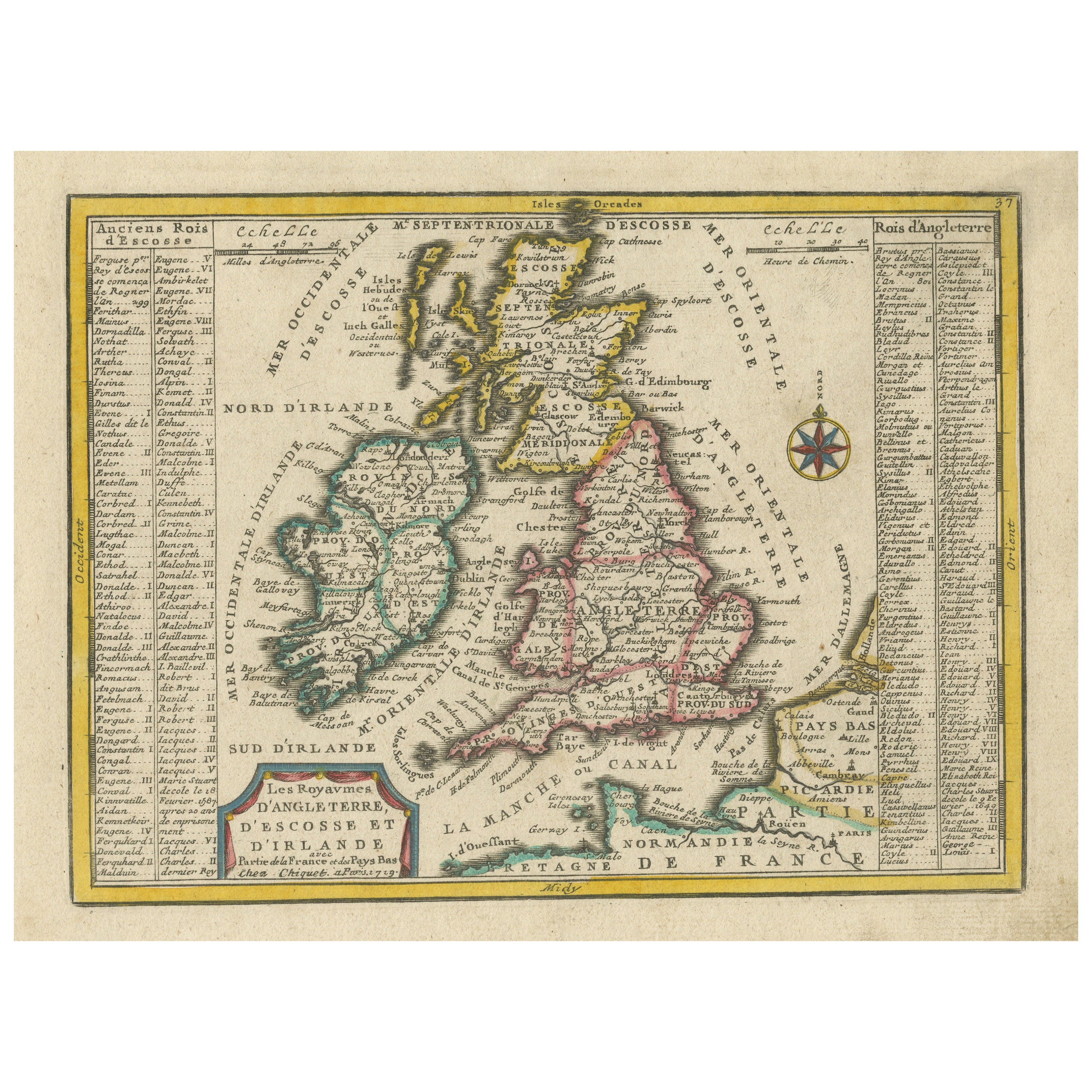
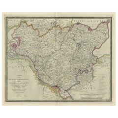
Original Antique Map of England, Ireland, Scotland and Wales
Located in Langweer, NL
Antique map titled 'Les Isles Britanniques, ou sont les Royaumes d Angleterre (..)'. Detailed map of England, Ireland, Scotland and Wales, with French coast and part of the Netherlan...
Category
Antique Early 18th Century Maps
Materials
Paper

$270 Sale Price
20% Off
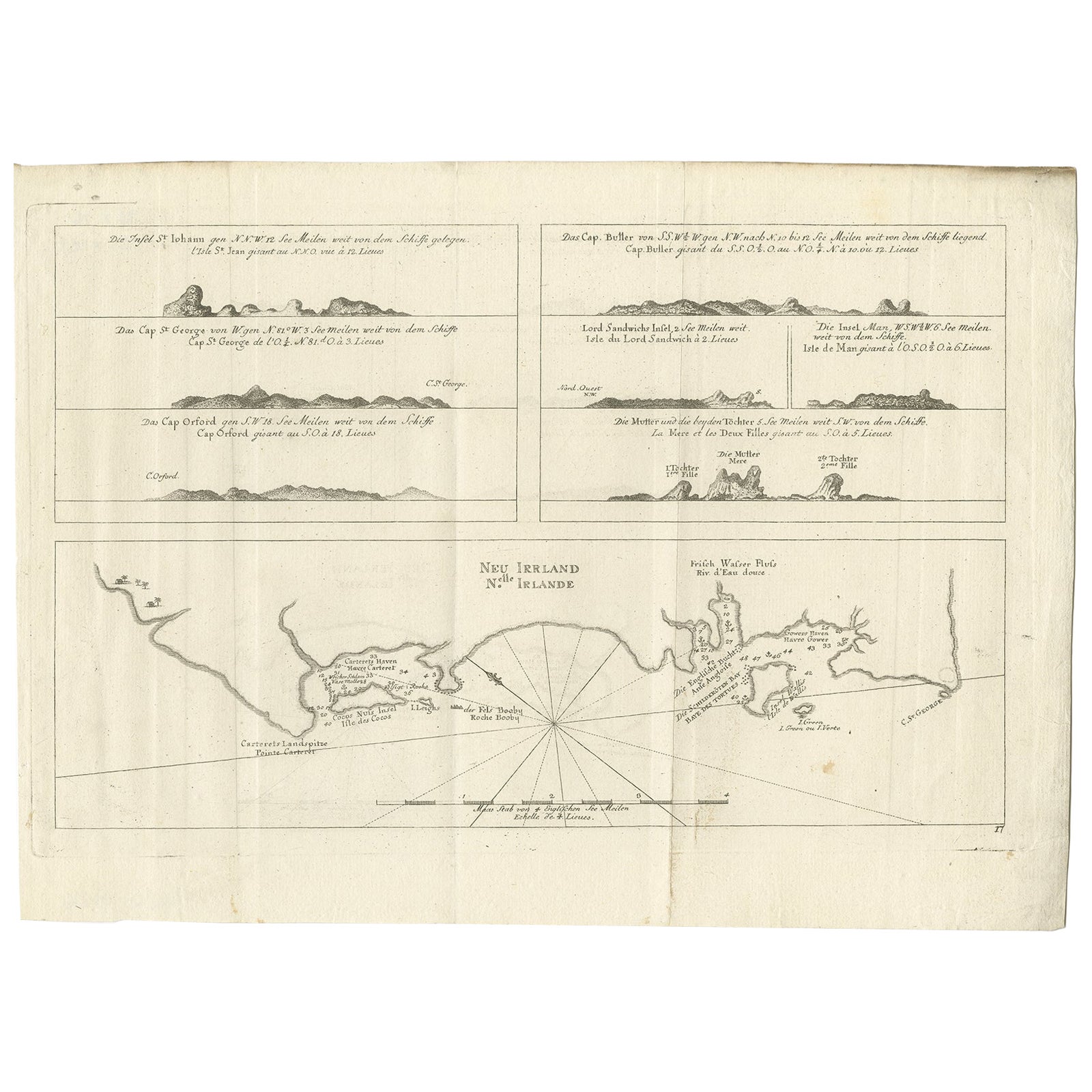
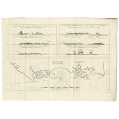
Antique Map of New Ireland, 1774
Located in Langweer, NL
Antique print titled 'Neu Irrland (..)'. Antique map of New Ireland with 7 coastal profiles, Papua New Guinea. Originates from 'Geschichte der See-Reisen u...
Category
Antique 18th Century Maps
Materials
Paper
$270 Sale Price
20% Off
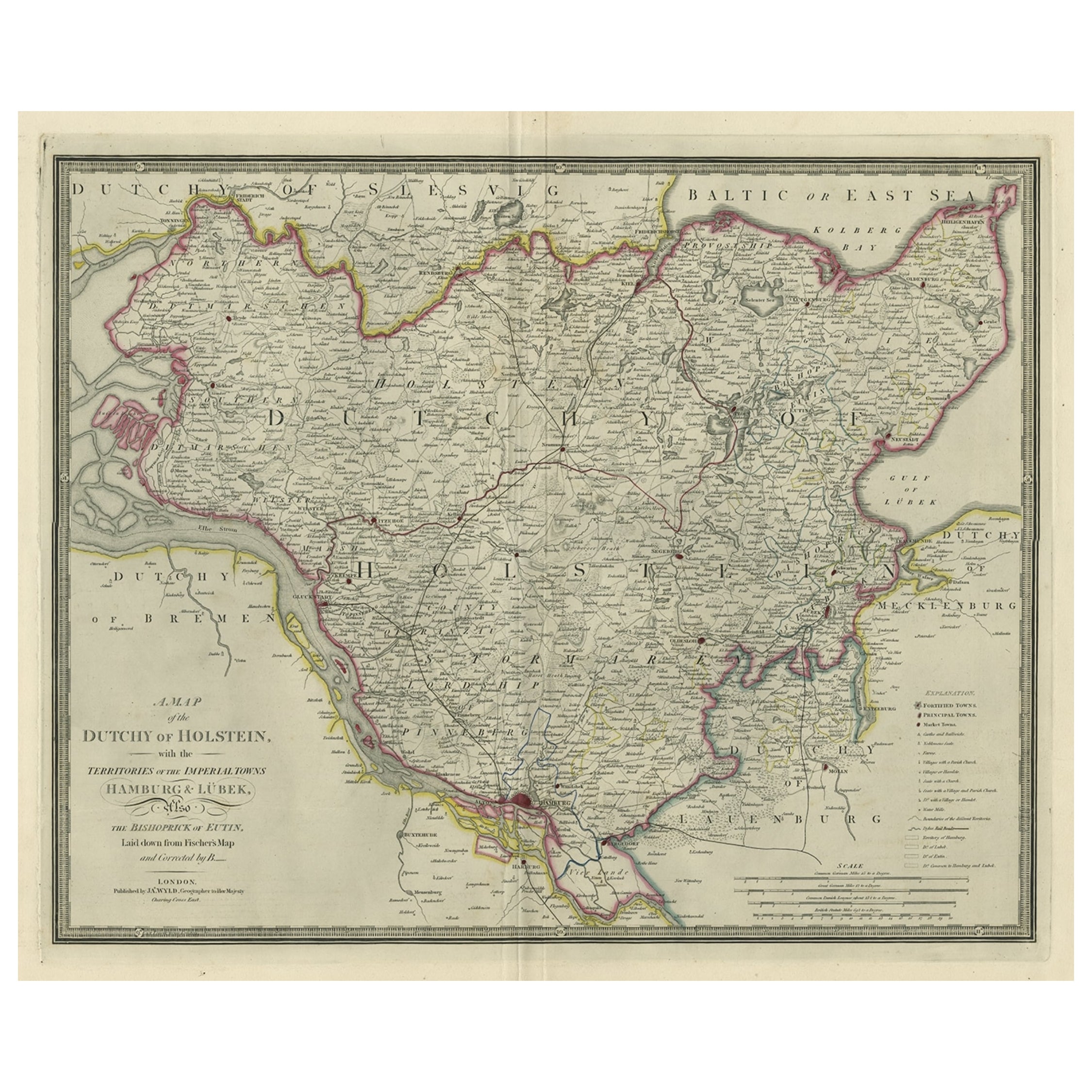
Large Original Antique Map of the Dutchy of Holstein, Germany, ca.1840
Located in Langweer, NL
Antique map titled 'A Map of the Dutchy of Holstein, with the Territories of the Imperial Towns Hamburg & Lubek, Also The Bishoprick of Eutin, Laid down from Fischer's Map (..)'. Sca...
Category
Antique 1840s Maps
Materials
Paper
$782 Sale Price
20% Off
Original Antique Map of the United Kingdom and Ireland, Published in 1875
Located in Langweer, NL
Antique map titled 'Iles Britanniques ou Royaume-Uni de la Grande Bretagne (..)'. Large map of the United Kingdom and Ireland. This map originates from...
Category
Antique Late 19th Century Maps
Materials
Paper

$244 Sale Price
40% Off
Recently Viewed
View AllMore Ways To Browse
Maps Tallis
Relief Map
Railroad And Indian
Antique Macedonia
Antique Maps Southeast Asia
Map Of Ancient Greece
Antique Railroad Collectibles
Cartographer Tool
Hungary Map
Large Map Of Italy
Antique Map Of Poland
Antique Railroad Maps
Antique Surveying Level
Island Plantation
Map 1901
Sri Lanka Map
Used Marine Compass
Antique Furniture Columbus