Original Map of Boston
View Similar Items


Want more images or videos?
Request additional images or videos from the seller
1 of 6
Original Map of Boston
About the Item
- Dimensions:Height: 31 in (78.74 cm)Width: 42 in (106.68 cm)Depth: 2 in (5.08 cm)
- Materials and Techniques:
- Period:
- Date of Manufacture:1900
- Condition:
- Seller Location:Norwell, MA
- Reference Number:Seller: 1028180291stDibs: LU1741212723971
About the Seller
5.0
Vetted Seller
These experienced sellers undergo a comprehensive evaluation by our team of in-house experts.
Established in 1967
1stDibs seller since 2015
346 sales on 1stDibs
Typical response time: 2 hours
More From This SellerView All
- 1891 Map of South Shore of BostonLocated in Norwell, MAOriginal 1891 map showing Cohasset, Scituate, Marshfield, Duxbury, Kingston, Norwell, Hanover, Hingham, Hull, Holbrook, Weymouth, Hanson, Pembroke, etc. Framed with glass. Circa 1891.Category
Antique 1890s North American Prints
MaterialsPaper
- Copy of Walker Map Titled Boston & SurroundingsLocated in Norwell, MACopy of a Walker map titled Boston & Surroundings. Shows Winchester to Dedham, with greater Boston in detail. Framed. Dimensions: 45" H x 31" L.Category
20th Century Prints
- Map of Boston and Surrounding TownsLocated in Norwell, MALater copy of a nineteenth century map of Boston and surrounding towns. Showing parts of Quincy, Milton, Hyde Park, Winthrop and Revere. Showing all of B...Category
Antique 19th Century North American Maps
MaterialsPaper
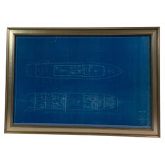
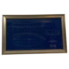
- Original Yacht Blueprint P-201-2 by John WellsLocated in Norwell, MAOriginal blueprint of a one hundred foot yacht by John Wells Incorporated of New York. The plan is a top view showing the top deck and cabin level. The top deck shows dining saloon, pilot house...Category
Vintage 1940s Nautical Objects
MaterialsPaper
- Original Blueprint for the Sailing Dingy “Burp” by John AldenLocated in Norwell, MABlueprint from John G Alden, naval architect, 131 State St, Boston. Plan is for No. 559, a class A sailing dingy named "Dunk.” Showing all hull lines in great detail. Rich blue color...Category
Vintage 1930s Nautical Objects
MaterialsPaper
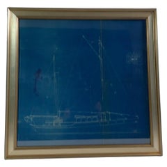
- 1929 Blueprint of a Yacht by John AldenLocated in Norwell, MAOriginal yacht blueprint from the famous naval architect John G Alden of State St, Boston. The vessel represented is a fifty three foot power cruiser with two masts. Large main cabin...Category
Vintage 1920s Nautical Objects
MaterialsPaper

You May Also Like
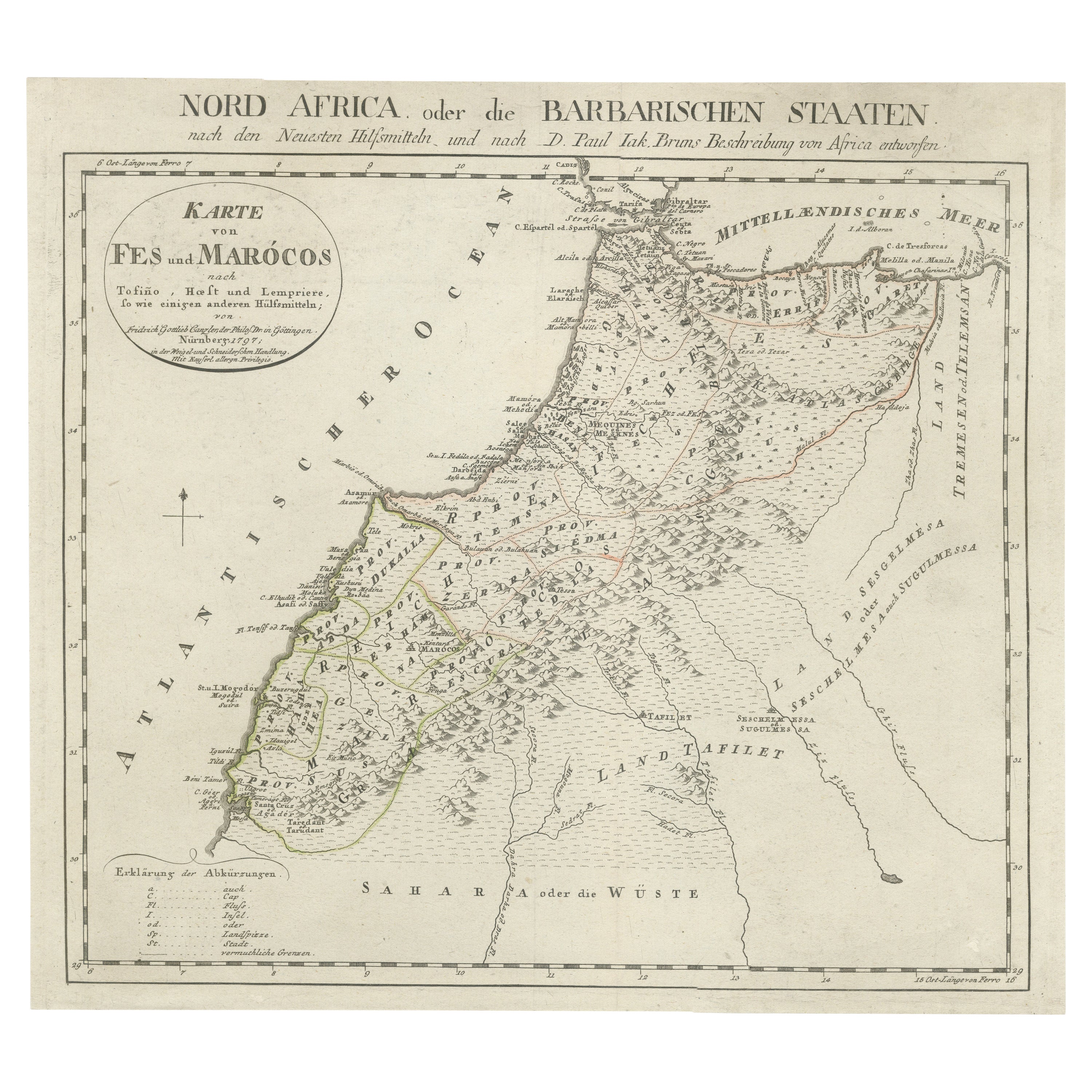
- Original Antique Map of AfricaLocated in Langweer, NLAntique map titled 'Afrika'. Original antique map of Africa, drawn by Van Beusekom. Published by 'Seyffardt's Boekhandel' in Amsterdam, circa 1870.Category
Antique Late 19th Century Maps
MaterialsPaper
 $298 Sale Price20% Off
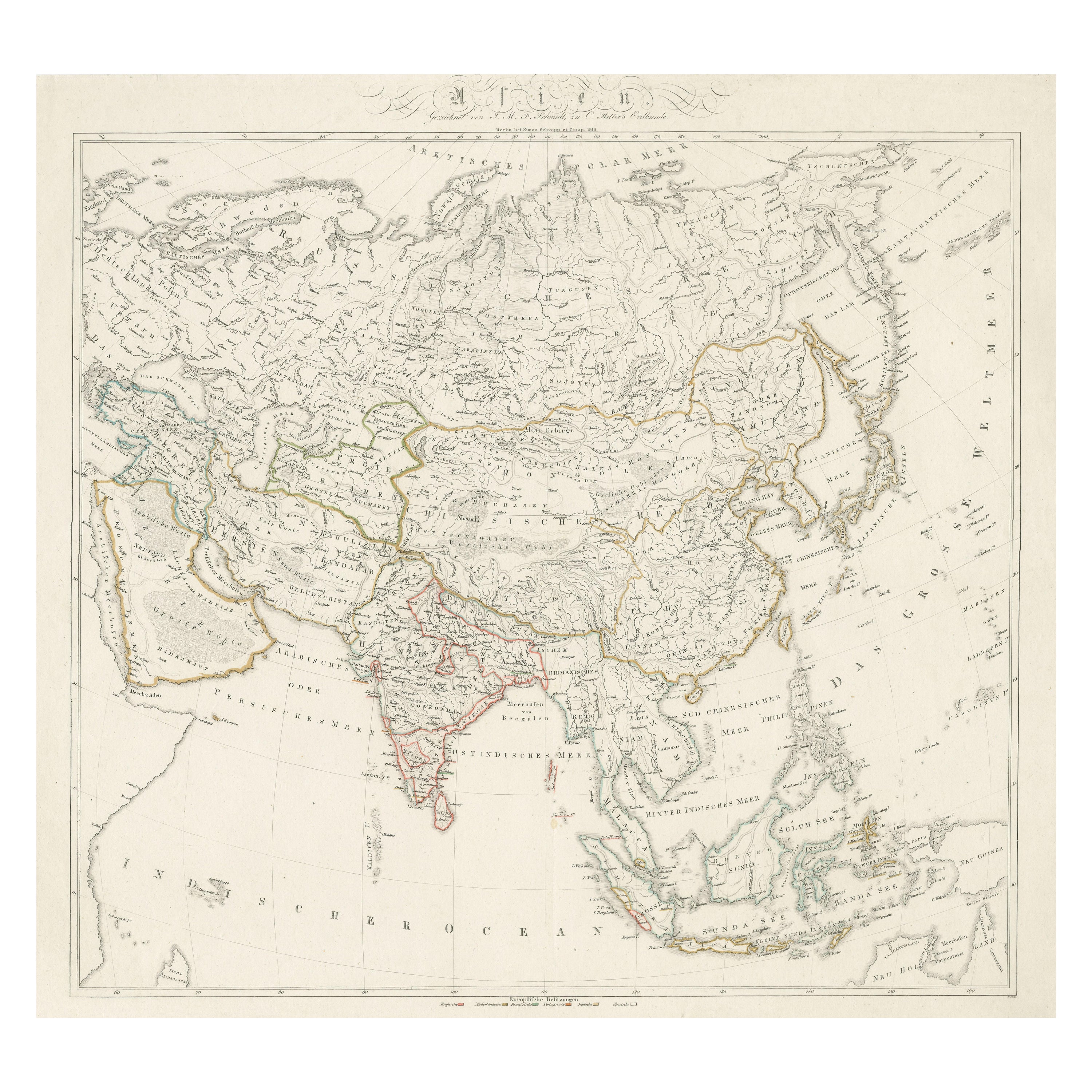
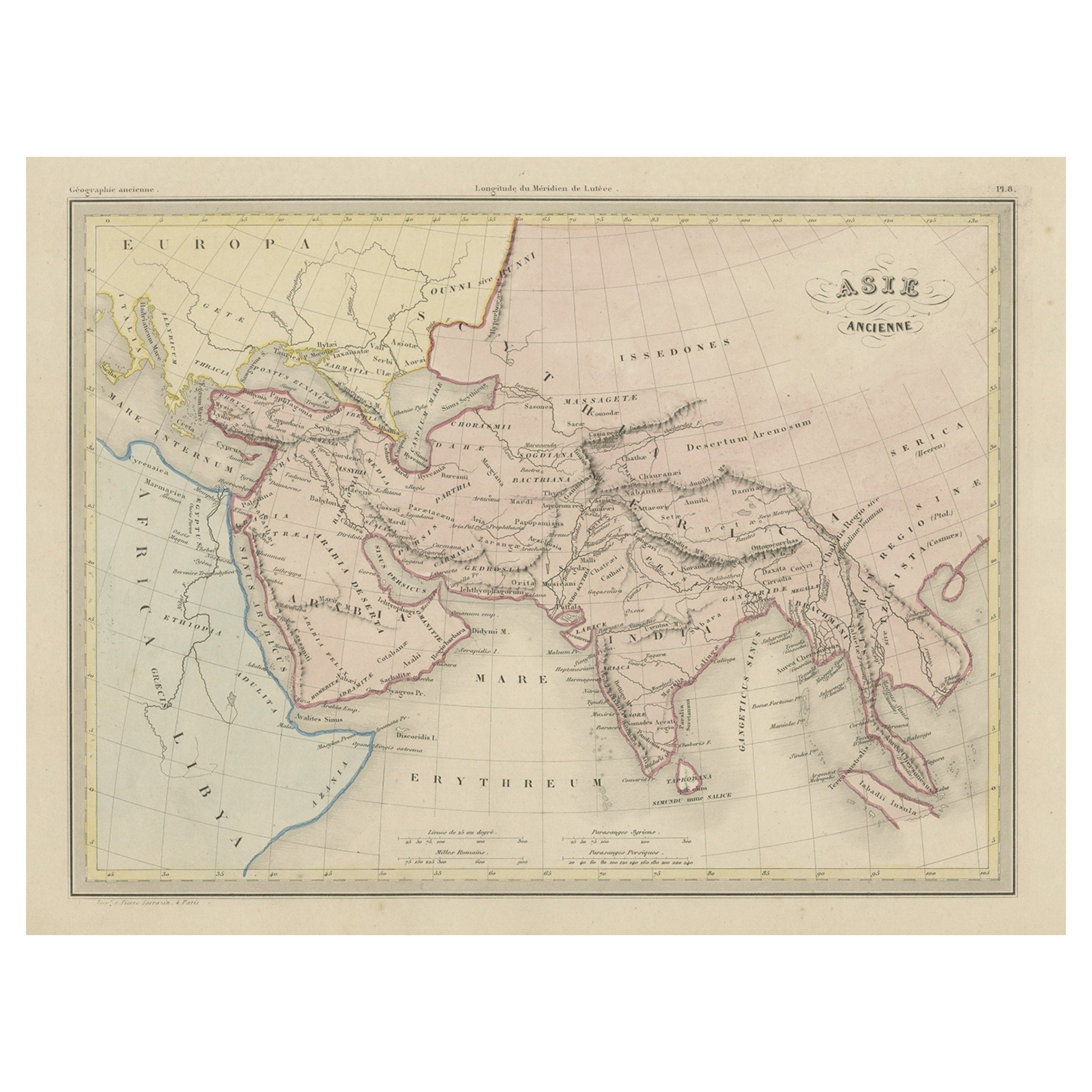
 - Original Antique Map of AsiaLocated in Langweer, NLAntique map titled 'Asien'. Original old map of Asia. Published in Berlin by Simon Schropp et Comp, 1819.Category
Antique Early 19th Century Maps
MaterialsPaper
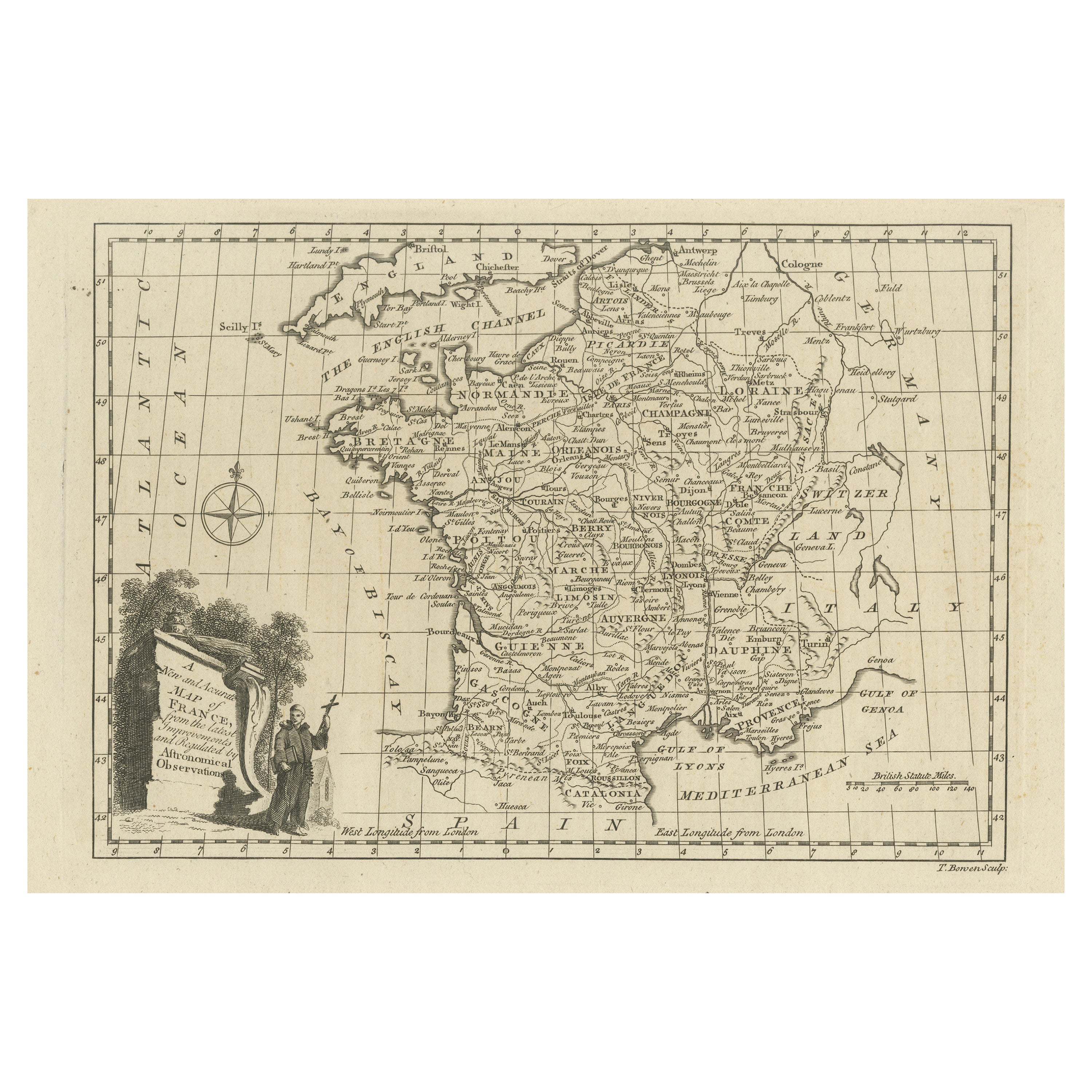
- Original Copper Engraved Map of FranceLocated in Langweer, NLAntique map titled 'New and Accurate Map of France from the latest improvements'. Original copper engraved map of France. Engraved by T. Bowen, published circa 1771.Category
Antique Late 18th Century Maps
MaterialsPaper
- Original Antique Map of Northern IndiaBy Jakob van der SchleyLocated in Langweer, NLAntique map titled 'Carte de l'Indoustan (..) - Kaart van Hindoestan (..)'. Original antique map of northern India. This map originates from 'His...Category
Antique Mid-18th Century Maps
MaterialsPaper
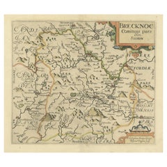
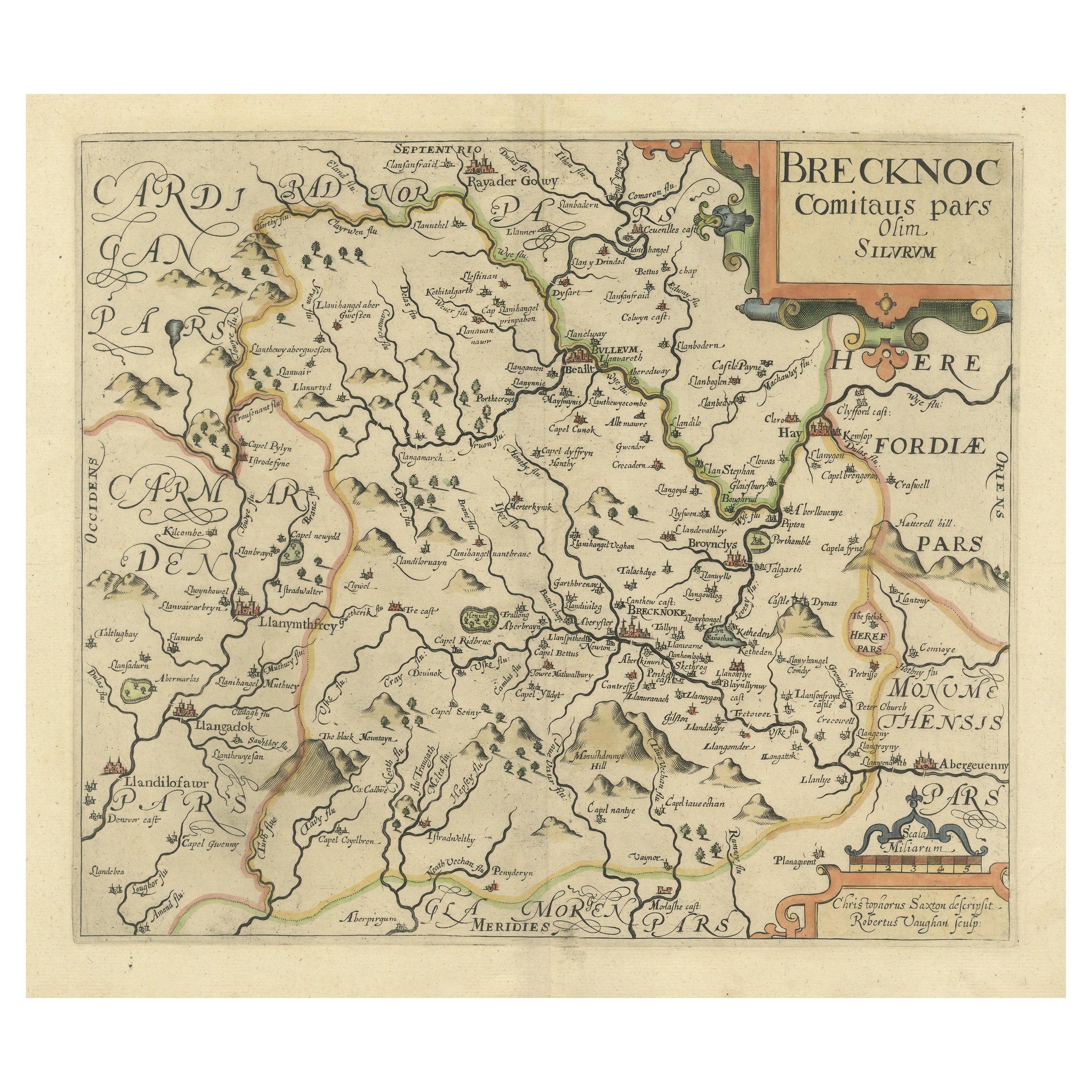
- Original Antique Map of Brecknockshire, WalesLocated in Langweer, NLAntique map titled 'Brecknoc comitaus pars olim silurum'. Original old map of Brecknockshire, Wales. Engraved by R. Vaughan after Christopher Saxton. Published circa 1640.Category
Antique Mid-17th Century Maps
MaterialsPaper
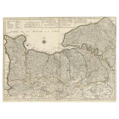
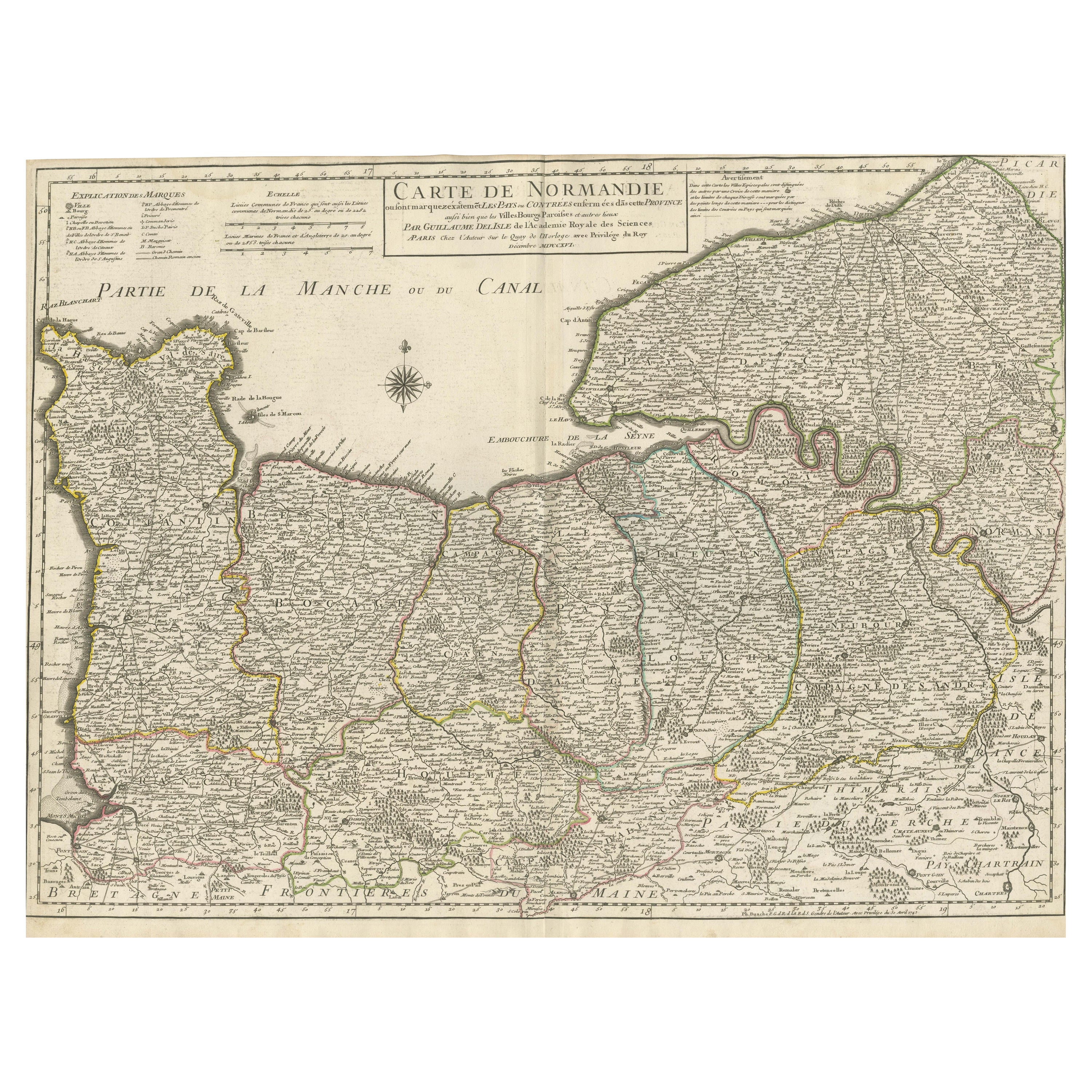
- Original Antique Map of Normandy, FranceLocated in Langweer, NLAntique map titled 'Carte de Normandie (..)'. Attractive map of Normandy, France. it depicts the former French Duchy of Normandy, covers the region fro...Category
Antique Mid-18th Century Maps
MaterialsPaper