1710s Maps
to
15
23
23
2,926
2,181
476
3
289
34
10
127
7
35
9
2
5
3
4
2
23
23
23
23
Period: 1710s
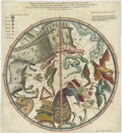
1711 Star Chart of Southern Sky with Mythical Constellations and Exotic Animals
Located in Langweer, NL
1711 Star Chart of the Southern Sky - "Mappa Stellarum Australium quae in Altitudine Poli Borei Graduum"
This beautiful star chart, engraved by Arnold van Westerhout in 1711, shows ...
Category
Antique 1710s Maps
Materials
Paper
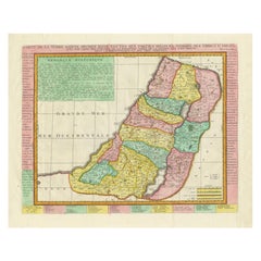
1732 Henri Chatelain Map of the Holy Land Divided Among the Tribes of Israel
Located in Langweer, NL
Title: 1732 Henri Chatelain Map of the Holy Land Divided Among the Tribes of Israel
This exquisite 18th-century map by Henri Chatelain, published in 1732, offers a detailed depict...
Category
Antique 1710s Maps
Materials
Paper
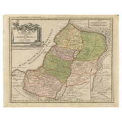
1718 Holy Land Map - Twelve Tribes, Six Provinces, Hand-Colored, Antique Map
Located in Langweer, NL
Title: Terra Sancta in XII olim Tribus nunc VI Provincias Dispertita
Cartographer: Christoph Weigel the Elder (1654–1725)
Publisher: Johann Ernst Adelbulner
Publication Locatio...
Category
Antique 1710s Maps
Materials
Paper
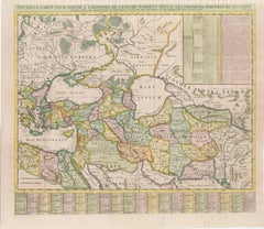
18th-Century Map of the Eastern Roman Empire by Henri Chatelain, c. 1719
Located in Langweer, NL
Title: 18th-Century Map of the Eastern Roman Empire by Henri Chatelain, c. 1719
Description: This intricately detailed map, titled *Nouvelle Carte pour Servir à l'Histoire de l'Empi...
Category
Antique 1710s Maps
Materials
Paper
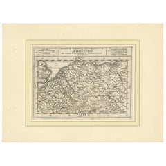
Germany and the Borders of Empire: Bodenehr’s Map of the Holy Roman World, 1710
Located in Langweer, NL
Title:
Germany and Surrounding Realms by Gabriel Bodenehr, circa 1710
This striking copperplate engraving, titled "S. Imperium Romano-Germanicum, Teutschland mit Seinen Angräntzende...
Category
Antique 1710s Maps
Materials
Paper
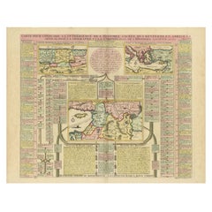
Biblical Map and Family Trees of the Holy Land by Chatelain, ca. 1720
Located in Langweer, NL
Title: 1720 Chatelain Map of the Holy Land with Biblical Family Trees and Chronology
Description:
This fascinating 18th-century folio map by Henry Abraham Chatelain combines geo...
Category
Antique 1710s Maps
Materials
Paper
Beautiful Large Scale Map of Spain and Portugal Published by Herman Moll in 1711
Located in Langweer, NL
Title: A New and Exact Map of Spain & Portugal
Author: Herman Moll
Date: 1711
Medium: Hand-colored copperplate engraving
Herman Moll (c. 1654-1732) was one of the most important London mapmakers in the first half of the eighteenth century. Moll was probably born in Bremen, Germany, around 1654. He moved to London to escape the Scanian Wars. His earliest work was as an engraver for Moses Pitt on the production of the English Atlas, a failed work which landed Pitt in debtor's prison. Moll also engraved for Sir Jonas Moore, Grenville Collins, John Adair, and the Seller & Price firm. He published his first original maps in the early 1680s and had set up his own shop by the 1690s.
Moll's work quickly helped him become a member of a group which congregated at Jonathan's Coffee House at Number 20 Exchange Alley, Cornhill, where speculators met to trade stock. Moll's circle included the scientist Robert Hooke...
Category
Antique 1710s Maps
Materials
Paper
1717 Johannes Van Keulen Sea Chart of the Eastern Atlantic - Amsterdam to Gambia
Located in Langweer, NL
1717 Johannes Van Keulen Sea Chart of the Eastern Atlantic - Amsterdam to Gambia
This 1717 sea chart by Johannes Van Keulen, titled "Nieuwe Paskaert vande ...
Category
Antique 1710s Maps
Materials
Paper
Old Map Covering All of Southeast Asia from Persia to the Timor Island, 1712
Located in Langweer, NL
Description: Antique map titled 'A New Map of the East Indies'. Old map covering all of Southeast Asia from Persia to the Timor Island, inclusive of the modern day nations of India, ...
Category
Antique 1710s Maps
Materials
Paper
Antique Map of Southeast Asia from Persia to the Timor Island, 1712
Located in Langweer, NL
Antique map titled 'A New Map of the East Indies'.
Old map covering all of Southeast Asia from Persia to the Timor Island, inclusive of the modern day nations of India, Ceylon, T...
Category
Antique 1710s Maps
Materials
Paper
Rare Old English Sea Chart of Part of Indonesia with Java, Madura and Bali, 1711
Located in Langweer, NL
Antique map titled 'A Large Draught of the East End of Java and Madura shewing the Streights of Bally.'
Rare early example of this working English Sea Chart of part of Indonesia ...
Category
Antique 1710s Maps
Materials
Paper
Rare Antique English SeaChart of Bali, Lombok, Floris, Borneo, Celebes etc, 1711
Located in Langweer, NL
Antique map titled 'A Large Draught from Benjar on the Island of Borneo To Macasser on the Island of Celebes Shewing the Streight of Bally with the Islands to the Eastward thereof.' ...
Category
Antique 1710s Maps
Materials
Paper
Moullart-Sanson Map of the Holy Land and Sacred Geography of the Old Testament
Located in Langweer, NL
"1716 Moullart-Sanson Map of the Holy Land and Sacred Geography of the Old Testament"
This engraved map, created by Pierre Moullart-Sanson and reissued by Robert de Vaugondy in 1740...
Category
Antique 1710s Maps
Materials
Paper
Rare Engraved City Plan of Nuremberg, Bavaria by Christoph Weigel, 1718
Located in Langweer, NL
Title: Rare Engraved City Plan of Nuremberg, Bavaria by Christoph Weigel, 1718
Description:
This detailed city plan of Nuremberg, Bavaria was crafted by Christoph Weigel in 1718 an...
Category
Antique 1710s Maps
Materials
Paper
Old Map of Tartary with Persia, Siberia, the Mogul Territories & China, ca.1717
Located in Langweer, NL
Antique map titled 'A Map of Independent Tartary, containing the territories of Usbeck, Gasgar, Tibet, Lassa & c'.
Old map depicting east of the Caspian Sea with parts of Persia, Siberia, the Mogul territories and on to western China...
Category
Antique 1710s Maps
Materials
Paper
1710 Edward Wells Detailed Ancient Greece Map with Ornate Cartouche
Located in Langweer, NL
"1710 Edward Wells Map of Ancient Greece: A New Map of Antient Greece, Tirana, Morea, Ilyricum, Sicily, and Macedonia"
Description of the Map:
This map, produced around 1710 and en...
Category
Antique 1710s Maps
Materials
Paper
Rare Antique Copper Engraving of a Map of Pegu and Arakan, Burma (Myanmar), 1714
Located in Langweer, NL
Antique map Myanmar (Birma) titled 'Les Royaumes de Pegu et d'Aracan'.
Rare map of Pegu and Arakan made after a map engraved by Pieter van den Keere and published in the 1628 edi...
Category
Antique 1710s Maps
Materials
Paper
Decorative Hand-Coloured Antique Map of the Four Irish Provinces, Ireland, c1718
Located in Langweer, NL
Title: Regni Hiberniae Accurata Tabula per Hermanum Moll
Decorative map of the four Irish provinces, Ireland, 1718, by Christoph Weigel (with credit to Herman Moll), engraved by Mi...
Category
Antique 1710s Maps
Materials
Paper
Old Engraving of the Trarbach Battle in Rhineland-Palatinate, Germany, c.1710
Located in Langweer, NL
Rare antique print titled 'Plan de la Ville et Chateau Traarbach (..)'. Battle plan of Trarbach, Rhineland-Palatinate, Germany.
Published circa 1710 b...
Category
Antique 1710s Maps
Materials
Paper
Map of Northern India & Surrounding Regions, incl Kabul, Candahar & Bhutan, 1710
Located in Langweer, NL
Antique map titled 'Magni Mogolis Imperium de Novo Correctum et Divisum Per F. de Witt Amstelodami.'
Map of Northern India and surrounding regions. This includes Kabul and Candah...
Category
Antique 1710s Maps
Materials
Paper
Original Antique Map of Hungary and Transylvania 'Modern Day Romania', C.1710
Located in Langweer, NL
Antique map titled 'Hungary and Transilvania'.
Original antique map of Hungary and Transylvania (modern day Romania), centered on Budapest.
Artists and Engravers: Herman Moll ...
Category
Antique 1710s Maps
Materials
Paper
Detailed Original Antique Map of India, Southeast Asia and the Far East, 1719
Located in Langweer, NL
Antique map titled 'Carte des Indes, de la Chine & des Iles de Sumatra, Java & c'.
Detailed map of India, Southeast Asia and the Far East, extending from Gujerat to the supposed "T...
Category
Antique 1710s Maps
Materials
Paper
Copper Engraving with a View on the Volga River in Russia, 1714
Located in Langweer, NL
Antique print titled 'Gezicht op de Rivier'.
Copper engraving with a view on the Volga river. This print originates from 'Reizen over Moskovie, door Persie en Indie (..)' by C. d...
Category
Antique 1710s Maps
Materials
Paper
Related Items
7 Vol. Set- Charles Merivale, A History Of The Romans Under The Empire, 1858
Located in Bridgeport, CT
London, Longman, Brown, Green, Longmans, & Roberts, various publishing dates. Bound in tan leather with red and brown with gilt spines. Marbelized end papers. All with bookplates ins...
Category
English Victorian Antique 1710s Maps
Materials
Leather, Paper
H 8.75 in W 6 in D 1.75 in
Four 18th Century Engraved and Hand-Colored Maps by Weigel
By Christoph Weigel
Located in Copenhagen, K
Small collection of four engraved maps of Italy, Balkan and of Central Asia.
Two are of Italy, one Corsica and Northern Italy and the other of the Southern Italian boot...
Category
German Antique 1710s Maps
Materials
Paper
Southern Beasts Ostrich Taxidermy
By Southern Beasts
Located in Houston, TX
21st Century Southern Beasts young ostrich taxidermy newly adorned with antique and vintage texttiles.
Category
American 1710s Maps
Materials
Textile, Feathers
Constellation Lockheed Aircraft Model
Located in Paris, FR
Aircraft model constellation Lockheed,
reduced model, lightweight wooden frame,
handcrafted in aluminum foil, with engraved
metal rivets. Measures: Base height: 26cm.
Category
Dutch 1710s Maps
Materials
Aluminum, Foil
Map of the Holy Land "Carte de la Syrie et de l'Egypte" by Pierre M. Lapie
Located in Alamo, CA
An early 19th century map of ancient Syria and Egypt entitled "Carte de la Syrie et de l'Egypte anciennes/dressée par M. Lapie, Colonel d'Etat Major, et...
Category
French Antique 1710s Maps
Materials
Paper
H 27 in W 21.38 in D 0.75 in
Trio of Tribal Drums Carved Wood and Animal Hide
Located in Topeka, KS
Intriguing trio of differing size tribal drums of carved wood and animal hide. They are in wonderful condition. Priced as a set. Circa 20th century.
We ar...
Category
Tribal 1710s Maps
Materials
Hide, Zebra Hide, Wood
Map Exploring The World, Midi Format
Located in New York, NY
A compelling exploration of the ways that humans have mapped the world throughout history - now in a compact new edition
Map: Exploring the World brings together more than 250...
Category
1710s Maps
Materials
Paper
The Holy Bible, Containing the Old and New Testaments, 1887
Located in Colorado Springs, CO
The Holy Bible, Containing the Old and New Testaments, Translated out of the Original Tongues: And with the Former Translations Diligently Compared and Revised, by His Majesty’s Spec...
Category
English Late Victorian Antique 1710s Maps
Materials
Leather, Paper
Immaculate Conception Chapel, Second Half of the 18th Century
Located in Madrid, ES
Sculpture, carved wood, glass, metal.
Carved wooden chapel with decoration on the top of balustrade and balusters in the shape of a vase of a certain Baroque memory, which presents t...
Category
Spanish Neoclassical Antique 1710s Maps
Materials
Metal, Other
Monumental Framed Medieval Facsimile Map Of The World Fra Mauro Wood Wall Panel
Located in Forney, TX
A remarkable palatial nearly 7.5ft x 7.5ft facsimile of the important Map of the World (circa 1450) by Fra MauroFra Mauro (Italian; circa 1400–1464), featuring a solid wood framed hi...
Category
Medieval 1710s Maps
Materials
Linen, Wood, Paper
H 88.25 in W 90.25 in D 2 in
Large Original Vintage Map of The World, circa 1920
Located in St Annes, Lancashire
Great map of The World
Original color.
Good condition / minor foxing
Published by Alexander Gross
Unframed.
Category
English Vintage 1710s Maps
Materials
Paper
1 Volume. The Holy Bible
Located in New York, NY
1 Volume. Anon. The Holy Bible. Containing The Old & New Testaments. Bound in full brown morocco by Zaehnsdorf, all edges gilt, raised bands. Published: Oxford: The University Press,...
Category
British Antique 1710s Maps
Materials
Leather
Previously Available Items
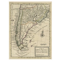
Antique Map of Chili, Patagonia, La Plata and the South Part of Brasil, ca.1710
Located in Langweer, NL
Antique map titled 'A Map of Chili, Patagonia, La Plata and ye South Part of Brasil'.
Detailed map showing the southern most part of South America's coast...
Category
Antique 1710s Maps
Materials
Paper
H 13 in W 9.06 in D 0 in
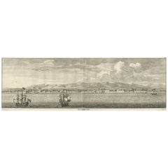
Panoramic Antique View of Bandar-Abbas 'Formerly Gamron, Persia' in Iran, 1714
Located in Langweer, NL
Antique print titled 'Gamron'. Panoramic view of the city of Bandar-Abbas (formerly Gamron) in Iran / Persia. This print originates from 'Reizen over Moskovie, door Persie en Indie' ...
Category
Antique 1710s Maps
Materials
Paper
H 6.7 in W 15.16 in D 0 in
Old Original Engraving with Coastal Views of Arabia, 1711
Located in Langweer, NL
Antique print titled 't Nieuwe Eilant - 't Prinsen Eilant - De zuidkust van 't gelukkige Arabie - de Baei van Musketta - d'Arabische Wal by de Kaep Monsandon - 't Eilant Lareke - 't ...
Category
Antique 1710s Maps
Materials
Paper
Original Antique Engraving of The City of Ramallah, Palestine, 1717
Located in Langweer, NL
Antique print titled 'Rama van d'Arabieren Ramla, en de Turken Remele, en Remle genaamt; volgens d'aftekening gedaan 1668 (..)'.
View of the city of Ramallah, Palestine. This pri...
Category
Antique 1710s Maps
Materials
Paper
Antique Map of Scotland Incl the Orkney Islands, ca.1718
Located in Langweer, NL
Decorative antique map of Scotland with title: Scotia Cambdeni Et Sibbaldi per Chr. Weigelium Norimb.
Old coloured map of Scotland that was printed in Nuremberg by Johann Ernst Ad...
Category
Antique 1710s Maps
Materials
Paper
Antique Double Hemisphere World Map with California as an Island, 1710
Located in Langweer, NL
Description: Antique map titled 'De Werelt Caart'. First state (out of three) antique double hemisphere world map from a Dutch bible by Cornelis D...
Category
Antique 1710s Maps
Materials
Paper
Framed Hand-Colored Early 18th Century Herman Moll Map of Spain and Portugal
By Herman Moll
Located in Alamo, CA
An 18th century copper plate engraved map of Spain and Portugal with attractive original outline hand-coloring entitled "A New And Exact Map Of Spain & Portugal Divided Into Its Kingdoms And Principalities & C., With Ye Principal Roads And Considerable Improvements, The Whole Rectifyd According To Ye. Newest Observations" by Herman Moll, first published in London in 1711. The cartouche in the right lower corner depicts a lion holder a sword atop a display of multiple coats of arms. Below are flags, armor and weapons.
The map is dedicated to Field Marshal John Campbell, 2nd Duke of Argyll, who commanded the British forces in Spain, during the War of Spanish Succession in 1711 and 1712. The English victories in the battles of Gibraltar and Fort Mahon are shown on the map. Also of interest is the 'Advertisment', containing one of Moll also includes the statement 'Among all ye Cheats that ye world are dayly abus'd with, none have lately been more Scandalous than that of Maps', which refers to the frequent plagiarism of his work by competitors.
The map is presented in an ornate black and brown wood frame with beaded design inner and outer margins, with a cream-colored mat. There are three vertical folds, as issued. There is mild discoloration along the right fold and minimal separation superiorly, as well as mild discoloration at the periphery of the margins and faint creases in the left lower corner and light or faded text in a small area on the left.
Herman Moll (1654-1732) was a prominent mapmaker in London in the early eighteenth century, having moved from Germany in the late 17th century. He initially worked for English printers, but soon opened his own establishment around 1690. He was a friend of the scientist Robert Hooke, the archaeologist William Stuckley, the authors Jonathan Swift and Daniel Defoe, and the pirates William Dampier...
Category
English Antique 1710s Maps
Materials
Paper
H 27.88 in W 42.13 in D 0.88 in
1719 Hand-Colored Map of France by John Senex
Located in Colorado Springs, CO
“A New Map of France, Showing the Roads & Post Stages Throout That Kingdom, as Also the Errors of Sanson's Map...”
This elegant map of France is divided into provinces with emphas...
Category
