Items Similar to Set of 4 Antique Maps of part of the United States of America

Want more images or videos?
Request additional images or videos from the seller
1 of 6
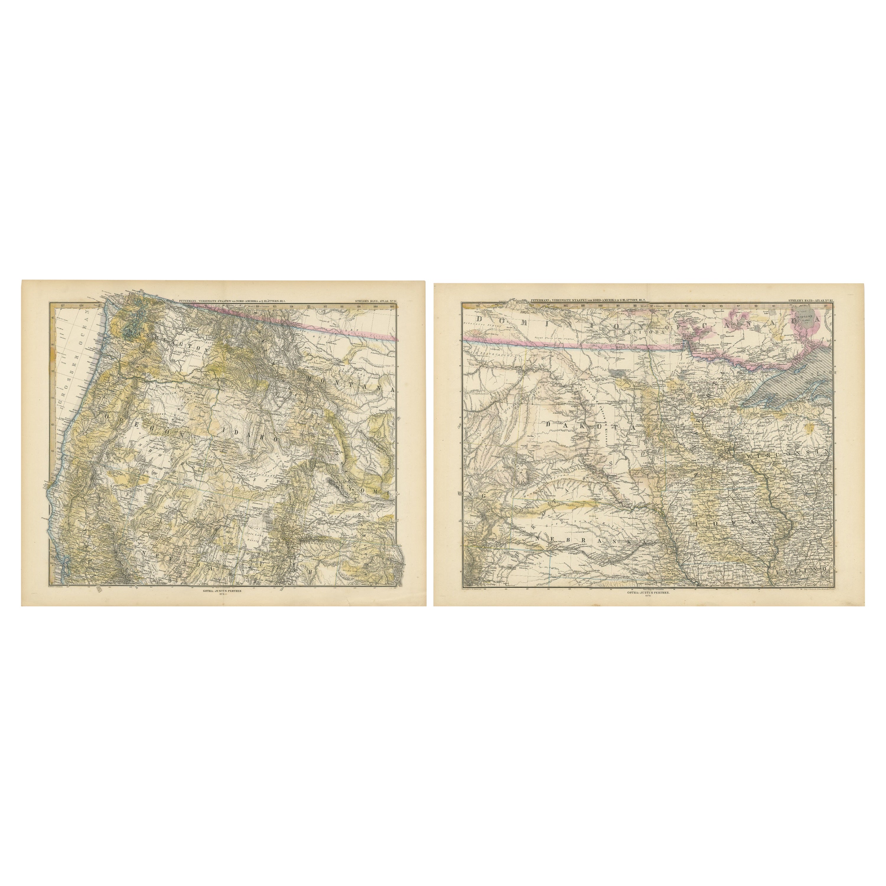
Set of 4 Antique Maps of part of the United States of America
$715.73per set
$1,101.12per set35% Off
£527.96per set
£812.24per set35% Off
€598per set
€920per set35% Off
CA$991.68per set
CA$1,525.66per set35% Off
A$1,076.77per set
A$1,656.57per set35% Off
CHF 570.23per set
CHF 877.27per set35% Off
MX$13,198.08per set
MX$20,304.74per set35% Off
NOK 7,056.79per set
NOK 10,856.59per set35% Off
SEK 6,668.29per set
SEK 10,258.91per set35% Off
DKK 4,552.49per set
DKK 7,003.83per set35% Off
About the Item
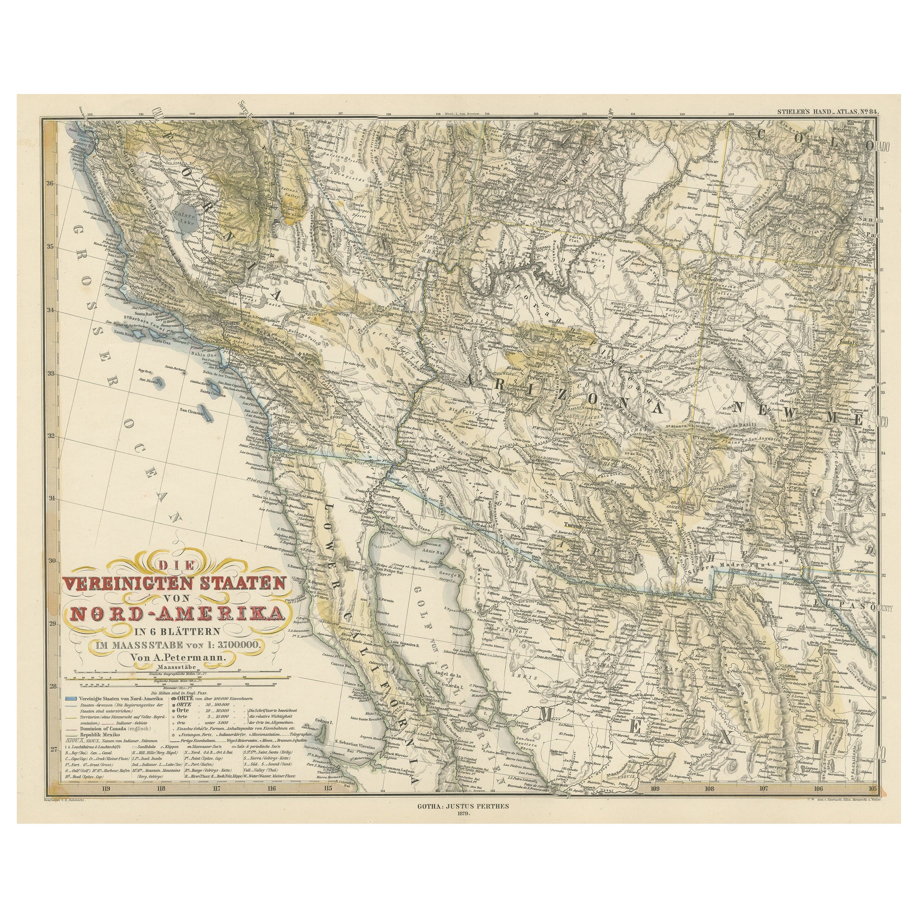
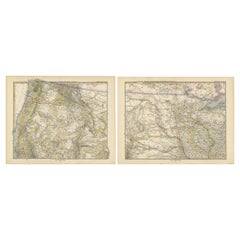
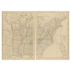
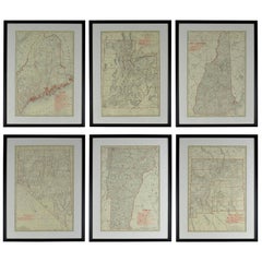
Set of four individual antique maps of part of the United States. Published as part of a set of six individual maps.
These maps originate from Stielers Handatlas, published circa 1874. Stielers Handatlas (after Adolf Stieler, 1775–1836), formally titled Hand-Atlas über alle Theile der Erde und über das Weltgebäude (Handy atlas of all parts of the world and of the universe), was the leading German world atlas of the last three decades of the 19th and the first half of the 20th century. Published by Justus Perthes of Gotha (established 1785 and still existing there) it went through ten editions from 1816 to 1945. As with many 19th century publications, an edition was issued in parts; for example, the eighth edition was issued in 32 monthly parts.
- Dimensions:Height: 15.16 in (38.5 cm)Width: 18.9 in (48 cm)Depth: 0.02 in (0.5 mm)
- Sold As:Set of 4
- Materials and Techniques:
- Period:
- Date of Manufacture:c.1874
- Condition:Wear consistent with age and use. General age-related toning. Original folding lines. Minor wear, blank verso. Please study images carefully.
- Seller Location:Langweer, NL
- Reference Number:Seller: BG-13192-11 +31stDibs: LU3054331372882
About the Seller
5.0
Recognized Seller
These prestigious sellers are industry leaders and represent the highest echelon for item quality and design.
Platinum Seller
Premium sellers with a 4.7+ rating and 24-hour response times
Established in 2009
1stDibs seller since 2017
2,622 sales on 1stDibs
Typical response time: <1 hour
- ShippingRetrieving quote...Shipping from: Langweer, Netherlands
- Return Policy
Authenticity Guarantee
In the unlikely event there’s an issue with an item’s authenticity, contact us within 1 year for a full refund. DetailsMoney-Back Guarantee
If your item is not as described, is damaged in transit, or does not arrive, contact us within 7 days for a full refund. Details24-Hour Cancellation
You have a 24-hour grace period in which to reconsider your purchase, with no questions asked.Vetted Professional Sellers
Our world-class sellers must adhere to strict standards for service and quality, maintaining the integrity of our listings.Price-Match Guarantee
If you find that a seller listed the same item for a lower price elsewhere, we’ll match it.Trusted Global Delivery
Our best-in-class carrier network provides specialized shipping options worldwide, including custom delivery.More From This Seller
View AllSet of two Antique Maps of Oregon, Idaho, Wyoming, Nebraska & Iowa, ca.1879
Located in Langweer, NL
Set of two individual antique maps of part of the United States. It shows the region and surroundings of Oregon, Idaho, Wyoming, Nebraska, Iowa, Dakota and Wisconsin. Published as pa...
Category
Antique Late 19th Century German Maps
Materials
Paper
$459 Sale Price / set
20% Off
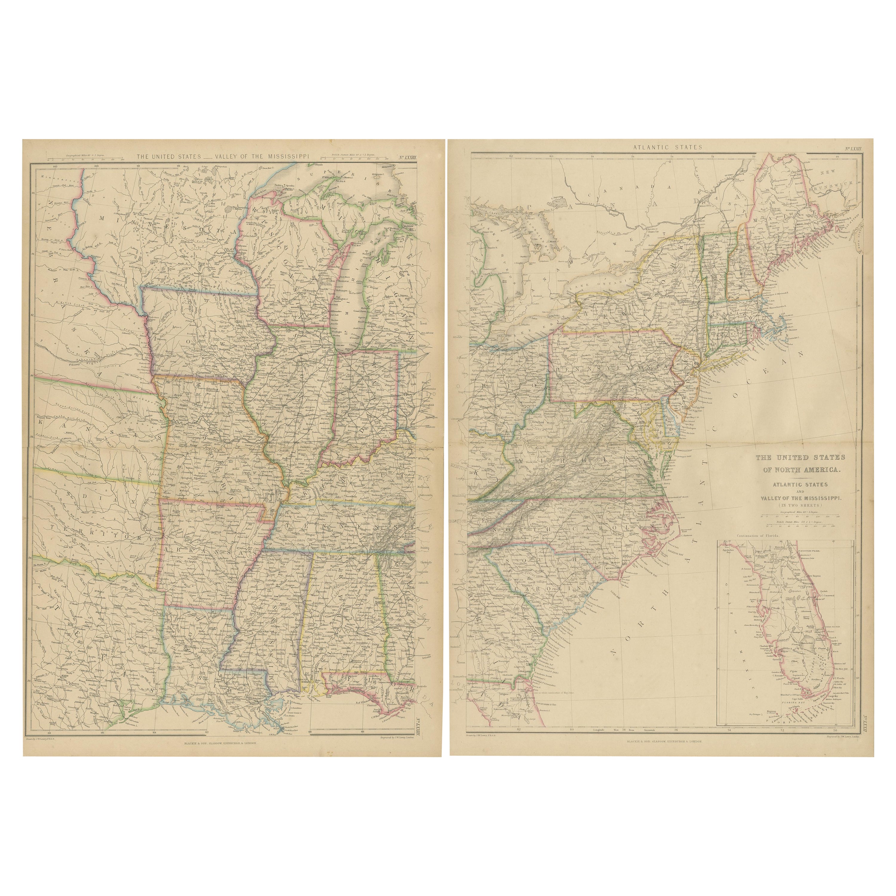
Set of 2 Antique Maps of the United States by W. G. Blackie, 1859
Located in Langweer, NL
Antique map titled 'The United States of North America, Atlantic States and Valley of the Mississippi'. Original antique map of the United States of North America, Atlantic States an...
Category
Antique Mid-19th Century Maps
Materials
Paper
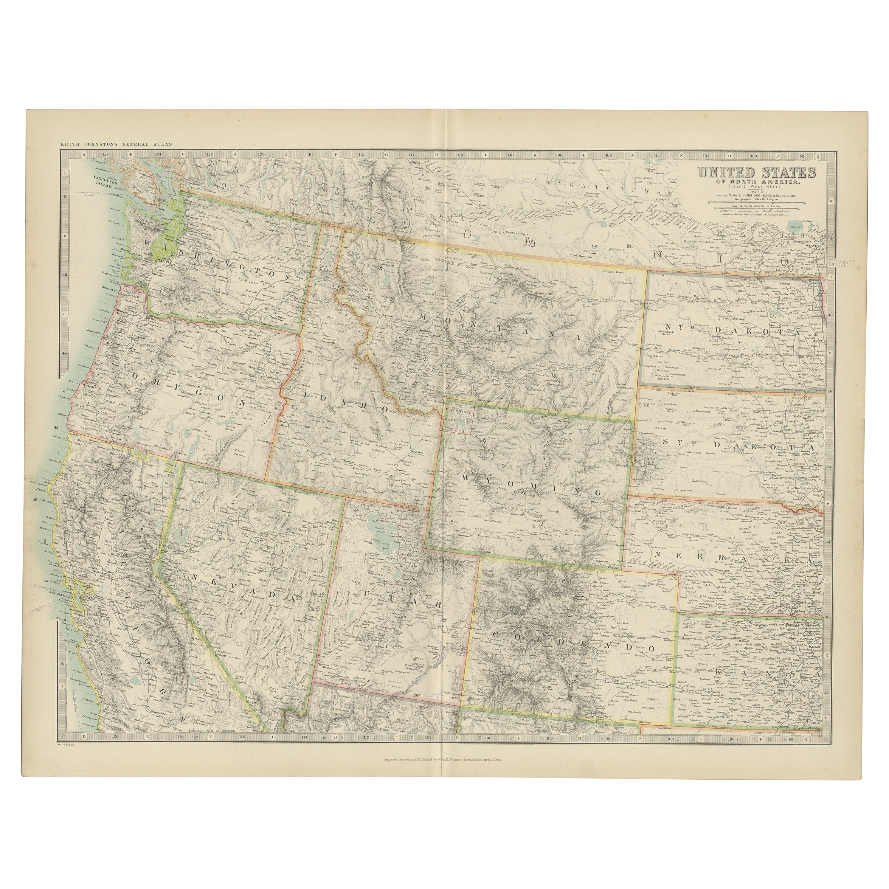
Antique Map of the United States 'North West' by Johnston, '1909'
Located in Langweer, NL
Antique map titled 'United States of North America'. Original antique map of the United States of North America ( North West ). This map originates from the ‘Royal Atlas of Modern Ge...
Category
Early 20th Century Maps
Materials
Paper

$239 Sale Price
20% Off
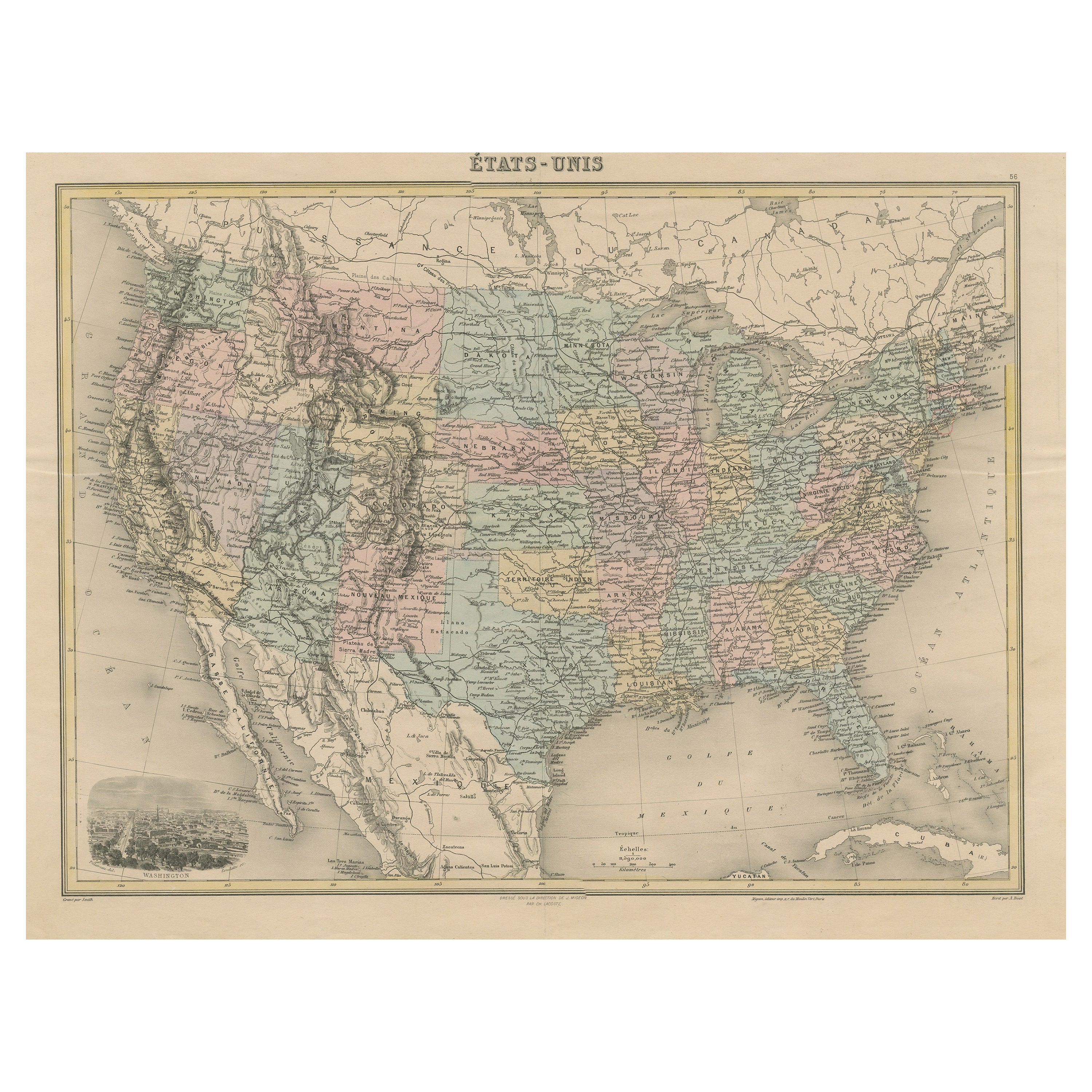
Antique Map of the United States with Vignette of Washington
Located in Langweer, NL
Antique map titled 'États-Unis'. A very attractive and detailed late 19th century map of the United States, with a fine decorative vignette of Washington. The extensive railway netwo...
Category
Antique Late 19th Century Maps
Materials
Paper
$459 Sale Price
20% Off
Antique Map of Part of the United States Including Lower California & Arizona
Located in Langweer, NL
Antique map of part of the United States of America including Lower California, Arizona and part of Mexico. This map was part of a set of six individual sheets with maps of the Unite...
Category
Antique Late 19th Century Maps
Materials
Paper

$421 Sale Price
20% Off
Antique Railroad Map of the United States by Rand, McNally & Co, 1900
Located in Langweer, NL
Antique map titled 'Rand, McNally & Co's New Official Railroad map of the United States with portions of The Dominion of Canada, The Republic of Mexico and the West Indies'. Large railroad map of the United States, sectionalised and laid on linen. Map shows state boundaries for the United States, Mexico, the West Indies, and lower portion of Canada; major cities and towns, military posts, Native American reservations, and railroads; Oklahoma and "Indian Territory." Inset: "Map of Alaska...
Category
20th Century Maps
Materials
Linen, Paper

$2,244 Sale Price
25% Off
Free Shipping
You May Also Like
Large Vintage Maps of the United States, in 3 Sections, 1920
Located in St Annes, Lancashire
Great maps of the USA in 3 sections
Unframed
Original color
By John Bartholomew and Co. Edinburgh Geographical Institute
Published, circa 1920
The measurements given is for just...
Category
Vintage 1920s British Maps
Materials
Paper

Large Original Antique Map of the United States of America. 1891
By Rand McNally & Co.
Located in St Annes, Lancashire
Fabulous map of The United States
Original color
By Rand, McNally & Co.
Dated 1891
Unframed
Free shipping.
Category
Antique 1890s American Maps
Materials
Paper

Set of 6 Original Vintage Maps of American States, circa 1900
Located in St Annes, Lancashire
Wonderful set of 6 vintage maps.
Random American states including Maine, Utah, New Hampshire, Nevada, Vermont and New Mexico.
Monochrome with red color outline.
Published by Rand,...
Category
Antique Early 1900s American Edwardian Decorative Art
Materials
Paper
Original Antique Map of United States, Grattan and Gilbert, 1843
Located in St Annes, Lancashire
Great map of United States
Drawn and engraved by Archer
Published by Grattan and Gilbert. 1843
Original colour
Unframed.
Category
Antique 1840s English Maps
Materials
Paper

Large Original Antique Map of California, USA, circa 1900
Located in St Annes, Lancashire
Fabulous map of California
Original color
Engraved and printed by the George F. Cram Company, Indianapolis.
Published, circa 1900
Unframed
Free shipping.
Category
Antique 1890s American Maps
Materials
Paper

Original Antique Map of the American State of Idaho & Wyoming, 1903
Located in St Annes, Lancashire
Antique map of Idaho and Wyoming
Published By A & C Black. 1903
Original colour
Good condition
Unframed.
Free shipping
Category
Antique Early 1900s English Maps
Materials
Paper
