1650s Furniture
to
86
120
84
210
28
19
1
1
1
1
1
1
40,695
134,979
542,268
285,668
85,428
260,825
124,247
12,755
5,560
18,622
22,727
19,432
54,119
72,328
60,959
21,590
9,192
80
67
66
37
28
83
50
42
28
24
210
210
210
4
4
2
2
2
Period: 1650s
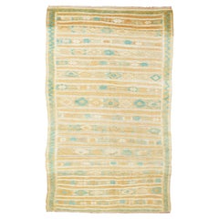
Vintage Kilim Rug 3'2'' x 5'8''
Located in New York, NY
Vintage Kilim rug 3'2'' x 5'8''. This rustic textile shows irregular horizontal abrashed rust, cream and light blue bands, enriched by extra-weft her...
Category
Turkish Antique 1650s Furniture
Materials
Cotton, Silk
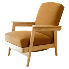
French Reclining Lounge Chair
Located in West Hollywood, CA
Reclining lounge chair with fold-out ottoman, newly upholstered, frame in bleached ash, France, circa 1950's.
Category
French Antique 1650s Furniture
Materials
Ash, Ultrasuede
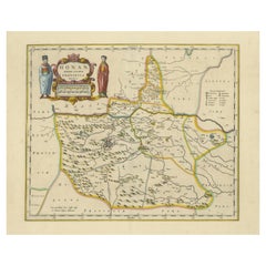
Original 17th-Century Antique Map of Henan (Honan) Province, China – by Blaeu
Located in Langweer, NL
17th-Century Antique Map of Henan Province, China – "Honan" by Blaeu, with Detailed Cartography and Artistic Cartouches
Description: This exceptional 17th-century map of Henan Province, historically referred to as "Honan," was created by Johannes Blaeu and published in 1655 as part of the *Novus Atlas Sinensis*. Henan, located in central China, is known as the cradle of Chinese...
Category
Antique 1650s Furniture
Materials
Paper
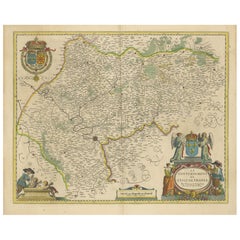
Beautiful 17th Century Map of Paris and Isle de France by Templeux, c.1650
Located in Langweer, NL
Map of Isle de France by D. de Templeux, ca. 1650, Hand-Colored and Decorative
This richly detailed antique map titled *Le Gouvernement de L'Isle de France* was engraved by Daniel d...
Category
Antique 1650s Furniture
Materials
Paper
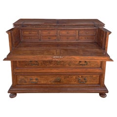
17th Century Italian Commode with Secretaire
Located in Vo', Veneto
"Canterano" chest of drawers with flap/desk
Measurements: H. 102 cm - W. 142 cm - D. 62 cm
Period: 1600
Origin: Emilia - Italy
Wood: Walnut, Poplar
Description:
Beautiful "Canteran...
Category
European Baroque Antique 1650s Furniture
Materials
Nutwood
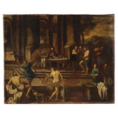
17th century Oil on Canvas Italian Biblical Painting Herod's Banquet, 1650
Located in Vicoforte, Piedmont
Antique Italian painting from the mid-17th century. Oil on canvas artwork, first canvas, depicting a biblical episode of great charm, Herod's banquet, of excellent pictorial quality....
Category
Italian Antique 1650s Furniture
Materials
Canvas
Mid-17th Century Brussels Verdure Tapestry
Located in New York, NY
Mid-17th Century Brussels Verdure Tapestry
5'9"x 8'5" - 175 x 257
A rare and important 17th century European tapestry from Belgium, handwoven circa 1650 in wool with a flat-weave co...
Category
Belgian Antique 1650s Furniture
Materials
Wool
LC/BD, Stool / Authentic Stool by Le Corbusier and B. Doshi
By Le Corbusier
Located in Zürich, CH
This item expresses a specific rawness. There is no need for precise execution or the desire to appear sophisticated. It is simple, self-evident, and direct. It is made out of basic ...
Category
Indian Mid-Century Modern Antique 1650s Furniture
Materials
Iron
Rosewood Bench by Celina Decorações, 1960s, Brazilian Midcentury Design
Located in New York, NY
This gorgeous bench was produced in the 1960s by Celina Decorações, which signed one of the most modern lines of Brazilian furniture at the period.
It consists of a very well-constructed piece in solid Rosewood, with slats rhythmically positioned supported by two boards working as lateral feet. One of the most beautiful details to pay attention to is the slats' perfect straight finish on the edges that contrast and highlight the organic curves on Rosewood veins.
Ideal for indoor uses, this bench offers statement seating in any space.
Based in Rio de Janeiro, the Celina Decorações factory imposed high-quality standards, maintaining handcrafted characteristics. The company was created in 1951 when Munis Zilberberg takes over the family business - a small upholstery workshop that worked on refurbishing sofa beds and antique furniture. The name is a tribute to her mother, Celina Zilberberg...
Category
Mid-Century Modern Antique 1650s Furniture
Materials
Rosewood
Vintage Clam Shell Shaped Table Lamp Mounted to a Rectangular Metal Black Base
Located in Los Angeles, CA
Vintage Large Solid Brass Silver-Plated Clam Shell Shaped Table Lamp on Rectangular Lacquered Metal Black Base
Circa: 1950s
Category
American Antique 1650s Furniture
Materials
Metal, Brass
Lino Sabattini Silverware "Cardinale" Vase for Christofle, France, 1956
Located in Reggio Emilia, IT
A France Mid-Century Modern design vase model “Cardinale” in silvered metal designed by Italian artist Lino Sabattini for Christofle France in 1956,...
Category
French Mid-Century Modern Antique 1650s Furniture
Materials
Silver Plate, Metal
$420 Sale Price
20% Off
Decorative Antique Map of the Quercy Region in France, 1657
Located in Langweer, NL
Antique map of France titled 'Quercy olim Cadurcium'.
Decorative map of the Quercy region. Quercy is a former province of France located in the country's southwest, bounded on th...
Category
Antique 1650s Furniture
Materials
Paper
$535 Sale Price
20% Off
Rare Large 1650 Copper Engraving Depicting the Naval Battle of Gibraltar, 1607
Located in Langweer, NL
Title: Rare Large 1650 Copper Engraving Depicting the Naval Battle of Gibraltar, 1607
Description: This rare and exceptionally large copper engraving, measuring 32 x 85 cm, capture...
Category
Antique 1650s Furniture
Materials
Paper
Antique Norwegian Silver Spoon, Circa 1650
Located in Jesmond, Newcastle Upon Tyne
An exceptional antique 17th century Norwegian silver spoon; an addition to our silver teaware collection.
This exceptional antique Norwegian silver spoon...
Category
Norwegian Antique 1650s Furniture
Materials
Silver
Original Antique Map showing Southern India, Northern Sri Lanka & Malabar, 1652
Located in Langweer, NL
Antique map titled 'Presqu'Isle de l'Inde deca le Gange (..)'.
Old map showing the southern part of India, including the northern part of Sri Lanka. With inset map of Southern India (Malabar). This map covers the subcontinent from the Bay of Bengal and the Gulf of Cambay to Ceylon. The Mogul Empire can be found in the north. Further south...
Category
Antique 1650s Furniture
Materials
Paper
$631 Sale Price
20% Off
17th Century Oil on Canvas Italian Biblical Painting Lot and his Daughters, 1650
Located in Vicoforte, Piedmont
Antique 17th-century Italian painting. Oil on canvas artwork depicting the famous biblical story of Lot and his daughters. After the destruction of Sodom and Gomorrah, Lot takes refu...
Category
Italian Antique 1650s Furniture
Materials
Canvas
Mid-Century Modern Crystal Vase Val Saint Lambert - Belgium, 1950
Located in Girona, Girona
Large vase of pliers worked crystal.
Design: Antonio Bon for Val Saint Lambert.
Belgium, Liège c. 1950.
Category
Belgian Mid-Century Modern Antique 1650s Furniture
Materials
Crystal
Vintage Kilim Rug 5'4'' x 10'6''
Located in New York, NY
Vintage Kilim rug 5'4'' x 10'6''.
Category
Turkish Antique 1650s Furniture
Materials
Wool, Cotton
17th-Century Original Antique Map of Hunan and Hubei Provinces, China – by Blaeu
Located in Langweer, NL
Title: 17th-Century Antique Map of Hunan and Hubei Provinces, China – "Hvqvang" by Blaeu, Richly Detailed and Illustrated
Description: This beautiful 17th-century map of the regions that now comprise Hunan and Hubei Provinces, historically referred to as "Hvqvang," was created by Johannes Blaeu and published in 1655 as part of the *Novus Atlas Sinensis*. This map, drawn with input from Jesuit missionary Martino Martini, provides a meticulous representation of central China’s geography, capturing its rivers, towns, and mountainous terrain.
The Yangtze River (Changjiang) is prominently featured, emphasizing the region’s importance as a vital waterway for trade and transportation. Wuhan, now a modern metropolis, and Changsha, the capital of Hunan Province, were historically significant cities that appear on the map. The area is also notable for its fertile lands and contributions to China’s agricultural prosperity, particularly in rice and tea production.
The decorative cartouche in the lower-right corner features two figures in traditional Chinese attire standing amid bamboo, symbolizing the cultural and natural richness of the region. Blaeu’s map combines precision and artistry, with vibrant hand-coloring distinguishing boundaries and geographical features. The copperplate engraving ensures fine detail, making this map a remarkable historical artifact.
Condition: Near excellent. Clean impression with vivid hand-coloring. Wide margins with minor age-toning appropriate for its age.
Framing Tips: Use a neutral double mat and a gilt or dark wood frame to enhance the presentation. UV-protective glass is recommended to preserve the vivid hand-coloring and intricate engraving details.
Hunan and Hubei, historically referred to as "Hvqvang," are known for their strategic location along the Yangtze River and their cultural and economic significance in Chinese history. The region’s fertile lands have supported extensive rice cultivation, earning it the title of one of China’s "breadbaskets." Hubei, with Wuhan at its center, has long been a hub of transportation and trade, owing to the convergence of the Yangtze and Han Rivers. Hunan, with Changsha as its capital, is known for its rich cultural heritage and contributions to Chinese literature and art.
Important places in the region include Wuhan, an ancient trade center, and Changsha, known for its historical sites and cultural prominence. The Yangtze River, a key feature on the map, highlights the region’s historical importance as a major waterway for commerce and agriculture. Other notable features include Dongting Lake, a vital ecological and cultural landmark, and the surrounding mountainous areas that have shaped the region’s history and development.
Keywords: antique map of Hunan, Hubei map, Hvqvang map, Yangtze River map, 17th-century Chinese map...
Category
Antique 1650s Furniture
Materials
Paper
17th Century Rosewood and Ebony Coat Rack Attributed to Herman Doomer Amsterdam
Located in Amsterdam, NL
Magnificent and ultra rare Baroque period wall coat rack.
Design attributed to Herman Doomer Amsterdam.
Striking Dutch design from the 17th century.
S...
Category
Dutch Baroque Antique 1650s Furniture
Materials
Ebony, Oak, Rosewood
$4,065 Sale Price
20% Off
17th Century Oil on Canvas Flemish Landscape Painting Apparition of Jesus, 1650
Located in Vicoforte, Piedmont
Antique landscape with figures from the 17th century. Oil on canvas painting depicting a splendid Flemish landscape that frames a famous episode of the New Testament, the appearance ...
Category
Dutch Antique 1650s Furniture
Materials
Canvas
Original Antique 17th-Century Map of Shaangxi (Xensi) Province, China – by Blaeu
Located in Langweer, NL
Antique 17th-Century Map of Shaangxi Province, China – "Xensi" by Blaeu, Featuring Decorative Cartouches
Description: This exquisite 17th-century map of Shaangxi Province, historically known as Xensi Province, is an exceptional work by Johannes Blaeu, one of the most celebrated mapmakers of the Dutch Golden Age. Originally published in Blaeu's groundbreaking 'Novus Atlas Sinensis', this map is a masterful blend of geography and artistry. Blaeu's atlas was created in collaboration with Martino Martini, a Jesuit missionary whose insights into China provided European audiences with unprecedented geographical accuracy.
The map meticulously charts Shaangxi's mountains, rivers, mines, cities, and towns, with names rendered in Latin. It also features a detailed section of the Great Wall of China, a symbol of the region's historical significance. The artistry of this map is further enhanced by its elaborate cartouches. At the top, a Chinese warrior is beautifully illustrated, while the lower-left corner displays a deer, possibly a reference to the elusive Pere David deer...
Category
Antique 1650s Furniture
Materials
Paper
17th-Century Original Antique Map of Guangxi Province, China – Qvangsii by Blaeu
Located in Langweer, NL
Title: Antique 17th-Century Map of Guangxi Province, China – "Qvangsii" by Blaeu, Richly Illustrated and Colored
Description: This fascinating 17th-century map of Guangxi Province, historically referred to as "Qvangsii," was crafted by Johannes Blaeu and published in 1655 as part of the *Novus Atlas Sinensis*. Blaeu’s atlas, created in collaboration with Jesuit missionary Martino Martini, introduced European audiences to the geography of China in an unprecedented way. Guangxi Province, known for its striking karst landscapes and important historical trade routes, is depicted here in remarkable detail.
The map highlights the province’s topography, including mountain ranges, rivers, and towns, all meticulously engraved and labeled in Latin. It also captures key trade connections and cultural significance, as Guangxi historically served as a bridge between China and Southeast Asia. The decorative cartouche at the top left is adorned with figures in traditional Chinese costumes, symbolizing the cultural richness of the region and adding artistic elegance to the map.
This map was engraved using the copperplate technique, known for its ability to produce fine, detailed lines. The hand-coloring further enhances the visual impact, clearly distinguishing territorial divisions and natural features. Blaeu’s reputation for both accuracy and artistry is evident in this piece, making it a collector’s item of historical and aesthetic significance.
Guangxi Province, historically referred to as "Qvangsii," is renowned for its breathtaking natural beauty, unique karst landscapes, and cultural diversity. It is famous for its dramatic limestone formations, verdant hills, and picturesque rivers, making it one of the most visually striking regions in China. Guangxi has historically been a significant trade corridor between China and Southeast Asia, contributing to its cultural and economic importance. It is also home to various ethnic minority groups, including the Zhuang, Miao, and Dong, whose traditions and festivals enrich the region's cultural tapestry.
Important places in Guangxi include Guilin, known for its iconic karst mountains and the Li River, which has inspired poets and artists for centuries. Yangshuo, a town near Guilin, is celebrated for its stunning natural scenery and outdoor activities. Nanning, the provincial capital, is an important economic and cultural hub. The Longji Rice Terraces, also known as the Dragon’s Backbone, are an engineering marvel and a popular tourist destination. Beihai, a coastal city, is known for its silver beaches and maritime trade history.
Keywords for this map include 17th-century China map, Guangxi Province, Qvangsii map, antique Chinese maps...
Category
Antique 1650s Furniture
Materials
Paper
Loudun and Mirebeau: A Cartographic Masterpiece of 17th Century France by Blaeu
Located in Langweer, NL
Cartography, 17th century. Willem (1571-1638) and Joan Blaeu (1596-1673), Theatrum Orbis Terrarum sive Atlas Novus..., 1635. Figure: Loudonois. Laudunum (Loudun); Mirebalais (Mirebea...
Category
Antique 1650s Furniture
Materials
Paper
$420 Sale Price
20% Off
Original 17th-Century Antique Map of Fujian (Fokien) Province, China – by Blaeu
Located in Langweer, NL
17th-Century Antique Map of Fujian Province, China – "Fokien" by Blaeu, with Decorative Cartouches
Description: This stunning 17th-century map of Fujian Province, historically ref...
Category
Antique 1650s Furniture
Materials
Paper
OriginaAntique 17th-Century Map of Guizhou Province, China – (Qveichev) by Blaeu
Located in Langweer, NL
Title: Antique 17th-Century Map of Guizhou Province, China – "Qveichev" by Blaeu, Richly Illustrated and Colored
Description: This remarkable map of Guizhou Province, historically known as "Qveichev," was created by Johannes Blaeu and published in 1655 as part of his *Novus Atlas Sinensis*. This atlas, developed in collaboration with Jesuit missionary Martino Martini, marked the first Western attempt at a comprehensive geographic representation of China. Blaeu’s map offers a detailed depiction of the mountainous terrain, rivers, and towns of Guizhou, a province known for its rugged beauty and cultural diversity.
The map is adorned with two decorative cartouches, each reflecting the artistic and cultural influences of the time. The title cartouche in the lower-right corner features two figures in traditional Chinese attire, symbolizing the blend of European cartographic mastery and Chinese heritage. The upper-left corner includes a secondary cartouche with an explanatory key, adding a touch of elegance to the map’s functionality. Towns, mountains, and rivers are meticulously labeled in Latin, showcasing Blaeu’s dedication to detail and accuracy.
Crafted using the copperplate engraving technique, this map demonstrates exceptional precision. The hand-coloring enhances its visual appeal, highlighting borders and geographic features with vibrant tones. Blaeu’s work is not only a tool for geographic understanding but also a piece of art that embodies the spirit of exploration during the Dutch Golden Age.
Guizhou Province, historically known as "Qveichev," is renowned for its breathtaking natural landscapes, rich ethnic diversity, and historical significance. As one of China's most mountainous regions, Guizhou is characterized by dramatic karst formations, lush green hills, and cascading waterfalls. The province is also home to a variety of ethnic minority groups, including the Miao, Dong, and Bouyei, whose traditions, colorful costumes, and vibrant festivals make the region culturally significant.
Famous features and important places include Huangguoshu Waterfall, one of Asia's largest and most iconic waterfalls, located near the city of Anshun. Zhijin Cave, a vast karst cave system, is celebrated for its stunning stalactites and stalagmites. Kaili is known as the cultural center of Miao traditions, with picturesque villages and celebrated festivals. Zunyi holds historical importance for the Zunyi Conference, a pivotal event in the Chinese Communist Party's history. Fanjing Mountain, a UNESCO World Heritage Site, stands out for its unique biodiversity and sacred Buddhist sites.
Keywords: antique map of China, Guizhou map, Qveichev, 17th-century China map...
Category
Antique 1650s Furniture
Materials
Paper
Original Antique 17th-Century Map of Shanxi (Xansi) Province, China – by Blaeu
Located in Langweer, NL
Antique 17th-Century Map of Shanxi Province, China – "Xansi" by Blaeu, with Artistic Cartouches
Description: This beautifully engraved map of Shanxi Province, historically referred to as "Xansi," was created by Johannes Blaeu in 1655 as part of his renowned *Novus Atlas Sinensis*. This atlas was the first comprehensive Western collection focused on Chinese geography, produced with the guidance of Jesuit missionary Martino Martini. Blaeu’s attention to detail and artistic flair are evident in this representation of Shanxi, highlighting mountains, rivers, cities, towns, and key geographic features. The Great Wall of China, an iconic landmark, is also depicted.
The map includes decorative cartouches that enhance its aesthetic appeal. The upper-left corner features the map's title framed in an ornate design, while the lower-right corner showcases a seated figure in traditional Chinese attire alongside a small globe, symbolizing the merging of European cartographic expertise and Chinese knowledge. Each city and geographic feature is labeled in Latin, making it a fascinating historical artifact of cross-cultural exploration.
This map was crafted using the copperplate engraving technique, prized for its ability to produce fine, precise details. It is further embellished with hand-coloring, which brings the landscape and decorative elements to life. Blaeu’s maps are highly regarded for their accuracy, artistry, and historical significance, making this piece a valuable collectible.
Shanxi Province, historically referred to as "Xansi," is renowned for its historical significance, natural landscapes, and rich cultural heritage. The region has been a crucial center of Chinese history and culture for centuries. Its name, meaning "West of the Mountains," refers to its location west of the Taihang Mountains. Shanxi has long been known for its coal resources, which have made it an important economic hub in modern times.
Important places in Shanxi include Pingyao, a UNESCO World Heritage Site known for its well-preserved ancient city walls and traditional Chinese architecture. The Yungang Grottoes, near Datong, are another UNESCO site, famous for their intricate Buddhist carvings and statues. Mount Wutai, one of China’s Four Sacred Buddhist Mountains, is a significant religious site that attracts pilgrims and tourists alike. Taiyuan, the provincial capital, is known for its historical sites, including the Jinci Temple. Shanxi is also known for its role in the early development of Chinese banking, particularly during the Ming and Qing Dynasties.
Keywords include antique map of Shanxi, Xansi map, Pingyao, Yungang Grottoes, Mount Wutai, 17th-century China map...
Category
Antique 1650s Furniture
Materials
Paper
17th-Century Antique Map of Jiangxi (Kiangsi) Province, China – by Blaeu
Located in Langweer, NL
Title: 17th-Century Antique Map of Jiangxi Province, China – "Kiangsi" by Blaeu, Detailed and Vibrantly Colored
Description: This detailed 17th-century map of Jiangxi Province, historically referred to as "Kiangsi," was created by Johannes Blaeu and published in 1655 as part of the *Novus Atlas Sinensis*. Jiangxi, located in southeastern China, is known for its cultural heritage, scenic landscapes, and significant contributions to Chinese history.
The map meticulously charts Jiangxi’s geography, including mountain ranges, rivers, and cities, with place names rendered in Latin. Poyang Lake, one of the largest freshwater lakes in China, is prominently depicted, emphasizing the region’s ecological and economic importance. The map also highlights key cities such as Nanchang, the provincial capital, which has long been a cultural and political center, and Jingdezhen, globally famous as the center of Chinese porcelain production.
The decorative cartouche in the lower-right corner features traditional Chinese figures, adding cultural depth to the map. Blaeu’s craftsmanship is evident in the precise copperplate engraving and the vibrant hand-coloring, which enhances the boundaries and natural features, making this map both a functional document and a work of art.
Condition: Nearly excellent. Sharp impression with vivid hand-coloring. Wide margins with minor age-toning appropriate for its age.
Framing Tips: Use a neutral double mat and an ornate gilt or dark wood frame to highlight the map’s historical and artistic value. UV-protective glass is recommended to preserve the hand-coloring and intricate details.
Jiangxi, historically referred to as "Kiangsi," is famous for its rich cultural history, stunning landscapes, and economic contributions. It has been a key region for porcelain production, with Jingdezhen renowned as the "Porcelain Capital" of the world. Poyang Lake, featured prominently on the map, is vital for fishing, transportation, and its ecological significance. The province’s location along the Gan River has historically made it an important transportation corridor. Nanchang, the provincial capital, is noted for its historical landmarks and political significance in modern Chinese history.
Keywords include: antique map of Jiangxi, Kiangsi map, Poyang Lake, Jingdezhen porcelain, 17th-century China map...
Category
Antique 1650s Furniture
Materials
Paper
Capture of Spanish Ships by Dutch Fleet Near Cuba, 1628, Led by Pieter Ita
Located in Langweer, NL
Title: The Capture of Two Spanish Admiral Ships by the Fleet of the Dutch West India Company under Admiral Pieter Adriaensz Ita, 1628
Description: This mid-17th century engraving, c...
Category
Antique 1650s Furniture
Materials
Paper
$535 Sale Price
20% Off
1654 Nicolas Sanson Map of Southern India and Southeast Asia
Located in Langweer, NL
1654 Nicolas Sanson Map of Southern India and Southeast Asia - Partie Meridionale de L'Inde
This 1654 map by Nicolas Sanson, titled "Partie Meridionale de L'Inde en deux Presqu'Is...
Category
Antique 1650s Furniture
Materials
Paper
Mapping the Heart of France: Willem Blaeu's 17th Century Île-de-France, ca.1650
Located in Langweer, NL
This original antique map titled "Le Gouvernement de l'Isle de France" represents the Île-de-France region, which historically was one of the provinces of France and contained the ci...
Category
Antique 1650s Furniture
Materials
Paper
$363 Sale Price
20% Off
Johannes Janssonius' 17th-Century Map of the Duchy of Bremen in Germany
Located in Langweer, NL
The map titled "Ducatus olim Episcopatus Bremensis et ostiorum Albis et Visurgis Fluviorum novissima Descriptio" by Johannes Janssonius provides a rich historical and geographical il...
Category
Antique 1650s Furniture
Materials
Paper
$736 Sale Price
20% Off
Circa 1659 Johannes Blaeu Map: Ducatus Silesiae Ligniciensis, Legnica Region
Located in Langweer, NL
Circa 1659 Johannes Blaeu Map: Ducatus Silesiae Ligniciensis, Legnica Region
This hand-colored map from circa 1659 by Johannes Blaeu, titled "Ducatus Silesiae Ligniciensis," depicts the region centered around Legnica (Lignitz) in southwestern Poland.
It extends to include the cities of Lublin, Jawor, and Lwówek Śląski.
The map features decorative elements such as a title cartouche adorned with a putto, garlands of fruit, and birds, and a distance scale cartouche that includes a hunter with his dogs.
This map is dedicated to Georgius Rodulfus, the Duke of Silesia, by Ionas Scultetus, reflecting the map's historical context and noble patronage.
It includes Spanish text on the verso, indicating publication between 1659 and 1672. Measuring 20.9 inches wide by 16.3 inches high, the map is in excellent condition with a sharp impression, full contemporary color, and a large watermark of the god Atlas. Minor details include a bit of printer's ink residue at the right and slight marginal soiling.
Keywords:
- Johannes Blaeu map
- Silesia historical map
- Legnica (Lignitz) map
- 17th-century Poland map...
Category
Antique 1650s Furniture
Materials
Paper
$1,052 Sale Price
20% Off
Antique Print of various Mammals Porcupine, Capybara, Otter, Monkey etc., 1657
Located in Langweer, NL
Antique print of various mammals; porcupine, capybara, otter, monkey etc. This print originates from 'Historiae Naturalis De Piscibus Et Cetis Libri V' by John Johnston, published by Matthias Merian in 1657.
Artists and Engravers: John Johnston (or Johnstone, 1603-1675) was a descendant of a Scottish family...
Category
Antique 1650s Furniture
Materials
Paper
$229 Sale Price
20% Off
Original Rare Antique Map of the Ancient German Empire in Northern Europe, c1650
Located in Langweer, NL
Antique map titled 'Germaniae Veteris typus.'
Map of the ancient German Empire in Northern Europe, based upon an earlier map by Ortelius. Extends fr...
Category
Antique 1650s Furniture
Materials
Paper
$631 Sale Price
20% Off
Circa 1659 Blaeu Family Map: Glogau and the Odra River Valley, Silesia
Located in Langweer, NL
Circa 1659 Blaeu Family Map: Glogau and the Odra River Valley, Silesia
This hand-colored map from circa 1659 by the Blaeu Family, titled "Ducatus Silesiae Glogani Vera Delineatio," provides a detailed view of the Odra River valley in western Poland, centered around the city of Glogau.
The map, based on the work of Silesian cartographer Jonas Scultetus, is oriented with north to the left. It intricately details forests, rivers, lakes, and numerous small villages.
A large decorative title cartouche features an ornate coat of arms and a key to the map's symbols. The bottom right includes a finely crafted scale of miles cartouche, adorned with calipers and a pair of falcons.
Published between 1659 and 1672, the map has Spanish text on the verso.
Measuring 19.9 inches wide by 16.4 inches high, it is in good condition with full contemporary color on a bright sheet, a watermark of the god Atlas, some marginal soiling, and a few short tears along the edges.
Keywords:
- Blaeu Family map
- Silesia historical map
- Glogau map
- Odra River valley
- 17th-century Poland map
- Jonas Scultetus
- Decorative cartouches
- Historical cartography
- Antique maps of Poland...
Category
Antique 1650s Furniture
Materials
Paper
$1,052 Sale Price
20% Off
Lithograph View on Nieuw Amsterdam J . Vingboons 1660s
Located in Den Haag, NL
Afther a gouache by J Vingboons 1660s Beautiful Lithograph from 1910/20
Nieuw Amsterdam ofte nue nieuw Lorx opt Teyland Man .
Very nice fresh colors . Comes with a old label on the...
Category
Dutch American Colonial Antique 1650s Furniture
Materials
Paper
Circa 1659 Willem Blaeu Map: Southwestern Switzerland with Geneva & Lakes
Located in Langweer, NL
Circa 1659 Willem Blaeu Map: Southwestern Switzerland with Geneva & Lakes
This detailed map from circa 1659 by Willem Blaeu, titled "Das Wiflispurgergow," highlights the southwestern region of Switzerland.
It features significant landmarks such as Geneva, Lake Geneva (Lacus Lemannus), Lake Neuchatel, Lake Biel, Bern, Freiburg, and Lake Thuner.
Based on the work of Gerard Mercator, this map is published with Spanish text on the verso, dating from the period between 1659 and 1672.
Measuring 19.9 inches wide by 15.1 inches high, the map is rendered in full contemporary color on a bright sheet that bears a large watermark of the god Atlas.
The condition is excellent, with a sharp impression, short centerfold separations at the top and bottom margins, and an archivally repaired tear in the right margin.
Keywords:
- Willem Blaeu map
- Gerard Mercator
- 17th-century Switzerland map...
Category
Antique 1650s Furniture
Materials
Paper
$1,186 Sale Price
20% Off
Murano Glass Fumè Bottle
Located in Vo', Veneto
Smoked glass bottle, VeArt, Murano manufacture (Venice), 1960s.
VeArt
Murano Artistic Glassware
VeArt Vetreria was founded in 1965 by the collaboration of Ludovico Diaz and Bili...
Category
Italian Antique 1650s Furniture
Materials
Glass, Art Glass
Nickel-Plated Fixture with Crystals
Located in New York, NY
A circa 1950s French nickel-plated light fixture with crystal pendants, four lights.
Category
French Farahan Sarouk Antique 1650s Furniture
Antique Engraving Showing Animals of the Guenon & Armadillo Species, 1657
Located in Langweer, NL
Antique print of various animals; Cercopithecus Sagovin Clusy (Guenon species) - Mapach (Racoon) - Cercopithecus Barbatus Clusy (Guenon species) - Iguavu sive Haut clusy - Armadillo ...
Category
Antique 1650s Furniture
Materials
Paper
$344 Sale Price
20% Off
Nils Thorsson Scandinavian Marselis Ceramic Vase for Royal Copenaghen, 1950s
Located in Reggio Emilia, IT
Ceramic scandinavian vase serie “Marselis” designed by Danish artist Nils Thorsson for Royal Copenaghen, Denmark 1950s
Please note that the item is original of the period and this...
Category
Danish Mid-Century Modern Antique 1650s Furniture
Materials
Ceramic
Old Portrait of Peter Canisius, a Renowned Dutch Jesuit Catholic Priest, Ca.1650
Located in Langweer, NL
Antique portrait titled 'R.Petrus Canisius Societatis Iesv'.
Old portrait of Peter Canisius, a renowned Dutch Jesuit Catholic priest. He became kno...
Category
Antique 1650s Furniture
Materials
Paper
$181 Sale Price
20% Off
Nils Thorsson Scandinavian Marselis Ceramic Bowl for Royal Copenaghen, 1950s
Located in Reggio Emilia, IT
Danish ceramic “Marselis” vase bowl serie designed by Nils Thorsson for Royal Copenaghen, 1950s
Please note that the item is original of the period and this shows normal signs of ...
Category
Danish Mid-Century Modern Antique 1650s Furniture
Materials
Ceramic
Two Original Antique Engravings with the Dutch and German North Sea Coast, c1650
Located in Langweer, NL
Antique map titled 'Nieuwe Caerte waerinne vertoont wordt de gantsche Vaert van Amsterdam over de Watten tot de stadt Hamborch toe'.
Two maps with the Dutch and German North Sea ...
Category
Antique 1650s Furniture
Materials
Paper
$564 Sale Price
20% Off
Vintage Signature Twin Persian Runners in Beige with Red & Green Floral Pattern
Located in Long Island City, NY
A pair of twin 3x21 vintage Persian runners, hand knotted in wool circa 1950-1960 from the acclaimed works of Rashid Farokhi. Among the rare few signature pieces, as seen in the uppe...
Category
Persian Kilim Antique 1650s Furniture
Materials
Wool
$19,200 Sale Price / set
20% Off
Beautiful Antique Map of the Moluccas or Spice Islands, Indonesia, ca.1650
Located in Langweer, NL
Antique map titled 'Insularum Moluccarum Nova Descriptio.'
Beautiful map of the Moluccas. The famous Spice Islands, the cornerstone of the Dutc...
Category
Antique 1650s Furniture
Materials
Paper
$707 Sale Price
20% Off
Old Map Focusing on the Wine Region of Metz, the Moselle Region of France, 1657
Located in Langweer, NL
Antique map of France titled 'Territorium Metense'.
Old map focusing on the wine region surrounding Metz, in the Moselle region of France. This map originates from 'Atlas Novus, ...
Category
Antique 1650s Furniture
Materials
Paper
$602 Sale Price
20% Off
Detailed Map of the Holy Land, Showing the Travels of Christ & Apostles, ca.1650
Located in Langweer, NL
Antique map titled 'Het Beloofde Landt Canaan door wandelt van onsen Salichmaeker Jesu Christo neffens syne Apostelen.'
Detailed map of the Holy Land, showing the travels of Christ and the Apostles, including Paul's travel's at sea and numerous sailing vessels. Below bible scenes such as the nativity and crucifiction of Christ. An excellent example of a Duch Bible map...
Category
Antique 1650s Furniture
Materials
Paper
$640 Sale Price
20% Off
Beautiful Original Antique Map of Antwerp, Belgium by Mapmaker Blaeu, ca.1652
Located in Langweer, NL
Description: Antique map titled 'Antverpia; Gallis Anvers. Vernacule Antwerpen.'
A very nicely coloured plan of Antwerp in Flanders, Belgium. West-oriented, with the river Scheld...
Category
Antique 1650s Furniture
Materials
Paper
$2,391 Sale Price
20% Off
Rare Old Copper Engraving of a Clove Tree in the East Indies, Asia, 1659
Located in Langweer, NL
Antique print titled 'Clove Tree'.
Copper engraving of a clove tree. This print originates from 'Voyages and Travels to the East-Indies' by J. Nieuhof.
Artists and engravers:...
Category
Antique 1650s Furniture
Materials
Paper
$267 Sale Price
20% Off
Rare Etching of a Warrior Standing and Leaning on a Long Sword, ca.1658
Located in Langweer, NL
Etching of a warrior standing and leaning on a long sword. Originates from a figurine series 1653-1658, signed with his monogram.
Artists and engravers: Sa...
Category
Antique 1650s Furniture
Materials
Paper
$535 Sale Price
20% Off
Old Engraving of Frederick Henry of Orange on his Death-bed, ca.1650
Located in Langweer, NL
Antique print titled 'Dodelycke Uytgang van Syn Hoogheyt Fred. Hendrik Prince van Oranje etc.'.
Old print of Frederick Henry on his death-bed, surrounded by family and officials. With legend containing the names of the family and officials.
Artists and Engravers: Engraved by Cornelis van Dalen...
Category
Antique 1650s Furniture
Materials
Paper
$707 Sale Price
20% Off
Antique Copper Engraving of Various Rodent Species, 1657
Located in Langweer, NL
Antique print of various rodent species; Aperea cuniculi species, Veld Ratte (Rodent, Rat species) - Carigueya (Opossum species) - Aguti (Agouti) - Cavia Cobaya - Cuniculi Inda Gesne...
Category
Antique 1650s Furniture
Materials
Paper
$219 Sale Price
20% Off
Attractive Antique Map of Western Africa with Lots of Details on the Coast, 1655
Located in Langweer, NL
Title: "L'Afrique, ou Lybie ulterieure ou sont le Saara, ou Desert, le pays des negres, la Guinee, et les Pays circonv. Tirée en partie de Sanut, et de l'Arabe de Nubie; en partie de diverses Cartes veües jusques a present".
Handsome map of Western Africa filled with information, much of it spurious, in the Sahara Desert, the Niger River and the coast of Guinea. Of particular interest are several incomplete rivers in the desert regions that appear and then disappear. The map is beautifully engraved with a title cartouche fashioned in the form of an oriental carpet.
The map shows a fantastic level of detail near the coastlines, which extends into legend and Ptolemaic myth in the interior of the continent. Detail is particularly extensive in Guinea and the Gold and Ivory Coasts. The Niger River is traced to its Malian lakes. The Mediterranean is barely visible in the northern part of the map. This map incorporates the discoveries made by Samuel Blommaert, who was director of the Dutch West Indies Company, in addition to traveling extensively to Africa and settling the oldest land deed...
Category
Antique 1650s Furniture
Materials
Paper
$621 Sale Price
20% Off
Detailed Original Antique Map of Thuringia, Germany by J. Janssonius, ca.1650
Located in Langweer, NL
Antique map titled 'Thuringiae Nova Descriptio.' Detailed map of Thuringia, Germany by J. Janssonius. With one cartouche, coat-of-arms and a mileage scale. With Erfurt in the centre....
Category
Antique 1650s Furniture
Materials
Paper
$640 Sale Price
20% Off
Engraved Map of Northern England, Focusing on Northumberland, 1658
Located in Langweer, NL
Antique map titled 'Ancien Royaume de Northumberland, aujourdhuy Provinces de Nort (..)'.
Engraved map of northern England, focusing on Northumber...
Category
Antique 1650s Furniture
Materials
Paper
$420 Sale Price
20% Off
Old Map of The Southern Part of Norway, Covering the Region Around Bergen, c1650
Located in Langweer, NL
Antique map titled 'Nova et Accurata Tabula Episcopatuum Stavangriensis et Asloiensis'.
Old map of the southern part of Norway, it covers the region around Bergen. Decorated with...
Category
Antique 1650s Furniture
Materials
Paper
$784 Sale Price
20% Off
Very Old and Rare Print of Various Sea Snakes, 1657
Located in Langweer, NL
Antique print titled 'Serpens Marinus Mari Norvegico - Serpens Marinus flavi coloris Maris Suedici Aldro - Scolopendra Marina aldro - Scolopendra Marina amethystini Coloris - Serpens Americana Indicus'. Old print of various sea snakes. This print originates from 'Historiae Naturalis De Piscibus Et Cetis Libri V' by J. Johnston.
Artists and Engravers: Published by M. Merian. John Johnston (or Johnstone, 1603-1675) was a descendant of a Scottish family...
Category
Antique 1650s Furniture
Materials
Paper
$210 Sale Price
20% Off
Original Antique Engraving of a Vox, Wolf and Hyenas, 1657
Located in Langweer, NL
Antique print of various animals; Lupus, Wolff (Wolf) - Vulpes, Fuchs (Fox) - Zilio Hyaena (Hyena). This print originates from 'Historiae Naturalis (..)' by John Johnston, published by Matthias Merian in 1657.
Artists and Engravers: John Johnston (or Johnstone, 1603-1675) was a descendant of a Scottish...
Category
Antique 1650s Furniture
Materials
Paper
$344 Sale Price
20% Off
Recently Viewed
View AllMore Ways To Browse
Antique Anchor
Antique Angles
Past Present Future
Antique Law
Auction Antique
Vintage Bauhaus Furniture
Teak Carved Furniture
Vintage Cubes
Medieval Antique
Vintage Eggs
Antique 1870s
Lost Wax
Swedish Furniture 1940s
Antique Wreath
Neoclassical Midcentury
French 1960 To 70s Furniture
Polishing Antique Brass
Brown Pearls
