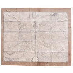
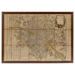
Mid-Sized Turgot Map of Paris, 1950 Pressing of a Map from 1739
View Similar Items


Want more images or videos?
Request additional images or videos from the seller
1 of 14
Mid-Sized Turgot Map of Paris, 1950 Pressing of a Map from 1739
About the Item
- Dimensions:Height: 68.25 in (173.36 cm)Width: 82.5 in (209.55 cm)Depth: 1 in (2.54 cm)
- Materials and Techniques:
- Place of Origin:
- Period:
- Date of Manufacture:1950
- Condition:Wear consistent with age and use. Minor losses.
- Seller Location:Washington, DC
- Reference Number:Seller: CJ14020961stDibs: LU86981300932
About the Seller
4.7
Vetted Seller
These experienced sellers undergo a comprehensive evaluation by our team of in-house experts.
1stDibs seller since 2009
154 sales on 1stDibs
Typical response time: 1 hour
More From This SellerView All
- 18th Century Map of ParisLocated in Washington, DC18th century map of Paris.Category
Antique Late 18th Century French Prints
MaterialsGlass, Wood, Paper
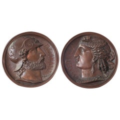
- Pair of Bonze Bas Relief of Greek God and GoddessLocated in Washington, DCA Pair of Bronze Bas Relief of Greek God and GoddessCategory
Antique 19th Century French Classical Greek Decorative Art
MaterialsBronze
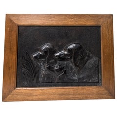
- Black Painted Resin Panel of a Hunting Dogs BustsLocated in Washington, DCA black painted resin panel of a hunting dogs busts.Category
Vintage 1950s French Decorative Art
MaterialsResin, Wood, Paint
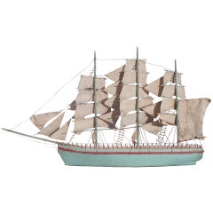
- Blue Painted Model of a Sail BoatLocated in Washington, DCA blue painted model of a sail boatCategory
20th Century French French Provincial Nautical Objects
MaterialsString, Wood, Paint
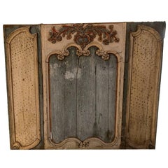
- 18th Century Painted Boiserie PanelLocated in Washington, DCA 18th century painted boiserie panel.Category
Antique 18th Century French Decorative Art
MaterialsWood, Paint
- French Hunting Trophies Priced IndividuallyLocated in Washington, DCSculptural quality hunting trophies from France. Newly mounted. Large $ 850.00 each. Medium $ 750.00 each.Category
20th Century French Taxidermy
MaterialsHorn, Wood
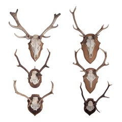 $850 / item
You May Also Like
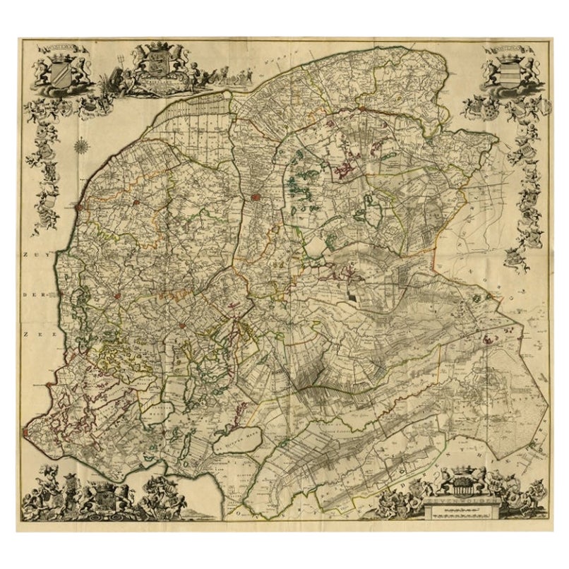
- Large Antique Wall Map of Friesland by Vegelin van Claerbergen, 1739Located in Langweer, NLAntique map titled 'Nieuwe Caert van Frieslant, Vermeerdert en verbetert op order der Ed. Mo. Heeren Gedeputeerde Staeten'. Rare and large attractive wall map of Friesland, the so-called 'Vegelin-map'. It shows the region of Oostergo, Westergo and Zevenwolden in Friesland, the Netherlands. Decorated with coats of arms of Friesland, Oostergo, Zevenwolden and other regions and cities/villages of Friesland. Artists and Engravers: For this particular map, Bernhardus Schotanus à Sterringa prepared the plates. However, these plates were never published in his 'Schotanus Atlas'. He wanted the plates to be published as a large wall map...Category
Antique 18th Century Maps
MaterialsPaper
 $8,107 Sale Price20% OffFree Shipping
 - Original Large Antique Map of Paris, France by John Dower, 1861Located in St Annes, LancashireFabulous monochrome map of Paris. Vignettes of St Germain En Laye, Saint Cloud, Versailles and Fontainbleau. Unframed. Drawn by J.Dower. Lithography by Weller. 4 sheets j...Category
Antique 1860s English Victorian Maps
MaterialsPaper
- Antique Map of Asia 'circa 1739'Located in Langweer, NLAntique map titled 'Asia Dividida em suas Regioens & Principaes Estados'. Rare and uncommon map of Asia. Signed '1739'. Source unknown, to be determined. ...Category
Antique Mid-18th Century Maps
MaterialsPaper
 $569 Sale Price35% Off
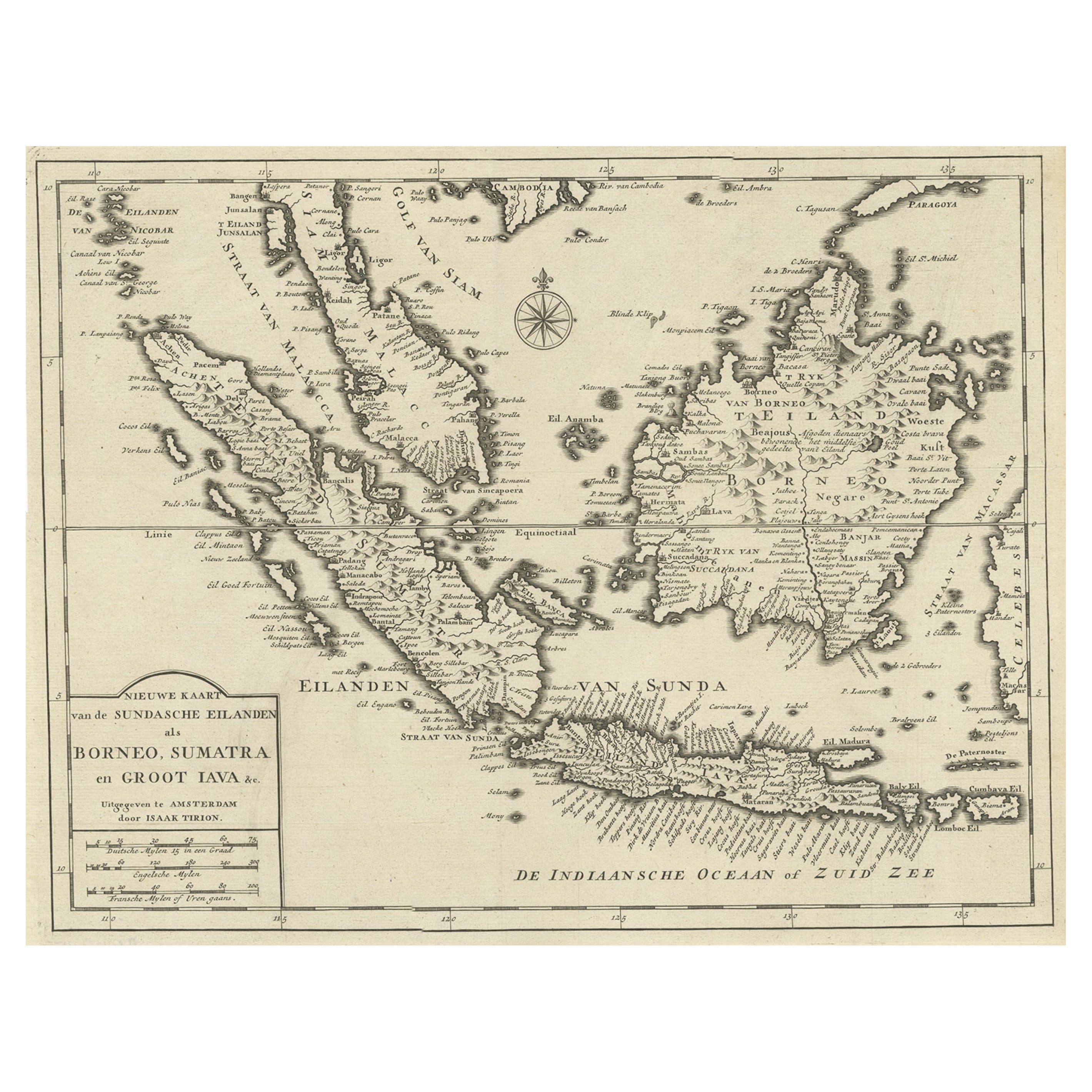
 - Detailed Map of Southeast Asia From the Tip of Cambodia to Java, 1739Located in Langweer, NLAntique map titled 'Nieuwe kaart van de Sundasche Eilanden als Borneo, Sumatra en Groot Iava & c'. Detailed map of Southeast Asia, extending from the tip of Cambodia to Java. Thi...Category
Antique 1730s Maps
MaterialsPaper
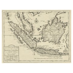 $567 Sale Price24% Off
 - Original Antique Map of Indonesia, 1861Located in St Annes, LancashireGreat map of Indonesia Drawn and engraved by Edward Weller Original color Published in The Weekly Dispatch Atlas, 1861 Repairs to minor e...Category
Antique 1860s English Victorian Maps
MaterialsPaper

- Original Antique Map of Missouri, 1889Located in St Annes, LancashireGreat map of Missouri Drawn and Engraved by W. & A.K. Johnston Published By A & C Black, Edinburgh. Original colour Unframed.Category
Antique 1880s Scottish Victorian Maps
MaterialsPaper

