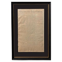
1791 Gazette of The United States, with Plans for the Capital City of Washington
View Similar Items

Want more images or videos?
Request additional images or videos from the seller
1 of 11
1791 Gazette of The United States, with Plans for the Capital City of Washington
$4,500List Price
About the Item
- Dimensions:Height: 20.13 in (51.14 cm)Width: 13.63 in (34.63 cm)Depth: 1 in (2.54 cm)
- Style:Federal (Of the Period)
- Materials and Techniques:
- Place of Origin:
- Period:1790-1799
- Date of Manufacture:1791
- Condition:Additions or alterations made to the original: Archivally framed by Artem Art Services in Colorado Springs, Colorado, in November of 2024. Wear consistent with age and use.
- Seller Location:Colorado Springs, CO
- Reference Number:Seller: PR5081stDibs: LU909745223842
About the Seller
4.9
Vetted Professional Seller
Every seller passes strict standards for authenticity and reliability
Established in 2010
1stDibs seller since 2011
464 sales on 1stDibs
Authenticity Guarantee
In the unlikely event there’s an issue with an item’s authenticity, contact us within 1 year for a full refund. DetailsMoney-Back Guarantee
If your item is not as described, is damaged in transit, or does not arrive, contact us within 7 days for a full refund. Details24-Hour Cancellation
You have a 24-hour grace period in which to reconsider your purchase, with no questions asked.Vetted Professional Sellers
Our world-class sellers must adhere to strict standards for service and quality, maintaining the integrity of our listings.Price-Match Guarantee
If you find that a seller listed the same item for a lower price elsewhere, we’ll match it.Trusted Global Delivery
Our best-in-class carrier network provides specialized shipping options worldwide, including custom delivery.More From This Seller
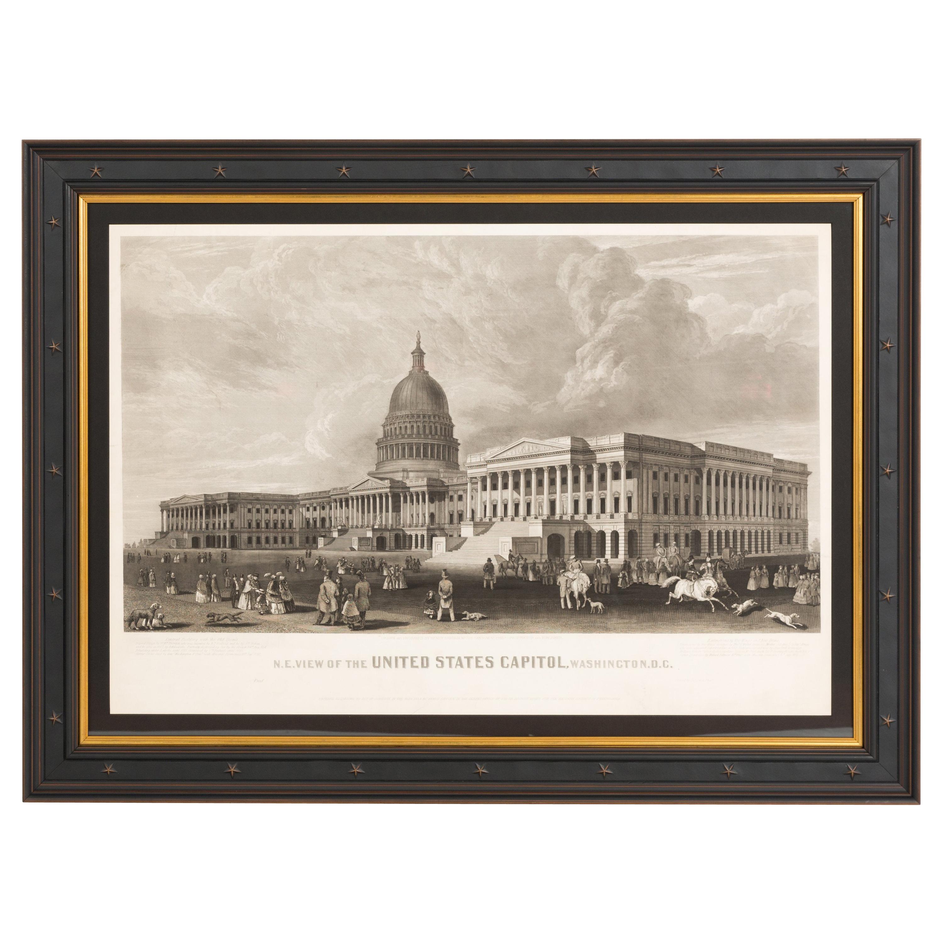
View AllN.E. View of the United States Capitol, Washington, DC Antique Proof Print 1858
Located in Colorado Springs, CO
This engraved print shows a view of the United States Capitol Building, in Washington, D.C. The print depicts the neoclassical building from the northeast orientation, with a bustling street scene in front. The steel engraving is a proof printing, drawn and engraved by Henry Sartain and published in 1858.
Plans began in May 1854 to build a new cast-iron dome for the United States Capitol. The then-architect of the Capitol Thomas Walter and his team were sold on the aesthetics of a new dome, as well as the utility of a fire-proof one. A year later, on March 3, 1855, President Franklin Pierce...
Category
Antique 1850s American Prints
Materials
Paper

"The British Surrendering their Arms to Gen. Washington..." after Renault, 1819
Located in Colorado Springs, CO
Presented is an engraving entitled “The British surrendering their arms to Gen. Washington after their defeat at Yorktown Virginia October 1781.” The dedication continues in the bottom margin, “To the defenders of American independence, this print is most respectfully inscribed by their fellow citizen, Jn. Fcis. Renault, assistant secretary to the Count de Grass, and engineer to the French Army, at the siege of York.” The engraving is after a painting by John Francis Renault, and engraved by Tanner, Vallance, Kearny & Co. and William Allen, in Philadelphia in January of 1819.
This historic print depicts the surrender of the British forces after the Battle of Yorktown. The print shows Lord Cornwallis offering his sword to the Duke de Lauzun, who defers the weapon to General Washington. British officers stand with Cornwallis on the right and French and American officers are shown at center and left. The immediate background is filled with an elaborate allegorical scene. Behind the British troops is a female representation of “Discord,” wearing a billowing robes and liberty cap and floating on storm clouds, as she sends lightning bolts to up-end the British people and a chariot below her. Behind the American and French officers, “Prosperity” stands next to an overflowing cornucopia, with “Justice”, an infant child with a paddle inscribed “American Constitution,” representing the helm of statehood. They crowd around a neoclassical monument with a giant urn...
Category
Antique 1810s American Federal Prints
Materials
Paper

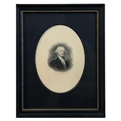
"Georgius Washington" Engraving by Giuseppe Longhi, 1817
Located in Colorado Springs, CO
Presented is a handsome engraved portrait of George Washington by Italian artist Giuseppe Longhi. Titled “Georgius Washington” this engraving was published in Padua, Italy in 1817. The composition is based on a drawing by Longhi himself, but certainly influenced by the Gilbert Stuart and John Trumbull portraits. Washington is depicted in a head and shoulders pose, with his chest to the left but his head angled to the right. He wears a dark coat and vest and a white shirt and ruffled cravat.
The father of our country, George Washington was the commander in chief of the Continental Army during the American Revolutionary War (1775-83) and served two terms as the first United States president...
Category
Antique 1810s Italian Federal Prints
Materials
Paper
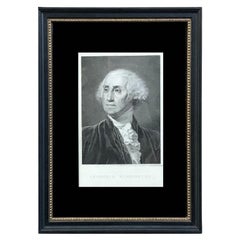
George Washington Engraving by H. B. Hall, after William Birch
By William Birch
Located in Colorado Springs, CO
Presented is a handsome engraved portrait of George Washington by artist H. B. Hall. This engraving was published in New York, in a limited edition of 125 impressions. The engraving is based on a painting by William Birch Gilbert Stuart, a small miniature in enamel, completed in 1796. Birch painted Washington from life in his office in Philadelphia, by the request of I. G. Van Staphorst, Esqr. of Amsterdam. In the small portrait, Washington is depicted in a head and shoulders pose, facing right. He wears a dark coat and vest and a white shirt and ruffled cravat.
The father of our country, George Washington was the commander in chief of the Continental Army during the American Revolutionary War (1775-83) and served two terms as the first United States president...
Category
Antique 19th Century American Federal Prints
Materials
Paper
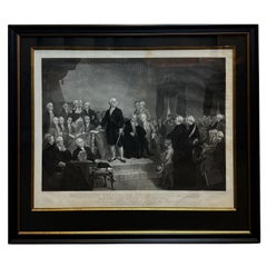
"Washington Delivering His Inaugural Address" Engraving by H. S. Sadd, 1860
Located in Colorado Springs, CO
Presented is a patriotic engraving titled “Washington Delivering His Inaugural Address. April 1789, in the old City Hall, New-York.” The print was engraved by Henry S. Sadd, after a ...
Category
Antique 1860s American Federal Prints
Materials
Paper
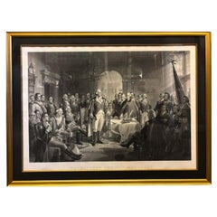
"Washington and His Generals" Engraving by A. H. Ritchie, circa 1870
By Alexander Hay Ritchie
Located in Colorado Springs, CO
This is a large, handsome engraving entitled Washington and His Generals by Alexander H. Ritchie, one of the best historical printmakers of the mid-nineteenth century. Ritchie is par...
Category
Antique 1870s American Federal Prints
Materials
Paper
You May Also Like
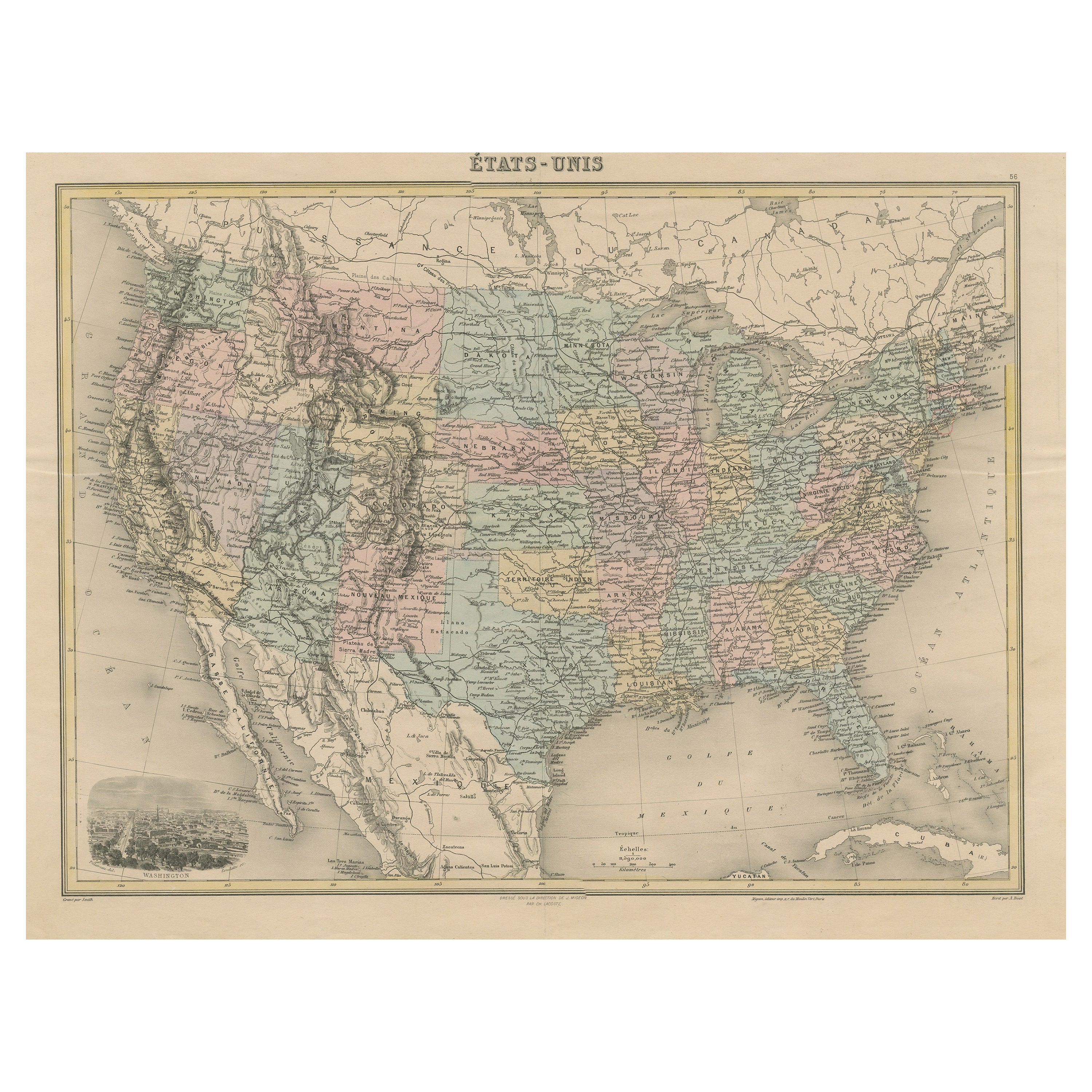
Antique Map of the United States with Vignette of Washington
Located in Langweer, NL
Antique map titled 'États-Unis'. A very attractive and detailed late 19th century map of the United States, with a fine decorative vignette of Washington. The extensive railway netwo...
Category
Antique Late 19th Century Maps
Materials
Paper
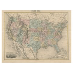
$457 Sale Price
20% Off
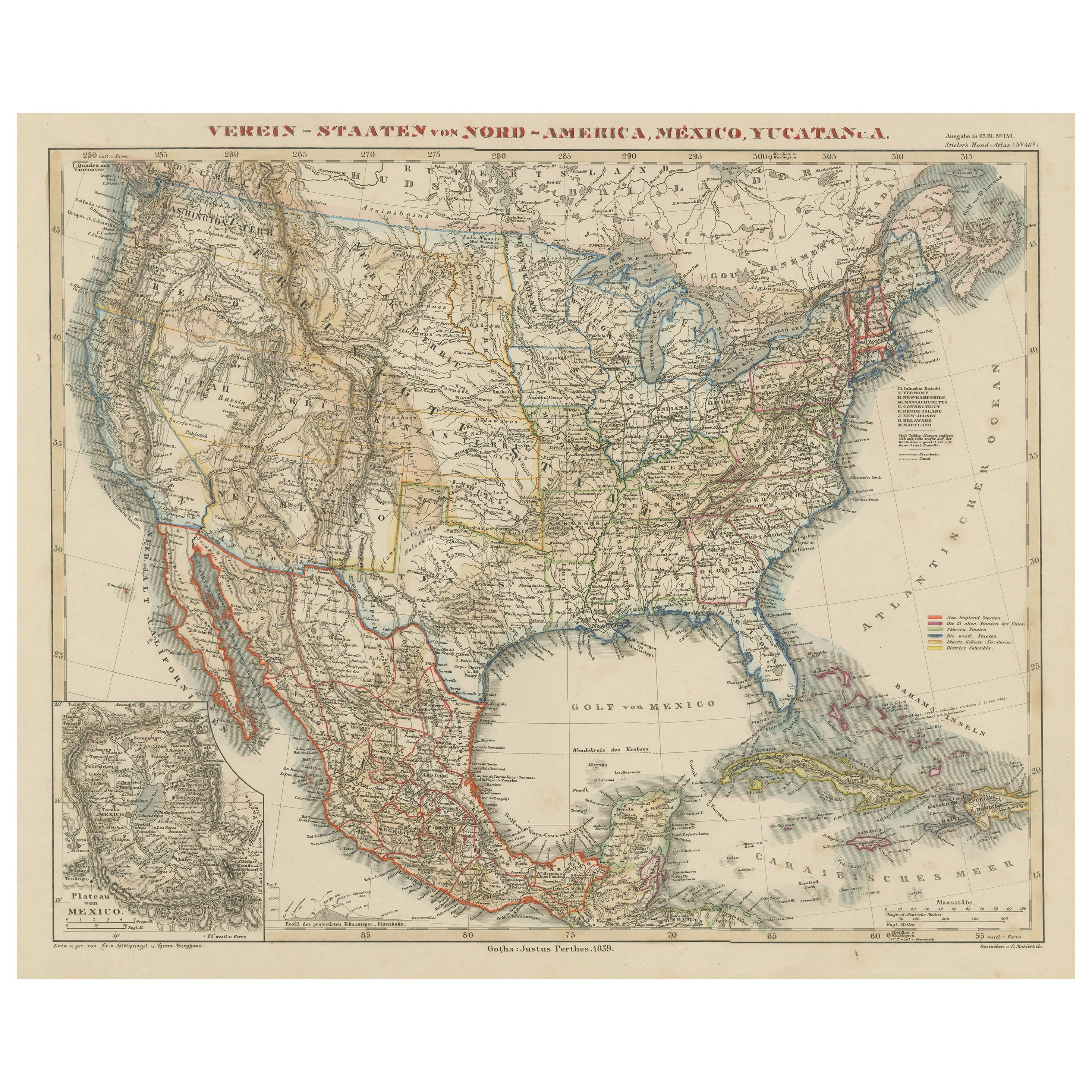
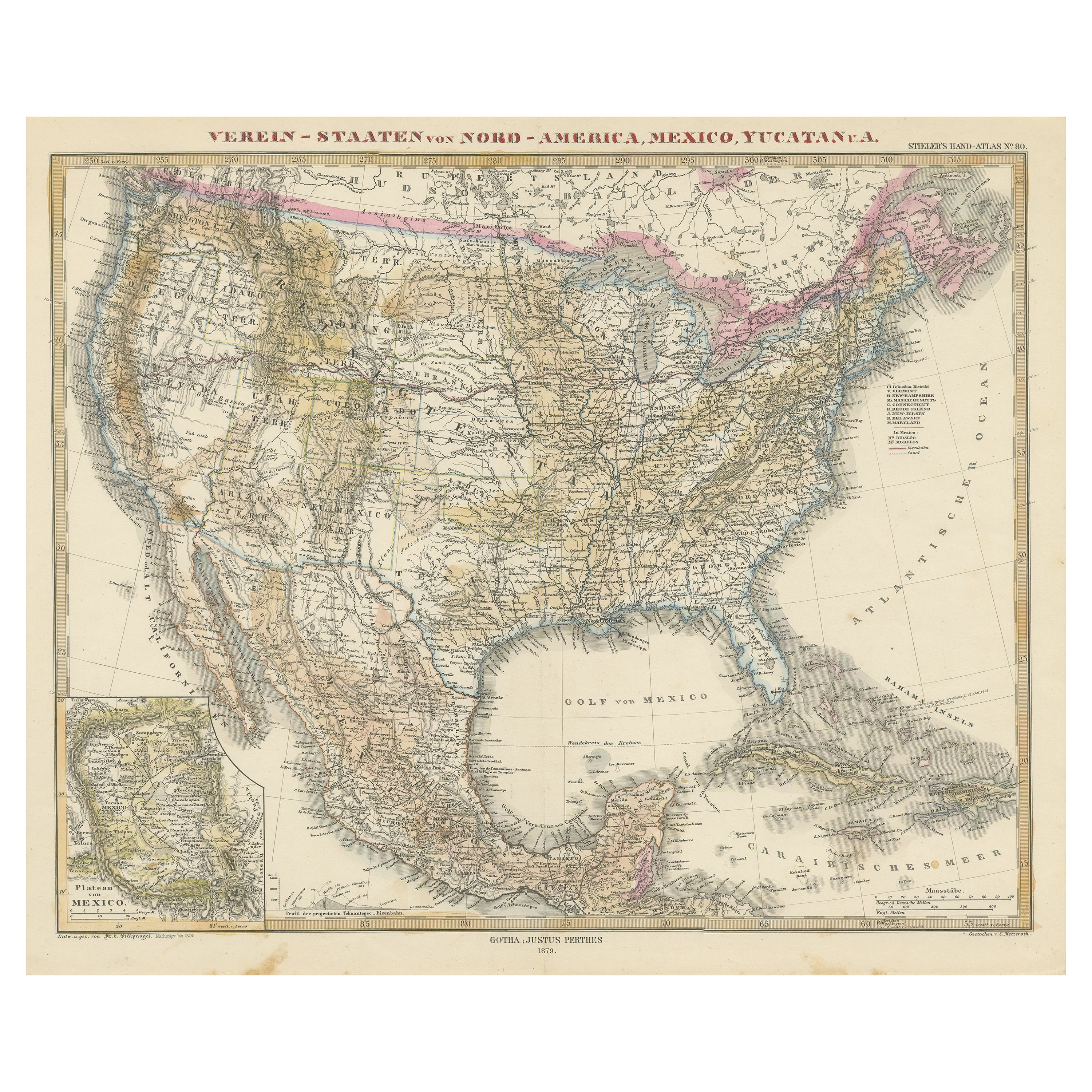
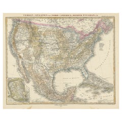
Antique Map of the United States with inset map of the region of Mexico City
Located in Langweer, NL
Antique map titled 'Verein-Staaten von Nord-America, Mexico, Yucatan u.a.'. Very detailed map of the United States of America showing the Caribbean. With an inset map of the surround...
Category
Antique Mid-19th Century Maps
Materials
Paper

$817 Sale Price
20% Off
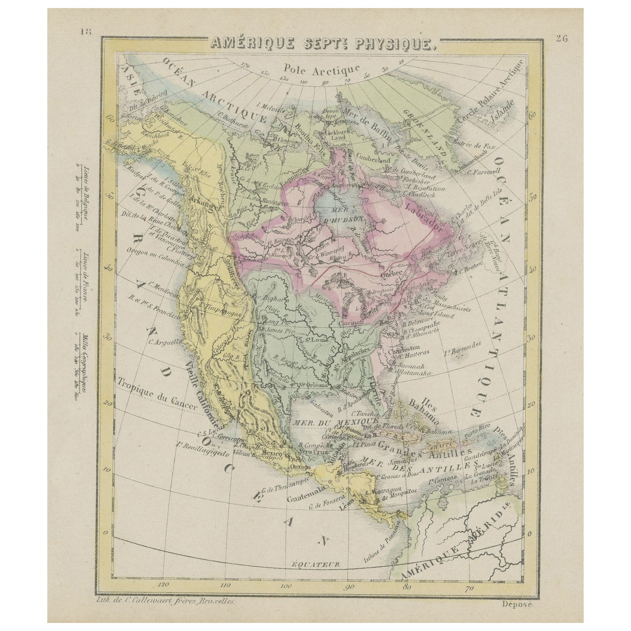
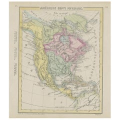
Small Map of the United States, circa 1870
Located in Langweer, NL
Antique map titled 'Amérique septe. Physique'. Small map of the United States. lithographed by C. Callewaert brothers in Brussels circa 1870.
Category
Antique Mid-19th Century Belgian Maps
Materials
Paper
Antique Map with Hand Coloring of the United States and the Caribbean
Located in Langweer, NL
Antique map titled 'Verein-Staaten von Nord-America, Mexico, Yucatan u.a.'. Very detailed map of the United States of America showing the Caribbean. With an inset map of the surround...
Category
Antique Late 19th Century Maps
Materials
Paper
$533 Sale Price
20% Off
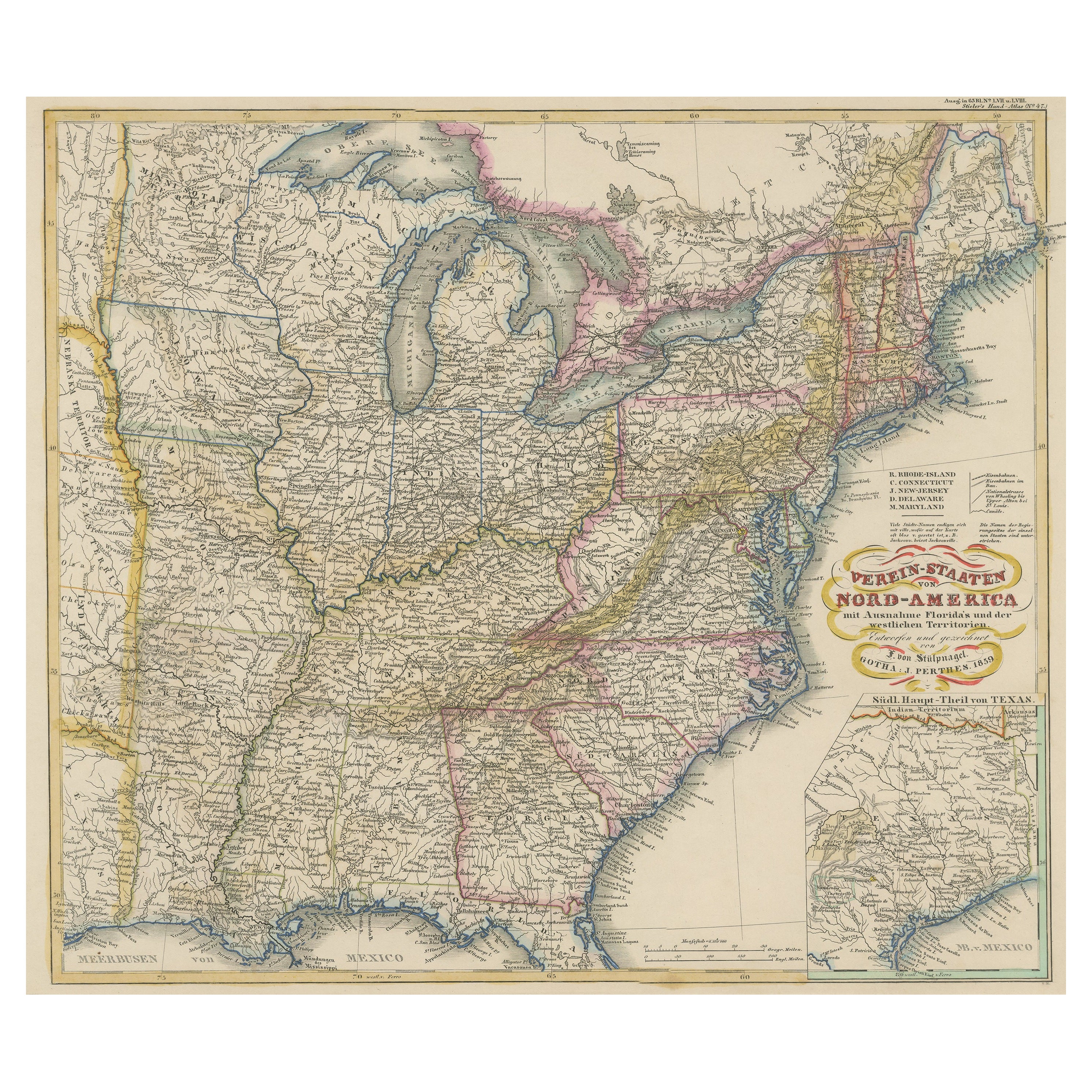
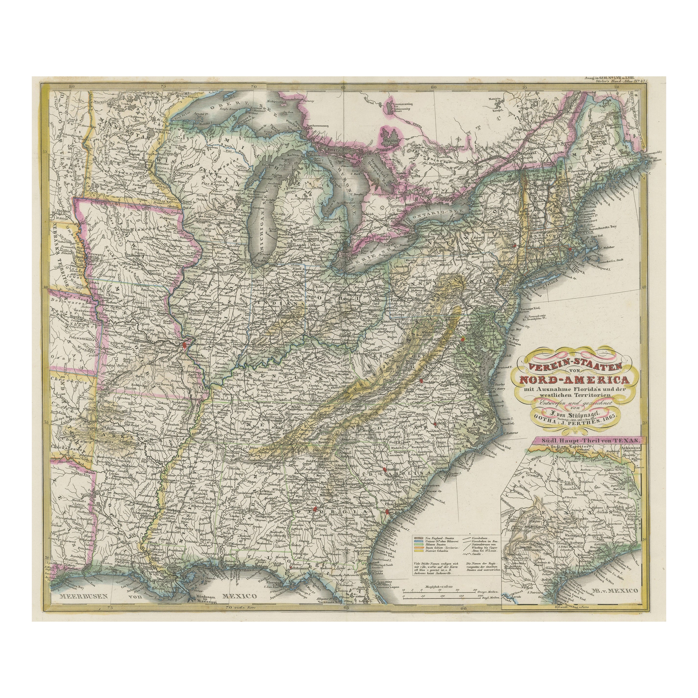
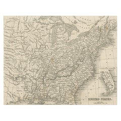
Antique Map of the Eastern United States with Inset Map of Texas
Located in Langweer, NL
Antique map titled 'Verein-Staaten von Nord-America mit Ausnahme Florida's und der Westlichen Territorien'. This map extends as far west as Louisiana and only includes the northern p...
Category
Antique Mid-19th Century Maps
Materials
Paper

$514 Sale Price
20% Off
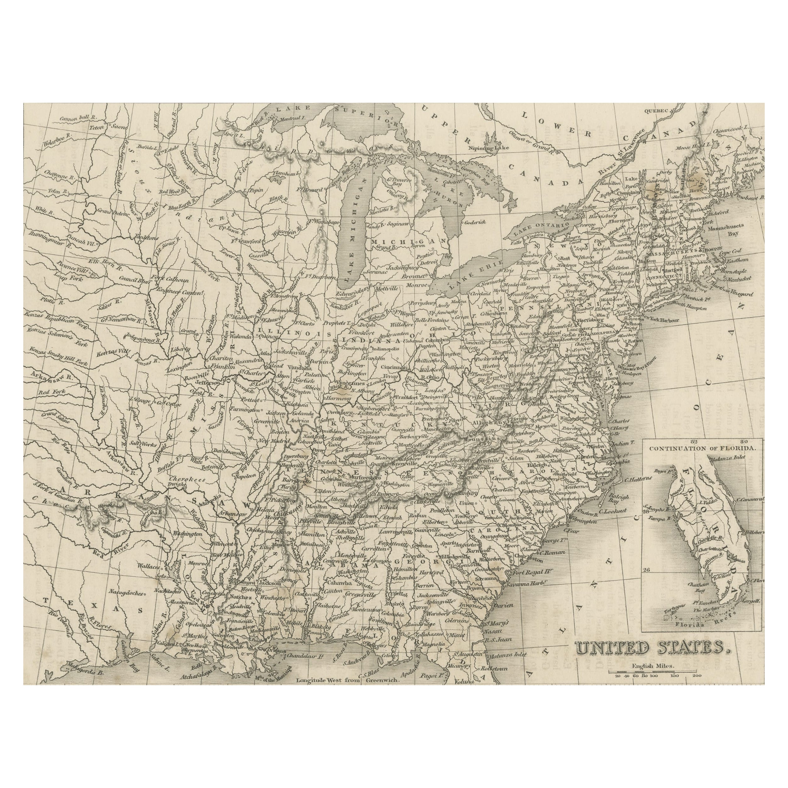
Steel Engraved Map of the United States with Inset Map of Florida
Located in Langweer, NL
Antique map titled 'United States'. Steel engraved map of the United States. With small inset map of the continuation of Florida. Source unknown, to be determined. Published circa 1843.
Category
Antique Mid-19th Century Maps
Materials
Paper
$152 Sale Price
20% Off