Items Similar to Copper Engraving of The Dutch and Austrian Netherlands Handcolored, 1772

Want more images or videos?
Request additional images or videos from the seller
1 of 6
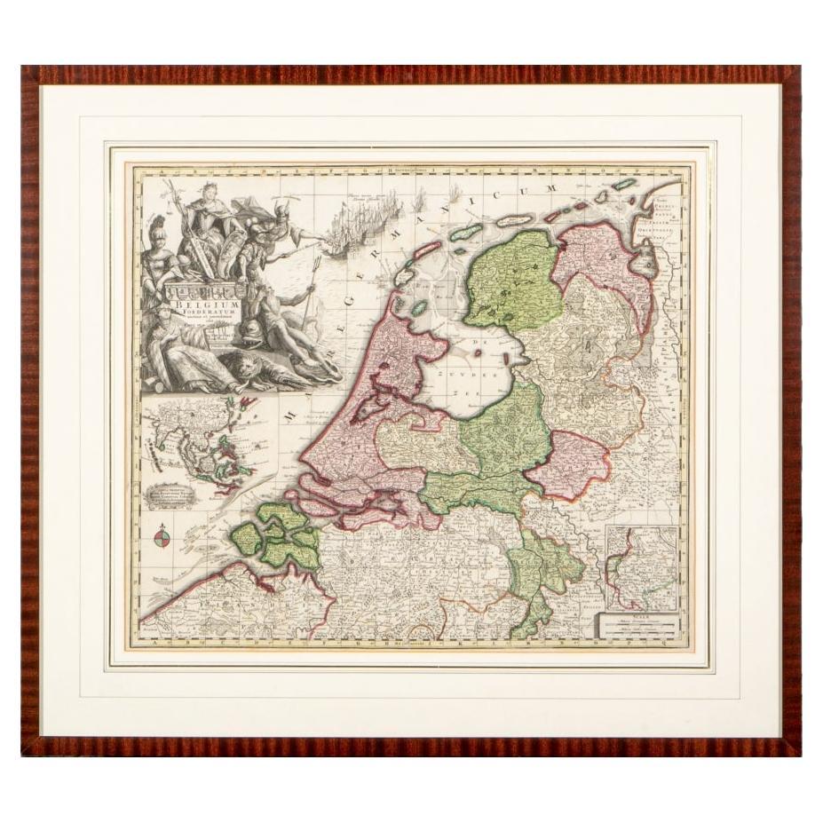
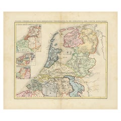
Copper Engraving of The Dutch and Austrian Netherlands Handcolored, 1772
$247.62
$309.5320% Off
£184.05
£230.0620% Off
€208
€26020% Off
CA$341.90
CA$427.3720% Off
A$379.14
A$473.9220% Off
CHF 199.21
CHF 249.0120% Off
MX$4,632.41
MX$5,790.5120% Off
NOK 2,492.37
NOK 3,115.4620% Off
SEK 2,339.51
SEK 2,924.3920% Off
DKK 1,583.82
DKK 1,979.7720% Off
About the Item
This antique map, a rare hand-colored engraved piece by E.A. Philippe de Pretot, showcases intricate detailing and vibrant colors. The dimensions of the map measure approximately 33 x 47 centimeters, presenting a visually striking and well-preserved piece.
The map's cartographic details, depicted in the elegant style characteristic of Philippe de Pretot's work, are brought to life by delicate hand coloring. Its condition is noted to be very good, indicating that the map has been well-maintained over time, retaining its clarity and colors.
Created in the French language, this map offers geographical information with an artistic touch, appealing to collectors interested in historical cartography. Philippe de Pretot's expertise in engraving and the meticulous hand coloring make this map a valuable addition for enthusiasts of antique maps or those fascinated by historical geography and art.
- Dimensions:Height: 13 in (33 cm)Width: 18.51 in (47 cm)Depth: 0 in (0.02 mm)
- Materials and Techniques:Paper,Engraved
- Period:1640-1649
- Date of Manufacture:1646
- Condition:Good condition. Some minor wear due to handling and age, but mainly in the outer margin, not affecting the image. Crease vertically across the centre of the sheet. Two remains of tape on the reverse. Study image carefully.
- Seller Location:Langweer, NL
- Reference Number:Seller: BG-13094-221stDibs: LU3054337490522
About the Seller
5.0
Recognized Seller
These prestigious sellers are industry leaders and represent the highest echelon for item quality and design.
Platinum Seller
Premium sellers with a 4.7+ rating and 24-hour response times
Established in 2009
1stDibs seller since 2017
2,609 sales on 1stDibs
Typical response time: <1 hour
- ShippingRetrieving quote...Shipping from: Langweer, Netherlands
- Return Policy
Authenticity Guarantee
In the unlikely event there’s an issue with an item’s authenticity, contact us within 1 year for a full refund. DetailsMoney-Back Guarantee
If your item is not as described, is damaged in transit, or does not arrive, contact us within 7 days for a full refund. Details24-Hour Cancellation
You have a 24-hour grace period in which to reconsider your purchase, with no questions asked.Vetted Professional Sellers
Our world-class sellers must adhere to strict standards for service and quality, maintaining the integrity of our listings.Price-Match Guarantee
If you find that a seller listed the same item for a lower price elsewhere, we’ll match it.Trusted Global Delivery
Our best-in-class carrier network provides specialized shipping options worldwide, including custom delivery.More From This Seller
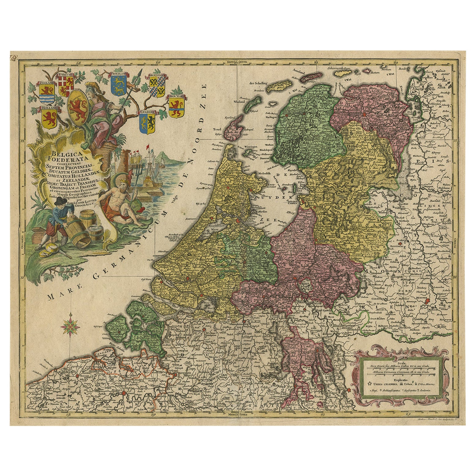
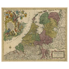
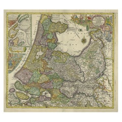
View AllLarge Antique Map of the Netherlands with Original Hand Coloring
Located in Langweer, NL
Original antique map titled 'Belgica Foederata complectens septem Provincias Ducatum Geldriae (..)". Large map of the Netherlands. Title a...
Category
Antique Mid-18th Century Maps
Materials
Paper
$780 Sale Price
20% Off
Antique Map of the Netherlands and Belgium by Homann, circa 1710
By Johann Baptist Homann
Located in Langweer, NL
Antique map titled 'Tabula Generalis Totius Belgii Provinciae XVII. Infer. Germaniae (..)'. Map of the Benelux countries by Johann Baptist Homann. Shows the area between the Seine es...
Category
Antique Early 18th Century German Maps
Materials
Paper

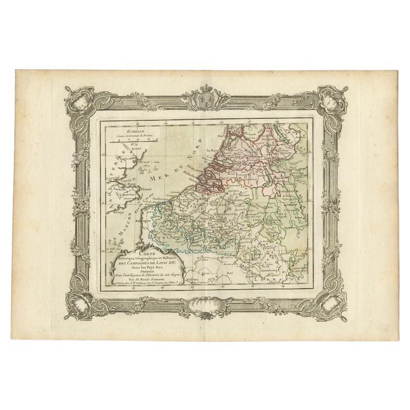
Antique Map of the Netherlands by Zannoni, 1765
Located in Langweer, NL
Antique map titled 'Carte Historique, Geographique et Militaire des Campagnes de Louis XIV dans les Pays Bas (..)'. Beautiful old map of the Netherlands...
Category
Antique 18th Century Maps
Materials
Paper
$209 Sale Price
20% Off
Detailed Old Map of the Seven Provinces of the Belgian/Dutch Federation, ca.1748
Located in Langweer, NL
Antique map titled 'Septem Provinciae seu Belgium Foederatum quod generliter Hollandia (..).' Detailed antique map of the seven provinces of the Belgian Federation (Dutch Federation)...
Category
Antique 18th Century Maps
Materials
Paper
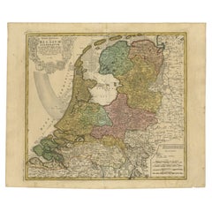
$428 Sale Price
20% Off
Antique Map of the Netherlands in 1560 by Mees, 1853
Located in Langweer, NL
Antique map titled 'Noord-Nederland in 1560. Kerkelijke verdeeling, na de oprigting der nieuwe bisdommen'. Map of the Netherlands in 1560. This map originates from 'Historische Atlas...
Category
Antique 19th Century Maps
Materials
Paper
$121 Sale Price
20% Off
Antique Map of the Northwestern Netherlands, incl Texel and Vlieland, ca.1741
Located in Langweer, NL
Antique print, titled: 'Tabula Comitatus Hollandiae in Praefecturas sua distributa; cui adjuncta est Provinc. Ultraiectina et maxima pars Geldriae summo studio delin. Et aeri incidit...
Category
Antique 1740s Maps
Materials
Paper
$895 Sale Price
20% Off
You May Also Like
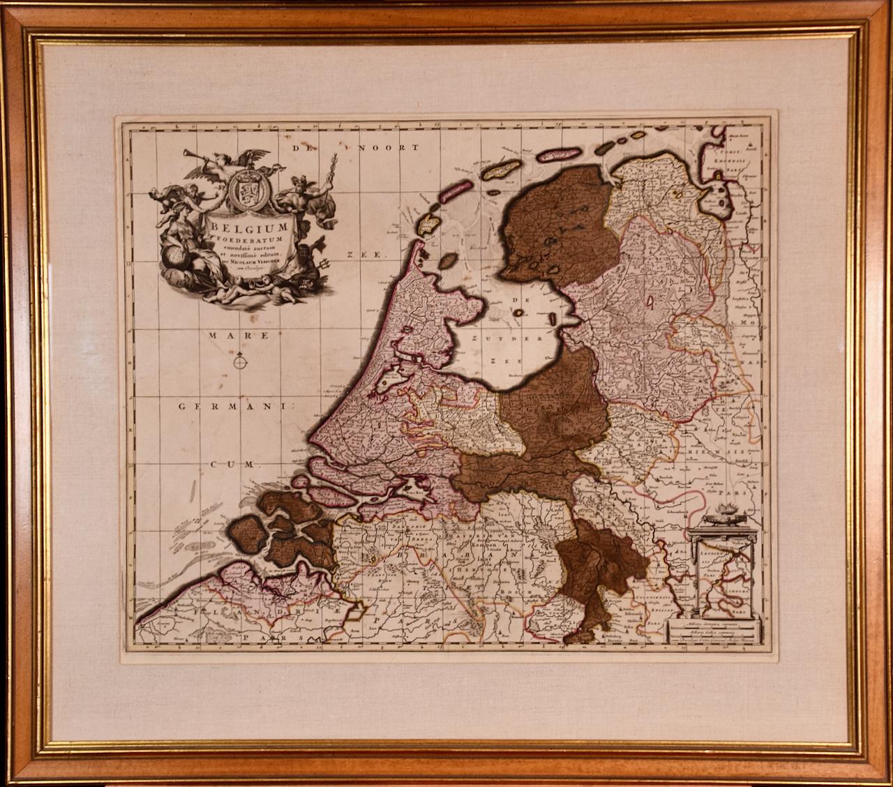
Belgium and the Netherlands: A Hand-colored 17th Century Map by Visscher
By Nicolaus Visscher
Located in Alamo, CA
This is an original hand-colored 17th century map of Belgium by Nicolaus (Nicolas) Visscher II entitled "Belgium Foederatum emendate auctum et novissime editum", published in Amsterdam in 1678. The map shows the seven provinces comprising the Belgium federation or the Republic of the Seven United Netherlands or the Dutch Republic as it was also known. The republic was formed when an alliance of seven Dutch provinces in the Spanish Netherlands revolted against rule by Spain in 1579 (the Union of Utrecht) and declared their independence in 1581 (the Act of Abjuration). The seven provinces were Groningen, Frisia, Overijssel, Guelders, Utrecht, Holland and Zeeland. This was a predecessor state to the Netherlands and the first fully independent Dutch nation state. Amsterdam, Delft, Rouen, Utrecht, Brugge, Ghent, and Antwerp are all included on the map. A small inset map in the lower right depicts the course of the Maas River from Maastricht to Wessem. There is a decorative cartouche in the upper left corner and a distance scale cartouche in the lower right corner.
The map is presented in an attractive antiqued medium brown-colored wood frame with gold-colored inner and outer trim and a light tan-colored fabric mat. The frame measures 26.63" high by 30" wide by 0.75" deep. There is some darkening of the red areas in the map, presumably related to oxidation of the original iron containing pigment over time. There are also a few scattered spots. The map is otherwise in very good condition.
The Visscher family were one of the great cartographic families of the 17th century. Begun by Claes Jansz Visscher...
Category
Late 17th Century Other Art Style Landscape Prints
Materials
Engraving

Matthaus Seutter, Framed 1730 Color Engraving Map of "Belgium Fonderatum"
Located in Bridgeport, CT
Label on verso. From Grosser Atlas. The name Belgium comes from the ancient designation "Gallis Belgica". Figural decoration upper left. M. Seutter was a famed German mapmaker in the...
Category
Antique 18th Century European Renaissance Maps
Materials
Brass

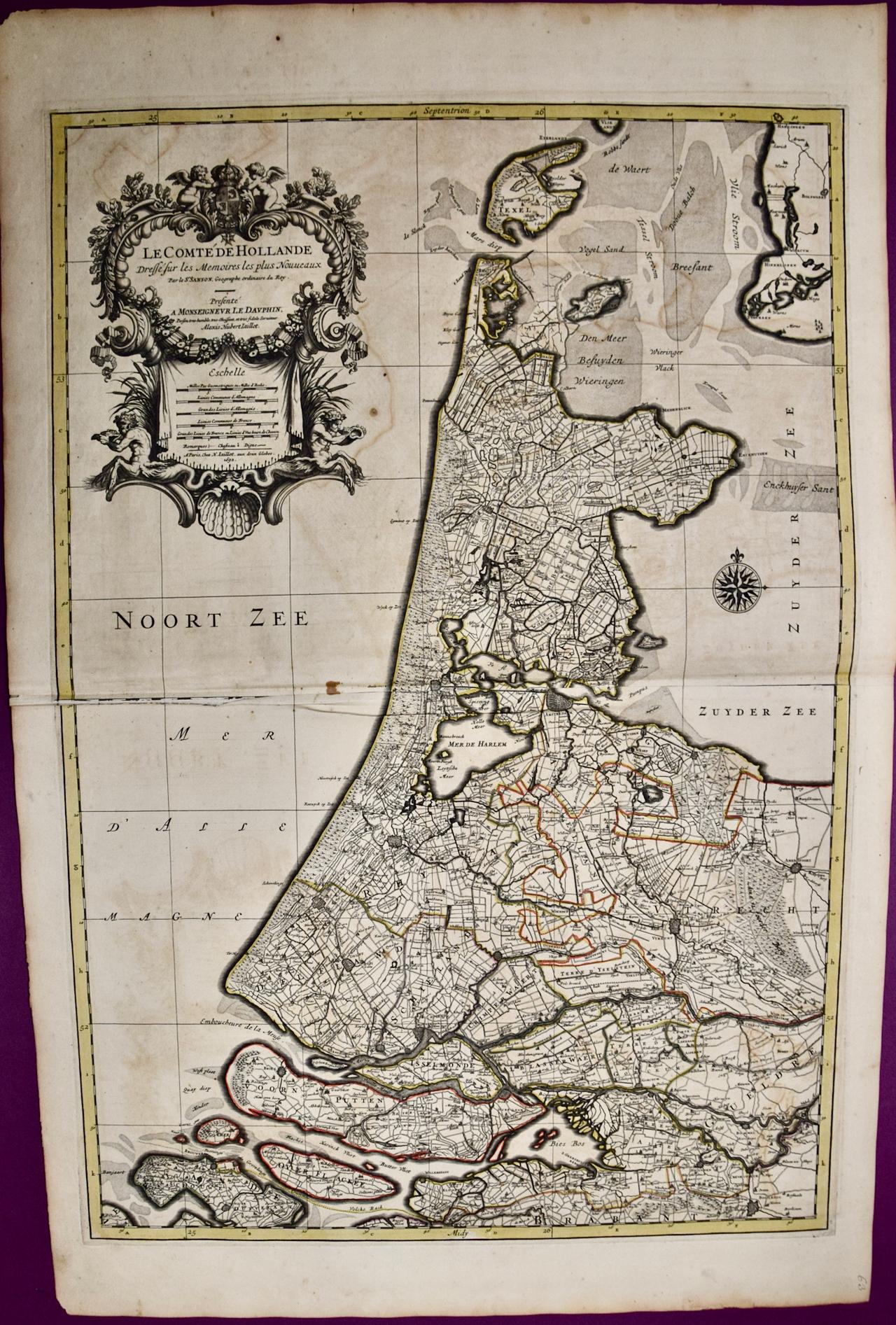
North Holland, Netherlands: A Large 17th C. Hand-colored Map by Sanson & Jaillot
By Nicholas Sanson d'Abbeville
Located in Alamo, CA
This large hand-colored map entitled "Le Comte De Hollande Dressee sur les Memoires les plus Nouveaux" was originally created by Nicholas Sanson d'Abbeville. This version was publish...
Category
1690s Landscape Prints
Materials
Engraving

West Germany: Original Hand Colored 17th Century Map by Johannes Janssonius
By Johannes Janssonius
Located in Alamo, CA
An original hand colored copperplate engraved map entitled in Latin "Archiepiscopatus Maghdeburgensis et Anhaltinus Ducatus cum terris adjacentibus", published in Amsterdam in 1640 i...
Category
Mid-17th Century Old Masters More Prints
Materials
Engraving

Southern Holland: An Original 17th C. Hand-colored Visscher Map "Hollandiae"
By Nicolaus Visscher
Located in Alamo, CA
This a beautiful framed hand colored 17th century map of the southern portions of Holland by Nicolaus (Nicolas) Visscher II entitled "Hollandiae pars Meridionalis, vulgo Zuyd-Holland", published in Amsterdam in 1678. The map shows the region between Breda, Heusden, Gornichem, Gouda, Dordrecht, and Willemstad. It includes a decorative cartouche in the lower left corner.
The map is presented in an attractive maple colored wood frame with gold trim and a fabric mat. There is a central vertical fold, as issued. There are small areas of discoloration consistent with age. The map is otherwise in very good condition.
The Visscher family were one of the great cartographic families of the 17th century. Begun by Claes Jansz Visscher...
Category
Late 17th Century Other Art Style Landscape Prints
Materials
Engraving

Hand Colored Copperplate Engraving of Copenhagen, Denmark
Located in Kastrup, DK
Hand-colored copperplate engraving depicting an interesting old view of Copenhagen seen from Frederiksberg Castle Gardens, approximate. 1790-1800.
Framed in a mahogany frame from sam...
Category
Antique Late 18th Century Danish Louis XVI Prints
Materials
Glass, Mahogany, Paper
More Ways To Browse
French Painted Enfilade
French Velvet Bed
Fretwork Spandrels
Garden Tea Lantern
George Iii Teapot
Glass Haberdashery Cabinet
Greco Roman Rings
Green Bedside Cabinet
Green Italian Decanter
Hermes Horse Plate
Japanese 4 Panel Screen
King Wood Bed Frame Antique
Naga Wood
Oak Music Cabinet
Oggetti Art Glass
Old Antique Coffee Pot
Owl Figurine
Pair Of Swan Sculptures