Sale
to
2,113
323
126,740
122,372
51,704
50,563
36,394
26,434
17,210
16,122
13,149
10,590
9,401
9,160
8,417
7,280
6,019
5,699
5,376
4,433
4,334
4,102
2,919
2,554
2,351
1,794
1,538
1,410
1,398
1,391
784
661
633
594
551
497
446
440
421
389
327
325
306
298
211
208
168
158
157
154
125
98
91
90
86
84
76
54
54
38
31
26
16
16
56
18
12
7
5
Period: 17th Century
Period: 1750s
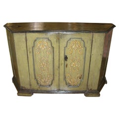
Rare 17th C. Tuscan Baroque Credenza Console Cabinet Italian Sideboard LA CA
Located in West Hollywood, CA
Rare 17th C. Tuscan Baroque Credenza Console Cabinet Italian Sideboard LA CA . A good late 17th century-early 18th century Tuscan baroque polychrome decorated credenza cabinet 2 door...
Category
Antique Late 17th Century Italian Baroque Credenzas
Materials
Iron
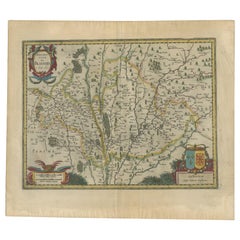
Antique Map of the Region of Blois by Janssonius, 'circa 1640'
By Johannes Janssonius
Located in Langweer, NL
Antique map titled 'Description du Blaisois'. Old map of the region of Blois, France. It shows the city of Blois, Amboise, the Loire River and more. Published by J. Janssonius, circa...
Category
Antique Mid-17th Century Maps
Materials
Paper
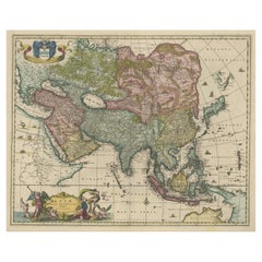
Antique Map of Asia and the East Indies and Korea as a Peninsula, ca.1660
Located in Langweer, NL
Antique map titled 'Asiae nova delineatio'. Decorative map of Asia and the East Indies. The map shows Korea as a peninsula. In China the Great Wall is depicted, as well as a long str...
Category
Antique 17th Century Maps
Materials
Paper
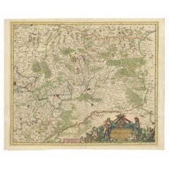
Historic 1690 Map of Lorraine in France by Allard - Cities of Toul, Nancy, Metz
Located in Langweer, NL
Exactissima Lotharingia - A Rare 17th Century Map of Lorraine by Carel Allard
This fascinating map of Lorraine, created by Carel Allard around 1690, is a stunning example of coppe...
Category
Antique 1690s Maps
Materials
Paper
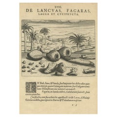
Treasures of the Tropics: Lac, Lancas, and Fagaras in De Bry's 1601 Engraving
Located in Langweer, NL
Title: "Treasures of the Tropics: Lac, Lancas, and Fagaras in De Bry's 1601 Engraving"
Description: In this detailed 1601 engraving by Theodore de Bry, a variety of tropical produce...
Category
Antique Early 17th Century Prints
Materials
Paper
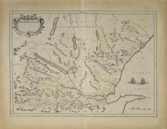
Map of Scotland - Etching by Johannes Blaeu - 1650s
Located in Roma, IT
Map of Scotland is an geographic map realized by Johannes Blaeu.
Etching, printed in 1660 ca.
Copper engraving, colored (coeval coloring), on paper, with center fold;
Latin text. ...
Category
1650s Modern Figurative Prints
Materials
Etching
Antique Print of The Siege of Baghdad, Irag, 1680
Located in Langweer, NL
Antique print titled 'Beleg van Bagdad'.
Old print of a group of soldiers on high ground outside the walls of Baghdad. This print originates from 'Naukeurige Beschryving van Asie...
Category
Antique 1680s Prints
Materials
Paper
Old Print of Farmers Harvesting Cinnamon on the Island Ceylon or Sri Lanka, 1672
Located in Langweer, NL
Antique print, titled: 'Hoe men de Caneel schilt opt Eyland Ceylon.'
This rare original plate shows a group of farmers harvesting cinnamon on the island of Ceylon / Sri Lanka. Du...
Category
Antique 1670s Prints
Materials
Paper
17th-18th Century, Shan, Antique Burmese Wooden Seated Monk / Disciple
Located in Sampantawong, TH
Antique Burmese wooden seated disciple on double lotus base, with gilded gold.
Age: Burma, Shan Period, 17th - 18th Century
Size: Height 51.5 C.M. / Width 23.7 C.M.
Condition: Nice ...
Category
Antique 17th Century Burmese Antiquities
Materials
Wood
Early 17th Century Flemish Historical Tapestry with the Roman General Coriolanus
Located in New York, NY
A Flemish historical tapestry panel from the early 17th century, featuring the famed Roman general, Gaeus Marcius, now called Coriolanus, returning triumphantly from the battle in wh...
Category
Antique Early 17th Century European Tapestries
Materials
Wool
Set of 2 Antique Mythology Prints after Bloemaert 'c.1680'
Located in Langweer, NL
Set of two antique mythology prints. These prints originate from 'Prima Pars: 't Eerste deel van de Teeken- Konst' by Abraham Bloemaert. Published by...
Category
Antique Late 17th Century Prints
Materials
Paper
Antique Print of a Greece Island, Most Likely Gavdopoula South of Crete, 1688
Located in Langweer, NL
Description: Untitled print of one of the islands of Greece, most likely Gavdopoula (located south of Crete).
Gavdopoula is an islet located north-west of its larger neighbour, G...
Category
Antique 1680s Maps
Materials
Paper
Antique Portrait of Ivan IV The Terrible, 1st Csar of All Russia, 1615
Located in Langweer, NL
Antique portrait titled 'Basilius Magnus (..)'. Portrait of Ivan IV (1530-84, 'the Terrible'). This print originates from 'Tooneel der keyseren ende coningen van christenryck sedert den onderganck van het Griecks keyserdom vervatende hare beeltnissen afcomsten ende voornaemste daden (..)'.
Ivan IV Vasilyevich (Russian: ???´? ????´??????; 25 August 1530 – 28 March [O.S. 18 March] 1584),[2] commonly known in English as Ivan the Terrible...
Category
Antique 17th Century Prints
Materials
Paper
Antique Map of Southeast Asia 'India, Indonesia' by N. Visscher, circa 1670
Located in Langweer, NL
Antique map titled 'Indiae Orientalis, nec non Insularum Adiacentium Nova Descriptio.' The map centers on the Strait of Malacca and Malay Peninsula. It extends from India and the Mal...
Category
Antique Mid-17th Century Maps
Materials
Paper
Late 17th Century Flemish Landscape Tapestry, with an Archer in a Forest
Located in New York, NY
A Flemish Baroque landscape hunting tapestry from the late 17th or early 18th century, depicting a young Archer carrying a bow and arrow within a forest in a meadowland setting. Encl...
Category
Antique Late 17th Century European Baroque Tapestries
Materials
Wool
Rare Small Map of Sumatra, Java, Borneo, Macassar, Madura, Bali, 1614
Located in Langweer, NL
One of the first maps of the Indonesia islands of Java, Bali, Sumbawa etc. in early days of the Dutch Indies. Also showing Banten, Jakarta (Jacatra), Indr...
Category
Antique Early 17th Century Maps
Materials
Paper
Small Original Antique Map of the Lower Alsace region, Germany
Located in Langweer, NL
Antique map titled 'Alsatia Inferior'. Small original antique map of the Lower Alsace region, Germany. This map originates from 'Atlas minor Gerardi Mercatoris a I. Hondio plurimis a...
Category
Antique Early 17th Century Maps
Materials
Paper
Antique Map of Asia Minor, showing Turkey, Cyprus and the Islands in the Aegean
Located in Langweer, NL
Antique map titled 'Natolia, quae olim Asia Minor'. Decorative map of Asia Minor, showing Turkey, Cyprus and the Islands in the Aegean. This attractive map shows all of Turkey, Cyprus and the Aegean Islands to a relatively high degree of accuracy. At the time the entire region was under the rule of the Ottoman Empire (Cyprus was conquered in 1571 from the Venetians). A maritime battle...
Category
Antique Mid-17th Century Maps
Materials
Paper
Antique Map of East Asia by Coronelli, circa 1690
Located in Langweer, NL
Antique map of East Asia showing New Holland and parts of Van Diemens Land and New Zealand. This map is the right hand part of a two sheet map, but is complete on its own. This map o...
Category
Antique Late 17th Century Maps
Materials
Paper
17th Century, Shan, Antique Burmese Bronze Seated Buddha
Located in Sampantawong, TH
Antique Burmese bronze Buddha sitting in Mara Vijaya (calling the earth to witness) posture on a base.
Age: Burma, Shan Period, 17th Century
Size: Height 26.2 C.M. / Width 14.5 C.M....
Category
Antique 17th Century Burmese Antiquities
Materials
Bronze
Great Antique Bird's-Eye View Plan of Brielle by Blaeu in The Netherlands, 1649
Located in Langweer, NL
Antique print, titled: 'Briela.'
Bird's-eye view plan of Brielle in The Netherlands. With key to locations and coats of arms. Text in Dutch on verso. This plan originates from the famous city Atlas: 'Toneel der Steeden' published by Joan Blaeu...
Category
Antique 1640s Maps
Materials
Paper
17th Century 'Florence Fragment' Base with Natural Coral Head
By Interi
Located in Dublin, Dalkey
17th century Italian 'Florence Fragment' base from Tuscany topped with a naturally formed coral head.
This fragment is from a church in Florence. It was found and saved from the Fl...
Category
Antique 17th Century Italian Rococo Mounted Objects
Materials
Coral, Gold Leaf
Old Engraving of Batavia 'Jakarta, Indonesia' with Map and Harbour View, 1750
Located in Langweer, NL
Antique map titled 'Carte des environs de Batavia '. French map of the Batavia area (Jakarta) in Indonesia. With cartouche, scale and compass rose. Published circa 1750.
The map i...
Category
Antique 1750s Maps
Materials
Paper
17th Century Flemish Mythological Tapestry, with the Deities Apollo & Artemis
Located in New York, NY
A Flemish mythological tapestry from the 17th century, depicting the twin Greek deities, Apollo and Artemis, with Apollo, the deity of music and the...
Category
Antique 17th Century European Tapestries
Materials
Wool
Old Original Engraving of Prussia on the Southeast Coast of the Baltic Sea, 1632
Located in Langweer, NL
Description: Antique map titled 'Prussia'.
Original map of Prussia, a historically prominent German state that originated in 1525 with a duchy centered on the region of Prussia o...
Category
Antique 1630s Maps
Materials
Paper
Antique Plan of the City of Jerusalem
Located in Langweer, NL
Antique map titled 'Jerusalem.' Plan of the ancient city of Jerusalem. With extensive key and scale. Source unknown, to be determined.
Cornelis de Bruijn (also spelled Cornelius de ...
Category
Antique Late 17th Century Prints
Materials
Paper
Rare Kangxi Chinese Porcelain Famille Noir Dish Birds Flower, ca 1700 Early
Located in Amsterdam, Noord Holland
Kangxi period and amazing quality dish with different kind of flowers, trees and birds in verte palette on a black ground. Base with bamboo sprouts on yellow ground and a shop mark.
Additional information:
Material: Porcelain & Pottery
Region of Origin: China
Period: ca 1700 Qing (1661 - 1912)
Age: Pre...
Category
Antique 17th Century Chinese Qing Decorative Bowls
Materials
Porcelain
Cartographic Elegance of Touraine: A 17th-Century Map Showing French Heritage
Located in Langweer, NL
"Ducatus Turonensis - Touraine," is a original antique historical map of the Touraine region, which is located in the heart of France, centered...
Category
Antique 1630s Maps
Materials
Paper
Antique Map of Northern Germany, showing the area of Mecklenburg-Vorpommern
Located in Langweer, NL
Antique map titled 'Meklenburg Ducatus'. Attractive map of northern Germany, showing the area of Mecklenburg-Vorpommern. Published by J. Janssonius, circa 1630.
Jan Janssonius (als...
Category
Antique Mid-17th Century Maps
Materials
Paper
Antique Map of the Northwestern Coast of Spain
Located in Langweer, NL
Antique map titled 'Gallaecia Regnum'. Original old map of the northwestern coast of Spain, extending from the Asturias de Oviedo region and Aviles in the Northeast to Bayona and the...
Category
Antique Mid-17th Century Maps
Materials
Paper
Loudun and Mirebeau: A Cartographic Masterpiece of 17th Century France by Blaeu
Located in Langweer, NL
Cartography, 17th century. Willem (1571-1638) and Joan Blaeu (1596-1673), Theatrum Orbis Terrarum sive Atlas Novus..., 1635. Figure: Loudonois. Laudunum (Loudun); Mirebalais (Mirebea...
Category
Antique 1650s Maps
Materials
Paper
Antique Map of the Rhineland and Alsace Region with Original Hand Coloring
Located in Langweer, NL
Antique map titled 'Palitinat du Rhein, Alsace, et partie de Souabe de Franconie (..)'. Double-page engraved map of the Rhineland and Alsace with original/contemporary hand coloring....
Category
Antique Mid-17th Century Maps
Materials
Paper
English Oak Dresser Base
Located in Wilson, NC
English oak dresser base, the drawers are cross banded with walnut. The drawer dividers have applied double cock beading. The sides have reces...
Category
Antique 1750s English Sideboards
Materials
Brass
Antique 17th Century Brussels Mythological Boar's Head Tapestry, by Jan Leyniers
By Charles Le Brun, Jan Leyniers
Located in New York, NY
An antique 17th century Brussels mythological tapestry, size 11'6 H x 10'8 W, from the workshop of the renowned weaver, Jan Leyniers, after cartoons by Charles Le Brun...
Category
Antique 17th Century Belgian Tapestries
Materials
Wool, Silk
17th Century Italian Painting with Angel Wing Frame and 17th Century Arm
By Interi
Located in Dublin, Dalkey
Titled "Vulnerabilita" by Jean O'Reilly Barlow
A 17th century Italian painting with a hand-carved 17th century arm. It is framed with 17...
Category
Antique 17th Century Italian Rococo Paintings
Materials
Quartz, Rock Crystal, Iron
Antique Engraving Showing Animals of the Guenon & Armadillo Species, 1657
Located in Langweer, NL
Antique print of various animals; Cercopithecus Sagovin Clusy (Guenon species) - Mapach (Racoon) - Cercopithecus Barbatus Clusy (Guenon species) - Iguavu sive Haut clusy - Armadillo ...
Category
Antique 1650s Prints
Materials
Paper
Antique Map of the Region of Sarlat in France by Janssonius, 1657
By Johannes Janssonius
Located in Langweer, NL
Antique map of France titled 'Le Diocese de Sarlat dioccesis Sarlatensis'. Decorative map of the Sarlat region, part of the Dordogne department. This map originates from 'Atlas Novus...
Category
Antique 17th Century Maps
Materials
Paper
Antique Map of the Region of Hauts-de-France by Hondius, circa 1630
Located in Langweer, NL
Antique map titled 'Description du Gouvernement de la Cappelle'. Old map of the region of Hauts-de-France including the cities of Vervins, Marle, Cappelle and others. This map origin...
Category
Antique Mid-17th Century Maps
Materials
Paper
Antique Bird's-Eye Plan of Tutecoryn (Tuticorin or Thoothukudi), India, 1672
Located in Langweer, NL
Antique map, titled: 'Tutecoryn.'
Bird's-eye plan of map of Tutecoryn (Tuticorin or Thoothukudi), India. This map originates from 'Naauwkeurige Beschryvinge van Malabar en Choroman...
Category
Antique 1670s Maps
Materials
Paper
Original Italian Frontispiece with Classic Elegance Engravings, 1757
Located in Langweer, NL
This is the frontispiece of the first volume of "Delle antichità di Ercolano" (The Antiquities of Herculaneum), published in 1757 by the Royal Printing House of Naples, Italy.
The ...
Category
Antique 1750s Prints
Materials
Paper
IMPORTANT 17TH CENTURY CIRCA 1680 OAK CARVED SURMOUNT OF CHERUB ANGELS & FLOWERs
Located in West Sussex, Pulborough
Royal House Antiques
Royal House Antiques is delighted to offer for sale lovely hand carved 17th century wall Surmount Circa 1640-1680 depicting winged Cherub Angels holding flowers...
Category
Antique 1680s English Charles II Architectural Elements
Materials
Oak
Antique Map of the Vermandois Region by Janssonius, circa 1650
By Johannes Janssonius
Located in Langweer, NL
Antique map titled 'Vermandois'. Old map of the Vermandois region, France. Vermandois was a French County that appeared in the Merovingian period. Its na...
Category
Antique Mid-17th Century Maps
Materials
Paper
Original Antique Map of the Road from London to Bensington
Located in Langweer, NL
Antique map titled 'The Road from London to St. Davids in com: Pembroke (..)'. A strip map of the road from London to Bensington. The map is ornamented with numerous compass roses, a...
Category
Antique Late 17th Century Maps
Materials
Paper
Antique Print with Views of Ephesus, Greece, an ancient Greek city, now Turkish
Located in Langweer, NL
Description: Antique print with two views of Ephesus, Greece, an ancient Greek city, and later a major Roman city, on the west coast of Asia Minor, near present-day Selcuk, Izmir Pro...
Category
Antique 1690s Prints
Materials
Paper
Antique Map of Germany and Central Europe
Located in Langweer, NL
Antique map titled 'S. Imperium Romano-Germanicum oder Teutschland mit seinen angrantzenden Königreichen und Provincien'. Original antique map of Germany...
Category
Antique Late 17th Century Maps
Materials
Paper
Antique Map of the Island Java, Indonesia, c.1650
Located in Langweer, NL
Antique map titled 'Insulae Iavae cum parte insularum Boreno Sumatrae (..)'.
Beautiful map of the island of Java and part of Borneo, Bali, Madura and Sumatra. With decorative carto...
Category
Antique 17th Century Maps
Materials
Paper
Antique Map of the City of Verdun by Merian, c.1650
Located in Langweer, NL
Antique map titled 'Verdun'. Orginal antique map of Verdun, a small city in the Meuse department in Grand Est in northeastern France. This map originates from 'Topographia Germaniae'...
Category
Antique 17th Century Maps
Materials
Paper
Lyonnais, Beaujolais, Forez, Mâconnais: A 1644 Depiction of France's Provinces
Located in Langweer, NL
An original antique map from 1644, depicting the French provinces of Lyonnais, Beaujolais, Forez, and Mâconnais. In this map, north is oriented to the right, which is a cartographic ...
Category
Antique 1640s Maps
Materials
Paper
Rare Religious Antique Frontispiece of the Acta Sanctorum, 1688
Located in Langweer, NL
Antique frontispiece titled 'Acta Sactorum Maii, Tomus VI'. This engraving depicts various religious figures. Originates from 'Acta Sanctorum', an encyclopedic text in 68 folio volum...
Category
Antique 17th Century Prints
Materials
Paper
Old Map Showing Info Related to the Ottoman Wars including Conflict Dates, c1690
Located in Langweer, NL
"Corso del Danubio da Vienna Sui a Vicopoli, e Paesi Adiacenti - Northwestern Sheet", Coronelli, Vincenzo Maria
Subject: Central Europe, Danube River
Period: 1690 (circa)
Publicatio...
Category
Antique 1690s Maps
Materials
Paper
Large Panoramic View of Thonon-les-Bains near Lake Geneva, France
Located in Langweer, NL
Antique print titled 'Thonon'. Rare and large panoramic view of Thonon-les-Bains, or Thonon, France. Thonon-les-Bains is part of a transborder metropolitan area known as Grand Genève...
Category
Antique Late 17th Century Prints
Materials
Paper
Rare Antique Engraved Portrait of Theodor, Sovereign of Moscow, Russia, 1615
Located in Langweer, NL
Antique portrait titled 'Theodorus Iohann Basil (..)'. Portrait of Theodor, sovereign of Muscovy, emperor of Russia. This print originates from 'Toon...
Category
Antique 17th Century Prints
Materials
Paper
Antique Portrait of Luis de Requesens y Zuniga, Spanish politician, 1618
Located in Langweer, NL
Antique portrait titled 'Ludovicus Requesentius Magnus (..)'. Old portrait of Luis de Requesens y Zuniga, Spanish politician and diplomat. This print originates from 'L'histoire des ...
Category
Antique 17th Century Prints
Materials
Paper
Antique Print of the Castle of Mongley, China by J. Nieuhof, 1665
Located in Langweer, NL
This print originates from a Dutch edition of: 'Gezandtschap der Nederlandtsche Oost-Indische Compagnie ... aan den grooten Tartarischen Cham, den tegenwoordigen keizer van China.' (...
Category
Antique Mid-17th Century Prints
Materials
Paper
Maritime Life and Flora: Antique Engravings by De Bry, 1601
Located in Langweer, NL
Title: "Maritime Life and Flora: Antique Engravings by De Bry, 1601"
This pair of original antique engravings, published in 1601 by the famed engraver Theodore de Bry, showcases the...
Category
Antique Early 17th Century Prints
Materials
Paper
Original 17th Century Hand-Colored Print of a Roach, Sea Snake and other Fish
Located in Langweer, NL
Antique print of illustrating several fish species including a roach and sea snake. These rare hand colored copperplate engraving has been selected from a work entitled "Historia Naturalis”, published in Amsterdam in 1657 under the supervision of John Jonston. John Jonston (or Johnstone), a descendant of a Scottish family...
Category
Antique Mid-17th Century Prints
Materials
Paper
1616 Bertius Map of Sumatra, Singapore and the Straits of Malacca
Located in Langweer, NL
Title: "1616 Bertius Map of Sumatra and the Straits of Malacca"
Description: This is an exquisite 1616 original antique map by Petrus Bertius, titled "Sumatra Insula," showcasing Su...
Category
Antique Early 17th Century Maps
Materials
Paper
Antique Map of France by Janssonius, c.1650
Located in Langweer, NL
Antique map titled 'Gallia Vetus'. Beautiful map of France based on Caesar's De Bello Gallico. In the columns to the left and right important tribes and people are described.
Art...
Category
Antique 17th Century Maps
Materials
Paper
