Sale
to
2,336
488
128,540
122,567
51,778
50,685
36,356
26,532
17,340
16,138
13,133
10,619
9,483
9,160
8,430
7,298
6,005
5,676
5,381
4,433
4,329
4,097
2,923
2,563
2,359
1,806
1,540
1,407
1,401
1,387
786
661
635
596
549
498
447
446
421
389
327
326
306
299
212
208
168
158
157
154
126
98
91
90
87
86
80
54
54
38
31
26
16
16
56
18
12
7
5
Period: 17th Century
Period: 1860s
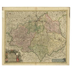
Antique Map of the Duchy of Saxony by De Wit, c.1680
Located in Langweer, NL
Antique map titled 'Circuli Saxoniae Superior Pars Meridionalis in qua sunt Ducatus Saxoniae, Comitatus Mansfeldiae, et Voitlandiae, Landgraviat Thuringiae, Marchionatus Misniae Prin...
Category
Antique 17th Century Maps
Materials
Paper
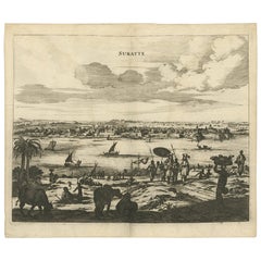
Original Copper Engraving of the Indian City of Suratte 'Surat', 1672
Located in Langweer, NL
Antique print, titled: 'Suratte'
View of the Indian city of Suratte (Surat) showing a panoramic view of the city with figures, animals and a river wi...
Category
Antique 1670s Prints
Materials
Paper
Portrait of Fernando Alvarez de Toledo y Pimentel, Grand duke of Alba, c.1690
Located in Langweer, NL
Antique print, titled: 'Ferdinand de Tolede. Duc d'Albe.'
Portrait of Fernando Alvarez de Toledo y Pimentel, Grand duke of Alba (1507-1582). Source un...
Category
Antique 1690s Prints
Materials
Paper
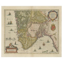
Antique Map of Southern Norway by Janssonius, c.1650
Located in Langweer, NL
"Antique map titled 'Nova et Accurata Tabula Episcopatuum Stavangriensis et Asloiensis'. Old map of the southern part of Norway, it covers the region around Bergen. Decorated with ma...
Category
Antique 17th Century Maps
Materials
Paper
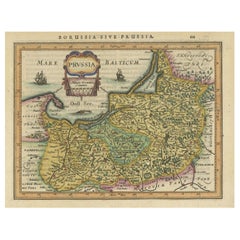
Original Decorative Antique Map of Prussia, 1628
Located in Langweer, NL
Antique map titled 'Prussia'. Original antique map of Prussia, a historically prominent German state that originated in 1525 with a duchy centered on th...
Category
Antique 1620s Maps
Materials
Paper
Map of the Region of Basel and Northern Switzerland by Ortelius, circa 1603
Located in Langweer, NL
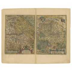
Two original antique maps on one sheet titled 'Basiliensis Territorii Descriptio Nova [with] Circulus sive Liga Sueviae'. The first centers on Basel, Switzerland, located on the Rhine River...
Category
Antique Early 17th Century Maps
Materials
Paper
Antique Plan of the Castle & City of Batavia 'Jakarta' on Java, Indonesia, c1669
Located in Langweer, NL
Antique map Batavia titled 'Ware Affbeeldinge wegens het Casteel ende Stadt Batavia'.
Antique print of the castle and city of Batavia on the Island of Java'. Rare edition with En...
Category
Antique 1660s Maps
Materials
Paper
Antique Engraving After a Self Portrait of Dutch Painter Abraham Bloemaert, 1694
Located in Langweer, NL
Antique print, titled: 'Abraham Blomaert'
Portrait of Abraham Bloemaert after a self-portrait by Bloemaert, engraved by Hendrik Snijers. Abraham ...
Category
Antique 1690s Prints
Materials
Paper
Antique Map of the Region Between the Rhine and Elbe River by Cluver, 1685
Located in Langweer, NL
Antique map titled 'Populorum Germanium inter Rhenum et Albim descriptio, ut inter Caesaris aevum incolurant (…).' Miniature map of the area between the Rhine and the Elbe, Germany. ...
Category
Antique 17th Century Maps
Materials
Paper
Antique Print of the Imperial Palace in Peking, China, 1668
Located in Langweer, NL
Antique print China titled ‘Interior aulae Imperatoriae facies'.
Antique print of the Imperial Palace in Peking, China. This print originates from ...
Category
Antique 1660s Prints
Materials
Paper
Antique Map of the City of Emden by Blaeu, 1649
Located in Langweer, NL
Antique map titled 'Emda'. Old map of the city of Emden, Germany. This map originates from 'Novum Ac Magnum Theatrum Urbium Belgicæ Liberæ ac Foederatæ' by J. Blaeu. Artists and Engr...
Category
Antique 17th Century Maps
Materials
Paper
Antique Decorative Frontispiece of Putti and Birds, 1660
Located in Langweer, NL
Antique print titled 'Dr. J. Jonstons Beschrijving van de Natuur der Vogelen (..)'.
Frontispiece of the Dutch edition of 'Historiae Naturalis de Avibus' by John Johnston. Transla...
Category
Antique 1660s Prints
Materials
Paper
Antique Map of the Region of Beauvais by Hondius, circa 1630
Located in Langweer, NL
Antique map titled 'Beauvaisis - Comitatus Belovacium'. Old map of the region of Beauvais, France. This map originates from a composite atlas and is signed by J. Hondius.
Category
Antique Mid-17th Century Maps
Materials
Paper
Original Map with Bird's-Eye View of Zutphen in the Netherlands by Blaeu, 1649
Located in Langweer, NL
Antique print, titled: 'Zutphen.' - Bird's-eye view plan of Zutphen in The Netherlands, with key to locations and coats of arms. Text in Dutch on verso. This plan originates from the famous city Atlas: 'Toneel der Steeden' published by Joan Blaeu...
Category
Antique 1640s Maps
Materials
Paper
Antique Map of the Rhine and Moselle River Region in Germany and France, c.1680
Located in Langweer, NL
Antique map titled 'Tabula Geographica qui Pars Meridionalis sive Superior Rheni, Mosae et Mosellae (..).'
Detailed map of the Rhine and Moselle River regions and contigous parts...
Category
Antique 17th Century Maps
Materials
Paper
Antique Map of Kent with Inset Plans of Rochester & Canterbury, England, 1676
Located in Langweer, NL
Antique map titled 'Kent with her Cities and Earles described and observed'.
Map of Kent, England. Includes inset town plans of Rochester and Canterbury....
Category
Antique 17th Century Maps
Materials
Paper
Map of the Alsace, France Incl the Rhine from Phillipsburg to South Basle, c1650
Located in Langweer, NL
Antique map titled 'Utriusquae Alsatiae Superioris Ac Inferioris Nova Tabula'.
Map of the Alsace region (France) including the Rhine from Phillipsburg to south of Basle. Two deco...
Category
Antique 1650s Maps
Materials
Paper
Original Antique Map of the Region of Picardy, France, ca.1602
Located in Langweer, NL
Antique map titled 'Picardiae Belgicae regionis descriptio'.
Original antique map of the region of Picardy, France. Superb example of the decorative style of Ortelius and filled ...
Category
Antique Early 1600s Maps
Materials
Paper
Amazingly Decorative Antique Fireback / Backsplash
Located in Haarlem, Noord-Holland
Superb tal cast iron fireback or backsplash.
This beautifully detailed fireback was originally a piece of a 17th century stove.
These were taken apart and sold separately.
Beaut...
Category
Antique 17th Century Architectural Elements
Materials
Iron
Antique Map of the City of Enkhuizen by Guicciardini, 1625
Located in Langweer, NL
Antique map titled 'Die Stadt Enchuijsen, La ville denchuijsen'. Map of Enkhuizen, Noord-Holland, The Netherlands. Oiginates from the 1625 edition of 'Discrittione di tutti i Paesi B...
Category
Antique 17th Century Maps
Materials
Paper
Antique Pair 17th C Dehua Blanc de Chine Whistles European figures on a horse
Located in Amsterdam, Noord Holland
A pair of Shunzhi or Kangxi Blanc de Chine Porcelain figures on horses.
Blanc de Chine Statues like these were made in the kilns of Dehua in Fujian province.
These are rare example...
Category
Antique 17th Century Chinese Ming Planters, Cachepots and Jardinières
Materials
Porcelain
Original Antique Map of the Rhine, South and North of Strasbourg, Germany, 1608
Located in Langweer, NL
Antique map titled 'Argentoratensis agri descriptio'.
Original antique map of the Rhine, both south and north of Strasbourg, based on Daniel Specklin's three-sheet map of the Elz...
Category
Antique Early 1600s Maps
Materials
Paper
Original Antique Map of the Southern Coast of France by Janssonius, 1657
By Johannes Janssonius
Located in Langweer, NL
Antique map of France titled 'Comté et Gouvernement de Provence'. Decorative map of the southern coast of France. This map originates from 'Atlas Novus,...
Category
Antique 17th Century Maps
Materials
Paper
Original Old Bird's-Eye View Plan of Sint-Winoksbergen or Bergen in France, 1649
Located in Langweer, NL
Antique map titled 'Berga Sti Winoci.' - Bird's-eye view plan of Sint-Winoksbergen in France, with key to locations and coats of arms. Text in Dutch on verso. This plan originates from the famous city Atlas: 'Toneel der Steeden' published by Joan Blaeu...
Category
Antique 1640s Maps
Materials
Paper
Original 'Gone with the Wind" vintage German movie poster
Located in Spokane, WA
Original Gone with the Wind “Vom Winde Verweht” vintage lithograph poster.
Original vintage movie poster with professional acid-free linen backing; excellent condition; ready to frame. This is the German 1962 release of Gone with the Wind, printed in the full lithographic style of the old French posters. Unique imagery of the famous scene of the burning of Atlanta.
Starring Clark Gable, Vivien Leigh, Leslie Howard, Olivia de Havilland...
Category
1860s American Modern Portrait Prints
Materials
Lithograph
Antique Map of Drenthe, the Netherlands, with Original Hand Coloring
Located in Langweer, NL
Original antique map titled 'Illustribus ac Potentibus Comitatus Drentiae (..)'. Old map of the province of Drenthe, the Netherlands. Published by H. Hondius circa 1639.
Hendrik ...
Category
Antique Mid-17th Century Maps
Materials
Paper
Antique Map of the Region of Zutphen in Overijssel, The Netherlands, 1683
Located in Langweer, NL
Antique map titled 'Ducatus Gelriae pars prima Quae est Neomagensis'. Antique map of the region of Zutphen, Gelderland, the Netherlands. This map originates from 'The English Atlas' ...
Category
Antique 17th Century Maps
Materials
Paper
Engraving of Dutch Attacking the Portuguese Fleet off Bantam, Indonesia, 1644
Located in Langweer, NL
Antique print titled 'Bantam'.
Copper engraving of the Dutch attack on the Portuguese fleet off Bantam in 1601 depicted as the victory of Admiral Wolfert Harmensz and his 5 ships over 30 Portuguese ships. The ships in the battle include the Sultan of Bantam’s war galleys (ghali); ocean-going craft with sails, oars and a prow battering ram built according to Mediterranean standards learnt from Portuguese renegades and Turkish shipwrights. They were built to allow them to shoot the large cannon...
Category
Antique 1640s Arms, Armor and Weapons
Materials
Paper
Antique Print of the City of Tiencienwey ‘Tientsin, China’ by J. Nieuhof, 1666
Located in Langweer, NL
Antique print titled 'Tiencienwey'. This plate shows a view on the Chinese city of Tiencienwey or Tientsin. Also depicted are many ships. This print originates from a German edition ...
Category
Antique Mid-17th Century Prints
Materials
Paper
Old Map of the Empire of the Assyriens & the Tigres and Euphrates Rivers, 1683
Located in Langweer, NL
Antique map titled 'Empire des Assyriens' and 'Assyrie Chaldee et Mesopotamie selon les Anciens'.
Two maps on one sheet, the upper sheet showing the Empire of the Assyriens and the second showing the region of the Tigres and Euphrates Rivers. This map originates from Alain Manesson Mallet's 'Description de l 'Univers'.
Artists and engravers: Alain Manesson Mallet (1630–1706) was a French cartographer and engineer. He started his career as a soldier in the army of Louis XIV, became a Sergeant-Major in the artillery and an Inspector of Fortifications. He also served under the King of Portugal, before returning to France, and his appointment to the court of Louis XIV. His military engineering and mathematical background led to his position teaching mathematics at court. His major publications were Description de L'Univers (1683) in 5 volumes, and Les Travaux de Mars ou l'Art de la Guerre (1684) in 3 volumes.
His Description de L'Universe contains a wide variety of information, including star maps...
Category
Antique 1680s Maps
Materials
Paper
Set of 6 Arita Edo Period Japanese Porcelain Chocolate Cup / Tea Bowl Japan
Located in Amsterdam, Noord Holland
Very nice edo period examples in nice condition, 17/18th century. With lovely Red, Gold and black/brown decoration of flowers. Unmarked.
Additional information:
Material: Porcelain ...
Category
Antique 17th Century Japanese Tea Sets
Materials
Porcelain
Decorative Original Antique Print Depicting the Cavalry Marching in China, 1665
Located in Langweer, NL
Antique print titled ‘Kryghs-Ordre in het Marseren. L’Ordre de la Cavallerie en Marchant’.
Decorative print depicting the cavalry. This print originates from ‘Joan Nieuhof, Het G...
Category
Antique 1660s Prints
Materials
Paper
Old Map by Blaeu of the City of Franeker, Friesland, The Netherlands, 1649
Located in Langweer, NL
Antique map titled 'Franekera'.
Old map of the city of Franeker, Friesland. Also shows two cartouches, coats of arms and legend. This map originates from a Latin edition of the t...
Category
Antique 1640s Maps
Materials
Paper
Antique Map of the Island of Borneo by Janssonius, circa 1650
Located in Langweer, NL
Antique map titled 'Insula Borneo et Occidentalis pars Celebis cum adjacentibus Insulis'. Rare sea chart of the island of Borneo. Published by J. Janssonius, circa 1650.
Category
Antique Mid-17th Century Maps
Materials
Paper
Original Antique Engraving of a Vox, Wolf and Hyenas, 1657
Located in Langweer, NL
Antique print of various animals; Lupus, Wolff (Wolf) - Vulpes, Fuchs (Fox) - Zilio Hyaena (Hyena). This print originates from 'Historiae Naturalis (..)' by John Johnston, published by Matthias Merian in 1657.
Artists and Engravers: John Johnston (or Johnstone, 1603-1675) was a descendant of a Scottish...
Category
Antique 1650s Prints
Materials
Paper
Antique Chinese Porcelain Hatcher Cargo Kraak Ghendi porcelain South China
Located in Amsterdam, Noord Holland
Sharing with you this very nicely decorated kraak Ghendi with a geometrical decoration. The piece was part of the Hatcher Collection. Auctioned by Christies Amsterdam in 1984. It is in very good condition.
The Hatcher Junk...
Category
Antique 17th Century Chinese Ming Planters, Cachepots and Jardinières
Materials
Porcelain
Rare Engraving of Mount Sinai with St. Catherine's Monastery and Bedouins, 1680
Located in Langweer, NL
Rare antique print titled ‘Bergh Sinai of Sint Catryn’.
This engraving shows Mount Sinai (also known as Mount Horeb) with St. Catherine's Monastery at the foot of the mountains a...
Category
Antique 1680s Religious Items
Materials
Paper
Antique Map of Thracia ‘Greece’ by J. Janssonius, circa 1650
Located in Langweer, NL
This antique map of Thracia is engraved and published by J. Janssonius after the cartographical sources by Abraham Ortelius. Ornated in the upper left corner with a title cartouche a...
Category
Antique Mid-17th Century Maps
Materials
Paper
Rare Engravings of Council of War in Bantam and Javanese Local Traders, 1614
Located in Langweer, NL
One leaf with an engraving on each site and text in old Dutch. One side shows the War Council of the locals in Bantam and the other side show some vegetables traders of Bantam.
B...
Category
Antique Early 17th Century Maps
Materials
Paper
Antique Engraving with a Description of the Monkey Temple in Japan, 1669
Located in Langweer, NL
Antique print, titled: 'Beschryving van de Japansche Apen-tempel.' - ('Description of the Japanese Monkey Temple').
Interior of a temple filled wit...
Category
Antique 1660s Prints
Materials
Paper
Old Map of The Southern Part of Norway, Covering the Region Around Bergen, c1650
Located in Langweer, NL
Antique map titled 'Nova et Accurata Tabula Episcopatuum Stavangriensis et Asloiensis'.
Old map of the southern part of Norway, it covers the region around Bergen. Decorated with...
Category
Antique 1650s Maps
Materials
Paper
Decorative Bird's-Eye View Plan of Ieper or Ypres in Belgium, 1649
Located in Langweer, NL
Antique print, titled: 'Ypra.'
Bird's-eye view plan of Ieper / Ypres in Belgium. With key to locations and coats of arms. Text in Latin on verso. This plan originates from the famous city Atlas: 'Toneel der Steeden' published by Joan Blaeu...
Category
Antique 1640s Maps
Materials
Paper
Antique Map of the Ancient British Isles by Janssonius 'circa 1640'
Located in Langweer, NL
Antique map titled 'Insularum Britannicarum Acurata Delineatio'. Original antique map of the ancient British Isles. England and Wales are labelled as B...
Category
Antique Mid-17th Century Maps
Materials
Paper
Antique Print of a Lama, a Guinea Pig and Guinea Sheep & Collared Peccary, 1657
Located in Langweer, NL
Antique print of various animals; Ovis Peruana (Lama species) - Aries Guineensis (Guinea Sheep) - Porcus Guineensis (Guinea Pig) - Zainq Tajacu Porcus sylvester (Collared peccary). T...
Category
Antique 17th Century Prints
Materials
Paper
Antique Engraving of Dutch and German North Sea Coast of Friesland, ca.1680
Located in Langweer, NL
Antique map titled 'Tabula Nova In qua accuratè demonstratur tota Navigatio ab Amstelodami Statione per Vada vulgo de Watten Hamburgum usq.' -
Two maps with the Dutch and German North Sea coast of Friesland, with West Frisian Islands and below East Frisian Islands with inset map of the Elbe around Hamburg. With title and a scale cartouche. Map by Henricus Hondius...
Category
Antique 1680s Maps
Materials
Paper
Antique Engravings, One Sheet with 3 Bird's Eye Plans of Rhodes, Greece, 1677
Located in Langweer, NL
Antique map, titled: 'Afbeelding der Oude Stad Rhodus (…).' - Sheet with 3 bird's eye plans of Rhodes, Greece.
Source unknown, to be determined.
Artists and Engravers: Made by ...
Category
Antique 17th Century Prints
Materials
Paper
Antique Engraving of Edo 'or Jeddo, Yedo, Now Tokyo', 1669
Located in Langweer, NL
Antique print, titled: 'Iedo'
A bird's eye view of Edo (or Jeddo, Yedo, now Tokyo) as seen from a nearby hill. 62 places are identified in a list (both in French and Dutch). Arno...
Category
Antique 1660s Maps
Materials
Paper
Decorative Antique Map of the Dutch Province of Noord-Brabant, ca.1640
Located in Langweer, NL
Antique map titled 'Quarta pars Brabantiae cujus Sylvaducis Willebordus vanderBurgt desrib'.
Highly detailed original antique map of the province of Noord-Brabant, the Netherlands. It shows the cities of 's-Hertogenbosch, Eindhoven and surroundings. Includes a decorative cartouche, 6 coats of arms, topped by winged cherubs and two larger coats of arms...
Category
Antique 1640s Maps
Materials
Paper
Decorative Antique Map of the Quercy Region in France, 1657
Located in Langweer, NL
Antique map of France titled 'Quercy olim Cadurcium'.
Decorative map of the Quercy region. Quercy is a former province of France located in the country's southwest, bounded on th...
Category
Antique 1650s Maps
Materials
Paper
Cartographic Treasures: A Journey Through the Gascogne and Guyenne Regions, 1680
Located in Langweer, NL
The antique map titled "Gouvernement de La Guienne & Gascogne" depicts the region of Gascogne and Guyenne, known for their wine production, in France.
This map is a rare edition, u...
Category
Antique Late 17th Century Maps
Materials
Paper
Old Print of John Tyler, the Tenth President of the United States, ca.1865
Located in Langweer, NL
Antique print titled 'John Tyler'. Old portrait of John Tyler.
John Tyler was the tenth president of the United States from 1841 to 1845 after briefly serving as the tenth vice president in 1841; he was elected to the latter office on the 1840 Whig ticket with President William Henry Harrison...
Category
Antique 1860s Prints
Materials
Paper
Detailed Antique Map of Northern Spanish Region of Aragon, c.1650
Located in Langweer, NL
Antique map titled 'Arragonia Regnum'.
Detailed map of northern Spanish region of Aragon. The map is centered on the city of Zaragoza, aka, Saragossa. Shows towns, rivers, castle...
Category
Antique 1650s Maps
Materials
Paper
Statue of Roman Empress Agrippina in Rome, Etching on Paper, 1660
Located in Langweer, NL
Antique print, titled: 'Agrippina in Hortis Mediceis.' - Statue of Agrippina in Rome. Agrippina was a Roman Empress. From the 1660 Dutch edition of 'Icones et Segmenta Nobil. Signorum et Statuarum quae Romae extant' by Francois Perrier...
Category
Antique 17th Century Prints
Materials
Paper
Antique Map of the French Province Maine, Showing Le Mans, Alencon Etc., Ca1640
Located in Langweer, NL
Antique map titled 'Le Maine'.
Old map of the province of Maine, France. It shows the cities of Le Mans, Alencon and others. This map originates from a composite atlas.
Artis...
Category
Antique 1640s Maps
Materials
Paper
Old Map of the City of Franeker, Friesland by the Famous Mapmaker Blaeu, 1652
Located in Langweer, NL
Antique map titled 'Franekera'. Old map of the city of Franeker, Friesland. Also shows two cartouches, coats of arms and legend. This map originates from a Latin edition of the town ...
Category
Antique 1650s Maps
Materials
Paper
Antique Print of the City of Jiangxi, formerly romanized as Kiangsi, China, 1668
By Johannes Nieuhof
Located in Langweer, NL
Antique print China titled 'Kiangsi'. Old print depicting a view on the Chinese city of Kiangsi with its ramparts. Behind the city wall a pagoda can be seen. This print originates fr...
Category
Antique 17th Century Prints
Materials
Paper
Antique Print of Domestic and Wild Cat Species, incl The Civet, 1657
Located in Langweer, NL
Antique print of domestic and wild cat species; Felis domestica, Zahme Katz (Domestic cat) - Felis sylvestris, Wilde Katz (Wild Cat) - Felis Zibetti, Zibet Katz (Civet cat) - Genetta...
Category
Antique 1650s Prints
Materials
Paper
Old Print of Jews Eating on Beds like Assyrians, Persians, Romans, Greeks, 1690
Located in Langweer, NL
Description: Antique print religion titled 'Het aanliggen op de Tafel-Bedden; hoedanigen Eetwyse der Assyriers, Persen, Grieken en Romeinen, ook by de Joden in gebruyk geraakt is'.
...
Category
Antique 1690s Prints
Materials
Paper
