Items Similar to China: An Original 18th Century Hand-colored Map by E. Bowen

Want more images or videos?
Request additional images or videos from the seller
1 of 12
Emanuel BowenChina: An Original 18th Century Hand-colored Map by E. Bowen1744
1744
$860
$1,07520% Off
£659.30
£824.1220% Off
€754.42
€943.0320% Off
CA$1,215.37
CA$1,519.2220% Off
A$1,321.06
A$1,651.3320% Off
CHF 707.19
CHF 883.9820% Off
MX$15,968.59
MX$19,960.7420% Off
NOK 8,911.93
NOK 11,139.9120% Off
SEK 8,219.11
SEK 10,273.8920% Off
DKK 5,634.34
DKK 7,042.9220% Off
About the Item
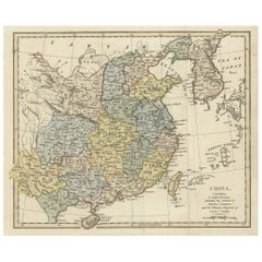
This is an original 18th century hand-colored map entitled "A New & Accurate Map of China, Drawn from Surveys made by the Jesuit Missionaries, by order of the Emperor. The whole being regulated by numerous astronomical observations" by Emanuel Bowen. It was published in 1744 in London in John Harris's "Navigantium atque Itinerantium Bibliotheca" or "A Complete Collection of Voyages and Travels". This highly detailed and colorful map depicts China, Korea, Taiwan (Formosa), the Yangtze and Yellow Rivers, the great cities of China and a portion of Mongolia in the north and Southeast Asia in the south..
The map is embellished with a Compass Rose in the lower right and an elaborate decorative title and distance scale cartouche in the lower left, which depicts Chinese architecture, pottery, a landscape with farm animals and a salesman sitting on the ground showing his wares to a standing wealthy appearing customer. Text in the upper left describes Jesuit surveys of China in the early 18th century.
This striking and beautifully hand-colored original 18th century map is printed on laid chain-linked paper with wide margins. The sheet measures 15.75" high and 19.75" wide. There is a vertical center fold, as issued. There are two tiny edge chips about the lower right corner. The map is otherwise in very good to excellent condition.
Emanuel Bowen (1694-1767) was a prominent British engraver and cartographer. He was born in Wales and worked in London as a mapmaker and engraver for much of his career. Bowen was honored as a fellow of the Royal Society and as the Royal Mapmaker to both to King George II of England and Louis XV of France. Based in London, Bowen was highly regarded for producing some of the largest, most detailed, most accurate and most attractive maps of his era. He is known to have worked with some of the most prominent cartographic names of the period including Herman Moll, John Owen, and Thomas Kitchin. Bowen was known for his skill in combining information from various sources to create comprehensive and useful maps. Bowen produced a wide range of maps, including maps of the British Isles, Europe, North America, Africa, and Asia. He also created maps for several important atlases, including the "Complete Atlas" (1752) and "A Complete System of Geography" (1747). Despite his renown and success, Bowen, like many cartographers, died in poverty. Upon Emanuel Bowen's death, his cartographic work was taken over by his son, Thomas Bowen who also died in poverty. Bowen's legacy as one of the most influential cartographers of the 18th century lives on through his many important maps and atlases.
- Creator:Emanuel Bowen (1694 - 1767, British)
- Creation Year:1744
- Dimensions:Height: 15.75 in (40.01 cm)Width: 19.75 in (50.17 cm)
- Medium:
- Movement & Style:
- Period:
- Framing:Framing Options Available
- Condition:
- Gallery Location:Alamo, CA
- Reference Number:Seller: # 49831stDibs: LU1173212161332
About the Seller
5.0
Platinum Seller
Premium sellers with a 4.7+ rating and 24-hour response times
Established in 2011
1stDibs seller since 2019
298 sales on 1stDibs
Typical response time: 1 hour
- ShippingRetrieving quote...Shipping from: Alamo, CA
- Return Policy
More From This Seller
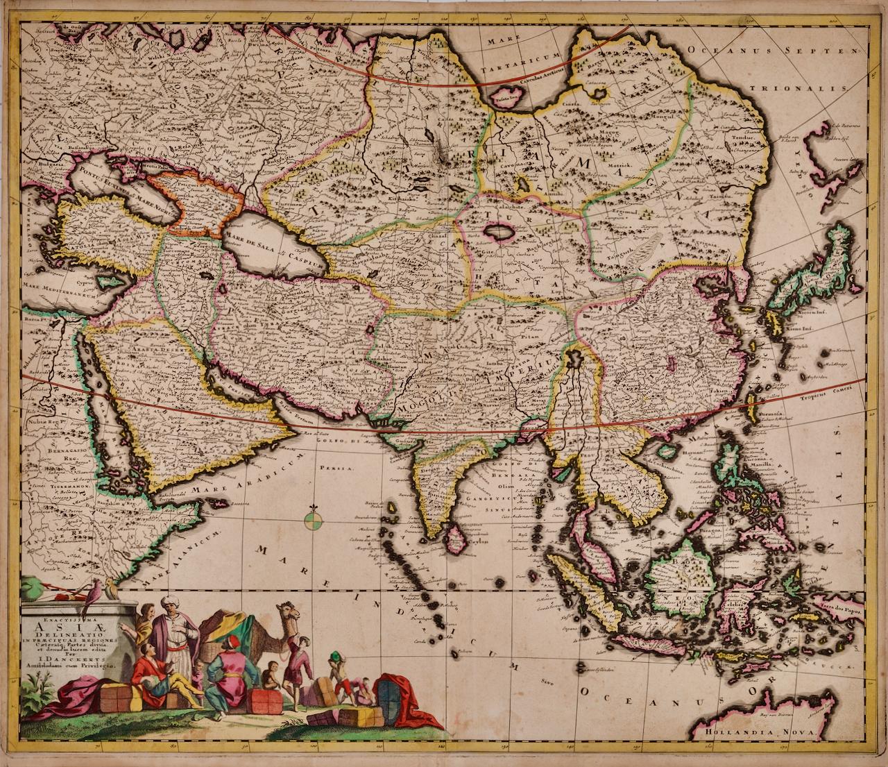
View AllAsia Declineatio: A 17th Century Hand-colored Map of Asia by Justus Danckerts
Located in Alamo, CA
This is a scarce 17th century beautifully hand-colored copperplate engraved map of Asia entitled “Exactissima Asiae Delineatio in Praecipuas Regiones Caerterasque Partes divisa et de...
Category
Late 17th Century Old Masters Landscape Prints
Materials
Engraving

Map of the East Indies: An Original 18th Century Hand-colored Map by E. Bowen
Located in Alamo, CA
This is an original 18th century hand-colored map entitled "An Accurate Map of the East Indies Exhibiting the Course of the European Trade both on the Continent and Islands" by Emanu...
Category
Mid-18th Century Old Masters Landscape Prints
Materials
Engraving

$1,020 Sale Price
20% Off
Map of the Russian Empire: An Original 18th Century Hand-colored Map by E. Bowen
Located in Alamo, CA
This is an original 18th century hand-colored map entitled "A New & Accurate Map of The Whole Russian Empire, As Contain'd Both In Europe and Asia, Drawn from Authentic Journals, Sur...
Category
Mid-18th Century Old Masters Landscape Prints
Materials
Engraving

Map of the World: An Original 18th Century Hand-colored Map by E. Bowen
Located in Alamo, CA
This is an original 18th century hand-colored map entitled "A New & Correct Chart of All The Known World Laid down according to Mercator's Projection" by Emanuel Bowen. It was published in 1744 in London in John Harris's "Navigantium atque Itinerantium Bibliotheca" or "A Complete Collection of Voyages and Travels". This highly detailed and colorful map depicts the world. as it was known in the mid 18th century. A majority of the northern and central portions of Canada and America are left blank due to the purity of knowledge at the time this map was published.
The map is embellished with four Compass Roses in the lower left, lower center, lower right and center, along with many rhumb lines. There a is a decorative title cartouche in the upper left. This colorful, attractive, historical and interesting 1744 map presents the entire world on Mercator's projection as it was understood in the middle part of the 18th century, before the landmark explorations of Captain’s Cook, Vancouver, Wilkes and others. It is an example of a nautical chart, a type of map that was designed specifically for use by mariners. The map is centered on the equator and includes both the Eastern and Western Hemispheres. The continents of North America, South America, Europe, Africa, and Asia are depicted, as well as various islands in the Atlantic, Pacific, and Indian Oceans. The map is laid out according to the Mercator projection, a type of cylindrical map projection that was developed in the 16th century by Flemish cartographer Gerardus Mercator. This projection has the advantage of preserving angles and shapes, making it useful for navigation. The map presents a paucity of inland detail, particularly for the Americas, but major cities, geographical landmarks, and regions are included. Ocean currents and Tradewinds are identified, as well as the magnetic declination lines or magnetic variance, which refers to the difference between true north and compass north. The continents are color coded, enhancing the beauty of this map. The three compass roses indicate the directions of the cardinal points.
The depiction of the western coast of America, the Pacific and Australia are interesting. There was very little exploration of Australia between the navigations of William Damper in 1699 and Tobias Furneaux in 1773. Most of the maps detail relies on the 17th century Dutch expeditions to Australia's western coast, by Abel Tasman and William Janszoon. Van Diemen's Land (Tasmania) and New Guinea appear connected to the Australian continent. New Zealand appears as a single landmass. North of New Zealand there is a landmass labelled 'Ter d' St. Esprit' which probably represents the New Hebrides Islands. This map precedes the accurate exploration of the South Pacific and east coast of Australia by Captain James Cook later in the 18th century. The map includes ‘Drakes' Port,' the site where Sir Francis Drake supposedly landed in 1579 during his 1579 circumnavigation of the globe. Here he claimed territory for England, restocked, and repaired his vessels. Drake named the region New Albion. The exact location of Drake's Port is a cartographic mystery. Drake's Harbor is believed to be in the region of San Francisco Bay, Bodega Bay, San Pablo Bay...
Category
Mid-18th Century Old Masters Landscape Prints
Materials
Engraving

$1,020 Sale Price
20% Off
Siberia as Explored by Behring: Original 18th Century Hand-colored Map by Bowen
Located in Alamo, CA
This is an original 18th century hand-colored map entitled "An Exact Chart of all the Countries through which Capt. Behring Travelled from Tobolski, Capital of Siberia to the Country...
Category
Mid-18th Century Old Masters Landscape Prints
Materials
Engraving

Europe: An Original 18th Century Hand-colored Map by E. Bowen
Located in Alamo, CA
This is an original 18th century hand-colored map entitled "A New & Accurate Map of Europe Drawn from the Best Authorities Assisted by the Most Improved Modern Charts and Maps." by E...
Category
Mid-18th Century Old Masters Landscape Prints
Materials
Engraving

$940 Sale Price
20% Off
You May Also Like
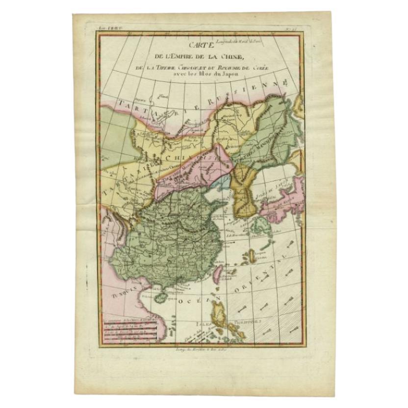
Antique Map of the Empire of China by Bonne, c.1780
By Rigobert Bonne
Located in Langweer, NL
Antique map titled 'Carte de L'Empire de la Chine.' Decorative map of the Empire of China, depicting China, Corea ( Korea ), Japan, Tonquin and the Philippine island Lucon. Source un...
Category
Antique 18th Century Maps
Materials
Paper

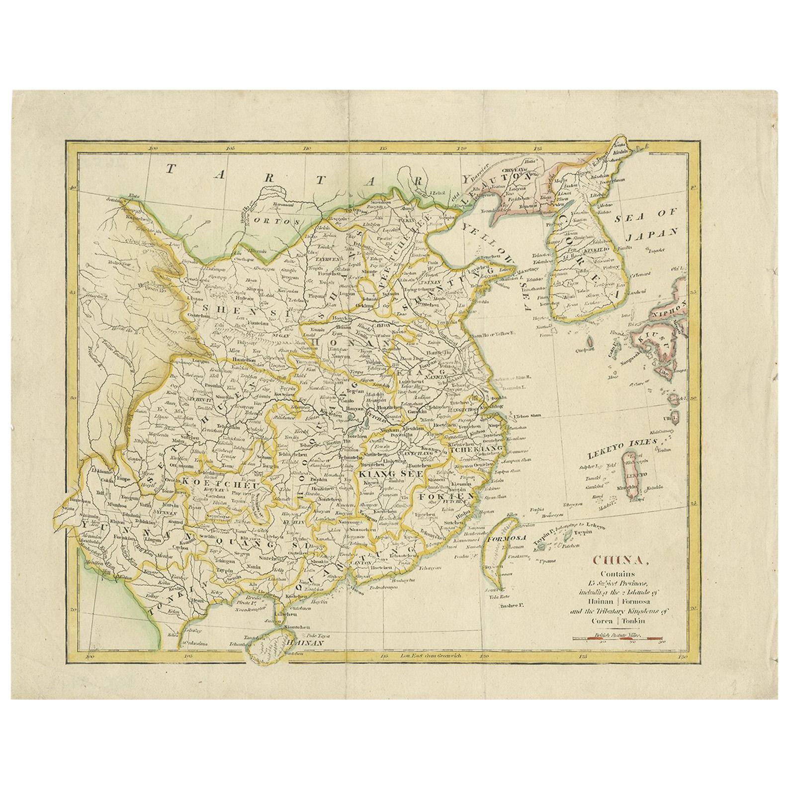
Antique Map of China by Wilkinson '1803'
Located in Langweer, NL
Antique map titled 'China, Contains 15 Subject Provinces Including the 2 Islands of Hainan, Formosa and the Tributary Kingdoms of Korea, Tonkin'. Old map depicting China, extending f...
Category
Antique Early 19th Century Maps
Materials
Paper

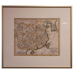
Antique Map of China Including Korea and Taiwan by Vaugondy, 1749
Located in Langweer, NL
Antique map titled 'Empire de la Chine'. Beautiful map of China including Korea and Taiwan (Formosa). This map originates from 'Atlas Universel (..)' by Gilles Robert de Vaugondy, 17...
Category
Antique Mid-18th Century Maps
Materials
Paper
$474 Sale Price
20% Off
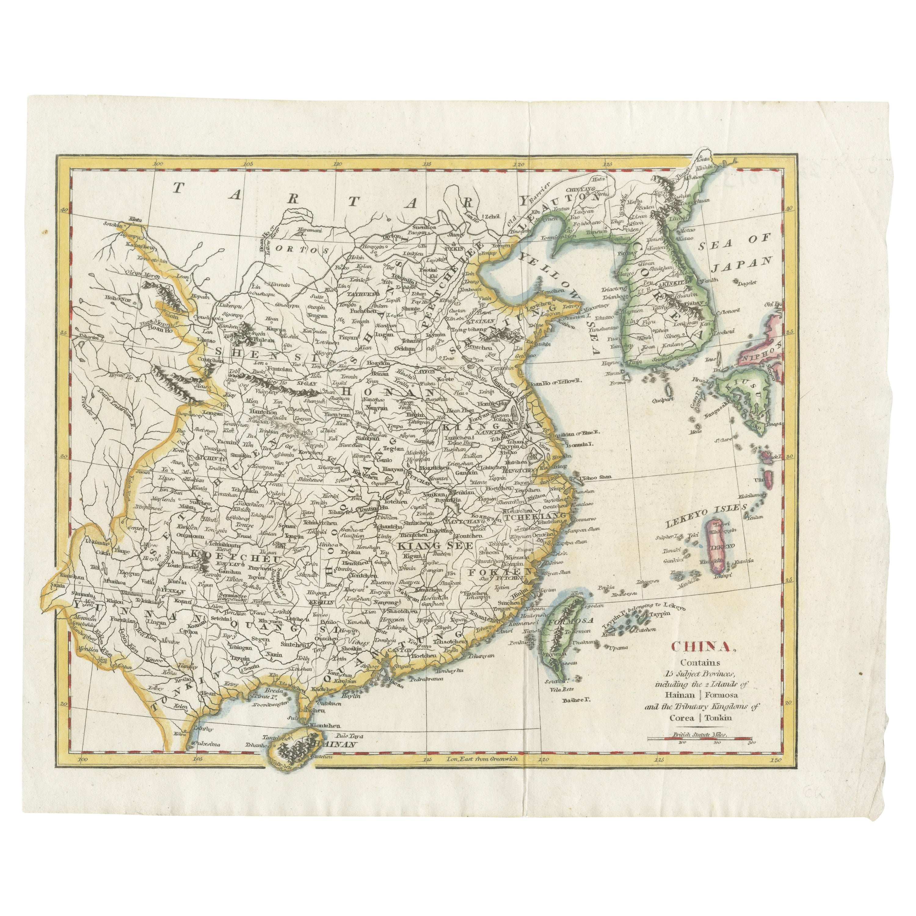
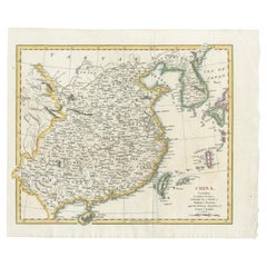
China with Hainan and Formosa Islands and the Kingdoms Corea and Tonkin, 1802
Located in Langweer, NL
Antique map titled 'China, Contains 15 Subject Provinces Including the 2 Islands of Hainan, Formosa and the Tributary Kingdoms of Korea, Tonkin'.
Old map depicting China, extendi...
Category
Antique Early 1800s Maps
Materials
Paper
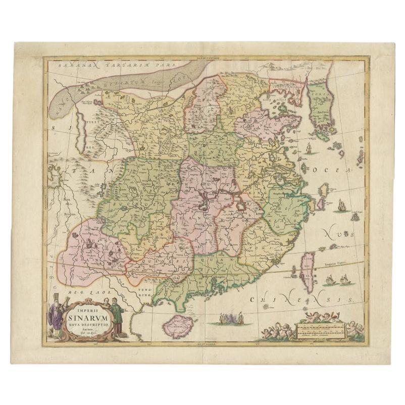
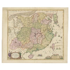
Antique Map of China and Korea incl Formosa and Hainan, by Janssonius, ca.1650
Located in Langweer, NL
Antique map titled 'Imperii Sinarum Nova Descriptio'. Beautiful map of China and Korea, much detail troughout the map. Including the Islands of Formosa (Taiwan) and Hainan. The Great...
Category
Antique 17th Century Maps
Materials
Paper
$2,798 Sale Price
20% Off
Original Old China Map, From Korea and the Sea of Japan to Teypin Island, 1803
Located in Langweer, NL
Antique map titled 'China, Contains 15 Subject Provinces Including the 2 Islands of Hainan, Formosa and the Tributary Kingdoms of Corea, Tonkin'.
Old map depicting China, extendi...
Category
Antique Early 1800s Maps
Materials
Paper
$521 Sale Price
20% Off
More Ways To Browse
Antique Farm Animals
Antique Maps Of North America
Antique Maps Of Britain
Map Colorful
China Engraving
King George Ii
Thomas Mcknight Serigraph
Watanabe Woodcut
Wayne Thiebaud Landscapes
Altman Central Park
Aspen Poster
Aspen Retro Poster
Ben Harman
Callahan Kevin
Christo and Jeanne-Claude On Sale
Christo Pont Neuf
David Hockney Arrival Of Spring
Earle Eyvind