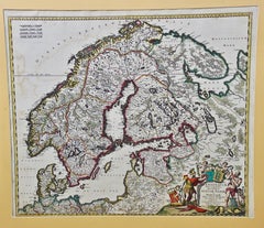
A Hand Colored 17th Century Map of Scandinavia by Frederick de Wit
View Similar Items


Want more images or videos?
Request additional images or videos from the seller
1 of 9
Frederick de WitA Hand Colored 17th Century Map of Scandinavia by Frederick de Wit 1680
1680
About the Item
- Creator:Frederick de Wit (1630 - 1706, Dutch)
- Creation Year:1680
- Dimensions:Height: 24 in (60.96 cm)Width: 26.5 in (67.31 cm)Depth: 0.13 in (3.31 mm)
- Medium:
- Movement & Style:
- Period:Late 17th Century
- Condition:
- Gallery Location:Alamo, CA
- Reference Number:Seller: # 16161stDibs: LU117325604642

Frederick de Wit
Frederick De Wit (1629-1706) was an engraver, cartographer and map dealer who ran a prominent and productive printing business in Amsterdam, founded in 1654 and initially called The Three Crabs and later The White Chart. He published his first atlas in 1662. In 1695 he purchased a large collection of the plates of the prestigious Blaeu publishing business. After his death in 1706, his wife Maria continued in the business for four years before selling it at the auction. A majority of the plates were purchased by Pieter Mortier. His thriving and growing business eventually became Covens & Mortier, one of the largest and most successful cartography and printing businesses of the eighteenth century.
About the Seller
5.0
Vetted Seller
These experienced sellers undergo a comprehensive evaluation by our team of in-house experts.
Established in 2011
1stDibs seller since 2019
233 sales on 1stDibs
Typical response time: 1 hour
More From This SellerView All
- Cartusia Bruxellensis Monastery in Brussels: A 17th C. Hand-colored EngravingBy Lucas Vorsterman the YoungerLocated in Alamo, CAThis is a 17th century hand-colored copperplate engraving entitled "Cartusia Bruxellensis" by Lucas Vorsterman, the Younger, after a drawing by Jacob van Werden or Jacques van Weerden, published in 1659 in Antonius Sanderus' book 'Chorographia sacra Brabantiae sive celebrium aliquot in ea provincia ecclesiarum et coenobiorum descriptio . . . Brussel' (A sacred chorography of Brabant, or a description of several famous churches and convents in that province). It also appeared in other publications by Sanderus. In the 17th century, Brussels was within the Duchy of Brabant. This engraving depicts a bird's-eye view of the Scheut Carthusian Monastery in Brussels. Scheut is a district of Anderlecht, a municipality of Brussels, Belgium. The monastery housed monks, who took a vow of silence, in 20 rooms. There is a central courtyard with trees and shrubs. Monks are depicted strolling along its pathways. The cells for the friars are in the middle the cloister. There are people along the streets in the foreground and to the right of the large, imposing monastery. Some are on horseback, others are walking. In the lower right, what appears to be a dog pulls a small cart containing barrels, possibly of beer or wine. Districts and neighborhoods are labelled in the background, including Scheut, Anderlecht and Ransfort. A very ornate cartouche in the lower left contains Latin and the artist's attribution. Another decorative cartouche in the upper central area contains the title. This beautifully hand-colored and detailed engraving is printed on laid, chain-linked paper with wide, full margins. The sheet measures 17.25" high and 21.25" wide. It has Latin text on the verso. It has a central vertical fold, as issued, which is reinforced on the verso. Two small spots in the lower margin may actually represent drops of watercolor paint used to color the engraving. It is otherwise in very good condition. Antonius Sanderus (1586-1664) was a Flemish Catholic cleric and historian. He was born "Antoon Sanders", but Latinized his name like many writers and scholars of his time. He was the author of several books, including 'Chorographia Sacra Brabantiae', which was illustrated with this engraving. Lucas Vorsterman the Younger (1624-between 1666 & 1676) was a Flemish Baroque engraver and draughtsman. He produced engravings after the work of contemporary painters and for books by Antwerp publishers. Jacob van Werden or Jacques van Weerden (active 1643-1669), was a Flemish draughtsman, cartographer, military engineer and archer who was active in the Habsburg Netherlands. His drawings were used as designs for prints executed by various printmakers. He worked on maps, topographical views, historical scenes, portraits and book illustrations. He had a career as a military engineer and a member of the guard of the Spanish King. He advised on various military engineering projects and was an engineer of the Spanish army...Category
Mid-17th Century Old Masters Landscape Prints
MaterialsEngraving
- L'Isle de France: A Hand-colored 17th Century Map by De WitBy Frederick de WitLocated in Alamo, CAThis colorful and detailed 17th century hand-colored copperplate map by Frederick De Wit was published in Amsterdam between 1666 and 1760. The map depicts the Île-de-France, which is one of the ancient provinces of France. Paris is located in the center of the map, with Versailles to the southwest The map extends from Rouen in the west to Reims in the east. The area around Paris, the Véxin Français, was the original domain of the king of France. Other areas were ruled by French feudal lords. For example, the Véxin Normand area was the domain of the Duke of Normandy...Category
Early 18th Century Old Masters More Prints
MaterialsEngraving
- Map of the Russian Empire: An Original 18th Century Hand-colored Map by E. BowenLocated in Alamo, CAThis is an original 18th century hand-colored map entitled "A New & Accurate Map of The Whole Russian Empire, As Contain'd Both In Europe and Asia, Drawn from Authentic Journals, Sur...Category
Mid-18th Century Old Masters Landscape Prints
MaterialsEngraving
- View of Emden, Germany: A 16th Century Hand-colored Map by Braun & HogenbergBy Franz HogenbergLocated in Alamo, CAThis is a 16th century original hand-colored copperplate engraved map of a bird's-eye View of Embden, Germany entitled " Emuda, vulgo Embden vrbs Frisia orientalis primaria" by Georg Braun & Franz Hogenberg, in volume II of their famous city atlas "Civitates Orbis Terrarum", published in Cologne, Germany in 1575. This is a beautifully colored and detailed map of Emden, a seaport in northwestern Germany, along the Ems River and perhaps portions of over Dollart Bay, near the border with the Netherland. The map depicts a bird's-eye view of the city from the southwest, as well as a view of the harbor and an extensive system of canals. Numerous ships of various sizes, as well as two rowboats containing numerous occupants are seen in the main waterway in the foreground and additional boats line two canals in the center of the city. Two men and two women are shown on a hill in the foreground on the right, dressed in the 16th century style of nobility. Two ornate crests are included in each corner. A title strap-work cartouche is in the upper center with the title in Latin. The crest on the right including Engelke up de Muer (The Little Angel on the Wall) was granted by Emperor Maximilian I in 1495. This is an English translation of an excerpt of Braun's description of Embden: "In Emden, the capital of East Frisia, rich merchants live in very fine houses. The city has a broad and well-situated harbour, which in my opinion is unique in Holland. Frisia and the whole of the Netherlands, for the ships can anchor here right under the city walls. They have also extended the harbour as far as the New Town, so that up to 400 ships can now find shelter here when the sea is rough." The emphasis on the harbor and waterways within the city highlights the importance of Emden's place as a seaport at this time. Embden developed from a Dutch/Flemish trading settlement in the 7th-8th centuries into a city as late as late 14th century. In 1494 it was granted staple rights, and in 1536 the harbour was extended. In the mid-16th century Emden's port was thought to have the most ships in Europe. Its population then was about 5,000, rising to 15,000 by the end of the 16th century. The Ems River flowed directly under the city walls, but its course was changed in the 17th century by the construction of a canal. Emden has canals within its city limits, a typical feature of Dutch towns, which also enabled the extension of the harbor. In 1744 Emden was annexed by Prussia and is now part of Germany. It was captured by French forces in 1757 during the Seven Years' War, but recaptured by Anglo-German forces in 1758. During the Napoleonic French era, Emden and the surrounding lands of East Frisia were part of the short-lived Kingdom of Holland. References:Van der Krogt 4, 1230, State 2; Taschen, Braun and Hogenberg...Category
16th Century Old Masters Landscape Prints
MaterialsEngraving
- Ireland: A Framed 17th Century Hand-colored Map by Jan JannsonBy Johannes JanssoniusLocated in Alamo, CAThis is a 17th century hand-colored map entitled "Hibernia Regnum Vulgo Ireland" by Johannes Janssonius's (Jan Jansson), published in Amsterdam in 1640. This highly detailed map depicts the Emerald Isle with an extensive display of towns, roads, mountains, rivers, lakes and county borders, etc. It includes two decorative cartouches on the left. The title cartouche includes the Irish harp and the second, in the upper left, includes a lion wearing a crown on the left, a unicorn on the right and a coat-of-arms in the middle, which includes another Irish harp. A distance scale is seen in the lower right, augmented with two putti. The map is embellished with three sailing ships and a sea monster. Western portions of Scotland and England...Category
Mid-17th Century Old Masters Landscape Prints
MaterialsEngraving
- View of Meissen, Germany: A 16th Century Hand-colored Map by Braun & HogenbergBy Franz HogenbergLocated in Alamo, CAThis is a 16th century original hand-colored copperplate engraved map of View of View of Meissen, Germany entitled "Misena Hermun Duvorum Urbs" by Georg Braun & Franz Hogenberg, from their famous city atlas "Civitates Orbis Terrarum", published in Cologne, Germany in 1575. The map depicts a side view and bird's-eye view, looking across the Elbe River (labelled Albis Fluvius on the map; White River in Latin) from the northeast. In the foreground are three women in conversation on a hill above the city, along with a man and a woman in conversation by a road, all dressed in contemporary costumes of the upper class. A coat-of-arms is present in each upper corner. A great castle sits atop a hill in the background on the left. Meissen grew up around Albrechtsburg castle, built by Emperor Henry I around AD 929, and was granted a municipal charter at the end of the 12th century. From 1471 onwards, the castle complex was reconstructed as the residence of the Saxon electors on the northeast corner of the Domberg (Cathedral Hill). Meissen cathedral is a Gothic hall church begun c. 1270; in 1413 a bolt of lightning destroyed its west towers, which were replaced only in the 20th century. Meissen lies to the northwest of Dresden, Germany in Saxony. Meissen is famous for its Meissen porcelain and the Albrechtsburg castle The following is an English translation of an excerpt from Braun's description of the city: "This city is surrounded by very many rivers, to the east flows the Elbe, to the south the Triebisch, to the west are the mountains, to the north the Meisse, after which the city is said to be named. The city is well-situated in its surroundings, the navigable rivers, the mountains and the healthy air. Around the city there is a good land to grow grain, fertile vineyards on the hillsides and without doubt the mountains are not without ore, for one mile away, up the Elbe, is Scharfenberg, where silver and lead ore are mined.." References: Van der Krogt 4, 2684; Taschen, Braun and Hogenberg...Category
16th Century Old Masters Landscape Prints
MaterialsEngraving


You May Also Like
- John Paul Jones Commander of a Squadron - 13 Colonies United States...Located in Santa Monica, CAAMERICAN REVOLUTION - (Attributed to Richard Brookshaw) JOHN PAUL JONES Commander of a Squadron in the Service of THE THIRTEEN UNITED STATES OF NORTH AMERICA, 1779 (Creswell LC1...Category
1770s Old Masters More Prints
MaterialsMezzotint
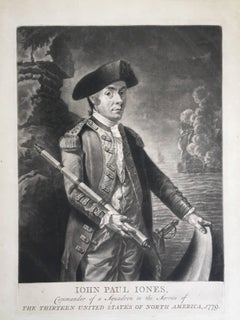 $4,250 Sale Price32% Off
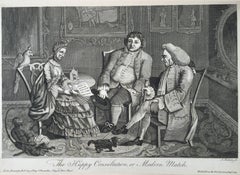
 - The Happy Consultation, or Modern MatchLocated in Santa Monica, CAEIGHTEENTH CENTURY BRITISH CARICATURE THE HAPPY CONSULTATION, or MODERN MATCH, 1769 (DG 4335) ...Category
1760s Old Masters More Prints
MaterialsEngraving
 $325 Sale Price56% Off
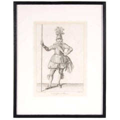
 - Antique Copper Engraving of an Officer of Pikeman by Francis GroseBy Francis GroseLocated in New York, NYFrancis Grose entered the army early in life and served in the cavalry, infantry, and militia. He produced some compelling and sought after engravings on subjects including ancient a...Category
19th Century Old Masters Figurative Prints
MaterialsLithograph
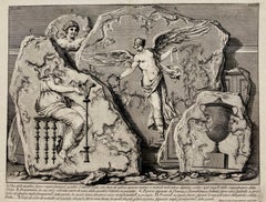
- (Large!) UNA DELLE QUATTRO FIGURE RAPPRESENTANTI QUATTRO VITTORIEBy Giovanni Battista PiranesiLocated in Santa Monica, CAGIOVANNI BATTISTA PIRANESI (1710-1778) UNA DELLE QUATTRO FIGURE RAPPRESENTANTI QUATTTRO VITTORIE, (Focillon 330, Wilton-Ely 463) 1750-1756 Etching, Plate 48 from “Le Antichita Romane“ vol. 3. Engraved by Jean Barbault...Category
1750s Old Masters More Prints
MaterialsEtching
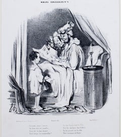
- "Ce Matin Avant l'Aurore, " Original Lithograph Genre Scene by Honore DaumierBy Honoré DaumierLocated in Milwaukee, WI"Ce Matin Avant l'Aurore" is an original lithograph by Honore Daumier, the second state of three. Original Text: Ce matin, avant l'aurore, Un Dieu vint me réveiller ; Il me dit : tu dors encore… Est-il temps de sommeiller ? De ton Papa c’est la fête, Fais lui quelque don flatteur En lui posant sur la tête Une Couronne de fleurs. Translation: This morning before dawn A God came to wake me up The curtains they were drawn And my snoring had to stop It is your daddy's birthday, A time for gifts and flowers To be placed on his head so gray Instead of his morning showers. Artwork Size: 9 1/4" x 9 1/4" Frame Size: 20 1/2" x 17 5/8" Artist Bio: Daumier was a prolific draftsman who produced over 4000 lithographs, he was perhaps best known for his caricatures of political figures and satires on the behavior of his countrymen, although posthumously the value of his painting has also been recognized. His works offer a commentary on social and political life in France in the 19th century. French caricaturist and painter, born at Marseilles. He showed in his earliest youth an irresistible inclination towards the artistic profession, which his father vainly tried to check by placing him first with a huissier, and subsequently with a bookseller. Having mastered the technique of lithography, Daumier started his artistic career by producing plates for music publishers, and illustrations for advertisements; these were followed by anonymous work for publishers, in which he followed the style of Charlet and displayed considerable enthusiasm for the Napoleonic legend. When, in the reign of Louis-Philippe, Philipon launched the comic journal, La Caricature, Daumier joined its staff, which included such powerful artists as Devéria, Raffet and Grandville, and started upon his pictorial campaign of scathing satire upon the foibles of the bourgeoisie, the corruption of the law and the incompetence of a blundering government. His caricature of the king as "Gargantua" led to Daumier's imprisonment for six months at Ste. Pélagie in 1832. The publication of La Caricature was discontinued soon after, but Philipon provided a new field for Daumier's activity when he founded the Charivari. For this journal Daumier produced his famous social caricatures, in which bourgeois society is held up to ridicule in the figure of Robert Macaire, the hero of a then popular melodrama. Another series, "L'Histoire Ancienne", was directed against the pseudoclassicism which held the art of the period in fetters. In 1848 Daumier embarked again on his political campaign, still in the service of Charivari, which he left in 1860 and rejoined in 1864. In spite of his prodigious activity in the field of caricature -- the list of Daumier's lithographed plates compiled in 1904 numbers no fewer than 3958 -- he found time for flight in the higher sphere of painting. Except for the searching truthfulness of his vision and the powerful directness of his brushwork, it would be difficult to recognize the creator of Robert Macaire, of Les Bas bleus, Les Bohémiens de Paris, and the Masques, in the paintings of "Christ and His Apostles" at the Ryks Museum in Amsterdam, or in his "Good Samaritan", "Don Quixote and Sancho Panza", "Christ Mocked...Category
1830s Old Masters Figurative Prints
MaterialsLithograph
- 8-foot "Thank You" monoprint in oil with collage, engraving and embossmentBy Mel BochnerLocated in Boca Raton, FL8-foot "Thank You" monoprint in oil with collage, engraving and embossment on handmade paper by artist Mel Bochner from Two Palms Publishing . Signed and dated in graphite on front l...Category
2010s Contemporary More Prints
MaterialsOil, Handmade Paper, Engraving, Monoprint