Want more images or videos?
Request additional images or videos from the seller
1 of 16
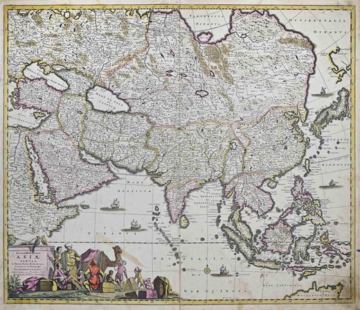
Frederick de WitPersia, Armenia & Adjacent Regions: A Hand-colored 17th Century Map by De Wit1680
1680
Price:$1,500
$1,875List Price
About the Item
- Creator:Frederick de Wit (1630 - 1706, Dutch)
- Creation Year:1680
- Dimensions:Height: 23.5 in (59.69 cm)Width: 27 in (68.58 cm)Depth: 1.325 in (3.37 cm)
- Medium:
- Movement & Style:
- Period:Late 17th Century
- Condition:
- Gallery Location:Alamo, CA
- Reference Number:Seller: # 46121stDibs: LU117328716502
Frederick de Wit
Frederick De Wit (1629-1706) was an engraver, cartographer and map dealer who ran a prominent and productive printing business in Amsterdam, founded in 1654 and initially called The Three Crabs and later The White Chart. He published his first atlas in 1662. In 1695 he purchased a large collection of the plates of the prestigious Blaeu publishing business. After his death in 1706, his wife Maria continued in the business for four years before selling it at the auction. A majority of the plates were purchased by Pieter Mortier. His thriving and growing business eventually became Covens & Mortier, one of the largest and most successful cartography and printing businesses of the eighteenth century.
About the Seller
5.0
Platinum Seller
Premium sellers with a 4.7+ rating and 24-hour response times
Established in 2011
1stDibs seller since 2019
298 sales on 1stDibs
Typical response time: 1 hour
Authenticity Guarantee
In the unlikely event there’s an issue with an item’s authenticity, contact us within 1 year for a full refund. DetailsMoney-Back Guarantee
If your item is not as described, is damaged in transit, or does not arrive, contact us within 7 days for a full refund. Details24-Hour Cancellation
You have a 24-hour grace period in which to reconsider your purchase, with no questions asked.Vetted Professional Sellers
Our world-class sellers must adhere to strict standards for service and quality, maintaining the integrity of our listings.Price-Match Guarantee
If you find that a seller listed the same item for a lower price elsewhere, we’ll match it.Trusted Global Delivery
Our best-in-class carrier network provides specialized shipping options worldwide, including custom delivery.You May Also Like
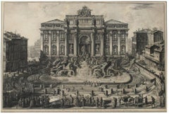
Veduta in Prospettiva della gran Fontana dell'Acqua Vergine detta di Trevi
By Giovanni Battista Piranesi
Located in New York, NY
Etching, 1773.
From the Vedute di Roma.
Framed dimensions 25.5 x 34.5 inches.
Category
18th Century Old Masters Landscape Prints
Materials
Etching
LITHOGRAPHS Greenwich Village NYC, Signed Mezzotint, Art Gallery, Photorealism
By John Baeder
Located in Union City, NJ
LITHOGRAPHS Greenwich Village NYC by the American photorealist artist John Baeder is a limited edition mezzotint printed using hand printmaking techniques on archival, cream colored ...
Category
1970s Photorealist Landscape Prints
Materials
Mezzotint
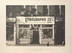
$446 Sale Price
25% Off
H 14 in W 23.75 in
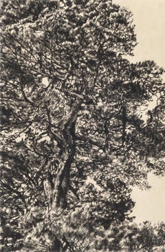
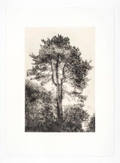
Branches Gold, Limited edition print, Landscape, Tree, Nature art
By Fiona Hamilton
Located in Deddington, GB
Scots Pine drypoint etching printed onto Japanese gampi tissue and backed onto German Hahnemule printmaking paper. This print depicts a mature pine tree, standing proud from the rest...
Category
2010s Contemporary Landscape Prints
Materials
Drypoint, Etching
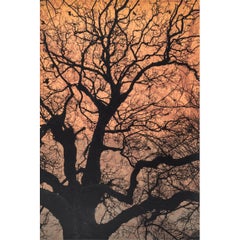
$101
H 22.05 in W 14.97 in D 0.4 in
Autumn Pine, Limited edition print, Landscape, Tree, Nature art
By Fiona Hamilton
Located in Deddington, GB
This print of a pine tree uses kitakata Japanese tissue chine collé to depict the warmth and colour of early autumnal light. It is then backed onto Hahnemule printmaking paper. The subject matter is from Ashton Court Estate in Bristol. This body of work is based on the book by Suzanne Simard, 'Finding the Mother Tree'. Trees communicate via mycorrhizal fungi to trade water and other nutrients. Ancient and mature trees nurture their offspring via these networks, as well as trading nutrients between other species. Botanist Simard has spent years working on this theory as part of a wider body of work, discovering what it means for forests, the climate and the wider Anthropocene. My work explores the ecological sublime and an appreciation of the majesty of nature. I use detailed intaglio etching, drypoint, lithography and chine collé to draw the viewer into an ethereal landscape that has an impact on our sense of place in relation to the natural world. I use primarily black and white with natural tones of chine collé and sometimes layers of lithographic texture to introduce warmth to the stark palette and to invoke a sublime emotional connection. I work from sketches, photographs, notes and memory to create my prints.
ADDITIONAL INFORMATION:
Black & White, Chine Collé, Drypoint, Drypoint print, Etching, Etching print on Paper
Edition of 20
44 H x 32 W x 1 D cm (17.32 x 12.60 x 0.39 in)
Sold unframed
Image size:
Height: 30cm (11.81 in)
Width: 20cm (7.87 in)
Complete size of sheet
Height: 44cm (17.32 in)
Width: 32cm (12.60 in)
Depth: 1cm (0.39 in)
ARTIST BIOGRAPHY:
Fiona Hamilton is a printmaker based in Bristol. Interested in process she uses a combination of mediums, both traditional and contemporary, to produce unique imagery, often as one off pieces or in small limited editions. She currently works in silkscreen, cyanotype and foil.
Fiona’s artwork draws on a lot of natural themes such as plants, leaves, trees and creatures including lots of birds. She mostly works directly from nature or from photographs she has taken. She regularly lugs a heavy telephoto lens about to get photos of birds...
Category
2010s Contemporary Landscape Prints
Materials
Drypoint, Etching
$263
H 17.33 in W 12.6 in D 0.4 in
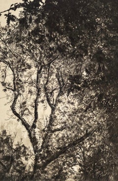
Winter Chestnut, Limited edition print, Landscape, Tree, Nature art
By Fiona Hamilton
Located in Deddington, GB
Scots Pine drypoint etching printed onto Japanese gampi tissue and backed onto German Hahnemule printmaking paper. This print depicts a mature pine tree, standing proud from the rest...
Category
2010s Contemporary Landscape Prints
Materials
Drypoint, Etching
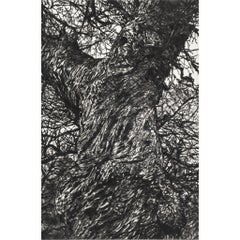
$236
H 24.81 in W 18.12 in D 0.4 in
Scots Pine, Limited edition print, Landscape, Tree, Nature art
By Fiona Hamilton
Located in Deddington, GB
Scots Pine drypoint etching printed onto Japanese gampi tissue and backed onto German Hahnemule printmaking paper. This print depicts a mature pine tree, standing proud from the rest...
Category
2010s Contemporary Landscape Prints
Materials
Drypoint, Etching
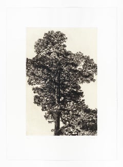
$330
H 24.81 in W 18.12 in D 0.4 in
Branches Blue, Limited edition print, Landscape, Tree, Nature art
By Fiona Hamilton
Located in Deddington, GB
This print is part of a small series of works to investigate the use of layering, colour blends and texture in screen print to elicit an ethereal, eerie and potentially dizzying sens...
Category
2010s Contemporary Landscape Prints
Materials
Drypoint, Etching
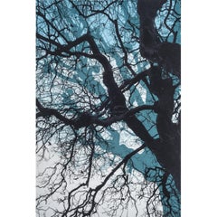
$101
H 22.05 in W 14.97 in D 0.4 in
Greville Smyth Pine, Limited edition print, Landscape, Tree, Nature art
By Fiona Hamilton
Located in Deddington, GB
A very detailed drypoint etching of a Pine tree printed onto gampi Japanese tissue and backed onto Hahnemule printmaking paper. This print considers how we view the contemporary sublime landscape and how easy it can be to experience when we take the time to look. We often don’t have to travel far: parks in cities, the coastline and stars in the night sky. The mature Scots Pine tree pictured...
Category
2010s Contemporary Landscape Prints
Materials
Drypoint, Etching
$384
H 24.81 in W 18.12 in D 0.4 in
Autumn Light, Limited edition print, Landscape, Tree, Nature art
By Fiona Hamilton
Located in Deddington, GB
Drypoint print onto photolitho printed kitakata with subtle gold ink and mounted onto Hahnemule printmaking paper. This print of a tree uses litho printed kitakata chine collé to dep...
Category
2010s Contemporary Landscape Prints
Materials
Drypoint, Etching
$384
H 24.81 in W 18.12 in D 0.4 in
Branches Purple, Limited edition print, Landscape, Tree, Nature art
By Fiona Hamilton
Located in Deddington, GB
Scots Pine drypoint etching printed onto Japanese gampi tissue and backed onto German Hahnemule printmaking paper. This print depicts a mature pine tree, standing proud from the rest...
Category
2010s Contemporary Landscape Prints
Materials
Drypoint, Etching
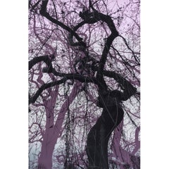
$101
H 22.05 in W 14.97 in D 0.4 in
More From This Seller
View AllCartusia Bruxellensis Monastery in Brussels: A 17th C. Hand-colored Engraving
By Lucas Vorsterman the Younger
Located in Alamo, CA
This is a 17th century hand-colored copperplate engraving entitled "Cartusia Bruxellensis" by Lucas Vorsterman, the Younger, after a drawing by Jacob van Werden or Jacques van Weerden, published in 1659 in Antonius Sanderus' book 'Chorographia sacra Brabantiae sive celebrium aliquot in ea provincia ecclesiarum et coenobiorum descriptio . . . Brussel' (A sacred chorography of Brabant, or a description of several famous churches and convents in that province). It also appeared in other publications by Sanderus. In the 17th century, Brussels was within the Duchy of Brabant.
This engraving depicts a bird's-eye view of the Scheut Carthusian Monastery in Brussels. Scheut is a district of Anderlecht, a municipality of Brussels, Belgium. The monastery housed monks, who took a vow of silence, in 20 rooms. There is a central courtyard with trees and shrubs. Monks are depicted strolling along its pathways. The cells for the friars are in the middle the cloister. There are people along the streets in the foreground and to the right of the large, imposing monastery. Some are on horseback, others are walking. In the lower right, what appears to be a dog pulls a small cart containing barrels, possibly of beer or wine. Districts and neighborhoods are labelled in the background, including Scheut, Anderlecht and Ransfort. A very ornate cartouche in the lower left contains Latin and the artist's attribution. Another decorative cartouche in the upper central area contains the title.
This beautifully hand-colored and detailed engraving is printed on laid, chain-linked paper with wide, full margins. The sheet measures 17.25" high and 21.25" wide. It has Latin text on the verso. It has a central vertical fold, as issued, which is reinforced on the verso. Two small spots in the lower margin may actually represent drops of watercolor paint used to color the engraving. It is otherwise in very good condition.
Antonius Sanderus (1586-1664) was a Flemish Catholic cleric and historian. He was born "Antoon Sanders", but Latinized his name like many writers and scholars of his time. He was the author of several books, including 'Chorographia Sacra Brabantiae', which was illustrated with this engraving.
Lucas Vorsterman the Younger (1624-between 1666 & 1676) was a Flemish Baroque engraver and draughtsman. He produced engravings after the work of contemporary painters and for books by Antwerp publishers.
Jacob van Werden or Jacques van Weerden (active 1643-1669), was a Flemish draughtsman, cartographer, military engineer and archer who was active in the Habsburg Netherlands. His drawings were used as designs for prints executed by various printmakers. He worked on maps, topographical views, historical scenes, portraits and book illustrations. He had a career as a military engineer and a member of the guard of the Spanish King. He advised on various military engineering projects and was an engineer of the Spanish army...
Category
Mid-17th Century Old Masters Landscape Prints
Materials
Engraving

Persia & Afghanistan: A Framed Hand-colored 17th Century Map by John Cary
By John Cary
Located in Alamo, CA
This colorful and detailed early 18th century copperplate map by John Cary entitled "A New Map of Persia from the Latest Authorities" was published in London in 1801. It depicts Persia, the region of modern day Afghanistan, the Caspian Sea, the Sea of Aral, the Persian Gulf...
Category
Early 19th Century Old Masters More Prints
Materials
Engraving

$940 Sale Price
20% Off
Map of the World: An Original 18th Century Hand-colored Map by E. Bowen
Located in Alamo, CA
This is an original 18th century hand-colored map entitled "A New & Correct Chart of All The Known World Laid down according to Mercator's Projection" by Emanuel Bowen. It was published in 1744 in London in John Harris's "Navigantium atque Itinerantium Bibliotheca" or "A Complete Collection of Voyages and Travels". This highly detailed and colorful map depicts the world. as it was known in the mid 18th century. A majority of the northern and central portions of Canada and America are left blank due to the purity of knowledge at the time this map was published.
The map is embellished with four Compass Roses in the lower left, lower center, lower right and center, along with many rhumb lines. There a is a decorative title cartouche in the upper left. This colorful, attractive, historical and interesting 1744 map presents the entire world on Mercator's projection as it was understood in the middle part of the 18th century, before the landmark explorations of Captain’s Cook, Vancouver, Wilkes and others. It is an example of a nautical chart, a type of map that was designed specifically for use by mariners. The map is centered on the equator and includes both the Eastern and Western Hemispheres. The continents of North America, South America, Europe, Africa, and Asia are depicted, as well as various islands in the Atlantic, Pacific, and Indian Oceans. The map is laid out according to the Mercator projection, a type of cylindrical map projection that was developed in the 16th century by Flemish cartographer Gerardus Mercator. This projection has the advantage of preserving angles and shapes, making it useful for navigation. The map presents a paucity of inland detail, particularly for the Americas, but major cities, geographical landmarks, and regions are included. Ocean currents and Tradewinds are identified, as well as the magnetic declination lines or magnetic variance, which refers to the difference between true north and compass north. The continents are color coded, enhancing the beauty of this map. The three compass roses indicate the directions of the cardinal points.
The depiction of the western coast of America, the Pacific and Australia are interesting. There was very little exploration of Australia between the navigations of William Damper in 1699 and Tobias Furneaux in 1773. Most of the maps detail relies on the 17th century Dutch expeditions to Australia's western coast, by Abel Tasman and William Janszoon. Van Diemen's Land (Tasmania) and New Guinea appear connected to the Australian continent. New Zealand appears as a single landmass. North of New Zealand there is a landmass labelled 'Ter d' St. Esprit' which probably represents the New Hebrides Islands. This map precedes the accurate exploration of the South Pacific and east coast of Australia by Captain James Cook later in the 18th century. The map includes ‘Drakes' Port,' the site where Sir Francis Drake supposedly landed in 1579 during his 1579 circumnavigation of the globe. Here he claimed territory for England, restocked, and repaired his vessels. Drake named the region New Albion. The exact location of Drake's Port is a cartographic mystery. Drake's Harbor is believed to be in the region of San Francisco Bay, Bodega Bay, San Pablo Bay...
Category
Mid-18th Century Old Masters Landscape Prints
Materials
Engraving

$1,020 Sale Price
20% Off
Map of the Russian Empire: An Original 18th Century Hand-colored Map by E. Bowen
Located in Alamo, CA
This is an original 18th century hand-colored map entitled "A New & Accurate Map of The Whole Russian Empire, As Contain'd Both In Europe and Asia, Drawn from Authentic Journals, Sur...
Category
Mid-18th Century Old Masters Landscape Prints
Materials
Engraving

Map of the East Indies: An Original 18th Century Hand-colored Map by E. Bowen
Located in Alamo, CA
This is an original 18th century hand-colored map entitled "An Accurate Map of the East Indies Exhibiting the Course of the European Trade both on the Continent and Islands" by Emanu...
Category
Mid-18th Century Old Masters Landscape Prints
Materials
Engraving

$1,020 Sale Price
20% Off
Mediterranean and Adriatic Seas: Original 18th Century Hand-colored Map by Bowen
Located in Alamo, CA
This is an original 18th century hand-colored map entitled "An Accurate Chart of The Mediterranean and Adriatic Sea's; with the Archipelago & Part of the Black Sea. Exhibiting all th...
Category
Mid-18th Century Old Masters Landscape Prints
Materials
Engraving

Recently Viewed
View AllMore Ways To Browse
Arab Man
Antique Maps Persia
Antique Yemen
Antique Measuring Devices
Armenia Map
Warhol Trucks
Wengen Retro Poster
Wolfgang Jorg
Yusaku Kamekura
Zakopane Poster
1920 Vintage Stove
Adolf Luther
Akira Yamaguchi
Alekos Fassianos On Sale
Alex Katz Good Afternoon 2
Alex Katz Rose Bud
Alex Katz Rose
Alexander Chen Signed Prints