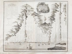
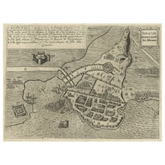
Items Similar to 18th Century Map Engraving - Plan of the Works of the City of Messina, Sicily


Want more images or videos?
Request additional images or videos from the seller
1 of 8
Unknown18th Century Map Engraving - Plan of the Works of the City of Messina, SicilyUnknown
Unknown
$285.60
$35720% Off
£218.54
£273.1720% Off
€250.12
€312.6520% Off
CA$403.34
CA$504.1820% Off
A$438.36
A$547.9520% Off
CHF 234.92
CHF 293.6520% Off
MX$5,322.52
MX$6,653.1520% Off
NOK 2,949.32
NOK 3,686.6520% Off
SEK 2,735.04
SEK 3,418.8020% Off
DKK 1,868.07
DKK 2,335.0920% Off
About the Item
A map of Messina, a harbour city in northeast Sicily. Inscribed with the title in plate to the lower edge, 'Plan of the Works of the City of Messina, one of the strongest and most considerable Cities of Sicily, and a fine Sea-Port'. There is a comprehensive key at the lower-right corner, titled 'Explanation of the principal works etc. of the City of Messina'. Engraved for 'Mr Tindal's Continuation of Mr Rapin's 'History of England'' with maps by Richard William Seale and John Basire and first published in 1727. This was a continuation of 'L'Histoire d'Angleterre' by Paul de Rapin-Thoyras (1661-1725) which was printed at the Hague in 1724. On laid.
- Creation Year:Unknown
- Dimensions:Height: 15.36 in (39 cm)Width: 19.3 in (49 cm)
- Medium:
- Period:
- Condition:There are several small closed tears around the edges. There is a centrefold crease and some mild foxing and discolouration around the edges. Cropped to the plate line at the upper edge.
- Gallery Location:Corsham, GB
- Reference Number:Seller: ra8381stDibs: LU881310269682
About the Seller
4.9
Gold Seller
Premium sellers maintaining a 4.3+ rating and 24-hour response times
Established in 2010
1stDibs seller since 2018
1,443 sales on 1stDibs
Typical response time: 2 hours
- ShippingRetrieving quote...Shipping from: Corsham, United Kingdom
- Return Policy
More From This Seller
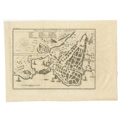
View All18th Century Map Engraving - Newport, a Strong Sea-Port Town in Flanders
Located in Corsham, GB
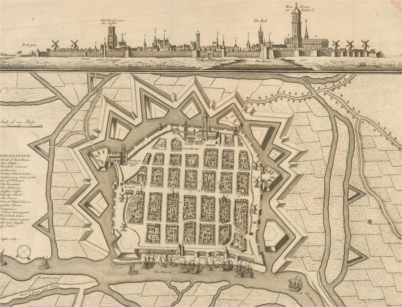
A map of Nieuwpoort, anglicised to 'Newport', in northern Belgium. There is a panorama in the upper quarter depicting major landmarks. Below is a plan of the town, including its strong defences and ships at the port in the lower register. Inscribed with the title in plate to the lower edge, 'Newport a Strong Sea-Port Town...
Category
18th Century More Prints
Materials
Engraving

$269 Sale Price
20% Off
18th Century Map Engraving - Mechlin, or Malines
Located in Corsham, GB
A map of Mechelen, known as Malines in French and Mechlin in English, a city and municipality in the province of Antwerp in the Flemish Region of Belgium. A birds-eye view plan of th...
Category
18th Century More Prints
Materials
Engraving

$269 Sale Price
20% Off
John Thomson (1777-1840) - 1830 Map Engraving, The Rivers of the World
By John Thomson
Located in Corsham, GB
A fine engraved chart table showing the lengths of the principal rivers across the world, from the second edition of John Thomson's 'New General Atlas' published in 1830. On paper.
Category
Early 19th Century More Prints
Materials
Engraving
$349 Sale Price
20% Off
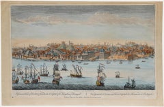
Laurie and Whittle - 1794 Engraving, A General View of the City of Lisbon
Located in Corsham, GB
A vibrant and captivating print depicting an expansive view of Lisbon, with ships sailing in the foreground. Inscribed within the plate below the image. On paper.
Category
Early 18th Century Landscape Prints
Materials
Engraving
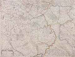
Henri Liebaux and Guillaume De L'Isle - 1706 Engraving, Map Of The Moscovites
Located in Corsham, GB
A early 18th Century map showing a section of Muscovite Russia. This is the lower half of the complete original map, finished with hand colouring. The artist's names are engraved in ...
Category
18th Century More Prints
Materials
Engraving
After Johann B. Homann (1664-1724) - 19th C, General Map of Spain and Portugal
Located in Corsham, GB
General map of Spain and Portugal divided into its current provinces by D.T. Lopez, newly drawn by F. L. G. in Nuremberg at the Heret of Homann, 1782. A double-page engraved map with...
Category
19th Century More Prints
Materials
Engraving

You May Also Like
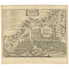
Antique Map of the City of Ambon by Valentijn, 1726
By F. Valentijn
Located in Langweer, NL
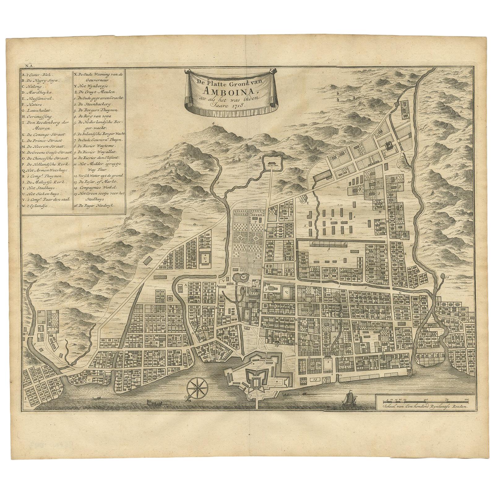
Antique map titled 'De Platte Grond van Amboina zoo als het was in den Jaare, 1718'. Antique map depicting the City of Ambon, Indonesia. This print originates from 'Oud en Nieuw Oost...
Category
Antique Early 18th Century Dutch Maps
Materials
Paper
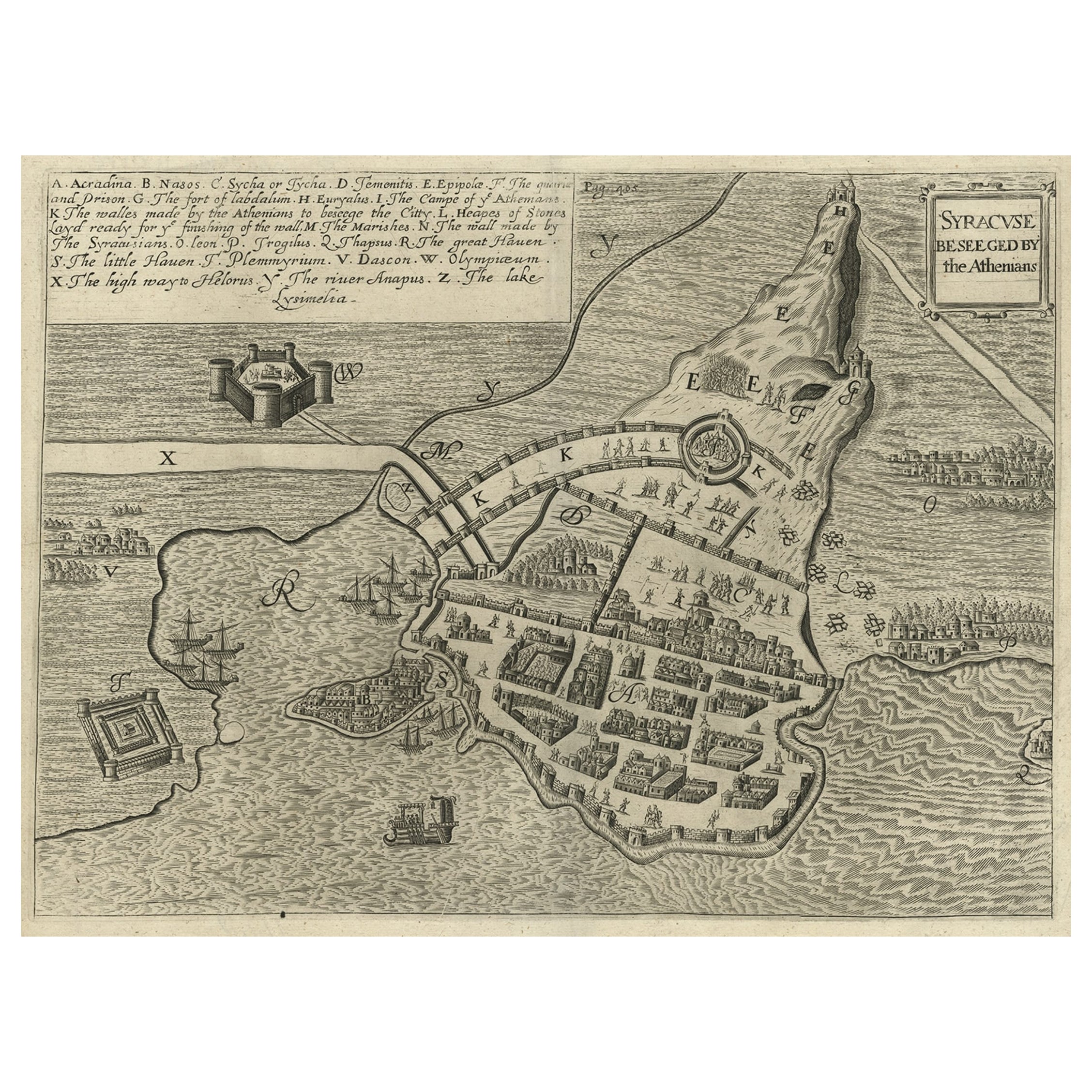
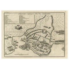
Antique Map of the Siege of Syracuse by the Athenians, 1648 – Thucydides
Located in Langweer, NL
Antique Map of the Siege of Syracuse by the Athenians, 1648 – Thucydides
This finely engraved plan depicts the Siege of Syracuse, one of the most dramatic episodes of the Peloponnes...
Category
Antique Mid-17th Century English Maps
Materials
Paper
$703 Sale Price
20% Off
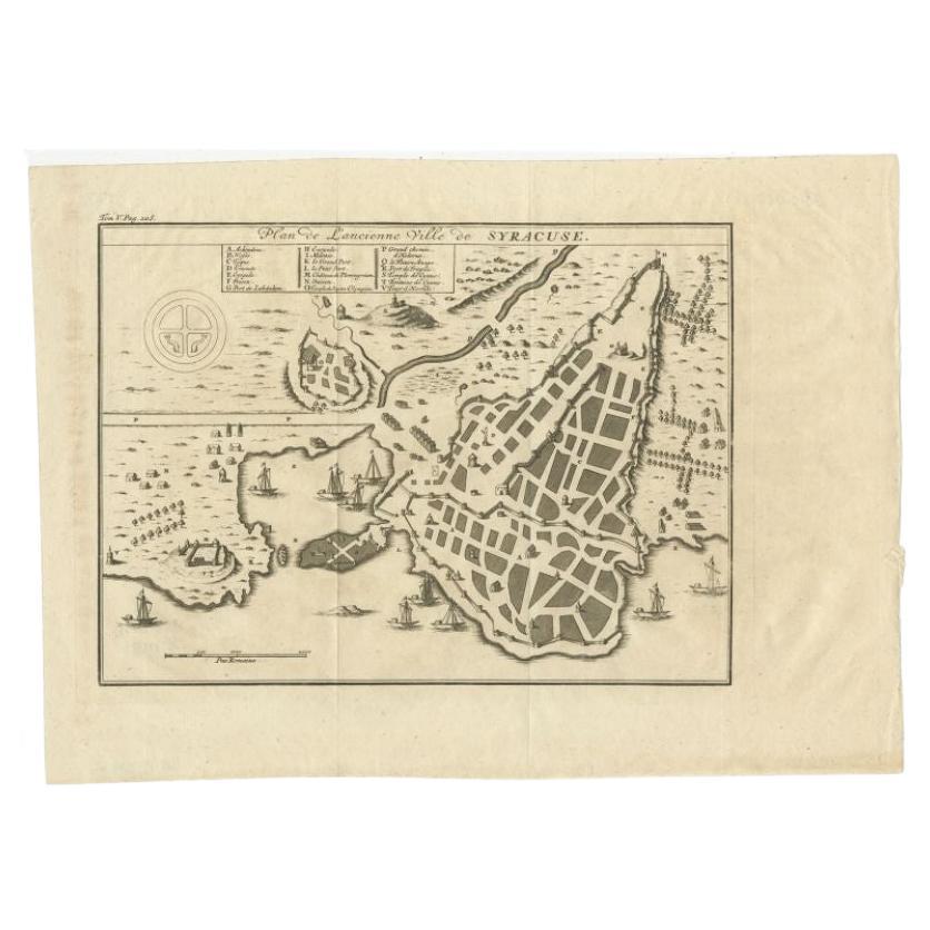
Antique Plan of Ancient Syracuse, cicily, Italy, 1740
Located in Langweer, NL
Antique print titled 'Plan de l'Ancienne Ville de Syracuse'. Plan of ancient Syracuse, Sicily, Italy. Source unknown, to be determined.
Artists and Engravers: Anonymous.
Condit...
Category
Antique 18th Century Maps
Materials
Paper
Antique Map of the Bay of Bantam, c.1720
Located in Langweer, NL
Rare, untitled miniature map of the Bay of Bantam with various Islands including Pulo Dua and Pulo Batto. This map originates from a small travelogue and may originate from an editio...
Category
Antique 18th Century Maps
Materials
Paper

$57 Sale Price
20% Off
Antique Plan of Ancient Syracuse, Plan of ancient Syracuse, Sicily, Italy
Located in Langweer, NL
Antique print titled 'Plan de l'Ancienne Ville de Syracuse'. Plan of ancient Syracuse, Sicily, Italy. This print originates from 'Histoire Universelle (..)'.
Artists and Engravers...
Category
Antique 18th Century Maps
Materials
Paper
Old Copper Engraving of the Siege of Syracuse, Sicily, Italy, Published, ca.1740
Located in Langweer, NL
Antique print titled 'Syracuse, Assiégée par les Atheniens'.
Old print of the siege of Syracuse, Sicily, Italy. Source unknown, to be determined.
The siege of Syracuse by the...
Category
Antique 1740s Maps
Materials
Paper
$266 Sale Price
20% Off
More Ways To Browse
Sicily Print
Sicily Map
Antique Maps Of Sicily
Mount Rushmore
Old Map Frames
Robert Indiana 1996
Us Navy Poster
Vintage Levi Jeans
Vintage Pan Am Poster
Vintage Technology Posters
Vintage Us Navy Posters
Warhol Heart
Aeroflot Vintage Poster
Dali Cheval
John Lennon Art For Sean
Juan Reus
Lucy In The Sky With Diamond
Northwest Airlines