Atlas Art
to
13
110
100
50
18
15
Overall Width
to
Overall Height
to
103
107
72
11
1
1
9
30
18
4
4
24
138
14
6
2
1
1
215
77
1
293
152,634
79,978
50,545
42,424
36,111
34,292
29,672
26,628
25,705
25,053
20,352
18,278
15,992
14,723
13,588
13,090
10,920
10,347
10,189
108
105
71
53
12
28
26
11
4
3
16
169
213
47
Art Subject: Atlas
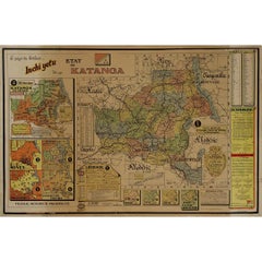
Original 1960 Map by Louis Dressen État du Katanga Congo
Located in PARIS, FR
This original 1960 poster by Louis Dressen, titled État du Katanga, is a rare and powerful visual document from one of the most turbulent moments in post-colonial African history. Pu...
Category
1960s Prints and Multiples
Materials
Paper, Lithograph
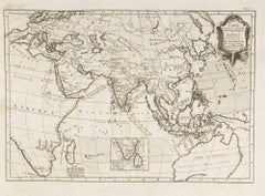
Carte Pour Servir a l'Histoire Philosophique.. - Etching by Rigobert Bonne- 1780
Located in Roma, IT
Etching on paper.
From Guillaume-Thomas Raynal, Histoire philosophique et politique des établissemens et du commerce des Européens dans les deux Indes, Geneva 1780.
This interestin...
Category
1780s Modern Figurative Prints
Materials
Etching
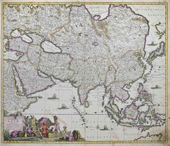
Accuratissima Totius Asiae Tabula - Etching by Frederick de Wit - 1680 ca
Located in Roma, IT
This double-page etching with contemporary coloring, entitled Accuratissima totius Asiae Tabula, was realized by the cartographer Frederick de Wit for the famous Atlas published in A...
Category
1680s Modern Figurative Prints
Materials
Etching
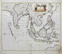
Tabula Indiae Orientalis - Etching by Frederick de Wit - 1680ca
Located in Roma, IT
This double-page etching with contemporary coloring, entitled Tabula Indiae orientalis, was realized by the cartographer Frederick de Wit for the famous Atlas published in Amsterdam ...
Category
1680s Modern Figurative Prints
Materials
Etching
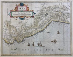
PERU
Located in Santa Monica, CA
JOHANNES JANSSON (1588 - 1664)
PERU, engraving with early coloring. Platemark 15 1/8 x 19 3/8 inches, sheet 17 x 20 1/2
A nice example of one of the earliest maps of Peru. From the ...
Category
1630s Old Masters Landscape Prints
Materials
Engraving
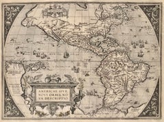
AMERICAE - Sive Novi Orbis, Nova Descriptio
Located in Santa Monica, CA
ABRAHAM ORTELIUS (1527 - 1598)
AMERICAE SIVE NOVI ORBIS, NOVA DESCRIPTIO, 1587 (1603) (Van Den Broecke 11, Burden 64; Schwartz & Ehrenberg 69)
Engraving. A very good, well printed...
Category
16th Century Old Masters Landscape Prints
Materials
Engraving
Antique Map - Mare Pacificum - Etching by Johannes Janssonius - 1650s
Located in Roma, IT
Mare Pacificum is an antique map realized in 1650 by Johannes Janssonius (1588-1664).
The Map is Hand-colored etching, with coeval watercolorang.
Good conditions with slight foxing...
Category
1650s Modern Figurative Prints
Materials
Etching
AMERICA
By John Speed
Located in Santa Monica, CA
IMPORTANT AMERICAN MAP - ONE OF THE FIRST TO SHOW CALIFORNIA as an ISLAND
JOHN SPEED (1552-1629)
AMERICA - With Those Known Parts In That Unknown Worlde (sic),
1626-(76)
(Burden 217 iv/iv) Engraving, uncolored. Engraved by Abraham Goos and
published by Thomas Basset and Richard Chiswell - 4th state of 4 in 1676
15 1/8 x 20 1/2” From “A Prospect of the Most Famous Parts of the
World”. Generally good condition. A repaired split in lower centerfold. This
is the most common version of this important map...
Category
1620s Old Masters Landscape Prints
Materials
Engraving
$4,000 Sale Price
52% Off
Accurata totius Archipelagi et Graeciae...- Etching by Frederick de Wit - 1680ca
Located in Roma, IT
This double-page etching with contemporary coloring, entitled Accurata totius Archipelagi et Graeciae Universae Tabula, was realized by the cartographer Frederick de Wit for the famo...
Category
1680s Modern Figurative Prints
Materials
Etching
Accuratissima Galliae Tabula - Etching by Frederick de Wit - 1680ca
Located in Roma, IT
This double-page etching with contemporary coloring, entitled Accuratissima Galliae Tabula [...], was realized by the cartographer Frederick de Wit for the famous Atlas published in ...
Category
1680s Modern Figurative Prints
Materials
Etching
$1,074 Sale Price
25% Off
Colombia Comercio Triangular, Pop Art Screenprint by Ana Mercedes Hoyos
Located in Long Island City, NY
Artist: Ana Mercedes Hoyos, Colombian (b. 1942)
Title: Colombia Comercio Triangular
Year: 2005
Edition: 75
Medium: Screenprint, signed and numbered in pencil
Size: 22 x 30 in. (55.8...
Category
Early 2000s Contemporary Figurative Prints
Materials
Screen
Dania Regnum - Etching by Frederick de Wit - 1680 ca
Located in Roma, IT
This double-page etching with contemporary coloring, entitled Dania Regnum [...], was realized by the cartographer Frederick de Wit for the famous Atlas published in Amsterdam in ca....
Category
1680s Modern Figurative Prints
Materials
Etching
$895 Sale Price
25% Off
Louisiana: A Framed 19th Century Map by O.W. Gray
Located in Alamo, CA
This framed 19th century map of the Louisiana territory was published in "Gray's Atlas of the United States with General Maps of the World, accompanied by Descriptions Geographical, Historical, Scientific and Statistica" published in 1873 in Philadelphia by O.W. Gray and Son and Stedman, Brown and Lyon. It is a highly detailed map of Louisiana...
Category
1870s Landscape Prints
Materials
Engraving
Novissima et Accuratissima Totius.. - Etching by Frederick de Wit - 1680ca
Located in Roma, IT
This double-page etching with contemporary coloring, entitled Novissima et Accuratissima totius Italiae, Corsicae et Sardiniae, was realized by the cartographer Frederick de Wit for ...
Category
1680s Modern Figurative Prints
Materials
Etching
Epirus Albania - Etching by Johannes Janssonius - 1650s
Located in Roma, IT
Epirus Albania is an ancient map realized in 1650 by Johannes Janssonius (1588-1664).
Good conditions.
From Atlantis majoris quinta pars, Orbem maritimum [Novus Atlas, volume V: ca...
Category
1650s Modern Figurative Prints
Materials
Etching
Novissima et Accuratissima... - Etching by Frederick de Wit - 1680 ca
Located in Roma, IT
This double-page etching with contemporary coloring, entitled Novissima et Accuratissima Septentrionalis ac Meridionalis Americae, was realized by the cartographer Frederick de Wit f...
Category
1680s Modern Figurative Prints
Materials
Etching
$1,253 Sale Price
25% Off
Union Pacific West vintage fun map railroad travel poster
Located in Spokane, WA
Original “The Union Pacific West fun map, archivally linen backed in very good condition. Ready to frame. This was initially folded, and the fold marks were ...
Category
1960s American Modern Landscape Prints
Materials
Offset
Totius Africae Accuratissima Tabula - Etching by Frederick de Wit - 1680 ca
Located in Roma, IT
This double-page etching with contemporary coloring, entitled Totius Africae Accuratissima Tabula, was realized by the cartographer Frederick de Wit for the famous Atlas published in...
Category
1680s Modern Figurative Prints
Materials
Etching
illustrated map of Morocco created in 1950 by Delaye
Located in PARIS, FR
Beautiful illustrated map of Morocco created in 1950 by Delaye. Main roads, car tracks, railroads are represented. This illustrated map is printed by P...
Category
1950s Prints and Multiples
Materials
Lithograph, Paper
Ancient Map - Zeilan - Etching by Johannes Janssonius - 1650s
Located in Roma, IT
Ancient Map - Zeilan is an ancient map realized in 1650 by Johannes Janssonius (1588-1664).
The Map is Hand-colored etching, with coeval watercoloring.
...
Category
1650s Modern Figurative Prints
Materials
Etching
WORLD MAP - Planisphaerium Terrestre Sive Terrarum Orbis... 1696
By Carel Allard
Located in Santa Monica, CA
CAREL ALLARD (1648 – 1709)
PLANISPHAERIUM TERRESTRE SIVE TERRARUM ORBIS… 1696 (Shirley 578)
Engraving, 20 ½ x 23 ½”, sheet 21 x 24 1/8". A stunning double hemisphere World Map...
Category
17th Century Old Masters Landscape Prints
Materials
Engraving
Antique Map - Gallia - Etching by Johannes Janssonius - 1650s
Located in Roma, IT
Antique Map - Gallia is an antique map realized in 1650 by Johannes Janssonius (1588-1664).
The Map is Hand-colored etching, with coeval watercoloring.
Good conditions with slight ...
Category
1650s Modern Figurative Prints
Materials
Etching
S.Juan de Puerto Rico - Etching by Johannes Janssonius - 1650s
Located in Roma, IT
S.Juan de Puerto Rico is an ancient map realized in 1650 by Johannes Janssonius (1588-1664).
Good conditions.
From Atlantis majoris quinta pars, Orbem maritimum [Novus Atlas, volum...
Category
1650s Modern Figurative Prints
Materials
Etching
Direccion de Hidrografia... - Etching by Tomàs Gozàlez - 1802
Located in Roma, IT
Etching on paper realized, among the others, by Tomàs Gozàlez.
From Juan Corradi, Descubrimiento y conquista de la América o Compendio de la historia general del Nuevo Mundo, Madrid...
Category
Early 1800s Modern Figurative Prints
Materials
Etching
1950 illustrated map Italy, Land of Saints and Sanctuaries
Located in PARIS, FR
In 1950, a highly detailed and artistically illustrated map titled Italie Terre de Saints et de Sanctuaires (Italy, Land of Saints and Sanctuaries) was published in Témoignage Chréti...
Category
1950s Prints and Multiples
Materials
Lithograph, Linen, Paper
New Map of the Terraqueous Globe - WORLD MAP - CALIFORNIA AS AN ISLAND
By Edward Wells
Located in Santa Monica, CA
EDWARD WELLS (British 1667- 1727)
A NEW MAP of the TERRAQUEOUS GLOBE - according to the latest Discoveries and most general Divisions of it into CONTINENTS and OCEANS, 1700-01 (Shirley 609)
Engraved by Michael Burghers, Oxford. Hand-colored, Platemark 14 1/4 x 20 1/8 inches. Central cartouche flanked by figures representing the continents with dedication to William, Duke of Gloucester...
Category
Early 1700s Old Masters Landscape Prints
Materials
Engraving
1956 original Air France poster “Réseau Aérien Mondial” (World Air Network)
Located in PARIS, FR
This 1956 original Air France poster, titled “Réseau Aérien Mondial” (World Air Network), is a stunning example of mid-century airline advertising. Designed at a time when air travel...
Category
1950s Prints and Multiples
Materials
Lithograph, Paper
North America: A Framed Hand-colored 19th Century German Map by Adolph Stieler
By Adolf Stieler
Located in Alamo, CA
This framed early 19th century map of North America entitled "Nord-Amerika" is plate No. LIV (No. 46) from Adolph Stieler's Hand-Atlas, published in Gotha, Germany by Justus Perthes ...
Category
1830s Landscape Prints
Materials
Engraving
Bermuda: An Early 17th Century Hand-colored Map by Henricus Hondius
By Henricus Hondius
Located in Alamo, CA
This attractive and interesting map of Bermuda by Henricus Hondius in 1633 is entitled "Mappa Aestivarum Insularum, Alias Barmudas". It is based on a ...
Category
Early 17th Century Old Masters Landscape Prints
Materials
Engraving
Asia Declineatio: A 17th Century Hand-colored Map of Asia by Justus Danckerts
Located in Alamo, CA
This is a scarce 17th century beautifully hand-colored copperplate engraved map of Asia entitled “Exactissima Asiae Delineatio in Praecipuas Regiones Caerterasque Partes divisa et de...
Category
Late 17th Century Old Masters Landscape Prints
Materials
Engraving
Mare Atlanticum - Etching by Johannes Janssonius - 1650s
Located in Roma, IT
Mare Atlanticum is an ancient map realized in 1650 by Johannes Janssonius (1588-1664).
Good conditions.
From Atlantis majoris quinta pars, Orbem maritimum [Novus Atlas, volume V: c...
Category
1650s Modern Figurative Prints
Materials
Etching
1944 original map "Les vins de Champagne – Montagne de Reims" by Louis Larmat
Located in PARIS, FR
The 1944 original map "Atlas de la France Vinicole – Les vins de Champagne – Montagne de Reims" by Louis Larmat is an exquisite piece of cartography that reflects both the history an...
Category
1940s Prints and Multiples
Materials
Lithograph, Paper
Archipelagus Septentrionalis - Etching by Johannes Janssonius - 1650s
Located in Roma, IT
Archipelagus Septentrionalis is an ancient map realized in 1650 by Johannes Janssonius (1588-1664).
Good conditions.
From Atlantis majoris quinta pars, Orbem maritimum [Novus Atlas...
Category
1650s Modern Figurative Prints
Materials
Etching
Expansions 9
Located in Dallas, TX
pastel on paper
Category
2010s Abstract Expressionist Animal Paintings
Materials
Paper, Pencil, Pastel
Orbis Terrarum - Etching by Johannes Janssonius - 1650s
Located in Roma, IT
Antique Map - Orbis Terrarum is an antique map realized in 1650 by Johannes Janssonius (1588-1664).
The Map is Hand-colored etching, with coeval watercoloring.
Good conditions with...
Category
1650s Modern Figurative Prints
Materials
Etching
Amstelredam - Etching by Johannes Janssonius - 1650s
Located in Roma, IT
Amstelredam is an ancient map realized in 1650 by Johannes Janssonius (1588-1664).
Good conditions.
From Atlantis majoris quinta pars, Orbem maritimum [Novus Atlas, volume V: carte...
Category
1650s Modern Figurative Prints
Materials
Etching
1944 original map Les vins de Champagne – Vignobles du Bar-Séquanais
Located in PARIS, FR
The 1944 original map "Atlas de la France Vinicole – Les vins de Champagne – Vignobles du Bar-Séquanais et du Bar-sur-Aubois", created by Louis Larmat and printed by Dorel in Paris, ...
Category
1940s Prints and Multiples
Materials
Lithograph, Paper
Ancient Map-Poli Arctici (Map of the Poles)-Etching by Johannes Janssonius-1650s
Located in Roma, IT
Poli Arctici is an ancient map realized in 1650 by Johannes Janssonius (1588-1664).
The Map is a Hand-colored etching, with coeval watercoloring.
Good conditions with slight foxing...
Category
1650s Modern Figurative Prints
Materials
Etching
Ancient Map - Macedonia - Etching by Johannes Janssonius - 1650s
Located in Roma, IT
Macedonia is an ancient map realized in 1650 by Johannes Janssonius (1588-1664).
The Map is Hand-colored etching, with coeval watercoloring.
Good condit...
Category
1650s Modern Figurative Prints
Materials
Etching
John Speede, Map of the County of Surrey, described and divided into hundreds
By John Speed
Located in London, GB
To see our other views and maps of England - including London, Oxford and Cambridge, scroll down to "More from this Seller" and below it click on "See all from this Seller" - or send us a message if you cannot find the view you want.
John Speed/Speede (1551/2-1629)
The County of Surrey Described and Divided into Hundreds
Engraving with later hand colouring and text to the reverse.
Dated to c.1650
36 x 49 cm
Probably the most famous early English mapmaker, John Speed's early life is somewhat of an enigma. He is believed to have trained as a rolling-press printer, but he was at heart an historian granted a sinecure in the Customs House by Queen Elizabeth to indulge his passion, later becoming a Fellow of the Society of Antiquaries. His first maps were historical, of the Holy Land 'Canaan as it was Possessed both in Abraham and Israels Dayes' and of England and Ireland recording 'all their Civill Warres since the Conquest'.
In 1611 he published his 'Hostory of Great Britaine' which he regarded as his magnum opus, but it was the companion atlas 'Theatre of the Empire of Great Britaine' that - as the first printed atlas of Great Britain - sealed his reputation. William Rogers engraved the first map, 'the County Palatine of Chester' in about 1600, but following his untimely death the task of engraving was passed to Jodocus Hondius of Amsterdam.
By 1612 the atlas was complete, the maps famed for their decorative elements. Many have town plans - Britain's first series of such plans - and descriptive text was printed to the reverse until the 1676 edition. Later printings (up until 1770) were issued without this text. By 1627 it has become a part of a world atlas 'Prospect of the Most Famous Parts of the World'. During the 17th century the plates passed through the hands of a series of publishers, the 1676 edition of Thomas Bassett and Richard Chiswell being regarded as its high point with the inclusion for the first time of a series of important maps. For the first half of the eighteenth century they were firmly established in the hands of the Overton family.
This particular edition originally featured in The Theatre Of The Empire Of Great Britaine. It features attractive inset views of the long-since destroyed Richmond...
Category
17th Century Realist Landscape Prints
Materials
Engraving
Amstelredam - Etching by Johannes Janssonius - 1650s
Located in Roma, IT
Amstelredam is an ancient map realized in 1650 by Johannes Janssonius (1588-1664).
Good conditions.
from Atlantis majoris quinta pars, Orbem maritimum [Novus Atlas, volume V: carte...
Category
1650s Modern Figurative Prints
Materials
Etching
Nova Zemla - Etching by Johannes Janssonius - 1650s
Located in Roma, IT
Nova Zemla is an ancient map realized in 1650 by Johannes Janssonius (1588-1664).
Good conditions.
From Atlantis majoris quinta pars, Orbem maritimum [Novus Atlas, volume V: carte ...
Category
1650s Modern Figurative Prints
Materials
Etching
Oceani Borealis - Etching by Johannes Janssonius - 1660s
Located in Roma, IT
Oceani Borealis is an ancient map realized in 1650 by Johannes Janssonius (1588-1664).
Good conditions.
From Atlantis majoris quinta pars, Orbem maritimum [Novus Atlas, volume V: c...
Category
1660s Modern Figurative Prints
Materials
Etching
Original poster to promote the 4th Tour de France of the Grand-mères automobiles
Located in PARIS, FR
The purpose of the poster was to promote the 4th Tour de France of the "Grand-mères automobiles" which was held from September 9 to 22, 1985.
The "Grand-Mères-Automobiles" were born ...
Category
1950s Prints and Multiples
Materials
Lithograph, Paper
See Glasgow by Train original vintage 1960s poster by Elizabeth Scott
Located in London, GB
To see our other original vintage posters, scroll down to "More from this Seller" and below it click on "See all from this Seller" - or send us a message if you cannot find the poste...
Category
1960s Prints and Multiples
Materials
Lithograph
Northern Scotland: 17th Century Hand-colored Map by Mercator
Located in Alamo, CA
This is a framed hand-colored 17th century map of Northern Scotland by Gerard Mercator entitled "Scotiae pars Septentrionalis", published in Amsterdam in 1636. It is a highly detailed map of the northern part of Scotland, with the northwest Highlands and the cities Inverness and Aberdeen, as well as the Orkney Islands and the Hebrides. There is a decorative title cartouche in the upper left corner.
The map is presented in an antiqued brown wood...
Category
Mid-17th Century Other Art Style Landscape Prints
Materials
Engraving
Polus Antarcticus - Etching by Johannes Janssonius - 1650s
Located in Roma, IT
Polus Antarcticus is a top rare ancient map realized in 1650 by Johannes Janssonius (1588-1664).
Good conditions.
From Atlantis majoris quinta pars, Orbem maritimum [Novus Atlas, v...
Category
1650s Modern Figurative Prints
Materials
Etching
Signed Feminist LGBTQ+ Colorful Ink on Paper Drawing - Profile Notation 418.015
Located in New York, NY
Linda Stein, Profile Notation 418.015 - Signed Feminist LGBTQ+ Colorful Ink, Color Pencil, Graphite on Paper Drawing
Profile Notation 418.015 is from Linda Stein's Profiles series-...
Category
2010s Feminist Figurative Drawings and Watercolors
Materials
Paper, Ink, Graphite, Color Pencil
1947 original map "Les eaux-de-vie de France - Le Cognac petite Champagne"
Located in PARIS, FR
The 1947 original map Atlas de la France Vinicole - Les eaux-de-vie de France - Le Cognac Petite Champagne et Borderies, created by Louis Larmat and printed by Dorel in Paris, is a d...
Category
1940s Prints and Multiples
Materials
Lithograph, Paper
Maris Mediterranei - Etching by Johannes Janssonius - 1650s
Located in Roma, IT
Maris Mediterranei is an ancient map realized in 1650 by Johannes Janssonius (1588-1664).
The Map is Hand-colored etching, with coeval watercoloring.
Good conditions with slight fo...
Category
1650s Modern Figurative Prints
Materials
Etching
Freti Canalis - Etching by Johannes Janssonius - 1650s
Located in Roma, IT
Freti Canalis is an ancient map realized in 1650 by Johannes Janssonius (1588-1664).
Good conditions.
From Atlantis majoris quinta pars, Orbem maritimum [Novus Atlas, volume V: car...
Category
1650s Modern Figurative Prints
Materials
Etching
Achaiae Noua - Etching by Johannes Janssonius - 1650s
Located in Roma, IT
Achaiae Noua is an ancient map realized in 1650 by Johannes Janssonius (1588-1664).
Good conditions.
From Atlantis majoris quinta pars, Orbem maritimum [Novus Atlas, volume V: cart...
Category
1650s Modern Figurative Prints
Materials
Etching
Barbarga - Etching by Johannes Janssonius - 1650s
Located in Roma, IT
Barbarga is an ancient map realized in 1650 by Johannes Janssonius (1588-1664).
Good conditions.
From Atlantis majoris quinta pars, Orbem maritimum [Novus Atlas, volume V: carte ma...
Category
1650s Modern Figurative Prints
Materials
Etching
Magnae Tartariae - Etching by Frederick de Wit - 1680ca
Located in Roma, IT
This double-page etching with contemporary coloring, entitled Magnae Tartariae, was realized by the cartographer Frederick de Wit for the famous Atlas published in Amsterdam in ca. 1...
Category
1680s Modern Figurative Prints
Materials
Etching
Battle of Courcelles - Lithograph - 1872
Located in Roma, IT
Battle of Courcelles is an artwork realized by R. Walker.
Lithograph, printed in 1872 by Milliam Mackenzie, London.
Good condition.
Category
1870s Modern Figurative Prints
Materials
Lithograph
Original 1940 Washington & Oregon Pictorial Map vintage poster
Located in Spokane, WA
Map of historical landmarks, American Indian territories, rivers, mountains, dams, colleges, federal grazing districts, cities, agriculture, and other activities that were present in...
Category
1940s American Realist Landscape Prints
Materials
Offset
Dépt. De L’Ariège, & Dépt. De la Vendée, from Atlas National de France Illustré
By Louis Francois Couche
Located in Middletown, NY
Two (2) historiated engraved maps, each 11 1/4 x 16 7/16 inches (285 x 418 mm) with handcoloring, on wove paper, the latter engraved by C. Smith after Couché fils, published by Combe...
Category
Mid-19th Century French School Landscape Prints
Materials
Watercolor, Handmade Paper, Engraving
Circa 1935 original poster by Walter Eckhard - Philips Radio G.M. Oord Haarlem
Located in PARIS, FR
A dazzling fusion of cartography, commercial ambition, and visual storytelling, this circa 1935 original poster by Walter Eckhard serves as a remarkable artifact of early globalism —...
Category
1930s Prints and Multiples
Materials
Paper, Lithograph
Map of Ancient Greece of Macedonia and... - Lithograph by Auguste Wahlen - 1844
Located in Roma, IT
Map of Ancient Greece of Macedonia and Thrace is a lithograph made by Auguste Wahlen in 1844.
Hand colored.
Good condition.
Bottom left is the original title "Carta della Grecia A...
Category
1840s Modern Figurative Prints
Materials
Lithograph
Original Vins du Sud-Ouest vintage French wine map poster
Located in Spokane, WA
Original Les Vignobles de France , Vins du Sud-Quest French vintage wine map poster. Horizontal. Size 36.5" x 27". Archival linen backed and re...
Category
Late 20th Century American Modern Landscape Prints
Materials
Lithograph
Recently Viewed
View AllMore Ways To Browse
Miracle On Ice
Murray Dessner
Native American Oklahoma
New England Barn
New Orleans Jazz Poster
Niagara Falls Oil
Oil Painting By Alice
Oil Painting Willow Tree
Oil Paintings New Zealand
Opera Nude
Orca Whale Art
Original Vintage Travel Posters Monte Carlo
Otto Lindberg
Painting Bird Hunting
Painting Bouvard Antoine Painting
Painting Signed Scott
Paintings Landscapes Signed Jacobs
Paris In The Rain
