Auctions
to
352
352
187
140
104
70
63
41
34
32
31
25
20
17
17
16
13
12
11
9
7
7
5
5
5
4
4
4
4
3
3
3
3
3
2
2
2
2
2
2
2
2
2
2
1
1
1
1
1
4
3
3
3
2
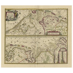
Antique Engraving of Dutch and German North Sea Coast of Friesland, ca.1680
Located in Langweer, NL
Antique map titled 'Tabula Nova In qua accuratè demonstratur tota Navigatio ab Amstelodami Statione per Vada vulgo de Watten Hamburgum usq.' -
Two maps with the Dutch and German North Sea coast of Friesland, with West Frisian Islands and below East Frisian Islands with inset map of the Elbe around Hamburg. With title and a scale cartouche. Map by Henricus Hondius...
Category
Antique 1680s Maps
Materials
Paper
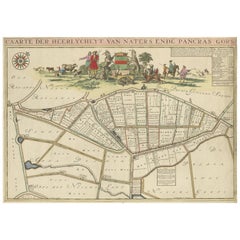
Beautiful Map of the Region Naters and Pancrasgors, The Netherlands, ca.1697
Located in Langweer, NL
Antique map titled ‘Caarte der Heerlyckheyt van Naters ende Pancras Gors’.
Beautiful map of the region Naters and Pancrasgors, The Netherlands. This map originates from ‘Caert-boec...
Category
Antique 1690s Maps
Materials
Paper
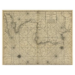
Original Antique Sea Chart of the Coastline from England to Gibraltar, ca.1700
Located in Langweer, NL
Antique map titled 'A Chart of the Sea-Coast from England to the Streights.'
Original antique map showing the European coastline from the South of England (and North of France) to ...
Category
Antique Early 1700s Maps
Materials
Paper
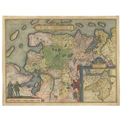
Map of East Frisian Islands & Northwestern Tip of Germany, Ostfriesland, c.1595
Located in Langweer, NL
Antique map titled 'Frisia Orientalis'. Beautiful map of east Frisian islands and the northwestern tip of Germany, Ostfriesland. With people in local costumes. Ornamented inset of the Eems estuary. Based on a manuscript map...
Category
Antique 16th Century Maps
Materials
Paper
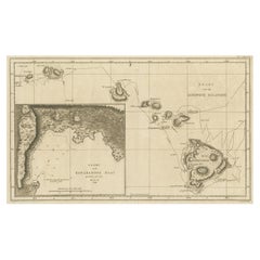
Map of the Hawaiian Islands with a Large Inset of Karakakooa Bay, 1803
Located in Langweer, NL
Antique map titled 'Kaart van de Sandwich Eilanden'.
Map of the Hawaiian Islands with a large inset of Karakakooa Bay, including soundings and anchorages. Originates from 'Reizen R...
Category
Antique Early 1800s Maps
Materials
Paper
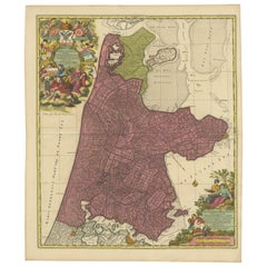
Beautiful Antique Map of the Province of Noord-Holland, the Netherlands, Ca.1730
Located in Langweer, NL
Antique map titled 'Kennemaria et Westfrisia vulgo et vernaculé Noord-Holland'.
Beautiful original antique map of the province of Noord-Holland, the Netherlands. Two large elaborat...
Category
Antique 1730s Maps
Materials
Paper
Old Copper Engraving of the Port City Dabhol in India, 1757
Located in Langweer, NL
Antique print titled 'Dabul'.
Old print of the port city Dabhol in India. In the 15th and 16th centuries, Dabul was an opulent Muslim trade center. Around 1660 it was annexed to th...
Category
Antique 1750s Maps
Materials
Paper
Old Hand-Colored Print with a View of Marseille, France, ca.1885
Located in Langweer, NL
Antique print titled 'Marseille aus der Vogelschau'.
Old print with a view of Marseille, France. This print originates from a German illustrated newsletter, published circa 1885.
...
Category
Antique 1850s Maps
Materials
Paper
Old Map of the Pacific, Incl Australia, Polynesia, Melanesia and Malaysia, 1872
Located in Langweer, NL
Antique map Oceania titled 'Map of Oceanica exhibiting its various divisions, island groups & c'.
Map of the Pacific, including Australia, Polynes...
Category
Antique 1870s Maps
Materials
Paper
Nice Decorative Hand-Colored Antique Map of Italy, ca.1745
Located in Langweer, NL
Antique map Italy titled 'A New Map of Italy from the lastest observations'.
Antique map of Italy originating from 'Geography Anatomiz'd: or, The G...
Category
Antique 1740s Maps
Materials
Paper
Map of the Ottoman Empire in Europe, incl. the Balkans, Greece & Turkey, c.1760
Located in Langweer, NL
Antique map Turkey titled 'An Accurate Map of Turky in Europe drawn from the best Authorities'.
Map of the Ottoman Empire in Europe, the Balkans, Greece, and Turkey in Europe. Engr...
Category
Antique 1760s Maps
Materials
Paper
Authentic Map of the Coast from Cape Formosa to the Dony River, Africa, 1732
Located in Langweer, NL
Antique map titled 'The New Correct Mapp of Calbar River vulgarly call'd Calabar (..)'.
An interesting map of the coast from Cape Formosa to the Dony River stated on the map to be ...
Category
Antique 1730s Maps
Materials
Paper
Print of Maps of Islands of the South Pacific, Incl. Pitcairn & Dusky Bay, 1788
Located in Langweer, NL
Antique map titled 'Esquisse de la Bay Dusky, Dans La Nouvelle Zeelande / I. Pitcairn / Isles de Wallis / I Turtle / I des Cocos and Traitres / Palmerston I. / I. Suavage / I. D'Hervey/ Havre Pickersgill / I de Pasques.'
Detailed set of maps of the islands of the South Pacific...
Category
Antique 1780s Maps
Materials
Paper
Original Antique Lithograph of a Horse Showing the Passion 'Rage & Agony', 1827
Located in Langweer, NL
Antique horse print titled 'Plate 1st Rage & Agony, dedicated by permission to his most Gracious Majesty George the Fourth (..)'.
Artists and Engravers: In 1827, British artist Henry Barnard Chalon (1770-1849), designed and lithographed a portfolio of six prints illustrating the “passions” of horses. Chalon had been appointed animal painter to the Duchess of York...
Category
Antique 1820s Prints
Materials
Paper
Original Antique Lithograph of a Horse Showing the Passion 'Courage', 1827
Located in Langweer, NL
Antique horse print titled 'Plate 5th Courage, dedicated by permission to his most Gracious Majesty George the Fourth (..)'.
Artists and Engravers: In 1827, British artist Henry Barnard Chalon (1770-1849), designed and lithographed a portfolio of six prints illustrating the “passions” of horses. Chalon had been appointed animal painter to the Duchess of York...
Category
Antique 1820s Prints
Materials
Paper
Original Old Antique Print Showing the True Euphorbium, 1737
Located in Langweer, NL
Antique print, titled: 'Euphorbium verum Antiquorum' - This original old antique print shows the true euphorbium. Source unknown, to be determined.
The True Euphorbium; Euphorbium verum Antiquorum
London: John Nourse, 1737.
Botanical print. Copper engraving with hand coloring. In very good condition.
Illustration of the true Euphorbium; plate 339 from "A Curious Herbal" which depicts exotic plants from the New World used for medicinal purposes.The cactus-like perennial plant is indigenous to Morocco.
Elizabeth Blackwell (1707-1758) was trained as an artist but untrained in botany. She collaborated with her botanist husband while he was in debtor's prison and with the curator of the Chelsea Physick Garden where the plants were under cultivation. She engraved the copper printing plates...
Category
Antique 1730s Prints
Materials
Paper
The New Bridge and Arsenal of Kingston, Hull, Yorkshire, Great Britain, ca.1770
Located in Langweer, NL
Antique print, titled: 'Vue de l'Est du Pont et Nouvel-Arsenal de Kingiston sur l'Hull.' - View of the New Bridge and arsenal of Kingston, Hull, Yorkshire, Great Britain. This is an ...
Category
Antique 1770s Prints
Materials
Paper
Original Copper Engraving of a Maori War Canoe, New Zealand, 1803
Located in Langweer, NL
Antique print New Zealand titled 'Oorlogs-Praauw van Nieuw-Zeeland'.
View of a Maori war canoe, New Zealand. Originates from 'Reizen Rondom de Waereld door James Cook (..)'.
Arti...
Category
Antique Early 1800s Prints
Materials
Paper
Antique Map of the Holy Land Described in the Old and New Testament, ca.1660
Located in Langweer, NL
Antique map titled 'Geographiae Sacrae ex Veteri et Novo Testamento Desumptae Tabula Prima quae Totius Orbis Partes Continet.'
Map of the lands described in the Old and New Testame...
Category
Antique 1660s Maps
Materials
Paper
Original Antique Lithograph of a Horse Showing the Passion 'Love', 1827
Located in Langweer, NL
Antique horse print titled 'Plate 2nd Love, dedicated by permission to his most Gracious Majesty George the Fourth (..)'.
Artists and Engravers: In 1827, British artist Henry Barnard Chalon (1770-1849), designed and lithographed a portfolio of six prints illustrating the “passions” of horses. Chalon had been appointed animal painter to the Duchess of York...
Category
Antique 1820s Prints
Materials
Paper
Rare Copper Engraving of Female with Five Breasts Lactating onto Others, 1686
Located in Langweer, NL
Antique print titled 'Painting'.
Rare antique print showing painters and various figures including: a female figure holding palette and brushes in centre, with another female figur...
Category
Antique 1680s Religious Items
Materials
Paper
Detailed Antique Map of Southeast England, incl Warwickshire and Hampshire, 1690
Located in Langweer, NL
Antique map titled 'Orientalior districtus Regni Angliae (..)'.
Detailed map of southeast England encompassing the country from Lincolnshire and the Wash south and including Warw...
Category
Antique 1690s Maps
Materials
Paper
Original Antique Engraving of a Sea Chart of the Western Mediterranean, ca.1650
Located in Langweer, NL
Antique map titled 'Pascaerte van 't westlyckste deel vande Middelandsche-Zee (..)'.
Sea chart of the Western Mediterranean. The map extends from the Straits of Gibralter to Italy ...
Category
Antique 1650s Maps
Materials
Paper
Antique Original Engraving of Chinese Vessels in the 18th Century, 1765
Located in Langweer, NL
Description: Plate no.34: 'Vaisseaux chinois.' (Chinese vessels.) This original auhentic plate originates from: 'Reize rondom de werreld, Gedaan in de jaaren 1740 tot 1744, door den ...
Category
Antique 1760s Prints
Materials
Paper
Antique Print of Chinese Street Punishments, 1859
Located in Langweer, NL
Antique print titled 'No.2 Street Punishments'. Print of Chinese street punishments. Shows a prisoner suspended from a cross-pole, supported by two upr...
Category
Antique 1850s Prints
Materials
Paper
Beautiful Decorative Hand-Colored Antique Map of West Canada, 1851
Located in Langweer, NL
Description: Antique map of Canada titled 'West Canada'.
With decorative vignettes titled Kingston and Falls of Niagara. Originates from 'The Illustrated Atlas, And Modern History Of The World Geographical, Political, Commercial & Statistical, Edited By R. Montgomery Martin'. Published; John Tallis London, New York, Edinburgh & Dublin. 1851.
Drawn and Engraved by J. Rapkin.
Artists and Engravers: John Tallis (1817-1876) was a British map...
Category
Antique 1850s Maps
Materials
Paper
Original Antique Map of Canaan, Armenia, Syria, Mesopotamia and Arabia, 1709
Located in Langweer, NL
Antique map titled 'Descriptio Paradisi et Terrae Canaan'.
Original antique map of Canaan, Armenia, Syria, Mesopotamia and Arabia. It displays the Middle East from the eastern Mediterranean Sea to the Persian Gulf...
Category
Antique Early 1700s Maps
Materials
Paper
Antique Map of Tracks of Anson's Ships around South America & Cape Horn, 1749
Located in Langweer, NL
Description: Antique map titled 'Kaart van het Zuidelykste Gedeelte van Zuider Amerika (..) - Carte de la Partie Meridionale de l'Amerique Meridionale (..)'.
Detailed chart tracking the route of Capt. George Anson's ship The Centurion in 1745. The chart shows the tracks of Anson's ships around South America & Cape Horn to the Juan Fernandes Islands, with notes on currents and positions.
In 1740 Capt. George Anson (1697-1762) of the Royal Navy, was given command of a squadron of ships. As England was at war with France and Spain, Anson's task was to intercept and capture a Spanish treasure...
Category
Antique 1740s Maps
Materials
Paper
Decorative Antique Map of the Malay Archipelago or East Indies Island, 1851
Located in Langweer, NL
Antique map Indonesia titled 'Malay Archipelago, or East India Islands'. With vignettes of Victoria Mount, New Guinea, Nativaes of New Guinea an...
Category
Antique 1850s Maps
Materials
Paper
Rare Antique Engraving of Life Near The Sestro River, Liberia in Africa, 1744
Located in Langweer, NL
Description: Antique print, titled: 'A map of Sestro River (…).' - This plate shows Fish, birds, animals and people in the area around the Sestro River, Liberia. Inset; a small map o...
Category
Antique 1740s Prints
Materials
Paper
Antique Map of London Showing the Area from Essex to Surrey, England, 1741
Located in Langweer, NL
Antique map titled 'Regionis quae est circa Londinum specialis repraesentatio (..)'
Very detailed map showing the area from Essex to Surrey and shows a lovely view of London with a high level of detail, stretching from Old London Bridge...
Category
Antique 18th Century Maps
Materials
Paper
Excellent Antique Map of America with Unusual Northwest Coast of America, c.1754
Located in Langweer, NL
Description: Antique map titled 'Nieuwe Kaart Van het Westelykste Deel Der Weereld, dienende tot aanwyzing an de Scheepstogten der Nederlanderne Naar West Indie.' Excellent map of America, featuring an unusual northwest coast of America, which includes Martin d'Aguilar's strait which provides for a Northwest Passage via the Great Lakes. The rest of the NW coast...
Category
Antique 1750s Maps
Materials
Paper
Antique Map of Germany of German in Roman Times, c.1660
Located in Langweer, NL
Antique map Germany titled 'Germaniae Veteris Typus'. Antique map probably by Blaeu or based on an earlier state by W. Blaeu.
Minor differences shown in the cartouches. Top left ha...
Category
Antique 17th Century Maps
Materials
Paper
Antique Print of Kangaroo and a 'Javanese' Pangolin in Australia, c.1825
Located in Langweer, NL
A antique print depicting a 'Wolliger Kanguruh' (a kangaroo) and a 'Iavanisches Schuppenthier' (a Pangolin, a scaly anteater) from a German publication around 1825-1830.
Heinri...
Category
Antique 1820s Prints
Materials
Paper
Antique Botany Print of Saxifraga Stolonifera or Creeping Saxifrage, 1865
Located in Langweer, NL
Antique botany print of Saxifraga stolonifera, a perennial flowering plant known by several common names, including creeping saxifrage, strawberry saxifrage, creeping rockfoil and ot...
Category
Antique 19th Century Prints
Materials
Paper
Antique Map of Artois in the North of France by Famous Mapmaker Blaeu, c.1640
Located in Langweer, NL
Antique map titled 'Artesia Comitatus Artois'. Map of Artois or Artesia, France. Artois is former province located in the northwestern part of France, boarding Belgium (Flanders) on ...
Category
Antique 17th Century Maps
Materials
Paper
Antique Map of England and London with Two Large Allegorical Views, c.1720
Located in Langweer, NL
Antique map titled 'Nouvelle Carte du gouvernement civil d'Angleterre (..)'. Old plan of London, with map of England and two large allegorical views. This map originates from Chatela...
Category
Antique 18th Century Maps
Materials
Paper
Antique Map of Buckinghamshire in England, 1743
Located in Langweer, NL
Antique map titled 'Buckingham both shyre and shire towne describ'. Map of Buckinghamshire, England. With town plans of Buckingham and Redding. This map originates from Overton's atl...
Category
Antique 18th Century Maps
Materials
Paper
Map of Australia, New Zealand, Part of China, Japan and Southeast Asia, 1857
Located in Langweer, NL
German Antique map titled 'Australien'. Map of Australia, New Zealand, part of China, Japan and Southeast Asia. In the upper right is a bit of the California coast by San Francisco. ...
Category
Antique 19th Century Maps
Materials
Paper
16th Century Map of Saudi Arabia, the Persian Gulf and Red Sea, ca. 1574
Located in Langweer, NL
Ptolemaic map of the Arabian Peninsula based on the 1548 map of Giacomo Gastaldi. It covers nearly all of the peninsula, but does not include the head of the Red Sea. The coastlines ...
Category
Antique 16th Century Maps
Materials
Paper
Vintage Botanical Treasures: Set of Three Flower Prints, circa 1930
Located in Langweer, NL
Set of three vintage flower prints. Little is known about these lovely prints, unsigned, no date. Aquarel? Published circa 1930.
Category
20th Century Prints
Materials
Paper
Vintage Geographic Splendor: 1859 Spain and Portugal
Located in Langweer, NL
The "Vintage Geographic Splendor: 1859 Spain and Portugal" map is an original antique piece from 'The Imperial Atlas of Modern Geography', published ...
Category
Antique Mid-19th Century Maps
Materials
Paper
Antique Map of Canada by Johnston '1909'
Located in Langweer, NL
Antique map titled 'Dominion of Canada'. Original antique map of Canada. This map originates from the ‘Royal Atlas of Modern Geography’. Publishe...
Category
Early 20th Century Maps
Materials
Paper
Original Antique Map of England and Wales from the 1909 Royal Atlas
Located in Langweer, NL
The antique map titled 'England and Wales' is a historical cartographic representation of these two nations. This original antique map of England...
Category
Early 20th Century Maps
Materials
Paper
Antique Map of West Canada by Tallis 'c.1850'
Located in Langweer, NL
Antique map titled 'West Canada'. Original antique map of West Canada, with decorative vignettes titled Kingston and Falls of Niagara. This map originates from 'The History and Topog...
Category
Antique Mid-19th Century Maps
Materials
Paper
Antique Chinese Rice Paper Pith Painting '19th Century'
Located in Langweer, NL
Antique Chinese rice paper pith painting. It shows a group gathering of men and women. Pith paper is made from the inner pith of the plant Tetrapane...
Category
Antique 19th Century Prints
Materials
Paper
Antique Chinese Rice Paper Pith Painting of Men and Women '19th century'
Located in Langweer, NL
The image portrays a detailed antique Chinese rice paper pith painting, a unique art form popular in the 19th century, especially for export to the ...
Category
Antique 19th Century Prints
Materials
Paper
Antique Print of Soldiers of the 11th and 12th Century by Strutt '1842'
Located in Langweer, NL
Antique print titled 'Soldiers of the Eleventh & Twelfth Centuries'. Original antique print of Soldiers of the 11th and 12th Century. This print originates from 'Illustration for Dre...
Category
Antique Mid-19th Century Prints
Materials
Paper
Antique Botany Print in Frame of Narcissus Tazetta or Polyanthus Narcissus, 1806
Located in Langweer, NL
Antique botany print of Narcissus Tazetta or Polyanthus Narcissus by William Curtis.
William Curtis began publication of the Botanical Magazine in February 1787 and continued almost without interruption for 160 years. After Curtis edited the first 13 volumes, the publication continued under the editors: John Simms (1800-1826), William Jackson Hooker (1827-1865) and Joseph Dalton Hooker (1865-1904). The images were engraved and hand-coloured by many artists including Sydenham Edwards, William Graves, James Sowerby, John Curtis, William Jackson Hooker, W.H. Fitch, Matilda Smith, Lillian Snelling...
Category
Antique Early 19th Century Prints
Materials
Paper
Antique Print of the Winning Horse 'Satirist' and a Jockey '1841'
Located in Langweer, NL
Antique horse print titled 'Satirist, winner of the Great St. Leger at Doncaster, 1841'. This aquatint print shows a winning horse and jockey of the Grea...
Category
Antique Mid-19th Century Prints
Materials
Paper
Antique Print of the Winning Horse 'Nutwith' and a Jockey 'c.1840'
Located in Langweer, NL
Antique horse print titled 'Nutwith the winner of the Great St. Leger Stakes at Doncaster, 1843'. This aquatint print shows a winning horse and jockey of...
Category
Antique Mid-19th Century Prints
Materials
Paper
Set of 9 Antique Costume Prints, Turkey, Albania, Anatolia, 'c.1840'
Located in Langweer, NL
Set of nine antique costume prints including costumes of Turkey, Albania, Anatolia and others. Source unknown, to be determined. Published circa 1840.
Category
Antique Mid-19th Century Prints
Materials
Paper
Antique Print of Hop Pickers at Work after A. Hunt, 'c.1880'
Located in Langweer, NL
Antique print titled 'Hop Picking'. Original antique print of hop pickers at work. Men and women work in the hop fields, possibly in Kent or Surrey, England. Right, two gentlemen buy...
Category
Antique Late 19th Century Prints
Materials
Paper
Antique Map of the World, Mercator Projection, by Wyld, '1845'
Located in Langweer, NL
Antique map titled 'The World'. Original antique world map, on Mercator's projection. This map originates from 'An Atlas of the World, Compr...
Category
Antique Mid-19th Century Maps
Materials
Paper
Antique Map of Europe by Wyld '1845'
Located in Langweer, NL
Antique map titled 'Europe'. Original antique map of Europe. This map originates from 'An Atlas of the World, Comprehending Separate Maps of its ...
Category
Antique Mid-19th Century Maps
Materials
Paper
Antique Map of the West Indies by Wyld '1845'
Located in Langweer, NL
Antique map titled 'Map of the West India Islands'. Original antique map of the West Indies, including Cuba, the Bahamas, the Antilles a...
Category
Antique Mid-19th Century Maps
Materials
Paper
Antique Map of the Kingdom of the Netherlands by Wyld '1845'
Located in Langweer, NL
Antique map titled 'Holland & Belgium formerly Kingdom of the Netherlands'. Original antique map of the Kingdom of the Netherlands. This map originates from 'An Atlas of the World, C...
Category
Antique Mid-19th Century Maps
Materials
Paper
Antique Map of South America by Wyld, '1845'
Located in Langweer, NL
Antique map titled 'South America'. Original antique map of South America. This map originates from 'An Atlas of the World, Comprehending ...
Category
Antique Mid-19th Century Maps
Materials
Paper
