An Accurate Map Of Europe
to
9
62
42
68
38
22
21
15
13
13
13
9
9
8
8
6
6
6
5
4
3
3
3
3
3
2
2
2
2
2
2
2
1
1
1
1
1
1
1
1
1
1
1
1
1
4
4
3
3
3
Sort By
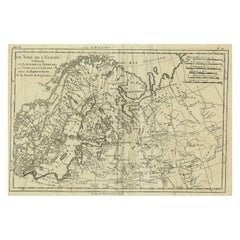
Antique Map of Northern Europe and European Russia, ca.1780
Located in Langweer, NL
Antique map titled 'Le Nord de L'Europe, Contenant Le Danemark, La Norwege; La Suede et La Laponie
Category
Antique 1780s Maps
Materials
Paper
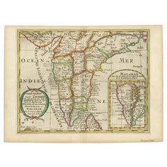
1705 Sanson Map of Southern India and Malabar with an Inset Map
Located in Langweer, NL
map’s intended readership.
Maps of India from this period were crucial for European powers vying for
Category
Antique Early 1700s Maps
Materials
Paper
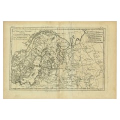
Antique Map of Northern Europe by Bonne, c.1780
Located in Langweer, NL
Antique map titled 'Le Nord de L'Europe, Contenant Le Danemark, La Norwege; La Suede et La Laponie
Category
Antique 18th Century Maps
Materials
Paper
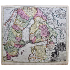
Scandinavia & Portions of Eastern Europe: 18th Century Hand-Colored Homann Map
By Johann Baptist Homann
Located in Alamo, CA
, becoming the leading map publisher in Germany and an important entity in the European map market. In 1715
Category
Antique Early 18th Century German Maps
Materials
Paper
H 20.75 in W 23.5 in D 0.07 in
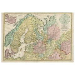
Historical Map of Northern Europe and Russia - Engraved for I. Harrison, 1788
Located in Langweer, NL
meticulous and accurate approach to mapmaking.
The map covers the vast territories of Northern Europe
Category
Antique 1780s Maps
Materials
Paper
H 21.26 in W 30.52 in D 0.01 in
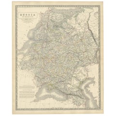
Antique Map of Russia 'in Europe' by W. & A.K. Johnston, circa 1850
By W. & A.K. Johnston
Located in Langweer, NL
Antique Map: Russia in Europe by W. & A.K. Johnston, Circa 1850
This highly detailed antique map
Category
Antique Mid-19th Century Maps
Materials
Paper
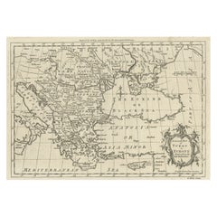
Map of the Ottoman Empire in Europe, incl. the Balkans, Greece & Turkey, c.1760
Located in Langweer, NL
Antique map Turkey titled 'An Accurate Map of Turky in Europe drawn from the best Authorities
Category
Antique 1760s Maps
Materials
Paper
H 8.67 in W 13.59 in D 0 in
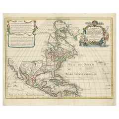
Scarce Latin Edition of Guillaume Delisle's 1700 Map of North America
Located in Langweer, NL
geographical knowledge across Europe. His maps are particularly recognized for their decorative cartouches and
Category
Antique Early 1700s Maps
Materials
Paper
Map of Independent Tartary with Vignettes of the Region's Culture, 1851
Located in Langweer, NL
both charm and educational value to the map, reflecting the 19th-century European interest in exotic
Category
Antique 1850s Maps
Materials
Paper
Antique Map of the Eastern Mediterranean and the Balkans
Located in Langweer, NL
Antique map titled 'La Turquie d'Europe et celle d'Asie'. Attractive double page map of the Eastern
Category
Antique Late 18th Century Maps
Materials
Paper
Antique Map of Peloponnesus, Greece by Pierre Antoine Tardieu, 1797
Located in Langweer, NL
his detailed and accurate maps. His inclusion on the map signifies his role in its design, research
Category
Antique 1790s Maps
Materials
Paper
Large 1693 Maritime Map of Irish Sea, West Coasts of Ireland, England, Scotland
Located in Langweer, NL
at improving navigation and charting European waters more accurately.
- It reflects the high level
Category
Antique 1690s Maps
Materials
Paper
H 24.81 in W 37.01 in D 0.01 in
Map of Southern Spain Depicting Castile, Andalusia, Granada, Murcia and Valencia
Located in Langweer, NL
:
- **Cartographer:** Robert de Vaugondy, a prominent French geographer, is known for his meticulously accurate maps
Category
Antique Mid-18th Century Maps
Materials
Paper
H 21.97 in W 30.83 in D 0.02 in
18th-Century Biblical Map of the Colonies of Ham: Africa, Middle East and Beyond
Located in Langweer, NL
maps were not intended to be accurate representations of geography but rather visualizations of
Category
Antique 1790s Maps
Materials
Paper
H 9.06 in W 11.03 in D 0 in
Historical Map of Ancient Germany (1787): Tribes and Territories by Mentele
Located in Langweer, NL
his detailed and accurate maps. His inclusion on the map signifies his role in its design, research
Category
Antique 1780s Maps
Materials
Paper
H 16.23 in W 21.26 in D 0.01 in
19th Century Illustrated Map of Ceylon (Sri Lanka) with Notable Landmarks
Located in Langweer, NL
John Tallis & Company is known for producing maps and atlases that were highly regarded for their
Category
Antique 1850s Maps
Materials
Paper
H 14.26 in W 10.71 in D 0 in
Victorian Visions of the New World: A Detailed Tallis Map of North America, 1851
Located in Langweer, NL
, ensured that the maps were both accurate for their time and aesthetically appealing.
This particular map
Category
Antique 1850s Maps
Materials
Paper
H 14.26 in W 10.71 in D 0 in
Large 1750 Map of the Kingdoms of Spain and Portugal by Robert de Vaugondy
Located in Langweer, NL
Portugal during the mid-18th century. The map is an excellent example of Vaugondy’s detailed and accurate
Category
Antique Mid-18th Century Maps
Materials
Paper
H 20.56 in W 27.84 in D 0.02 in
Original Antique Hand-Colored Map of Friesland by C. Merian, 1659
Located in Langweer, NL
Inferioris" by Martin Zeiler, published in 1659.
Merian was renowned for his detailed and accurate
Category
Antique Mid-17th Century Maps
Materials
Paper
1683 Alain Manesson Mallet Map of Ancient India, the Ganges, and Taprobane
Located in Langweer, NL
. The map labels Persia, Scythia, and the Gangetic Gulf (Golfe Gangetique), reflecting early European
Category
Antique 1680s Maps
Materials
Paper
H 7.88 in W 5.32 in D 0.01 in
Very Large Double Page Detailed Map of Italy and Surrounding Regions, 1794
Located in Langweer, NL
time, often working with cartographers of great repute to produce high-quality and accurate maps
Category
Antique 1790s Maps
Materials
Paper
H 25.79 in W 36.23 in D 0 in
Detailed 1795 Map of the Americas with Exploration Tracks and Nice Cartouche
Located in Langweer, NL
struggle to map this region accurately.
In the lower part of the map, an inset shows an alternate
Category
Antique 1790s Maps
Materials
Paper
H 20.67 in W 27.17 in D 0.01 in
Mid-19th Century Decorative Map of Asia with Cultural and Natural Vignettes
Located in Langweer, NL
John Tallis & Company, known for their decorative mid-19th-century maps, created this map of Asia
Category
Antique 1850s Maps
Materials
Paper
H 10.71 in W 14.26 in D 0 in
1856 U.S. Coast Survey Map of Chesapeake Bay and Delaware Bay
Located in Colorado Springs, CO
Presented is U.S. Coast Survey nautical chart or maritime map of Chesapeake Bay and Delaware Bay
Category
Antique 1850s American Maps
Materials
Paper
Captain Cook's Exploration of Tahiti 18th C. Hand-Colored Map by Bellin
By Jacques-Nicolas Bellin
Located in Alamo, CA
This beautiful 18th century hand-colored copper plate engraved map is entitled "Carte de l'Isle de
Category
Antique Mid-18th Century French Maps
Materials
Paper
H 11.38 in W 17.5 in D 0.13 in
Monumental Framed Medieval Facsimile Map Of The World Fra Mauro Wood Wall Panel
Located in Forney, TX
Republic of Venice. He is celebrated for creating the most detailed, advanced, and accurate map of the
Category
Early 20th Century Medieval Maps
Materials
Linen, Wood, Paper
H 88.25 in W 90.25 in D 2 in
Cartographic Elegance: The Art and Science of 17th-Century Asian Maps, ca.1681
Located in Langweer, NL
that while maps from this period attempted to be accurate, they were often influenced by the
Category
Antique 1680s Maps
Materials
Paper
H 7.49 in W 9.22 in D 0 in
Sweden & Adjacent Portions of Scandinavia: A Hand-Colored 18th C. Map by Homann
By Johann Baptist Homann
Located in Alamo, CA
, becoming the leading map publisher in Germany and an important entity in the European map market. In 1715
Category
Antique 1720s German Maps
Materials
Paper
H 21 in W 23.38 in D 0.07 in
Road Map John Ogilby No 75 Kings Lyn Harwich, Britannia Framed Wallhanging
By John Ogilby
Located in BUNGAY, SUFFOLK
Europe. It was composed of maps of seventy-three major roads and cross-roads, presented in a continuous
Category
Antique 1670s European Baroque Maps
Materials
Paper
H 15.75 in W 19.69 in D 0.6 in
1710 Edward Wells Detailed Ancient Greece Map with Ornate Cartouche
Located in Langweer, NL
Artistic Details:
- Coverage: The map covers a significant part of southeastern Europe and includes parts
Category
Antique 1710s Maps
Materials
Paper
Road Map, John Ogilby, No 54, London, Yarmouth, Britannia
By John Ogilby
Located in BUNGAY, SUFFOLK
Europe. It was composed of maps of seventy-three major roads and cross-roads, presented in a continuous
Category
Antique 1670s English Baroque Maps
Materials
Paper
Antique Map Featuring Turkey, Persia, India, Egypt & Arabia by James Wyld, 1839
Located in Langweer, NL
detailed and accurate maps, was a prominent figure in the field of geography and cartography in the 19th
Category
Antique 1830s Maps
Materials
Paper
H 16.74 in W 22.05 in D 0 in
Map Road Strip Britannia Sheet 2 John Ogilby London Aberistwith Islip Bramyard
By John Ogilby
Located in BUNGAY, SUFFOLK
national road-atlas of any country in Western Europe. It was composed of maps of seventy-three major roads
Category
Antique 17th Century English Baroque Maps
Materials
Paper
H 14.38 in W 19.3 in D 0.79 in
Map Road John Ogilby Britannia No 74 Ipswich to Norwich Cromer Framed
By John Ogilby
Located in BUNGAY, SUFFOLK
national road-atlas of any country in Western Europe. It was composed of maps of seventy-three major roads
Category
Antique 1670s English Baroque Maps
Materials
Paper
Road Map No43 London to Kings Lynn, Royston to Downham, John Ogilby, Britannia
By John Ogilby
Located in BUNGAY, SUFFOLK
John Ogilby (British 1600-1676) Cosmographer and Geographick Printer to Charles II.
A road map
Category
Antique Late 17th Century British Charles II Maps
Materials
Paper
H 20.48 in W 24.41 in D 0.4 in
Road Map John Ogilby London St David's Britannia No 15 Abingdon Monmouth Framed
By John Ogilby
Located in BUNGAY, SUFFOLK
John Ogilby (British 1600-1676) Cosmographer and Geographick Printer to Charles II. A road map from
Category
Antique 1670s English Baroque Maps
Materials
Paper
H 20.48 in W 24.41 in D 0.6 in
Road Map Britannia No 32 the Road from London to Barnstable John Ogilby Framed
By John Ogilby
Located in BUNGAY, SUFFOLK
Europe. It was composed of maps of seventy-three major roads and cross-roads, presented in a continuous
Category
Antique Late 17th Century English Charles II Maps
Materials
Paper
H 20.48 in W 24.41 in D 0.6 in
Road Map Britannia No 15 London to St Davids John Ogilby Brown Gilt Frame
By John Ogilby
Located in BUNGAY, SUFFOLK
Lechlade, to Fairford, to Barnsley to Gloucester showing Monmouth as the destination. A road map from
Category
Antique Late 17th Century British Charles II Maps
Materials
Paper
H 22.05 in W 26.19 in D 0.6 in
Road Map Britannia No 25 London to the Lands End, John Ogilby Brown Gilded Frame
By John Ogilby
Located in BUNGAY, SUFFOLK
Senan in Cornwall. By John Ogilby His Majesties Cosmographer. A road map from Britannia, 1675/6. No 25
Category
Antique Late 17th Century British Charles II Maps
Materials
Paper
H 22.05 in W 26.19 in D 0.6 in
Road Map Britannia 1675/6 No 5 Road London to Barwick, London Stilton Grey Frame
By John Ogilby
Located in BUNGAY, SUFFOLK
John Ogilby (British 1600-1676) cosmographer and geographick printer to Charles II.
A road map from
Category
Antique Late 17th Century British Charles II Maps
Materials
Paper
H 22.84 in W 25.99 in D 0.4 in
Antique Print of the City of Ten-Tchoo-Foo, China, 1796
Located in Langweer, NL
ambassador's page. On the embassy's arrival in China it emerged that the 11-year-old was the only European
Category
Antique 1790s Maps
Materials
Paper
Western Hemisphere - 1876 Edition by Adolf Stieler, Published by Justus Perthes
Located in Langweer, NL
the most detailed and accurate atlases available.
2. Mapmaker's Signature:
- The map is signed by
Category
Antique 1870s Maps
Materials
Paper
H 14.97 in W 18.12 in D 0 in
Rare North Atlantic and Caribbean Sea Chart: Newfoundland to Venezuela, 1745
Located in Langweer, NL
accurately, making the map an essential tool for mariners of the period.
This map also features finely drawn
Category
Antique 1740s Maps
Materials
Paper
H 22.05 in W 25.99 in D 0.01 in
Roman Italy and Provinces: A Cartographic Snapshot, 1880
Located in Langweer, NL
The map titled "ITALIA, Gallia Cisalpina, Sicilia, Sardinia, Corsica" focuses on Italy and its
Category
Antique 1880s Maps
Materials
Paper
Europe: An Original 18th Century Hand-colored Map by E. Bowen
Located in Alamo, CA
This is an original 18th century hand-colored map entitled "A New & Accurate Map of Europe Drawn
Category
Mid-18th Century Old Masters Landscape Prints
Materials
Engraving
Map of the World: An Original 18th Century Hand-colored Map by E. Bowen
Located in Alamo, CA
Hebrides Islands. This map precedes the accurate exploration of the South Pacific and east coast of
Category
Mid-18th Century Old Masters Landscape Prints
Materials
Engraving
Map of the Russian Empire: An Original 18th Century Hand-colored Map by E. Bowen
Located in Alamo, CA
This is an original 18th century hand-colored map entitled "A New & Accurate Map of The Whole
Category
Mid-18th Century Old Masters Landscape Prints
Materials
Engraving
Map of the East Indies: An Original 18th Century Hand-colored Map by E. Bowen
Located in Alamo, CA
This is an original 18th century hand-colored map entitled "An Accurate Map of the East Indies
Category
Mid-18th Century Old Masters Landscape Prints
Materials
Engraving
China: An Original 18th Century Hand-colored Map by E. Bowen
Located in Alamo, CA
This is an original 18th century hand-colored map entitled "A New & Accurate Map of China, Drawn
Category
Mid-18th Century Old Masters Landscape Prints
Materials
Engraving
H 15.75 in W 19.75 in
Circa 1825 original engraving of the map of Syria by Giraldon Bovinet
Located in PARIS, FR
, is a historically significant map that reflects early 19th-century cartographic techniques and
Category
1820s Prints and Multiples
Materials
Paper, Engraving
Map of Canonor - Etching by G. Braun/F. Hogenberg - 1575
Located in Roma, IT
his Latin name Rantzovius, who provided maps of Northern Europe, specially of Danish cities. The
Category
16th Century Modern Figurative Prints
Materials
Etching
H 5.52 in W 6.3 in D 0.04 in
Map of San Georgi - Etching by G. Braun/F. Hogenberg - 1575
Located in Roma, IT
), beter known under his Latin name Rantzovius, who provided maps of Northern Europe, specially of Danish
Category
16th Century Modern Figurative Prints
Materials
Etching
H 5.52 in W 6.3 in D 0.04 in
Theories of Planetary Orbits: A Framed 18th C. Celestial Map by Doppelmayr
By Johann Gabriel Doppelmayr 1
Located in Alamo, CA
flourished, becoming the leading map publisher in Germany and an important entity in the European map market
Category
Early 18th Century Landscape Prints
Materials
Engraving
H 31.5 in W 34.94 in D 1 in
Captain Cook's Exploration of Tahiti: 18th C. Hand-colored Map by Bellin
By Jacques-Nicolas Bellin
Located in Alamo, CA
This beautiful 18th century hand-colored copper plate engraved map is entitled "Carte de l'Isle de
Category
Late 18th Century Landscape Prints
Materials
Engraving
ANTIQUE EDWARDIAN LEATHER CLAD & EMBOSSED FiRE SCREEN WITH MAP DECORATION
Located in West Sussex, Pulborough
, it covers within the M25 only for the UK and local Europe only for international, if you would like
Category
Antique Early 1900s European Edwardian Screens and Room Dividers
Materials
Leather, Pine
H 29.93 in W 26.38 in D 12.8 in
Sweden and Adjacent Portions of Scandinavia: A Hand-colored 18th C. Homann Map
By Johann Baptist Homann
Located in Alamo, CA
flourished, becoming the leading map publisher in Germany and an important entity in the European map market
Category
Early 18th Century Old Masters Landscape Prints
Materials
Engraving
CIRCA 1850 MALBY & CO MAP OF SWiTZERLAND BY BAUERKELLER BURR WALNUT CHESS TABLE
By Malby & Co.
Located in West Sussex, Pulborough
, it covers within the M25 only for the UK and local Europe only for international, if you would like
Category
Antique 1850s Swiss Early Victorian Game Tables
Materials
Walnut
H 27.76 in W 30.32 in D 23.63 in
View of Seravalle, Italy: A 16th Century Hand-colored Map by Braun & Hogenberg
By Franz Hogenberg
Located in Alamo, CA
This is an original 16th century copperplate originally hand-colored engraved map of View of
Category
16th Century Old Masters Landscape Prints
Materials
Engraving
1947 original map Gouvernement Généraux du Poitou, du Pays d'Aunis
Located in PARIS, FR
The 1947 original map Gouvernement Généraux du Poitou, du Pays d'Aunis et de Saintonge Angoumois
Category
1940s Prints and Multiples
Materials
Paper, Lithograph
Mediterranean and Adriatic Seas: Original 18th Century Hand-colored Map by Bowen
Located in Alamo, CA
This is an original 18th century hand-colored map entitled "An Accurate Chart of The Mediterranean
Category
Mid-18th Century Old Masters Landscape Prints
Materials
Engraving
- 1
Get Updated with New Arrivals
Save "An Accurate Map Of Europe", and we’ll notify you when there are new listings in this category.
An Accurate Map Of Europe For Sale on 1stDibs
At 1stDibs, there are many versions of the ideal an accurate map of Europe for your home. Each an accurate map of Europe for sale was constructed with extraordinary care, often using paper, wood and metal. Whether you’re looking for an older or newer an accurate map of Europe, there are earlier versions available from the 18th Century and newer variations made as recently as the 21st Century. Each an accurate map of Europe bearing Baroque, Victorian or modern hallmarks is very popular. Johann Baptist Homann, Jacques-Nicolas Bellin and Emanuel Bowen each produced at least one beautiful an accurate map of Europe that is worth considering.
How Much is a An Accurate Map Of Europe?
Prices for a an accurate map of Europe start at $153 and top out at $135,000 with the average selling for $1,275.
