Antique Map London City
4
to
5
65
37
34
33
28
24
14
14
11
8
8
5
5
5
4
4
4
4
4
4
3
3
2
2
2
2
2
2
1
1
1
1
1
1
1
1
1
1
1
19
6
2
2
1
Sort By
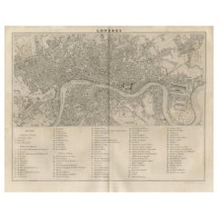
Antique Map of the City of London by Balbi '1847'
Located in Langweer, NL
Antique map titled 'London'. Original antique map of the city of London. This map originates from
Category
Antique Mid-19th Century Maps
Materials
Paper
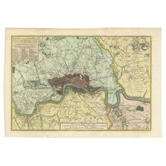
Antique Map of London by Tirion '1754'
Located in Langweer, NL
Antique map titled 'Kaart van Londen enz. en van het naby gelegen land ruim een Uur gaans rondsom
Category
Antique Mid-18th Century Maps
Materials
Paper
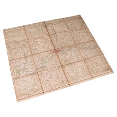
Antique Folding London Map, English, Cartography, Historic, Georgian, Dated 1783
Located in Hele, Devon, GB
This is an antique folding London map. An English, paper on linen cartographical study of the
Category
Antique Late 18th Century British Georgian Maps
Materials
Linen, Paper
H 6.3 in W 6.11 in D 0.6 in
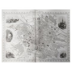
Original Antique Map / City Plan of Brussels by Tallis, circa 1850
Located in St Annes, Lancashire
Great map of Brussels.
Steel engraving.
Published by London Printing & Publishing Co
Category
Antique 1850s English Maps
Materials
Paper
No Reserve
H 13.75 in W 10.75 in D 0.07 in
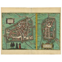
Antique Map of The Frisian Cities Leeuwarden and Franeker in Friesland, 1580
Located in Langweer, NL
Antique map titled 'Lewardum Occidentlis Frisiae Opp: 1580, Franicher Nobiliu hominum, in Frisia
Category
Antique 16th Century Maps
Materials
Paper
H 19.69 in W 15.36 in D 0 in
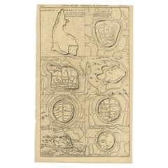
Antique Map of Cities of the Province of Che-Kiang in China, 1738
Located in Langweer, NL
Antique map titled 'Cities of the Province of Che-Kyang'. Old map depicting four walled cities of
Category
Antique 18th Century Maps
Materials
Paper
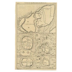
Antique Map of Cities of the Province of Che-Kyang in China, 1738
Located in Langweer, NL
Antique print China titled 'Cities of the Province of Che-Kyang'. Old map depicting four walled
Category
Antique 18th Century Maps
Materials
Paper
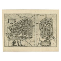
Antique Map of the City of Leeuwarden and Franeker by Braun & Hogenberg, 1580
Located in Langweer, NL
Antique map titled 'Lewardum Occidentlis Frisiae Opp: 1580, Franicher Nobiliu hominum, in Frisia
Category
Antique 16th Century Maps
Materials
Paper
H 15.56 in W 20.95 in D 0 in
Antique Map of the Cities of the Qing Dynasty Provinces in China, 1738
Located in Langweer, NL
Antique print titled 'Cities of the Province of Kyang-si, Fo-kyen, Shan-Si & Yun-nan'. Old map
Category
Antique 18th Century Maps
Materials
Paper
Antique Map of London Showing the Area from Essex to Surrey, England, 1741
Located in Langweer, NL
Antique map titled 'Regionis quae est circa Londinum specialis repraesentatio (..)'
Very detailed
Category
Antique 18th Century Maps
Materials
Paper
No Reserve
H 24.89 in W 21.11 in D 0 in
Antique Map of the Cities of the Province of Quey-Chew by Basire, 1738
Located in Langweer, NL
Antique print titled 'Cities of the Province of Quey-Chew'. Old map depicting four walled cities of
Category
Antique 18th Century Maps
Materials
Paper
Antique Map of the Cities of the Province of Shen-Si by Basire, 1738
Located in Langweer, NL
Antique print titled 'Cities of the Province of Shen-Si'. Old map depicting four walled cities of
Category
Antique 18th Century Maps
Materials
Paper
Antique Map of the Cities of the Province of Hu-Quang by Basire, 1738
Located in Langweer, NL
Antique print titled 'Cities of the Province of Hu-Quang'. Old map depicting four walled cities of
Category
Antique 18th Century Maps
Materials
Paper
Antique County Map of Derbyshire, England, 1804
Located in Langweer, NL
Antique county map of Derbyshire first published, circa 1800. Villages, towns, and cities
Category
Antique Early 1800s Maps
Materials
Paper
Antique County Map of Leicestershire, England, 1804
Located in Langweer, NL
Antique county map of Leicestershire first published c.1800. Villages, towns, and cities
Category
Antique Early 1800s Maps
Materials
Paper
Antique County Map of Monmouthshire, England, circa 1804
Located in Langweer, NL
Antique county map of Monmouthshire first published circa 1800. Villages, towns, and cities
Category
Antique Early 1800s Maps
Materials
Paper
Antique Decorative County Map of Lincolnshire, England, 1804
Located in Langweer, NL
Antique county map of Lincolnshire first published circa 1800 Cities illustrated include Grantham
Category
Antique Early 1800s Maps
Materials
Paper
Antique Decorative County Map of Huntingdonshire, England, 1804
Located in Langweer, NL
Antique county map of Huntingdonshire first published c.1800. Cities illustrated include Kimbolton
Category
Antique Early 1800s Maps
Materials
Paper
No Reserve
H 25.2 in W 21.26 in D 0 in
Antique Hand-Colored County Map of Rutland, England, 1804
Located in Langweer, NL
Antique county map of Rutland first published c.1800. Villages, towns, and cities illustrated
Category
Antique Early 1800s Maps
Materials
Paper
Antique Colourful and Decorative County Map of Bedfordshire, England, 1804
Located in Langweer, NL
Antique county map of Bedfordshire first published c.1800. Villages, towns, and cities illustrated
Category
Antique Early 1800s Maps
Materials
Paper
H 25.2 in W 21.26 in D 0 in
Antique Decorative Map of The County of Nottinghamshire, England, 1804
Located in Langweer, NL
Antique county map of Nottinghamshire first published c.1800. Villages, towns, and cities
Category
Antique Early 1800s Maps
Materials
Paper
H 25.2 in W 21.26 in D 0.02 in
Original Hand-Colored Antique County Map of Durham, England, 1804
Located in Langweer, NL
Antique county map of Durham first published c.1800. Villages, towns, and cities illustrated
Category
Antique Early 1800s Maps
Materials
Paper
No Reserve
H 21.26 in W 25.2 in D 0 in
Original Antique Map of the Road from Marlborough to Huntspil
Located in Langweer, NL
Antique map titled 'The Continuation of the Road from London to Bristol (..)'. A strip map of the
Category
Antique Late 17th Century Maps
Materials
Paper
Antique Decorative and Detailed County Map of Cumberland, England, 1804
Located in Langweer, NL
Antique county map of Cumberland first published c.1800. Villages, towns, and cities illustrated
Category
Antique Early 1800s Maps
Materials
Paper
Antique Map of Peru and Bolivia by J. Tallis, circa 1851
Located in Langweer, NL
A decorative and detailed mid-19th century map of Peru and Bolivia, South America which was drawn
Category
Antique Mid-19th Century Maps
Materials
Paper
Antique Map of Japan, the Kurile Islands and Liu Kiu Islands, 1886
Located in Langweer, NL
The map is an exquisite piece, showcasing Japan's vibrant geography. Engraved by J. Bartholomew and
Category
Antique Late 19th Century Maps
Materials
Paper
Original Hand-Colored Antique Map of the County of Hereford in England, 1804
Located in Langweer, NL
Antique county map of Herefordshire first published c.1800. Villages, towns, and cities illustrated
Category
Antique Early 19th Century Maps
Materials
Paper
H 25.2 in W 21.26 in D 0.02 in
1851 Map of "Independent Tartary", Ric. R018
Located in Norton, MA
colored antique map.
Publisher: The London Printing and Publishing Company – Limited.
(active circa 1800
Category
Antique 19th Century Unknown Maps
Materials
Paper
1859 Vintage Maps of England and Wales: Blackie's Imperial Geographic Detail
Located in Langweer, NL
The "Antique Map of England & Wales" from 'The Imperial Atlas of Modern Geography', published by W
Category
Antique Mid-19th Century Maps
Materials
Paper
H 14.57 in W 21.26 in D 0.02 in
Original Old Map Northeast India, incl Part of Himalayas and China, 1853
Located in Langweer, NL
Antique map titled 'India X'.
Old map of the the northeast region of India, including part of
Category
Antique 1850s Maps
Materials
Paper
Attractive Original Hand-Colored Map of the Swabia Region of Germany, 1799
Located in Langweer, NL
Antique map titled 'A New Map of the Circle of Swabia, from the Latest Authorities'.
Attractive
Category
Antique 1790s Maps
Materials
Paper
H 19.97 in W 23.23 in D 0 in
Antique Chart of The Spanish Coastline from Bilbao Eastwards, C.1720
Located in Langweer, NL
Antique map titled 'A Chart of the Sea Coasts Biscay and Gallicia Between Cape Machicaca and Cape
Category
Antique 18th Century Maps
Materials
Paper
London, City and West End. Antique Map City Plan Chromolithograph, circa 1895
Located in Melbourne, Victoria
'London (City Und Westend)'
Colour lithograph. 1895.
250mm by 305mm (sheet).
Late 19th century
Category
Late 19th Century Victorian More Prints
Materials
Lithograph
New France and Labrador - Graphite Drawing, Landscape, On Antiqued Map
By Don Pollack
Located in Chicago, IL
Coeur d’Alenes trail in Northern Idaho. It is a place of rugged and stark beauty barely on the old maps
Category
21st Century and Contemporary Contemporary Landscape Paintings
Materials
Canvas, Oil
Original Antique Poster Norvege Norway Midnight Sun Stavkirke Church Travel Map
Located in London, GB
, Tangiers, Germany, Moscow and Petrograd, Reykjavik, London, Vienna, Lisbon, Cairo and other cities, the
Category
Antique 1610s Norwegian Posters
Materials
Paper
H 38.98 in W 25.6 in D 0.04 in
Antique Print of London with St. Paul's Cathedral Before the Fire, ca.1725
Located in Langweer, NL
Antique print London titled 'Londres, capitale de l'Angleterre'.
Antique print of London with
Category
Antique 1720s Prints
Materials
Paper
H 12.21 in W 14.77 in D 0 in
Cambridgeshire map 17th century engraving by John Speed
By John Speed
Located in London, GB
A beautifully coloured map of Cambridgeshire, with an antique description of the county to the
Category
1610s Landscape Prints
Materials
Engraving
Cambridge map 17th century engraving after John Speed
By John Speed
Located in London, GB
Engraving
8 x 12 cm
A beautifully coloured map of Cambridgeshire, with an antique description of the county
Category
1620s Landscape Prints
Materials
Engraving
Antique Print of Amsterdam and St. Paul Island, 1753
Located in Langweer, NL
Antique print titled 'Isle d'Amsterdam, Isle St. Paul'. Two images on one sheet depicting Amsterdam
Category
Antique 18th Century Prints
Materials
Paper
Antique 2nd Edition Book, Nineveh & Its Remains Vol.1, English, Victorian, 1849
Located in Hele, Devon, GB
scope across 400 pages, including illustrations and maps
This second edition published in 1849 in London
Category
Antique Mid-19th Century British Books
Materials
Paper
H 9.06 in W 6.11 in D 1.38 in
John Pym Portret, Who Helped Establish Foundations of Parliamentary Democracy
Located in Langweer, NL
size: 22 x 36 cm.
We sell original antique maps to collectors, historians, educators and interior
Category
Antique 18th Century Prints
Materials
Paper
H 20.87 in W 14.18 in D 0 in
Pair of Philip & Son Globes, circa 1946
By George Philip & Son
Located in London, GB
, atlases and wall maps.
Bentleys are Members of LAPADA, the London and Provincial Antique Dealers
Category
Vintage 1940s British Globes
Materials
Brass
OLD MASTER OIL PAINTING High Quality 19th CENTURY Stormy Seas Gold Gilt Frame
By James Edward Meadows
Located in Ferndown, GB
. Cleaned Ready to hang.
" frame is in wonderful condition
Fine Original Antique 19th Century British OLD
Category
Mid-20th Century Realist Landscape Paintings
Materials
Oil
Section 30 - Landscape Painting, Original Oil on Canvas
By Don Pollack
Located in Chicago, IL
via bicycle following Lewis and Clark. His work has utilized maps, documents, photography, painting
Category
21st Century and Contemporary Contemporary Landscape Paintings
Materials
Canvas, Oil
Living Dangerously, Original Oil Painting, Large Scale Fictional Book Cover
By Don Pollack
Located in Chicago, IL
work has utilized maps, documents, photography, painting, and installation.This work was routed in a
Category
21st Century and Contemporary Contemporary Figurative Paintings
Materials
Canvas, Oil
Section 35
By Don Pollack
Located in Chicago, IL
via bicycle following Lewis and Clark. His work has utilized maps, documents, photography, painting
Category
21st Century and Contemporary Contemporary Landscape Paintings
Materials
Canvas, Oil
Battle For Yellowstone, Original Oil Painting of Oversized Fictional Bookcover
By Don Pollack
Located in Chicago, IL
,– such as a 3000 mile journey via bicycle following Lewis and Clark. His work has utilized maps
Category
21st Century and Contemporary Contemporary Figurative Paintings
Materials
Canvas, Oil
Silent Running
By Don Pollack
Located in Chicago, IL
via bicycle following Lewis and Clark. His work has utilized maps, documents, photography, painting
Category
21st Century and Contemporary Contemporary Figurative Paintings
Materials
Canvas, Oil
I'm Witnessing a Forest Fire-Oil Painting, Fictional Penguin Classic Book Cover
By Don Pollack
Located in Chicago, IL
bicycle following Lewis and Clark. His work has utilized maps, documents, photography, painting, and
Category
21st Century and Contemporary Contemporary Landscape Paintings
Materials
Canvas, Oil
H 31 in W 19 in D 1.5 in
Chicago Portage - Serene Wooded Landscape with Stormy Skies, Oil on Canvas
By Don Pollack
Located in Chicago, IL
Coeur d’Alenes trail in Northern Idaho. It is a place of rugged and stark beauty barely on the old maps
Category
21st Century and Contemporary Contemporary Landscape Paintings
Materials
Canvas, Oil
Dracula
By Don Pollack
Located in Chicago, IL
via bicycle following Lewis and Clark. His work has utilized maps, documents, photography, painting
Category
21st Century and Contemporary Contemporary Figurative Paintings
Materials
Canvas, Oil
Original Antique Poster Norvege Norway Midnight Sun Stavkirke Church Travel Map
Located in London, GB
, Tangiers, Germany, Moscow and Petrograd, Reykjavik, London, Vienna, Lisbon, Cairo and other cities, the
Category
Early 1900s More Prints
Materials
Paper
Washington D.C. Map, 1795
By John Russell
Located in Houston, TX
This map is based on the 1792 plan published by Andrew Ellicott. This is one of nine maps published
Category
Antique 1790s Great Britain (UK) Maps
Antique City Maps, London, gold leaf, unframed
Located in Los Angeles, CA
different city or state. We can customize any map. Printed on a gold leaf paper and framed in acrylic box
Category
2010s Contemporary More Prints
Materials
Gold Leaf
Antique City Maps, London, gold leaf, acrylic box frame
Located in Los Angeles, CA
different city or state. We can customize any map. Printed on a gold leaf paper and framed in acrylic box
Category
2010s Contemporary More Prints
Materials
Gold Leaf
Large 1812 Antique Map of London
By Langley & Belch
Located in La Jolla, CA
Scarce decorative plan of London, featuring 24 vignettes of major landmarks around the City.
One
Category
Antique 1810s English Regency Prints
London Street Map, Original on Vintage Vase by David Harper
By David Harper
Located in London, GB
London Street Map vase
Part of my vintage painted pottery and porcelain series. These pieces are
Category
2010s English Modern Vases
Materials
Porcelain
Large 8'6 Antique London Triptych Map, English, Framed, Cartography, Victorian
Located in Hele, Devon, GB
This is a large antique London triptych map. An English, framed parchment city plan, dating to the
Category
Antique Late 19th Century British Maps
Materials
Paper
H 41.54 in W 34.65 in D 1.78 in
John Senex Map of London in 1720
By John Senex
Located in London, GB
Plan of the City's of London, Westminster and Borough of Southwark, original antique map, published
Category
Antique 1720s British George II Maps
Map Plan of the City of Washington in the Territory of Columbia
Located in Colorado Springs, CO
Plan (Map) of the City of Washington in the Territory of Columbia Published 1796, in the American
Category
Antique Late 18th Century American Maps
- 1
Get Updated with New Arrivals
Save "Antique Map London City", and we’ll notify you when there are new listings in this category.
Antique Map London City For Sale on 1stDibs
At 1stDibs, there are many versions of the ideal antique map london city for your home. Frequently made of paper, wood and metal, every antique map london city was constructed with great care. There are 67 variations of the antique or vintage antique map london city you’re looking for, while we also have 1 modern editions of this piece to choose from as well. Your living room may not be complete without an antique map london city — find older editions for sale from the 18th Century and newer versions made as recently as the 21st Century. An antique map london city, designed in the Georgian, Victorian or modern style, is generally a popular piece of furniture. Many designers have produced at least one well-made antique map london city over the years, but those crafted by Charles Smith & Son, John Senex and Geographia, Ltd. are often thought to be among the most beautiful.
How Much is a Antique Map London City?
Prices for an antique map london city can differ depending upon size, time period and other attributes — at 1stDibs, they begin at $30 and can go as high as $12,500, while the average can fetch as much as $1,222.
More Ways To Browse
Big Natural Stone Mountains And Lakes
Antique Painting 16th
Utah Leather
Antique Surveying Compass
Utah Map
Map Of German
Map Of Quebec
Antique Maps Of Kansas
Antique Arkansas Maps
Nova Scotia Map
Nebraska Map
Map Of Kentucky
Map Of Washington Dc
Washington Dc Map
Antique Alabama Map
Antique Maps Kansas City
Map Of Utah
Antique Maps Washington Dc
