Antique Map Of The South Of France
to
104
253
31
130
96
91
86
59
34
30
27
27
25
18
14
12
12
12
10
9
8
8
8
7
6
5
4
4
4
3
3
3
3
2
2
2
2
2
2
2
2
1
1
1
1
1
1
1
1
1
1
1
42
42
4
4
3
Sort By
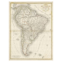
Scarce Antique Map of South America
Located in Langweer, NL
Antique map titled 'Carte de l'Amérique Méridionale'. Scarce map of South America, published in
Category
Antique Early 19th Century Maps
Materials
Paper
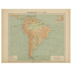
Relief Atlas Map of South America by Hachette – Antique French Map c.1883
Located in Langweer, NL
Antique Map of South America – Physical Relief Map by Hachette, c.1883
Description:
This antique
Category
Antique Late 19th Century French Maps
Materials
Paper
$463
H 10.12 in W 12.84 in D 0.01 in
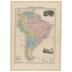
Antique Map of South America by Migeon '1880'
By J. Migeon
Located in Langweer, NL
Antique map titled 'Amérique Méridionale'. Old map of South America. With an inset map of the
Category
Antique Late 19th Century French Maps
Materials
Paper
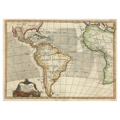
Antique Map of South American, The West Indies & Most of Africa, Ca.1775
Located in Langweer, NL
Antique map titled 'Carte pour Servir a l' Histoire Philosophique et Politique des Etablissemens et
Category
Antique 1770s Maps
Materials
Paper
$723 Sale Price
20% Off
H 15.04 in W 19.77 in D 0 in
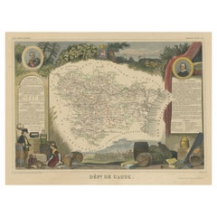
Hand Colored Antique Map of the Department of Aude, France
By Victor Levasseur
Located in Langweer, NL
Antique map titled 'Dépt. de l'Aude'. Map of the French department of Aude, France. This area of
Category
Antique Mid-19th Century Maps
Materials
Paper
$323 Sale Price
20% Off
H 14.49 in W 21.58 in D 0.02 in
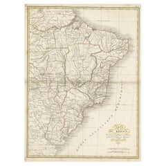
Antique Map of Brazil Extending South to the Mouth of the Rio de la Plata
Located in Langweer, NL
Antique map titled 'Carte du Brésil'. ?Beautiful map of Brazil extending south to the mouth of the
Category
Antique Early 19th Century Maps
Materials
Paper
$228 Sale Price
20% Off
H 23.31 in W 17.33 in D 0.02 in
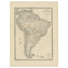
Antique Map of South America by Lapie '1842'
Located in Langweer, NL
Antique map titled 'Carte Générale de l'Amérique Meridionale'. Map of South America. This map
Category
Antique Mid-19th Century Maps
Materials
Paper
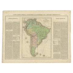
Antique Map of South America by Buchon, 1825
Located in Langweer, NL
Antique map titled 'Carte de l'Amérique méridionale'. Map of South America with attractive
Category
Antique 19th Century Maps
Materials
Paper
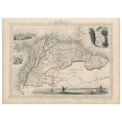
Antique Map of the Northern Part of South America by J. Tallis, circa 1851
Located in Langweer, NL
A decorative and detailed mid-19th century map of the northern part of South America (including
Category
Antique Mid-19th Century English Maps
Materials
Paper
$446
H 10.6 in W 14.41 in D 0.01 in
Antique Map of South West Germany with an Inset of Brisac or Brisach, France
Located in Langweer, NL
Antique map Germany titled 'A New and Accurate Map of the South West part of Germany. Comprehending
Category
Antique 18th Century Maps
Materials
Paper
$333
H 15.36 in W 10.24 in D 0 in
Antique Map of South America Depicting Guayana, c.1780
Located in Langweer, NL
Operations et les Cartes recentes des Ingenieurs-Geographes Francois'. Antique map of South America depicting
Category
Antique 18th Century Maps
Materials
Paper
$333 Sale Price
20% Off
H 14.77 in W 9.65 in D 0 in
Antique Map of Cayenne and Cassepouri, French Guinea, South America, c.1730
Located in Langweer, NL
Cayenne and Cassepouri, French Guinea, South America, and Martinique in the West Indies. The map of
Category
Antique 18th Century Maps
Materials
Paper
$361 Sale Price
20% Off
H 16.54 in W 13.59 in D 0 in
Map of the Alsace, France Incl the Rhine from Phillipsburg to South Basle, c1650
Located in Langweer, NL
Antique map titled 'Utriusquae Alsatiae Superioris Ac Inferioris Nova Tabula'.
Map of the
Category
Antique 1650s Maps
Materials
Paper
$342 Sale Price
20% Off
H 19.69 in W 23.23 in D 0 in
Striking Antique Map of Cayenne in French Guyana, South America, ca.1760
Located in Langweer, NL
Description: Antique map titled 'Land-kaart van het Eiland en de Volkplanting van Cayenne aan de
Category
Antique 1760s Maps
Materials
Paper
$1,284 Sale Price
20% Off
H 15.75 in W 17.6 in D 0 in
Original Antique Map of Normandy, France
Located in Langweer, NL
Antique map titled 'Carte de Normandie (..)'. Attractive map of Normandy, France. it depicts the
Category
Antique Mid-18th Century Maps
Materials
Paper
Antique Map of South America by G. Anson, 1749
Located in Langweer, NL
Antique map titled 'Kaart van het Zuidelykste Gedeelte van Zuider Amerika (..) - Carte de la Partie
Category
Antique Mid-18th Century Dutch Maps
Materials
Paper
Antique Map of the Alsace Region of France by Schenk 'circa 1700'
Located in Langweer, NL
Antique map titled 'Superioris atque Inferioris Alsatiae'. Beautiful map of the Alsace region, from
Category
Antique Early 18th Century Maps
Materials
Paper
$571 Sale Price
20% Off
H 24.41 in W 20.67 in D 0.02 in
Antique Map of the Alsace Region of France by Janssonius, c.1650
Located in Langweer, NL
Antique map titled 'Utriusquae Alsatiae Superioris Ac Inferioris Nova Tabula'. Map of the Alsace
Category
Antique 17th Century Maps
Materials
Paper
$314 Sale Price
20% Off
H 19.69 in W 23.23 in D 0 in
Decorative Antique Map of the Quercy Region in France, 1657
Located in Langweer, NL
Antique map of France titled 'Quercy olim Cadurcium'.
Decorative map of the Quercy region
Category
Antique 1650s Maps
Materials
Paper
$532 Sale Price
20% Off
H 19.69 in W 23.63 in D 0 in
Print of Maps of Islands of the South Pacific, Incl. Pitcairn & Dusky Bay, 1788
Located in Langweer, NL
Antique map titled 'Esquisse de la Bay Dusky, Dans La Nouvelle Zeelande / I. Pitcairn / Isles de
Category
Antique 1780s Maps
Materials
Paper
$418 Sale Price
20% Off
H 12.21 in W 18.31 in D 0 in
Antique Map of the Western Hemisphere by Lapie, France, circa 1830
Located in Langweer, NL
Antique Map of the Western Hemisphere by Lapie, France, circa 1830
This beautifully engraved and
Category
Antique 1830s Maps
Materials
Paper
$190
H 11.62 in W 16.42 in D 0.01 in
Antique Map of the Route of the Hebrews – Egypt to the Red Sea, 1720
Located in Langweer, NL
the map north-south.
Marked “Tome 3, N° 4” and engraved by Porlier (Porlier Sculp.), this plate was
Category
Antique Early 18th Century French Maps
Materials
Paper
$547
H 7.88 in W 11.74 in D 0.01 in
French Antique Map of Oceania with Details of the Australian Colonies, c.1840
Located in Langweer, NL
Antique map Oceania titled 'Océanie par C.V. Monin'. Old map of Oceania with an inset of New South
Category
Antique 19th Century Maps
Materials
Paper
$209 Sale Price
20% Off
H 13 in W 17.52 in D 0 in
1858 Map of South France with Corsica – Marseille to Italian Border
Located in Langweer, NL
Antique Map of Southeastern France & Corsica – Stülpnagel Engraving, 1858
Highly detailed 19th
Category
Antique Mid-19th Century German Maps
Materials
Paper
$487
H 14.77 in W 17.88 in D 0.01 in
Antique Map of the Region of Le Mans 'France' by Blaeu, circa 1640
By Willem Blaeu
Located in Langweer, NL
Antique Map: Cenomanorum Galliae regionis typus vulgo le Mans – Blaeu, circa 1640
This
Category
Antique Mid-17th Century Maps
Materials
Paper
$475 Sale Price
20% Off
H 20.08 in W 23.23 in D 0.02 in
Antique Map of French Colonies – La France, 19th Century
Located in Langweer, NL
Title: Antique Map of French Colonies – La France, 19th Century
Description: This antique 19th
Category
Antique 1870s Maps
Materials
Paper
Antique Map of Tracks of Anson's Ships around South America & Cape Horn, 1749
Located in Langweer, NL
Description: Antique map titled 'Kaart van het Zuidelykste Gedeelte van Zuider Amerika (..) - Carte
Category
Antique 1740s Maps
Materials
Paper
$618 Sale Price
20% Off
H 21.66 in W 19.69 in D 0 in
Mission of the Moxos, Peru – Antique French Jesuit Map by Portier, c.1790
Located in Langweer, NL
Mission of the Moxos, Peru – Antique French Jesuit Map by Portier, c.1790
This antique French map
Category
Antique Late 18th Century French Maps
Materials
Paper
$392
H 7.88 in W 6.38 in D 0.01 in
Antique Map of the Admiralty Islands, Bismarck Archipelago
Located in Langweer, NL
Antique map titled 'Trois Vues des Isles de l'Amirauté'. Several coastal views of the Admiralty
Category
Antique Late 18th Century Maps
Materials
Paper
$361 Sale Price
20% Off
H 11.03 in W 17.84 in D 0.02 in
Antique Map of the Region of Rethelois by Janssonius, 1657
By Johannes Janssonius
Located in Langweer, NL
Antique map of France titled 'Dioecese de Rheims et le Païs de Rethel'. Detailed map, centered on
Category
Antique Mid-17th Century Maps
Materials
Paper
$471 Sale Price
20% Off
H 19.69 in W 23.63 in D 0.02 in
Antique Map of France in Provinces, with Inset of Paris
Located in Langweer, NL
Antique map titled 'France par Provinces'. Original antique map of France in Provinces. It covers
Category
Antique Mid-19th Century Maps
Materials
Paper
$104 Sale Price
20% Off
H 9.97 in W 13.31 in D 0.02 in
Antique Map of the Amazon River – Maragnon or River of the Amazons, c.1760
Located in Langweer, NL
complement the aged paper and precise linework. This map pairs well with other 18th-century South American or
Category
Antique Mid-18th Century French Maps
Materials
Paper
$547
H 9.85 in W 15.56 in D 0.01 in
Detailed Antique Map of the Windward Islands in the Caribbean
By Covens & Mortier
Located in Langweer, NL
Antique map titled 'Carte des Antilles Francoises et des Isles Voisines'. Original antique map of
Category
Antique Early 18th Century Maps
Materials
Paper
$894 Sale Price
20% Off
H 25.6 in W 21.86 in D 0.02 in
Map of South America 1792 by Elwe – Hand-Colored Antique Dutch Engraving
By J.B. Elwe
Located in Langweer, NL
Map of South America 1792 by Elwe – Hand-Colored Antique Dutch Engraving
This striking antique map
Category
Antique Late 18th Century European Maps
Materials
Paper
$2,022
H 21.46 in W 25.6 in D 0.02 in
Map of the Western Coast of South America from Ecuador into Chili, ca.1780
Located in Langweer, NL
Antique map titled 'Carte du Perou avec une partie des pays qui en sont a l'est.'
Map of the
Category
Antique 1780s Maps
Materials
Paper
$323 Sale Price
20% Off
H 15.16 in W 10.24 in D 0 in
Antique Map of the Swabia Region of Germany by Cary, '1811'
By John Cary
Located in Langweer, NL
Antique map titled 'A New Map of the Circle of Swabia'. Antique map of Swabia in Southwestern
Category
Antique Early 19th Century Maps
Materials
Paper
$237 Sale Price
20% Off
H 21.46 in W 24.81 in D 0.02 in
Original Detailed Antique Map of the East Coast of Africa, 1747
Located in Langweer, NL
Antique map titled 'Carte de la coste Orientale d'Afrique - Kaart van de Oostkust van Afrika
Category
Antique 1740s Maps
Materials
Paper
$180 Sale Price
20% Off
H 11.89 in W 9.45 in D 0 in
Antique Map of Artois in the North of France by Famous Mapmaker Blaeu, c.1640
Located in Langweer, NL
Antique map titled 'Artesia Comitatus Artois'. Map of Artois or Artesia, France. Artois is former
Category
Antique 17th Century Maps
Materials
Paper
$456 Sale Price
20% Off
H 19.69 in W 23.43 in D 0 in
Antique Map of the Bay of Terney by La Pérouse, 1797
Located in Langweer, NL
Antique map titled 'Plan de la Baie de Ternai'. Old map of the north eastern coast of Russia. This
Category
Antique 18th Century Maps
Materials
Paper
$145 Sale Price
20% Off
H 20.28 in W 13.78 in D 0 in
Antique Map the Windward or South Caribbean Islands and Guiana, 1859
Located in Langweer, NL
Antique map titled 'The Windward or South Caribbean Islands'. Original antique map of South
Category
Antique Mid-19th Century Maps
Materials
Paper
$247 Sale Price
20% Off
H 14.57 in W 21.26 in D 0.02 in
Antique Map of Egypt with Detailed Inset of the Nile Delta, ca. 1799
Located in Langweer, NL
Antique Map of Egypt with Detailed Inset of the Nile Delta, ca. 1799
This finely engraved antique
Category
Antique Early 1800s French Maps
Materials
Paper
$547
H 20.56 in W 25.6 in D 0.01 in
Antique Map of French Guiana and Cayenne – Circa 1835
Located in Langweer, NL
Antique Map of French Guiana and Cayenne – Circa 1835
This rare 19th-century map of French
Category
Antique 1830s Maps
Materials
Paper
Antique Map of the Coast of Peru and Chile – Detailing Ports & Coastlines, c1760
Located in Langweer, NL
Map of the Coast of Peru and Chile – “Côte du Pérou et Côte du Chili”, c.1760
This 18th-century
Category
Antique Late 18th Century French Maps
Materials
Paper
$547
H 12.05 in W 7.88 in D 0.01 in
Antique Map of the Pacific Ocean by Renneville, 1702
Located in Langweer, NL
Antique map, untitled. A map of the Pacific Ocean, with the coast of Peru in the right edge and the
Category
Antique 18th Century Maps
Materials
Paper
Striking Large Format Antique Map of Southeastern France, 1799
Located in Langweer, NL
Antique map titled 'The South Eastern Part of France which includes Roussillon-Languedoc, with a
Category
Antique 1790s Maps
Materials
Paper
$618 Sale Price
20% Off
H 23 in W 32.56 in D 0 in
Antique Map of Aude ‘France’ by V. Levasseur, 1854
By Victor Levasseur
Located in Langweer, NL
Antique map titled 'Dépt. de 'l'Aude'. Map of the French department of Aude, France. This area of
Category
Antique Mid-19th Century Maps
Materials
Paper
$171 Sale Price
20% Off
H 13.98 in W 20.67 in D 0.02 in
Dutch Antique Map of the West Coast of Africa, to the Cape of Good Hope, 1747
Located in Langweer, NL
Antique map of the Coast of Africa titled 'Kaart van de West Kust van Afrika (..)'.
Map of the
Category
Antique 1740s Maps
Materials
Paper
$371 Sale Price
20% Off
H 10.63 in W 12.6 in D 0 in
Antique Map of the Region of Artois by Covens & Mortier, c.1730
By Covens & Mortier
Located in Langweer, NL
Antique map titled 'Carte d'Artois et des environs'. Large map of the region of Artois, France
Category
Antique 18th Century Maps
Materials
Paper
$314 Sale Price
20% Off
H 20.87 in W 24.81 in D 0 in
Antique Map of North and South America by Pierre Antoine Tardieu (1784-1869)
Located in Langweer, NL
This is an original antique map titled "Carte Générale et Politique de l'Amérique," depicting the
Category
Antique Early 1800s Maps
Materials
Paper
$494 Sale Price
20% Off
H 16.34 in W 22.25 in D 0.01 in
Detailed Decorative Antique Map of the Coast of Malabar and Coromandel, India
Located in Langweer, NL
Antique map titled 'Carte des Côtes de Malabar et de Coromandel'. Finely engraved map of the
Category
Antique Mid-18th Century Maps
Materials
Paper
$1,142 Sale Price
20% Off
H 21.07 in W 25.2 in D 0.02 in
Original Antique Map of the Route of M. Zurabek – Caspian Sea to Isfahan, 1722
Located in Langweer, NL
Original Antique Map of the Route of M. Zurabek – Caspian Sea to Isfahan, 1722
This 18th-century
Category
Antique Early 18th Century French Maps
Materials
Paper
$428
H 7.88 in W 9.26 in D 0.01 in
Antique Map of Saldanha Bay 'Near Cape Town, South Africa' by Bellin, 1750
By Jacques-Nicolas Bellin
Located in Langweer, NL
Antique map titled ‘Carte De La Baye De Saldana ou Saldane Dressee sur les Remarques des
Category
Antique 18th Century Maps
Materials
Paper
$309
H 8.86 in W 11.42 in D 0.01 in
Antique Map of Cities in the Region of Hubei in China, 1758
Located in Langweer, NL
Antique map titled 'Plans de Quelques villes de la province de Hou-Quang.' Three plans of cities in
Category
Antique 18th Century Maps
Materials
Paper
$304 Sale Price
20% Off
H 9.38 in W 13.35 in D 0 in
Bonne Map of Philippines, Formosa, Siam, Indochina & South China, 1780
Located in Langweer, NL
Bonne Map of Philippines, Formosa, Siam, Indochina & South China, 1780
Les Isles Philippines
Category
Antique 1780s Maps
Materials
Paper
$275 Sale Price
20% Off
H 10.24 in W 14.57 in D 0.01 in
Large Antique Sea Chart of the South-Eastern Coast of Sumatra, Indonesia
Located in Langweer, NL
Antique map titled 'Carte pour aller du Détroit de la Sonde ou de Batavia, au Détroit de Banca
Category
Antique Late 18th Century Maps
Materials
Paper
$447 Sale Price
20% Off
H 30.2 in W 20.87 in D 0.02 in
Antique Map of the Rethelois or Rethel Region in France by Janssonius, ca.1650
By Johannes Janssonius
Located in Langweer, NL
Antique map of France titled 'Dioecese de Rheims et le Païs de Rethel'.
Detailed map, centered
Category
Antique 17th Century Maps
Materials
Paper
$333 Sale Price
20% Off
H 19.69 in W 22.64 in D 0 in
Decorative Antique Map of Central Asia
Located in Langweer, NL
Antique map titled 'Carte de la Tartarie Indépendante (..)'. Decorative map of Central Asia
Category
Antique Late 18th Century Maps
Materials
Paper
Original Copperplate Engraved Detailed Map of South Africa, ca.1680
Located in Langweer, NL
Antique map titled 'Pays et Coste des Caffres Empires de Monomotapa (..)'.
Detailed map of
Category
Antique 1680s Maps
Materials
Paper
$342 Sale Price
20% Off
H 9.65 in W 14.57 in D 0 in
- 1
Get Updated with New Arrivals
Save "Antique Map Of The South Of France", and we’ll notify you when there are new listings in this category.
Antique Map Of The South Of France For Sale on 1stDibs
Choose from an assortment of styles, material and more with respect to the antique map of the south of France you’re looking for at 1stDibs. Each antique map of the south of France for sale was constructed with extraordinary care, often using paper, fabric and wood. You’ve searched high and low for the perfect antique map of the south of France — we have versions that date back to the 18th Century alongside those produced as recently as the 20th Century are available. An antique map of the south of France made by Victorian designers — as well as those associated with Art Deco — is very popular. Many designers have produced at least one well-made antique map of the south of France over the years, but those crafted by Johannes Janssonius, Victor Levasseur and Covens & Mortier are often thought to be among the most beautiful.
How Much is a Antique Map Of The South Of France?
The average selling price for an antique map of the south of France at 1stDibs is $684, while they’re typically $39 on the low end and $14,750 for the highest priced.
More Ways To Browse
Antique Surveying Compass
German Kugel
Gold Grenade
Antique Paper Mache Dog
Antique Piggy Bank Pigs
Antique Porcelain Spittoon
Antique Prussia Bowl
Antique Santo Nino
Antique Scottish Flask
Antique Shaker Bucket
Antique Shuttlecock
Antique Silver Plated Elkington Tray
Antique Silver Posy Holder
Antique Silver Tilting Water Pitcher
Antique Silver Wager Cup
Antique Smelting Pots
Antique Spiegel Furniture
Antique Statue Art Nouveau Spelter
