Antique Map Ortelius

to
24
62
21
82
40
38
25
8
4
2
2
1
1
1
1
1
23
1
1
Sort By
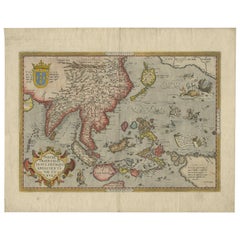
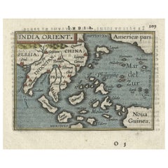
1601 Miniature Map of Southeast Asia & Nova Guinea by Ortelius, Vrients Edition
Located in Langweer, NL
This miniature map of the East Indies and Nova Guinea was created by Abraham Ortelius and published
Category

Early 1600s Antique Map Ortelius

Materials

Paper

Antique Map of Southeast Asia by Ortelius '1587'
By Abraham Ortelius
Located in Langweer, NL
Antique map titled 'Indiae Orientalis Insularumque Adiacientium Typus'. Ortelius includes early
Category

16th Century Antique Map Ortelius

Materials

Paper

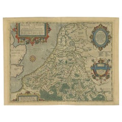
Antique Map of the Low Countries by Ortelius, 1584
By Abraham Ortelius
Located in Langweer, NL
English Channel and part of Britain. This map originates from Ortelius' 'Theatrum Orbis Terrarum
Category

16th Century Antique Map Ortelius

Materials

Paper

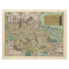
1584 Ortelius Map of Switzerland: A Cartographic Reversal
Located in Langweer, NL
This is a fine example of Ortelius' map of Switzerland from his *Theatrum Orbis Terrarum
Category

16th Century Antique Map Ortelius

Materials

Paper

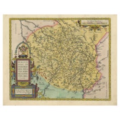
1584 Abraham Ortelius Map of Lower Burgundy, France
Located in Langweer, NL
1584 Abraham Ortelius Map of Lower Burgundy, France Description of the Map: This antique map by
Category

16th Century Antique Map Ortelius

Materials

Paper

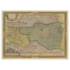
Antique Map of Austria by Ortelius, c.1612
Located in Langweer, NL
and most frequently collected of all sixteenth-century mapmakers. Ortelius started his career as a map
Category

17th Century Antique Map Ortelius

Materials

Paper

Antique Map of Austria by Ortelius, c.1612
H 18.71 in W 22.84 in D 0 in
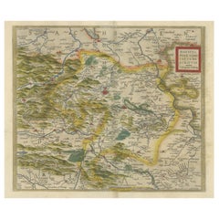
Antique Map of the Region of Mansfeld, Saxony-Anhalt, Germany
By Abraham Ortelius
Located in Langweer, NL
Antique map titled 'Mansfeldiae Comitatus Descriptio'. Original antique map of the region of
Category

Early 17th Century Antique Map Ortelius

Materials

Paper

Antique Map of North Africa by Ortelius, c.1600
Located in Langweer, NL
coast of Africa. This map originates from 'Theatrum Orbis Terrarum' by A. Ortelius. Artists and
Category

17th Century Antique Map Ortelius

Materials

Paper

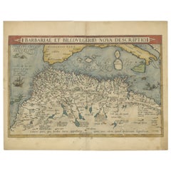
Antique Map of North Africa by Ortelius, c.1580
Located in Langweer, NL
Antique map titled 'Barbariae et Biledulgerid Nova Descriptio'. Original antique map of North
Category

16th Century Antique Map Ortelius

Materials

Paper

Antique Miniature Map of the Roman Province of Illyricum 'Dalmatia'
By Abraham Ortelius
Located in Langweer, NL
Antique miniature map titled 'Illyricum'. Original small map of Illyricum. The Roman province of
Category

Early 17th Century Antique Map Ortelius

Materials

Paper

Antique Map of East Frisia by Ortelius, c.1595
Located in Langweer, NL
different languages. Beside the Theatrum, Ortelius compiled a series of historical maps and published it in
Category

16th Century Antique Map Ortelius

Materials

Paper

Coloured Antique Map of Sicily, Sardinia, Corfu, Elba, Malta and Zerbi (Jerba)
By Abraham Ortelius
Located in Langweer, NL
Ortelius' map combining, on one page, maps of the islands of Sicily, Sardinia, Corfu, Elba, Malta and Zerbi
Category

16th Century Antique Map Ortelius

Materials

Paper

Exquisite 1580 Ortelius Map of the Narbonne Coastal Region, France
Located in Langweer, NL
"Exquisite 1580 Ortelius Map of the Narbonne Coastal Region, France" Description of the Map: This
Category

16th Century Antique Map Ortelius

Materials

Paper

Exquisite 1600 Ortelius Map of Artois, France: A Collector’s Piece
Located in Langweer, NL
Exquisite 1600 Ortelius Map of Artois, France: A Collector’s Piece with Rich Historical Detail
Category

Early 1600s Antique Map Ortelius

Materials

Paper

1592 Abraham Ortelius Map "Lorraine: Lotharingiae Nova Descripti, Ric.A005
Located in Norton, MA
1592 Abraham Ortelius map entitled "Lorraine: Lotharingiae Nova Descripti Ric.a005
Category

16th Century Dutch Antique Map Ortelius

Materials

Paper

Antique Map of Greece from Ortelius's Theatrum Orbis Terrarum, 1595
Located in Langweer, NL
and Argos. Own a piece of history with this exquisite 1595 Ortelius map of ancient Greece, 'Graecia
Category

16th Century Antique Map Ortelius

Materials

Paper

Antique Map of the Region of Salzburg by Ortelius 'circa 1606'
Located in Langweer, NL
Antique map titled 'Salisburgensis Iurisdictionis'. Original antique map of the region of Salzburg
Category

Early 17th Century Antique Map Ortelius

Materials

Paper

Antique Map of the Region of Poitou by Ortelius, circa 1600
Located in Langweer, NL
Antique map titled 'Poictou'. Original antique map of the region of Poitou, a former province of
Category

Early 17th Century Antique Map Ortelius

Materials

Paper

1597 Abraham Ortelius Map Burgundy, France Entitled "Bvrgvndiae dvcatvs Ric.a010
Located in Norton, MA
1597 Abraham Ortelius map of Burgundy, France entitled "Bvrgvndiae dvcatvs Ric.a010
Category

16th Century Dutch Antique Map Ortelius

Materials

Paper

Austria by Wolfgang Lazius – A Magnificent 16th-Century Map from Ortelius
Located in Langweer, NL
published in Abraham Ortelius’ Theatrum Orbis Terrarum, the first modern atlas, this map presents a highly
Category

16th Century Antique Map Ortelius

Materials

Paper

Thraciae Veteris Typus – 1618 Ortelius Map of Ancient Thrace with Hand Color
Located in Langweer, NL
Thraciae Veteris Typus – 1618 Ortelius Map of Ancient Thrace with Hand Color This striking early
Category

Early 1600s Antique Map Ortelius

Materials

Paper

Antique Map of the Artois Region of France by Ortelius, 'circa 1590'
Located in Langweer, NL
Antique map titled 'Artesia'. Original antique map of the Artois region, France. Published by A
Category

16th Century Antique Map Ortelius

Materials

Paper

1590 Ortelius Map of Calais and Vermandois, France and Vicinity Ric.a014
Located in Norton, MA
1590 Ortelius map of Calais and Vermandois, France and Vicinity Ric.a014 Two rare regional
Category

16th Century Dutch Antique Map Ortelius

Materials

Paper

Antique Map of the Picardy Region of France by Ortelius, 'circa 1590'
Located in Langweer, NL
Antique map titled 'Picardiae Belgicae regionis descriptio'. Original antique map of the Picardy
Category

16th Century Antique Map Ortelius

Materials

Paper

Antique Map of the Region of Verona 'Italy' by Ortelius, circa 1584
Located in Langweer, NL
Antique map titled 'Veronae Urbis Terratorium'. Original antique map of the Verona region, Italy
Category

Late 19th Century Antique Map Ortelius

Materials

Paper

1573 Ortelius Map: First to Name California, Spanning Tartary to North America
Located in Langweer, NL
"1573 Abraham Ortelius Map of Tartary, Japan, and Western North America" Description of the Map
Category

16th Century Antique Map Ortelius

Materials

Paper

Antique Map of Friesland, Groningen and German East Friesland by Ortelius, 1603
Located in Langweer, NL
Antique map titled 'Oost end West Vrieslandts beschrijvinghe. Utriusque Frisiorum Regionis Noviss
Category

17th Century Antique Map Ortelius

Materials

Paper

Antique Map of Friesland with Elaborate Cartouche by Mapmaker Ortelius, c.1570
Located in Langweer, NL
Antique map titled 'Oost end West Vrieslandts beschrijvinghe. Utriusque Frisiorum Regionis Noviss
Category

16th Century Antique Map Ortelius

Materials

Paper

Antique Map of Denmark and Oldenburg ‘Germany’ by A. Ortelius, circa 1598
Located in Langweer, NL
Antique map titled 'Daniae Regni Typus' and 'Oldenburg Comit'. A nice example of Ortelius maps of
Category

16th Century Antique Map Ortelius

Materials

Paper

Antique Map of the Region of Calais and The Vermandois Region by Ortelius
Located in Langweer, NL
detailed regional maps by Ortelius. The first map shows Belgian and French Coastal region, from Estaples to
Category

17th Century Antique Map Ortelius

Materials

Paper

Map of the Region of Basel and Northern Switzerland by Ortelius, circa 1603
Located in Langweer, NL
Two original antique maps on one sheet titled 'Basiliensis Territorii Descriptio Nova [with
Category

Early 17th Century Antique Map Ortelius

Materials

Paper

1612 Abraham Ortelius, Entitled "Lorraine, Lotharingiae, Nova Desciptio, " Ric008
Located in Norton, MA
Description: Artists and Engravers: Ortelius is the best known for producing the atlas from which this map
Category

17th Century Dutch Antique Map Ortelius

Materials

Paper

Original Antique Miniature Map of Persia, Published, ca.1601
Located in Langweer, NL
a name for a collection of maps, it is Ortelius who is remembered as the creator of the first modern
Category

Early 1600s Antique Map Ortelius

Materials

Paper

Northern Italy: A 16th Century Hand-colored Map by Abraham Ortelius
By Abraham Ortelius
Located in Alamo, CA
of the world in 1564. Ortelius also published a map of Egypt in 1565, a map of the Holy Land, a plan
Category

16th Century Old Masters Antique Map Ortelius

Materials

Engraving

17th Century Framed Map of Ancient France Titled "Typus Galliae Veteris"
Located in Dallas, TX
renowned 16th-century cartographer Abraham Ortelius, this map was later published by Guillaume Blaeu, one
Category

17th Century Dutch Baroque Antique Map Ortelius

Materials

Glass, Giltwood, Paper

Original Antique Map of the Region of Picardy, France, ca.1602
Located in Langweer, NL
the word "Atlas" as a name for a collection of maps, it is Ortelius who is remembered as the creator
Category

Early 1600s Antique Map Ortelius

Materials

Paper

Antique Map of the Namen or Namur Region in Wallonia, Belgium
Located in Langweer, NL
first used the word "Atlas" as a name for a collection of maps, it is Ortelius who is remembered as the
Category

1610s Antique Map Ortelius

Materials

Paper

Original Old Map of Northeastern Greece & Northwestern Turkey, Published in 1661
Located in Langweer, NL
This small map was engraved by Petrus Kaerius and is based on Ortelius' map of the same title. It
Category

1660s Antique Map Ortelius

Materials

Paper

Decorative Original Antique Map of Valencia in Southern Spain, circa 1601
Located in Langweer, NL
and the aesthetic qualities of Ortelius's work. Antique maps like this are not only valuable for their
Category

Early 17th Century Antique Map Ortelius

Materials

Paper

Antique Map of Romania and Bulgaria Centered on the Danube River
Located in Langweer, NL
Romania and Bulgaria centered on the Danube River. The map is based on Ortelius' map of the region which
Category

Mid-17th Century Antique Map Ortelius

Materials

Paper

Old Antique Map of the Province of Friesland, the Netherlands, c.1580
Located in Langweer, NL
map. Based on a manuscript map made by Sibrandus Leonis (Leo Sybrands). First state map by Ortelius
Category

16th Century Antique Map Ortelius

Materials

Paper

Superb Antique Map of the Province of Gelderland, the Netherlands, ca.1575
Located in Langweer, NL
. Auctore'. This superb map is Ortelius' first plate covering Gelderland. It is based on Christiaan
Category

16th Century Antique Map Ortelius

Materials

Paper

Antique Map of the Region Around the Nile and the City of Carthage
Located in Langweer, NL
detailed regional maps by Ortelius. One map shows the region around the Nile, as far as Aswan. The other
Category

16th Century Antique Map Ortelius

Materials

Paper

16th-Century Map of the Ottoman Empire and Near East: Turcici Imperii Descriptio
Located in Langweer, NL
* by Ortelius, 1571 This rare copperplate engraving, Turcici Imperii Descriptio, is an original map
Category

16th Century Antique Map Ortelius

Materials

Paper

Very Old Original Hand-Colored Map of the Basel Region, Switzerland, Ca.1578
Located in Langweer, NL
Antique print titled 'Basiliensis territorii descriptio nova'. Old map of the Basel region
Category

16th Century Antique Map Ortelius

Materials

Paper

Original Rare Antique Map of the Ancient German Empire in Northern Europe, c1650
Located in Langweer, NL
Europe, based upon an earlier map by Ortelius. Extends from the Adriatic to the Baltic and the Vistula
Category

1650s Antique Map Ortelius

Materials

Paper

Old Map of Ancient Times covering Egypt Towards Arabia and India to Java, c.1660
Located in Langweer, NL
in antiquity. Composed by Jan Jansson after a similar 1597 map published by A. Ortelius in his
Category

1660s Antique Map Ortelius

Materials

Paper

The 1564 Medici Danti Map of California
By Fra Egnazio Danti
Located in New York, NY
Ulloa and Juan Rodriguez Cabrillo and recorded in printed maps by Mercator, Ortelius, and Battista
Category

17th Century Old Masters Antique Map Ortelius

Materials

Canvas, Paper, Ink, Watercolor, Gouache, Pen

1573 Hand-Colored Ortelius Map of the Americas
By Abraham Ortelius
Located in La Jolla, CA
. An attractive example of this early state of Ortelius' first map of America, first published in 1570
Category

16th Century Belgian Northern Renaissance Antique Map Ortelius

Materials

Paper

Luxembourg Map
By Abraham Ortelius
Located in Houston, TX
, 1595. The Duchy of Luxembourg, lying between the Rivers Meuse and Moselle, is presented in this map
Category

Early 1600s Dutch Antique Map Ortelius

Luxembourg Map
H 19.32 in W 14.44 in D 0.01 in
Venice and Padua Map
By Abraham Ortelius
Located in Houston, TX
Patavini Territorii Corographia, Iac. Castaldo Avct. (A map of the fields of Treviso by Giovanni
Category

Early 1600s Dutch Antique Map Ortelius

Venice and Padua Map
H 14.75 in W 19.25 in D 0.01 in
"Terra Sancta" Map of the Holy Land by Abraham Ortelius (1527-1598) Framed
By Abraham Ortelius
Located in San Francisco, CA
Abraham Ortelius (1527-1598) was a cartographer, geographer and map maker from Antwerp in the
Category

17th Century Belgian Baroque Antique Map Ortelius

Materials

Paper

Map of Ireland Titled "Hiberniae Britannicae Insulae Nova Descriptio Irland"
By Abraham Ortelius
Located in San Francisco, CA
Abraham Ortelius (1527-1598) was a cartographer, geographer and maker from Antwerp in the Spanish
Category

Early 18th Century Belgian Antique Map Ortelius

Materials

Paper

Antique Map of Austria and Hungary by Ortelius, c.1590
Located in Langweer, NL
Antique map titled 'Austriae ducatus chorographia, Wolfgango Lazio auctore'. Decorative regional
Category

16th Century Antique Map Ortelius

Materials

Paper

Gades Map (Map of Cadiz) - Original Etching by Abraham Ortelius - 1584
By Abraham Ortelius
Located in Roma, IT
Gades Map (Map of Cadiz) is an original Artwork realized in 1584 by Abraham Ortelius (also Ortels
Category

16th Century Old Masters Antique Map Ortelius

Materials

Etching

Aegypti Map - Original Etching by Abraham Ortelius - 1584
By Abraham Ortelius
Located in Roma, IT
Aegypti Map (Map of Egypt) is an original Artwork realized in 1584 by Abraham Ortelius (also Ortels
Category

16th Century Old Masters Antique Map Ortelius

Materials

Watercolor, Etching

Antique Map of Greece by G. Magini, 1597
Located in Langweer, NL
Magini's map of Greece, based upon Ortelius' map of 1570. This rare map originates from the 1597
Category

16th Century Antique Map Ortelius

Materials

Paper

Antique Map of Greece by G. Magini, 1597
H 5.99 in W 8.08 in D 0.02 in
Map of the Americas by Abraham Ortelius, 16th Century Framed Original Engraving
By Abraham Ortelius
Located in CHARLESTON, SC
Abraham Ortelius (hand colored later) Ortelius' map of the Americas is the most recognized and
Category

16th Century American Antique Map Ortelius

Materials

Paper

Florida and Virginia: A 17th Century Hand-colored Map by Hondius after Mercator
By Gerard Mercator
Located in Alamo, CA
much more of a scientist and academic than Ortelius and his maps reflected his more meticulous approach
Category

Early 17th Century Dutch Antique Map Ortelius

Materials

Paper

Abraham Ortelius (1527-1598) - 17th Century Engraving, Map of the Holy Land
By Abraham Ortelius
Located in Corsham, GB
An early 17th or late 16th century map showing the land of Canaan with an inset map depicting the
Category

18th Century Antique Map Ortelius

Materials

Engraving

  • 1
Get Updated with New Arrivals
Save "Antique Map Ortelius", and we’ll notify you when there are new listings in this category.

Antique Map Ortelius For Sale on 1stDibs

With a vast inventory of beautiful furniture at 1stDibs, we’ve got just the antique map ortelius you’re looking for. Frequently made of paper, every antique map ortelius was constructed with great care. You’ve searched high and low for the perfect antique map ortelius — we have versions that date back to the 18th Century alongside those produced as recently as the 19th Century are available. A well-made antique map ortelius has long been a part of the offerings for many furniture designers and manufacturers, but those produced by Abraham Ortelius are consistently popular.

How Much is a Antique Map Ortelius?

An antique map ortelius can differ in price owing to various characteristics — the average selling price 1stDibs is $703, while the lowest priced sells for $192 and the highest can go for as much as $3,523.

Read More

Medal-Worthy Memorabilia from Epic Past Olympic Games

Get into the games! These items celebrate the events, athletes, host countries and sporting spirit.

Ahoy! You’ve Never Seen a Collection of Sailor Art and Kitsch Quite Like This

French trendsetter and serial collector Daniel Rozensztroch tells us about his obsession with objects related to seafaring men.

39 Incredible Swimming Pools

It's hard to resist the allure of a beautiful pool. So, go ahead and daydream about whiling away your summer in paradise.

Pamela Shamshiri Shares the Secrets behind Her First-Ever Book and Its Effortlessly Cool Interiors

The sought-after designer worked with the team at Hoffman Creative to produce a monograph that beautifully showcases some of Studio Shamshiri's most inspiring projects.

Moroccan Artworks and Objects Take Center Stage in an Extraordinary Villa in Tangier

Italian writer and collector Umberto Pasti opens the doors to his remarkable cave of wonders in North Africa.

Montecito Has Drawn Royalty and Celebrities, and These Homes Are Proof of Its Allure

Hollywood A-listers, ex-pat aristocrats and art collectors and style setters of all stripes appreciate the allure of the coastal California hamlet — much on our minds after recent winter floods.

Whaam! Blam! Pow! — a New Book on Pop Art Packs a Punch

Publishing house Assouline and writer Julie Belcove have teamed up to trace the history of the genre, from Roy Lichtenstein, Andy Warhol and Yayoi Kusama to Mickalene Thomas and Jeff Koons.
The Sparkling Legacy of Tiffany & Co. Explained, One Jewel at a Time

A gorgeous new book celebrates — and memorializes — the iconic jeweler’s rich heritage.