Large 19th Century Maps
8
to
86
347
177
392
112
97
86
75
69
26
25
20
18
16
15
13
10
10
9
9
8
8
6
5
4
4
3
3
3
2
2
2
2
2
2
2
2
1
1
1
1
1
1
1
1
42
42
15
4
3
Sort By
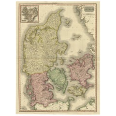
19th Century Large Original Antique Map of Denmark by J. Pinkerton, 1812
By Pinkerton
Located in Langweer, NL
Highly detailed map of Denmark. One of the best large format English atlas maps of the period
Category
Antique Early 19th Century Maps
Materials
Paper
Free Shipping
H 28.75 in W 21.26 in D 0.02 in
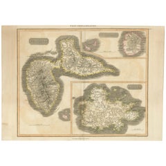
Large Antique Map of Guadeloupe and Antigua with Adjacent Isles, 19th Century
Located in Langweer, NL
Title: "Antique Map of Guadeloupe and Antigua with Adjacent Isles, 19th Century"
Source: New
Category
Antique Early 19th Century Maps
Materials
Paper
No Reserve
H 21.07 in W 29.34 in D 0 in
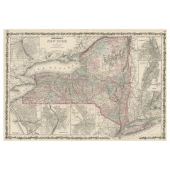
Large Antique Map of New York State with Inset Maps
Located in Langweer, NL
Antique map titled 'Johnson's New York' Large map of New York State. With insets of Albany, Oswego
Category
Antique Mid-19th Century Maps
Materials
Paper
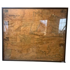
Framed Mid-19th Century Wall Map of Long Island, the Hamptons
Located in Sag Harbor, NY
A Framed museum quality find. This large wall map dates to the mid-1800s. Detailed inset maps of
Category
Antique Mid-19th Century American Maps
Materials
Linen, Paper
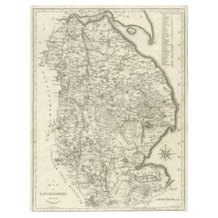
Large Antique County Map of Lincolnshire, England
Located in Langweer, NL
Antique map titled 'A Map of Lincolnshire from the best Authorities'. Original old county map of
Category
Antique Early 19th Century Maps
Materials
Paper
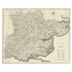
Large Antique County Map of Essex, England
Located in Langweer, NL
Antique map titled 'A Map of Essex from the best Authorities'. Original old county map of Essex
Category
Antique Early 19th Century Maps
Materials
Paper
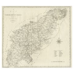
Large Antique County Map of Northamptonshire, England
Located in Langweer, NL
Antique map titled 'A Map of Northamptonshire from the best Authorities'. Original old county map
Category
Antique Early 19th Century Maps
Materials
Paper
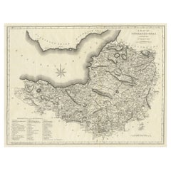
Large Antique County Map of Somersetshire, England
Located in Langweer, NL
Antique map titled 'A Map of Somersetshire from the best Authorities'. Original old county map of
Category
Antique Early 19th Century Maps
Materials
Paper
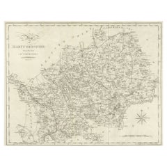
Large Antique County Map of Hertfordshire, England
Located in Langweer, NL
Antique map titled 'A Map of Hartfordshire from the best Authorities'. Original old county map of
Category
Antique Early 19th Century Maps
Materials
Paper
Large Antique County Map of Ruthlandshire, England
Located in Langweer, NL
Antique map titled 'A Map of Ruthlandshire from the best Authorities'. Original old county map of
Category
Antique Early 19th Century Maps
Materials
Paper
Large Antique County Map of Norfolk, England
Located in Langweer, NL
Antique map titled 'A Map of Norfolk from the best Authorities'. Original old county map of Norfolk
Category
Antique Early 19th Century Maps
Materials
Paper
Large Antique County Map of Middlesex, England
Located in Langweer, NL
Antique map titled 'A Map of Middlesex from the best Authorities'. Original old county map of
Category
Antique Early 19th Century Maps
Materials
Paper
Large Antique County Map of Huntingdonshire, England
Located in Langweer, NL
Antique map titled 'A Map of Huntingdonshire from the best Authorities'. Original old county map of
Category
Antique Early 19th Century Maps
Materials
Paper
Large Antique Map of England and Wales
Located in Langweer, NL
Antique map titled 'An Accurate Map of England and Wales'. Original old map of England and Wales
Category
Antique Early 19th Century Maps
Materials
Paper
Large Antique County Map of Cambridgeshire, England
Located in Langweer, NL
Antique map titled 'A Map of Cambridgeshire from the best Authorities'. Original old county map of
Category
Antique Early 19th Century Maps
Materials
Paper
Large Antique County Map of Nottinghamshire, England
Located in Langweer, NL
Antique map titled 'A Map of Nottinghamshire from the best Authorities'. Original old county map of
Category
Antique Early 19th Century Maps
Materials
Paper
Large Antique County Map of Suffolk, England
Located in Langweer, NL
Antique map titled 'A Map of Suffolk from the best Authorities'. Original old county map of Suffolk
Category
Antique Early 19th Century Maps
Materials
Paper
Large Antique County Map of Surrey, England
Located in Langweer, NL
Antique map titled 'A Map of Surry from the best Authorities'. Original old county map of Surrey
Category
Antique Early 19th Century Maps
Materials
Paper
Large Antique County Map of Westmorland, England
Located in Langweer, NL
Antique map titled 'A Map of Westmoreland from the best Authorities'. Original old county map of
Category
Antique Early 19th Century Maps
Materials
Paper
Large Antique County Map of Buckinghamshire, England
Located in Langweer, NL
Antique map titled 'A Map of Buckinghamshire from the best Authorities'. Original old county map of
Category
Antique Early 19th Century Maps
Materials
Paper
Large Antique County Map of Worcestershire, England
Located in Langweer, NL
Antique map titled 'A Map of Worcestershire from the best Authorities'. Original old county map of
Category
Antique Early 19th Century Maps
Materials
Paper
Large Antique County Map of Northumberland, England
Located in Langweer, NL
Antique map titled 'A Map of Northumberland from the best Authorities'. Original old county map of
Category
Antique Early 19th Century Maps
Materials
Paper
Large Antique County Map of Derbyshire, England
Located in Langweer, NL
Antique map titled 'A Map of Derbyshire from the best Authorities'. Original old county map of
Category
Antique Early 19th Century Maps
Materials
Paper
Large Antique County Map of Warwickshire, England
Located in Langweer, NL
Antique map titled 'A Map of Warwickshire from the best Authorities'. Original old county map of
Category
Antique Early 19th Century Maps
Materials
Paper
Large Antique County Map of Cumberland, England
Located in Langweer, NL
Antique map titled 'A Map of Cumberland from the best Authorities'. Original old county map of
Category
Antique Early 19th Century Maps
Materials
Paper
Large Antique County Map of Durham, England
Located in Langweer, NL
Antique map titled 'A Map of Durham from the best Authorities'. Original old county map of Durham
Category
Antique Early 19th Century Maps
Materials
Paper
1832 Large Map "Russian & Poland" Ric. R0012
Located in Norton, MA
Large map 1832
"Russian & Poland"
Ric.r0012
Russia & Poland, by J. Arrowsmith. London, pubd
Category
Antique 19th Century Unknown Maps
Materials
Paper
Large Antique 1859 Map of North America
Located in Sag Harbor, NY
This Map was made by Augustus Mitchell in 1859 It is in amazing condition for being 163 years old
Category
Antique Mid-19th Century American Maps
Materials
Canvas, Paper
Large Antique Map of the Asian Continent, 1814
Located in Langweer, NL
Antique map titled 'Asia'. Large antique map of the Asian continent. Drawn under the direction of
Category
Antique 19th Century Maps
Materials
Paper
Large Antique County Map of Leicestershire, England, 1805
Located in Langweer, NL
Explore Leicestershire's Past: Antique Map by John Cary
Step into the history of Leicestershire
Category
Antique Early 19th Century Maps
Materials
Paper
Large Antique County Map of North Wales, England
Located in Langweer, NL
Antique map titled 'A Map of North Wales from the best Authorities'. Original old county map of
Category
Antique Early 19th Century Maps
Materials
Paper
Large Antique County Map of Wiltshire, England, 1805
Located in Langweer, NL
Antique map titled 'A Map of Wiltshire from the best Authorities'. Original old county map of
Category
Antique Early 19th Century Maps
Materials
Paper
Large Antique County Map of South Wales, England
Located in Langweer, NL
Antique map titled 'A Map of South Wales from the best Authorities'. Original old county map of
Category
Antique Early 19th Century Maps
Materials
Paper
Large Antique Map of the State of Texas, 1861
Located in Langweer, NL
, wagon roads, the U.S. Mail Route, rivers, ports, large towns, and villages of the mid-19th century. Much
Category
Antique Mid-19th Century Maps
Materials
Paper
Large Antique Map of New England with decorative Vignettes
Located in Langweer, NL
Antique map titled 'Johnson's New England'. Large map of New England, comprising the states
Category
Antique Mid-19th Century Maps
Materials
Paper
Large Antique Map of England Hand Colored by Counties
Located in Langweer, NL
Antique map titled 'A New Map of England from the latest Authorities'. Large map of England, hand
Category
Antique Early 19th Century Maps
Materials
Paper
Large Antique Map of France with Original Hand Coloring
Located in Langweer, NL
Antique map titled 'France in Provinces'. Beautiful antique map of France. Drawn and engraved for
Category
Antique Early 19th Century Maps
Materials
Paper
Large Antique County Map of Warwickshire, England, with Hand Coloring
Located in Langweer, NL
Antique map titled 'A Map of Warwickshire from the best Authorities'. Original old county map of
Category
Antique Early 19th Century Maps
Materials
Paper
H 22.17 in W 17.21 in D 0.02 in
Large Antique County Map of Leicestershire, England, with Outline Coloring
Located in Langweer, NL
Antique map titled 'A Map of Leicestershire from the best Authorities'. Original old county map of
Category
Antique Early 19th Century Maps
Materials
Paper
H 22.21 in W 17.21 in D 0.02 in
Large Antique Map of Denmark by Bowles, c.1780
By Thomas
Located in Langweer, NL
Antique map titled 'Bowles's new pocket map of the Kingdom of Denmark (..)' Large map of Denmark
Category
Antique 18th Century Maps
Materials
Paper
Large Antique Map of Bass Strait, Tasmania, Australia by Cook, 1803
Located in Langweer, NL
maps from the 16th to the 20th centuries. Buying and collecting antique maps is a tradition that goes
Category
Antique 19th Century Maps
Materials
Paper
Large Antique Map of the west coast of Celebes, Sulawesi, Indonesia
Located in Langweer, NL
Original antique map titled 'Kaart der Westkust van Celebes van Makasser tot Laijkan'. This large
Category
Antique Mid-19th Century Maps
Materials
Paper
Large Antique County Map of the East Riding of Yorkshire, England
Located in Langweer, NL
Antique map titled 'A Map of the East Riding of Yorkshire from the best Authorities'. Original old
Category
Antique Early 19th Century Maps
Materials
Paper
Large Antique County Map of Cornwall and the Isles of Scilly, England
Located in Langweer, NL
Antique map titled 'A Map of Cornwall from the best Authorities'. Original old county map of
Category
Antique Early 19th Century Maps
Materials
Paper
H 17.37 in W 21.66 in D 0.02 in
Antique Map of Denmark with an Inset Map of Iceland, 1832
Located in Langweer, NL
Antique map titled 'Denmark'. Large map of Denmark with an inset map of Iceland.
Artists and
Category
Antique 19th Century Maps
Materials
Paper
1860 Large Map "Carte De La Siberie Russie D'asie, " Ric.R0001
Located in Norton, MA
Large 1860 map "Carte De La Siberie Russie D'Asie," R-0001
" Authentic" - 1860 map "Carte De La
Category
Antique 19th Century Unknown Maps
Materials
Paper
Large Antique Map of Egypt and the Nile Delta by Wyld, 1854
Located in Langweer, NL
Antique map titled 'Lower Egypt and the adjacent desert, with a part of Palestine to which has been
Category
Antique 19th Century Maps
Materials
Paper
Extremely Large Hand-Drawn Manuscript Map of Surinam, 1830, History of Slavery
Located in Amsterdam, NL
A unique large hand-drawn map of Surinam by Albrecht Helmut Hiemcke (German, 1760-1839
Category
Antique Mid-19th Century Surinamer Maps
Materials
Paper
Free Shipping
H 34.85 in W 97.05 in D 0.08 in
Large and Rare Antique Map of Northern India in Original Coloring, c.1825
Located in Langweer, NL
antique maps from the 16th to the 20th centuries. Buying and collecting antique maps is a tradition that
Category
Antique 19th Century Maps
Materials
Paper
H 21.26 in W 29.34 in D 0 in
Large Antique County Map of the West Riding of Yorkshire 'South Part', England
Located in Langweer, NL
Antique map titled 'A Map of the South Part of the West Riding of Yorkshire from the best
Category
Antique Early 19th Century Maps
Materials
Paper
H 16.46 in W 21.66 in D 0.02 in
Large Antique County Map of the West Riding of Yorkshire 'North Part', England
Located in Langweer, NL
Antique map titled 'A Map of the North Part of the West Riding of Yorkshire from the best
Category
Antique Early 19th Century Maps
Materials
Paper
H 16.54 in W 21.38 in D 0.02 in
Large Antique Map of the Lower Nile Valley Including Egypt and Nubia, 1842
Located in Langweer, NL
includes a wide range of authentic antique maps from the 16th to the 20th centuries. Buying and collecting
Category
Antique 19th Century Maps
Materials
Paper
H 26.78 in W 19.89 in D 0 in
Superb, Large Map of British India, Chinese Empire, Indochina, Malaysia, 1860
Located in Langweer, NL
beautiful French maps to emerge during the 19th century.
Category
Antique 1860s Maps
Materials
Paper
H 22.8 in W 31.07 in D 0 in
Antique Map of Asia, 1846
Located in Langweer, NL
to the 20th centuries. Buying and collecting antique maps is a tradition that goes back hundreds of
Category
Antique 19th Century Maps
Materials
Paper
Antique Map of Egypt, '1875'
Located in Langweer, NL
Antique map titled 'Carte des l'Égypte'. Large map of Egypt. This map originates from 'Atlas de
Category
Antique Late 19th Century Maps
Materials
Paper
Large Antique Map of Asia The Royal Atlas of Modern Geography by Johnston, 1882
Located in Langweer, NL
includes a wide range of authentic antique maps from the 16th to the 20th centuries. Buying and collecting
Category
Antique 19th Century Maps
Materials
Paper
H 19.53 in W 24.22 in D 0 in
Antique Map of New Zealand, 1895
Located in Langweer, NL
Antique map titled 'Neu-Seeland.' Map of New Zealand. With inset maps of the large cities. This
Category
Antique 19th Century Maps
Materials
Paper
Large and Detailed Map of the Russian Empire in Asia, ca.1780
Located in Langweer, NL
Asia'. Large and detailed map of the Russian Empire in Asia. Source unknown, to be determined
Category
Antique 1780s Maps
Materials
Paper
Map of Boston and Surrounding Towns
Located in Norwell, MA
Later copy of a nineteenth century map of Boston and surrounding towns. Showing parts of Quincy
Category
Antique 19th Century North American Maps
Materials
Paper
Antique Map of Eastern Polynesia, 1849
Located in Langweer, NL
Antique map titled 'Ost-Polynesien'. Interesting variant issue, with large detailed insets top
Category
Antique Mid-19th Century Maps
Materials
Paper
- 1
Get Updated with New Arrivals
Save "Large 19 Th Century Maps", and we’ll notify you when there are new listings in this category.
Large 19th Century Maps For Sale on 1stDibs
An assortment of large 19th century maps is available at 1stDibs. The range of distinct large 19th century maps — often made from paper, wood and metal — can elevate any home. Large 19th century maps have been made for many years, and versions that date back to the 18th Century alongside those produced as recently as the 21st Century. Large 19th century maps are generally popular furniture pieces, but neoclassical, Victorian and Baroque styles are often sought at 1stDibs. Large 19th century maps have been a part of the life’s work for many furniture makers, but those produced by J. Wyld, Samuel Augustus Mitchell and F. Barbedienne Foundry are consistently popular.
How Much are Large 19th Century Maps?
Large 19th century maps can differ in price owing to various characteristics — the average selling price at 1stDibs is $1,423, while the lowest priced sells for $50 and the highest can go for as much as $922,167.
More Ways To Browse
Native American Tribes Map
Papua New Guinea Antique Map
Antique Furniture Queensland
Map Of Native American Tribes
Heinrich Kiepert On Sale
Carte Egypte Antique
Mappemonde Antique
Fair Mont Furniture
Queensland Maps
Antique Maps Kansas City
Antique Route 66
Cornwall Map
Antique Map Austro Hungarian
Berkshire Antique Map
1847 Rio
Otto Von Bismarck
Antique Furniture Basingstoke
Christopher Rush
