Map Dress
3
to
20
207
123
196
138
56
50
45
41
40
24
19
18
18
17
17
14
13
13
12
12
10
9
9
8
8
5
4
3
2
2
2
2
2
1
1
1
1
1
1
1
42
42
13
11
7
Sort By
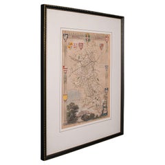
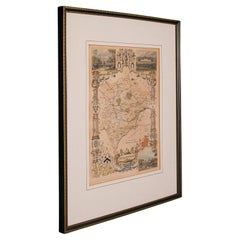
Antique Lithography Map, Buckinghamshire, English, Framed Cartography, Victorian
Located in Hele, Devon, GB
This is an antique lithography map of Buckinghamshire. An English, framed atlas engraving of
Category
Antique Mid-19th Century British Victorian Maps
Materials
Wood, Paper
H 16.15 in W 13.19 in D 0.6 in
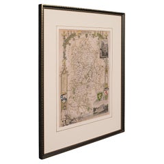
Antique Lithography Map, Bedfordshire, English, Framed Engraving, Cartography
Located in Hele, Devon, GB
This is an antique lithography map of Bedfordshire. An English, framed atlas engraving of
Category
Antique Mid-19th Century British Victorian Maps
Materials
Wood
H 15.75 in W 13.19 in D 0.6 in
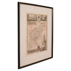
Antique Lithography Map, Hertfordshire, English, Framed Engraving, Cartography
Located in Hele, Devon, GB
This is an antique lithography map of Hertfordshire. An English, framed atlas engraving of
Category
Antique Mid-19th Century British Victorian Maps
Materials
Wood
H 13.59 in W 15.75 in D 16.34 in
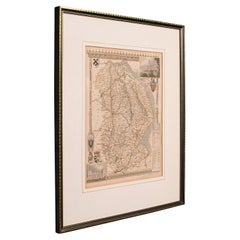
Antique Lithography Map, Lincolnshire, English, Framed, Engraving, Cartography
Located in Hele, Devon, GB
This is an antique lithography map of Lincolnshire. An English, framed atlas engraving of
Category
Antique Mid-19th Century British Victorian Maps
Materials
Wood
H 15.95 in W 13.39 in D 0.6 in
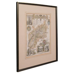
Antique Lithography Map, Gloucestershire, English, Framed Engraving, Cartography
Located in Hele, Devon, GB
This is an antique lithography map of Gloucestershire. An English, framed atlas engraving of
Category
Antique Mid-19th Century British Victorian Maps
Materials
Wood
H 15.75 in W 13 in D 0.6 in
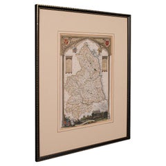
Antique Lithography Map, Northumberland, English, Framed, Engraving, Cartography
Located in Hele, Devon, GB
This is an antique lithography map of Northumberland. An English, framed atlas engraving of
Category
Antique Mid-19th Century British Victorian Maps
Materials
Wood
H 16.74 in W 13.98 in D 0.6 in
Antique Lithography Map, Worcestershire, English, Framed Engraving, Cartography
Located in Hele, Devon, GB
This is an antique lithography map of Worcestershire. An English, framed atlas engraving of
Category
Antique Early 19th Century British Regency Maps
Materials
Wood
H 15.95 in W 13.19 in D 0.6 in
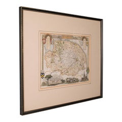
Antique County Map, Norfolk, English, Framed Lithography, Cartography, Victorian
Located in Hele, Devon, GB
This is an antique lithography map of Norfolk. An English, framed atlas engraving of cartographic
Category
Antique Mid-19th Century British Victorian Maps
Materials
Glass, Wood
H 14.57 in W 16.93 in D 0.6 in
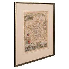
Antique County Map, Rutlandshire, English, Framed, Cartography, Victorian, 1860
Located in Hele, Devon, GB
This is an antique lithography map of Rutlandshire. An English, framed atlas engraving of
Category
Antique Mid-19th Century British Victorian Maps
Materials
Wood
H 15.75 in W 13.19 in D 0.6 in
Antique Lithography Map, County Durham, English, Framed Cartography, Victorian
Located in Hele, Devon, GB
This is an antique lithography map of County Durham. An English, framed atlas engraving of
Category
Antique Mid-19th Century British Mid-Century Modern Maps
Materials
Wood
H 13.98 in W 16.15 in D 0.6 in
Antique Lithography Map, Western Russia, English, Framed, Cartography, Victorian
Located in Hele, Devon, GB
This is an antique lithography map of Western Russia. An English, framed atlas engraving of
Category
Antique Mid-19th Century British Early Victorian Maps
Materials
Wood
H 21.46 in W 17.33 in D 0.6 in
Antique Lithography Map, West Africa, English, Framed, Cartography, Victorian
Located in Hele, Devon, GB
This is an antique lithography map of Western Africa. An English, framed atlas engraving of
Category
Antique Mid-19th Century British Early Victorian Maps
Materials
Wood
H 17.52 in W 19.89 in D 0.79 in
Antique Lithography Map, Black Sea, English, Framed, Cartography, Victorian
Located in Hele, Devon, GB
This is an antique lithography map of the Black Sea region. An English, framed atlas engraving of
Category
Antique Mid-19th Century British Early Victorian Maps
Materials
Wood
H 17.72 in W 20.48 in D 0.79 in
Antique Lithography Map, South America, English, Framed, Cartography, Victorian
Located in Hele, Devon, GB
This is an antique lithography map of South America. An English, framed atlas engraving of
Category
Antique Mid-19th Century British Early Victorian Maps
Materials
Wood
H 21.86 in W 17.13 in D 0.79 in
Antique Lithography Map of Cheshire, English, Framed, Cartography, Victorian
Located in Hele, Devon, GB
This is an antique lithography map of Cheshire. An English, framed atlas engraving of cartographic
Category
Antique Mid-19th Century British Victorian Maps
Materials
Wood
H 13.59 in W 15.56 in D 0.6 in
Antique Lithography Map, Northamptonshire, English, Framed Cartography, C.1860
Located in Hele, Devon, GB
This is an antique lithography map of Northamptonshire. An English, framed atlas engraving of
Category
Antique Mid-19th Century British Victorian Maps
Materials
Wood
H 15.95 in W 13.19 in D 0.6 in
Antique Lithography Map, Cumbria, English, Framed Cartography Interest, Georgian
Located in Hele, Devon, GB
This is an antique lithography map of Cumbria. An English, framed engraving of cartographic
Category
Antique Early 18th Century British Georgian Maps
Materials
Wood
H 21.86 in W 25.2 in D 0.79 in
Antique Lithography Map, Durham, English, Framed, Cartography, Early Georgian
Located in Hele, Devon, GB
This is an antique lithography map of Durham. An English, framed engraving of cartographic interest
Category
Antique Early 18th Century British Georgian Maps
Materials
Wood
H 20.28 in W 21.86 in D 0.6 in
Vintage Reproduction 17th Century Map of Europe, American, Cartography, Blaeuw
Located in Hele, Devon, GB
This is a vintage reproduction map of Europe. An American, paper stock cartography print in frame
Category
Late 20th Century Central American Mid-Century Modern Maps
Materials
Glass, Wood, Paper
H 30.32 in W 38.39 in D 1.38 in
Antique Lithography Map, Isle of Thanet, Kent, English, Cartography, Victorian
Located in Hele, Devon, GB
This is an antique lithography map of The Isle of Thanet in Kent. An English, framed atlas
Category
Antique Mid-19th Century British Victorian Maps
Materials
Wood
H 14.57 in W 16.15 in D 0.6 in
Antique Lithography Map, Cornwall, English Framed Engraving, Cartography, C.1850
Located in Hele, Devon, GB
This is an antique lithography map of the Duchy of Cornwall. An English, framed atlas engraving of
Category
Antique Mid-19th Century British Victorian Maps
Materials
Wood
H 13.98 in W 16.34 in D 0.6 in
Antique Coaching Road Map, Devon, English, Regional Cartography, Georgian, 1720
Located in Hele, Devon, GB
This is an antique coaching road map of Devon. An English, framed lithograph engraving of regional
Category
Antique Early 18th Century British Georgian Maps
Materials
Wood
H 12.21 in W 9.65 in D 0.6 in
Antique Coaching Road Map, South Devon, English, Framed, Cartography, Georgian
Located in Hele, Devon, GB
This is an antique coach road map of South Devon. An English, framed lithograph engraving of
Category
Antique Early 18th Century British Georgian Maps
Materials
Wood
H 12.21 in W 9.65 in D 0.4 in
Antique Lithography Map, Isle of Wight, English, Framed, Engraving, Cartography
Located in Hele, Devon, GB
This is an antique lithography map of the Isle of Wight. An English, framed atlas engraving of
Category
Antique Early 19th Century British Regency Maps
Materials
Wood
H 13.59 in W 15.56 in D 0.6 in
Antique Map of the Maluku Islands by Blaeu, c.1640
Located in Langweer, NL
Antique map titled 'Moluccae Insulae Celeberrimae'. Decorative map of the Maluku Islands, also
Category
Antique 17th Century Maps
Materials
Paper
Antique Map of Manipa and Other Maluku Islands, Indonesia, 1726
Located in Langweer, NL
, een Orangkaya van Manipa.'
Four maps of islands and two figures in native dress. The islands are
Category
Antique 18th Century Maps
Materials
Paper
Antique Coach Road Map, East Devon, English, Framed, Cartography, Georgian, 1720
Located in Hele, Devon, GB
This is an antique coach road map of East Devon. An English, framed lithograph engraving of
Category
Antique Early 18th Century British Georgian Maps
Materials
Wood
H 12.01 in W 9.45 in D 0.4 in
Antique Map of the Province of Groningen in the Netherlands, 1634
Located in Langweer, NL
hand corner embellished with a couple in local dress. This map originates from 'Belgium sive Germania
Category
Antique 17th Century Maps
Materials
Paper
Antique Map of the City of Leuven, Belgium, with Original Coloring, 1609
Located in Langweer, NL
importance as a cultural and artistic hub.
On the bottom right of the map, there are three figures dressed
Category
Antique Early 17th Century Maps
Materials
Paper
H 11.74 in W 13.94 in D 0.02 in
Decorative Map of the Spice Islands in the Mollucas, Indonesia, ca.1640
Located in Langweer, NL
Antique map titled 'Moluccae Insulae Celeberrimae'.
Decorative map of the Spice Islands. Inset
Category
Antique 1640s Maps
Materials
Paper
Antique Map of Manipa, Nusa-Laut, Saparua & Haruku 'Indonesia' by F. Valentijn
Located in Langweer, NL
Four maps of islands and two figures in native dress. The islands are: Manipa, Nusa-Laut (Noessa
Category
Antique Early 18th Century Maps
Materials
Paper
H 19.89 in W 23.63 in D 0.02 in
Antique Map of the Spice Islands 'Moluccas', Indonesia by W. Blaeu, circa 1640
By Willem Blaeu
Located in Langweer, NL
Antique map titled 'Moluccae Insulae Celeberrimae'. Highly decorative antique map of the Spice
Category
Antique Mid-17th Century Maps
Materials
Paper
H 19.69 in W 23.04 in D 0.02 in
Decorative Map of the Maluku or Moluccas or Spice Islands, Indonesia, Ca.1640
Located in Langweer, NL
Antique map titled 'Moluccae Insulae Celeberrimae'.
Decorative map of the Maluku Islands, also
Category
Antique 1640s Maps
Materials
Paper
H 19.3 in W 22.64 in D 0 in
Antique Maps of Manipa, Nusa-Laut, Saparua and Haruku in Maluku, Indonesia 1726
Located in Langweer, NL
, een Orangkaya van Manipa.' Four maps of islands and two figures in native dress. The islands are
Category
Antique 18th Century Maps
Materials
Paper
H 25.6 in W 21.66 in D 0 in
Jean Paul Gaultier Optical Illusion Striped Body Map Kim Kardashian Dress
By Jean Paul Gaultier
Located in PARIS, FR
Iconic Optical Illusion dress by Jean Paul Gaultier!
One of the most iconic Jean-Paul Gaultier
Category
1990s Italian Evening Dresses
Antique Sea Chart of Hudson Bay and Arctic Canada by Van Keulen, circa 1681
Located in Langweer, NL
Antique map titled 'Pascaarte vande Noorderzee Custen van America (..)'. Sea chart of Hudson Bay
Category
Antique Late 17th Century Maps
Materials
Paper
No Reserve
H 20.87 in W 23.82 in D 0.02 in
Engraving of Allegorical Celebrations of the British Victories in America, 1880
Located in Langweer, NL
III in classical dress. An allegorical image of America at the top, with a map of North America
Category
Antique 1880s Maps
Materials
Paper
Free Shipping
H 16.74 in W 21.93 in D 0 in
Norma Kamali 1980 Sweats Grey Sweatshirt 2 pc Dress w Snap Front Top & Skirt
By Norma Kamali
Located in Portland, OR
This is an iconic outfit from Norma Kamali line called "Sweats" from 1980 that put her on the map
Category
1980s American Day Dresses
Vuokko Suomi Finland Vintage Dress by Marimekko Designer Vuokko Nurmesniemi
Located in Portland, OR
credited with putting Marimekko on the map! She then opened her own company and this dress is from that
Category
1970s Finnish Informal Dresses
Jean Paul Gaultier Robot Cyber 5th Fifth Element SS90 Trompe L'oeil Dress
By Jean Paul Gaultier
Located in PARIS, FR
has been mapped out in shades of grey with very determined seams. Marked a size Medium dress stretches
Category
1990s French Mini Dresses
1970s Pauline Trigère Red Print Strapless Dress & Cape Set
By Pauline Trigère
Located in Boca Raton, FL
Pauline Trigère a prominent figure in putting American designers on the map. Like many of the
Category
1970s American Evening Dresses and Gowns
S/S 1996 Jean Paul Gaultier 'Cyberbaba' X-Ray Print Wrap Dress
By Jean Paul Gaultier
Located in North Hollywood, CA
S/S 1996 Jean Paul Gaultier 'Cyberbaba' Collection cyber print wrap dress. Upper portion features
Category
1990s Evening Dresses and Gowns
Pauline Trigère Abstract Floral Print Cotton Kimono Angel-Sleeve Dress, 1960s
Located in Boca Raton, FL
Pauline Trigère was a prominent figure in putting American designers on the map. Like many of the
Category
1960s Unknown Evening Dresses and Gowns
Roberto Cavalli F/W 2003 Black "Astrology" print bias-cut silk evening dress
By Roberto Cavalli
Located in Milano, IT
- Seamed constellation printed crepe hugs all of the curves and features a range of star maps, calligraphic
Category
Early 2000s Italian Evening Gowns
Jean Paul Gaultier Optical Illusion 1996 S/S Tattoo Dragon Butterfly Mesh Dress
By Jean Paul Gaultier
Located in PARIS, FR
iconic and rare Cyberbaba tattoo and body map optical illusion sheer mesh top with skirt.
The top is
Category
1990s Italian Evening Dresses
Free Shipping
Size: See description.
1970s Diane Von Furstenberg Vintage Shocking Hot Pink Silk Wrap Dress Size 2 / 4
By Diane von Furstenberg
Located in San Diego, CA
Chic and classic 70s DIANE VON FURSTENBERG shocking vibrant pink silk signature wrap dress
Category
1970s Cocktail Dresses
Cambridgeshire map 17th century engraving by John Speed
By John Speed
Located in London, GB
Great Britaine', first published in 1611. The map is populated by four figures in academic dress, and
Category
1610s Landscape Prints
Materials
Engraving
"The Story Map Of The West Indies" 1936
Located in Bristol, CT
Framed colour map of the West Indies published 1936 w/ border design motif adapted from native West
Category
1930s More Prints
Materials
Paper
Large Vintage France Map, Continental, Historical Cartography, Late 20th Century
Located in Hele, Devon, GB
This is a large vintage map of France. A Continental, framed example of historical cartography
Category
Late 20th Century European Mid-Century Modern Prints
Materials
Glass, Wood, Paper
H 36.62 in W 28.35 in D 1.38 in
Original Vintage Advertising Poster Unilever Overseas India Illustrated Map
Located in London, GB
Original vintage advertising poster for Unilever Overseas India. Great illustrated map of India
Category
Vintage 1950s British Posters
Materials
Paper
H 29.53 in W 20.08 in D 0.04 in
Map of Canonor - Etching by G. Braun/F. Hogenberg - 1575
Located in Roma, IT
by Franz Hogenberg, eventually contained 546 prospects, bird-eye views and map views of cities from
Category
16th Century Modern Figurative Prints
Materials
Etching
H 5.52 in W 6.3 in D 0.04 in
Frankfort, Germany: A 16th Century Hand-colored Map by Braun & Hogenberg
By Franz Hogenberg
Located in Alamo, CA
This is a 16th century original hand-colored copperplate engraved map of Frankfort, Germany
Category
16th Century Old Masters Landscape Prints
Materials
Engraving
Map of San Georgi - Etching by G. Braun/F. Hogenberg - 1575
Located in Roma, IT
the maps figures in local dress. This feature was anticipated in Hans Lautensack's etched view of
Category
16th Century Modern Figurative Prints
Materials
Etching
H 5.52 in W 6.3 in D 0.04 in
Original Vintage Travel Poster Visit Hungary Pictorial Map Budapest Lake Balaton
Located in London, GB
Original vintage travel poster - Visit Hungary! - featuring a pictorial map of the country
Category
Vintage 1960s Hungarian Posters
Materials
Paper
H 26.38 in W 38.59 in D 0.04 in
Canterbury: An Original 16th C. Framed Hand-colored Map by Braun & Hogenberg
By Franz Hogenberg
Located in Alamo, CA
This is a framed 16th century map and city view of Canterbury, England entitled "Cantuarbury" by
Category
16th Century Old Masters Landscape Prints
Materials
Engraving
H 18.75 in W 22.25 in D 0.88 in
Tournai (Tournay), Belgium: A 16th Century Hand-colored Map by Braun & Hogenberg
By Franz Hogenberg
Located in Alamo, CA
This is a 16th century original hand-colored copperplate engraved map of Tournai, Belgium, entitled
Category
16th Century Old Masters Landscape Prints
Materials
Engraving
Original Vintage Poster Vignobles De France Vins De Bourgogne Burgundy Wine Map
Located in London, GB
decorative map of the Bourgogne region marking the river Rhine and the vineyards with bunches of grapes and
Category
Vintage 1950s French Posters
Materials
Paper
H 26.78 in W 33.27 in D 0.04 in
Original Vintage Poster Vineyards Of Bordeaux Wine Map Les Vignobles De France
Located in London, GB
France Bordeaux Wines featuring a pictographic map of the Bordeaux wine region with colourful
Category
Vintage 1960s French Posters
Materials
Paper
H 26.38 in W 37.01 in D 0.04 in
[Civitates Orbis Terrarum]Map of Cefal - Etching by G. Braun/F. Hogenberg - 1575
Located in Roma, IT
by Franz Hogenberg, eventually contained 546 prospects, bird-eye views and map views of cities from
Category
16th Century Contemporary Figurative Prints
Materials
Etching
View of Meissen, Germany: A 16th Century Hand-colored Map by Braun & Hogenberg
By Franz Hogenberg
Located in Alamo, CA
This is a 16th century original hand-colored copperplate engraved map of View of View of Meissen
Category
16th Century Old Masters Landscape Prints
Materials
Engraving
- 1
Get Updated with New Arrivals
Save "Map Dress", and we’ll notify you when there are new listings in this category.
Map Dress For Sale on 1stDibs
On 1stDibs, you can find the most appropriate vintage or contemporary map dress for your needs in our varied inventory. black is a pretty popular color, but we also have brown, green, pink and more in stock now. Finding the perfect map dress may mean sifting through those that were made during different time periods — popular versions were made as early as the 16th Century and a newer one, made as recently as the 21st Century, can also be found on the site. Making an accessory such as this has likely been a part of the legacy of many fashion designers, but those produced by Arnold Scaasi, Diane von Furstenberg and Hermès are consistently popular. There aren’t many items for men if you’re seeking these accessories, as most of the options available are for women and unisex.
How Much is a Map Dress?
The price for a map dress starts at $133 and tops out at $75,000, and on average, selling for $1,648.
More Ways To Browse
Feather Trim Dress
Feather Trim Dresses
Tear Drop Shaped Earrings
Feather Trim Gown
Gold Virgo
1985 Dress
Salem House
Bath Oil Painting Masters
Marine Paintings 18th Century
Henri Matisse Blue Nude
Antique Lithograph Portrait
Maria Park
Nude Awakening
Unknown Impressionist Painting Russian
Print Pensive Woman
Vintage Bouquet Illustration
Run After Money
Charles White Charcoal
