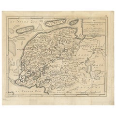
Map Of Netherlands
10
to
103
981
267
754
416
277
226
201
124
117
82
53
47
46
45
40
32
25
21
21
16
15
14
12
11
11
10
10
10
8
8
7
7
7
7
6
6
6
5
4
4
3
3
3
3
2
2
2
2
2
2
2
1
1
1
1
1
1
1
70
51
31
31
27
Sort By
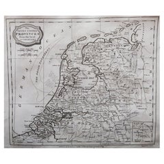
Original Antique Map of The Netherlands, Engraved by Barlow, Dated 1807
Located in St Annes, Lancashire
Great map of Netherlands
Copper-plate engraving by Barlow
Published by Brightly & Kinnersly
Category
Antique Early 1800s English Maps
Materials
Paper
No Reserve
H 8 in W 10 in D 0.07 in
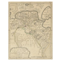
Antique Map of Groningen, the Netherlands, 1771
Located in Langweer, NL
province of Groningen, the Netherlands. This map originates from 'Nieuwe kerkelyke geographische zak- en
Category
Antique 18th Century Maps
Materials
Paper
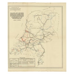
Vintage Road Map of the Netherlands '1928'
Located in Langweer, NL
wegen welke voorkomen op het Rijkswegenplan'. Map of the Netherlands, used to illustrate the highways
Category
20th Century Maps
Materials
Paper
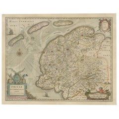
Antique Map of Friesland, The Netherlands, 1638
Located in Langweer, NL
Antique map titled 'Frisia Occidentalis'.
Original antique map of Friesland, the Netherlands
Category
Antique 17th Century Maps
Materials
Paper
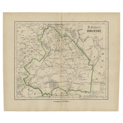
Antique Map of Drenthe, The Netherlands, 1864
Located in Langweer, NL
Antique map titled 'De Provincie Drenthe'. Map of the province of Drenthe, the Netherlands. This
Category
Antique 19th Century Maps
Materials
Paper
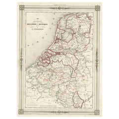
Antique Map of the Netherlands, Belgium and Luxembourg
Located in Langweer, NL
Antique map titled 'Carte des Royaumes Hollande et Belgique'. Attractive map of the Netherlands
Category
Antique Mid-19th Century Maps
Materials
Paper
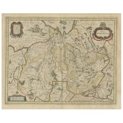
Antique Map of the Province of Overijssel, the Netherlands
Located in Langweer, NL
Original antique map titled 'Ditio Trans-Isulana'. Original old map of the province of Overijssel
Category
Antique Mid-17th Century Maps
Materials
Paper
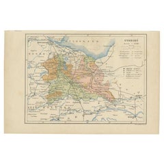
Antique Map of Utrecht in The Netherlands, 1883
Located in Langweer, NL
Antique map titled 'Utrecht'. Map of Utrecht, a province of the Netherlands. This map originates
Category
Antique 19th Century Maps
Materials
Paper
Antique Map of Friesland in the Netherlands, 1770
Located in Langweer, NL
province of Friesland, the Netherlands. This map originates from 'Nieuwe kerkelyke geographische zak- en
Category
Antique 18th Century Maps
Materials
Paper
Antique Map of Deventer in the Netherlands, 1691
Located in Langweer, NL
Plate 'Devendr.' (Plan of the fortified city of Deventer, The Netherlands.) This attractive
Category
Antique 17th Century Maps
Materials
Paper
Antique Map of Coevorden in the Netherlands, 1691
Located in Langweer, NL
Plate 'Covorden.' (Plan of the fortified city of Coevorden, The Netherlands.) This attractive
Category
Antique 17th Century Maps
Materials
Paper
Antique Map of Fortification of Bellingwolderschans, The Netherlands, 1673
Located in Langweer, NL
, the Netherlands. This map originates from 'Teatro del Belgio', by G. Gualdo Priorato.
Artists and
Category
Antique 17th Century Maps
Materials
Paper
H 13.39 in W 9.45 in D 0 in
Antique Map of the Netherlands by Kuyper, 1883
Located in Langweer, NL
orohydrographic map of the Netherlands, two maps on one sheet. This map originates from 'Atlas van Nederland
Category
Antique 19th Century Maps
Materials
Paper
Antique Map of the Netherlands by Brugsma, 1864
Located in Langweer, NL
Antique map titled 'Het Koningrijk der Nederlanden'. Map of the Netherlands. This map originates
Category
Antique 19th Century Maps
Materials
Paper
Antique Map of the Netherlands by Petri, 1852
Located in Langweer, NL
Antique map titled 'Het Koninkrijk der Nederlanden'. Map of the Netherlands, with coats of arms of
Category
Antique 19th Century Maps
Materials
Paper
Antique Map of the Netherlands by Guicciardini, 1582
Located in Langweer, NL
Antique map titled 'Hollandiae Cattorum Regionis Typus'. Early copper engraving of the Netherlands
Category
Antique 16th Century Maps
Materials
Paper
Antique Map of the Netherlands by Zannoni, 1765
Located in Langweer, NL
Pays Bas (..)'. Beautiful old map of the Netherlands. This map originates from 'Atlas Historique de la
Category
Antique 18th Century Maps
Materials
Paper
Antique Map of the Netherlands by Guicciardini, 1612
Located in Langweer, NL
Antique map titled 'Belgicarum Provinciarum Nova Descriptio'. Beautiful old map of the Netherlands
Category
Antique 17th Century Maps
Materials
Paper
Antique Map of Province Friesland, The Netherlands, 1787
Located in Langweer, NL
Jacobus Kok'. Original antique map of the province of Friesland, the Netherlands. This map originates from
Category
Antique 18th Century Maps
Materials
Paper
Antique Map of Hennaarderadeel, Friesland, the Netherlands, 1868
Located in Langweer, NL
Antique map titled 'Provincie Friesland - Gemeente Hennaarderadeel'. Map of the township of
Category
Antique 19th Century Maps
Materials
Paper
Antique Map of Dantumadeel, Friesland, The Netherlands, 1868
Located in Langweer, NL
Antique map titled 'Provincie Friesland - Gemeente Dantumadeel'. Map of the township of Dantumadeel
Category
Antique 19th Century Maps
Materials
Paper
Antique Map of Ferwerderadeel, Friesland, the Netherlands, 1868
Located in Langweer, NL
Antique map titled 'Provincie Friesland - Gemeente Ferwerderadeel'. Map of the township of
Category
Antique 19th Century Maps
Materials
Paper
Antique Map of Lemsterland in the Netherlands, 1868
Located in Langweer, NL
Antique map titled 'Provincie Friesland - Gemeente Lemsterland'.
Map of the township of
Category
Antique 19th Century Maps
Materials
Paper
Antique Map of Western Germany with part of the Netherlands
Located in Langweer, NL
Antique map titled 'Ducatus Iuliacensis Cliviensis et Montensis (..)'. Original old map of Western
Category
Antique Mid-18th Century Maps
Materials
Paper
Antique Map of Drenthe, a Province of The Netherlands, 1635
Located in Langweer, NL
Antique map titled 'Drentiae'. Original antique map of the province of Drenthe, the Netherlands
Category
Antique 17th Century Maps
Materials
Paper
Antique Map of Noord-Holland, Province of The Netherlands, 1902
Located in Langweer, NL
Netherlands. This map originates from 'Atlas van Nederland'. Artists and Engravers: Published by Seyffardt's
Category
20th Century Maps
Materials
Paper
Antique Map of Ijlst , Friesland in the Netherlands, 1865
Located in Langweer, NL
Friesland: Gemeente IjJlst. These scarse detailed maps of Dutch Towns originate from the 'Gemeente
Category
Antique 19th Century Maps
Materials
Paper
Antique Map of Drenthe, Province of the Netherlands, C.1870
Located in Langweer, NL
Antique map titled 'De Provincie Drenthe'. Map of the province of Drenthe, the Netherlands. This
Category
Antique 19th Century Maps
Materials
Paper
Antique Map of the Netherlands and Belgium, circa 1880
Located in Langweer, NL
Antique map titled 'Hollande et Belgique'. Old map of the Netherlands and Belgium. With decorative
Category
Antique 19th Century Maps
Materials
Paper
Antique Map of Zeeland, The Netherlands, by Jaillot, 1693
Located in Langweer, NL
Antique map titled 'Le Comte de Zeelande (..).' Detailed map of the province of Zeeland, The
Category
Antique 17th Century Maps
Materials
Paper
Antique Map of Drenthe, Province in the Netherlands, 1883
Located in Langweer, NL
Antique map titled 'Drenthe'. Map of Drenthe, a province of the Netherlands. This map originates
Category
Antique 19th Century Maps
Materials
Paper
Antique Map of Gaasterland in Friesland, the Netherlands, 1718
Located in Langweer, NL
map of Gaasterland, Friesland, the Netherlands. Originates from 'Uitbeelding van de Heerlijkheid van
Category
Antique 18th Century Maps
Materials
Paper
Antique Map of Friesland, Province in The Netherlands, 1864
Located in Langweer, NL
Antique map titled 'De Provincie Friesland'. Map of the province of Friesland, the Netherlands
Category
Antique 19th Century Maps
Materials
Paper
Antique Map of the Province Limburg, The Netherlands, 1864
Located in Langweer, NL
Antique map titled 'De Provincie Limburg'. Map of the province of Limburg, the Netherlands. This
Category
Antique 19th Century Maps
Materials
Paper
Antique Map of the Netherlands by Brugsma, c.1870
Located in Langweer, NL
Antique map titled 'Het Koningrijk der Nederlanden'. Map of the Netherlands. This map originates
Category
Antique 19th Century Maps
Materials
Paper
Antique Map of Leeuwarden, Capital of Friesland, the Netherlands, 1868
Located in Langweer, NL
Antique map titled 'Provincie Friesland - Gemeente Leeuwarden'. Map of the township of Leeuwarden
Category
Antique 19th Century Maps
Materials
Paper
Antique Map of Schiermonnikoog, an island of the Netherlands, 1868
Located in Langweer, NL
Antique map titled 'Provincie Friesland - Gemeente Schiermonnikoog'. Map of the township of
Category
Antique 19th Century Maps
Materials
Paper
Antique Map of Schiermonnikoog, Wadden Island of the Netherlands, 1868
Located in Langweer, NL
Antique map titled 'Provincie Friesland - Gemeente Schiermonnikoog'. Map of the township of
Category
Antique 19th Century Maps
Materials
Paper
Antique Map of Haskerland in Friesland, The Netherlands, 1868
Located in Langweer, NL
Antique map titled 'Provincie Friesland - Gemeente Haskerland'.
Map of the township of
Category
Antique 19th Century Maps
Materials
Paper
Antique Map of Gaasterland, Friesland in the Netherlands, 1868
Located in Langweer, NL
Antique map titled 'Provincie Friesland - Gemeente Gaasterland'. Map of the township of Gaasterland
Category
Antique 19th Century Maps
Materials
Paper
Antique Map of Baarderadeel in Friesland, The Netherlands, 1868
Located in Langweer, NL
Antique map titled 'Provincie Friesland - Gemeente Baarderadeel'. Map of the township Baarderadeel
Category
Antique 19th Century Maps
Materials
Paper
Antique Map of Kollumerland in Friesland, The Netherlands, 1868
Located in Langweer, NL
Antique map titled 'Provincie Friesland - Gemeente Kollumerland en Nieuw-Kruisland'.
Map of the
Category
Antique 19th Century Maps
Materials
Paper
Antique Map of Leeuwarderadeel in Friesland, The Netherlands, 1868
Located in Langweer, NL
Antique map titled 'Provincie Friesland - Gemeente Leeuwarderadeel'.
Map of the township of
Category
Antique 19th Century Maps
Materials
Paper
Antique Map of the Netherlands by N. Visscher, 1684
Located in Langweer, NL
Antique map titled 'Comitatus Hollandiae Tabula Pluribus Locis Recens Emendata a Nicolao I
Category
Antique Late 17th Century Maps
Materials
Paper
Original Antique Map of the Township of Uithuizermeeden, the Netherlands, 1862
Located in Langweer, NL
maps of Dutch Towns originate from the 'Gemeente atlas van de Provincie Groningen in 62 kaarten.' by C
Category
Antique 19th Century Maps
Materials
Paper
H 7.49 in W 9.85 in D 0 in
Antique Map of the Kingdom of the Netherlands by Wyld '1845'
Located in Langweer, NL
Antique map titled 'Holland & Belgium formerly Kingdom of the Netherlands'. Original antique map of
Category
Antique Mid-19th Century Maps
Materials
Paper
Antique Map of the Township of Coevorden in The Netherlands, 1865
Located in Langweer, NL
Drenthe - Gemeente Coevorden, Padhuis, Wijnhars. These scarse detailed maps of Dutch Towns
Category
Antique 19th Century Maps
Materials
Paper
Antique Map of the Township of Zuidhorn in The Netherlands, 1862
Located in Langweer, NL
Groningen: Gemeente Noordhorn-Zuidhorn. These scarse detailed maps of Dutch Towns originate from
Category
Antique 19th Century Maps
Materials
Paper
Antique Map of the Township of Dwingelo in The Netherlands, 1865
Located in Langweer, NL
Drenthe: Gemeente Dwingelo, Eemster, Lhee. These scarse detailed maps of Dutch Towns originate from
Category
Antique 19th Century Maps
Materials
Paper
Antique Map of the Township of Gasselte in The Netherlands, 1865
Located in Langweer, NL
Drenthe: Gemeente Gasselte, Gasseltternijeveen. These scarse detailed maps of Dutch Towns originate
Category
Antique 19th Century Maps
Materials
Paper
Antique Map of the Township of Anloo in the Netherlands, 1865
Located in Langweer, NL
Drenthe - Gemeente Anloo, Eext, Gasteren, Annen, Schipborg. These scarse detailed maps of Dutch
Category
Antique 19th Century Maps
Materials
Paper
Antique Map of the Township of Nijeveen in The Netherlands, 1865
Located in Langweer, NL
Drenthe: Gemeente Nijeveen, Kolderveen. These scarse detailed maps of Dutch Towns originate from
Category
Antique 19th Century Maps
Materials
Paper
Antique Map of the Township of Gieten in the Netherlands, 1865
Located in Langweer, NL
Drenthe: Gemeente Gieten, Gieterveen, De Hilte. These scarse detailed maps of Dutch Towns originate
Category
Antique 19th Century Maps
Materials
Paper
Antique Map of the Township of Sleen in the Netherlands, 1865
Located in Langweer, NL
Drenthe: Gemeente Sleen, Emmerzand, Venoord. These scarse detailed maps of Dutch Towns originate
Category
Antique 19th Century Maps
Materials
Paper
Antique Map of the Township of Oosterhesselen in the Netherlands, 1865
Located in Langweer, NL
Drenthe: Gemeente Oosterhesselen, Zwinderen. These scarse detailed maps of Dutch Towns originate
Category
Antique 19th Century Maps
Materials
Paper
Antique Map of the City of Assen in The Netherlands, 1865
Located in Langweer, NL
Drenthe - Gemeente Assen. (no 2, Stad). These scarse detailed maps of Dutch Towns originate from
Category
Antique 19th Century Maps
Materials
Paper
Antique Map of the Township of Odoorn in the Netherlands, 1865
Located in Langweer, NL
Drenthe: Gemeente Odoorn, Exlo, Valthe. These scarse detailed maps of Dutch Towns originate from
Category
Antique 19th Century Maps
Materials
Paper
Antique Map of the Township of Havelte in The Netherlands, 1865
Located in Langweer, NL
Drenthe: Gemeente Havelte, Wapserveen, Uffelte. These scarse detailed maps of Dutch Towns originate
Category
Antique 19th Century Maps
Materials
Paper
Antique Map of the Township of Rolde, Drenthe, the Netherlands, 1865
Located in Langweer, NL
Drenthe: Gemeente Rolde, Balloo, Grolloo, Schoonlo. These scarse detailed maps of Dutch Towns
Category
Antique 19th Century Maps
Materials
Paper
Antique Map of the Township of Zweelo in the Netherlands, 1865
Located in Langweer, NL
Drenthe: Gemeente Zweelo, Weesup, Meppen, Benneveld. These scarse detailed maps of Dutch Towns
Category
Antique 19th Century Maps
Materials
Paper
- 1
- ...
Get Updated with New Arrivals
Save "Map Of Netherlands", and we’ll notify you when there are new listings in this category.
Map Of Netherlands For Sale on 1stDibs
An assortment of map of Netherlands is available at 1stDibs. Each of these unique map of Netherlands was constructed with extraordinary care, often using paper, glass and metal. We have 931 antique and vintage map of Netherlands in-stock, while there are 40 modern editions to choose from as well. Map of Netherlands have been produced for many years, with earlier versions available from the 18th Century and newer variations made as recently as the 21st Century. Map of Netherlands bearing modern or mid-century modern hallmarks are very popular at 1stDibs. There have been many well-made map of Netherlands over the years, but those made by Johannes Janssonius, Maarten Vrolijk and B. Schotanus are often thought to be among the most beautiful.
How Much are Map Of Netherlands?
Prices for map of Netherlands start at $0 and top out at $332,052 with the average selling for $498.
