North Pole Map
2
to
6
131
17
112
91
28
21
20
16
14
13
11
9
8
7
6
5
5
4
3
3
2
2
2
2
2
2
2
1
1
1
1
1
1
1
1
1
1
1
42
42
3
3
3
Sort By
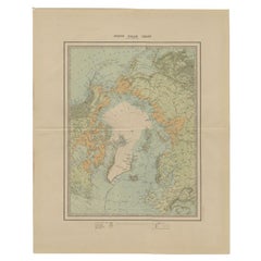
Antique Map of the North Pole by Johnston, 1882
Located in Langweer, NL
Antique map titled 'North Pole Chart'. Old map of the North Pole showing the various regions and
Category
Antique 19th Century Maps
Materials
Paper
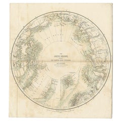
Antique Map of the North Pole by Fullarton, 1856
Located in Langweer, NL
map of the North Pole, displaying the Northwest Passage discovered by Captain Robert McClure. The map
Category
Antique 19th Century Maps
Materials
Paper
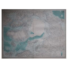
Large Original Vintage Map of The North Pole, circa 1920
Located in St Annes, Lancashire
Great maps of The North Pole.
Unframed.
Original color.
By John Bartholomew and Co. Edinburgh
Category
Vintage 1920s British Maps
Materials
Paper
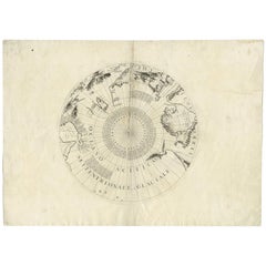
Antique Map of the North Pole by V.M. Coronelli, circa 1692
By Vincenzo Coronelli
Located in Langweer, NL
Globe gore by Vincenzo Maria Coronelli shows the North Pole with the coasts of Canada, Greenland
Category
Antique Late 17th Century Maps
Materials
Paper
Free Shipping
H 19.3 in W 26.78 in D 0.02 in
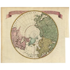
Antique Map of the Northern Hemisphere and North Pole by Tirion, circa 1754
Located in Langweer, NL
'. Map of the Northern Hemisphere and North Pole, which shows the NE Passage, but no definite NW Passage
Category
Antique Mid-18th Century Maps
Materials
Paper
H 12.8 in W 14.77 in D 0.02 in
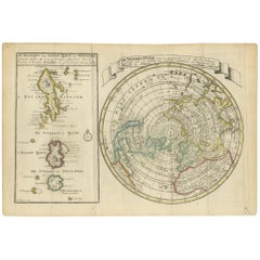
Antique Map of the North Pole & Sangihe Archipelago by Keizer & de Lat, 1788
Located in Langweer, NL
van Sangir Sjauw en Pangasare (..)'. Interesting map that includes a map of the North Pole featuring
Category
Antique Late 18th Century Maps
Materials
Paper
H 8.08 in W 11.82 in D 0.02 in
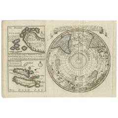
Antique Map of the South Pole by Keizer & de Lat, 1788
Located in Langweer, NL
antique map of the South Pole including two small inset maps of Cape Circoncision (a peninsula on the
Category
Antique Late 18th Century Maps
Materials
Paper
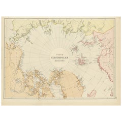
Arctic Exploration: An Original Map of the North Circumpolar Regions, 1882
Located in Langweer, NL
a projection centered on the North Pole, offering a unique view of the Arctic territories. The map
Category
Antique 1880s Maps
Materials
Paper
H 11.03 in W 14.97 in D 0 in
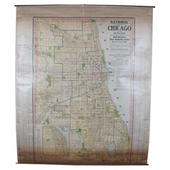
Antique Chicago Illinois National Map Commercial Rollup Classroom Census Map 47"
Located in Dayton, OH
, IN. Paper map with linen trim, suspended from rolled metal poles at upper and lower edge.
Dimensions
Category
Early 20th Century North American Maps
Materials
Paper
H 47 in W 41 in D 0.05 in
Beautiful Antique Map of the Northern Hemisphere with California as an Island
By Isaak Tirion
Located in Langweer, NL
tot Amsterdam door Isaak Tirion'. Beautiful map of the Northern Hemisphere and North Pole, which shows
Category
Antique Mid-18th Century Maps
Materials
Paper
H 13.98 in W 18.9 in D 0.02 in
Blue Map - map, north pole, blue, geometrical, mathematical
By Marco Araldi
Located in London, GB
, applying traditional techniques such as multiple Cartesian coordinates and polar system coordinates to maps
Category
2010s Contemporary Landscape Paintings
Materials
Ink, Acrylic
H 39.38 in W 39.38 in D 1.58 in
Nice Sheet of the Sangihe Archipelago in Indonesia & California Island, 1788
Located in Langweer, NL
Eilanden van Sangir Sjauw en Pangasare (..)'. Interesting map that includes a map of the North Pole
Category
Antique 1780s Maps
Materials
Paper
H 8.08 in W 12.01 in D 0 in
Antique Kittinger 8-inch Terrestrial World Globe on a Mahogany Wooden Stand
By Kittinger Furniture Company
Located in Philadelphia, PA
near the North Pole), and some spots of losses (the largest of which is in the horizontal bar
Category
Early 20th Century Maps
Materials
Mahogany, Gesso, Wood, Paper
H 18 in W 11.5 in D 11.5 in
Pair of Fine Desk Globes by J. Cary, 1816 and 1824
Located in Amsterdam, NL
Authorities extant; exhibiting the late discoveries toward the North Pole and every improvement in Geography
Category
Antique Early 19th Century Maps
Materials
Other
North America Map Economy Wall Chart Rollable Poster Vintage Mural
Located in Berghuelen, DE
A vintage pull-down map showing the economy of North America, published by Harms. Colorful print on
Category
Late 20th Century German Country Prints
Materials
Canvas, Wood, Paper
Canada Greenland North America Map Vintage Mural Rollable Wall Chart Countrycore
Located in Berghuelen, DE
A classical pull-down map of Canada and Greenland (North American Continent). Used as teaching
Category
Vintage 1970s German Country Posters
Materials
Canvas, Wood
H 74.81 in W 79.14 in D 0.79 in
Vintage Map Wall Chart Countries of North America Rollable Mural Poster
Located in Berghuelen, DE
The vintage pull-down school map illustrates the countries / states of North America. Published by
Category
Late 20th Century German Country Prints
Materials
Canvas, Wood, Paper
H 51.19 in W 39.38 in D 0.79 in
North America Vintage Map Pull-Down Wall Chart Poster Countrycore Print
Located in Berghuelen, DE
A traditional vintage pull-down school map illustrating North America, published by Westermann
Category
Late 20th Century German Country Prints
Materials
Wood, Paper, Canvas
H 66.54 in W 61.42 in D 0.79 in
Vintage Mural Map of North Africa Countrycore African Wall Chart Decoration
Located in Berghuelen, DE
The wall map shows North Africa. It was published by Westermann-Schulwandkarten. Used as teaching
Category
Late 20th Century German Country Prints
Materials
Canvas, Wood, Paper
H 61.42 in W 100.01 in D 0.79 in
Denmark Greenland Faroe Islands the North Atlantic Vintage Mural Map Wall Chart
Located in Berghuelen, DE
The vintage pull-down mural map illustrates Denmark with Greenland, the Faroe Islands and the North
Category
Vintage 1970s German Country Posters
Materials
Canvas, Wood, Paper
H 75.6 in W 81.5 in D 0.79 in
Land Use and Livestock North America Picture Map Wall Chart Poster Mural
Located in Berghuelen, DE
The vintage rollable picture map of North- and Middle America shows land use and livestock
Category
Late 20th Century German Country Prints
Materials
Canvas, Wood, Paper
H 47.25 in W 35.44 in D 0.79 in
Great Britain Scandinavia Northern France Netherland Germany Mural Map
Located in Berghuelen, DE
The vintage pull-down cottagecore mural map illustrates the North Sea countries with Great Britain
Category
Vintage 1970s German Country Posters
Materials
Canvas, Wood, Paper
H 81.89 in W 88.19 in D 0.79 in
Framed World Map print showing double hemisphere dating to 1642 originally, New
Located in Lincoln, Lincolnshire
celestial hemispheres, North and South Poles, sailing ships and sea monsters. Full of fascinating detail, it
Category
2010s British Charles II Prints
Materials
Glass, Wood, Paper
H 19.69 in W 27.56 in D 1.58 in
Vintage Table Globe, English, World Map, 13.5 Inch Diameter, Cartography, C.1960
Located in Hele, Devon, GB
This is a vintage table globe. An English, paper finished world map with chrome meridian, dating to
Category
Vintage 1960s British Mid-Century Modern Globes
Materials
Chrome
H 16.34 in W 13.39 in D 13.39 in
Large Brass Table World Time Zone Clock by Kundo / Kieninger & Obergfell, 1970s
By Kundo, Kieninger & Obergfell
Located in München, BY
time zones. The heavy case and base are made of brass.
The center of the clock is the North Pole. The
Category
Vintage 1970s German Mid-Century Modern Table Clocks and Desk Clocks
Materials
Brass, Metal
H 10.24 in W 9.26 in D 4.14 in
Philips' Celestial Globe, circa 1935
By George Philip & Son
Located in London, GB
, thin elliptical strips of paper that narrow to a point at the North and South Poles.
Over the years
Category
Vintage 1930s British Globes
Materials
Brass
William IV Terrestrial And Celestial Floor Globes By J. W. Cary
By John & William Cary
Located in New Orleans, LA
during expeditions to the North Pole, while the celestial globe provided a timeless map of the heavens
Category
Antique 19th Century English Regency Globes
Materials
Mahogany
Philips 14 Inch Globe, circa 1940
By Philips
Located in London, GB
the North and South Poles.
Over the years, Philip acquired the production lines of other British globe
Category
Vintage 1940s British Globes
Materials
Gesso, Wood, Paper
Pocket Globe, Nicholas Lane, London, post 1779
By Nicholas Lane
Located in Milano, IT
aligned and glued to the sphere. On the Poles, two pins had been inserted, but these are now missing.
In
Category
Antique 1780s English Other Models and Miniatures
Materials
Leather, Wood, Paper
A truly delightful miniature terrestrial pocket globe
By Nathaniel Mills
Located in ZWIJNDRECHT, NL
north and a south pole, an equator, and lines of latitude and longitude.
The Terrestrial Globe.
The
Category
Antique Mid-18th Century British Dutch Colonial Globes
Materials
Other
Little America by Richard E. Byrd, First Edition, 1930
Located in Colorado Springs, CO
Floyd Bennett made the first flight over the North Pole. The expedition was well equipped with three
Category
Vintage 1930s American Books
Materials
Leather, Paper
Pair of Philip & Son Globes, circa 1946
By George Philip & Son
Located in London, GB
point at the North and South Poles.
Over the years, Philip acquired the production lines of other
Category
Vintage 1940s British Globes
Materials
Brass
A huge pair of 21 inches Cruchley Library Globes
By G.F. Cruchley
Located in ZWIJNDRECHT, NL
authorities. Exhibiting the discoveries in equatorial Africa, north pole. And the new settlements and
Category
Antique 1850s British Victorian Globes
Materials
Other
Captain James Cook: 18th C. Portrait by William Hodges After Cook's 2nd Voyage
By William Hodges
Located in Alamo, CA
occupied the South Pole. He also explored the northwest coast of North America, including present day
Category
1770s Portrait Prints
Materials
Engraving
Lithograph - Flowers
By (after) Henri Matisse
Located in Collonge Bellerive, Geneve, CH
evening on the last night of the year, 31 December 1869 (Le Cateau-Cambrésis is in the extreme north of
Category
1940s Modern Still-life Prints
Materials
Lithograph
Henri Matisse (After) - Lithograph - Pumpkin and Flowers
By (after) Henri Matisse
Located in Collonge Bellerive, Geneve, CH
evening on the last night of the year, 31 December 1869 (Le Cateau-Cambrésis is in the extreme north of
Category
1940s Modern Still-life Prints
Materials
Lithograph
H 9.45 in W 12.6 in D 0.04 in
Henri Matisse (After) - Lithograph - Flowers
By (after) Henri Matisse
Located in Collonge Bellerive, Geneve, CH
evening on the last night of the year, 31 December 1869 (Le Cateau-Cambrésis is in the extreme north of
Category
1940s Modern Still-life Prints
Materials
Lithograph
H 9.45 in W 12.6 in D 0.04 in
Henri Matisse (After) - Lithograph - Pumpkin and Flowers
By (after) Henri Matisse
Located in Collonge Bellerive, Geneve, CH
evening on the last night of the year, 31 December 1869 (Le Cateau-Cambrésis is in the extreme north of
Category
1940s Modern Figurative Prints
Materials
Lithograph
H 12.6 in W 9.45 in D 0.04 in
Henri Matisse (After) - Lithograph - Flowers
By (after) Henri Matisse
Located in Collonge Bellerive, Geneve, CH
Cateau-Cambrésis is in the extreme north of France near the Belgian border). The house had two rooms, a
Category
1940s Modern Figurative Prints
Materials
Lithograph
H 12.6 in W 9.45 in D 0.04 in
Henri Matisse (After) - Lithograph - Woman with Flowers in Her Hair
By (after) Henri Matisse
Located in Collonge Bellerive, Geneve, CH
Cateau-Cambrésis is in the extreme north of France near the Belgian border). The house had two rooms, a
Category
1940s Modern Portrait Prints
Materials
Lithograph
H 12.6 in W 9.45 in D 0.04 in
Original Lithograph - Henri Matisse - Apollinaire
By Henri Matisse
Located in Collonge Bellerive, Geneve, CH
the year, 31 December 1869 (Le Cateau-Cambrésis is in the extreme north of France near the Belgian
Category
1930s Modern Portrait Prints
Materials
Linocut
Guillaume Apollinaire
By Henri Matisse
Located in Collonge Bellerive, Geneve, CH
the year, 31 December 1869 (Le Cateau-Cambrésis is in the extreme north of France near the Belgian
Category
1930s Modern Portrait Prints
Materials
Lithograph
Original Lithograph - Henri Matisse - Apollinaire
By Henri Matisse
Located in Collonge Bellerive, Geneve, CH
the year, 31 December 1869 (Le Cateau-Cambrésis is in the extreme north of France near the Belgian
Category
1930s Modern Portrait Prints
Materials
Linocut
Original Lithograph - Henri Matisse - Apollinaire
By Henri Matisse
Located in Collonge Bellerive, Geneve, CH
the year, 31 December 1869 (Le Cateau-Cambrésis is in the extreme north of France near the Belgian
Category
1930s Modern Portrait Prints
Materials
Linocut
Creole Dancer
By (after) Henri Matisse
Located in Collonge Bellerive, Geneve, CH
Cateau-Cambrésis is in the extreme north of France near the Belgian border). The house had two rooms
Category
Mid-20th Century Modern Still-life Prints
Materials
Lithograph
Antique world map - Mappe Monde by Lowitz - Handcoloured engraving - 18th c.
Located in Zeeland, Noord-Brabant
show the North and South poles, also in Nuremberg projection. Two small insets show sun solstices
Category
1740s Old Masters More Prints
Materials
Engraving
Planiglobii Terrestris.
By Johann Baptist Homann
Located in Zeeland, Noord-Brabant
inset maps show the North and South poles in Nuremberg projection. Two small insets show sun solstices
Category
1740s More Prints
Materials
Engraving, Etching
Decorative Antique World Map with two Hemispheres
Located in Langweer, NL
hemisphere (South Pole) Australia showing- Northern hemisphere (Perpendicular from North Pole) - Northern
Category
Antique Mid-18th Century Maps
Materials
Paper
1900 Plan of the City of Washington Antique Map
Located in Colorado Springs, CO
Tiber Creek are shown to the north outside of the street pattern. Each block is numbered. A few major
Category
Early 20th Century American Maps
Materials
Paper
Antique Coastal Chart of the North Sea between England and the Netherlands, 1730
Located in Langweer, NL
ofte Zee Atlas, contained 27 charts from the North Pole to North and South America. The charts all
Category
Antique 1730s Maps
Materials
Paper
H 20.63 in W 24.53 in D 0 in
Map Plan of the City of Washington in the Territory of Columbia
Located in Colorado Springs, CO
, accompanied by a more substantial ‘American Atlas’ containing twenty-one maps. Six of these (North America
Category
Antique Late 18th Century American Maps
17th Century Hand-Colored Map of Bordeaux Region of France by Mercator/Hondius
Located in Alamo, CA
A 17th century hand-colored map entitled "Bourdelois Pais de Medoc et la Prevoste de Born" by
Category
Antique Mid-17th Century Dutch Maps
Materials
Paper
H 10.75 in W 13.5 in D 0.13 in
Vintage Map North Pole South Pole Polar Region Rollable Wall Chart
Located in Berghuelen, DE
A classical pull-down wall chart map illustrating the North and South polar region, published by
Category
Mid-20th Century German Country Prints
Materials
Canvas, Wood, Paper
English Pocket Globe by Lane, London, between 1817 and 1833
By Lane's
Located in Milano, IT
inserted on the poles.
In the North Pacific Ocean, above the Tropic of Cancer, the globe bears a cartouche
Category
Antique 1820s English George IV Maps
Materials
Shagreen, Paper
Vintage Relief Map Pull-Down Wall Chart North Asia Russia China Poster Print
Located in Berghuelen, DE
A classical rollable school map or vintage wall chart showing the Northern Asian continent with
Category
Late 20th Century German Country Prints
Materials
Paper, Canvas, Wood
H 36.62 in W 51.19 in D 0.79 in
Original Vintage Air France Travel Advertising Poster Airline Lucien Boucher Map
By Lucien Boucher
Located in London, GB
countries with images of various activities and sights, people, trees, mountain ranges, the North Pole
Category
Vintage 1950s French Posters
Materials
Paper
H 29.93 in W 43.31 in D 0.04 in
Cassini World Map “Planisphere Representant Toute L’etendue Du Monde” circa 1792
By J.B. Elwe
Located in Shippensburg, PA
A rich and interesting world map derived from Jacques Cassini's North Polar projection first
Category
Antique 1790s Dutch Prints
Materials
Copper
H 28 in W 21.6 in D 0.88 in
William IV Terrestrial Globe by Cruchley
Located in Lymington, Hampshire
discoveries towards the North Pole and …Australia, New Zealand, California, Texas etc, London, O.F.Cruchley
Category
Antique 1830s English Globes
Materials
Oak
Philips' Terrestrial Globe, circa 1925
By George Philip & Son
Located in London, GB
point at the North and South Poles.
Over the years, Philip acquired the production lines of other
Category
Vintage 1920s British Globes
Materials
Gesso, Wood, Paper
Antique Victorian Terrestrial Library Table Globe by C.F. Cruchley, 19th C
Located in London, GB
the latest discoveries towards the North Pole
and the new setllements & divisions of
Australia New
Category
Antique 1850s English Victorian Globes
Materials
Brass
H 18.9 in W 17.33 in D 17.33 in
- 1
Get Updated with New Arrivals
Save "North Pole Map", and we’ll notify you when there are new listings in this category.
North Pole Map For Sale on 1stDibs
Choose from an assortment of styles, material and more with respect to the north pole map you’re looking for at 1stDibs. A north pole map — often made from paper, canvas and fabric — can elevate any home. There are many kinds of the north pole map you’re looking for, from those produced as long ago as the 18th Century to those made as recently as the 20th Century. A well-made north pole map has long been a part of the offerings for many furniture designers and manufacturers, but those produced by Vincenzo Coronelli are consistently popular.
How Much is a North Pole Map?
The average selling price for a north pole map at 1stDibs is $315, while they’re typically $50 on the low end and $1,500 for the highest priced.
More Ways To Browse
Antique Maryland Map
Antique Map Maryland
World Map Clock
Antique Hawaii Map
Antique Map Of Hawaii
Antique Maps Of Maryland
Vintage World Map Desk
Antique Maps Hawaii
Antique Maps Of Hawaii
Antique Map Hawaii
Antique Hawaii Maps
Maps Of Ireland 18th Century
German Timer
Antique Maps Of Ancient Greece
Johnston Brass
Vintage Piano Posters
Braque Verve
Sleeping Unit
