Pieter Van Der Aa Maps
Dutch, 1659-1733
Pieter van der Aa began his career at Leiden in 1683 as a Latin trade publisher, publishing classical texts about medicine and science. He was a Dutch publisher of maps and atlases active in the late 17th and early 18th centuries. During his long and impressive career, Van der Aa produced thousands of maps, including a vast 28 volume atlas containing no less than 3,000 maps.
to
11
13
13
13
13
13
13
13
92
104
58
28
21
Creator: Pieter Van Der Aa
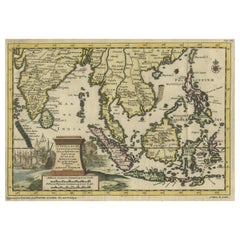
Striking Antique Map Centered on the Malay Peninsula
By Pieter Van Der Aa
Located in Langweer, NL
Antique map titled 'D'Indiaanze Landschappen Zeen en Eylanden, van Couchin af tot in de Moluccos (...)'. Striking map of the region from the Philippines and Formosa to India and the ...
Category
Early 18th Century Antique Pieter Van Der Aa Maps
Materials
Paper
$1,151 Sale Price
20% Off
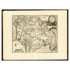
Antique Map of the Mughal Empire by Van der Aa, C.1725
By Pieter Van Der Aa
Located in Langweer, NL
Antique map titled 'Royaume de Grand Mogol (..).' This map shows the extend of the Mughal Empire, which includes northern India, from Golconda to Afghanistan and eastwards to Bengal....
Category
18th Century Antique Pieter Van Der Aa Maps
Materials
Paper
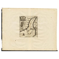
Antique Map of the Gulf of Cambay, Gujarat, India, 1725
By Pieter Van Der Aa
Located in Langweer, NL
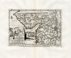
Antique map titled 'Le Golfe de Cambaye at la Rade de Suratt.' (The gulf of Cambay and the coast of Surat, India.) The Gulf of Khambhat, formerly known as the Gulf of Cambay, is an i...
Category
18th Century Antique Pieter Van Der Aa Maps
Materials
Paper
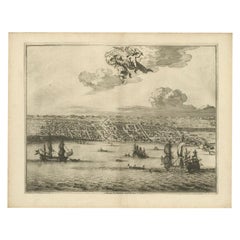
Print of Makassar 'Ujung Pandang' in the Dutch East Indies 'Indonesia', c.1725
By Pieter Van Der Aa
Located in Langweer, NL
Antique print titled 'Macasar, Capitale du Roiaume de même nom'. This rare print shows Makassar, the present capital of South Sulawesi, Indonesia. In the foreground several VOC ships...
Category
18th Century Antique Pieter Van Der Aa Maps
Materials
Paper
$422 Sale Price
20% Off
Antique Print of the Death of Emperor Cubo at Kyoto, Japan, ca. 1725
By Pieter Van Der Aa
Located in Langweer, NL
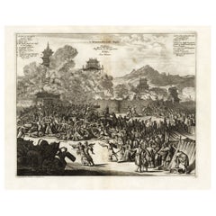
Antique print titled 't Vermoorden vande Keyser Cubus. / Massacre de l'Empereur Cubo, dans Meaco.' Engraving of the killing of Emperor Cubo at Kyoto, Japan. The city Kyoto was known ...
Category
18th Century Antique Pieter Van Der Aa Maps
Materials
Paper
$883 Sale Price
20% Off
Antique Map of the Roadstead of Bantam by Van der Aa, 1725
By Pieter Van Der Aa
Located in Langweer, NL
Antique map titled 'La rade de Bantam'. (The roadstead of Bantam.) This map shows the Indonesian city of Banten / Bantam on Java, Indonesia and its roadstead. With compass rose and s...
Category
18th Century Antique Pieter Van Der Aa Maps
Materials
Paper
$252 Sale Price
20% Off
Antique Map of the Maluku Islands by Van der Aa, 1714
By Pieter Van Der Aa
Located in Langweer, NL
Antique Map Moluccas titled 'Les Isles Moluques'. Rare map of the Spice Islands made after a map engraved by Pieter van den Keere and published in the 1628 edition of the Mercator At...
Category
18th Century Antique Pieter Van Der Aa Maps
Materials
Paper
$191 Sale Price
20% Off
Antique Map of the Maluku Islands by Van der Aa, 1725
By Pieter Van Der Aa
Located in Langweer, NL
Antique map titled 'Les Iles Moluques (..).' (The Moluccan Islands, Maluku, Moluccas, Spice Islands, Indonesia.) Extremely rare in this edition. This plate originates from the very s...
Category
18th Century Antique Pieter Van Der Aa Maps
Materials
Paper
$252 Sale Price
20% Off
Antique Map of the Roadstead of Batavia by Van der Aa, 1725
By Pieter Van Der Aa
Located in Langweer, NL
Antique map titled 'La rade de Batavia'. (The roadstead of Batavia.) This map shows the roadstead before the Indonesian city of Batavia, nowadays Jakarta. This plate originates from ...
Category
18th Century Antique Pieter Van Der Aa Maps
Materials
Paper
$295 Sale Price
20% Off
Antique Map of the Region of Osaka and Hirado Island in Japan, 1725
By Pieter Van Der Aa
Located in Langweer, NL
Antique map titled 'Description exacte et fidele des villes, bourgs et villages qui les Ambassadeurs de Hollande ont rencontrez dans leur voyage par terre de la ville Osacca jusqu'a ...
Category
18th Century Antique Pieter Van Der Aa Maps
Materials
Paper
$1,271 Sale Price
20% Off
Antique Map of the City of Materan 'Indonesia' by P. van der Aa, circa 1725
By Pieter Van Der Aa
Located in Langweer, NL
Antique map titled 'La Ville de Materan, capitale de Roiaume de meme nom, avec ses environs. Le tout environne de Montagnes qui lui serve de murailles.' The city of Materan, capital ...
Category
Early 18th Century Antique Pieter Van Der Aa Maps
Materials
Paper
$379 Sale Price
20% Off
Antique Plan of Batavia, Capital of the Dutch East Indies, by Van Der Aa, 1725
By Pieter Van Der Aa
Located in Langweer, NL
Antique map titled 'Plan de Batavia'. (Plan of Batavia.) This plate shows a plan of the city of Batavia / Jakarta in Indonesia. With extensive legend, compass rose and scale. This pl...
Category
18th Century Antique Pieter Van Der Aa Maps
Materials
Paper
$547 Sale Price
20% Off
Antique Map of the Island of Java by Van Der Aa, 1725
By Pieter Van Der Aa
Located in Langweer, NL
Antique map titled 'Map: 'L'Ile de Java'. (The island of Java.) This map shows the Indonesian island of Java. With compass rose and scale. This plate originates from the very scarse:...
Category
18th Century Antique Pieter Van Der Aa Maps
Materials
Paper
$379 Sale Price
20% Off
Related Items
Manly P Hall, the Secret Teachings of All Ages, First Edition Book & 4 Prints
By TASCHEN
Located in Los Angeles, CA
The classic encyclopedia of the arcane in an expanded edition.
Renowned philosopher and lecturer Manly P. Hall’s masterful encyclopedia of ancient symbols, hidden rituals, and arcane practices has remained a classic since first published in 1928. Hall’s densely detailed writings explore topics ranging from Hermeticism to Tarot, Egyptian mythology to Pythagorean theory. Each chapter is accompanied by the vivid illustrations of artist J. Augustus Knapp, with additional images by Mihran Serailian found in the companion volume, each taking their own unique approach to nearly 60 artworks depicting occult subject matter.
The initial concept for what became known as Hall’s “Great Book”, first began in 1923 when the young Los Angeles-based orator began a months-long trip around the globe. Circumnavigating by ship, Hall visited Egypt, China and India, immersing himself in the philosophical and religious history of each country. Upon his return he spent the next five years penning his massive compendium of philosophy and myth.
Nearly a century after its release, this iconic masterwork has been reproduced for the first time from the rare and extravagant original edition. This meticulously-restored version of Hall’s “Great Book” is also accompanied by an expansive companion book, featuring condensed summaries of each chapter of The Secret Teachings, alongside newly-discovered artworks, rare photography...
Category
21st Century and Contemporary Pieter Van Der Aa Maps
Materials
Foil
$500 / item
H 18.7 in W 13.2 in D 3 in
Antique Map of Principality of Monaco
By Antonio Vallardi Editore
Located in Alessandria, Piemonte
ST/619 - "Old Geographical Atlas of Italy - Topographic map of ex-Principality of Monaco" -
ediz Vallardi - Milano -
A somewhat special edition ---
Category
Late 19th Century Italian Other Antique Pieter Van Der Aa Maps
Materials
Paper
Original Antique Map of The London Underground. 1911
Located in St Annes, Lancashire
Superb map of The London Underground
Published by Ward Lock, 1911
Folding map. Printed on paper
Unframed.
Good condition/ Minor repair to an edge tear on right edge ( shown in ...
Category
1910s English Vintage Pieter Van Der Aa Maps
Materials
Canvas, Paper
Kiyoshi Saito Signed Limited Edition Japanese Woodblock Print Bisyamonten, Kyoto
By Kiyoshi Saitō
Located in Studio City, CA
A beautifully designed and composed woodblock print by famed Japanese printmaker Kiyoshi Saito. Many consider Saito to be one of the most important, if not the most important, contem...
Category
1960s Japanese Showa Vintage Pieter Van Der Aa Maps
Materials
Paper
$1,695
H 24 in W 29.25 in D 1.25 in
Dendy Sadler, "The Royal and Ancient" Golf Print
Located in Oxfordshire, GB
Golf print 'The Royal and Ancient' after Dendy Sadler.
A good oak framed artist proof golf etching by James Dobie after the painting by Dendy Sadler. The ...
Category
1910s English Sporting Art Vintage Pieter Van Der Aa Maps
Materials
Oak, Paper
Antique Golf Print, Royal North Devon Golf Club, Photogravure of Westward Ho
Located in Oxfordshire, GB
Royal North Devon Golf Club 1893 by Mayall & Co. Ltd.
A great image of the members of the 'Royal North Devon Golf Club, Westward Ho!' from 1893. The figures are all photographs superimposed onto a painted background of the course. In the margin is printed 'Permanent Autotype, Produced by Mayall & Co. Ltd. 73 Piccadilly'. The image appears very much photographic but is more of a photomechanical print rather than a photograph.
John Jabez Edwin Paisley Mayall (1813-1901) was an English photographer who in 1860 took the first carte-de-visite photographs of Queen Victoria.
Taken from Royal North Devon:-
Royal North Devon at Westward Ho! Can rightly claim to be the cradle of English Golf. Founded in 1864, it is the oldest golf course in the country and is regarded as the St Andrews of the South. The golf course is as tough as any of the UK's more famous links layouts and has recently been placed in Golf World 's 'Top 100 Courses in the World' that a golfer 'must play'.
Not only is Royal North Devon a great course, it is also a place of huge historical importance. Inside the warmly welcoming clubhouse, the golf museum, honours boards and the clubs top competition trophies are worth a visit on their own and help to tell the story of the game and this remarkable club's unique place in it.
Above all, this is great, natural golf that is largely unchanged from 100 years ago when Harold Hilton et al pronounced Westward Ho! As England's No 1 competition golf course. RND is pure, raw exhilaration and ultimately the experience of playing a fast running links in a stiff breeze still tests the very best in the game.
Many of the great players of the last 100 years were regular competitors at RND but the greatest of them all is without doubt John Henry Taylor...
Category
1890s British Sporting Art Antique Pieter Van Der Aa Maps
Materials
Paper
$2,627
H 20 in W 34.25 in D 0.1 in
Original Antique Map of Ancient Greece, Achaia, Corinth, 1786
Located in St Annes, Lancashire
Great map of Ancient Greece. Showing the region of Thessaly, including Mount Olympus
Drawn by J.D. Barbie Du Bocage
Copper plate engraving by P.F Tardieu
Original hand color...
Category
1780s French Other Antique Pieter Van Der Aa Maps
Materials
Paper
Framed 1838 Mexico & Gulf of Mexico Map
Located in Stamford, CT
Framed 1838 Mexico & Gulf of Mexico map. Printed by Fisher, Son & Co. of London in 1838. As found framed condition. Map has not been examined outside of th...
Category
1830s English American Classical Antique Pieter Van Der Aa Maps
Materials
Glass, Wood, Paper
Antique Map of Virginia & the Chesapeake Bay by Jacques-Nicolas Bellin, c. 1750
By Jacques-Nicolas Bellin
Located in Philadelphia, PA
A fine antique 18th century French map of North America.
By Jacques-Nicolas Bellin.
On laid paper with polychrome highlights.
Depicting Virginia, the Chesapeake Bay, and the nearb...
Category
18th Century French Baroque Antique Pieter Van Der Aa Maps
Materials
Paper
$895
H 15.13 in W 18.63 in D 1.13 in
Print No. 1 of 400 Depicting a Nautical Schooner Made in the Mid-19th Century
Located in Milan, IT
Print depicting a schooner, no. 1 of 400 copies signed Z21, made in the mid-19th century. Non-coeval briarwood frame; measures with frame 50 x 40 cm.
Category
1850s British Antique Pieter Van Der Aa Maps
Materials
Paper
$839
H 15.75 in W 19.69 in D 0.79 in
The Prints of Reginald Marsh by Norman Sasowsky, Catalog Raisonne, First Edition
Located in valatie, NY
The Prints of Reginald Marsh by Norman Sasowsky. Clarkson N. Potter, Inc. / Publisher / Distributed by Crown Publishers, Inc., New York, 1976. First Edition hardcover with dust jacke...
Category
1970s American Vintage Pieter Van Der Aa Maps
Materials
Paper
$125
H 3.94 in W 3.65 in D 0.4 in
Superb Large India Silver Tribal Necklace Gujarat Vintage Asian Tribal Jewellery
Located in London, GB
A superb large Indian Tribal silver necklace from the Gujarat region with large ornate central silver medallion with turquoise and coral beads
Weight 400 grams
Category
Early 20th Century Indian Pieter Van Der Aa Maps
Materials
Silver
$899
H 3.55 in W 11.82 in D 0.4 in
Previously Available Items
Rare Antique Map of the Kingdom of Gujarat, India, C.1725
By Pieter Van Der Aa
Located in Langweer, NL
Antique map titled 'Koninkryk van Guzaratte met d'engte van Cambaya (...) door den hr. I.B. de Lavanha beschreven. - Le Royaume de Guzarate avec te Golfe de Cambaya (..).'
Map of t...
Category
18th Century Antique Pieter Van Der Aa Maps
Materials
Paper
Pieter Van Der Aa maps for sale on 1stDibs.
Pieter Van Der Aa maps are available for sale on 1stDibs. These distinctive items are frequently made of paper and are designed with extraordinary care. There are many options to choose from in our collection of Pieter Van Der Aa maps, although beige editions of this piece are particularly popular. If you’re looking for additional options, many customers also consider maps by Isaak Tirion, Jakob van der Schley, and Covens & Mortier. Prices for Pieter Van Der Aa maps can differ depending upon size, time period and other attributes — on 1stDibs, these items begin at $215 and can go as high as $1,331, while a piece like these, on average, fetch $488.
