Items Similar to Antique Map of Ille et Vilaine ‘France’ by V. Levasseur, 1854

Want more images or videos?
Request additional images or videos from the seller
1 of 5
Antique Map of Ille et Vilaine ‘France’ by V. Levasseur, 1854
About the Item
Antique map titled 'Dépt. d'Ille et Vilaine'. Map of the French department of Ille et Vilaine. France. Its coastal area is famous for its seafood, and especially its oysters. The region is also known for its remarkable megalithic prehistoric ruins. The whole is surrounded by elaborate decorative engravings designed to illustrate both the natural beauty and trade richness of the land. There is a short textual history of the regions depicted on both the left and right sides of the map. This map originates from ‘Atlas National de la France Illustré’. Published by A. Combette, Paris, 1854.
- Dimensions:Height: 13.98 in (35.5 cm)Width: 20.67 in (52.5 cm)Depth: 0.02 in (0.5 mm)
- Materials and Techniques:
- Period:
- Date of Manufacture:1854
- Condition:General age-related toning. Please study image carefully.
- Seller Location:Langweer, NL
- Reference Number:
About the Seller
5.0
Platinum Seller
These expertly vetted sellers are 1stDibs' most experienced sellers and are rated highest by our customers.
Established in 2009
1stDibs seller since 2017
1,916 sales on 1stDibs
Typical response time: <1 hour
- ShippingRetrieving quote...Ships From: Langweer, Netherlands
- Return PolicyA return for this item may be initiated within 14 days of delivery.
More From This SellerView All
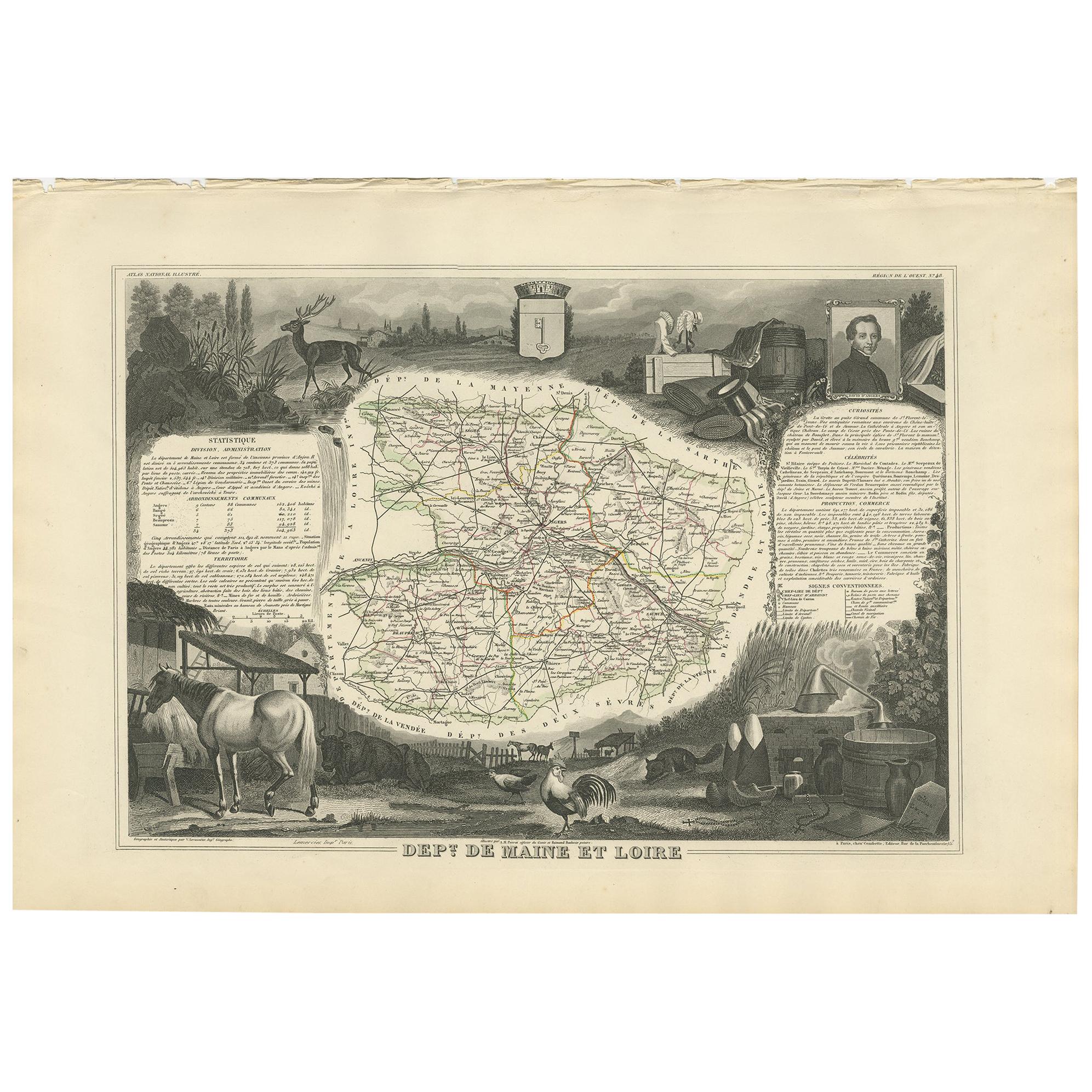
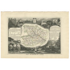
- Antique Map of Maine et Loire ‘France’ by V. Levasseur, 1854Located in Langweer, NLAntique map titled 'Dépt. de Maine et Loire'. Map of the French department of Maine et Loire, France. This area of France is part of the Loire Valley wine region, where nearly every ...Category
Antique Mid-19th Century Maps
MaterialsPaper
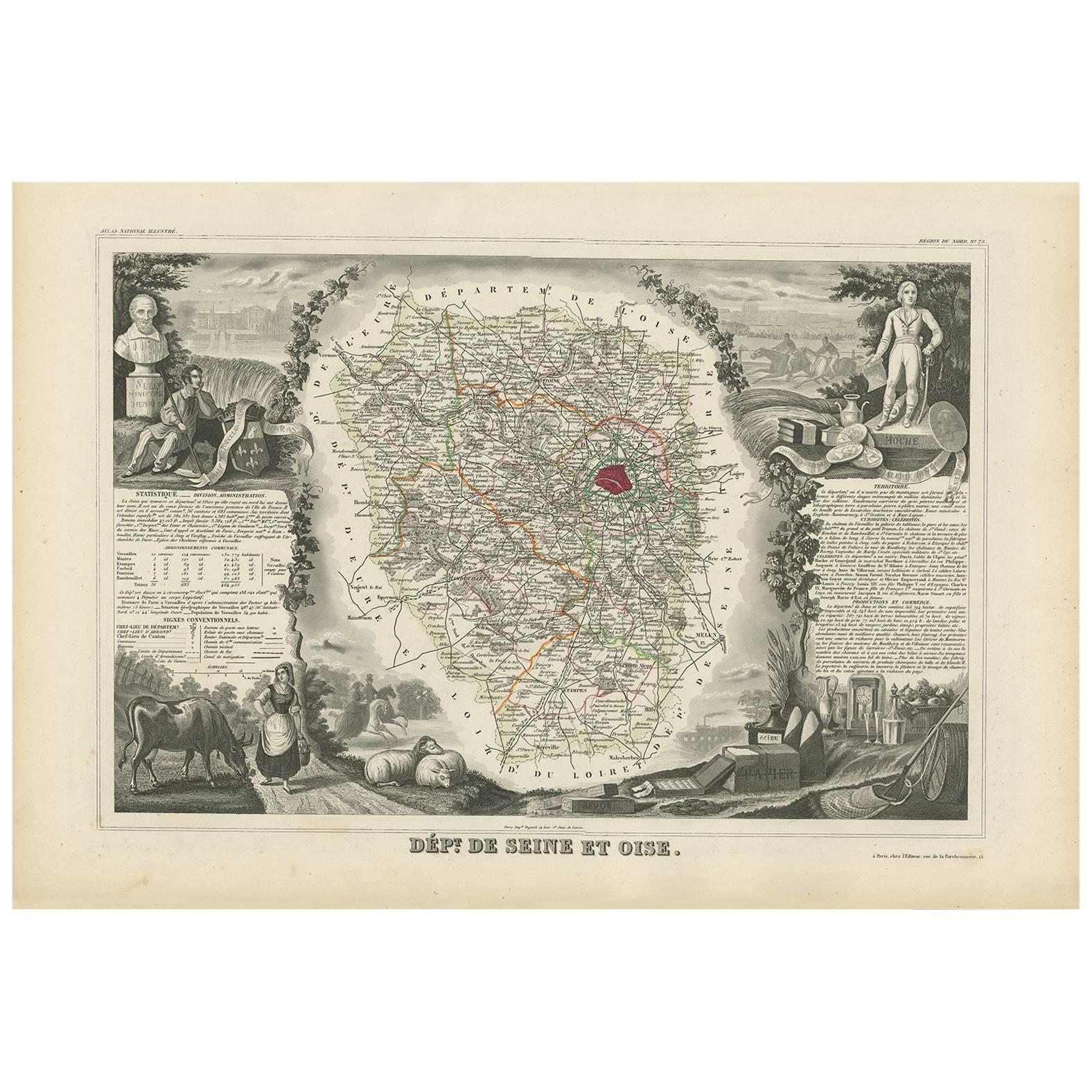
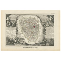
- Antique Map of Seine et Oise 'France' by V. Levasseur, 1854By Victor LevasseurLocated in Langweer, NLAntique map titled 'Dépt. de Seine et Oise'. Map of the French department of Seine-et-Oise. Centred on Versailles, its administrative centre, Seine-et-Oise extends from Espernon to M...Category
Antique Mid-19th Century Maps
MaterialsPaper
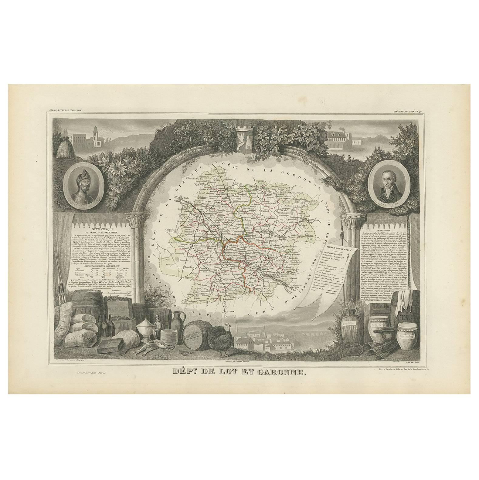
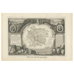
- Antique Map of Lot et Garonne ‘France’ by V. Levasseur, 1854Located in Langweer, NLAntique map titled 'Dépt. de Lot et Garonne'. Map of the French department of Lot et Garonne, France. This area of France is known for its production of Buzet wines and Cabécou d’Ant...Category
Antique Mid-19th Century Maps
MaterialsPaper
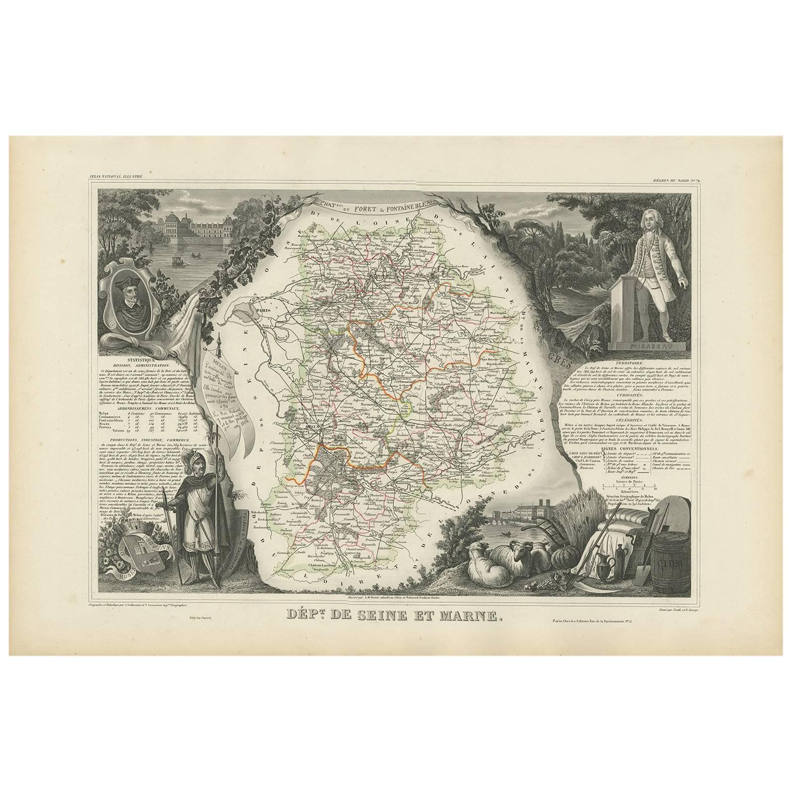
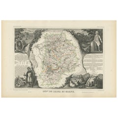
- Antique Map of Seine et Marne 'France' by V. Levasseur, 1854By Victor LevasseurLocated in Langweer, NLAntique map titled 'Dépt. de Seine et Marne'. Map of the French department of Seine Et Marne, France. This region produces a wide variety of wines and h...Category
Antique Mid-19th Century Maps
MaterialsPaper
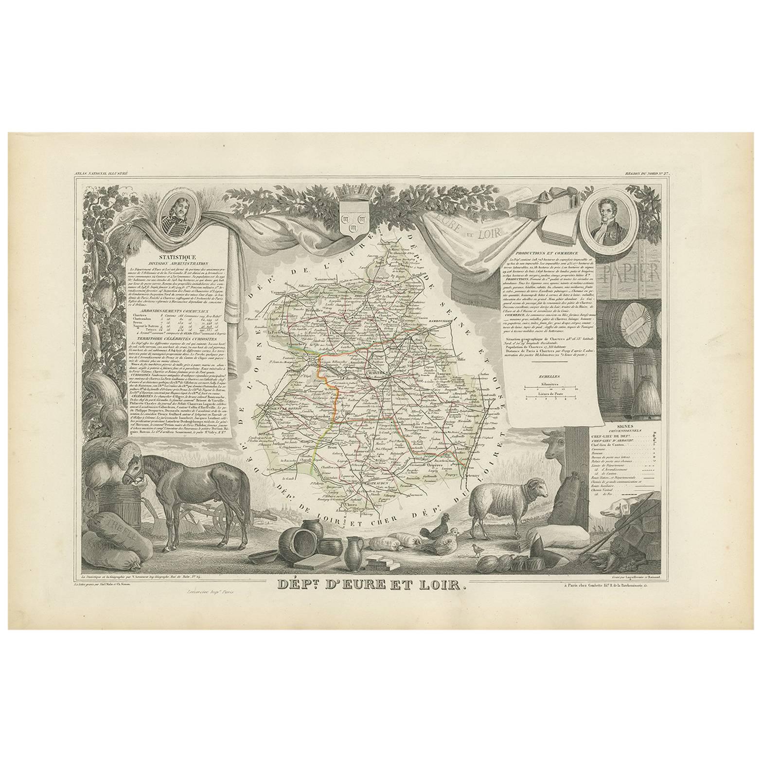
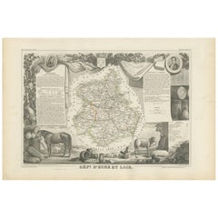
- Antique Map of Eure Et Loir ‘France’ by v. Levasseur, 1854By Victor LevasseurLocated in Langweer, NLAntique map titled 'Dépt. d'Eure et Loir'. Map of the French department of Eure Et Loir, France. This area is home to the famous Chartres Cathedral....Category
Antique Mid-19th Century Maps
MaterialsPaper
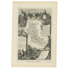
- Antique Map of Loire ‘France’ by V. Levasseur, 1854Located in Langweer, NLAntique map titled 'Dépt. de la Loire'. Map of the French department of Loire, France. This area of France is part of the Loire Valley wine growing region. The area includes 87 appel...Category
Antique Mid-19th Century Maps
MaterialsPaper
You May Also Like
- Fine Antique 1856 Hand Watercolour Map of Dept Des Hautes Alpes by Levasseur'sLocated in GBWe are delighted to offer for sale this stunning 1856 hand watercolour map of the Austrian Alps titled Dept Des Hautes Alpes taken from the Atlas National...Category
Antique 1850s French Early Victorian Maps
MaterialsPaper
- Original Large Antique Map of Paris, France by John Dower, 1861Located in St Annes, LancashireFabulous monochrome map of Paris. Vignettes of St Germain En Laye, Saint Cloud, Versailles and Fontainbleau. Unframed. Drawn by J.Dower. Lithography by Weller. 4 sheets j...Category
Antique 1860s English Victorian Maps
MaterialsPaper
- Original Antique Map of Indonesia, 1861Located in St Annes, LancashireGreat map of Indonesia Drawn and engraved by Edward Weller Original color Published in The Weekly Dispatch Atlas, 1861 Repairs to minor e...Category
Antique 1860s English Victorian Maps
MaterialsPaper

- Original Antique Map of Missouri, 1889Located in St Annes, LancashireGreat map of Missouri Drawn and Engraved by W. & A.K. Johnston Published By A & C Black, Edinburgh. Original colour Unframed.Category
Antique 1880s Scottish Victorian Maps
MaterialsPaper

- Large Original Antique Map of Australia by Sidney Hall, 1847Located in St Annes, LancashireGreat map of Australia Drawn and engraved by Sidney Hall Steel engraving Original colour outline Published by A & C Black. 1847 Unframed Free shipping.Category
Antique 1840s Scottish Maps
MaterialsPaper
- Large Original Antique Map of Europe by Sidney Hall, 1847Located in St Annes, LancashireGreat map of Europe Drawn and engraved by Sidney Hall Steel engraving Original colour outline Published by A & C Black. 1847 Unframed Free shipping.Category
Antique 1840s Scottish Maps
MaterialsPaper


Recently Viewed
View AllMore Ways To Browse
Coastal Maps
Antique Map Prints
Antique Prints Maps
Antique Prints And Maps
Antique Maps And Prints
Map 19th Century
Antique Atlas Furniture
Map Of France
Large Maps
Large Map
Antique German Collectibles
Original World Map
World Atlas
Map Of Itsly
Antique World Map
World Map Antique
World Antique Map
Antique Map World