1902 "Topographical Map of the Original District of Columbia, After Arnold
View Similar Items

Want more images or videos?
Request additional images or videos from the seller
1 of 5
1902 "Topographical Map of the Original District of Columbia, After Arnold
About the Item
- Dimensions:Height: 29.75 in (75.57 cm)Width: 32.5 in (82.55 cm)Depth: 0.25 in (6.35 mm)
- Materials and Techniques:
- Period:1900-1909
- Date of Manufacture:1902
- Condition:Wear consistent with age and use. Map is trimmed to border; laid on period linen. Old folds are visible, and several small edge chips or repairs. Original hand coloring, still bright and attractive. Map is presented unframed.
- Seller Location:Colorado Springs, CO
- Reference Number:Seller: M3011stDibs: LU909724645272
About the Seller
4.9
Platinum Seller
These expertly vetted sellers are 1stDibs' most experienced sellers and are rated highest by our customers.
Established in 2010
1stDibs seller since 2011
400 sales on 1stDibs
More From This SellerView All
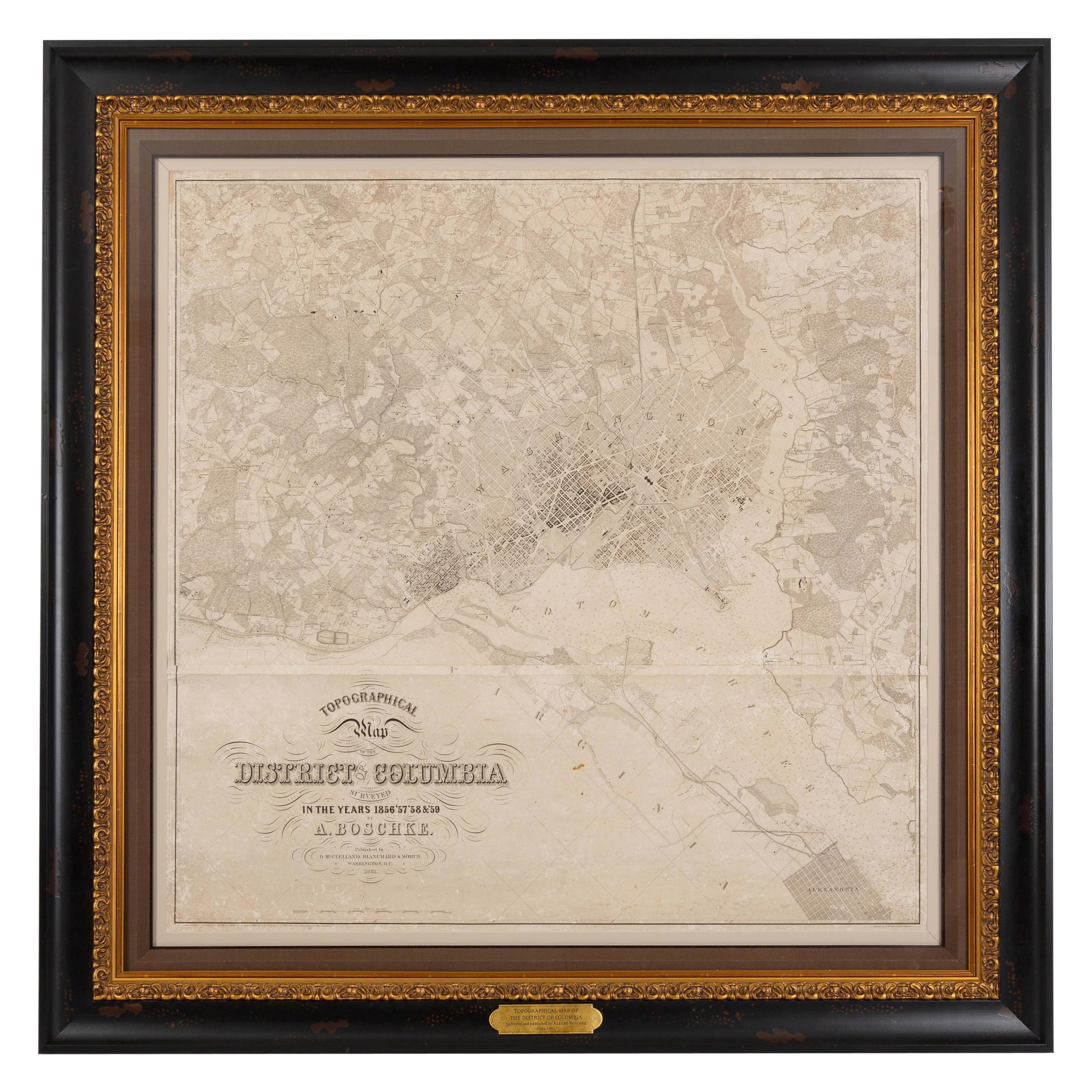
- 1861 Topographical Map of the District of Columbia, by Boschke, Antique MapLocated in Colorado Springs, COPresented is an original map of Albert Boschke's extremely sought-after "Topographical Map of the District of Columbia Surveyed in the Years 1856 ...Category
Antique 1860s American Historical Memorabilia
MaterialsPaper
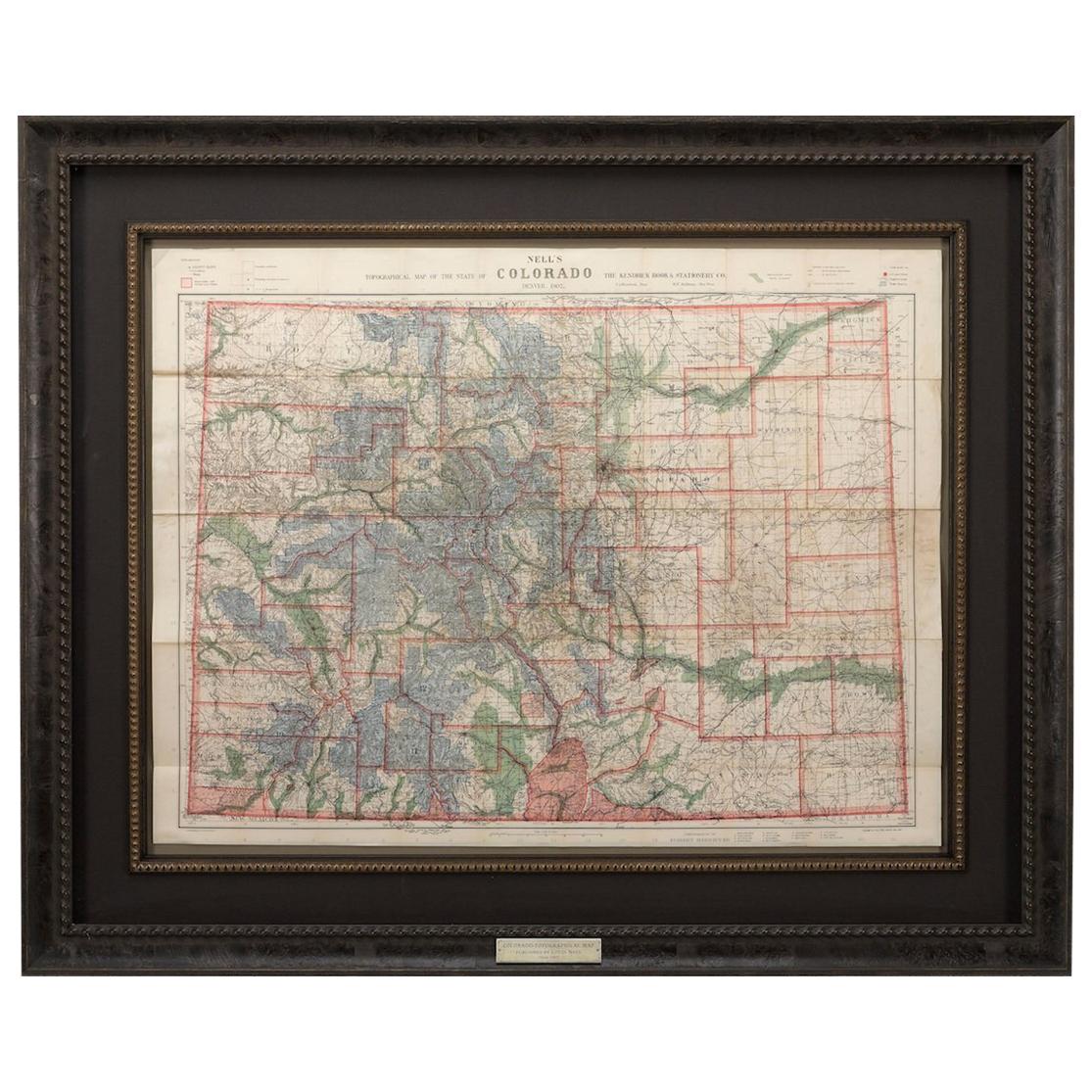
- 1907 Map of Colorado, Antique Topographical Map, by Louis NellLocated in Colorado Springs, COThis highly detailed pocket map is a topographical map of the state of Colorado by Louis Nell from 1907. The map "has been complied from all availabl...Category
Antique Early 1900s American Maps
MaterialsPaper
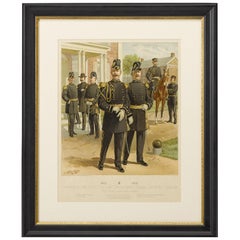
- Original "1902-1907 Officers of the Staff Corps" by C. Ogden, 1908Located in Colorado Springs, CO1908 "1902-1907 Officers of the Staff Corps & Departments, General Staff and Chaplain in Full Dress" Chromolithograph by C. Ogden This colorful lithograph by H. A. Ogden was publish...Category
Antique Early 1900s American Prints
MaterialsPaper
- "Clason's Guide Map of Montana" by The Clason Map Company, Circa 1920sLocated in Colorado Springs, COPresented is “Clason's Guide Map of Montana,” published in the early 1920s by the Clason Map Company. Issued as a folding map, this map identifies county boundaries, county seats, Na...Category
Vintage 1920s American Art Deco Maps
MaterialsPaper
- 1908 "Map of Texas" by The Kenyon CompanyLocated in Colorado Springs, COPresented is an antique map of the state of Texas, printed as a pocket map in 1908 by The Kenyon Company. The state map is brightly colored by county, with principal cities and towns listed. The congressional districts are numbered and boldly outlined in red. Rivers, roads, and railroads all appear prominently on this fantastic map...Category
Antique Early 1900s American Maps
MaterialsPaper
- 1859 "Map of the United States of America..." by J. H. ColtonBy J.H. ColtonLocated in Colorado Springs, COPresented is an 1859 “Map of the United States of America, the British Provinces, Mexico, the West Indies and Central America with Part of...Category
Antique 1850s American Maps
MaterialsPaper


You May Also Like
- Orense in Depth: A 1902 Topographical Map of Galicia's Mountainous ProvinceLocated in Langweer, NLThe map is a detailed cartographic representation of the province of Orense (Ourense in Galician), located in the northwest of Spain, as it was in 1902. Here's a brief description an...Category
Antique Early 1900s Maps
MaterialsPaper
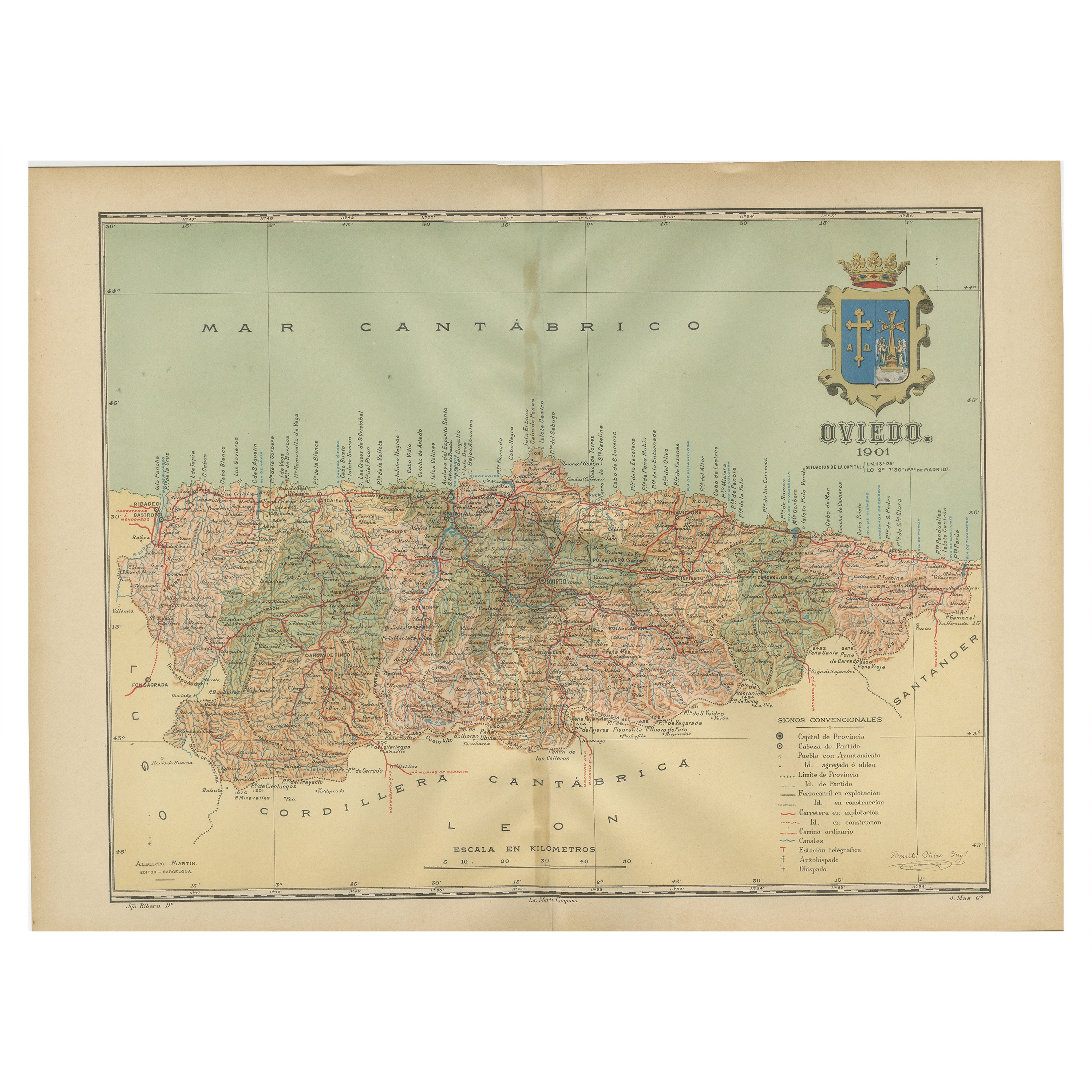
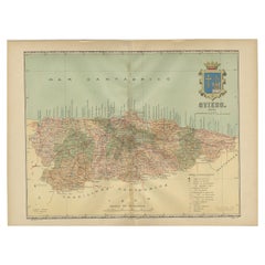
- The Lay of the Land: A 1901 Topographic Map of Oviedo, AsturiasLocated in Langweer, NLThe province depicted on the historical map on offer, Oviedo, corresponds to the modern-day autonomous community of Asturias in northwestern Spain. Here are some points about Asturia...Category
Antique Early 1900s Maps
MaterialsPaper
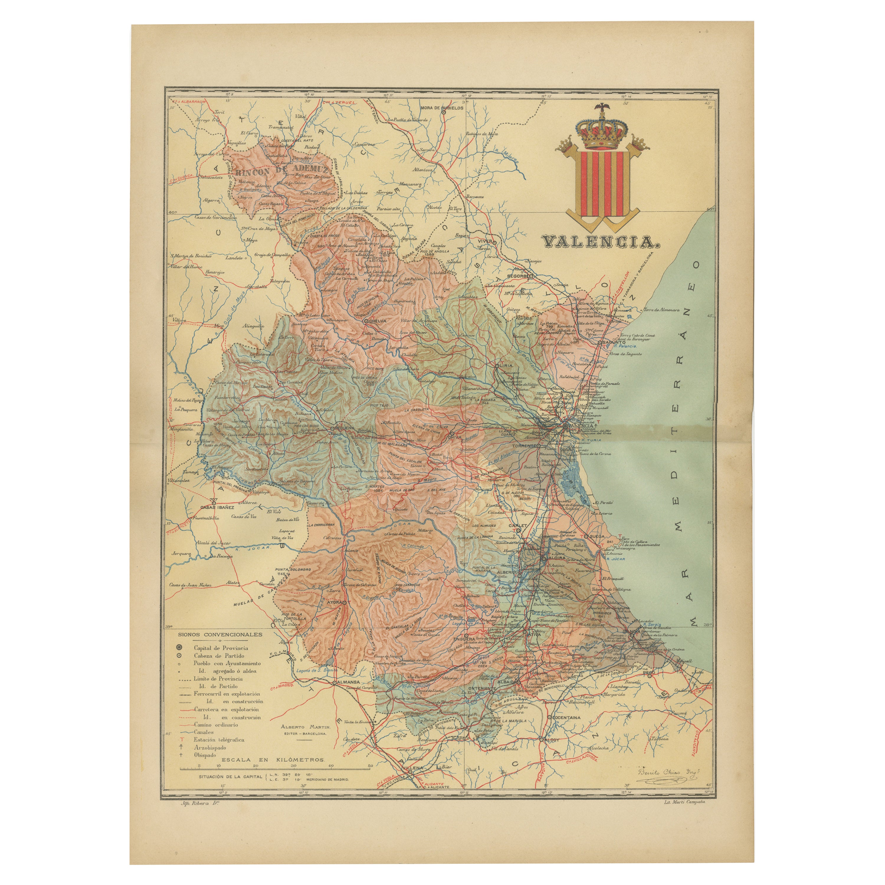
- Topographical and Infrastructure Map of the Province of Valencia, 1901Located in Langweer, NLA historical map of the province of Valencia, dated 1901. The map includes intricate details such as topographical features, with mountain ranges and river systems prominently marked...Category
Antique Early 1900s Maps
MaterialsPaper
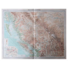
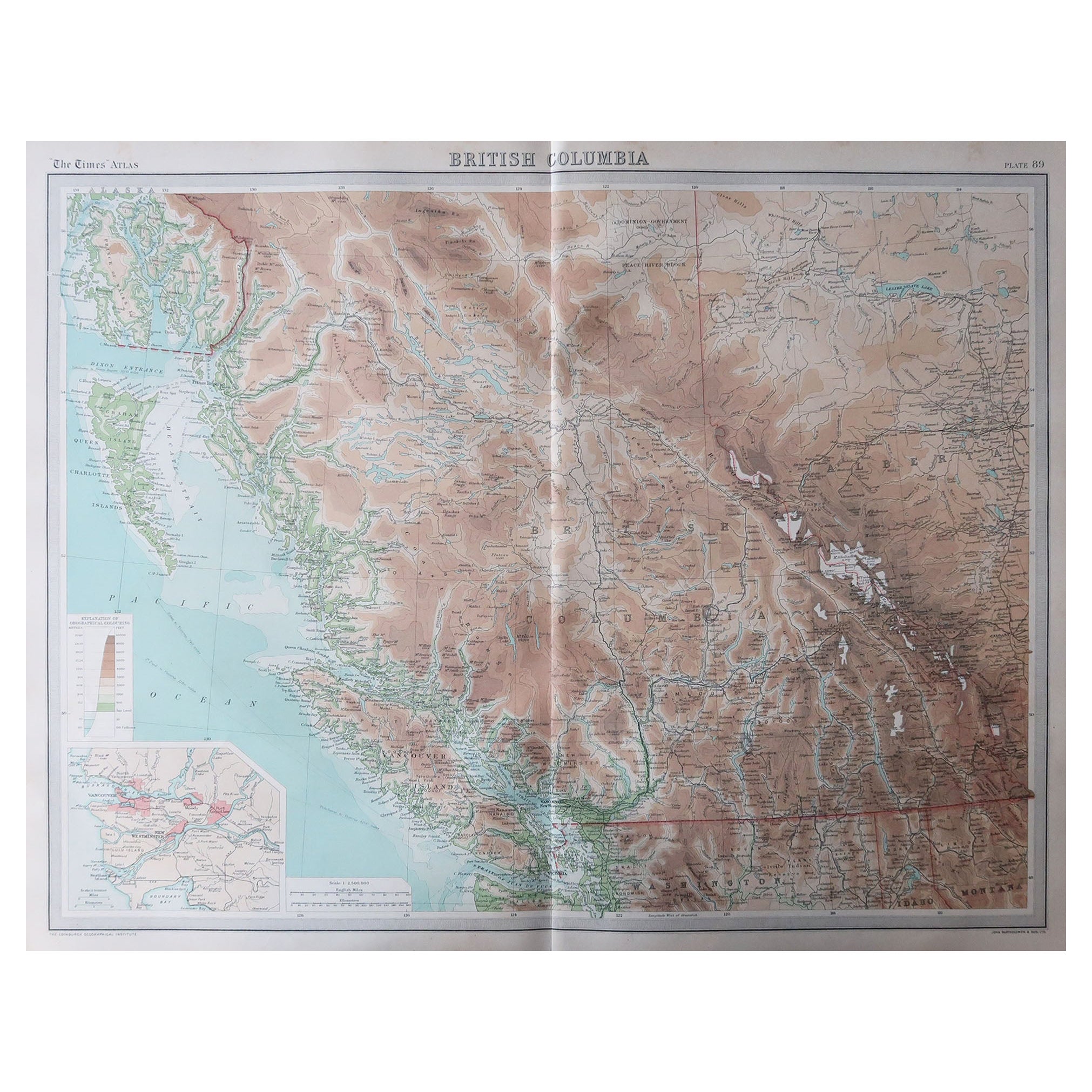
- Large Original Vintage Map of British Columbia, Canada, circa 1920Located in St Annes, LancashireGreat map of British Columbia Unframed Original color By John Bartholomew and Co. Edinburgh Geographical Institute Published, circa 1920 ...Category
Vintage 1920s British Maps
MaterialsPaper
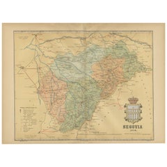
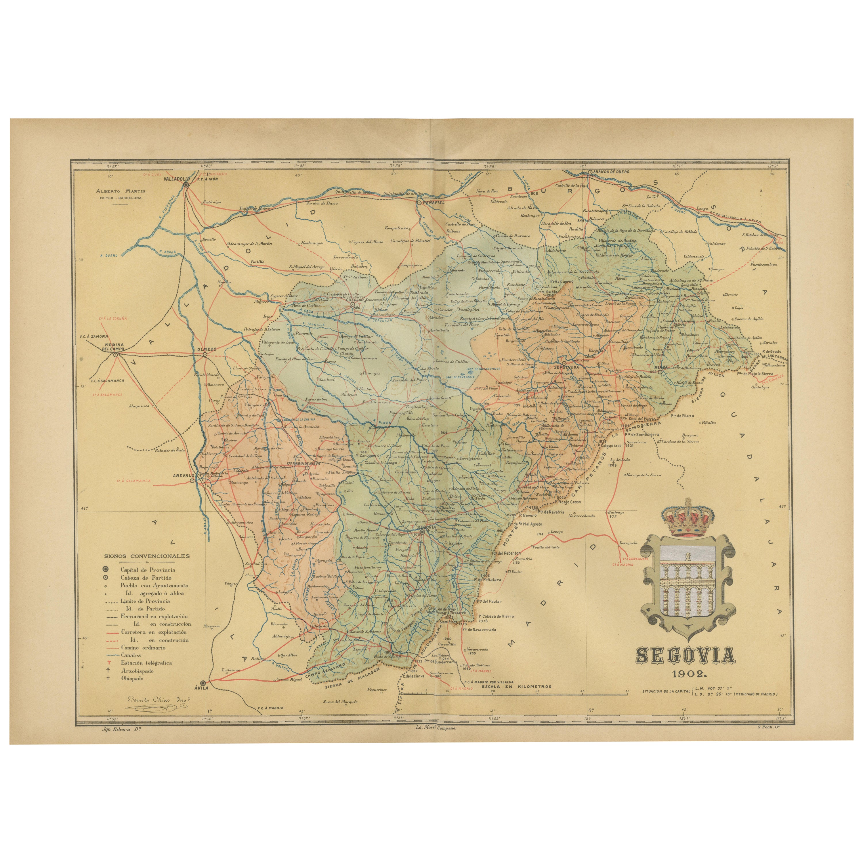
- Topographical and Administrative Cartography of Segovia in Spain, 1902Located in Langweer, NLAn original old map of the province of Segovia from the year 1902. Segovia is a historic area located in the central part of Spain, northwest of Madrid. Known for its rich history, a...Category
Antique Early 1900s Maps
MaterialsPaper
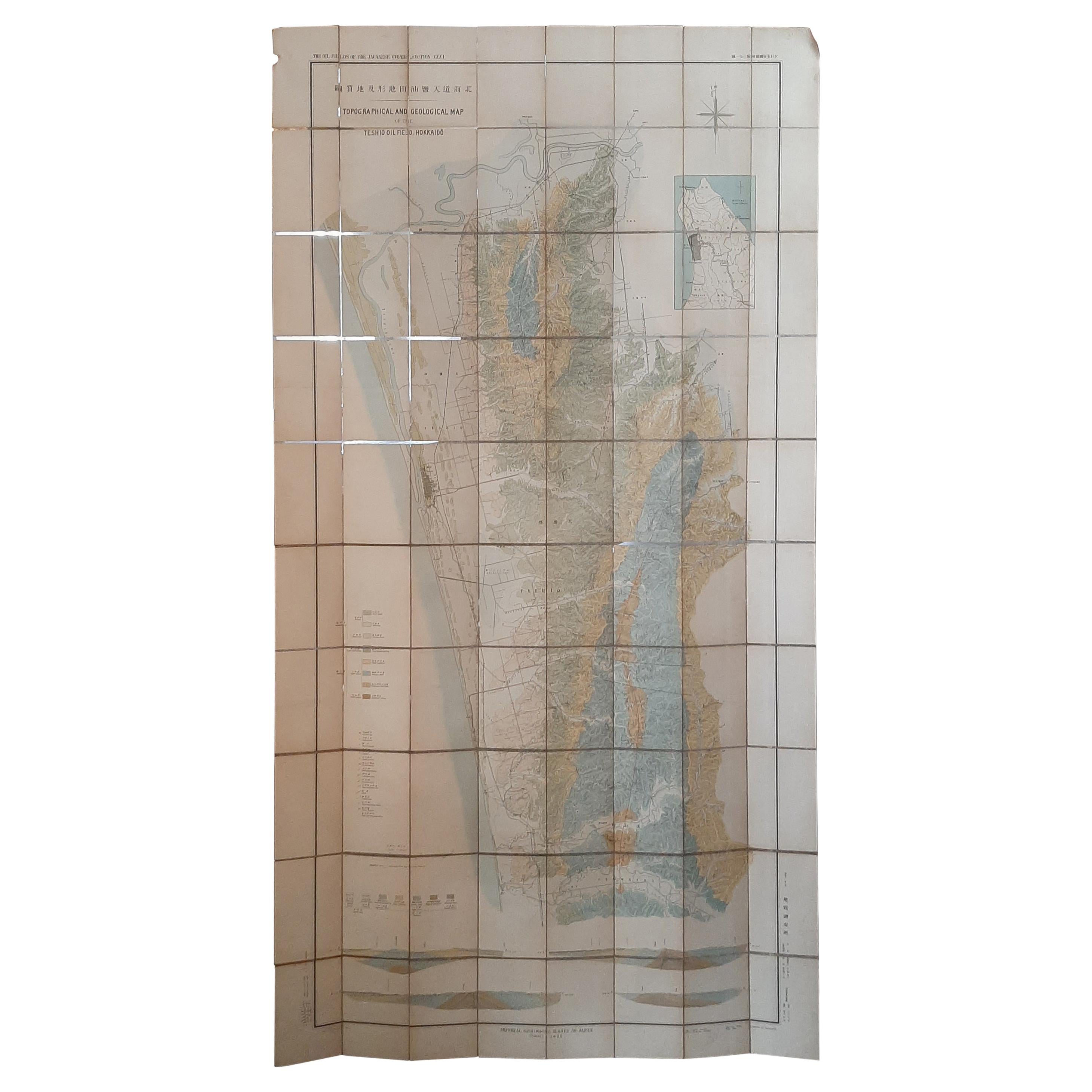
- Large Topographical and Geological Map of the Teshio Oil Field, '1936'Located in Langweer, NLTopographical and geological map of the Teshio oil field. Shows location of oil well, oil sand, natural gas, coal, Sulphur spring, anticlinal axis, prof...Category
20th Century Maps
MaterialsLinen, Paper
 $1,051 Sale Price20% Off