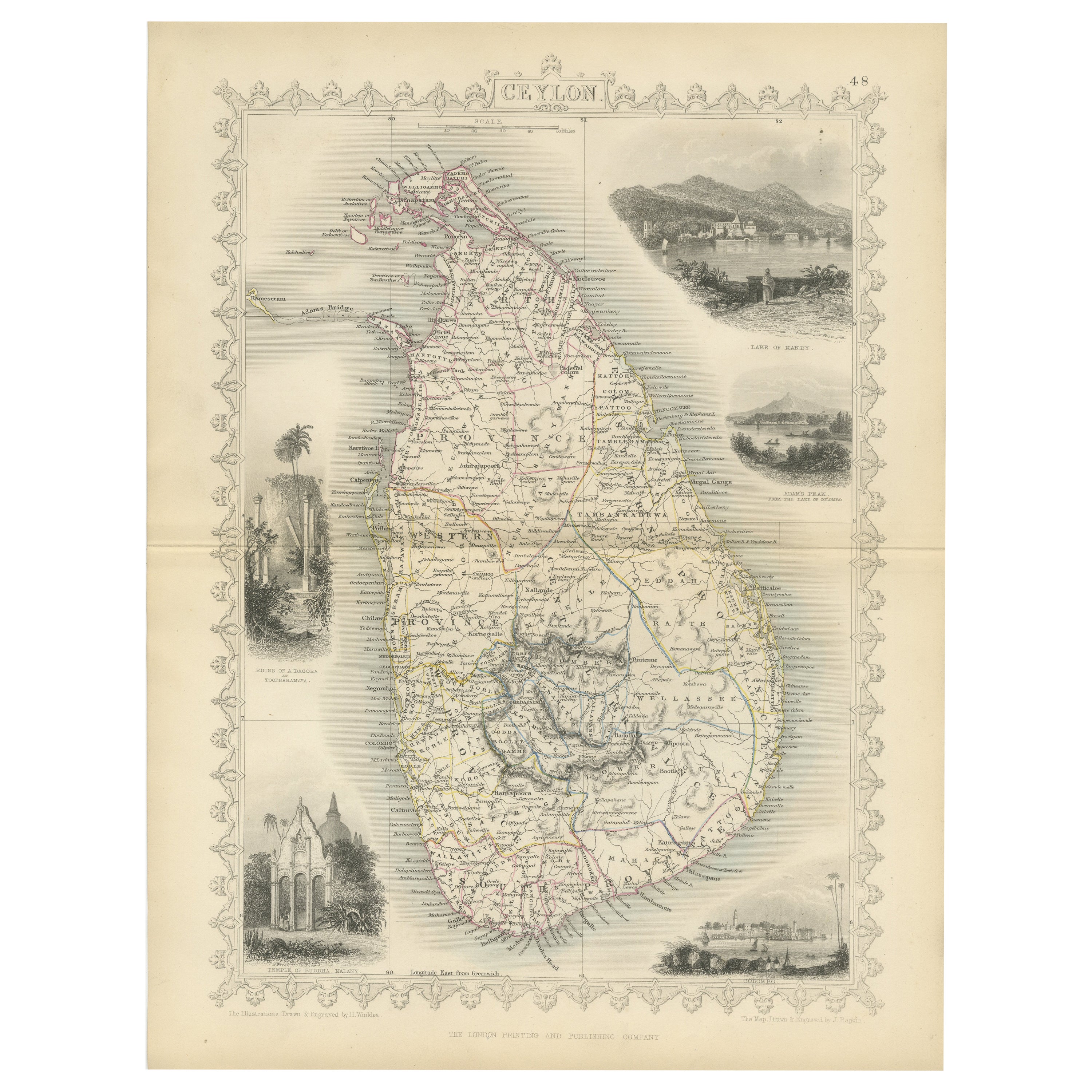
19th Century Lithograph Map Of Lower Manhattan
View Similar Items


Want more images or videos?
Request additional images or videos from the seller
1 of 11
19th Century Lithograph Map Of Lower Manhattan
About the Item
- Dimensions:Height: 25.5 in (64.77 cm)Width: 31 in (78.74 cm)Depth: 1 in (2.54 cm)
- Materials and Techniques:
- Place of Origin:
- Period:
- Date of Manufacture:1859
- Condition:Wear consistent with age and use. Minor losses.
- Seller Location:Haddonfield, NJ
- Reference Number:Seller: 322071stDibs: LU94347861733
About the Seller
5.0
Platinum Seller
These expertly vetted sellers are 1stDibs' most experienced sellers and are rated highest by our customers.
Established in 2010
1stDibs seller since 2012
1,605 sales on 1stDibs
More From This SellerView All
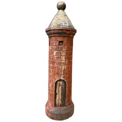
- Wooden 19th Century Polychrome Sculpture Of A Medieval TowerLocated in Haddonfield, NJAn early 19th century hand carved and painted sculpture of a medieval tower in wood.Category
Antique 1790s Belgian Rococo Models and Miniatures
MaterialsHardwood
 $599 Sale Price20% Off
 - Ceramic Inkwell, Late 19th Century, SwedenLocated in Haddonfield, NJFantastic ceramic inkwell, with what seems to be a pottery oven in the midst of two naivistic lions. You lift of the top lid to place pens and lift up the two lions heads for ink. Co...Category
Antique 1870s Swedish Folk Art Inkwells
MaterialsCeramic
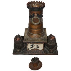 $406 Sale Price80% Off
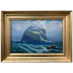
 - Swedish 19th Century Nautical Oil Painting of a Coastline and Sailing BoatsLocated in Haddonfield, NJA 19th century oil painting on canvas representing a rocky island, coastline and sailing boats.Category
Antique Late 19th Century Swedish Romantic Paintings
MaterialsCanvas
- Collection of Three Antique Scottish Carpet Rug Balls, Late 19th CenturyLocated in Haddonfield, NJSet of three scottish stoneware carpet rug balls. Carpet balls in reds and green. A storied game dating back Centuries, Carpet Ball is similar to Bocci...Category
Antique Late 19th Century Scottish Victorian Games
MaterialsStoneware
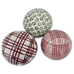 $420 Sale Price / set20% Off
 - 19th Century Baroque Style Baptismal Charger in BrassLocated in Haddonfield, NJA 19th century baptismal plate in brass with beveled flower decoration to celebrate the birth of the infant. The dish can be wall-mounted.Category
Antique Mid-19th Century European Baroque Decorative Dishes and Vide-Poche
MaterialsBrass
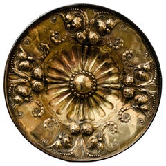 $990 Sale Price26% Off
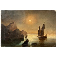
 - 19th Century Oil Painting of Swedish Coastline with Sail Boat in MoonlightLocated in Haddonfield, NJ19th century oil painting of Swedish coastline with sail boat in moonlight.Category
Antique Late 19th Century Swedish Romantic Paintings
MaterialsCanvas
You May Also Like
- Vintage Oversized New York City Lower Manhattan 1840s Map PrintLocated in Dayton, OHVintage late 20th century reproduction print of New York City featuring lower Manhattan in 1840.Category
Late 20th Century Victorian Maps
MaterialsPaper
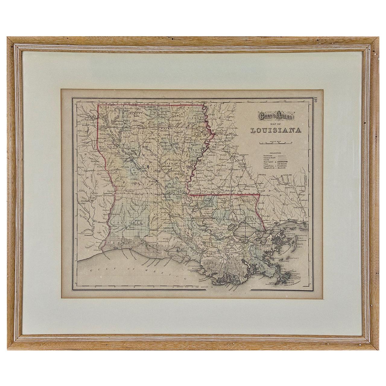
- Louisiana: A Framed 19th Century Map by O. W. GrayBy Gray and CoLocated in Alamo, CAThis framed 19th century map of the Louisiana territory was published in "Gray's Atlas of the United States with General Maps of the World, accompanied by Descriptions Geographical, Historical, Scientific and Statistica" published in 1873 in Philadelphia by O.W. Gray and Son and Stedman, Brown and Lyon. It is a highly detailed map of Louisiana...Category
Antique Mid-19th Century American Other Maps
MaterialsPaper
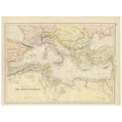
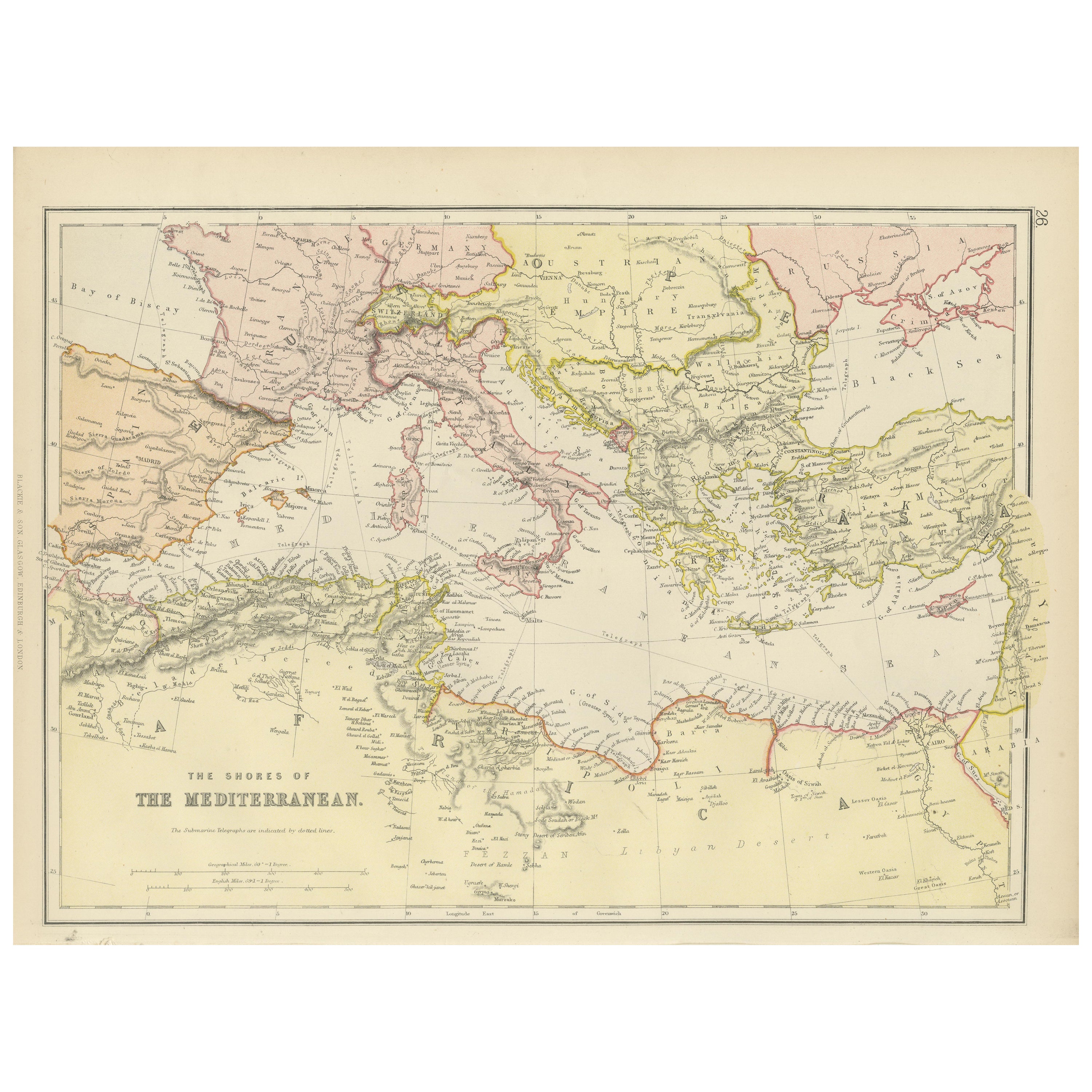
- Mediterranean Tapestry: A 19th Century Map of the Mediterranean Shores, 1882Located in Langweer, NLThis map, titled "The Shores of the Mediterranean," is part of the 1882 atlas by Blackie & Son, and it portrays the coastal regions that surround the Mediterranean Sea. It is a detailed representation of the diverse and historically rich countries that share the Mediterranean coastline, spanning from the Strait of Gibraltar in the west to the Levantine Sea in the east, and from the southern shores of Europe down to the northern coastlines of Africa. The map is a vivid document of the time, with each country along the Mediterranean basin meticulously outlined. The northern coast includes the southern parts of Europe, featuring Spain...Category
Antique 1880s Maps
MaterialsPaper
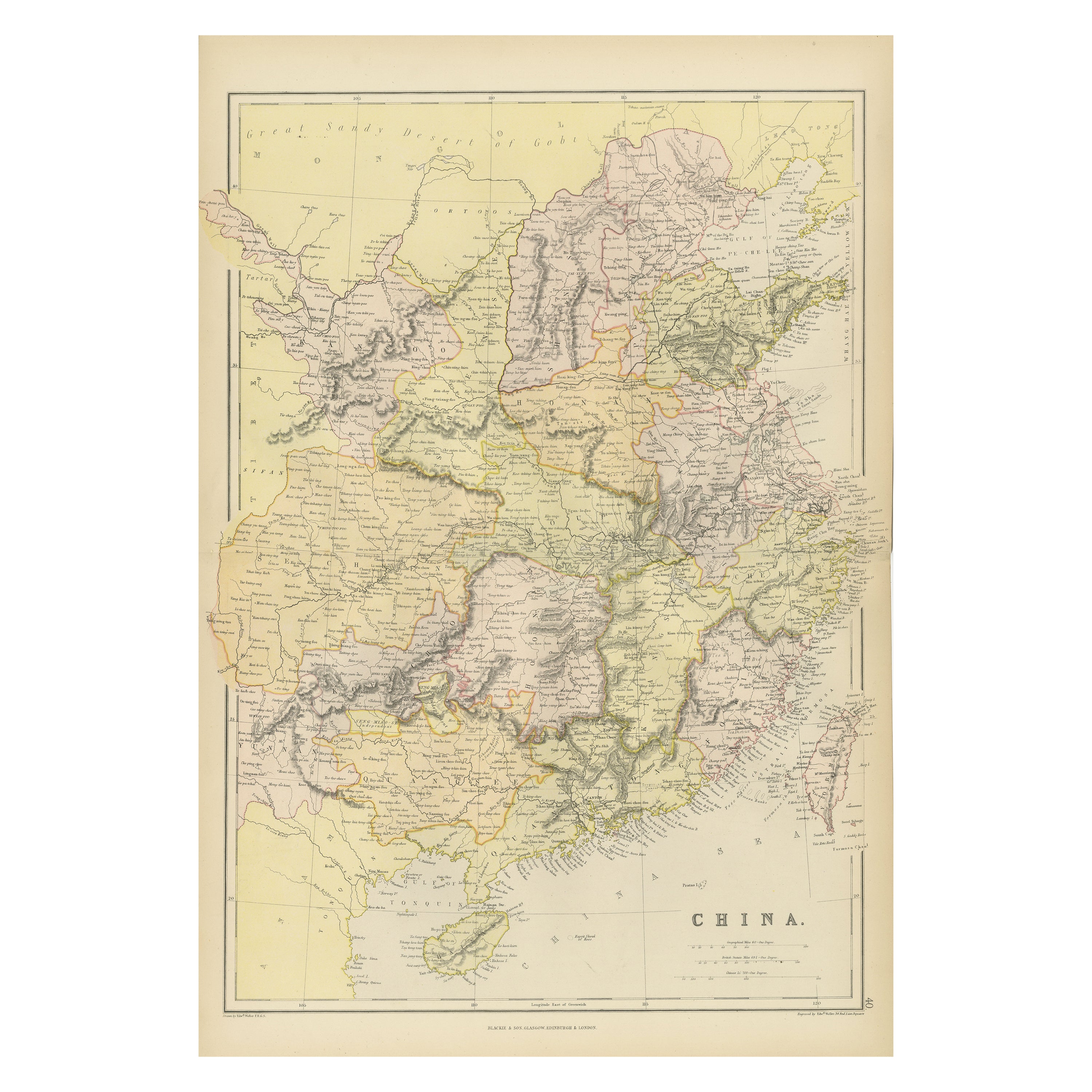
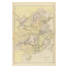
- Antique 19th Century Map of China by Blackie & Son, 1882Located in Langweer, NLThis map is an 1882 Blackie & Son map of China. The title "CHINA." is prominently displayed at the bottom. The map is colored to differentiate various regions, possibly indicating di...Category
Antique 1880s Maps
MaterialsPaper
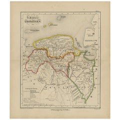
- Antique Map of Groningen from a 19th Century Dutch Atlas, 1864Located in Langweer, NLAntique map titled 'De Provincie Groningen'. Map of the province of Groningen, the Netherlands. This map originates from 'F. C. Brugsma's Atlas van het Koninkrijk der Nederlanden (.....Category
Antique 19th Century Maps
MaterialsPaper
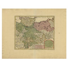
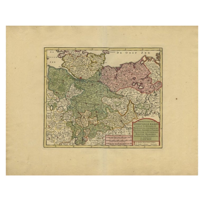
- Antique Map of Lower Saxony in Germany, c.1740Located in Langweer, NLAntique map titled 'Nieuwe Kaart van de Neder Saxise Kreits (..).' Attractive detailed map showing Lower Saxony, Germany, including Mekelenburg, Lauwenburg, Holstein, Bremen, Verden ...Category
Antique 18th Century Maps
MaterialsPaper