Maps
to
1,542
1,846
40
1,888
26
2
2
1
1
2,926
2,181
476
3
289
34
10
127
7
35
9
2
5
3
4
2
1,873
23
11
5
3
126
61
34
20
18
1,888
1,888
1,888
24
16
13
12
12
Maps For Sale
Period: 18th Century
Period: 1920s
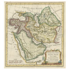
Old Map Depicting Turkey, Persia, Arab and Black Sea Etc, 1778
Located in Langweer, NL
Antique map titled 'Turquie d'Asie, Arabie, Perse, Tartarie Independante'.
Old map of Turkey in Asia. The map shows all of Turkey and the Black Sea, and extends east to include t...
Category
1770s Antique Maps
Materials
Paper
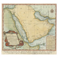
Original Antique Map of Arabia and the Red Sea
Located in Langweer, NL
Antique map titled 'Carte de la Coste d'Arabie (..) - Kaart van de Kust van Arabië (..)'. This is a Dutch version, engraved by J. van Schley, of Bellin's map of Arabia and the Red Sea...
Category
Mid-18th Century Antique Maps
Materials
Paper
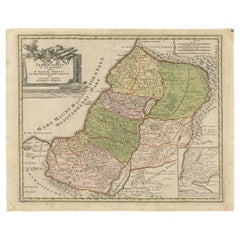
1718 Holy Land Map - Twelve Tribes, Six Provinces, Hand-Colored, Antique Map
Located in Langweer, NL
Title: Terra Sancta in XII olim Tribus nunc VI Provincias Dispertita
Cartographer: Christoph Weigel the Elder (1654–1725)
Publisher: Johann Ernst Adelbulner
Publication Locatio...
Category
1710s Antique Maps
Materials
Paper
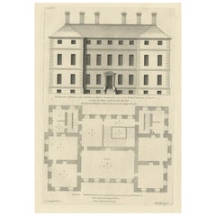
Antique Print of the Melville House in Fife, Scotland, 1725
Located in Langweer, NL
Antique print titled 'The Elevation of Melvin House in the Shire of Fyfe (..)'.
Old engraving of Melville House in Fife, Scotland. This print originates from 'Vitruvius Britannic...
Category
18th Century Antique Maps
Materials
Paper
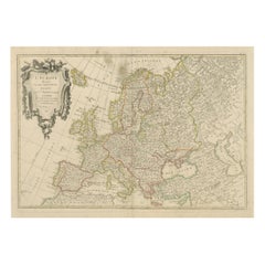
Europe Divided into Principal States by Jean Denis Janvier, Paris, 1782
Located in Langweer, NL
This is a historical map of Europe titled "L'Europe divisee en ses Principaux Etats," created by Jean Denis Janvier in 1782.
This beautiful map depicts the political boundaries and...
Category
1780s Antique Maps
Materials
Paper
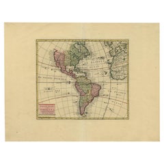
Very Attractive Map of North and South America and Western Part of Africa, 1744
Located in Langweer, NL
Antique map titled 'Nieuwe Kaart van America.' Very attractive map of North and South America, the western part of Africa and south west Europe. With full contemporary hand colouring...
Category
18th Century Antique Maps
Materials
Paper
Original Antique Map of Ancient Greece- Boeotia, Thebes, 1787
Located in St Annes, Lancashire
Great map of Ancient Greece. Showing the region of Boeotia, including Thebes
Drawn by J.D. Barbie Du Bocage
Copper plate engraving by P.F T...
Category
1780s French Other Antique Maps
Materials
Paper
Rare Antique Wall-Map of North America: French and Indian War Boundaries, 1793
Located in Langweer, NL
Rare 1793 Map of North America: French and Indian War Boundaries and Historical Notes
This remarkable engraved map of North America, printed in 1793 by Emanuel Bowen and John Gibs...
Category
1790s Antique Maps
Materials
Paper
Original Antique Engraving of Kannur 'or Cannanore', Kerala, India, 1726
Located in Langweer, NL
Antique print, titled: 'Cananor' - This is a print of a view of Kannur (or Cannanore), Kerala, India. From the monumental: "Oud en Nieuw Oost-Indiën ..." ...
Category
1720s Antique Maps
Materials
Paper
Original Antique Map of Tartary 'Northern China & Far Eastern Russia', 1757
Located in Langweer, NL
Antique map titled 'Carte de la Tartarie Orientale (..)'.
Original antique map of what is present day northern China and far eastern Russia. Centere...
Category
1750s Antique Maps
Materials
Paper
1742 Antique Map of the Persian Empire with Detailed Borders and Cartouche
Located in Langweer, NL
Title: 1742 Covens & Mortier Map of the Persian Empire by Guillaume De L'Isle
This remarkable 1742 map, "Carte de Perse," was originally designed by Guillaume De L'Isle, a preemin...
Category
1740s Antique Maps
Materials
Paper
Map of Friesland (La Frise), from a French Atlas - circa 1756
Located in Langweer, NL
Title: Map of Friesland (La Frise), from "Atlas Nouveau Portatif" (1756)
This is an 18th-century map of Friesland (Frise), a northern province of the Netherlands, engraved by *Georg...
Category
1750s Antique Maps
Materials
Paper
Antique Map of Southern Palestine by Bachiene, 1763
Located in Langweer, NL
"Antique map of the south part of Palestine. This simplified map shows the most important cities of the Jewish Land. Source unknown, to be determined. Artists and Engravers: Made by ...
Category
18th Century Antique Maps
Materials
Paper
Finely Engraved Historical Map of Middle East and Asia, c.1745
Located in Langweer, NL
Description: Antique map titled'Theatrum Historicum pars Orientalis.'
Finely engraved historical map with a profusion of details. It shows the Middle East and Asia. Decorative ti...
Category
1740s Antique Maps
Materials
Paper
Antique Map of the Port of Zihuatanejo in Mexico, c.1740
Located in Langweer, NL
Antique map titled 'Plan du Port de Chequetan ou Seguataneo'. Map of the Mexican port of Zihuatanejo. This area was originally named Cihuatlán in Aztec, which means 'Place of Women,'...
Category
18th Century Antique Maps
Materials
Paper
Highly Detailed Antique Map of the Holy Land Showing 12 Tribes of Israel, c.1720
Located in Langweer, NL
Antique map titled 'Heylige Land verdeeld in de Twaalf Stammen Israels (..).'
Highly detailed map of the Holy Land divided into 12 tribes of Israel...
Category
1720s Antique Maps
Materials
Paper
1782 Map of the East Indies – India, Siam, Philippines, Java, Borneo, Ganges
Located in Langweer, NL
1782 Bayly Map of the East Indies – India, Siam, Philippines, Java, Borneo, Ganges
This finely engraved and vibrantly hand-colored map titled 'A New Map of the East Indies' was dr...
Category
1780s Antique Maps
Materials
Paper
Antique Map of the Coast of Southern France, 1793
Located in Langweer, NL
Antique map titled '14th Chart of the Coast of France, from Port Vendres to the Petit Rhône'. Original map with later hand coroling of the coast of Southern France.
The "14th Chart of the Coast of France, from Port Vendres to the Petit Rhône" is an antique map that offers a detailed depiction of the southern coast of France, specifically highlighting the Mediterranean coastline. This map, which dates back to 1793, was originally part of "Le Petit Neptune Français; Or, French Coasting Pilot," a publication designed for maritime navigation along the French coastlines.
Key Features of the Map:
1. **Geographic Coverage**:
- The map covers the southern French coastline from Port Vendres in the west to the Petit Rhône in the east.
- It includes notable regions such as Languedoc, the Gulf of Lyon, and parts of Catalonia (Spain).
2. **Notable Places**:
- **Montpellier**: A major city in the Diocese of Montpellier, an important cultural and economic center.
- **Narbonne**: Located in the Diocese of Narbonne, a historical city with Roman heritage.
- **Agde**: Situated in the Diocese of Agde, known for its ancient Greek colony origins.
- **Béziers**: Part of the Diocese of Béziers, another city with deep historical roots dating back to Roman times.
- **Port Vendres**: A critical port near the Spanish border.
- **Catalonia**: Including parts of northeastern Spain, emphasizing the coastal connection between France and Spain.
3. **Dioceses and Regions**:
- The map is marked with various dioceses such as Montpellier, Agde, Narbonne, and Béziers, indicating ecclesiastical boundaries.
- It highlights the broader region of Languedoc, a historical province known for its wine production and medieval history.
4. **Navigational Aids**:
- The map features a compass rose with radiating lines, a common navigational aid in maritime maps...
Category
Late 18th Century Antique Maps
Materials
Paper
Map of Tartary by Isaak Tirion: Detailed Cartography of Northern Asia, ca.1740
Located in Langweer, NL
This is an antique map titled "Nieuwe Kaart van Tartarie," which translates to "New Map of Tartary." The map was created by Isaak Tirion, a prominent Dutch cartographer and publisher...
Category
1740s Antique Maps
Materials
Paper
Large Antique Map of the German Empire
Located in Langweer, NL
Antique map titled 'A Map of Germany (..)'. Large antique map of the German Empire, highly detailed. Engraved by T. Kitchin. Published J. Blair, cir...
Category
Late 18th Century Antique Maps
Materials
Paper
Original Antique Map of Greece and part of Turkey
Located in Langweer, NL
Original antique map titled 'La Grece ou partie meridionale de la Turquie d'Europe'. Small map of Greece and part of Turkey. This map originates from 'Le nouveau et curieux Atlas Geo...
Category
Early 18th Century Antique Maps
Materials
Paper
Antique Map of the Middle East with a Large Arabia, 1799
Located in Langweer, NL
Antique map titled 'Perse, Turquie Asiatique et Arabie (..)'. Map of the Middle East with a large Arabia, extending from the Black Sea to the In...
Category
Late 18th Century Antique Maps
Materials
Paper
Antique Map of Flanders, France Incl the Cities Lille, Tournai, Douai, c.1730
Located in Langweer, NL
Antique map titled 'Flandriae comitatus pars Australis'. Decorative antique map of the southern portion of Flanders, France. It shows the cities of Lille (Rijsel), Douai, Tournai (Do...
Category
18th Century Antique Maps
Materials
Paper
Antique Engraving of Malaysia, Brunei, Singapore, Java, Borneo, Sumatra, c.1750
Located in Langweer, NL
Nice decorative and detailed map from the Gulf of Siam and Mindoro to Timo, Java and Sumatra Borneo and Roy de Siam. Large compass rose and nice cartouche.
Title: Carte des Isles ...
Category
Mid-18th Century Antique Maps
Materials
Paper
French Antique Map of France and Western Europe, 1765
Located in Langweer, NL
Antique map titled 'Carte de tous les Lieux, célébres dans l'Histoire (..)'. Beautiful old map of France and western Europe. This map originates from 'Atlas Historique de la France A...
Category
18th Century Antique Maps
Materials
Paper
Map of the Vietnamese Coast, Centered on Turon Harbor 'Da Nang Area', 1796
Located in Langweer, NL
Antique map titled 'A chart of part of the coast of Cochin-China including Turon Harbour and the Island Callao'.
Detailed map of the Vietnamese Coast, centered on Turon Harbor (D...
Category
1790s Antique Maps
Materials
Paper
18th-Century Map of the Eastern Roman Empire by Henri Chatelain, c. 1719
Located in Langweer, NL
Title: 18th-Century Map of the Eastern Roman Empire by Henri Chatelain, c. 1719
Description: This intricately detailed map, titled *Nouvelle Carte pour Servir à l'Histoire de l'Empi...
Category
1710s Antique Maps
Materials
Paper
Pl. 8 Antique Plan of the House of Mr. Morel by Le Rouge, c.1785
Located in Langweer, NL
Antique print titled 'Plan de la Maison de Ville et de Campagne de Mr. Morel'. Copper engraving showing a plan of the house of Mr. Morel. This print originates from 'Jardins Anglo-Ch...
Category
18th Century Antique Maps
Materials
Paper
Antique Print of Duncombe Park by Campbell, 1725
Located in Langweer, NL
Antique print titled 'Elevation of Duncomb Park in Yorkshire (..)'. Old engraving of Duncombe Park, Yorkshire. Duncombe Park is the seat of the Duncombe family whose senior members a...
Category
18th Century Antique Maps
Materials
Paper
Old Map of the Spice Islands, Moluccas by Bellin, Published in 1771
Located in Langweer, NL
Title: 1771 Jacques-Nicolas Bellin Map of the Moluccas, the Spice Islands of Indonesia
Description: This finely engraved eighteenth-century map, titled Carte Particulière des Is...
Category
1770s Antique Maps
Materials
Paper
Original Antique Map of Normandy, France
Located in Langweer, NL
Antique map titled 'Carte de Normandie (..)'. Attractive map of Normandy, France. it depicts the former French Duchy of Normandy, covers the region fro...
Category
Mid-18th Century Antique Maps
Materials
Paper
Antique Map of the Cities of the Qing Dynasty Provinces in China, 1738
Located in Langweer, NL
Antique print titled 'Cities of the Province of Kyang-si, Fo-kyen, Shan-Si & Yun-nan'. Old map depicting four walled cities of the Chinese Qing dynasty provinces Yunnan, Shanxi, Fuji...
Category
18th Century Antique Maps
Materials
Paper
Old Map of North Africa Depicting Libya, Morocco, Algeria, Tunis Etc, 1922
Located in Langweer, NL
Antique map of Africa titled 'Northern Africa'.
Old map of North Africa depicting Libya, Morocco, Algeria, Tunis and surroundings. This map originates from 'The Times' atlas.
...
Category
1920s Vintage Maps
Materials
Paper
Antique Map of Java, Madura, Bali and the Sunda Strait, Indonesia, c.1770
Located in Langweer, NL
Antique map Indonesia titled 'Nouvelle Carte de l'Isle de Java - Nieuwe kaart, van het Eiland Java'. Chart of the island of Java, depicting soun...
Category
18th Century Antique Maps
Materials
Paper
Large Antique Map of Asia including All of Southeast Asia, c.1792
Located in Langweer, NL
Antique map titled 'L' Asie Divisee en ses Empires, Royaumes, et Etats'. Attractive, large map of Asia including all of Southeast Asia. The cartography is archaic for the period with...
Category
18th Century Antique Maps
Materials
Paper
Historical Map of the Black Sea and Surrounding Regions, 1705
Located in Langweer, NL
Title: "Map of Turcomania, Georgia, and Comania"
This print presents an intricately detailed map of the Caucasus region, titled “Turcomania, Georgien Commanie,” by the esteemed cart...
Category
Early 1700s Antique Maps
Materials
Paper
Antique Map of Martinique, Showing Roads, Houses, Sugar Plantations, etc. c.1750
Located in Langweer, NL
Antique map titled 'Carte de l'Isle de la Martinique'.
Detailed map of Martinique. Shows hilly terrain, forests, roads, houses, and even the sugar plantations. The island was to ...
Category
18th Century Antique Maps
Materials
Paper
Rare 1757 Jesuit Map of California and Baja, Dedicated to the King of Spain
Located in Langweer, NL
Title: Rare 1757 Jesuit Map of California and Baja, Dedicated to the King of Spain
This rare and detailed map, titled *Carte de la Californie Levee par la Société des Jésuites*, wa...
Category
1750s Antique Maps
Materials
Paper
Large Decorative Antique Map of the Mediterranean, ca.1770
Located in Langweer, NL
Antique map titled 'Carte de la Mer Mediterranee en Douze Feuilles'.
First map out of twelve fine engraved double-page and folding maps that join to create a large wall map...
Category
1770s Antique Maps
Materials
Paper
Antique Map of of Bengal and the mouth of the Ganges River
Located in Langweer, NL
Antique map titled 'Carte du Bengale, avec la partie Septentrionale (..)'. Original antique map of Bengal and the mouth of the Ganges river. This map ori...
Category
Late 18th Century Antique Maps
Materials
Paper
Rare Unusual Antique Map of Asia with a Landbridge from Korea to America, 1717
Located in Langweer, NL
Antique map titled 'L'Asie Suivant les Nouvelles Decouvertes (..).' Interesting and very unusual map of the Asian continent.
The map is based primarily on Dutch sources, particular...
Category
18th Century Antique Maps
Materials
Paper
Antique Architectural Print of Pavilions for English Gardens by Le Rouge, 1776
Located in Langweer, NL
Antique print titled 'Pavillons Grottes pour les Jardins Anglais'. Copper engraving showing pavilions for English gardens. This print originates from 'J...
Category
18th Century Antique Maps
Materials
Paper
Antique Map of the Eastern Part of the World by Tirion, 1755
By Isaak Tirion
Located in Langweer, NL
Antique map titled 'Nieuwe Kaart van het Oostelykste Deel der Weereld, dienende tot Aanwyzing van de Scheepstogten der Nederlanderen naar Oostindië'. Australia (Nieuw Holland) shown ...
Category
Mid-18th Century Dutch Antique Maps
Materials
Paper
Map of the Margraviate and Electorate of Brandenburg by de Beaurain - ca.1750
Located in Langweer, NL
Historical Map of the Margraviate and Electorate of Brandenburg by Chevalier de Beaurain - Circa 1750
This impressive historical map, titled "Carte du Marquisat et Electorat de Br...
Category
1750s Antique Maps
Materials
Paper
Antique Map of Scandinavia by T. Jefferys, circa 1750
Located in Langweer, NL
Antique map titled 'Sweden, Denmark, Norway & Finland'. An original mid-18th century copper engraved antique map of Scandinavia by Thomas Jefferys....
Category
Mid-18th Century Antique Maps
Materials
Paper
Antique Bird's Eye View of Scheveningen Near The Hague, the Netherlands, 1730
Located in Langweer, NL
Antique print titled 'Afbeeldinge van Schevelinge in den Jaare 1729'.
Bird's eye view of Scheveningen near The Hague / Den Haag, the Netherlands. This print originates from 'Beschr...
Category
1730s Antique Maps
Materials
Paper
Engraving of a Map of Florida, the Gulf Coast, Caribbean & Central America, 1728
Located in Langweer, NL
This exceptional antique map, titled "Nouvelle Carte Marine de Toute les Cotes de l´Amerique" and alternatively known as "Nieuwe groote en seer Curieuse Paskaart van Geheel-WestIndie...
Category
Mid-18th Century European Antique Maps
Materials
Paper
Original Antique Map of Abyssinia, Sudan and the Red Sea, 1749
Located in Langweer, NL
Antique map titled 'Nubie, Abissinie et Cote d'Ajan'.
Map of Abyssinia, Sudan and the Red Sea by Robert Vaugondy. Covers from Arabia and Egypt south to M...
Category
1740s Antique Maps
Materials
Paper
Print of Garden Pavilions of the Earl of Tilney and Knight Stevenson, c.1785
Located in Langweer, NL
Antique print titled 'Pavillon pour les jardins (..)'. Copper engraving showing the pavilions of the Earl of Tilney and Knight Stevenson.
Earl Tylney, of Castlemaine in the Count...
Category
18th Century Antique Maps
Materials
Paper
Old Map of Anatolia, part of modern-day Turkey, Armenia and Syria, 1745
Located in Langweer, NL
Title: "Kaartje van Natolie en Syrie opgesteld door de Hr. Lucas en de Hr. Guil de L'Isle en andere auteuren"
The title "Kaartje van Natolie en Syrie opgesteld door de Hr. Lucas en...
Category
1740s Antique Maps
Materials
Paper
Large Antique Lithography Map of Kent, English, Cartography, Robert Morden, 1700
Located in Hele, Devon, GB
This is a large antique lithography map of Kent. An English, framed atlas engraving of cartographic interest by Robert Morden, dating to the early 18th century and later.
Superb li...
Category
Early 18th Century British Queen Anne Antique Maps
Materials
Glass, Wood, Paper
Old Map of the Lower Bishopric of Münster (1726-1750) by Sanson & Ottens, c.1750
Located in Langweer, NL
Historical Map of the Lower Bishopric of Münster (1726-1750) by Sanson & Ottens – Hand-Colored Copperplate Engraving
The map titled "BASSE PARTIE DE L'EVESCHE DE MUNSTER" is a detai...
Category
1750s Antique Maps
Materials
Paper
Old Map of the Western Region of the Kingdom of Algiers, Algeria, 1773
Located in Langweer, NL
Antique map titled 'Kaart van het Westelyk Gedeelte van het Ryk van Algiers'.
Old map of the western region of the Kingdom of Algiers, Algeria. Originates from the first Dutch ed...
Category
1770s Antique Maps
Materials
Paper
Bay of Saint Helena: French Naval Chart by N.B. Ingénieur de la Marine, ca.1770
Located in Langweer, NL
Bay of Saint Helena: French Naval Chart by N.B. Ingénieur de la Marine, 18th Century
This meticulously detailed copper engraving, titled 'Carte de la Baye de Sainte Helene' (Map of the Bay of Saint Helena), was drawn by N.B., an engineer of the French Navy (*Ingénieur de la Marine*). The map was created based on the navigational observations of mariners and published in the 18th century, most likely in France. It offers a precise and practical representation of Saint Helena Bay, a crucial anchorage point in the South Atlantic Ocean.
Saint Helena Bay, located on the island of Saint Helena, was an important stopover for ships sailing between Europe and Asia, particularly for Dutch and British vessels during the Age of Exploration and the later colonial period. Its significance was further heightened when the island became the final exile location of Napoleon Bonaparte from 1815 to 1821.
The map shows the bay with impressive attention to detail, depicting the coastline with numerous soundings marked in French and English leagues (*Lieues Marines de France et d'Angleterre*), allowing navigators to gauge the water depth and avoid hazards. The bay’s natural topography, including hills and coastal elevations, is rendered in delicate engraving lines. A large central peak dominates the landscape, surrounded by rugged terrain, while a smaller inlet and river (*Riviere*) are also shown, highlighting the complex geography of the bay.
A decorative fleur-de-lis compass rose marks the left side of the chart, indicating orientation and providing a clear sense of direction for mariners. The map's clean and elegant design reflects the French cartographic tradition of combining functional navigation aids with aesthetic appeal.
The chart includes practical features such as scale indicators and coastal profiles that help sailors recognize the bay from a distance. The detailed soundings marked throughout the bay make this map an invaluable tool for understanding the navigational challenges of the area, particularly for large, heavily laden ships.
This rare chart belongs to a series of marine maps...
Category
1770s Antique Maps
Materials
Paper
Antique Engraving of Persepolis, a City Sacked by Alexander the Great, 1726
Located in Langweer, NL
Antique print titled 'Ruinen van 't Paleis van Darius, gelegen in 't oude Persepolis, door last van Alexander de Groote verbrandt (..)'.
Persepolis was sacked by the troops of Al...
Category
1720s Antique Maps
Materials
Paper
Antique Map of India during the height of the Mughal Imperial Expansion, 1713
Located in Langweer, NL
Antique map titled 'L'Inde de ca le Gange (..)'. Beautiful original antique map embracing most of India, made during the height of the Mughal imperial expansion. The map encompasses ...
Category
Early 18th Century Antique Maps
Materials
Paper
1700 Guillaume Delisle Map: Western Mediterranean & Moorish North Africa
Located in Langweer, NL
1700 Guillaume Delisle Map: Western Mediterranean & Moorish North Africa
This hand-colored map from 1700 by Guillaume Delisle, titled "In Notitiam Ecclesiasticam Africae Tabula Geographica," offers a detailed look at the regions under Moorish control during the later medieval period.
It encompasses the northern African coast from Morocco to Libya, the Iberian Peninsula, and the western Mediterranean, including notable islands such as Sardinia, Corsica, Malta, the Balearics, and Sicily, where a smoking Mount Etna is depicted.
The map is embellished with three decorative cartouches, adding artistic flair to the detailed geographical renderings.
Engraved by Jean Baptiste Liebaux, the map measures 25.2 inches wide by 19.1 inches high.
It features a sharp impression with contemporary outline color, later enhanced cartouches, and is printed on a bright sheet with a Society of Jesus watermark.
The condition is very good, with an archivally repaired centerfold separation at the bottom and light toning along the edges.
Keywords:
- Guillaume Delisle map
- Western Mediterranean historical map
- Northern Africa map...
Category
Early 1700s Antique Maps
Materials
Paper
Antique Plan of the Region of Cassis, France
Located in Langweer, NL
Antique map titled 'Plan de Cassis et environs'. Original plan of the region of Cassis, France. This map originates from 'Le Petit Atlas Maritime (..)' by J.N. Bellin. Published 1764...
Category
Mid-18th Century Antique Maps
Materials
Paper
