Maps
to
521
816
71
889
16
13
6
4
4
2
1
2,923
2,186
476
3
289
34
10
127
7
35
9
2
5
3
4
2
845
31
24
23
16
145
110
97
84
78
889
889
889
29
6
2
2
1
Maps For Sale
Period: 20th Century
Period: Late 19th Century
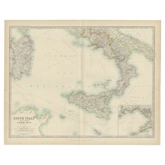
Antique Map of South Italy and the Island of Sardinia by Johnston (1909)
Located in Langweer, NL
Antique map titled 'South Italy and the Island of Sardinia'. Original antique map of South Italy and the Island of Sardinia. With inset map of Naples. Th...
Category
Early 20th Century Maps
Materials
Paper
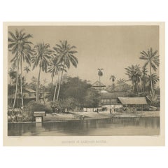
Old Print of a Mosque in a Kampung Java or Village of Javanese, Indonesia, 1874
Located in Langweer, NL
Antique print titled 'Missigit in Kampong Djawa'.
Antique print depicting a scene in Indonesia. Originates from 'De Oorlog tusschen Nederland en Atchin' by G.L. Klepper.
Artis...
Category
1870s Antique Maps
Materials
Paper
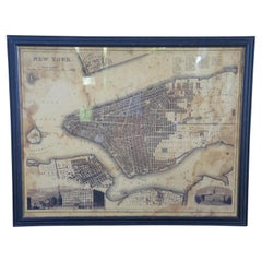
Vintage Oversized New York City Lower Manhattan 1840s Map Print
Located in Dayton, OH
Vintage late 20th century reproduction print of New York City featuring lower Manhattan in 1840.
Category
Late 20th Century Victorian Maps
Materials
Paper
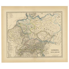
Roman Frontiers Engraved: Germania, Raetia, and Noricum, Published in 1880
Located in Langweer, NL
The map, titled "GERMANIA, RAETIA, NORICUM," depicts the regions of Germania, Raetia, and Noricum, which correspond to parts of modern-day Central and Eastern Europe, including areas of Germany, Austria, Switzerland, and the Balkans.
Features of the map include:
1. **Regional Divisions**: The map is divided into the regions of Germania, Raetia, and Noricum, each likely differentiated by color or shading.
2. **Topography**: It details the mountain ranges, rivers, and other geographical features of the region. The Alps, which are central to Raetia, are prominently displayed.
3. **Roman Settlements and Roads**: The map likely marks Roman...
Category
1880s Antique Maps
Materials
Paper
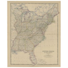
Antique Map of the United States of North America, c.1882
Located in Langweer, NL
Antique map titled 'United States of North America'. Old map of the United States of North America. This map originates from 'The Royal Atlas of Modern Geography, Exhibiting, in a Se...
Category
1880s Antique Maps
Materials
Paper
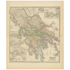
Original Antique Map of Greece and Epirus after the Persian Wars, Published 1880
Located in Langweer, NL
The map titled "GRAECIA, EPIRUS post bella Persica," translates to "Greece and Epirus after the Persian Wars." It covers the regions of ancient Greece and Epirus following the Greco-Persian Wars, a series of conflicts between the Greek city-states and the Persian Empire during the 5th century BC.
What makes this map interesting:
1. **Historical Context**: The period after the Persian Wars was pivotal for ancient Greece, leading to the rise of Athens as a major power and the Golden Age of Athens.
2. **Inset Maps**: Detailed insets, such as the one showing the Acropolis of Athens, provide close-up views of historically significant locations.
3. **Topography**: It features the diverse terrain of Greece, from the rugged mountain ranges to the intricate coastlines and islands, influencing the development of Greek city-states.
4. **City-States**: The map likely details the various polis or city-states, such as Athens, Sparta, Thebes, and others, which played critical roles in the Persian Wars.
5. **Battle Sites**: It might mark important battle sites from the wars, like Marathon, Thermopylae, Salamis, and Plataea.
6. **Latin Labels**: The use of Latin for place names and descriptions adds to the map's scholarly quality.
7. **Cultural Landmarks**: The map may include locations of significant cultural and historical landmarks from the era, such as temples, theatres, and agoras.
This map is from the "Spruner-Menke Atlas Antiquus," compiled by Karl Spruner von Merz and edited by Theodorus Menke. The atlas, known for its detailed maps of historical and ancient geographies, was a significant educational tool in the 19th century.
The Greco-Persian Wars, which included famous battles such as Marathon and Salamis, were crucial for the preservation of Greek independence...
Category
1880s Antique Maps
Materials
Paper
Authentic Antique Map of India and Ceylon, '1875'
Located in Langweer, NL
Antique map titled 'Carte générale des Indes'. Large map of India and Ceylon. This map originates from 'Atlas de Géographie Moderne Physique et Politique' by A. Levasseur. Published ...
Category
Late 19th Century Antique Maps
Materials
Paper
Original Antique Map of the American State of Missouri ( Northern part ), 1903
Located in St Annes, Lancashire
Antique map of Missouri ( Northern Part )
Published By A & C Black. 1903
Original colour
Good condition
Unframed.
Free shipping
Category
Early 1900s English Antique Maps
Materials
Paper
Maritime and Terrestrial Survey of Spanish Santander in 1901, An Original Map
Located in Langweer, NL
This antique map is a historical map of the province of Santander (currently known as Cantabria) from the year 1901. Santander is located along the northern coast of Spain, bordering...
Category
Early 1900s Antique Maps
Materials
Paper
Historical Large Map of Kyoto, Japan (1905) - Published by Kobayashi
Located in Langweer, NL
Old map of Kyoto, Japan. Published by Kobayashi, 1905.
This is an old map of Kyoto, Japan, published by Kobayashi in 1905. The map showcases a detailed layout of Kyoto during the ea...
Category
Early 20th Century Maps
Materials
Paper
Original Antique Map of the American State of Washington, 1889
Located in St Annes, Lancashire
Great map of Washington
Drawn and Engraved by W. & A.K. Johnston
Published By A & C Black, Edinburgh.
Original colour
Unframed.
Category
1880s Scottish Victorian Antique Maps
Materials
Paper
End XIX century Small Terrestrial Globe Signed C.M.C Paris Papier Maché Sphere
Located in Milan, IT
Small terrestrial globe signed C.M.C. Paris, end of XIX century. Papier maché sphere and turned and ebonized wooden base. Height cm 13 - inches 5.1, diameter of sphere cm 6,5 - inche...
Category
1890s French Antique Maps
Materials
Paper
Antique Decorative Coloured Map Marocco, Algeria and Tunis, 1882
Located in Langweer, NL
The maps is from the 1882 atlas by Blackie & Son and offers a detailed view of the North African regions as understood in the late 19th century.
**Map of Morocco, Algeria, and Tun...
Category
1880s Antique Maps
Materials
Paper
1904 "Nell's Topographical Map of the State of Colorado"
Located in Colorado Springs, CO
This highly detailed pocket map is a topographical map of the state of Colorado by Louis Nell from 1904. The map "has been compiled from all available...
Category
Early 1900s American Antique Maps
Materials
Leather, Paper
Antique Map of Virginia, with Inset Map of the South Western Continuation
Located in Langweer, NL
Antique map titled 'Virginia'. Original antique map of Virginia, United States. With inset map of the south western continuation of Virginia. T...
Category
Late 19th Century Antique Maps
Materials
Paper
Old Map of Mediterranean Powers: Pompey to Actium (66-31 BC), Published in 1880
Located in Langweer, NL
This is a historical map that depicts the Mediterranean region during a specific timeframe in Roman history, from the return of Pompey the Great after...
Category
1880s Antique Maps
Materials
Paper
Levant in Antiquity: Lands of Phoenicia, Judea, and Neighboring Kingdoms, 1880
Located in Langweer, NL
The map is titled "PHOENICE, COELESYRIA, IDUMAEA, JUDAEA MACCABAEORUM TEMPORE," which translates to "Phoenicia, Coele-Syria, Idumea, Judea at the Time of the Maccabees."
This origi...
Category
1880s Antique Maps
Materials
Paper
1882 Original Antique Map of New Zealand with Inset of Auckland's Environs
Located in Langweer, NL
This 1882 map of New Zealand, published by Blackie and Son as part of the 'Comprehensive Atlas and Geography of the World,' provides a detailed representation of the North Island and...
Category
1880s Antique Maps
Materials
Paper
1901 Chart of Port Jefferson, New York
Located in Norwell, MA
Original chart by George Eldridge of Port Jefferson on Long Island, New York. The identified waters include Setauket Harbor, Mount Misery Point, and Match Rock. Two channels are mark...
Category
Early 1900s North American Antique Maps
Materials
Paper
Antique Map of New Hampshire
Located in Langweer, NL
Antique map titled 'New Hampshire'. Original antique map of New Hampshire, United States. This print originates from 'Encyclopaedia Britan...
Category
Late 19th Century Antique Maps
Materials
Paper
Large Original Vintage Map of the South Pole, circa 1920
Located in St Annes, Lancashire
Great map of the South pole.
Unframed.
Original color.
By John Bartholomew and Co. Edinburgh Geographical Institute.
Published, circa 1920.
Category
1920s British Vintage Maps
Materials
Paper
Burnished brass earth globe - Circa 1930s
Located in Linkebeek, BE
Burnished brass earth globe - Circa 1930s
Globe - World map
Measures : 20x18cm H:25cm
Wear consistent with age and use
Category
20th Century Maps
Materials
Brass
Antique Map of The World in Hemispheres on Various Projections, 1882
Located in Langweer, NL
This stunning 1882 'Antique Map of The World in Hemispheres' showcases an exquisite blend of cartographic precision and artistic elegance. Crafted under the watchful eye of W.G. Blac...
Category
1880s Antique Maps
Materials
Paper
Large Original Antique City Plan of Philadelphia, USA, circa 1900
Located in St Annes, Lancashire
Fabulous colorful map of Philadelphia
Original color
By Rand, McNally & Co.
Published, circa 1900.
Unframed
Free shipping.
Category
Early 1900s American Antique Maps
Materials
Paper
Antique Map of the West Indies in Full Color, 1922
Located in Langweer, NL
Antique map titled 'The West Indies.' A map of the West Indies, the Carribean region. This includes the Greater Antilles (Jamaica, Haiti, Puerto Rico and Cuba) and the Lesser Antille...
Category
20th Century Maps
Materials
Paper
Antique Map of Spain, Mauritia and Africa by H. Kiepert, circa 1870
Located in Langweer, NL
Antique map titled 'Hispania, Mauretania et Africa'. This map originates from 'Atlas Antiquus. Zwölf Karten zur Alten Geschichte' by H. Kiepert. Published in Berlin, circa 1870.
Category
Late 19th Century Antique Maps
Materials
Paper
Antique Map of Ohio, with Inset Maps of Cleveland, Columbus and Cincinnati
Located in Langweer, NL
Antique map titled 'Ohio'. Original antique map of Ohio, United States. With inset maps of Cleveland, Columbus and Cincinnati. This print originates from 'Encyclopaedia Britannica', ...
Category
Late 19th Century Antique Maps
Materials
Paper
Large 1950's Philips' Hanging Globe
By Philips
Located in Hastings, GB
A superb decorators' interior design piece, this very large hanging globe made by the Philips' company in the 1950's hangs from a brass chain, the ...
Category
1950s English Mid-Century Modern Vintage Maps
Materials
Brass
Antique Map of Mexico and Central America by Johnson '1872'
Located in Langweer, NL
Antique map titled 'Johnson's Mexico (..)'. Two maps one one sheet showing Mexico and Central America, with inset maps of Tehuantepec and Panama. This map originates from 'Johnson's ...
Category
Late 19th Century Antique Maps
Materials
Paper
Architectural Print of the French Villa Weber, Chabat, c.1900
Located in Langweer, NL
Antique print titled 'Villa Weber, Mr. Paul Sédille Architecte'. This print depicts the design of a building in France. Originates from 'La Brique et La Terre Cuite' by P. Chabat. Ar...
Category
20th Century Maps
Materials
Paper
Antique Map of the Region of Verona 'Italy' by Ortelius, circa 1584
Located in Langweer, NL
Antique map titled 'Veronae Urbis Terratorium'. Original antique map of the Verona region, Italy. Centered on Verona, and including Mantua, and Lago de Garda. Published by A. Orteliu...
Category
Late 19th Century Antique Maps
Materials
Paper
Large Original Antique Map of North Dakota, USA, circa 1900
Located in St Annes, Lancashire
Fabulous map of North Dakota
Original color
Engraved and printed by the George F. Cram Company, Indianapolis.
Published, circa 1900
Unframed
Free shi...
Category
1890s American Antique Maps
Materials
Paper
Antique Map of the East Indies by Levasseur, '1875'
Located in Langweer, NL
Antique map titled 'Carte de la Malaisie'. Large map of the East Indies. This map originates from 'Atlas de Géographie Moderne Physique et Politique' by A. Levasseur. Published 1875.
Category
Late 19th Century Antique Maps
Materials
Paper
Antique Map of Kentucky
Located in Langweer, NL
Antique map titled 'Kentucky'. Original antique map of Kentucky, United States. This print originates from 'Encyclopaedia Britannica', Ninth E...
Category
Late 19th Century Antique Maps
Materials
Paper
Antique Map of Western States, Michigan, Wisconsin, Iowa by A & C. Black, 1870
Located in Langweer, NL
Antique map titled 'Western States, Michigan, Wisconsin, Minnesota, Iowa with portions of Illinois & Indiana'. Original antique map of Western States, Michigan, Wisconsin, Minnesota,...
Category
Late 19th Century Antique Maps
Materials
Paper
Antique Map of Northern Africa by Levasseur, '1875'
Located in Langweer, NL
Antique map titled 'Carte de l'Afrique Septentrionale'. Large map of Northern Africa. This map originates from 'Atlas de Géographie Moderne Physique et...
Category
Late 19th Century Antique Maps
Materials
Paper
Antique Map of New Zealand by G.F. Cram, 'circa 1906'
Located in Langweer, NL
Antique map titled 'New Zealand'. Large map of New Zealand with a small legend of the Chatham Islands. On the verso, a map of the North Polar regions and a map of Tasmania can be fou...
Category
20th Century Maps
Materials
Paper
Antique Map of New Zealand and Tasmania, 1904
Located in Langweer, NL
This large antique map is taken from; 'Andrees Allgemeiner Handatlas in 126 Haupt-Und 139 Nebenkarten', Bielefeld; Leipzig: Velhagen & Klasing 1899. Andrees Allgemeiner Handatlas was...
Category
20th Century Maps
Materials
Paper
Old Map of the Oceans Around Australia, Indonesia and New Zealand, 1880
Located in Langweer, NL
Antique map titled 'Océanie'.
Old map of the oceans around Australia, Indonesia and New Zealand. With vignettes of people from Polynesia and the old monument Laparouse. This map ...
Category
1880s Antique Maps
Materials
Paper
Antique Map of Moldova to Thessaly and from the Adriatic to the Black Sea, 1880
Located in Langweer, NL
Antique map titled 'Turquie d'Europe'.
Map of the european parts of Turkey. The map covers from Moldova to Thessaly and from the Adriatic to the Black Sea. Greece and the island ...
Category
1880s Antique Maps
Materials
Paper
Antique Map of Oceania by Levasseur, '1875'
Located in Langweer, NL
Antique map titled 'Carte générale de l'Océanie'. Large map of Oceania. This map originates from 'Atlas de Géographie Moderne Physique et Politique' by A. Levasseur. Published 1875.
Category
Late 19th Century Antique Maps
Materials
Paper
Antique Map of the German Empire by Levasseur, '1875'
Located in Langweer, NL
Antique map titled 'Carte générale de l'Europe Centrale (..)'. Large map of the German Empire. This map originates from 'Atlas de Géographie Moderne Phys...
Category
Late 19th Century Antique Maps
Materials
Paper
Antique Map of Persia and Afghanistan by Johnston '1909'
Located in Langweer, NL
Antique map titled 'Persia and Afghanistan'. Original antique map of Persia and Afghanistan. This map originates from the ‘Royal Atlas o...
Category
Early 20th Century Maps
Materials
Paper
Large U.S. Coast and Geodetic Survey Chart A of the Atlantic Coast, 1877
Located in Nantucket, MA
Large U.S. Coast and Geodetic Survey Chart A of the Atlantic Coast, 1877, re-issued in February 1881, a printed paper laid down on linen navigational chart of the U.S. Atlantic coast...
Category
1880s American Other Antique Maps
Materials
Linen
Antique Map of Pennsylvania and New Jersey by Johnson, 1872
Located in Langweer, NL
Antique map titled 'Johnson's Pennsylvania and New Jersey'. Original map showing Pennsylvania and New Jersey. This map originates from 'Johnson's New Illustrated Family Atlas of the ...
Category
Late 19th Century Antique Maps
Materials
Paper
Decorative Vintage Print, Dutch Chart of Australia, 1st Edition, 1952
Located in Langweer, NL
The vintage school chart of Australia titled "Australië," created by W. Bakker & H. Rush and published in 1952:
**Title**: Australië
**Creators**: W. Bakker & H. Rush
**Publication ...
Category
Mid-20th Century European Maps
Materials
Canvas
Antique Map of the Prussian Monarchy by Levasseur, '1875'
Located in Langweer, NL
Antique map titled 'Carte générale de la Monarchie Prussienne (..)'. Large map of the Prussian Monarchy. This map originates from 'Atlas de Géographie Moderne Physique et Politique' ...
Category
Late 19th Century Antique Maps
Materials
Paper
Antique Map of The Dutch City of Gorinchem by Smulders, Lithograph, 1916
Located in Langweer, NL
Antique map Gorinchem titled 'Gorkum'. Antique map depicting the city of Gorinchem, The Netherlands.
Artists and Engravers: Lithograph by J. Smulders & Co, Den Haag.
Condition...
Category
20th Century Maps
Materials
Paper
1923 "Washington, The Beautiful Capital of the Nation" Baltimore and Ohio RR Map
Located in Colorado Springs, CO
This is a fabulous 1923 bird's eye map of Washington, DC that shows the city in amazing detail. Every building is individually drawn and all major roads in the city are shown. The vi...
Category
1920s American Art Deco Vintage Maps
Materials
Paper
Vintage Folding Map of the Streets of Moscow, Russia, circa 1950
Located in Langweer, NL
Antique map titled 'Carte Illustree des Rues de Moscou'. Vintage folding map of the streets of Moscow, Russia. Published by Intourist.
Category
20th Century Maps
Materials
Paper
1970's rotating replogle world globe
Located in Los Angeles, CA
An elegant world globe by Paul Mc Cobb, the brass patina is much nicer in person
Category
1970s American Mid-Century Modern Vintage Maps
Materials
Brass
Antique European War Folding Map, ‘circa 1915’
Located in Langweer, NL
Antique folding map of the European War (1914-1915) titled 'The Eastern Campaign '. From Petrograd to Berlin, geographically colored. Published on linen b...
Category
Early 20th Century Maps
Materials
Paper
Antique Map of England and Wales, 1903, with Detailed Counties and Railways
Located in Langweer, NL
Title: Antique Map of England and Wales, 1903, with Detailed Counties and Railways
Description:
This beautifully detailed antique map, titled "England and Wales," was engraved and p...
Category
Early 20th Century Maps
Materials
Paper
Mid-Century World Map Globe Table Light or Lamp
Located in Miami, FL
Good quality world map globe lamp.
If you are looking for stylish and beautiful quality item to upgrade your interior (whether at home or in your office) then this Parisian globe...
Category
Mid-20th Century French Mid-Century Modern Maps
Materials
Chrome
1873 "Map of the States of California and Nevada" by Chas. Drayton Gibbes
Located in Colorado Springs, CO
Presented is Warren Holt and Charles Drayton Gibbes' 1873 “Map of California and Nevada.” This map is considered to be one of the finest large-scale ...
Category
1870s American Antique Maps
Materials
Paper
Antique Map of Turkey in Asia (Asia Minor and Transcaucasia), 1903
Located in Langweer, NL
Antique Map of Turkey in Asia (Asia Minor and Transcaucasia), 1903, with Intricate Provincial Borders
This antique map, titled "Turkey in Asia (Asia Minor) and Transcaucasia," was e...
Category
Early 20th Century Maps
Materials
Paper
Antique Map of the Mediterranean Basin, 1903, with Detailed Coastal and Inland
Located in Langweer, NL
Title: Antique Map of the Mediterranean Basin, 1903, with Detailed Coastal and Inland Geography
Description: This antique map, titled "Basin of the Mediterranean," was engraved and ...
Category
Early 20th Century Maps
Materials
Paper
1889 Map of Italy in 3D Relief
Located in Weesp, NL
Introducing a true gem for collectors and history enthusiasts alike: this rare 1889 *"Italia in Rilievo"* map by L. Roux & Co. from Torino, a masterpiece of craftsmanship and cartogr...
Category
1880s European Antique Maps
Materials
Paper
