Maps
to
185
334
22
356
3
3
2
1
1
2,926
2,181
476
3
289
34
10
127
7
35
9
2
5
3
4
2
346
12
10
9
2
81
76
63
22
15
356
356
356
5
1
1
1
1
Maps For Sale
Period: Early 20th Century
Period: 1750s
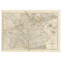
Antique Map of Germany by Johnston '1909'
Located in Langweer, NL
Antique map titled 'Empire of Germany'. Original antique map of Germany. With inset maps of Frankfurt and Munich. This map originates from the ‘...
Category
Early 20th Century Maps
Materials
Paper
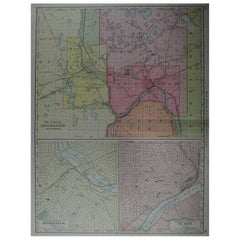
Large Original Antique City Plan of Minneapolis and St Paul, USA, circa 1900
Located in St Annes, Lancashire
Fabulous colorful map of Minneapolis and St Paul, Minnesota.
Original color
By Rand, McNally & Co.
Published, circa 1900
Unframed
Minor edge tears
Free shipping.
Category
Early 1900s American Antique Maps
Materials
Paper
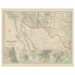
Antique Map of the United States of North America by Johnston '1909'
Located in Langweer, NL
Antique map titled 'United States of North America'. Original antique map of United States of North America ( South West Sheet ). With inset maps of Chicago...
Category
Early 20th Century Maps
Materials
Paper
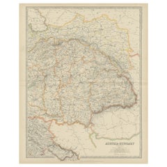
Antique Map of Austria- Hungary by Johnston, '1909'
Located in Langweer, NL
Antique map titled 'Austria- Hungary'. Original antique map of Austria- Hungary. This map originates from the ‘Royal Atlas of Modern Geography’....
Category
Early 20th Century Maps
Materials
Paper
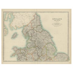
Original Antique Map of England and Wales from the 1909 Royal Atlas
Located in Langweer, NL
The antique map titled 'England and Wales' is a historical cartographic representation of these two nations. This original antique map of England...
Category
Early 20th Century Maps
Materials
Paper
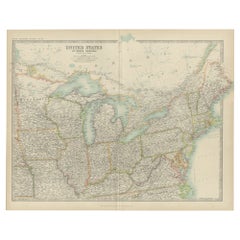
Antique Map of the United States ' North East ' by Johnston '1909'
Located in Langweer, NL
Antique map titled 'United States of North America'. Original antique map of United States of North America ( North East ). This map orig...
Category
Early 20th Century Maps
Materials
Paper
Large Sea Chart of the British Islands, 1918
Located in Langweer, NL
Antique map titled 'The British Islands'.
Large sea chart of the British Islands. It shows Ireland, Scotland, England, the Shetland Islands and part of Fra...
Category
1910s Vintage Maps
Materials
Paper
Original Antique Map of the Northwestern Part of Russia in Europe, 1753
Located in Langweer, NL
Antique map titled 'Partie septentrionale de la Russie Européenne'.
Detailed map of the Northwestern part of Russia, from the Gulf of Finland and Poland, to the western part of Asian Russia.
Artists and Engravers: Gilles Robert de Vaugondy (1688-1766) was the head of a leading family of geographers in eighteenth century France. Gilles got his start when he jointly inherited the shop of Pierre-Moullart Sanson, grandson of the famous geographer Nicholas Sanson. The inheritance included the business, its stock of plates, and a roller press...
Category
1750s Antique Maps
Materials
Paper
Prince of Orange, First King of the Netherlands & Grand Duke of Luxembourg, 1750
Located in Langweer, NL
Antique portrait titled 'Willem de I. Prins van Oranje enz. enz. enz'.
Portrait of William I, Prince of Orange. William I Frederick, born Willem Frederik Prins van Oranje-Nassau ...
Category
1750s Antique Maps
Materials
Paper
Old Map of Turkmenistan, Uzbekistan, Afghanistan, Tajikistan, Kyrgyzstan, 1757
Located in Langweer, NL
Antique map titled 'Kort over det Lille Bukarie og de naest graensende Lande. af Engelske Skribentere ved N. Bellin Ingenieur ved Marinen efter Söe Etaten'.
Map of present-day Turkmenistan, Uzbekistan, Afghanistan, Tajikistan, Kyrgyzstan including part of China. Originates from 'Almindelig histoirie over reiser til lands og bands (..)'. This 17 volume set is a translation of Collection of voyages and travels edited by Awnsham and John Churchill and Thomas Osborne...
Category
1750s Antique Maps
Materials
Paper
Old Map of the Gulf of Bothnia, the Northernmost Arm of the Baltic Sea, 1759
Located in Langweer, NL
Antique map titled 'Carte du Golphe de Bothnie'.
Original antique map of the Gulf of Bothnia, the northernmost arm of the Baltic Sea. It is situated between Finland's west coast ...
Category
1750s Antique Maps
Materials
Paper
Nicely Hand-Colored Antique Map of Part of India, the Ganges & Hindustan, 1755
Located in Langweer, NL
Antique map titled 'Carte de l'Inde en deca du Gange comprenant l' Indoustan (..)'
A map of part of India, the Ganges and Hindustan. From: Antoine Francois Prevost d'Exiles' (or ...
Category
1750s Antique Maps
Materials
Paper
Old Map of The Kurile Islands, from Hokkaido, Japan to Kamchatka, Russia, c.1750
Located in Langweer, NL
Antique map titled 'Carte des Iles Kouriles'. Original antique map of the Kuril Islands.
The Kuril Islands or Kurile Islands are a volcanic archipelago that stretches approximate...
Category
1750s Antique Maps
Materials
Paper
Antique Map of Denmark by Johnston '1909'
Located in Langweer, NL
Antique map titled 'Denmark'. Original antique map of Denmark. With inset maps of Iceland, Faroe Island, and Copenhagen. This map originates from the ‘Royal Atlas of Modern Geography...
Category
Early 20th Century Maps
Materials
Paper
Detailed Antique Map Showing Mansfeld in Saxony-Anhalt, Germany, ca.1750
Located in Langweer, NL
Description: Antique map titled 'Die Grafschaft Mansfeld Konigl. Preuss. Churfurstl. Sachsischen Antheils mit allen darinnen befindlichen Stadten Dorfschaften.'
Detailed map show...
Category
1750s Antique Maps
Materials
Paper
Antique Map of the Caribbean Island of St Kitts, ca.1750
Located in Langweer, NL
Description: Antique map titled 'Carte de l'Isle St. Christophe pour Servir a l'Histoire Genle. des Voyages.'
Detailed map of the Island of St. Kitts, showing the Parishes, towns, ...
Category
1750s Antique Maps
Materials
Paper
Antique Map of Turkey in Europe with Bulgaria by Johnston '1909'
Located in Langweer, NL
Antique map titled 'Turkey in Europe with Bulgaria'. Original antique map of Turkey in Europe with Bulgaria. With inset maps of The Bosporus & Constantinople, and Crete (or Candia). ...
Category
Early 20th Century Maps
Materials
Paper
Antique Map of Canada by Johnston '1909'
Located in Langweer, NL
Antique map titled 'Dominion of Canada'. Original antique map of Canada. With inset map of Newfoundland. This map originates from the ‘Royal Atla...
Category
Early 20th Century Maps
Materials
Paper
Antique Map of Abyssinia with Upper Nubia by Johnston, '1909'
Located in Langweer, NL
Antique map titled 'Abyssinia with Upper Nubia'. Original antique map of Abyssinia with Upper Nubia. This map originates from the ‘Royal Atlas of Modern Geography’. Published by W. &...
Category
Early 20th Century Maps
Materials
Paper
Antique Map of Turkey in Asia by Johnston '1909'
Located in Langweer, NL
Antique map titled 'Turkey Asia ( Asia Minor )'. Original antique map of Turkey in Asia. This map originates from the ‘Royal Atlas of Modern Geog...
Category
Early 20th Century Maps
Materials
Paper
Antique Map of Central Asia by Johnston '1909'
Located in Langweer, NL
Antique map titled 'Central Asia'. Original antique map of Central Asia. This map originates from the ‘Royal Atlas of Modern Geography’. Published by W. & A.K. Johnston, 1909.
Category
Early 20th Century Maps
Materials
Paper
Antique Map of the German Empire by Johnston, '1909'
Located in Langweer, NL
Antique map titled 'Empire of Germany'. Original antique map of the German Empire. With inset maps of Berlin and Potsdam. This map originates from the ‘R...
Category
Early 20th Century Maps
Materials
Paper
Antique Map of France by Johnston (1909)
Located in Langweer, NL
Antique map titled 'France'. Original antique map of France. With inset maps of France in provinces, part of the Riviera and Corsica. This map or...
Category
Early 20th Century Maps
Materials
Paper
Antique Map of the Baltic Sea by Johnston, '1909'
Located in Langweer, NL
Antique map titled 'Basin of the Baltic'. Original antique map of Baltic Sea. With inset maps of Kiel, Stettin, Danzig and St Petersburg. This map originate...
Category
Early 20th Century Maps
Materials
Paper
Antique Map of Asia by Johnston '1909'
Located in Langweer, NL
Antique map titled 'Asia'. Depicting China, Japan, Indonesia, India, Arabia and more. This map originates from the ‘Royal Atlas of Modern Geography’. Published by W. & A.K. Johnston,...
Category
Early 20th Century Maps
Materials
Paper
Antique Chart of the World by Johnston '1909'
Located in Langweer, NL
Antique map titled 'Chart of the World on Mercator's Projection Showing the directions of the Oceans Currents with the Routes and Distances Between Principal Ports'. Detailed map of ...
Category
Early 20th Century Maps
Materials
Paper
Antique Map of Egypt, Arabia Petraea and Lower Nubia by Johnston '1909'
Located in Langweer, NL
Antique map titled 'Egypt, Arabia Petraea and Lower Nubia'. Original antique map of Egypt, Arabia Petraea and Lower Nubia. With inset maps of Alexandriam Cairo and the Suez Canal...
Category
Early 20th Century Maps
Materials
Paper
Antique Map of the Orange River Colony in South Africa, 1901
Located in Langweer, NL
Antique map titled 'Orange River Colony, northern part'. Lithograph of the northern part of the Orange River Colony, Africa. The Orange River Colony was the British colony created af...
Category
Early 20th Century Maps
Materials
Paper
1918 American Frohse Anatomical Chart, A. J. Nystrom, Max Brodel Illustrator
By A.J. Nystrom & Co, Max Brödel
Located in Buffalo, NY
Antique American Frohse Anatomical pull down chart, by A. J. Nystrom, ,revised and augmented by Max Brodel illustrator... Amazing color, patina, age appropriate wear. dated 1918..
Max (Paul Heinrich) Brödel
1870-1941
Brödel, an illustrator and the first director of the Art as Applied to Medicine program at Johns Hopkins...
Category
1910s American Steampunk Vintage Maps
Materials
Wood, Paper
Map of Friesland (La Frise), from "Atlas Nouveau Portatif" (1756)
Located in Langweer, NL
Title: Map of Friesland (La Frise), from "Atlas Nouveau Portatif" (1756)
This is an 18th-century map of Friesland (Frise), a northern province of the Netherlands, engraved by *Georg...
Category
1750s Antique Maps
Materials
Paper
Antique Webber Costello Globe on Metal Tripod Base c 1900 / 1920's
Located in New York, NY
Rare floor model globe made by Weber Costello, circa 1900. The 12" globe rests on a folding metal base. This example is in very good, original condition, showing only light wear, nor...
Category
Early 20th Century American Industrial Maps
Materials
Metal
1915 "San Francisco City and County" Hanging Map by W. Bashford Smith
Located in Colorado Springs, CO
Presented is a rare wall map of San Francisco by W. Bashford Smith. Published in San Francisco in 1915, this map indicates streets and city districts, and, most notably, shows the si...
Category
1910s American Art Deco Vintage Maps
Materials
Wood, Paper
Old Portrait of Henry Frederick, Prince of Wales, c.1750
Located in Langweer, NL
Antique portrait titled 'Henry, Prince of Wales, Son of K. James I'.
Old portrait of Henry Frederick. Henry Frederick, Prince of Wales (1594-1612) was the elder son of James VI and I, King of England and Scotland, and his wife, Anne of Denmark. Prince Henry was widely seen as a bright and promising heir to his father's thrones. However, at the age of 18, he predeceased his father when he died of typhoid fever. His younger brother Charles succeeded him as heir apparent to the English, Irish and Scottish thrones...
Category
1750s Antique Maps
Materials
Paper
Engraving of Amalia, Princess of Orange, 1757
Located in Langweer, NL
Rare antique portrait ( proof print circa 1750) with title Amelia, Gravinne van Solms, gemalinne van Frederik Hendrik, Prins van Oranje etc.
Engraving of Amalia, Princess of Orange. Half length with curled hair with pearl ropes, pearl earrings and necklace, low gown, and jewelled bodice.
Artists and Engravers: Jakob Houbraken was a very productive Dutch 18th century engraver...
Category
1750s Antique Maps
Materials
Paper
Antique Map of Hangzhou, Capital of the Province of Zheijang, China, c.1750
Located in Langweer, NL
Antique map titled ‘Plan de la ville de Hang-Tcheou-Fou ou Hang-Chew-Fu Capitale de la Province de Che-Kiang’. This original print shows a map of the city of Hangzhou, capital of the...
Category
1750s Antique Maps
Materials
Paper
Palace & Gardens of Shah Shuja, Prince of Rajmahal & Munger, India, 1757
Located in Langweer, NL
Antique print titled 'Paleis en Tuynen van Cha-Sousa Prins van Ragi Mohol - Grondtekening der Stad Mongheer‘.
This print depicts the palace and gardens of Shah Shuja, Prince of R...
Category
1750s Antique Maps
Materials
Paper
Small Detailed Antique Map of France, with Decorative Title Cartouche, 1754
Located in Langweer, NL
Antique map France titled 'An Accurate Map of France drawn from the best authorities'.
Small, detailed map of France. With decorative title cartouche.
...
Category
1750s Antique Maps
Materials
Paper
Antique Map of the Gulf of Bothnia, the Northernmost Arm of the Baltic, 1759
Located in Langweer, NL
Antique map titled 'Suite du Golphe de Bothnie'.
Original antique map of the Gulf of Bothnia, the northernmost arm of the Baltic Sea. It is situated between Finland's west coast ...
Category
1750s Antique Maps
Materials
Paper
Map of the Russian Islands of Novaya Zemlya and Pechorskaya Guba, 1758
Located in Langweer, NL
Antique map titled 'Carte du detroit de Waeigats ou de Nassau.'
Map of the Russian islands of Novaya Zemlya (Nova Zembla) and Pechorskaya Guba, here Nouvelle Zemble and Grande Ba...
Category
1750s Antique Maps
Materials
Paper
Map of North and East coast of Asia with Japan & inset maps of Kamchatka, c1750
Located in Langweer, NL
Antique map titled 'Nouvelle representation des Cotes Nord et Est de L'Asie.'
Map the north and east coast of Asia, showing an oddly shaped Japan and inset maps of Kamchatka. Thi...
Category
1750s Antique Maps
Materials
Paper
Decorative Original Antique Panoramic View of Atjeh on Sumatra, Indonesia, 1756
Located in Langweer, NL
Antique print titled 'Achem - Atsjien'.
Decorative panoramic view of Atjeh on Sumatra, Indonesia. On this engraving a pagode like building is visible in the background. In the fo...
Category
1750s Antique Maps
Materials
Paper
Map of the Circle of Franconia, Germany Bamberg, Wurtzburg and Nuremberg, 1757
Located in Langweer, NL
Antique map titled 'Cercle de Franconie (..)'.
Map of the Circle of Franconia, Germany. Centered on Bamberg, Wurtzburg and Nuremberg. This map originates from 'Atlas Universel (..)'.
Artists and Engravers: Gilles Robert de Vaugondy (1688 - 1766), also known as Le Sieur or Monsieur Robert, and his son, Didier Robert de Vaugondy (c.1723 - 1786), were leading mapmakers in France during the 18th century. In 1757, they published The Atlas Universel, one of the most important atlases of the 18th century. To produce the atlas, the Vaugondys integrated older sources with more modern surveyed maps...
Category
1750s Antique Maps
Materials
Paper
Nicely Colored Original Antique Map of Upper Saxony, Middle Germany, 1756
Located in Langweer, NL
Antique map titled 'Partie Meridionale du cercle de Haute Saxe (..)'.
Original antique map of upper Saxony, Germany. It was the name given to the majority of the German lands held by the House of Wettin, in what is now called Central Germany.
Artists and Engravers: Gilles Robert de Vaugondy (1688 - 1766), also known as Le Sieur or Monsieur Robert, and his son, Didier Robert de Vaugondy (c.1723 - 1786), were leading mapmakers in France during the 18th century. In 1757, they published The Atlas Universel, one of the most important atlases of the 18th century. To produce the atlas, the Vaugondys integrated older sources with more modern surveyed maps...
Category
1750s Antique Maps
Materials
Paper
Antique Plan of Fort Dauphin on Madagascar of the East Coast of Africa, 1756
Located in Langweer, NL
Antique map titled 'Plan du Fort Dauphin (..) -
Grondtekening van 't Fort Dauphin'. Plan of Fort Dauphin on the island of Madagascar of the east coast of Africa. This print origi...
Category
1750s Antique Maps
Materials
Paper
Antique Map of India ( Southern ) by Johnston (1909)
Located in Langweer, NL
Antique map titled 'India'. Original antique map of India Southern sheet. With inset maps of south eastern provinces of India. This map originates from the ‘Royal Atlas of Modern Geo...
Category
Early 20th Century Maps
Materials
Paper
Antique Map of Spain and Portugal by Johnston, '1909'
Located in Langweer, NL
Antique map titled 'Spain and Portugal'. Original antique map of Spain and Portugal. With inset maps of the Canary Islands, Madeira, Lisbon and Ma...
Category
Early 20th Century Maps
Materials
Paper
Antique Map of Belgium and the Netherlands by Johnston '1909'
Located in Langweer, NL
Antique map titled 'Belgium and The Netherlands'. Original antique map of Belgium and the Netherlands. With inset maps of Amsterdam and Brussels. This m...
Category
Early 20th Century Maps
Materials
Paper
Antique Map of South-West Russia by Johnston (1909)
Located in Langweer, NL
Antique map titled 'South-West Russia'. Original antique map of South-West Russia. With inset map of Odessa. This map originates from the ‘Royal Atlas of Modern Geography’. Published...
Category
Early 20th Century Maps
Materials
Paper
Antique Map of the United States 'North West' by Johnston, '1909'
Located in Langweer, NL
Antique map titled 'United States of North America'. Original antique map of the United States of North America ( North West ). This map originates from the ‘Royal Atlas of Modern Ge...
Category
Early 20th Century Maps
Materials
Paper
Antique Map of Sweden and Norway by Johnston (1909)
Located in Langweer, NL
Antique map titled 'Sweden and Norway'. Original antique map of Sweden and Norway. With inset maps of Christiania and Stockholm. This map originates from...
Category
Early 20th Century Maps
Materials
Paper
Antique Map of India 'Northern' by Johnston '1909'
Located in Langweer, NL
Antique map titled 'India'. Original antique map of India, Northern sheet. This map originates from the ‘Royal Atlas of Modern Geography’. Published by W. & A.K. Johnston, 1909.
Category
Early 20th Century Maps
Materials
Paper
Antique Map of Scotland 'Northern' by Johnston, '1909'
Located in Langweer, NL
Antique map titled 'Scotland'. Original antique map of Scotland. With inset map of the Shetland Islands. This map originates from the ‘Royal Atlas of M...
Category
Early 20th Century Maps
Materials
Paper
Antique Map of South America by Johnston '1909'
Located in Langweer, NL
Antique map titled 'South America, Southern Sheet'. Depicting Chile, Argentina, Brazil, Patagonia, the Falkland Island and more. With inset maps of Valparaiso, Rio de Janeiro and Bue...
Category
Early 20th Century Maps
Materials
Paper
Antique Map of the East Indies by Brouwer, 1917
Located in Langweer, NL
Antique map titled 'Geotektonische Schetskaart van het Oostelijk Gedeelte van den Oost-Indischen Archipel':
**Title**: Geotektonische Schetskaart van het Oostelijk Gedeelte van den ...
Category
Early 20th Century Maps
Materials
Canvas, Paper
Antique Plan of Paramaribo 'Suriname' Published 1920
Located in Langweer, NL
Large lithographed plan of Paramaribo, capital city of Suriname, showing the situation, circa 1916-1917. With small inset plan. Published in 1920.
Category
Early 20th Century Maps
Materials
Paper
Antique Map of Northern Natal by Stanford, 1900
Located in Langweer, NL
Antique map titled 'Northern Natal'. Lithograph of Northern Natal. The Colony of Natal was a British colony in south-eastern Africa. It was proclaimed a British colony on 4 May 1843 ...
Category
Early 20th Century Maps
Materials
Paper
Mamaroneck New York Harbor Chart from 1901
Located in Norwell, MA
Original harbor chart by George Eldridge in 1801 of Mamaroneck New York. Showing Oriental Hen Island, Rye Point, Scotch Caps, Crane Island, Decency Point, etc.. Showing local water d...
Category
Early 1900s North American Antique Maps
Materials
Paper
1912 "Panoramic View of New York City and Vicinity" by Jacob Ruppert
Located in Colorado Springs, CO
This is an attractive and very scarce map of New York, published by the Yorkville brewer Jacob Ruppert in 1912. The map shows an expansive view of the region reaching from Sandy Hook in the south and Yonkers to the north, to Hicksville in the east and past Newark to the west. This beautifully colored birds eye view shows waterways with all shipping traffic, boroughs, and clearly labeled railroad routes. It is presented on period dowels and backed on its original linen.
Jacob Ruppert was born in New York City in 1842 to Bavarian immigrants. His father owned a brewery in Manhattan where young Jacob learned the business of brewing. In 1862, Jacob established the Jacob...
Category
1910s American Vintage Maps
Materials
Paper
