Maps
to
1,542
1,846
40
1,888
26
2
2
1
1
2,926
2,181
476
3
289
34
10
127
7
35
9
2
5
3
4
2
1,873
23
11
5
3
126
61
34
20
18
1,888
1,888
1,888
24
16
13
12
12
Maps For Sale
Period: 18th Century
Period: 1920s
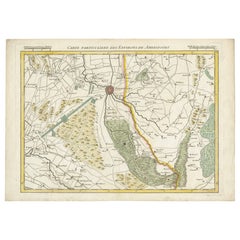
Map of Amersfoort and Surroundings by Covens & Mortier, published in 1747
Located in Langweer, NL
Map of Amersfoort and Surroundings by Covens & Mortier, published in 1747
Hand-coloured copper engraving titled *Carte Particulière des Environs de Amersfoort*, created by Jean Cove...
Category
1740s Antique Maps
Materials
Paper
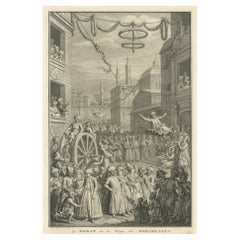
Old Engraving of the Bairam Celebration, the Easter of the Muslims, 1737
Located in Langweer, NL
Antique print titled 'Le Bairam ou la Paque des Mahometans'.
Old print of the Bairam celebration, the Easter of the Muslims. Originates from 'Ceremonies et coutumes Religieuses.....
Category
1730s Antique Maps
Materials
Paper
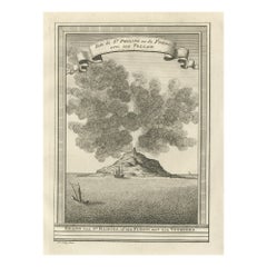
Old Engraving of Volcano Piton de la Fournaise on Reunion Island, c.1750
Located in Langweer, NL
Antique print titled 'Eiland van St. Filippus, of van Fuego, met zyn vuurberg'. Old print of Piton de la Fournaise, a shield volcano on the eastern side of Reunion island...
Category
18th Century Antique Maps
Materials
Paper
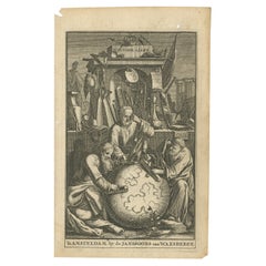
Antique Frontispiece of an Old Dutch Book Depicting Globe Makers, 1717
Located in Langweer, NL
Antique frontispiece titled 'Iets voor Allen'. This print originates from 'Iets voor Allen, zijnde een Verhandeling en Verbeelding Van allerhande Standen, Studien, Konsten, Wetenscha...
Category
18th Century Antique Maps
Materials
Paper
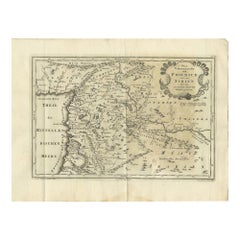
Original Antique Map of Syria Phoenice by Van Dùren '1749'
Located in Langweer, NL
Interesting Antique map published in Germany titled 'Neue Vorstellung von Phoenice und Syrien (..)' This map is engraved with a lot of details. It is an original antique map of Syria...
Category
Mid-18th Century Antique Maps
Materials
Paper
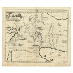
Antique Map of the Middle East by Mortier, 1700
Located in Langweer, NL
Antique map titled 'Carte de la Situation du Paradis Terrestre (..)'. Detailed map of the Holy Land and the Middle East, centered on the Garden of Eden and including a large Cyprus. ...
Category
18th Century Antique Maps
Materials
Paper
Antique Plan of Meaco, Kyoto, Japan
Located in Langweer, NL
Antique map titled 'Plan de la Ville de Meaco - Platte-Grond van de Stad Miaco'. Detailed and unusual antique copper engraved plan of Kyoto, ancient named Meaco, when it was the capi...
Category
Mid-18th Century Antique Maps
Materials
Paper
Antique Map of Java and Madura Island, Indonesia, c.1760
Located in Langweer, NL
Antique map titled 'Idee de l'Isle de Java.'
Well engraved and attractive chart of the island shows all principal harbors and coastal details, plus rivers, mountains and volcanoe...
Category
18th Century Antique Maps
Materials
Paper
Large Original Vintage Map of India, circa 1920
Located in St Annes, Lancashire
Great map of India
Original color.
Good condition / repair to some minor damage just above Sri Lanka. Shown in the last image.
Published by Alexander Gross
Unframed.
Category
1920s English Vintage Maps
Materials
Paper
18th Century Antique Conrad Lotter Septentrionalis Meridionalis American Maps
Located in Dayton, OH
Pair of rare hand colored maps from the 1770's, depicting "America Septentrionalis" (North America), engraved by Georg Friedrich Lotter and America Meridionalis (South America), engr...
Category
18th Century Antique Maps
Materials
Paper
Antique Map of the Sanaga River, Senegal, 1747
Located in Langweer, NL
Antique map titled 'Cours De La Riviere De Sanaga Ou Senegal (..) - Kaart van den Loop der Riviere Sanaga (..)'. Attractive double map of the Sanaga River, Senegal, Africa. This map ...
Category
18th Century Antique Maps
Materials
Paper
Bonne Map of Philippines, Formosa, Siam, Indochina & South China, 1780
Located in Langweer, NL
Bonne Map of Philippines, Formosa, Siam, Indochina & South China, 1780
Les Isles Philippines, celle de Formose, le Sud de la Chine, les Royaumes de Tunkin, de Cochinchine, de Cambog...
Category
1780s Antique Maps
Materials
Paper
Antique Print with Views of Tinian Island, the Northern Mariana Islands, 1749
Located in Langweer, NL
Antique print titled 'Le cote du sud-ouest de l'Ile de Tinian' and 'Vue de la rade de Tinian, ou le Centurion fit de l'eau.' Views of the south-west side of the island of Tinian and a view of the anchorage of Tinian, where the Centurion got water. This print originates from 'Reize rondsom de Werreld (..)' by George Anson, published 1749.
Tinian is one of the three principal islands of the Commonwealth of the Northern Mariana Islands...
Category
18th Century Antique Maps
Materials
Paper
Antique Miniature Map of France and the Low Countries by Mallet, circa 1719
Located in Langweer, NL
Antique map titled 'France - Païs-Bas'. Miniature Map of France and the Low Countries. Published by A.M. Mallet, circa 1719.
Frame included. We carefully pack our framed items to ...
Category
Early 18th Century Antique Maps
Materials
Paper
Antique Map of The Harbour of Acapulco in Mexico, 1749
Located in Langweer, NL
Description: Antique map titled 'Plan van de Haven van Acapulco (..) - Plan du Port d'Acapulco (..)'. Original antique map of the Port of Acapulco on the coast of Mexico in the South...
Category
1740s Antique Maps
Materials
Paper
Antique Architectural Print of a New Design for Robert Walpole, England, 1725
Located in Langweer, NL
Antique print titled 'This New Design of my Invention, is most humbly inscrib'd to the Rt. Honble Robert Walpole (..)'.
Old print depicting a new de...
Category
18th Century Antique Maps
Materials
Paper
Original Detailed Antique Map of the East Coast of Africa, 1747
Located in Langweer, NL
Antique map titled 'Carte de la coste Orientale d'Afrique - Kaart van de Oostkust van Afrika'.
Original antique map of the east coast of Africa. Reaches from Cape of Good Hope an...
Category
1740s Antique Maps
Materials
Paper
Antique Plan of the Overground Area of Baths of Emperor Titus, Rome, Italy, 1786
Located in Langweer, NL
Antique print titled 'Plan des Thermes de Titus Partie Superieure'.
Plan of the overground area of the Baths of Titus. The Baths of Titus or Thermae Titi were public baths (Thermae) built in 81 AD at Rome, by Roman emperor Titus...
Category
18th Century Antique Maps
Materials
Paper
Original Antique Bird's Eye View Plan of Hoorn, The Netherlands by Blaeu, c.1700
Located in Langweer, NL
Antique map titled 'Horna vulgo Hoorn'.
Bird's eye view plan of Hoorn, The Netherlands. With title cartouche, coats of arms and key. From an atlas published by De Wit, ca. 1698-1...
Category
Early 1700s Antique Maps
Materials
Paper
Print of Makassar 'Ujung Pandang' in the Dutch East Indies 'Indonesia', c.1725
Located in Langweer, NL
Antique print titled 'Macasar, Capitale du Roiaume de même nom'. This rare print shows Makassar, the present capital of South Sulawesi, Indonesia. In the foreground several VOC ships...
Category
18th Century Antique Maps
Materials
Paper
Original Antique Map of Asia
Located in Langweer, NL
Antique map titled 'l'Asie'. Original antique map of Asia. Engraved by André after Bonne. Published circa 1780.
Category
Late 18th Century Antique Maps
Materials
Paper
Large Original Vintage Map of Spain, circa 1920
Located in St Annes, Lancashire
Great map of Spain
Original color.
Good condition
Published by Alexander Gross
Unframed.
Category
1920s English Vintage Maps
Materials
Paper
Rare Handcolored Map of Isle de Juan Fernandes 'Robinson Crusoe Island', Chili
Located in Langweer, NL
Antique map titled 'Die Insel Iuan Fernandes in der Sudsee (..)'. This map depicts Robinson Crusoe, one of the Juan Fernández Islands.
Robinson Crusoe Island, formerly known as Más a Tierra, is the second largest of the Juan Fernández Islands. From 1704 to 1709, the island was home to the marooned sailor Alexander Selkirk, who at least partially inspired novelist Daniel Defoe's fictional Robinson Crusoe in his 1719 novel, although the novel is explicitly set in the Caribbean.
This was just one of several survival stories from the period of which Defoe would have been aware. To reflect the literary lore associated with the island and attract tourists, the Chilean government renamed the place Robinson Crusoe Island in 1966. This map originates from a German edition of 'Voyage around the World...
Category
Mid-18th Century Antique Maps
Materials
Paper
Antique Map of the World on Mercator's Projection, 1788
Located in Langweer, NL
Antique map titled 'Kaart van de Geheele Wereld (..)'. Uncommon small world map on Mercator's projection. Nice detail of the islands throughout the wor...
Category
Late 18th Century Antique Maps
Materials
Paper
Antique Map of New Ireland Island in the Bismarck Archipelago, New Guinea, 1772
Located in Langweer, NL
Antique map titled 'Nova Hibernia'. Antique map of New Ireland, an island in the Bismarck Archipelago, New Guinea. Lying just north of New Britain, from which it is separated by St. ...
Category
18th Century Antique Maps
Materials
Paper
Antique Plan of Alicante Bay, Spain
Located in Langweer, NL
Antique map titled 'Plan de la Baye d'Alicant'. Black and white harbor chart /port plan of Alicante Bay, Spain. This map originates from the scarce atlas 'Recueil de Plusiers Plans d...
Category
Mid-18th Century Antique Maps
Materials
Paper
Old Engraving of the Ruins of the Palace of Cleopatra in Old Egypt, Africa
Located in Langweer, NL
This plate shows views of the ruins of the Palace of Cleopatra, Egypt. Source unknown, to be determined. Artists and Engravers: Cornelis de Bruijn (also spelled Cornelius de Bruyn, p...
Category
18th Century Antique Maps
Materials
Paper
Large Original Vintage Map of the South Eastern States Inc. Florida, circa 1920
Located in St Annes, Lancashire
Great map of The South Eastern States
Original color. Good condition
Published by Alexander Gross
Unframed.
Category
1920s English Vintage Maps
Materials
Paper
Cemetery on Amsterdam Island, French Territory in the Indian Ocean, ca.1785
Located in Langweer, NL
Antique print titled 'Begraafplaats op het eiland Amsterdam'.
Engraved view of a local cemetery on Amsterdam Island, a small French territory in the southern Indian Ocean. Origin...
Category
1780s Antique Maps
Materials
Paper
Antique Map of Eastern Tartary as Surveyed by the Jesuits, 1746
Located in Langweer, NL
Antique map titled 'A Map of Eastern Tartary as Surveyed by the Jesuits in 1709, 10 & 11'. The map covers much of the course of the Amur River or Heilong Jiang, the world's tenth lon...
Category
18th Century Antique Maps
Materials
Paper
Original Copper Engraving Depicting Dutch Merchants visting China, ca.1700
Located in Langweer, NL
Title: 'The departure of the Empirour Hockflieuw to the Emprial Court at Peking' with further description in Dutch.
The Dutch man Pieter van Hoorn, his son...
Category
Early 1700s Antique Maps
Materials
Paper
Rare Sea Chart of the East Frisian Islands or Watten and the North Sea, c.1700
Located in Langweer, NL
Description: Antique map titled 'Paskaarte van de rievier de Elve streckende van Oldenbroek tot Hamburgh.'
Rare and interesting chart of the East Frisian Islands (or Watten) and ...
Category
Early 1700s Antique Maps
Materials
Paper
Antique Map of Barbary and Biledulgerid by Sanson, 1705
Located in Langweer, NL
Antique map, titled: 'Gedeelte van Barbaryen (…).' - Decorative hand colored map of a part of Barbary (Algeria) and Biledulgerid (Tegoryn, Zeb etc.), North Africa. Source unknown, to...
Category
18th Century Antique Maps
Materials
Paper
Antique Map of Africa with French Cartouche and Scale, c.1780
Located in Langweer, NL
Antique map titled 'L'Afrique'. Original antique map of Africa. With beautiful title cartouche and scale. Source unknown, to be determined.
Artists and Engravers: Gilles Robert de...
Category
18th Century Antique Maps
Materials
Paper
Barbados Island at the Height of the Plantation Economy, Circa 1759
Located in Langweer, NL
Carte de l'Isle de la Barbade by Jacques-Nicolas Bellin (1703–1772), Circa 1759
This rare antique map of Barbados, titled Carte de l'Isle de la Barbad...
Category
1750s Antique Maps
Materials
Paper
Antique Print of a Section of the Kew Gardens, London, England, c.1785
Located in Langweer, NL
Antique print titled 'Coupe sur la longueur d'une partie de la Galerie des Antiques dans les jardins de Kew'.
Copper engraving showing a section of the Royal Botanic...
Category
18th Century Antique Maps
Materials
Paper
Large Original Vintage Map of Iceland, circa 1920
Located in St Annes, Lancashire
Great map of Iceland
Original color. Good condition
Published by Alexander Gross
Unframed.
Category
1920s English Victorian Vintage Maps
Materials
Paper
Antique Map of Russia and Central Asia, showing the Northeast Passage
Located in Langweer, NL
Antique map titled 'Generalis Totius Imperii Moscovitici (..)'. Decorative map of Russia and Central Asia, showing the Northeast Passage. The map covers the entirety of the Russian Empire at the time, stretching from the Arctic Circle in the north to the "Oceanus Orientalis" and the northern parts China (Chinae Septentrionalis confinia), Mongolia and India in the south. Published by J.B. Homann, circa 1730.
Johann Baptist Homann was born 1664 in Oberkammlach. He founded his business 1702 in Nuremberg, Germany. After a long period of Dutch domination in map publishing, the Homann publishing house became the most important map...
Category
Mid-18th Century Antique Maps
Materials
Paper
Original Antique Map of the Bay and the Island of Arguin, Mauritania, 1747
Located in Langweer, NL
Antique map titled ’Plan de la Baye et Isle d'Arguim (..) - Oppervlakte van de Baai en 't Eiland van Arguin (..)'.
Original antique map of the bay and the island of Arguin. This ...
Category
1740s Antique Maps
Materials
Paper
Antique Map of India, the East Indies and the Philippines
Located in Langweer, NL
Antique map titled 'Les Indes Orientales et leur Archipel'. Original antique map of India, the East Indies and the Philippines. Source unknown, to be determined. Published circa 1760.
Category
Mid-18th Century Antique Maps
Materials
Paper
Antique Map of the Northern Hemisphere, 1782
Located in Langweer, NL
Antique map titled 'Hémisphère Septentrional pour voir plus distinctement les Terres Arctiques (..)'.
Map of the Northern Hemisphere, originall...
Category
1780s Antique Maps
Materials
Paper
Antique Print of Horseheath Hall in Cambridgeshire, England, 1725
Located in Langweer, NL
Antique print titled 'General front of Horse heath Hall in Cambridgeshire (..)'.
Old engraving of Horseheath Hall, Cambridgeshire.
The original Hall was the home of the Alington family and was visited by Queen Elizabeth 1...
Category
18th Century Antique Maps
Materials
Paper
Rare Large Etching of a Market of War Horses, Ca.1720
Located in Langweer, NL
Huchtenburg, J. van (1647-1733).
Impressive rare large etching of a 'War-" Horse-market. - This print has been professional doubled with Japanes...
Category
1720s Antique Maps
Large Original Antique Folding Map of Manchester, England, Dated 1793
Located in St Annes, Lancashire
Superb map of Manchester and Salford
Folding map. Printed on paper laid on to the original canvas
Unframed.
Published by C. Laurent, 1793.
Free shippi...
Category
1790s English Georgian Antique Maps
Materials
Canvas, Paper
Bay of Arguin, West Coast of Africa from Cape Blanco to Tanit, Africa, 1747
Located in Langweer, NL
Antique map titled 'Carte De La Coste Occidentale D'Afrique (..)
Kaart van de Westkust van Afrika (..)'. Original antique map of the western coast of Africa. Shows the area aroun...
Category
1740s Antique Maps
Materials
Paper
Old Map of Region Champagne-Ardenne with Reims, Troyes & Épernay in France, 1759
Located in Langweer, NL
Antique map titled 'Tabula Geographica Campaniae (..).'
Detailed map of the Champagne region in France by J. B. Homann, covering the region Champagne-Ardenne with Reims, Troyes a...
Category
1750s Antique Maps
Materials
Paper
Antique Map of the Region of Fulda by Homann, c.1730
Located in Langweer, NL
Antique map titled 'S.R.I. Principatus Fuldensis in Buchonia'. Rare edition of the large JB Homann map of the principality of Fulda, Germany.
Artists and Engravers: Johann Baptist...
Category
18th Century Antique Maps
Materials
Paper
Antique Map of North and East Asia, 1751
Located in Langweer, NL
Map 2: 'Carte des parties nord et est de L'Asie'. (Map of the Northern parts and East Asia.) Five maps on one sheet, showing California, Alaska and Siberia, Korea and Japan. South to...
Category
18th Century Antique Maps
Materials
Paper
Attractive Detailed Map of the Empire of the Great Mogul, Incl India, 1731
Located in Langweer, NL
Antique map titled 'Nieuwe Kaart van t Keyzer Ryk Grooten Mogol.'
Attractive detailed map of the Empire of the Great Mogul, which included India, Sri Lanka, Pakistan and Banglade...
Category
1730s Antique Maps
Materials
Paper
Attractive Hand-Colored Antique Plan of Nagapattinam in India, 1744
Located in Langweer, NL
Antique map titled 'Negapatam.' Attractive bird's-eye view of Nagapattinam, India from Churchill's 'A Collection of Voyages and Travels, some now first printed from original manuscri...
Category
18th Century Antique Maps
Materials
Paper
Antique Map of the Arabian Peninsula by Bonne 'c.1780'
Located in Langweer, NL
Antique map titled 'Carte de l'Arabie, du Golfe Persique, et de la Mer Rouge (..)'. Original antique map of the Arabian Peninsula, including the horn...
Category
Late 18th Century Antique Maps
Materials
Paper
Antique Map of New England and Eastern Canada by Homann Heirs, circa 1755
Located in Langweer, NL
Antique map titled 'Partie Orientale de la Nouvelle France ou du Canada (..)'. Original antique map of New England and Eastern Canada made a...
Category
Mid-18th Century Antique Maps
Materials
Paper
Antique Map of Greece, Turkey and surroundings with original coloring
Located in Langweer, NL
Antique map titled 'Nieuwe Kaart van Europisch Turkyen na de alderlaatste ontdekking in t licht gebracht'. Antique map of Greece with Crete and Cyprus, Turkey and the Black Sea. Publ...
Category
Mid-18th Century Antique Maps
Materials
Paper
Large Original Vintage Map of Egypt, circa 1920
Located in St Annes, Lancashire
Great map of Egypt
Unframed
Original color
By John Bartholomew and Co. Edinburgh Geographical Institute
Published, circa 1920
Free shipping.
Category
1920s British Vintage Maps
Materials
Paper
Antique Map of Oostergo by Von Reilly, 1791
Located in Langweer, NL
Antique map titled 'Oostergo'. Map of the Oostergo region, Friesland, the Netherlands. This map orginates from 'Schauplatz der fünf Theile der Welt'. Artists and Engravers: Franz Jos...
Category
18th Century Antique Maps
Materials
Paper
Antique Map of Southeast Asia by J. Ottens, 1710
Located in Langweer, NL
Antique map titled 'Le Royaume de Siam avec Les Royaumes Qui Luy sont Tributaries'. Influential map of Southeast Asia. Ottens incorporated information provided by the French Jesuits ...
Category
Early 18th Century Antique Maps
Materials
Paper
18th Century Hand Colored Map of Spain and Portugal by Visscher
Located in Alamo, CA
This is an early 18th century map of Spain and Portugal, with attractive original hand-coloring, entitled "Hispaniae et Portugalliae Regna per Nicolaum Visscher cum Privilegio Ordinu...
Category
Early 18th Century Dutch Antique Maps
Materials
Paper
Antique Map of the South Part of Great Britain by Tirion, c.1750
By Isaak Tirion
Located in Langweer, NL
Antique map titled 'Nieuwe Kaart van 'T Zuider Gedeelte van Groot Britannie behelzende Het Koningryk Engeland (..).'
Attractive map showing the south part of Great Britain; the K...
Category
18th Century Antique Maps
Materials
Paper
