Maps
to
1,541
1,819
41
1,863
26
4
1
1
1
1
2,923
2,186
476
3
289
34
10
127
7
35
9
2
5
3
4
2
1,844
22
13
5
3
98
35
20
17
17
1,863
1,863
1,863
24
16
13
12
12
Maps For Sale
Period: Late 20th Century
Period: 18th Century
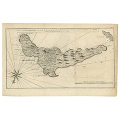
Antique Map of Juan Fernandez, Chile, c.1740
Located in Langweer, NL
Antique map titled 'l'Ile de Juan Fernandes dans la Mer du Sud (..)'.
This map depicts Juan Fernandez Island in the Southern Sea. Source unknown, to be determined.
Artists and En...
Category
18th Century Antique Maps
Materials
Paper
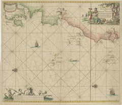
1717 Johannes Van Keulen Sea Chart of the Eastern Atlantic - Amsterdam to Gambia
Located in Langweer, NL
1717 Johannes Van Keulen Sea Chart of the Eastern Atlantic - Amsterdam to Gambia
This 1717 sea chart by Johannes Van Keulen, titled "Nieuwe Paskaert vande ...
Category
1710s Antique Maps
Materials
Paper
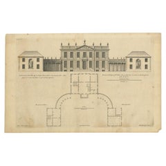
Antique Print of the House of John Waller by Campbell, 1725
Located in Langweer, NL
Antique print titled 'The Elevation of Iohn Waller Esqr. his house in Beaconsfield in Buckinghamshire (..)'. Old engraving of the house of John Waller in Beaconsfield. This print ori...
Category
18th Century Antique Maps
Materials
Paper
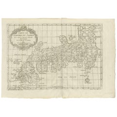
Antique Map of Japan by J.N. Bellin, 1752
Located in Langweer, NL
Bellin's wonderfully detailed map of Japan from the atlas of Prevost d'Exiles' influential collection of travel narratives, Histoire Generale des Voyages. Considered the best general...
Category
Mid-18th Century Antique Maps
Materials
Paper
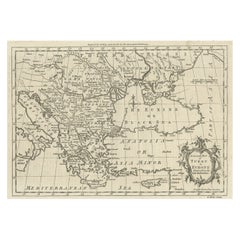
Map of the Ottoman Empire in Europe, incl. the Balkans, Greece & Turkey, c.1760
Located in Langweer, NL
Antique map Turkey titled 'An Accurate Map of Turky in Europe drawn from the best Authorities'.
Map of the Ottoman Empire in Europe, the Balkans, Greece, and Turkey in Europe. Engr...
Category
1760s Antique Maps
Materials
Paper
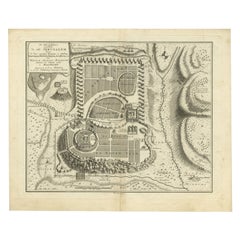
Bird's-Eye Plan of Jerusalem in Israël, a Rare Original Engraving, 1750
Located in Langweer, NL
Antique map titled 'De VIIde Landkaart Verbeeldende de Stad Jerusalem Beneven de daar Omgelegen Bergen en Dalen (..).'
Bird's-eye plan of Jerusalem in Israel. This map shows the mo...
Category
18th Century Antique Maps
Materials
Paper
1756 Map of Brazil from Bahia to São Paulo by Bellin – French Colonial Engraving
Located in Langweer, NL
Antique Map of Brazil from Bahia to São Paulo – Bellin for L'Histoire des Voyages
This elegant 18th-century French map titled "Suite du Bresil, Depuis la Baie de Tous les Saints jus...
Category
1750s Antique Maps
Materials
Paper
18th-Century Map of Tyrol and Surrounding Regions by Johann Baptist Homann
Located in Langweer, NL
18th-Century Map of Tyrol and Surrounding Regions by Johann Baptist Homann
Description: This striking 18th-century map by Johann Baptist Homann depicts the County of Tyrol (Tirol)...
Category
1720s Antique Maps
Materials
Paper
1720 Maps of the Holy Land: Ancient and Modern by De Fer and Danet
Located in Langweer, NL
1720 Maps of the Holy Land: Ancient and Modern by De Fer and Danet
This set of two 1720 maps, published by Nicolas de Fer and Danet in Paris, presents a unique juxtaposition of t...
Category
1720s Antique Maps
Materials
Paper
Detailed Antique Map of Asia Minor & Cyprus with Historical Notes, 1732
Located in Langweer, NL
Antique map titled 'Carte De L'Asie Inferieure Selon Les Auteurs Anciens (..)'. Detailed map of Asia Minor & Cyprus. With historical notes. This original old antique print / plate or...
Category
18th Century Antique Maps
Materials
Paper
Detailed Map of Arabian Peninsula and Canaan, Highlighting Biblical Territories
Located in Langweer, NL
This antique map, titled "Terre de Chanaan ou Terre Promise a Abraham," is a finely detailed copper-engraved map created around 1750 by Delamarche in Paris, based on earlier works by...
Category
1750s Antique Maps
Materials
Paper
Authentic Antique Map of the Caribbean, Gulf Coast and Central America, 1787
Located in Langweer, NL
Antique map titled 'Les Isles Antilles et le Golfe du Méxique'. Original old map of the Caribbean, Gulf Coast and Central America. With inset map of Bermuda...
Category
Late 18th Century Antique Maps
Materials
Paper
Antique Map of the Island of Borneo in Asia (Indonesia), 1726
Located in Langweer, NL
Antique map titled 'Kaart van het Eyland Borneo'. Early map of the island of Borneo. This map originates from 'Oud en Nieuw Oost-Indiën' by F. Valentijn.
Artists and Engravers: Fran...
Category
18th Century Antique Maps
Materials
Paper
Antique Map of Friesland Also Know as the Peacock Map, C.1580
Located in Langweer, NL
Antique map titled ?Frisia Occidentalis?. Original antique map of the province of Friesland, the Netherlands. Includes a fascinating inset of ancient Friesland with a peacock and myt...
Category
18th Century Antique Maps
Materials
Paper
Antique Map of Indochina, the Malaysian Peninsula and Northern Sumatra
Located in Langweer, NL
Antique map titled 'Nieuwe Kaart van India over de Ganges of van Malakka, Siam, Cambodia, Chiampa, Kochinchina, Laos, Pegu, Ava, enz'. Original old map of Indochina, the Malaysian Pe...
Category
Mid-18th Century Antique Maps
Materials
Paper
Antique Map of Lotharingia (Lorraine) by Danckerts, c. 1700 – Hand-Colored
Located in Langweer, NL
Antique Map of Lotharingia (Lorraine) by Theodorus Danckerts circa 1700 Hand-Colored
This beautifully detailed antique map of Lotharingia, now the Lorraine region in northeastern ...
Category
Early 1700s Antique Maps
Materials
Paper
Original Antique Engraving of Kannur 'or Cannanore', Kerala, India, 1726
Located in Langweer, NL
Antique print, titled: 'Cananor' - This is a print of a view of Kannur (or Cannanore), Kerala, India. From the monumental: "Oud en Nieuw Oost-Indiën ..." ...
Category
1720s Antique Maps
Materials
Paper
Rare 1770 Bellin Map of Sumatra with Stunning Decorative Cartouches
Located in Langweer, NL
Title: 1750 Bellin Map of Sumatra with Decorative Cartouches
This exquisite 18th-century map of Sumatra, drawn by Jacques-Nicolas Bellin around 1750, is a testament to the artistr...
Category
1770s Antique Maps
Materials
Paper
Dutch Antique Map of the West Coast of Africa, to the Cape of Good Hope, 1747
Located in Langweer, NL
Antique map of the Coast of Africa titled 'Kaart van de West Kust van Afrika (..)'.
Map of the west coast of Africa, from 11 degrees south latitude to the Cape of Good Hope. This...
Category
1740s Antique Maps
Materials
Paper
Antique Map of South America by J. Cook, 1775
Located in Langweer, NL
Antique map titled 'Kaart van het Zuidlyk Eind van Amerika'. Map of the sourthern part of South America, focusing on Cook's tracks around the Cape Horn and T...
Category
Mid-18th Century Antique Maps
Materials
Paper
Antique Map of the Adour River, Near Bayonne, France
Located in Langweer, NL
Antique map titled 'Cours de la riviere de l'Adour depuis la mer jusqua Bayonne'. Original old map of the Adour river, near Bayonne, France. This map originates from 'Le Petit Atlas ...
Category
Mid-18th Century Antique Maps
Materials
Paper
Antique Map of Western Tartary and the Gobi Desert of the Russian Empire, c.1750
Located in Langweer, NL
Antique map titled 'A Map of Western Tartary Drawn from the Survey of the Jesuits and Mr. Kyrillow's Map of the Russian Empire'. Map of the Gobi Desert and the eastern portion of the...
Category
18th Century Antique Maps
Materials
Paper
Rare Small Antique Map of Great Britain and Ireland
Located in Langweer, NL
Antique map titled 'La Grande Bretagne et Irlande'. Small antique map of Great Britain and Ireland. Source unknown, to be determined. Publ...
Category
Mid-18th Century Antique Maps
Materials
Paper
Antique Map of the Location of the Garden of Eden and Travels of the Patriarchs
Located in Langweer, NL
Title: Map of the Location of the Garden of Eden and Travels of the Patriarchs
Cartographer/Publisher:
Pieter Mortier (1661–1711), published by Covens & Mortier (Amsterdam, 1725)...
Category
1720s Antique Maps
Materials
Paper
Antique Print of Inhabitants of Arakan in Southern Myanmar 'Burma', 1738
Located in Langweer, NL
Antique print titled 'Il mode nel quale si vestono gti abilanti di Arakan'. Engraving of inhabitants of Arakan, a historic coastal region in Southeast Asia. This print originates fro...
Category
18th Century Antique Maps
Materials
Paper
Rare 18th-Century Hand-Colored Map of Southeast Asia and the East Indies, 1748
Located in Langweer, NL
1748 Homann Map of Southeast Asia and East Indies by Homann Heirs
This original 1748 map, published by the renowned Homann Heirs, depicts Southeast Asia, the East Indies, and adjace...
Category
1740s Antique Maps
Materials
Paper
Pl. 10 Antique Print of a Garden Casino and Repository by Le Rouge, c.1785
Located in Langweer, NL
Antique print titled 'Casine de Wilton à la Comtesse de Pembroke (..)'. Copper engraving showing the casino of Pembroke and repository of Mr. Hotham Baronet. This print originates fr...
Category
18th Century Antique Maps
Materials
Paper
Old Map of North India From Kandahar East to Burma 'Pegu' and South to Goa, 1776
Located in Langweer, NL
Description: Antique map titled 'Indes Iere Feuille'.
Old map of northern India. Covers the subcontinent from Kandahar east as far as Burma (Pegu) and south to just past Goa. Names...
Category
1770s Antique Maps
Materials
Paper
Antique Map of Virginia & the Chesapeake Bay by Jacques-Nicolas Bellin, c. 1750
Located in Philadelphia, PA
A fine antique 18th century French map of North America.
By Jacques-Nicolas Bellin.
On laid paper with polychrome highlights.
Depicting Virginia, the Chesapeake Bay, and the nearb...
Category
18th Century French Baroque Antique Maps
Materials
Paper
Antique Print of Batavia, Capital of the Dutch East Indies or Indonesia, '1726'
Located in Langweer, NL
Antique print Indonesia titled 'Batavia in 't Verschiet'. Large panoramic view on Batavia, present day Jakarta, Indonesia. Originates from 'Oud en Nieuw Oost-Indiën (..)' by François...
Category
18th Century Antique Maps
Materials
Paper
Old Map of the Kingdoms of Fez, Algiers, Segelmese, Tafilet and Morocco, ca.1760
Located in Langweer, NL
Antique map titled 'A Map of the Empire of Morocco Comprehending the Kingdoms of Fez, Morocco'.
Original antique map of the kingdoms of Fez, Algiers, Segelmese, Tafilet and Moroc...
Category
1760s Antique Maps
Materials
Paper
Original Antique Map of Egypt by Van Dùren '1749'
Located in Langweer, NL
Decorative German antique engraving with titled 'Neue Vorstellung von Aegypten (..)'. It concerns a rare original antique map of Egypt. This map o...
Category
Mid-18th Century Antique Maps
Materials
Paper
Map of Choromandel & Malabar, Incl Kerala, Tamil Nadu & Part of Sri Lanka, 1726
Located in Langweer, NL
Antique map titled 'Nieuwe kaart van Choromandel ende Malabar.'
Original antique map of Southern India documenting the VOC's areas of influence. Included is Kerala, Tamil Nadu...
Category
1720s Antique Maps
Materials
Paper
Antique Colored Engraving of Madras 'Chennai' and Fort St. George in India, 1751
Located in Langweer, NL
Antique print titled 'Plan de Madras et du Fort St. Georges'. Plan of the city of Madras (or Chennai), the capital of the state of Tamil Nadu, India. Also shows a plan of Fort St. Ge...
Category
18th Century Antique Maps
Materials
Paper
Large Scale Map of Greece, Extending to Cythera with Inset of Macedonia, ca.1786
Located in Langweer, NL
Antique map titled 'Graeciae Antiquae'.
Large scale map of Greece, extends south to the island of Cythera. Inset map shows details of Macedonia. Pu...
Category
1780s Antique Maps
Materials
Paper
Antique Map of Eastern Seram, Part of the Maluku Island in East Indonesia, 1726
Located in Langweer, NL
Antique map titled 'De Landvoogdy van Amboina met de elf onderhoorige Eylanden.' Detailed map of the eastern part of Seram in Indonesia, part of the Maluku islands. Map of the southe...
Category
18th Century Antique Maps
Materials
Paper
Architectural Antique Print of Various Garden Temples by Le Rouge, c.1785
Located in Langweer, NL
Untitled antique print showing various garden temples. This print originates from 'Jardins Anglo-Chinois à la Mode' by Georg Louis le Rouge. Artists and ...
Category
18th Century Antique Maps
Materials
Paper
The Valley of Inspruck: An 18th-Century Engraved Perspective, 1792
Located in Langweer, NL
Title: "The Valley of Inspruck: An 18th-Century Engraved Perspective"
This elegant original antique engraving, titled "The Valley of Inspruck," showcases a serene view of the Innsbruck Valley. The artwork is delicately rendered, capturing the grandeur of the mountains and the pastoral tranquility of the valley.
The print depicts a detailed landscape scene, replete with towering craggy peaks that loom over a peaceful settlement nestled in the valley. A striking feature is the contrast between the ruggedness of the natural environment and the cultivated lands and architecture, indicating a harmonious coexistence of humanity with nature.
It was published as directed on January 1, 1792, by T & G Egerton of Whitehall for the author. Albanis Beaumont is credited with the original design ('Del.' for delineavit, indicating he drew the initial illustration), and Cornelis Apostool is noted for the engraving work ('Sculp.' for sculpsit, indicating he engraved the image).
The publication of this print during the late 18th century aligns with a time when there was a heightened interest in natural beauty and the picturesque, reflected in the art and literature of the Romantic period. This print would have appealed to those with an appreciation for both the aesthetic and the sublime qualities of the European landscape.
The publication by T & G Egerton, a reputable firm known for their work in the arts, and the involvement of a skilled artist and engraver like Beaumont and Apostool, respectively, underline the quality and desirability of the print. It is a piece that would attract collectors of fine engravings and admirers of European landscapes, offering a window into the aesthetic values and artistic endeavors of the late 18th century.
As a historical piece, this print offers a view into the past, inviting contemplation of the rich cultural and natural heritage of the Innsbruck area. It is a valuable collectible for enthusiasts of antique maps and prints...
Category
Late 18th Century Antique Maps
Materials
Paper
Antique Bird's Eye-view Atjien or Atjeh in Aceh in Northern Sumatra, Indonesia
Located in Langweer, NL
Description: Antique print Indonesia titled 'Atsjien'. Bird's eye-view of the Town of Atjien on the northernmost point of Sumatra. This print originates from 'Oud en Nieuw Oost-Indië...
Category
1720s Antique Maps
Materials
Paper
Antique Map of Eastern Turkey, Caucasus, Israel through Iraq and part of Arabia
Located in Langweer, NL
Antique map titled 'Nieuwe Kaart van Irak Arabia, Kurdistan, Diarbek, Turkomannia, Syrie en het Heilige Land'. Beautiful map including eastern Turkey, the Caucasus, Israel through Ir...
Category
Mid-18th Century Antique Maps
Materials
Paper
Antique Map of Asia Minor with Cyprus, Syria and Turkey and the Black Sea, 1747
Located in Langweer, NL
Antique map Middle East titled 'A New and accurate map of Anatolia or Asia Minor, with Syria and such other provinces of the Turkish Empire (.....
Category
18th Century Antique Maps
Materials
Paper
Antique Map of Mozambique and Cape of Good Hope with Kingdom Monomotapa, 1780
Located in Langweer, NL
Antique map titled 'Carte Du Canal De Mozambique.' The main map, on the right, covers from the Cape of Good Hope north as far as Zanzibar and modern day Kenya, focusing on the gold r...
Category
18th Century Antique Maps
Materials
Paper
Antique Print of the Batavia Massacre 'Present-Day Jakarta', Indonesia
Located in Langweer, NL
Antique print titled 'Tableau de la Partie de Batavia, ou s'est fait proprement le terrible Massacre des Chinois (..)'. Original antique print of the Batavia massacre. The 1740 Batav...
Category
Mid-18th Century Antique Maps
Materials
Paper
Antique Map of Sumatra, Indonesia 'c.1780'
Located in Langweer, NL
Antique map titled 'Neue Karte von der Insel Sumatra'. Extremely rare map of Sumatra, Indonesia. Published circa 1780.
Category
Late 18th Century Antique Maps
Materials
Paper
1773 John Blair Map of the Ancient Holy Land: Tribes, Journeys, and Empires
Located in Langweer, NL
Title: 1773 John Blair Map of the Ancient Holy Land: Tribes, Journeys, and Empires
This exceptional map by John Blair, published in London in 1773, offers a richly detailed view o...
Category
1770s Antique Maps
Materials
Paper
Antique Map of Southern Palestine by Bachiene, 1763
Located in Langweer, NL
"Antique map of the south part of Palestine. This simplified map shows the most important cities of the Jewish Land. Source unknown, to be determined. Artists and Engravers: Made by ...
Category
18th Century Antique Maps
Materials
Paper
Antique Map of South America by Tirion 'circa 1765'
Located in Langweer, NL
Antique map titled 'Kaart van het Onderkoningschap van Peru, zig uitstrekkende over Chili, Paraguay en andere Spaansche Landen: als ook van Brazil en verdere Bezittingen van Portugal...
Category
Mid-18th Century Antique Maps
Materials
Paper
1748 Homann Heirs Double Map of the East Indies and Southeast Asia
Located in Langweer, NL
Title: 1774 Homann Heirs Double Map of the East Indies and Southeast Asia
Description:
This stunning 1774 double map by the Homann Heirs showcases the East Indies and Southeast ...
Category
1740s Antique Maps
Materials
Paper
Original Antique Map of England, Ireland, Scotland and Wales
Located in Langweer, NL
Antique map titled 'Les Isles Britanniques, ou sont les Royaumes d Angleterre (..)'. Detailed map of England, Ireland, Scotland and Wales, with French coast and part of the Netherlan...
Category
Early 18th Century Antique Maps
Materials
Paper
Original Hand-Colored Antique Map of Africa by Elwe '1792'
Located in Langweer, NL
Antique map titled 'l'Afrique Divisée en ses Empires, Royaumes, et Etats'. Decorative large map of Africa. The cartography is typical for the 17th century with the Nile originating i...
Category
Late 18th Century Antique Maps
Materials
Paper
Antique Map of the Northern Coast of Africa and Southern Europe, circa 1745
Located in Langweer, NL
Antique map titled 'In Notitiam Ecclesiasticam Africae Tabula Geographica'. Very decorative hand-colored map of the northern coast of Africa, Spain, Italy and the Mediterranean with the islands of Sardinia, Corsica, Majorca, Minorca etc. Sicily features a smoking Mount Aetna. Embellished with three architectural cartouches...
Category
Mid-18th Century Antique Maps
Materials
Paper
Geographical Antique Map of Principality of Monaco
Located in Alessandria, Piemonte
ST/609 - Interesting antique color map of Monaco Principality in French language : "Carte qui contient le Principauté de Piémont, le Monferrat et la comté de...
Category
Late 18th Century Italian Other Antique Maps
Materials
Paper
Original Engraved Map of Saint Lucia in the West Indies by Bellin, 1758
Located in Langweer, NL
The "Carte de L’Isle de Sainte Lucie" by Jacques Nicolas Bellin, a prominent figure as the Royal Hydrographer and engineer of the French Navy, is a remarkable antique map showcasing ...
Category
1750s Antique Maps
Materials
Paper
Antique Map of Guadeloupe, Island in the Caribbean, c.1757
Located in Langweer, NL
Antique map titled 'Carte de L'Isle de la Guadeloupe'.
A very decorative map of Guadeloupe in the Caribbean, adorned with rhumb lines, fleur-de-lys, and two decorative rococo-style...
Category
18th Century Antique Maps
Materials
Paper
Antique Map of the Northern Portion of the Philippines by J.N. Bellin, 1764
Located in Langweer, NL
Detailed map of the Northern portion of the Philippines, extending from Batanes and Babuyanes to Mindonoro and Masbate, and centered on Luzon. One of the most detailed maps of the pe...
Category
Mid-18th Century Antique Maps
Materials
Paper
18th Century Antique Engraving of the Southern Hemisphere by G. de L'Isle
Located in Langweer, NL
Antique map titled 'Hemisphere Meridional pour voir plus distinctement Les Terres Australes'. Hemispherical map of the southern hemisphere centered on ...
Category
Late 18th Century Antique Maps
Materials
Paper
Antique Map of South American, The West Indies & Most of Africa, Ca.1775
Located in Langweer, NL
Antique map titled 'Carte pour Servir a l' Histoire Philosophique et Politique des Etablissemens et du Commerce des Europeens dans les deux Indes'.
This map is roughly centered o...
Category
1770s Antique Maps
Materials
Paper
Antique Map of Southern England and Wales by Zatta, 1784
Located in Langweer, NL
"Antique map titled 'Parte Meridionale dell' Inghilterra e del Pricipato di Galles'. Engraved map of the southern part of England and Wales, with title cartouche. Shows political and...
Category
18th Century Antique Maps
Materials
Paper
