
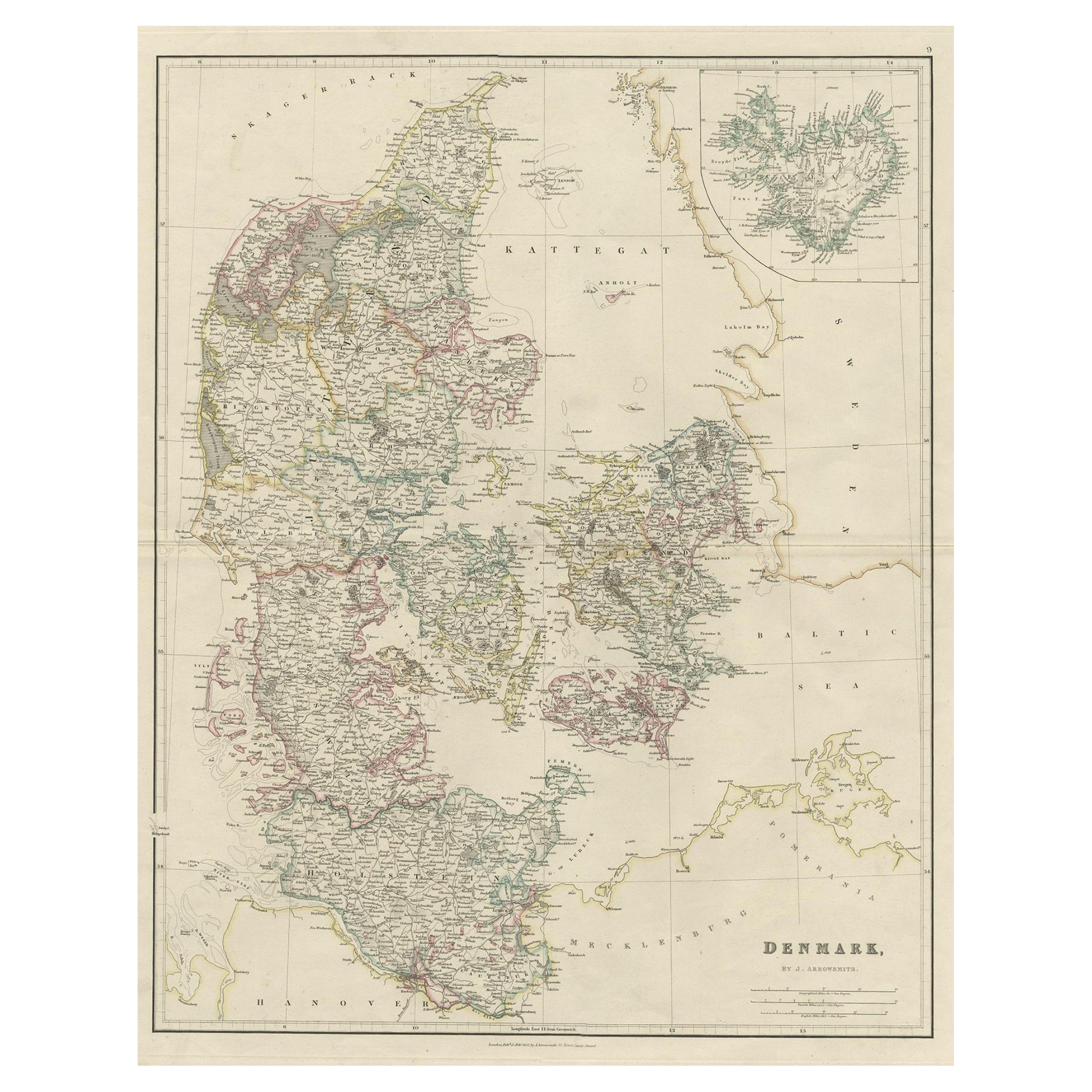
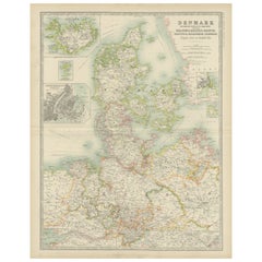
Antique Map of Denmark by C. F. Weiland, 1829
View Similar Items


Want more images or videos?
Request additional images or videos from the seller
1 of 21
Antique Map of Denmark by C. F. Weiland, 1829
About the Item
- Creator:C. F. Weiland (Maker)
- Dimensions:Height: 31 in (78.74 cm)Width: 26.25 in (66.68 cm)Depth: 1 in (2.54 cm)
- Materials and Techniques:
- Place of Origin:
- Period:
- Date of Manufacture:1829s-1830s
- Condition:Wear consistent with age and use. Minor fading. Please study detailed images for small faded areas and tiny scratches to the frame.
- Seller Location:Haddonfield, NJ
- Reference Number:Seller: 327761stDibs: LU943411819563
About the Seller
5.0
Platinum Seller
These expertly vetted sellers are 1stDibs' most experienced sellers and are rated highest by our customers.
Established in 2010
1stDibs seller since 2012
1,610 sales on 1stDibs
More From This SellerView All
- Large European 1930's Nautical Map Reader Magnifying GlassLocated in Haddonfield, NJThis European set of two nautical magnifying glass map-readers are quite unusual and rarely found. It is fully encased in it's heavy wooden and metal enforced box. Hailing from betwe...Category
Vintage 1930s German Industrial Nautical Objects
MaterialsMetal
 $6,000 Sale Price36% Off
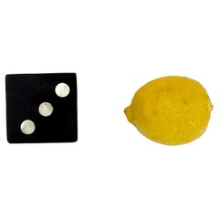
 - Large Vintage Die in Mother-of-Pearl and Rosewood, DenmarkLocated in Haddonfield, NJLarge Danish Paperweight Die in Rosewood and Mother-of-Pearl, Mid-Century Modern. Measures: 2 Inch.Category
Mid-20th Century Danish Mid-Century Modern Games
MaterialsMother-of-Pearl, Rosewood
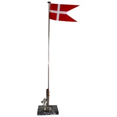
- Danish Flag Post on Marble Stand with Royal Monogram of King Frederik IX, 1947Located in Haddonfield, NJDanish flag post with Dannebrog on a marble stand with Royal Monogram of King Frederik IX. The flag post is most likely made for the coronation of the Ki...Category
Mid-20th Century Danish Mid-Century Modern Historical Memorabilia
MaterialsMarble, Silver Plate
 $700 Sale Price20% Off
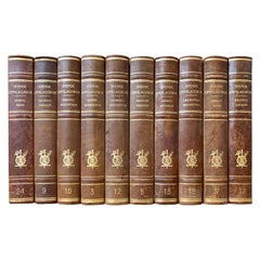
 - Large Collection of Tall Decorative Scandinavian Antique Leather-Bound BooksLocated in Haddonfield, NJA collection of 15 sets of 10 large tall-size decorative Swedish leather-bound books from the 1950s.Category
Mid-20th Century Swedish Books
MaterialsLeather, Paper
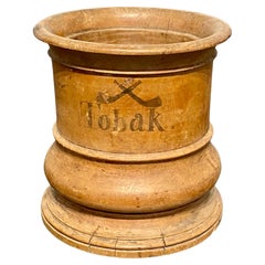
- Small Danish Wooden Tobacco Jar, circa 1800-1825Located in Haddonfield, NJSmall Circular Danish wooden tobacco jar, circa 1800-1825 The jar has "TOBAK" and illustrations of two chalk pipes painted on one side of the jar...Category
Antique Early 19th Century Danish Folk Art Tobacco Accessories
MaterialsBirch
- Set of 4 European Hand Colored Prints of Birds from 1830Located in Haddonfield, NJA set of 4 hand colored birds prints, from 1830. By Comte, Achille Joseph (1802-1866), "Keepsake d´histoire naturelle. Description des oiseaux. Suivie d´un exposé de l art de les pr...Category
Antique 1830s French Biedermeier Prints
MaterialsPaper
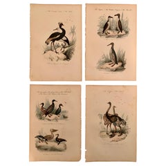 $476 Sale Price / set20% Off
You May Also Like
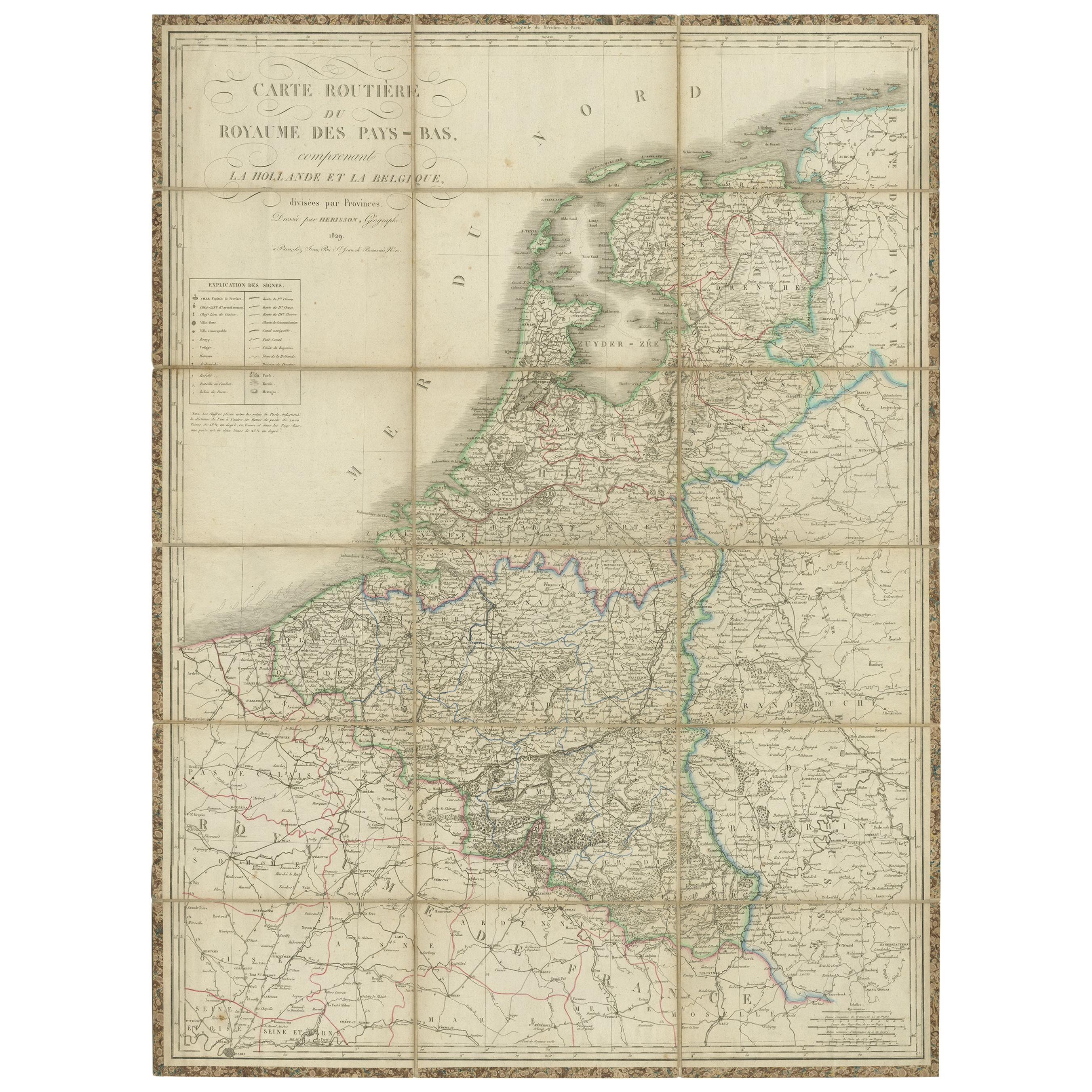
- Antique Map of the Netherlands and Belgium by Hérisson, 1829Located in Langweer, NLFor your online catalogue, here is a detailed description of the antique map titled 'Carte Routière du Royaume des Pays-Bas comprenant la Hollande et la Belgique,' published by Eustache Hérisson in 1829: **Title**: 'Carte Routière du Royaume des Pays-Bas comprenant la Hollande et la Belgique' **Publisher**: Eustache Hérisson **Publication Year**: 1829 This original antique map is a detailed depiction of the Netherlands and Belgium, dating back to 1829. As a 'Carte Routière', it focuses on the road networks of the region, providing valuable historical insights into the transportation and geographical understanding of the early 19th century. The map's delineation of the Kingdom of the Netherlands, including both Holland and Belgium, is particularly noteworthy as it represents the political geography of the period shortly before Belgium's independence in 1830. The map is sectionalised and laid on linen, a common practice in the 19th century for preserving and reinforcing maps, making them more durable and portable. This method of mounting also suggests that the map was intended for practical use, possibly by travelers or for educational purposes. **Artist and Publisher**: Eustache Hérisson, the publisher of this map, was a known figure in the cartographic and publishing world of the early 19th century. His work is characterized by attention to detail and accuracy, making this map not only a beautiful piece of art but also a reliable historical document. This map is a valuable historical artifact, offering insights into the geographical and political landscape of the Netherlands...Category
Antique Mid-19th Century Maps
MaterialsPaper
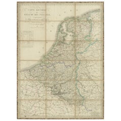 $659 Sale Price20% Off
 - Antique Map of Denmark by Johnston '1909'Located in Langweer, NLAntique map titled 'Denmark'. Original antique map of Denmark. With inset maps of Iceland, Faroe Island, and Copenhagen. This map originates from the ‘Royal Atlas of Modern Geography...Category
Early 20th Century Maps
MaterialsPaper
- Antique Map of Denmark by Lowry, 1852Located in Langweer, NLAntique map titled 'Denmark'. Original map of Denmark. This map originates from 'Lowry's Table Atlas constructed and engraved from the most recent Authorities' by J.W. Lowry. Publish...Category
Antique Mid-19th Century Maps
MaterialsPaper
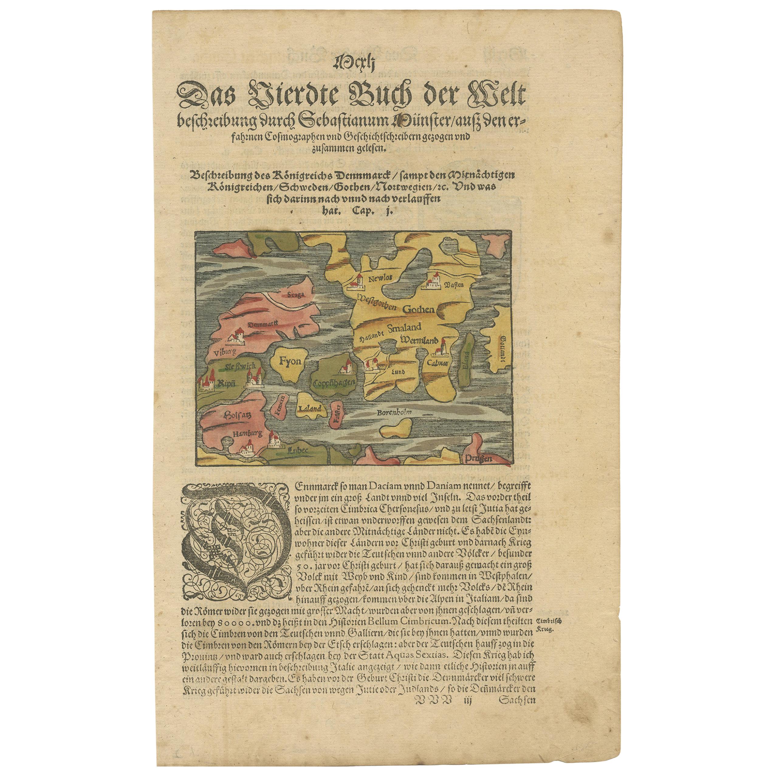
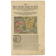
- Antique Map of Denmark by Münster '1588'Located in Langweer, NLAntique map titled 'Beschreibung des Königreichs Dennmarck (..)'. Early map of Denmark. This map originates from 'Cosmographey Oder beschreibung Aller Länder (..)' by Sebastian Münster.Category
Antique 16th Century Maps
MaterialsPaper
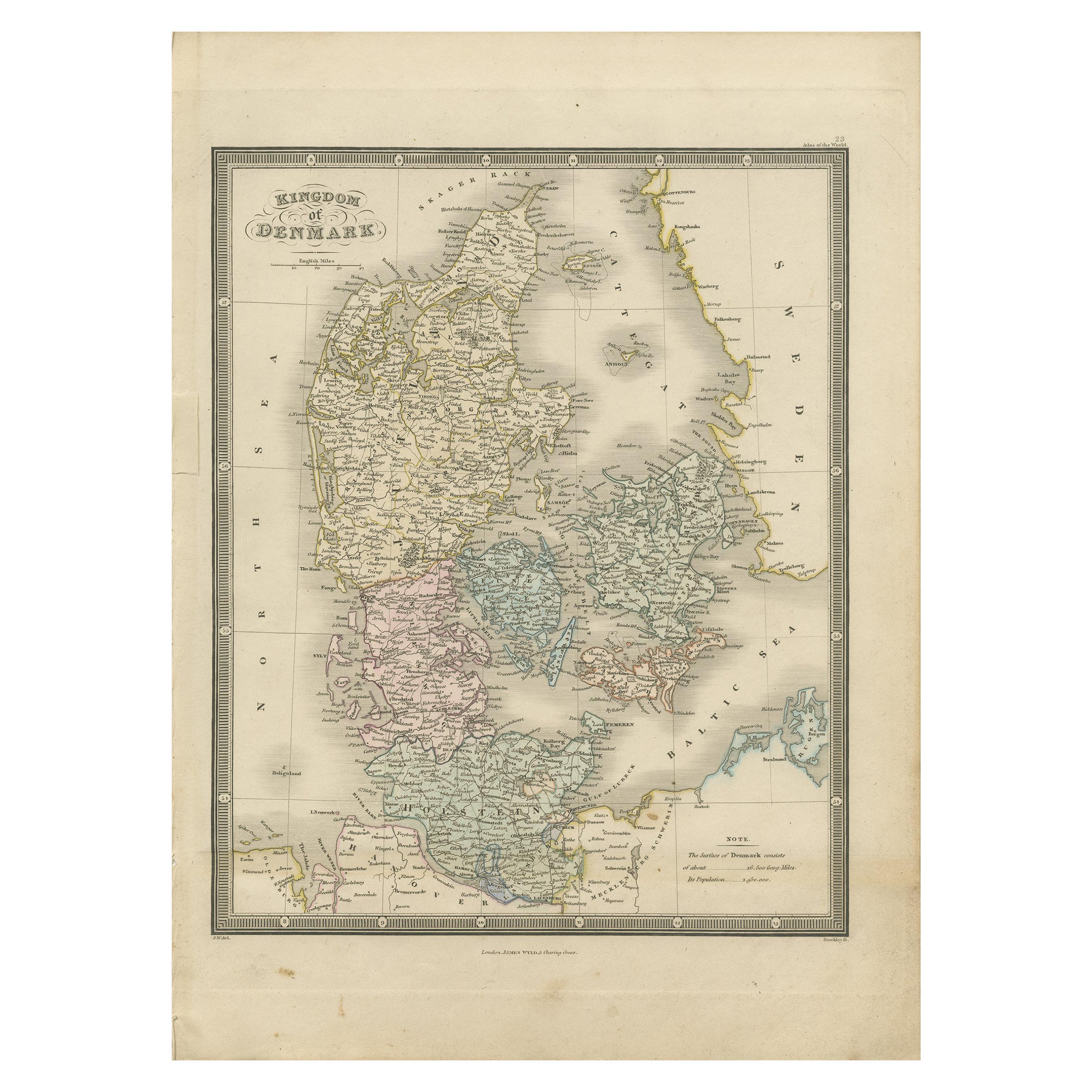
- Antique Map of Denmark by A.K. Johnston, 1865Located in Langweer, NLAntique map titled 'Denmark and the Duchies Schleswig, Holstein & Lauenburg; Hanover, Brunswick, Mecklenburg, Oldenburg, Anhalt and Lippe'. With an inset map of Iceland, Copenhagen a...Category
Antique Mid-19th Century Maps
MaterialsPaper
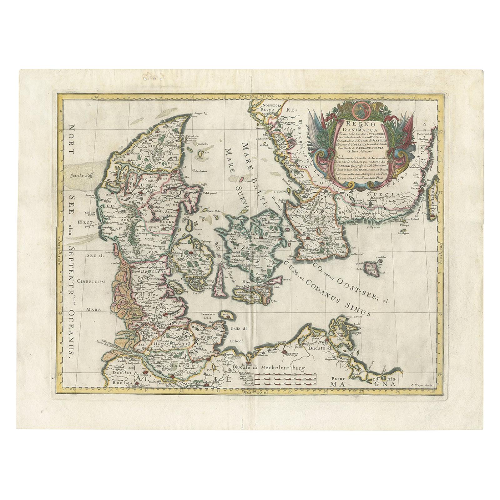
- Antique Map of Denmark by F. de Wit, 1680Located in Langweer, NLAntique map titled 'Dania Regnum'. Large, attractive map of Denmark, Sleschwig-Holstein and southern Sweden. Good detail throughout. Embellished with a title cartouche with the Danis...Category
Antique Late 17th Century Maps
MaterialsPaper
 $769 Sale Price27% Off


Recently Viewed
View AllMore Ways To Browse
Antique Map Denmark
Map Of France
Large Map
Large Maps
Antique German Collectibles
Original World Map
World Atlas
Map Of Itsly
Antique Map World
Antique Maps World
Antique World Map World Maps
Antique World Maps
Antique World Maps World Maps
World Map Antique
World Antique Map
Antique World Map
Old Map
Antique Map Of World