Items Similar to Antique Map of Anjouan or Ndzuani Island, Part of The Comoros, 1749


Want more images or videos?
Request additional images or videos from the seller
1 of 5
Antique Map of Anjouan or Ndzuani Island, Part of The Comoros, 1749
$344.70
$430.8720% Off
£254.27
£317.8320% Off
€288
€36020% Off
CA$477.60
CA$59720% Off
A$518.58
A$648.2220% Off
CHF 274.62
CHF 343.2820% Off
MX$6,356.27
MX$7,945.3320% Off
NOK 3,398.59
NOK 4,248.2320% Off
SEK 3,211.48
SEK 4,014.3520% Off
DKK 2,192.50
DKK 2,740.6320% Off
About the Item
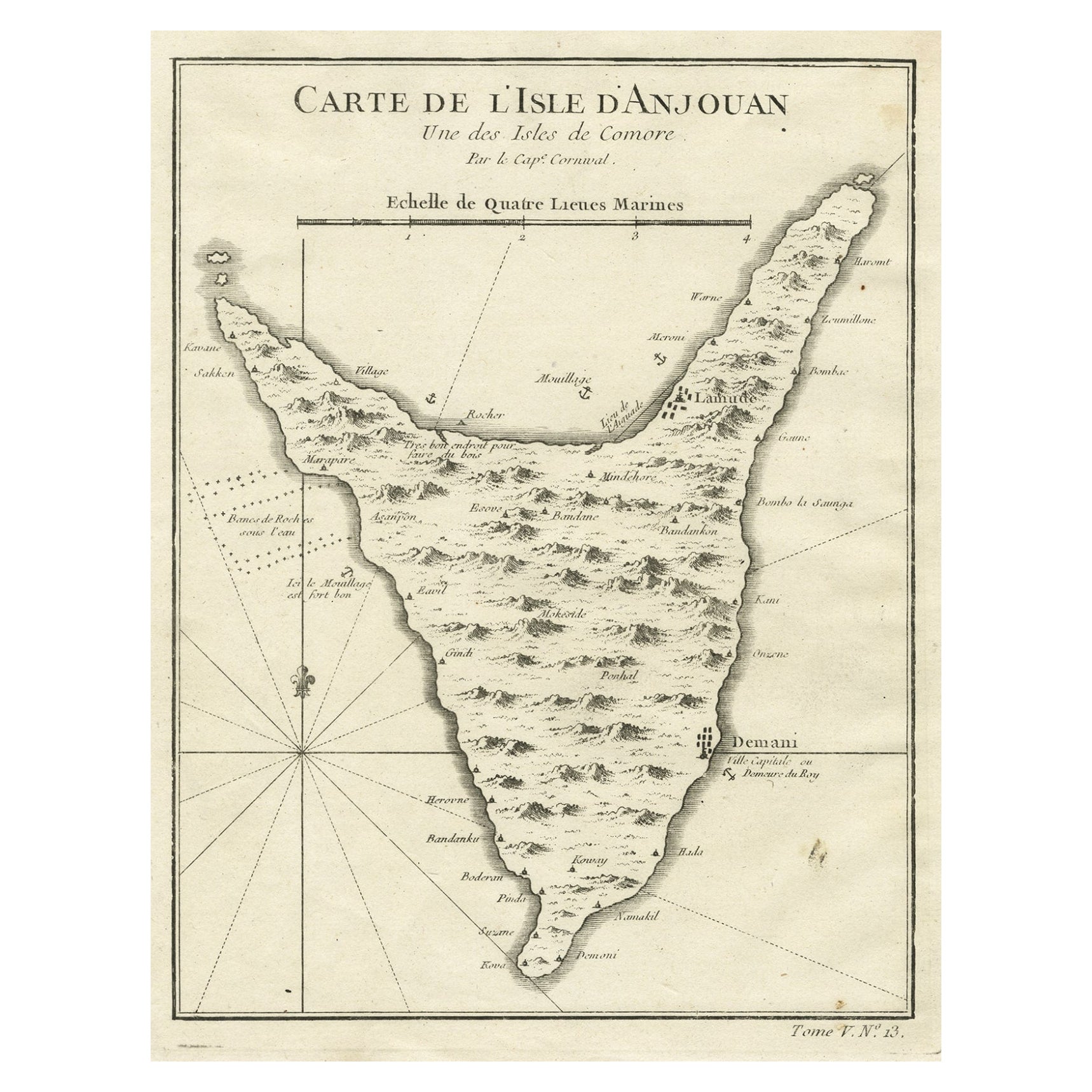
Antique map titled ‘Carte de L’Isle D’Anjouan - Kaart van 't Eiland Anjouan’. Original antique map of Anjouan, also known as Ndzuwani or Nzwani, or, historically, as Johanna, an autonomous island in the Indian Ocean that forms part of the Union of the Comoros. This map originates from 'Historische beschryving der Reizen (..)' published by P. de Hondt, 1749.
The Comoros, officially the Union of the Comoros, is an island country in the Indian Ocean, at the northern end of the Mozambique Channel off the eastern coast of Africa. It shares maritime borders with Madagascar and Mayotte to the southeast, Tanzania to the northwest, Mozambique to the west, and the Seychelles to the northeast. Its capital and largest city is Moroni. The official state religion is Sunni Islam. As a member of the Arab League, it is the only country in the Arab world which is entirely in the Southern Hemisphere. The country has three official languages: Comorian, French and Arabic.
It has the worst income inequality of any nation, with a Gini coefficient over 60%, and ranks in the worst quartile on the Human Development Index. As of 2008, about half the population lived below the international poverty line of US$1.25 a day.
Artists and Engravers: Jakob van der Schley (1715-1779) was a Dutch draughtsman and engraver, who studied under Bernard Picart.
Condition: Good, general age-related toning. Original plate mark visible. Please study image carefully.
Date: 1749
Overall size: 19.4 x 25 cm
Image size: 16 x 21.8 cm
We sell original antique maps to collectors, historians, educators and interior decorators all over the world. Our collection includes a wide range of authentic antique maps from the 16th to the 20th centuries. Buying and collecting antique maps is a tradition that goes back hundreds of years. Antique maps have proved a richly rewarding investment over the past decade, thanks to a growing appreciation of their unique historical appeal. Today the decorative qualities of antique maps are widely recognized by interior designers who appreciate their beauty and design flexibility. Depending on the individual map, presentation, and context, a rare or antique map can be modern, traditional, abstract, figurative, serious or whimsical. We offer a wide range of authentic antique maps for any budget.
- Dimensions:Height: 9.85 in (25 cm)Width: 7.64 in (19.4 cm)Depth: 0 in (0.01 mm)
- Materials and Techniques:
- Period:
- Date of Manufacture:1749
- Condition:
- Seller Location:Langweer, NL
- Reference Number:Seller: BL-000331stDibs: LU3054326077642
About the Seller
5.0
Recognized Seller
These prestigious sellers are industry leaders and represent the highest echelon for item quality and design.
Platinum Seller
Premium sellers with a 4.7+ rating and 24-hour response times
Established in 2009
1stDibs seller since 2017
2,622 sales on 1stDibs
Typical response time: <1 hour
- ShippingRetrieving quote...Shipping from: Langweer, Netherlands
- Return Policy
Authenticity Guarantee
In the unlikely event there’s an issue with an item’s authenticity, contact us within 1 year for a full refund. DetailsMoney-Back Guarantee
If your item is not as described, is damaged in transit, or does not arrive, contact us within 7 days for a full refund. Details24-Hour Cancellation
You have a 24-hour grace period in which to reconsider your purchase, with no questions asked.Vetted Professional Sellers
Our world-class sellers must adhere to strict standards for service and quality, maintaining the integrity of our listings.Price-Match Guarantee
If you find that a seller listed the same item for a lower price elsewhere, we’ll match it.Trusted Global Delivery
Our best-in-class carrier network provides specialized shipping options worldwide, including custom delivery.More From This Seller
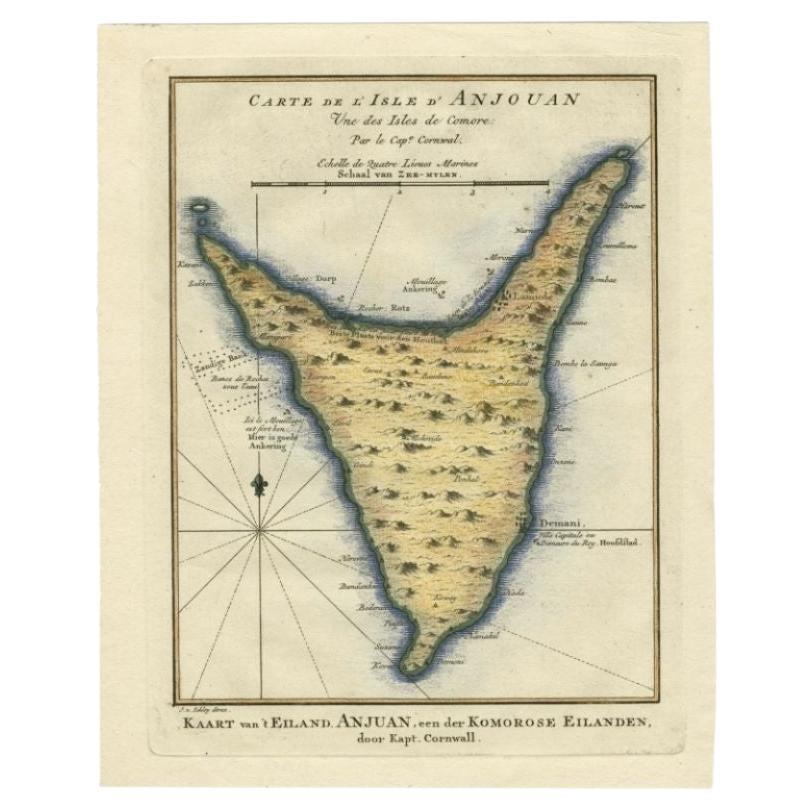
View AllAntique Map of Anjouan or Ndzuani, Island of The Comoros, 1748
Located in Langweer, NL
Antique map titled ‘Carte de L’Isle D’Anjouan’. Original antique map of Anjouan, also known as Ndzuwani or Nzwani, or, historically, as Johanna, an autonomous island in the Indian Oc...
Category
Antique 18th Century Maps
Materials
Paper
$220 Sale Price
20% Off
Antique Map of the Island Anjouan by Van Schley, c.1750
Located in Langweer, NL
Antique map titled 'Carte de l'Isle d'Anjouan une des Isles de Comore'. Striking map of the Island Anjouan, part of the Comoros in the Indian Ocean by Nicolas Bellin. Source unknown,...
Category
Antique 18th Century Maps
Materials
Paper

$119 Sale Price
20% Off
Antique Map of Juan Fernandez Island by Anson '1749'
Located in Langweer, NL
Antique map titled 'l'Ile de Juan Fernandes dans la Mer du Sud (..) - Het Eiland Juan Fernandes in de Zuid Zee (..)'. This map depicts Juan Fernandez Island in the Southern Sea. This...
Category
Antique Mid-18th Century Maps
Materials
Paper

$191 Sale Price
20% Off
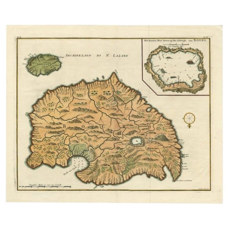
Antique Map of Buru Island, Indonesia, c.1725
Located in Langweer, NL
Antique map titled 'Boero'. Original antique map of Buru island. With an inset of the lake on top of the inland mountain. This map originates from Valentyn's 'Oud en Nieuw Oost Indie...
Category
Antique 18th Century Maps
Materials
Paper

$526 Sale Price
20% Off
Antique Map of Ambelau and Buru Island, Maluku or Moluccas in Indonesia, 1726
Located in Langweer, NL
Antique map titled 'Boero - Amblauw (..).' Detailed map of the Island Ambelau and Buru, Maluku Islands, Indonesia, by Francois Valentyn. With an inset of the lake on the Buru mountai...
Category
Antique 18th Century Maps
Materials
Paper

$354 Sale Price
20% Off
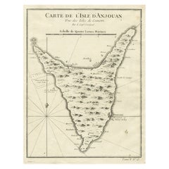
Antique Map of Anjouan Island by Valentijn, 1726
By F. Valentijn
Located in Langweer, NL
Antique map titled 'Anzuany'. This map depicts the island of Anjouan, one of the Comoros islands situated between Madagascar and Africa. The map is oriented with north to the left wi...
Category
Antique Early 18th Century Dutch Maps

You May Also Like
St. Christophe (St. Kitts): Bellin 18th Century Hand Colored Map
Located in Alamo, CA
Jacques Bellin's copper-plate map of the Caribbean island of Saint Kitts entitled "Carte De De l'Isle St. Christophe Pour servir á l'Histoire Genle. des V...
Category
1740s Other Art Style Landscape Prints
Materials
Engraving

Large Original Antique Map of The Canary Islands. 1894
Located in St Annes, Lancashire
Superb Antique map of The Canary Islands
Published Edward Stanford, Charing Cross, London 1894
Original colour
Good condition
Unframed.
Free shipping
Category
Antique 1890s English Maps
Materials
Paper

West Coast of Africa; Guinea & Sierra Leone: Bellin 18th Century Map
Located in Alamo, CA
This is a Jacques Bellin copper-plate map entitled "Partie de la Coste de Guinee Dupuis la Riviere de Sierra Leona Jusquau Cap das Palmas", depicting the coast of Guinea and Sierra L...
Category
1740s Old Masters Landscape Prints
Materials
Engraving

Original Antique Map of South America. C.1780
Located in St Annes, Lancashire
Great map of South America
Copper-plate engraving
Published C.1780
Two small worm holes to left side of map
Unframed.
Category
Antique Early 1800s English Georgian Maps
Materials
Paper

Ancient Map - Zeilan - Etching by Johannes Janssonius - 1650s
By Johannes Janssonius
Located in Roma, IT
Ancient Map - Zeilan is an ancient map realized in 1650 by Johannes Janssonius (1588-1664).
The Map is Hand-colored etching, with coeval watercoloring.
...
Category
1650s Modern Figurative Prints
Materials
Etching

Map Colonies Francaises Martinique, 1845
Located in BUNGAY, SUFFOLK
Colonies Francaises, Martinique, Amerique DU SUD
Geographie et Statistique par V.Levasseur. Ing'r Geographe.
Illustre par Raymond Bonheur, peintre.
Grave par Laguihermie, Rue St...
Category
Antique 19th Century French Maps
Materials
Paper

More Ways To Browse
Antique Mozambique
Birds Eye View Map
North Africa Map
West Africa Map
Antique Compass Map
Antique Maps California
Biblical Maps
Hungary Map
Maps Of Mediterranean
Treasure Map
Antique Navigational Tools
Mississippi Furniture
Caribbean Antiques
Antique Maps West Indies
Antique Mozambique
Malaysian Antique Furniture
Relief Map
Sur Tout