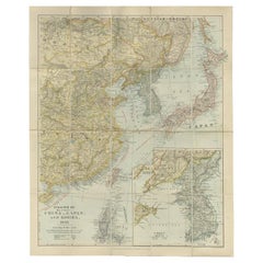
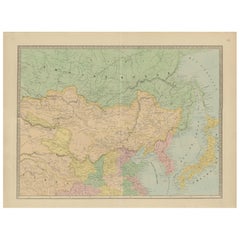
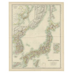
Antique Map of Eastern China, Japan and Korea by Stanford, 1898
View Similar Items


Want more images or videos?
Request additional images or videos from the seller
1 of 5
Antique Map of Eastern China, Japan and Korea by Stanford, 1898
$1,853.20List Price
About the Item
- Dimensions:Height: 26.78 in (68 cm)Width: 22.05 in (56 cm)Depth: 0 in (0.01 mm)
- Materials and Techniques:
- Period:
- Date of Manufacture:1898
- Condition:
- Seller Location:Langweer, NL
- Reference Number:Seller: BG-113521stDibs: LU3054326172242
About the Seller
5.0
Recognized Seller
These prestigious sellers are industry leaders and represent the highest echelon for item quality and design.
Platinum Seller
Premium sellers with a 4.7+ rating and 24-hour response times
Established in 2009
1stDibs seller since 2017
2,613 sales on 1stDibs
Authenticity Guarantee
In the unlikely event there’s an issue with an item’s authenticity, contact us within 1 year for a full refund. DetailsMoney-Back Guarantee
If your item is not as described, is damaged in transit, or does not arrive, contact us within 7 days for a full refund. Details24-Hour Cancellation
You have a 24-hour grace period in which to reconsider your purchase, with no questions asked.Vetted Professional Sellers
Our world-class sellers must adhere to strict standards for service and quality, maintaining the integrity of our listings.Price-Match Guarantee
If you find that a seller listed the same item for a lower price elsewhere, we’ll match it.Trusted Global Delivery
Our best-in-class carrier network provides specialized shipping options worldwide, including custom delivery.More From This Seller
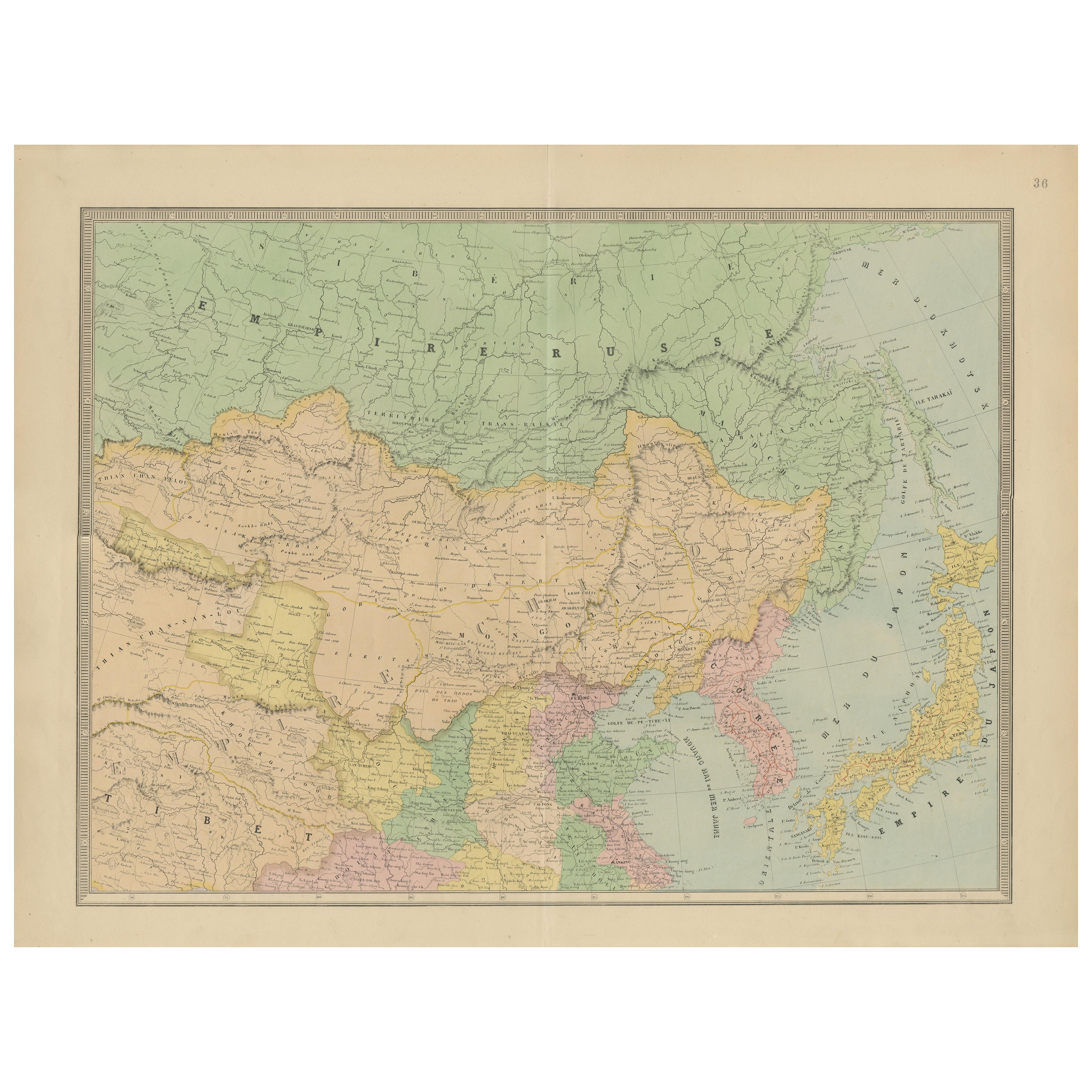
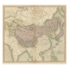
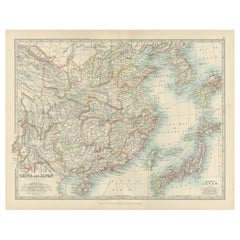
View AllAntique Map of China, Japan & Korea – Eastern Asia by Andriveau-Goujon, 1860
Located in Langweer, NL
Antique Map of China, Japan & Korea – Eastern Asia by Andriveau-Goujon, 1860
This beautifully hand-colored antique map, titled “Carte de la Chine, de la Corée et du Japon,” was publ...
Category
Antique Mid-19th Century French Maps
Materials
Paper
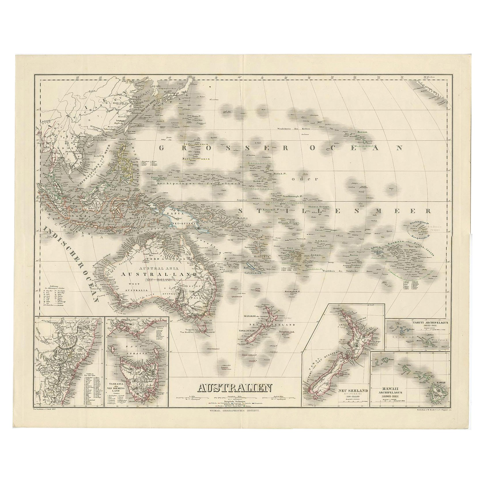
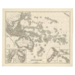
Map of Australia, New Zealand, Part of China, Japan and Southeast Asia, 1857
Located in Langweer, NL
German Antique map titled 'Australien'. Map of Australia, New Zealand, part of China, Japan and Southeast Asia. In the upper right is a bit of the California coast by San Francisco. ...
Category
Antique 19th Century Maps
Materials
Paper
$669 Sale Price
20% Off
Free Shipping
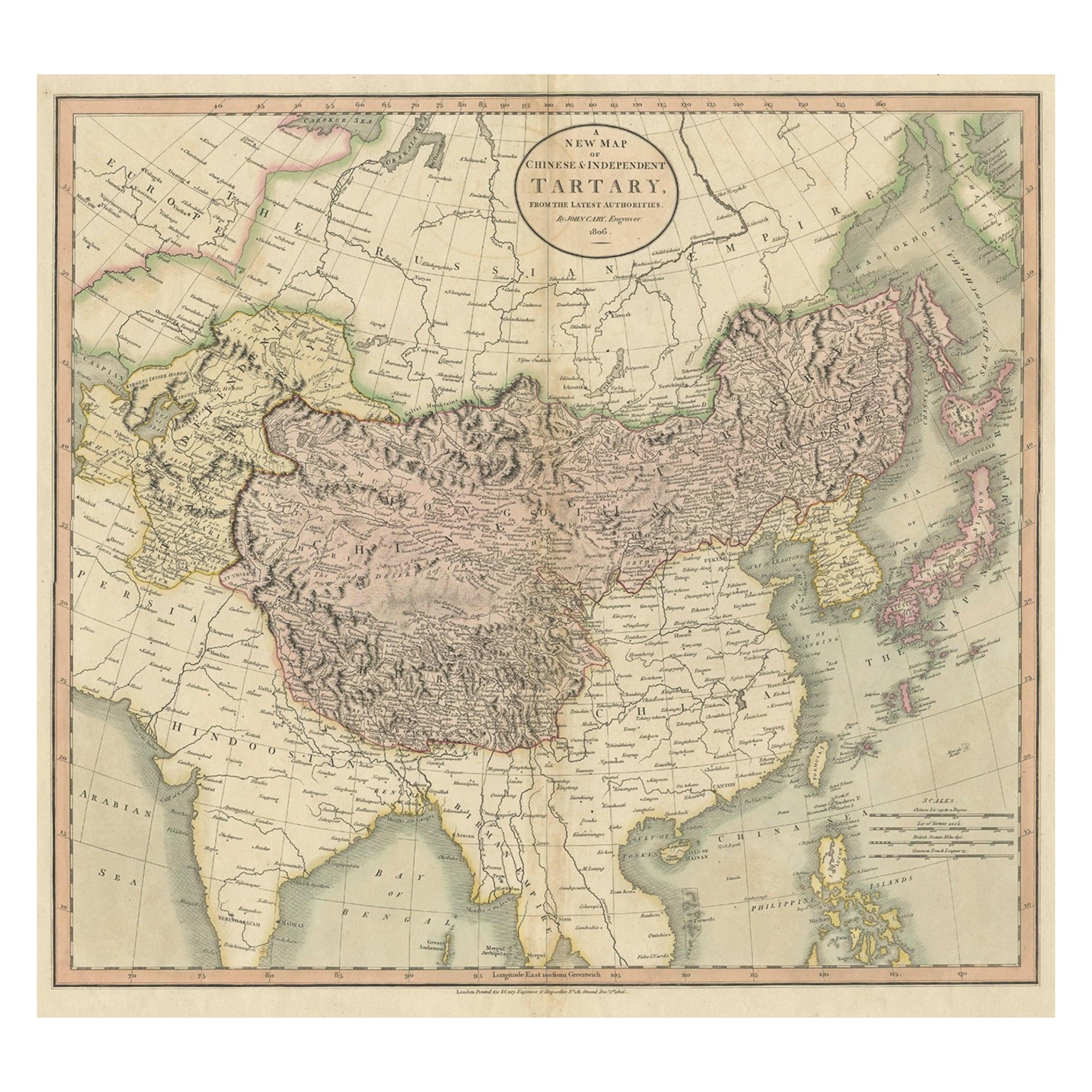
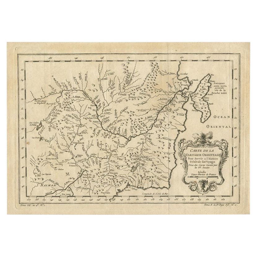
Antique Map of Chinese and Independent Tartary, Korea and Japan, 1806
Located in Langweer, NL
Antique map titled 'A New Map of Chinese & Independent Tartary'. Beautiful map of Chinese Tartary, Korea and Japan.
Artists and Engravers: John Cary (1755-1835) was a British car...
Category
Antique 19th Century Maps
Materials
Paper
$334 Sale Price
20% Off
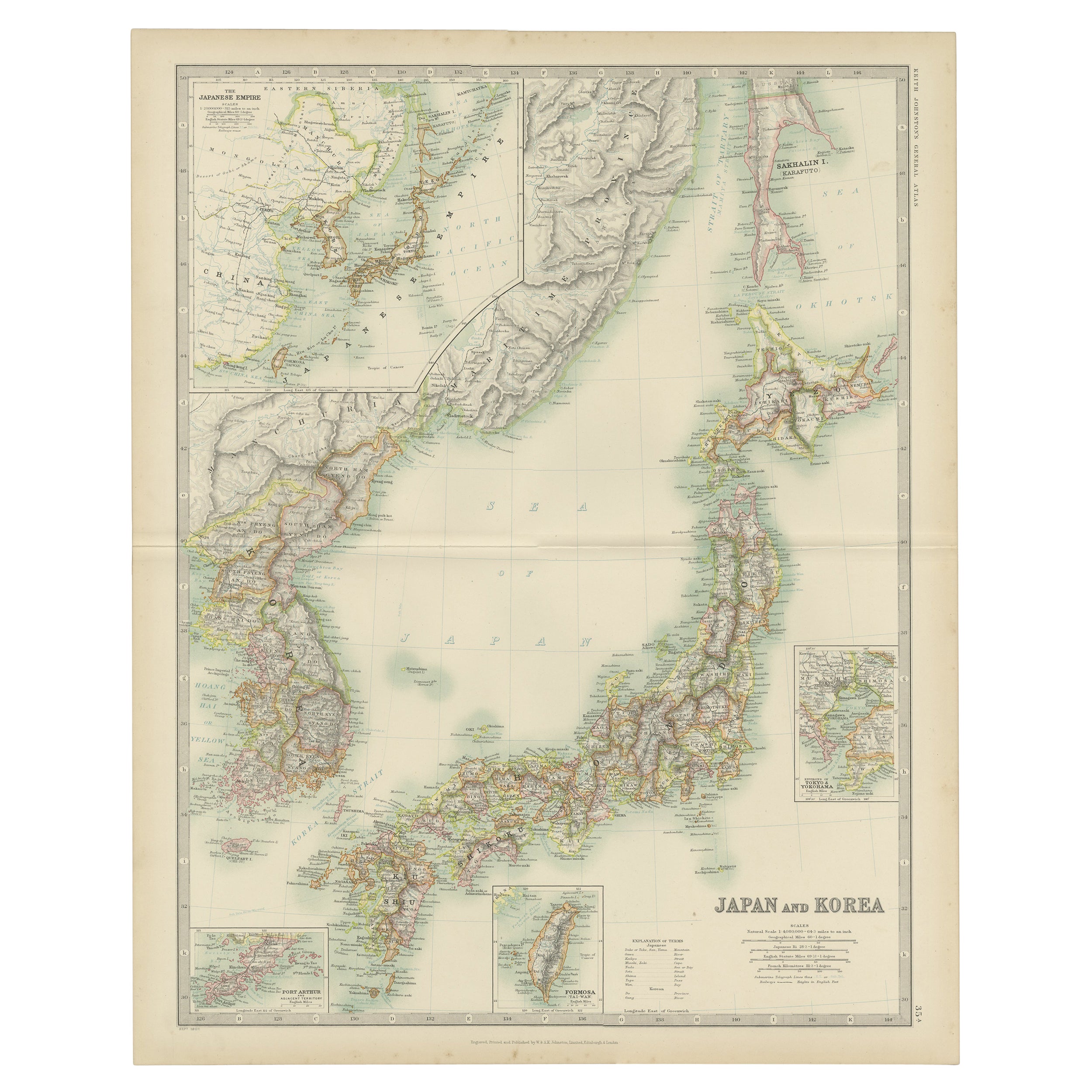
Antique Map of Japan and Korea by Johnston '1909'
Located in Langweer, NL
Antique map titled 'Japan and Korea'. Original antique map of Japan and Korea. With inset maps of the Japanese Empire, Port Arthur, Formosa ,Tokyo and Yoko...
Category
Early 20th Century Maps
Materials
Paper
$334 Sale Price
20% Off
Antique Map of Japan and Korea by Sanson, 'c.1690'
Located in Langweer, NL
Antique map titled 'Les Iles du Iapon (..)'. Original antique map, with beautiful (later) hand coloring, of Japan and the Island of Corey (Korea). Uncommon edition, with '234' at top...
Category
Antique Late 17th Century Maps
Materials
Paper

$956 Sale Price
20% Off
Antique Map of China, Taiwan, Korea, Hong-Kong and Japan, 1903
Located in Langweer, NL
Antique Map of China, Taiwan, Korea, Hong-Kong and Japan, 1903
Description: This antique map, titled "India (Southern Sheet) and the South Eastern Provinces," was engraved and publi...
Category
Early 20th Century Maps
Materials
Paper
You May Also Like
Large University Chart “Physical Map of Africa” by Bacon
Located in Godshill, Isle of Wight
Large university chart “Physical Map of Africa” by Bacon
W&A K Johnston’s Charts of Physical Maps By G W Bacon,
This is colorful Physical map of North America, it is large lithograph set...
Category
Early 20th Century Folk Art Posters
Materials
Linen

Large University Chart “Political Map of North America” by Bacon
Located in Godshill, Isle of Wight
Large University Chart “Political Map of North America” by Bacon
W&A K Johnston’s Charts of Physical Maps By G W Bacon,
This is colourful Physical map ...
Category
Early 20th Century American Empire Posters
Materials
Linen

Large University Chart “Political Map of North America” by Bacon
Located in Godshill, Isle of Wight
Large University chart “Political Map of North America” by Bacon
W&A K Johnston’s Charts of Political Maps by G W Bacon,
This is colorful Physical ...
Category
Early 20th Century American Empire Posters
Materials
Linen

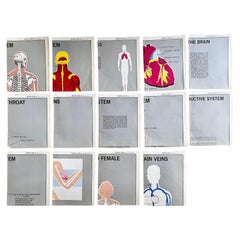
Set of (14) Vintage Anatomy Charts by American Map Co. - sold individually
Located in Philadelphia, PA
Set of (14) Vintage Anatomy Charts
American Map Co. - Circa 1950.
14 Total Charts - Sold Individually -( 14 available )
( discounted to buy as a set )
29" x 37" unfolded
9.5" x 12...
Category
Mid-20th Century American Mid-Century Modern Posters
Materials
Paper
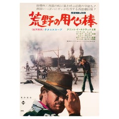
'A Fistful of Dollars' Original Vintage Movie Poster, Japanese, 1967
Located in Devon, GB
Featuring a stylish photomontage with Clint Eastwood’s surly stare front and centre, this scarce B2 poster advertised the first Japanese release of Sergio Leone's 1964 Spaghetti Western ‘A Fistful of Dollars.’ First released in Italy as ‘Per un pugno...
Category
Vintage 1960s Japanese Post-Modern Posters
Materials
Paper
Original Antique Map of The Eastern Hemisphere by Dower, circa 1835
Located in St Annes, Lancashire
Nice map of the Eastern Hemisphere
Drawn and engraved by J.Dower
Published by Orr & Smith. C.1835
Unframed.
Free shipping
Category
Antique 1830s English Maps
Materials
Paper

Recently Viewed
View AllMore Ways To Browse
Antique Map Of Korea
Stanford Furniture
Stanford Antique Furniture
J C Walker Map
Caribbean Map
Map Of Ancient Greece
California Map
Antique Ecuador
Antique Map New York
Malabar Map
Iranian Plates
18th Century Maps America
Antique Map Of Egypt
John Speed Maps
Malaysia Map
Antique Linen Map
Ipswich Antique Furniture
Jamaican Antique