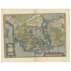
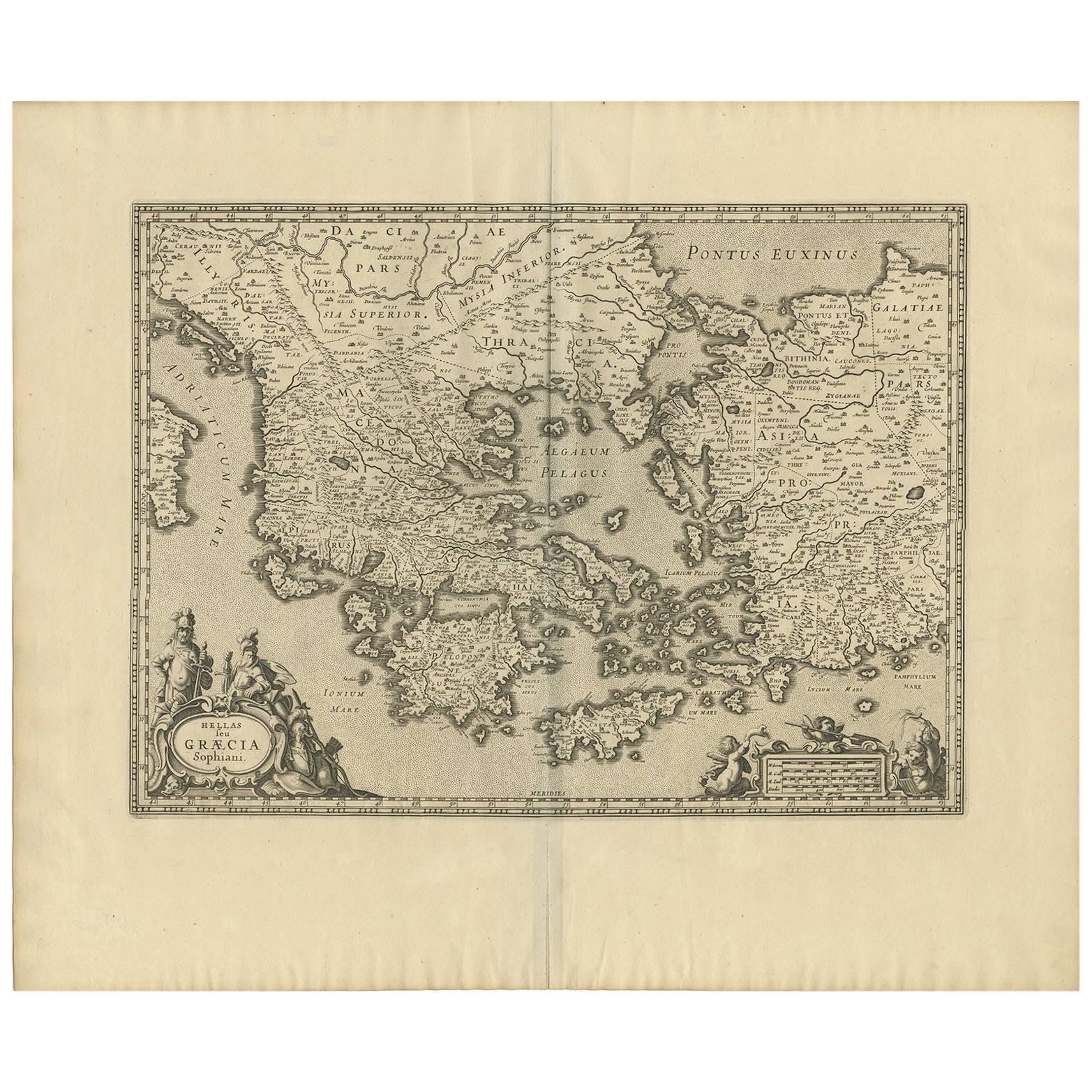
Antique Map of Greece by Ortelius, circa 1579
View Similar Items


Want more images or videos?
Request additional images or videos from the seller
1 of 5
Antique Map of Greece by Ortelius, circa 1579
About the Item
- Dimensions:Height: 16.93 in (43 cm)Width: 21.66 in (55 cm)Depth: 0.02 in (0.5 mm)
- Materials and Techniques:
- Period:
- Date of Manufacture:circa 1579
- Condition:Original/contemporary coloring, minor wear. General age-related toning, Latin text on verso. Please study images carefully.
- Seller Location:Langweer, NL
- Reference Number:Seller: BG-12885-11stDibs: LU3054322270342
About the Seller
5.0
Recognized Seller
These prestigious sellers are industry leaders and represent the highest echelon for item quality and design.
Platinum Seller
Premium sellers with a 4.7+ rating and 24-hour response times
Established in 2009
1stDibs seller since 2017
2,442 sales on 1stDibs
Typical response time: 1 hour
Authenticity Guarantee
In the unlikely event there’s an issue with an item’s authenticity, contact us within 1 year for a full refund. DetailsMoney-Back Guarantee
If your item is not as described, is damaged in transit, or does not arrive, contact us within 7 days for a full refund. Details24-Hour Cancellation
You have a 24-hour grace period in which to reconsider your purchase, with no questions asked.Vetted Professional Sellers
Our world-class sellers must adhere to strict standards for service and quality, maintaining the integrity of our listings.Price-Match Guarantee
If you find that a seller listed the same item for a lower price elsewhere, we’ll match it.Trusted Global Delivery
Our best-in-class carrier network provides specialized shipping options worldwide, including custom delivery.More From This Seller
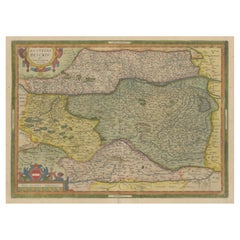
View AllAntique Map of Austria by Ortelius, c.1612
Located in Langweer, NL
Antique map titled 'Austriae Descrip. per Wolfgangum Lazium' Original antique map of Austria. Published by A. Ortelius, circa 1612.
Artists a...
Category
Antique 17th Century Maps
Materials
Paper
$694 Sale Price
20% Off
Antique Map of the Region of Salzburg by Ortelius 'circa 1606'
Located in Langweer, NL
Antique map titled 'Salisburgensis Iurisdictionis'. Original antique map of the region of Salzburg, Austria. Published by A. Ortelius, circa 1606.
Category
Antique Early 17th Century Maps
Materials
Paper

$694 Sale Price
20% Off
Antique Map of the Region of Poitou by Ortelius, circa 1600
Located in Langweer, NL
Antique map titled 'Poictou'. Original antique map of the region of Poitou, a former province of west-central France whose capital city was Poitiers. Published by A. Ortelius, circa ...
Category
Antique Early 17th Century Maps
Materials
Paper

$555 Sale Price
20% Off
Antique Map of Southeast Asia by Ortelius '1587'
By Abraham Ortelius
Located in Langweer, NL
Antique map titled 'Indiae Orientalis Insularumque Adiacientium Typus'. Ortelius includes early European depictions of both Japan and China and is the first to name Formosa (Taiwan). The Philippines and East Indies or Spice Islands are shown based upon Portuguese and Spanish sources, and before their penetration by the Dutch. Japan is shown in kite form, as a large oval island...
Category
Antique 16th Century Maps
Materials
Paper

Antique Map of East Frisia by Ortelius, c.1595
Located in Langweer, NL
Antique print, titled: 'Frisia Orientalis.' Map of East Frisia originating from 'Theatrum Orbis Terrarum'. It is based on the manuscript map by Jon Bloe...
Category
Antique 16th Century Maps
Materials
Paper

$787 Sale Price
20% Off
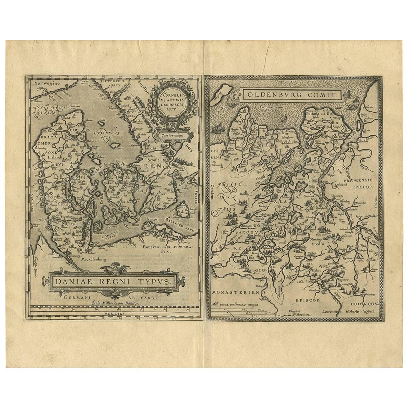
Antique Map of Denmark and Oldenburg ‘Germany’ by A. Ortelius, circa 1598
Located in Langweer, NL
Antique map titled 'Daniae Regni Typus' and 'Oldenburg Comit'. A nice example of Ortelius maps of Denmark and Oldenburg, which first appeared in the 1584 edition of his Theatrum Orbi...
Category
Antique 16th Century Maps
Materials
Paper
$833 Sale Price
20% Off
You May Also Like
Original Antique Map of Ancient Greece, Achaia, Corinth, 1786
Located in St Annes, Lancashire
Great map of Ancient Greece. Showing the region of Thessaly, including Mount Olympus
Drawn by J.D. Barbie Du Bocage
Copper plate engraving by P.F Tardieu
Original hand color...
Category
Antique 1780s French Other Maps
Materials
Paper

Original Antique Map of Ancient Greece- Boeotia, Thebes, 1787
Located in St Annes, Lancashire
Great map of Ancient Greece. Showing the region of Boeotia, including Thebes
Drawn by J.D. Barbie Du Bocage
Copper plate engraving by P.F T...
Category
Antique 1780s French Other Maps
Materials
Paper

Original Antique Map of Spain and Portugal, circa 1790
Located in St Annes, Lancashire
Super map of Spain and Portugal
Copper plate engraving by A. Bell
Published, circa 1790.
Unframed.
Category
Antique 1790s English Other Maps
Materials
Paper

Antique Map of Italy by Andriveau-Goujon, 1843
By Andriveau-Goujon
Located in New York, NY
Antique Map of Italy by Andriveau-Goujon, 1843. Map of Italy in two parts by Andriveau-Goujon for the Library of Prince Carini at Palazzo Carini i...
Category
Antique 1840s French Maps
Materials
Linen, Paper

$3,350 / set
Antique Map of Principality of Monaco
By Antonio Vallardi Editore
Located in Alessandria, Piemonte
ST/619 - "Old Geographical Atlas of Italy - Topographic map of ex-Principality of Monaco" -
ediz Vallardi - Milano -
A somewhat special edition ---
Category
Antique Late 19th Century Italian Other Prints
Materials
Paper

Greece, "Graeciae Antiquae"" A 17th Century Hand-colored Map by Sanson
By Nicolas Sanson
Located in Alamo, CA
This is an original 17th century hand colored copperplate engraved map of Greece entitled "Graeciae Antiquae Tabula Hanc Geographicam" by Nicolas d'Abbeville Sanson, engraved and pub...
Category
Antique Mid-17th Century French Maps
Materials
Paper

Recently Viewed
View AllMore Ways To Browse
Antique Map Iceland
Antique Maps Of Malta
Map Holder
Mitchell Antique Maps
Antique Geological Maps
Antique Map Of Kent
Antique Map Of Maine
Victorian Portico
Vintage Wooden Roller
Von Gotha
Antique Chart Table
Antique Map Palestine
Antique Maps Hampshire
Antique Powder Tins
Brooklyn Map
Map Of Colorado
Antique Bermuda Furniture
Antique Life Buoy