Items Similar to Antique Map of the Kingdom of Denmark by Keizer & de Lat, 1788


Want more images or videos?
Request additional images or videos from the seller
1 of 5
Antique Map of the Kingdom of Denmark by Keizer & de Lat, 1788
$333.33
$416.6720% Off
£247.76
£309.7020% Off
€280
€35020% Off
CA$460.24
CA$575.3020% Off
A$510.38
A$637.9720% Off
CHF 268.16
CHF 335.2120% Off
MX$6,235.93
MX$7,794.9120% Off
NOK 3,355.11
NOK 4,193.8920% Off
SEK 3,149.34
SEK 3,936.6820% Off
DKK 2,132.06
DKK 2,665.0720% Off
About the Item
Antique map titled 't Koninkryk van Denemarke'. Uncommon original antique map of the Kingdom of Denmark. This map originates from 'Nieuwe Natuur- Geschied- en Handelkundige Zak- en Reisatlas' by Gerrit Brender à Brandis. Published by J. Keizer and I. de Lat, 1788.
- Dimensions:Height: 8.08 in (20.5 cm)Width: 10.83 in (27.5 cm)Depth: 0.02 in (0.5 mm)
- Materials and Techniques:
- Period:
- Date of Manufacture:1788
- Condition:General age-related toning. Original folding lines. Original/contemporary hand coloring, blank verso. Minor wear, please study image carefully.
- Seller Location:Langweer, NL
- Reference Number:Seller: BG-12854-441stDibs: LU3054321979062
About the Seller
5.0
Recognized Seller
These prestigious sellers are industry leaders and represent the highest echelon for item quality and design.
Platinum Seller
Premium sellers with a 4.7+ rating and 24-hour response times
Established in 2009
1stDibs seller since 2017
2,609 sales on 1stDibs
Typical response time: <1 hour
- ShippingRetrieving quote...Shipping from: Langweer, Netherlands
- Return Policy
Authenticity Guarantee
In the unlikely event there’s an issue with an item’s authenticity, contact us within 1 year for a full refund. DetailsMoney-Back Guarantee
If your item is not as described, is damaged in transit, or does not arrive, contact us within 7 days for a full refund. Details24-Hour Cancellation
You have a 24-hour grace period in which to reconsider your purchase, with no questions asked.Vetted Professional Sellers
Our world-class sellers must adhere to strict standards for service and quality, maintaining the integrity of our listings.Price-Match Guarantee
If you find that a seller listed the same item for a lower price elsewhere, we’ll match it.Trusted Global Delivery
Our best-in-class carrier network provides specialized shipping options worldwide, including custom delivery.More From This Seller
View AllDenmark and Baltic Region – Antique Map by Guillaume de l’Isle, c.1730
By Covens & Mortier
Located in Langweer, NL
Denmark and Baltic Region – Antique Map by Guillaume de l’Isle, c.1730
This antique map titled Carte du Royaume de Danemark is a detailed 18th-century depiction of Denmark and its surrounding regions. Originally created by renowned French cartographer Guillaume de l’Isle, the map was published around 1730 by the Dutch publishers Covens...
Category
Antique Mid-18th Century Maps
Materials
Paper

$561 Sale Price
20% Off
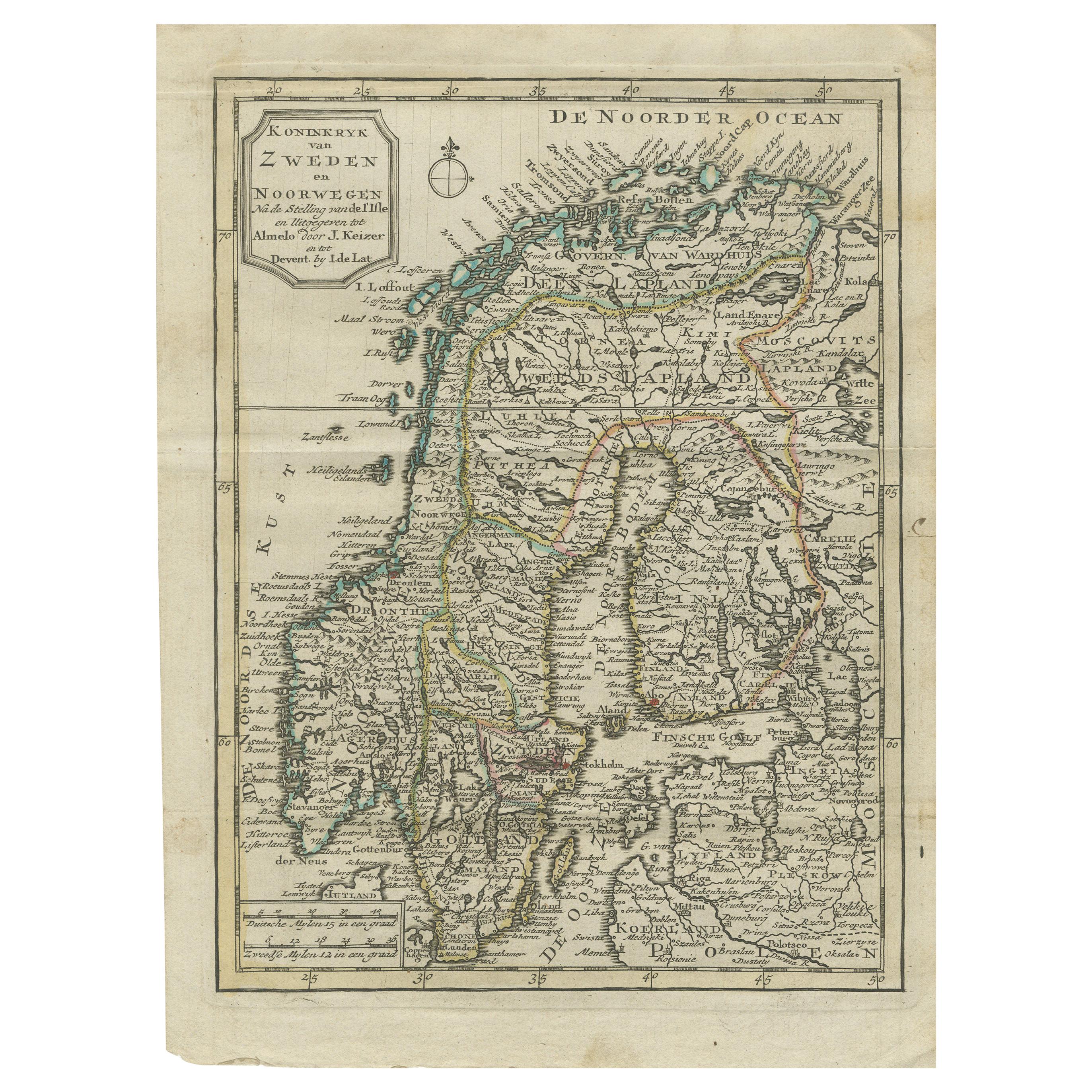
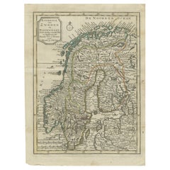
Antique Map of the Kingdom of Sweden and Norway by Keizer & de Lat, 1788
Located in Langweer, NL
Antique map titled 't Koninkryk van Zweden en Noorwegen'. Uncommon original antique map of the Kingdom of Sweden and Norway. This map originates from 'Nieuwe Natuur- Geschied- en Han...
Category
Antique Late 18th Century Maps
Materials
Paper
$333 Sale Price
20% Off
Antique Map of Denmark with Schleswig-Holstein and the South of Sweden, c.1750
Located in Langweer, NL
Antique map titled 'General Charte von Konigreich Daenemark nebst dem Herzogthum Holstein.' Denmark with Schleswig-Holstein and the southern coast of Sweden. The large title cartouch...
Category
Antique 18th Century Maps
Materials
Paper

$352 Sale Price
20% Off
Antique Map of Denmark by Moll 'circa 1730'
By Herman Moll
Located in Langweer, NL
Antique map titled 'Denmark, agreeable to Modern History'. Uncommon map of Denmark by Herman Moll, published, circa 1730.
Category
Antique Mid-18th Century Maps
Materials
Paper

$333 Sale Price
20% Off
Map of Denmark Divided into Dioceses – G. & L. Valk, ca. 1690
Located in Langweer, NL
Map of Denmark Divided into Dioceses – G. & L. Valk, ca. 1700
Detailed antique map titled "Regnum Daniae, divisum in Dioeceses Arhusiam, Albergum, Viborgum, et Ripam," showing Denma...
Category
Antique Late 17th Century Maps
Materials
Paper

$523 Sale Price
20% Off
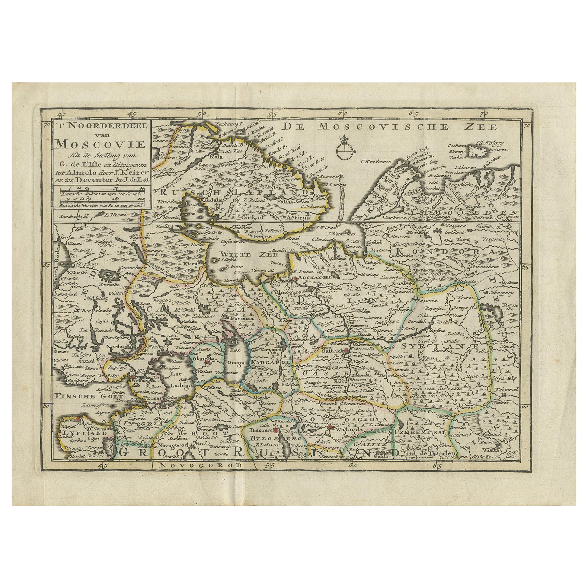
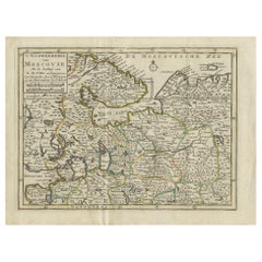
Antique Map of Northern Muscovy by Keizer & de Lat, 1788
Located in Langweer, NL
Antique map titled 't Noorderdeel van Moscovie (..)'. Uncommon original antique map of Northern Muscovy, Russia. This map originates from 'Nieuwe Natuur- Geschied- en Handelkundige Z...
Category
Antique Late 18th Century Maps
Materials
Paper
$333 Sale Price
20% Off
You May Also Like
18th Century Emanuel Bowen Map of County of York, c.1740
By Emanuel Bowen
Located in Royal Tunbridge Wells, Kent
Antique 18th century British rare and original Emanuel Bowen (1694-1767) map of the County of York divided into its Ridings and subdivided into wapontakes, mounted in solid wood fram...
Category
Antique Early 18th Century British Maps
Materials
Paper

1752 Vaugoundy Map of Flanders : Belgium, France, and the Netherlands, Ric.a002
Located in Norton, MA
Large Vaugoundy Map of Flanders:
Belgium, France, and the Netherlands
Colored -1752
Ric.a002
Description: This is a 1752 Didier Robert de Vaugondy map of Flanders. The map de...
Category
Antique 17th Century Unknown Maps
Materials
Paper

17th Century Map of Denmark by French Cartographer Sanson, Dated 1658
By Nicolas Sanson
Located in Copenhagen, K
17th century map of Denmark by French cartographer Sanson.
Nicolas Sanson (20 December 1600-7 July 1667) was a French cartographer, termed by some the creator of French geography an...
Category
Antique 17th Century French Maps
Materials
Paper

Map of Denmark, 1724
Located in Houston, TX
Extraordinary copper engraved map of Denmark by cartographer Christoph Weigel from 1724. Shows counties, rivers and towns. Ornate title cartouche. Original hand-color. Over 250 years old.
Original antique map displayed...
Category
17th Century Other Art Style More Prints
Materials
Paper, Ink, Watercolor

1643 Willem&Joan Blaeu Map NW Flanders "Flandriae Teutonicae Pars Prientalior
Located in Norton, MA
1643 Willem and Joan Blaeu map of northwest Flanders, entitled
"Flandriae Teutonicae Pars Prientalior,"
Ric0012
" Authentic" - Map of the northwest Fl...
Category
Antique 17th Century Dutch Maps
Materials
Paper

Original Antique Map of Sweden, Engraved by Barlow, 1806
Located in St Annes, Lancashire
Great map of Sweden
Copper-plate engraving by Barlow
Published by Brightly & Kinnersly, Bungay, Suffolk. 1806
Unframed.
Category
Antique Early 1800s English Maps
Materials
Paper

More Ways To Browse
Antique Map Denmark
Framed World Map
Rare Compass
16th Century Scotland
Antique Wood Coat Of Arms
Antique Maps Australia
Antique Quadrant
Caribbean Antique Furniture
Antique Native American Collectibles
Turkey Map
Map Of Austria
Antique Mediterranean Map
Antique Furniture Building Plans
Map Of Ireland
18th Century Compass
18th Century Maps America
Map Of Great Britain
Miniature Maps