Items Similar to Antique Map of Oostergo, Friesland, by Von Reilly, 1791


Video Loading
Want more images or videos?
Request additional images or videos from the seller
1 of 11
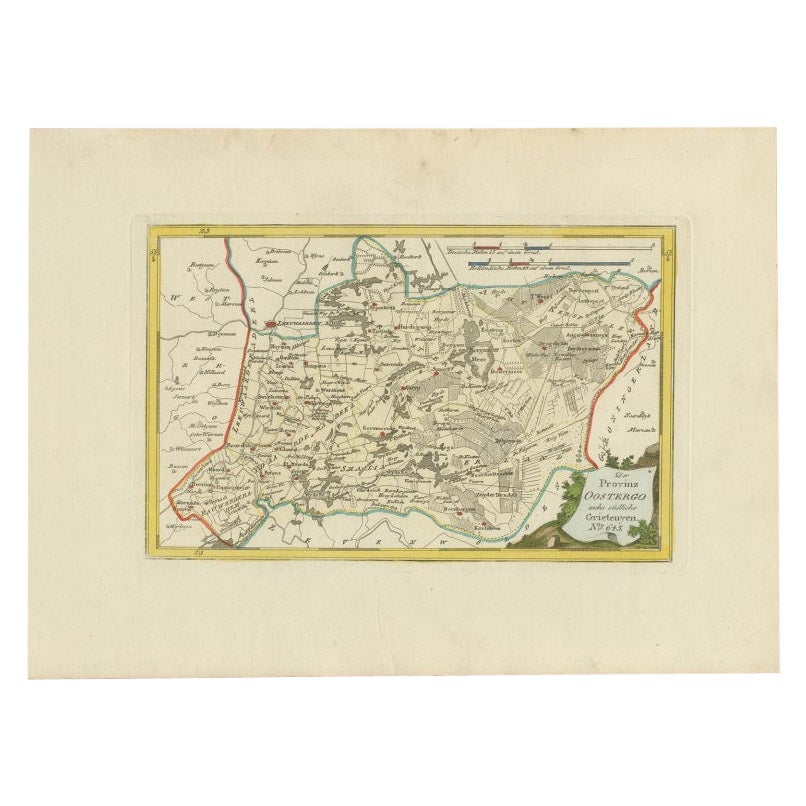
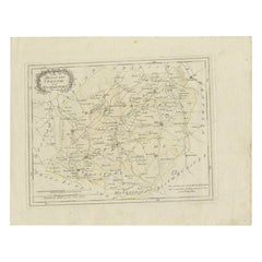
Antique Map of Oostergo, Friesland, by Von Reilly, 1791
$466.78
£344.32
€390
CA$646.75
A$702.24
CHF 371.89
MX$8,607.45
NOK 4,602.25
SEK 4,348.88
DKK 2,969.02
About the Item
Title: Oostergo, Friesland – von Reilly antique map, 1791
Fine original 18th-century engraved map of Oostergo, one of the historic quarters of Friesland, the Netherlands. Published in Vienna in 1791 as part of Franz Johann Josef von Reilly’s ambitious world atlas Schauplatz der fünf Theile der Welt, the sheet depicts the northern and eastern parts of Friesland. The map highlights towns, villages, waterways, and dikes, with clear district boundaries emphasized in contemporary outline hand-colour. The Zuiderzee coast, Lauwerszee, and borders with Groningen and Drenthe are indicated, while the title cartouche in the lower right carries the inscription “Oostergo No. 643” in von Reilly’s distinctive Viennese style.
Von Reilly (1766–1820) was a Vienna-based publisher and map dealer who sought to compile one of the most comprehensive atlases of his age, combining clarity and detail. His maps were engraved by Ignaz Alberti (also Albrecht, 1760–1794), an Austrian illustrator and engraver known for fine linework and legibility. These maps are particularly valued for documenting the Dutch provinces at the end of the 18th century with both decorative and historical charm.
The map of Oostergo is of strong regional interest, showing settlements such as Dokkum, Kollum, Ferwerd, Buitenpost, Bergum (Burgum), and numerous surrounding villages. With its wide margins, clear impression, and hand-coloured borders, this is a desirable example for collectors of Friesland maps, Dutch history, and Enlightenment cartography.
Condition report:
Good condition. General age-related toning, some light handling marks to margins. Contemporary outline hand-colouring preserved. Strong plate impression with blank verso. No folds, tears, or repairs noted.
Framing tips:
A soft ivory or cream mount highlights the paper tone, while a thin yellow or green inner line can echo the original outline colour. A walnut or dark wood frame provides classical depth; for a lighter appearance, oak or maple is also suitable.
Technique: Copper engraving with contemporary outline hand-colour
Maker: Franz J. J. von Reilly (engr. Ignaz Alberti), Vienna, 1791
Important places on the von Reilly 1791 map of Oostergo (Friesland):
Leeuwarden – capital of Friesland, main city of the province
Dokkum – fortified town, important religious and trading centre
Kollum – regional market town in the northeast
Ferwerd (Ferwerderadeel) – village and former municipality
Buitenpost – settlement between Dokkum and Groningen border
Burgum (Bergum) – central village in Oostergo quarter
Broeksterwoude – smaller settlement
Oostrum – village near Dokkum
Engwierum – settlement near the Lauwerszee
Ee – historic Frisian village
Stroobos – border village between Friesland and Groningen
Geographic features:
Lauwerszee – former inland sea, later transformed into Lauwersmeer
Zuiderzee – along the western edge, later IJsselmeer
Borders with Groningen and Drenthe – shown in outline colour
Extensive waterways, dikes, and polders – typical of Frisian landscape management
Keywords:
Oostergo, Friesland antique map, Leeuwarden 18th century, Dokkum, Kollum, Ferwerd, Buitenpost, Burgum, Engwierum, Ee Friesland, Stroobos, Lauwerszee, Zuiderzee, von Reilly map 1791, Ignaz Alberti engraving, Schauplatz der fünf Theile der Welt, Austrian cartography, Frisian history
- Dimensions:Height: 11.42 in (29 cm)Width: 15.56 in (39.5 cm)Depth: 0 in (0.01 mm)
- Materials and Techniques:Paper,Engraved
- Place of Origin:
- Period:
- Date of Manufacture:1791
- Condition:Good condition. General age-related toning, some light handling marks to margins. Contemporary outline hand-colouring preserved. Strong plate impression with blank verso. No folds, tears, or repairs noted.
- Seller Location:Langweer, NL
- Reference Number:Seller: PCT-10481stDibs: LU3054327620602
About the Seller
5.0
Recognized Seller
These prestigious sellers are industry leaders and represent the highest echelon for item quality and design.
Platinum Seller
Premium sellers with a 4.7+ rating and 24-hour response times
Established in 2009
1stDibs seller since 2017
2,623 sales on 1stDibs
Typical response time: <1 hour
- ShippingRetrieving quote...Shipping from: Langweer, Netherlands
- Return Policy
Authenticity Guarantee
In the unlikely event there’s an issue with an item’s authenticity, contact us within 1 year for a full refund. DetailsMoney-Back Guarantee
If your item is not as described, is damaged in transit, or does not arrive, contact us within 7 days for a full refund. Details24-Hour Cancellation
You have a 24-hour grace period in which to reconsider your purchase, with no questions asked.Vetted Professional Sellers
Our world-class sellers must adhere to strict standards for service and quality, maintaining the integrity of our listings.Price-Match Guarantee
If you find that a seller listed the same item for a lower price elsewhere, we’ll match it.Trusted Global Delivery
Our best-in-class carrier network provides specialized shipping options worldwide, including custom delivery.More From This Seller
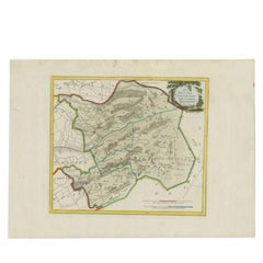
View AllAntique Map of Oostergo by Von Reilly, 1791
Located in Langweer, NL
Antique map titled 'Der Provinz Oostergo sechs südliche Grietenyen'. Map of the Oostergo region, Friesland, the Netherlands. This map orginates from 'Schauplatz der fünf Theile der W...
Category
Antique 18th Century Maps
Materials
Paper

$151 Sale Price
20% Off
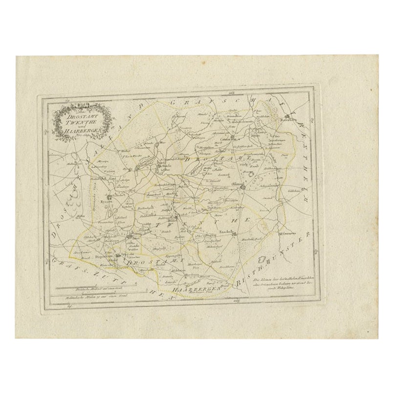
Antique Map of Part of Overijssel by Von Reilly, 1792
Located in Langweer, NL
Antique map titled 'Das Drostamt Twenthe und Haarbergen'. This map depicts part of The Netherlands (Overijssel). This map originates from 'Schauplatz der fünf Theile der Welt' publis...
Category
Antique 18th Century Maps
Materials
Paper
$119 Sale Price
20% Off
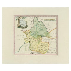
Antique Map of Zevenwolden by Von Reilly, 1791
Located in Langweer, NL
Friesland Zevenwouden eastern districts map, Reilly, Vienna, c.1791–95
Description:
Engraved map with original hand color of the Zevenwouden (Seven Forests) region in Friesland, Net...
Category
Antique 18th Century Austrian Maps
Materials
Paper
Antique Map of Friesland by Von Reilly, 1791
Located in Langweer, NL
Antique map titled 'Friesland'. Map of the province of Friesland, the Netherlands. This map orginates from 'Schauplatz der fünf Theile der Welt'. Artists and Engravers: Franz Joseph ...
Category
Antique 18th Century Austrian Maps
Materials
Paper

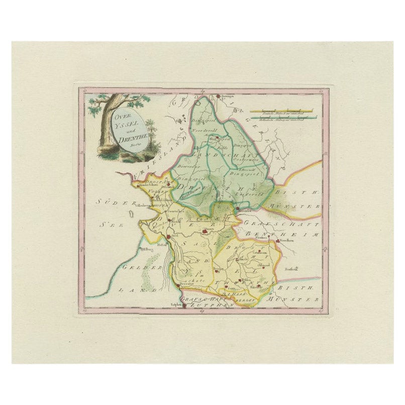
Antique Map of Overijssel and Drenthe by Von Reilly, c.1795
Located in Langweer, NL
Antique map titled 'Overyssel und Drenthe'. Decorative map of Overijssel and Drenthe, The Netherlands. This map originates from 'Schauplatz Der Funf Theile der Welt' (Wien: Reilly, 1...
Category
Antique 18th Century Maps
Materials
Paper
$148 Sale Price
20% Off
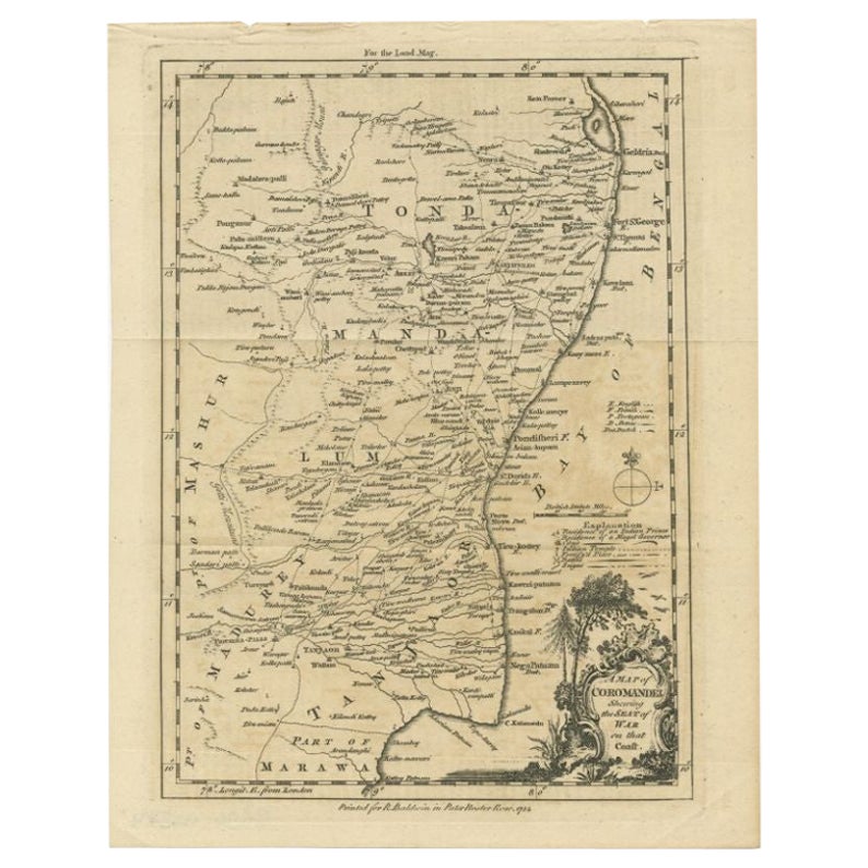
Antique Map of the Coromandel Peninsula, 1754
Located in Langweer, NL
Antique map titled 'A map of Coromandel shewing the Seat of War on that coast'. Rare map of Coromandel printed for the London Magazine.
Artists and Engr...
Category
Antique 18th Century Maps
Materials
Paper

$113 Sale Price
20% Off
You May Also Like
Original Antique Map of Ancient Greece- Boeotia, Thebes, 1787
Located in St Annes, Lancashire
Great map of Ancient Greece. Showing the region of Boeotia, including Thebes
Drawn by J.D. Barbie Du Bocage
Copper plate engraving by P.F T...
Category
Antique 1780s French Other Maps
Materials
Paper

Map Southern Scotland Thomas Conder Alex Hogg 1795
Located in BUNGAY, SUFFOLK
A new map of the southern part of Scotland containing the counties of Stirling, Lanerk, Renfrew, Linlithgow, Edinburgh, Peebles, Haddingtoun, Berwick, Selkirk, Roxburgh, Dumfries, Wigtoun, Kirkudbright & Air
Published by Alex Hogg at the Kings Arms...
Category
Antique 18th Century English Georgian Maps
Materials
Paper

1752 Vaugoundy Map of Flanders : Belgium, France, and the Netherlands, Ric.a002
Located in Norton, MA
Large Vaugoundy Map of Flanders:
Belgium, France, and the Netherlands
Colored -1752
Ric.a002
Description: This is a 1752 Didier Robert de Vaugondy map of Flanders. The map de...
Category
Antique 17th Century Unknown Maps
Materials
Paper

Li Governi di Borgogna - Ancient Map - 1777
Located in Roma, IT
Li Governi di Borgogna is an original black and white etching on paper, printed by Antonio Zatta in Venice, 1777.
Original Title: Li Governi di Borgogna della Franca Contea e del Ly...
Category
1770s Modern Landscape Prints
Materials
Etching

1790 Thomas Stackhouse Map, Entitled "Russia in Europe, " , Ric.a004
Located in Norton, MA
1790 Thomas Stackhouse map, entitled
"Russia in Europe"
Ric.a004
Stackhouse, Thomas
Russia in Europe [map]
London: T. Stackhouse, 1783. Map. Matted hand-colored copper engraving. Image size: 14.5 x 15.25 inches. Mat size: 22.75 x 23.75 inches. A beautiful example of this map of Eastern Europe...
Category
Antique 17th Century Unknown Maps
Materials
Paper

Original Antique Map of Switzerland, Engraved By Barlow, Dated 1807
Located in St Annes, Lancashire
Great map of Switzerland
Copper-plate engraving by Barlow
Published by Brightly & Kinnersly, Bungay, Suffolk.
Dated 1807
Unframed.
Category
Antique Early 1800s English Maps
Materials
Paper

More Ways To Browse
Franz Joseph
Jamaican Antique
Large Map Of Italy
Louisiana Antiques
Maps South East Asia
New Jersey Antique Furniture
Ptolemy Map
Antique Maps Massachusetts
Antique Maps Singapore
Antique Planisphere
Map Of Palestine
R Johnston
Santa Cruz Island
Shetland Map
Antique Alabama Map
Antique Framed Map Engravings
Antique Furniture Cheshire
Antique Great Lakes Map