Items Similar to Antique Map of West Africa, focused on the Congo and Angola


Want more images or videos?
Request additional images or videos from the seller
1 of 6
Antique Map of West Africa, focused on the Congo and Angola
$813.02
$1,016.2720% Off
£601.88
£752.3520% Off
€680
€85020% Off
CA$1,125.01
CA$1,406.2720% Off
A$1,240.30
A$1,550.3820% Off
CHF 648.89
CHF 811.1120% Off
MX$15,216.21
MX$19,020.2720% Off
NOK 8,168.19
NOK 10,210.2420% Off
SEK 7,638.55
SEK 9,548.1920% Off
DKK 5,179.82
DKK 6,474.7820% Off
About the Item
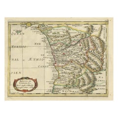
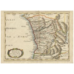
Original antique map titled 'Regna Congo et Angola'. Decorative 17th Century English map of a portion of West Africa, focused on the Congo and Angola. The map is centered on the Zaire River (Congo) and Coanza River, which show a common source of the Aquilunda River. The map is drawn from a similar map published by Blaeu in Amsterdam.
Published by John Ogilby, circa 1670. John Ogilby (1600-1676) was an English geographer and publisher, one of the most prominent of the seventeenth century. Little is known of his early life but by 1619 he was apprenticed to John Draper, a dancing-master in London. He worked as a dancing-master, courtier, and theater owner form 1620-1641. From 1649 he worked as a poet, translator, and publisher of classical texts. It is only in the last decade of his life that he entered into geography.
- Dimensions:Height: 13.86 in (35.2 cm)Width: 16.38 in (41.6 cm)Depth: 0.02 in (0.5 mm)
- Materials and Techniques:
- Period:Late 17th Century
- Date of Manufacture:circa 1670
- Condition:Wear consistent with age and use. General age-related toning, minor wear. Original folding line, blank verso. Please study image carefully.
- Seller Location:Langweer, NL
- Reference Number:Seller: BG-13187-21stDibs: LU3054331144402
About the Seller
5.0
Recognized Seller
These prestigious sellers are industry leaders and represent the highest echelon for item quality and design.
Platinum Seller
Premium sellers with a 4.7+ rating and 24-hour response times
Established in 2009
1stDibs seller since 2017
2,613 sales on 1stDibs
Typical response time: <1 hour
- ShippingRetrieving quote...Shipping from: Langweer, Netherlands
- Return Policy
Authenticity Guarantee
In the unlikely event there’s an issue with an item’s authenticity, contact us within 1 year for a full refund. DetailsMoney-Back Guarantee
If your item is not as described, is damaged in transit, or does not arrive, contact us within 7 days for a full refund. Details24-Hour Cancellation
You have a 24-hour grace period in which to reconsider your purchase, with no questions asked.Vetted Professional Sellers
Our world-class sellers must adhere to strict standards for service and quality, maintaining the integrity of our listings.Price-Match Guarantee
If you find that a seller listed the same item for a lower price elsewhere, we’ll match it.Trusted Global Delivery
Our best-in-class carrier network provides specialized shipping options worldwide, including custom delivery.More From This Seller
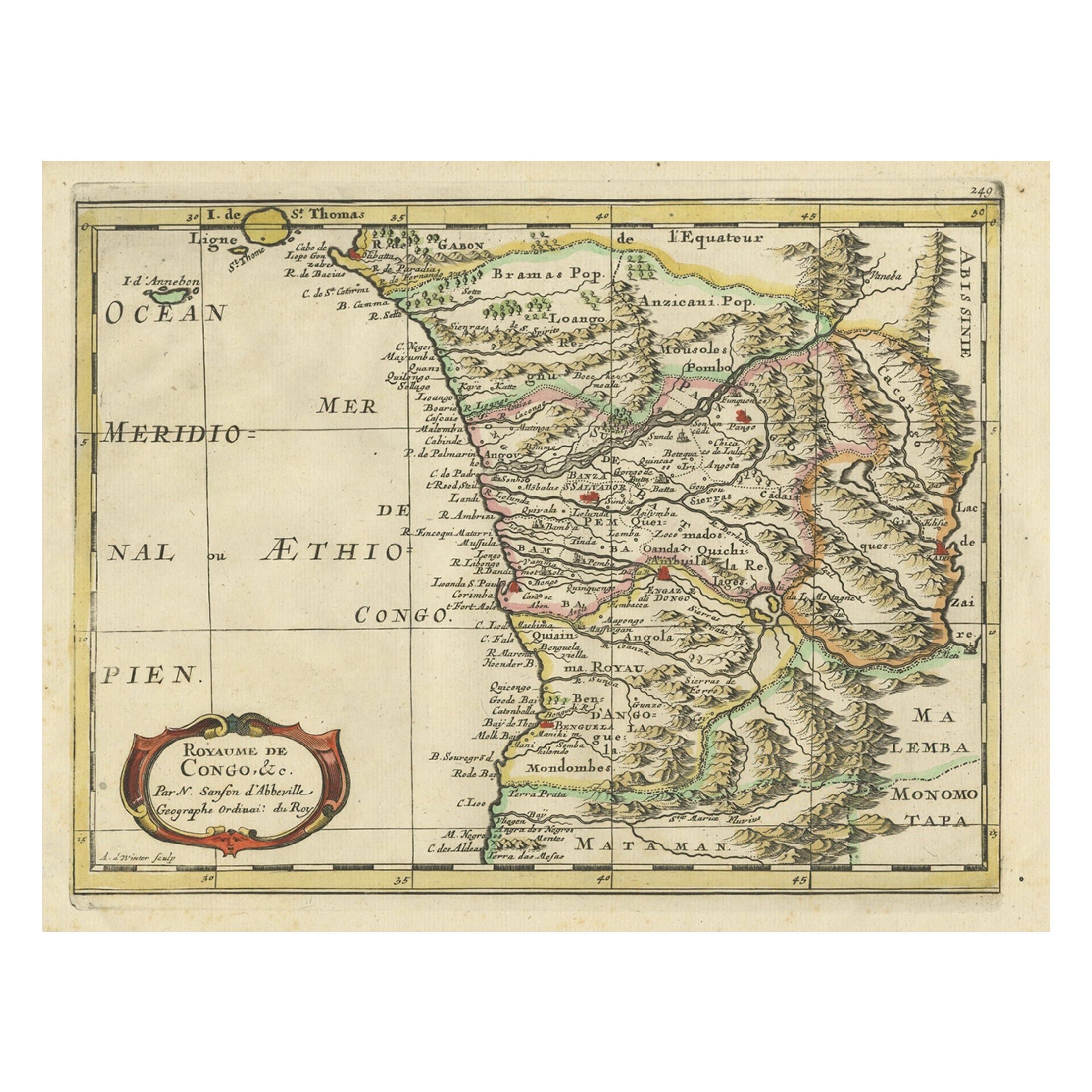
View AllAntique Map of Gabon, Angola and the Congo Region in Africa c.1680
Located in Langweer, NL
Antique map titled 'Royaume de Congo'.
Map of Gabon, the Congo and Angola from Cape Lopez and Sao Tomé to approximately the border with present-day Namibia. The map is fully engrav...
Category
Antique 17th Century Maps
Materials
Paper
Antique Map of the Congo, Gabon and Angola by N. Sanson, circa 1700
Located in Langweer, NL
Attractive map of Gabon, the Congo and Angola from Cape Lopez and Sao Tomé to approximately the border with present-day Namibia. The map is fully engraved with mountains, rivers, for...
Category
Antique Early 18th Century Maps
Materials
Paper
$267 Sale Price
20% Off
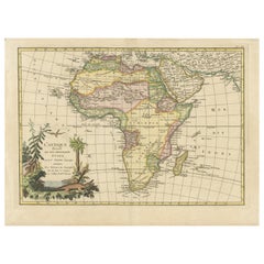
Original Antique Map of Africa with large decorative cartouche
Located in Langweer, NL
Original antique map titled 'L'Afrique divisée en ses principaux États'. Attractive and precise map of Africa, with large decorative cartouche. Engraved by Janvier. Published by Dela...
Category
Antique Late 18th Century Maps
Materials
Paper
$946 Sale Price
20% Off
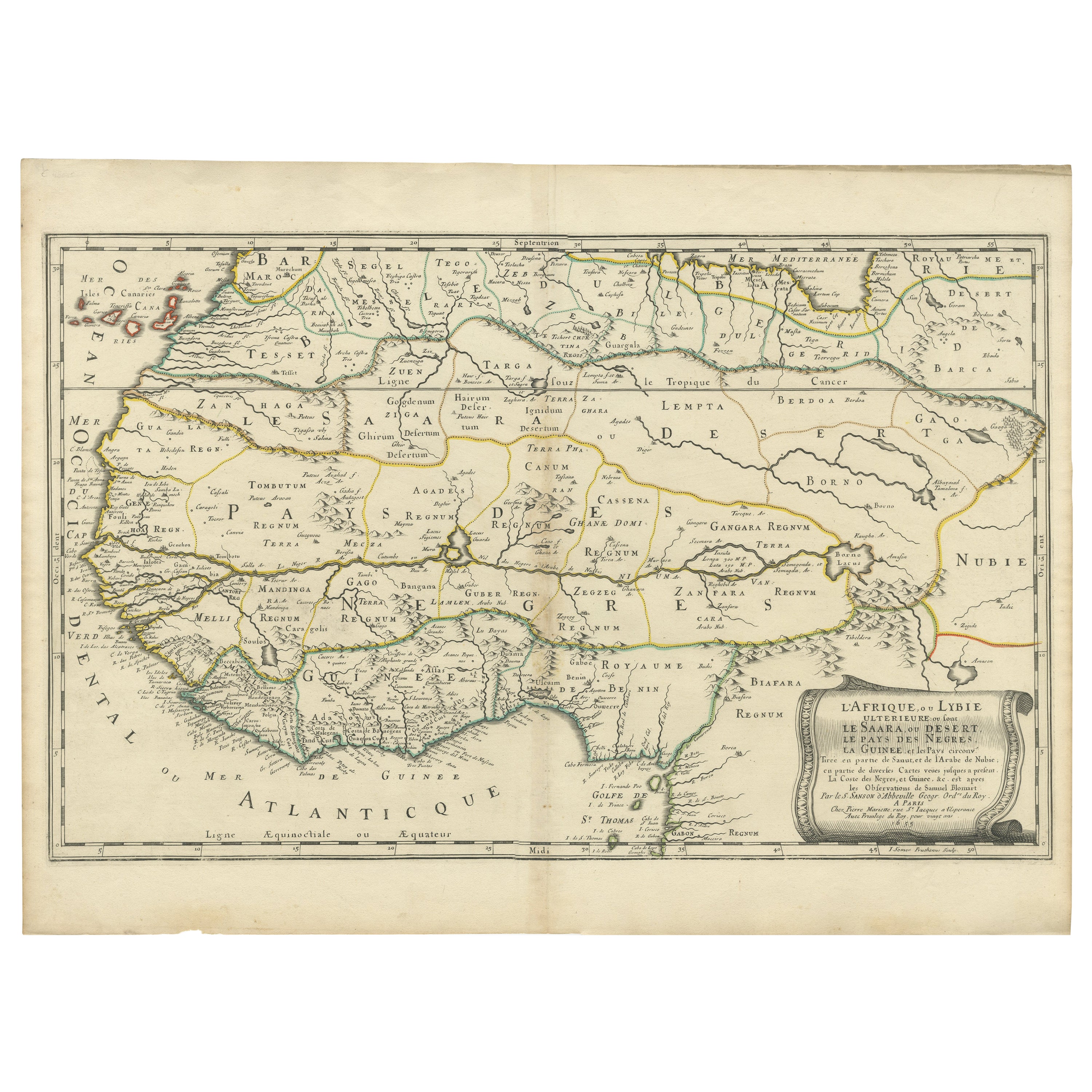
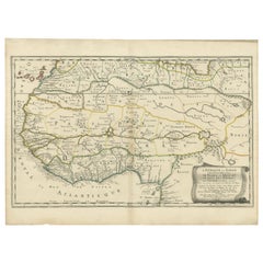
Attractive Antique Map of Western Africa with Lots of Details on the Coast, 1655
Located in Langweer, NL
Title: "L'Afrique, ou Lybie ulterieure ou sont le Saara, ou Desert, le pays des negres, la Guinee, et les Pays circonv. Tirée en partie de Sanut, et de l'Arabe de Nubie; en partie de diverses Cartes veües jusques a present".
Handsome map of Western Africa filled with information, much of it spurious, in the Sahara Desert, the Niger River and the coast of Guinea. Of particular interest are several incomplete rivers in the desert regions that appear and then disappear. The map is beautifully engraved with a title cartouche fashioned in the form of an oriental carpet.
The map shows a fantastic level of detail near the coastlines, which extends into legend and Ptolemaic myth in the interior of the continent. Detail is particularly extensive in Guinea and the Gold and Ivory Coasts. The Niger River is traced to its Malian lakes. The Mediterranean is barely visible in the northern part of the map. This map incorporates the discoveries made by Samuel Blommaert, who was director of the Dutch West Indies Company, in addition to traveling extensively to Africa and settling the oldest land deed...
Category
Antique 1650s Maps
Materials
Paper
$621 Sale Price
20% Off
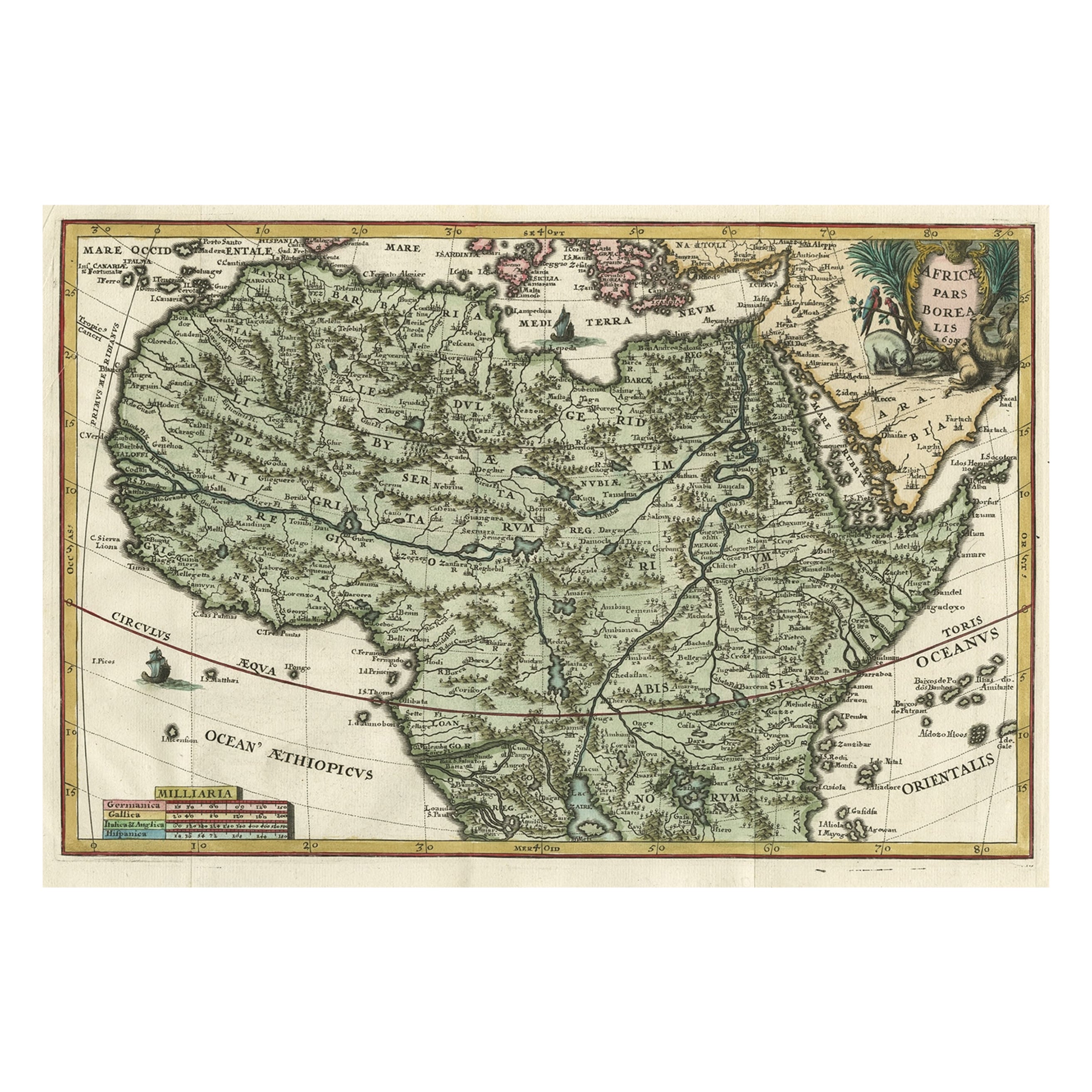
Very Decorative Rare Antique Map of the Northern Part of Africa, 1702
Located in Langweer, NL
Antique map titled 'Africae Pars Borealis.'
Very decorative antique map of the northern part of Africa by Heinrich Scherer. The map is full of the spurious geography of the perio...
Category
Antique Early 1700s German Maps
Materials
Paper

$828 Sale Price
30% Off
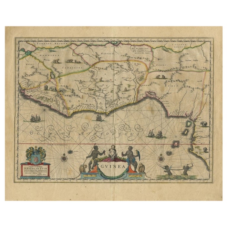
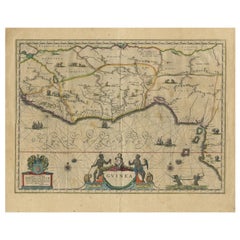
Antique Map of Guinea in West Africa by Blaeu, c.1638
Located in Langweer, NL
Antique map titled 'Guinea'.
Decorative map of West Africa, including numerous animals in the interior, sailing ships and several elegant cartouches. Both the map and the sea are s...
Category
Antique 17th Century Maps
Materials
Paper
$526 Sale Price
20% Off
You May Also Like
Large Original Antique Map of Africa. C.1900
Located in St Annes, Lancashire
Fabulous map of Africa
Original color.
Engraved and printed by the George F. Cram Company, Indianapolis.
Published, C.1900.
Unframed.
Free shipping.
Category
Antique 1890s American Maps
Materials
Paper

Original Antique Map of Africa by Dower, circa 1835
Located in St Annes, Lancashire
Nice map of Africa
Drawn and engraved by J.Dower
Published by Orr & Smith. C.1835
Unframed.
Free shipping
Category
Antique 1830s English Maps
Materials
Paper

Map Holy Land La Terre Sainte Engraved van Loon Published N de Fer 1703 French
Located in BUNGAY, SUFFOLK
La Terre Sainte, The Holy Land, Tiree Des Memoires De M.De.La Rue. Par N. de Fer. Geographe de Sa Majeste Catoliq et de Monseigneur le Dauphin. Avec Privil du Roi 1703
Detailed map of the Holy Land from Nicholas de Fer's L'Atlas Curieux ou le Monde. East is oriented at the top.
MAKER Nicolas de Fer 1646-1720
The French cartographer and engraver, Nicolas de Fer, was a master at creating maps that were works of art. The maps that he published were printed during the Baroque period when the decorative arts were characterized by ornate detail. De Fer’s detailed maps and atlases were valued more for their decorative content than their geographical accuracy.
Nicolas de Fer was born in 1646. His father, Antoine de Fer, owned a mapmaking firm. At the age of twelve, Nicolas was apprenticed to a Parisian engraver named Louis Spirinx. The family business was starting to decline when his father died in 1673. Nicolas de Fer’s mother, Genevieve, took over the business after the death of her husband. In 1687 the business was passed on to Nicolas and the profits increased after he took over the firm. Nicolas de Fer was a prolific cartographer who produced atlases and hundreds of single maps. He eventually became the official geographer to King Louis XIV of France and King Philip V...
Category
Antique Early 1700s French Louis XIV Maps
Materials
Paper

Africa. North-West Part. Century Atlas antique vintage map
Located in Melbourne, Victoria
'The Century Atlas. Africa. Southern Part'
Original antique map, 1903.
Central fold as issued. Map name and number printed on the reverse corners.
Sheet 40cm by 29.5cm.
Category
Early 20th Century Victorian More Prints
Materials
Lithograph

West Africa: 18th Century Hand-colored Homann Map Entitled "Guinea Propria"
By Johann Baptist Homann
Located in Alamo, CA
This is a scarce richly hand colored copper plate engraved map of Africa entitled "Guinea Propria, nec non Nigritiae vel Terrae Nigrorum Maxima Pars" by Johann Baptist Homann (1664-1...
Category
1740s Other Art Style Prints and Multiples
Materials
Engraving

Africa. Central. Century Atlas antique vintage map
Located in Melbourne, Victoria
'The Century Atlas. Africa. Central'
Inset map of 'Madagascar'.
Original antique map, 1903.
Central fold as issued. Map name and number printed on the reverse corners.
Sheet 29.5cm...
Category
Early 20th Century Victorian More Prints
Materials
Lithograph

More Ways To Browse
Cambodia Antique Map
Charles Hutchinson
Coronelli Globe
Denoyer Geppert Anatomy
E Fletcher
Framed Africa Maps
Gabon Antique Map
Hudson River Map
Mauritius Antique Map
Nova Hollandia
Used Furniture Cleveland Ohio
Vintage Bartholomew Maps
1820 World Map
Aden Yemen
Antique Map New Orleans
Dakota Johnson
French School Map
Miliens S