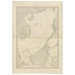
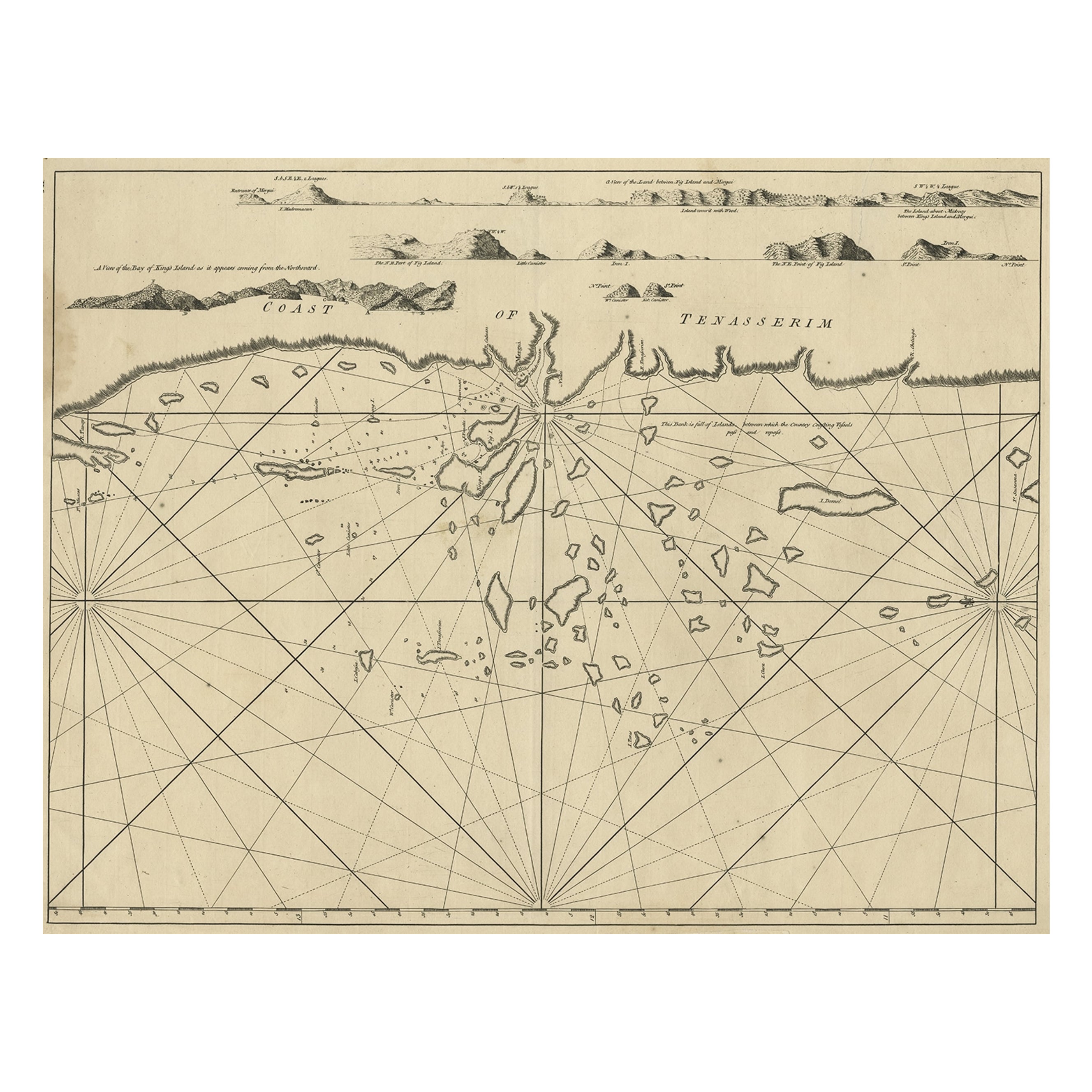
Antique Sea Chart of the South China Sea by Daussy, 1838
View Similar Items


Want more images or videos?
Request additional images or videos from the seller
1 of 5
Antique Sea Chart of the South China Sea by Daussy, 1838
About the Item
- Dimensions:Height: 40.56 in (103 cm)Width: 27.96 in (71 cm)Depth: 0.02 in (0.5 mm)
- Materials and Techniques:
- Period:
- Date of Manufacture:1838
- Condition:Wear consistent with age and use. Minor spotting. Some surface dirt and brown ink annotations. Some handling creases and tears in the margins. Please study images carefully.
- Seller Location:Langweer, NL
- Reference Number:Seller: BG-120531stDibs: LU3054316323482
About the Seller
5.0
Recognized Seller
These prestigious sellers are industry leaders and represent the highest echelon for item quality and design.
Platinum Seller
Premium sellers with a 4.7+ rating and 24-hour response times
Established in 2009
1stDibs seller since 2017
2,434 sales on 1stDibs
Typical response time: 1 hour
Authenticity Guarantee
In the unlikely event there’s an issue with an item’s authenticity, contact us within 1 year for a full refund. DetailsMoney-Back Guarantee
If your item is not as described, is damaged in transit, or does not arrive, contact us within 7 days for a full refund. Details24-Hour Cancellation
You have a 24-hour grace period in which to reconsider your purchase, with no questions asked.Vetted Professional Sellers
Our world-class sellers must adhere to strict standards for service and quality, maintaining the integrity of our listings.Price-Match Guarantee
If you find that a seller listed the same item for a lower price elsewhere, we’ll match it.Trusted Global Delivery
Our best-in-class carrier network provides specialized shipping options worldwide, including custom delivery.More From This Seller
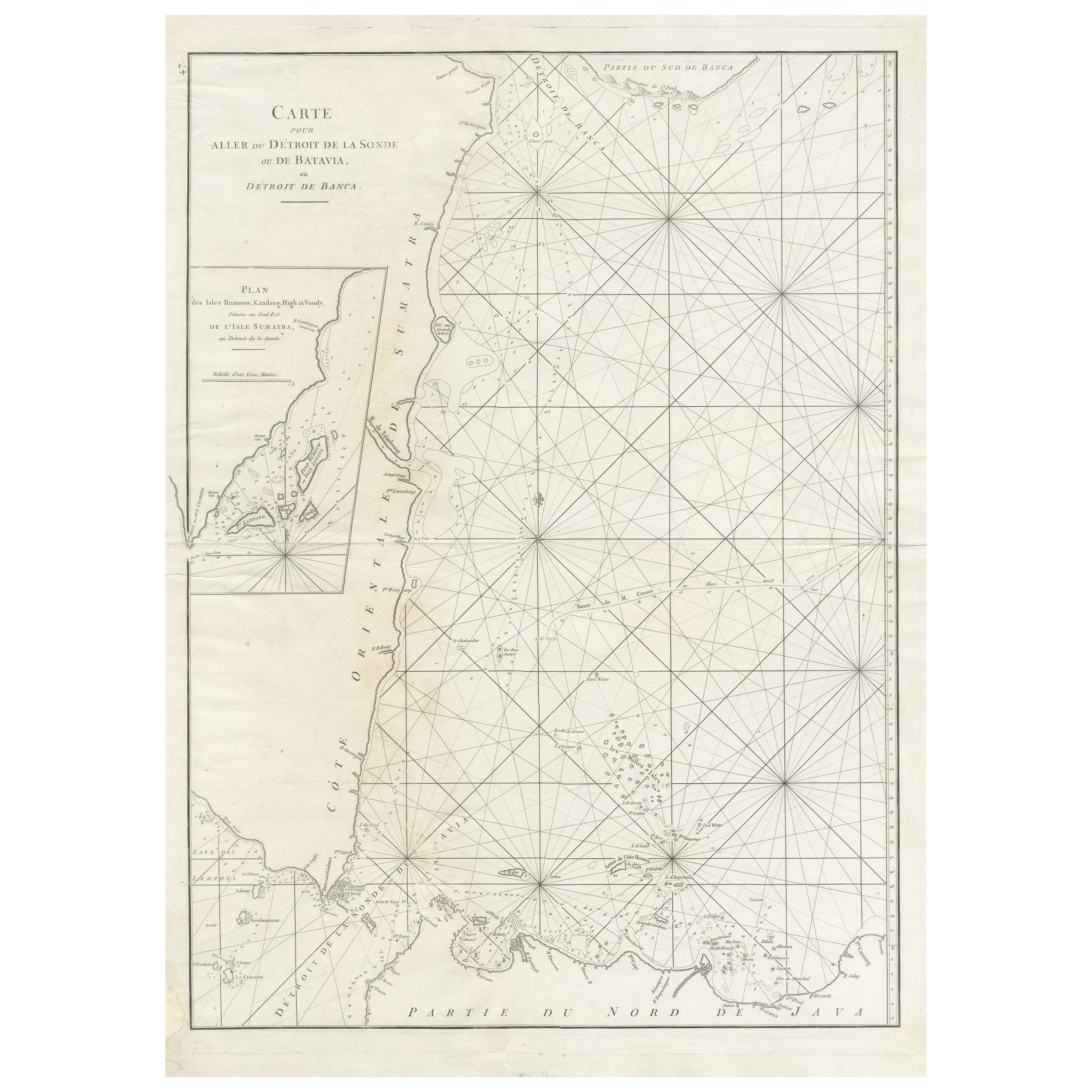
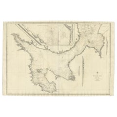
View AllLarge Antique Sea Chart of the South-Eastern Coast of Sumatra, Indonesia
Located in Langweer, NL
Antique map titled 'Carte pour aller du Détroit de la Sonde ou de Batavia, au Détroit de Banca'. This uncommon sea chart shows northern Java and eastern Sumatra along with an inset of the small islands in the Detroit Sound. The handsome chart provides detailed navigational information, including the route of Julien Crozet in April 1772, who led a French expedition to the South Pacific after the voyage's commander, Marion De Fresne, and 26 crew members were killed (and allegedly eaten) by a Maori tribe in the Bay of Islands off the coast of New Zealand. With title upper left corner and small inset map of the small isles nearby the south-eastern coast of Sumatra.
J. B. d'Apres de Mannevillette, from his atlas "Neptune orientale". French sailor...
Category
Antique Late 18th Century Maps
Materials
Paper
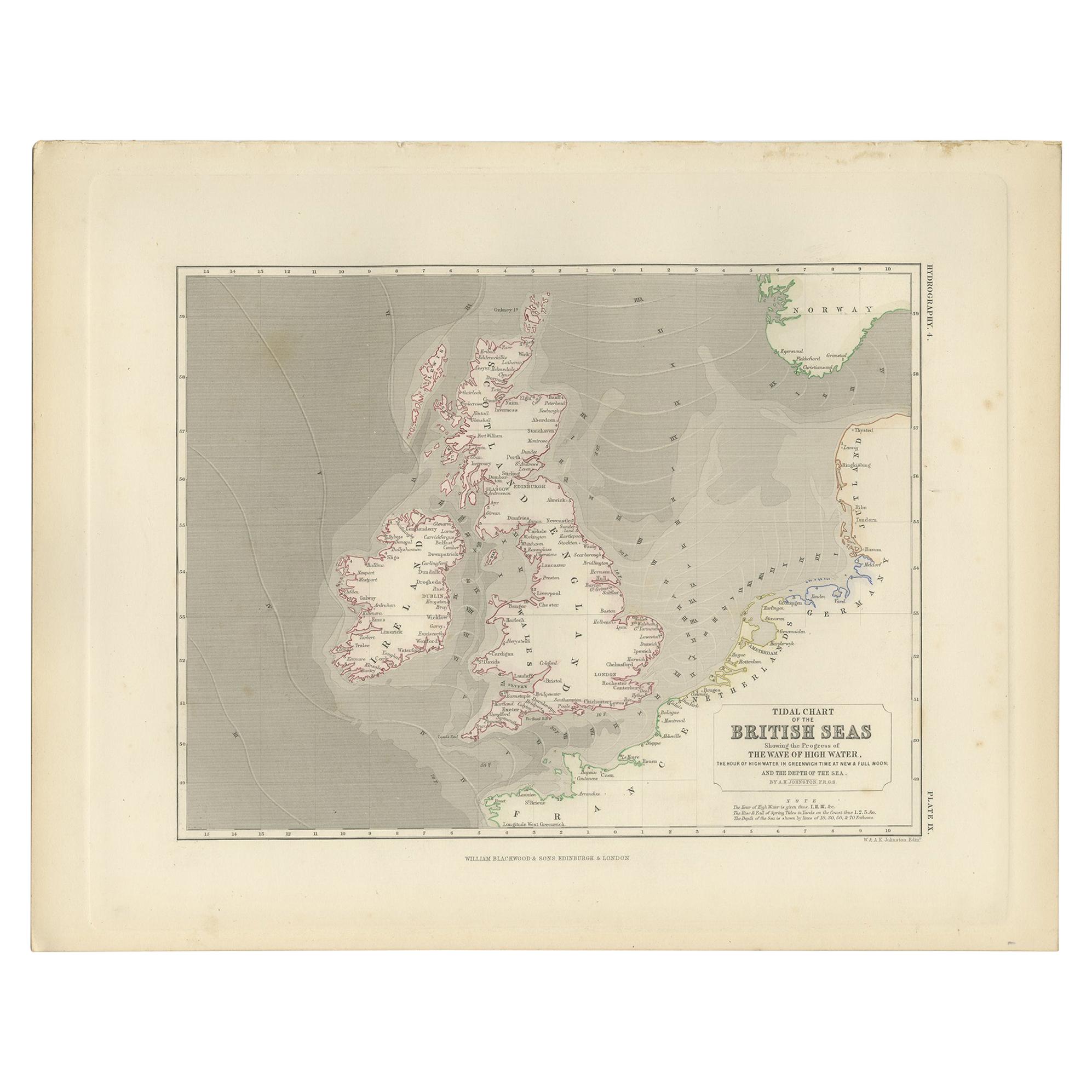
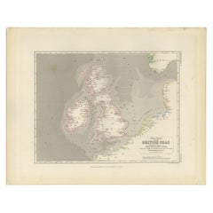
Antique Tidal Chart of the British Seas by Johnston, '1850'
Located in Langweer, NL
Antique map titled 'Tidal Chart of the British Seas showing the progress of the wave of high water'. Original antique tidal chart of the British Seas. This map originates from 'The P...
Category
Antique Mid-19th Century Maps
Materials
Paper
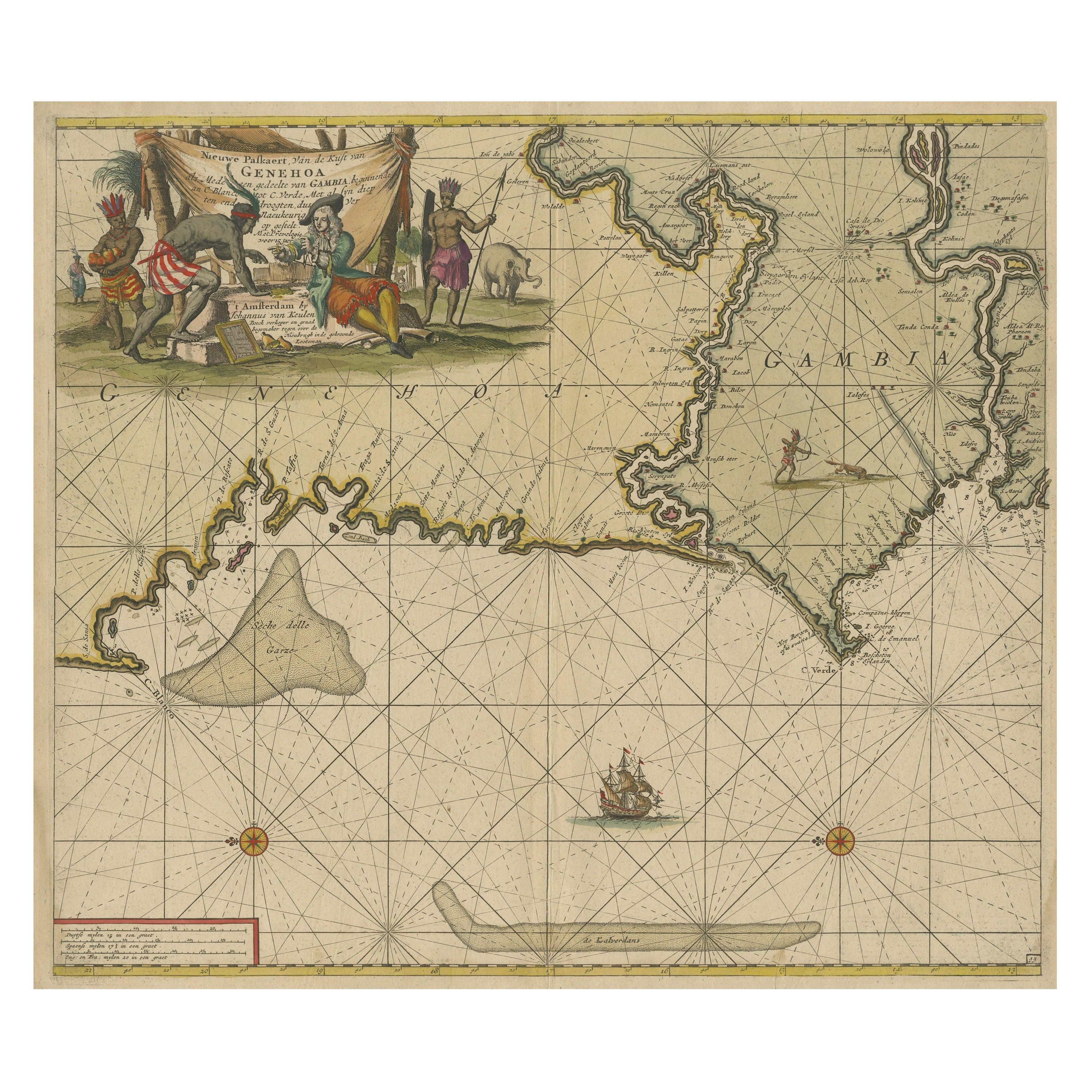
Antique Sea Chart of the Western Coast of Africa
Located in Langweer, NL
Antique map titled 'Nieuwe Paskaert van de Kust van Genehoa (..)'. This attractive sea chart covers the western coast of Africa from Cape Blanco (Ras Nouadhibou) to Cape Verde (Dakar...
Category
Antique Late 17th Century Maps
Materials
Paper
$821 Sale Price
20% Off
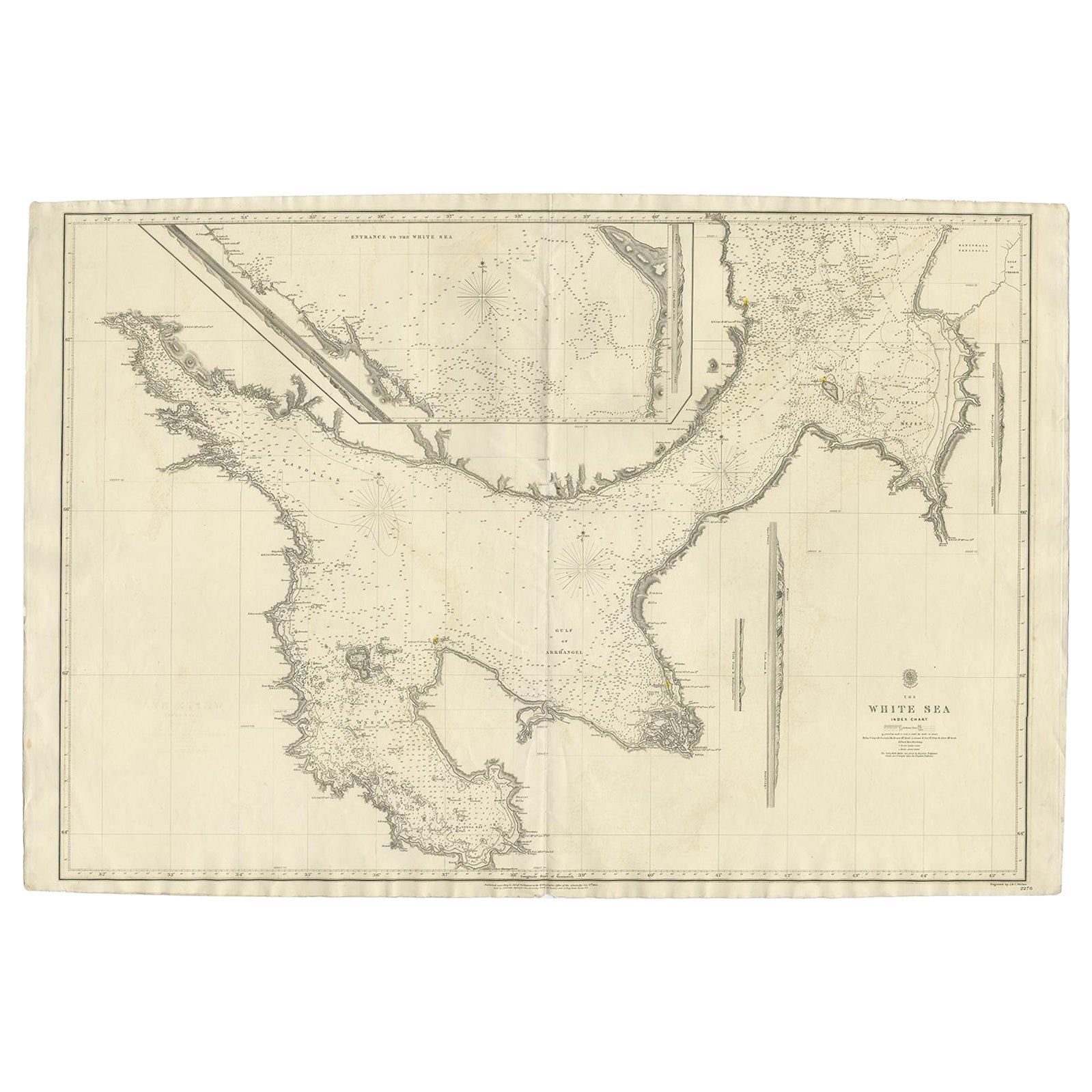
Large Antique Chart of The White Sea, Russa 1854
Located in Langweer, NL
Antique map titled 'The White Sea Index Chart'. Large uncommon map of the White Sea with a smaller inset map of the entrance to the White Sea. The white sea is a southern inlet of th...
Category
Antique 19th Century Maps
Materials
Paper
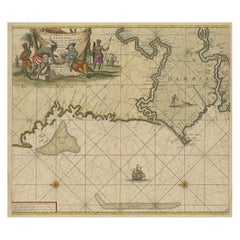
Antique Sea Chart of the Shetland Islands, Scotland, ca.1745
Located in Langweer, NL
Antique map of Scotland titled 'Nieuwe Paskaard van Hitland met de daar omleggende eylanden na de nieuwe aftekening gemaakt by den Lofwaarden en onvermoeyden Hit en Zeeman Ian Bruyst...
Category
Antique 1740s Maps
Materials
Paper

$1,153 Sale Price
20% Off
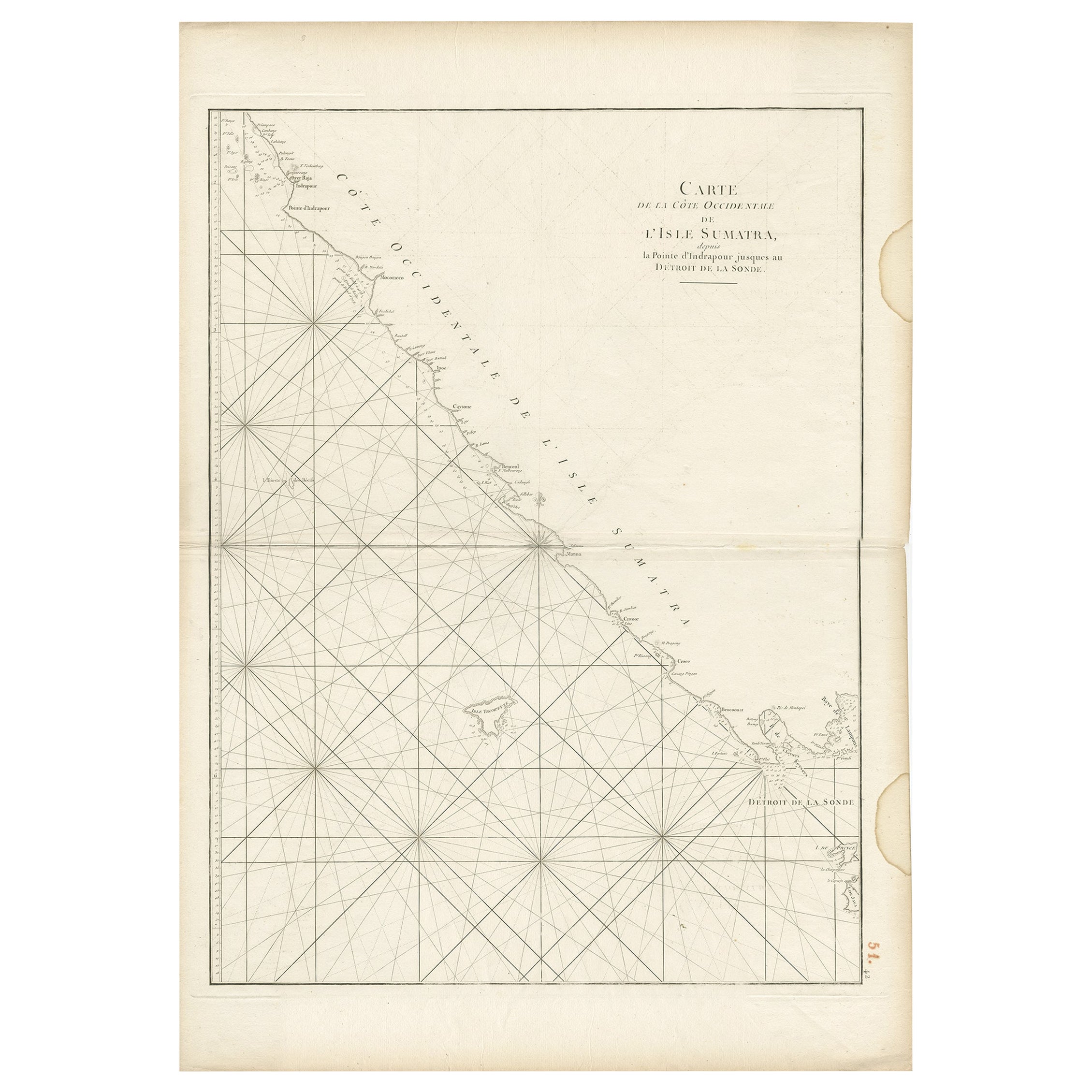
Antique Sea Chart of the Coast of Sumatra, Indonesia, circa 1775
Located in Langweer, NL
Antique map titled 'Carte de la Côte Occidentale de l'Isle Sumatra'. Sea chart of the part of the south-western coast of Sumatra with the Nassau (Nias) and Fortune isles.
Artists ...
Category
Antique 18th Century Maps
Materials
Paper
You May Also Like
1889 Sea Chart Map of Delaware Bay by George Eldridge, Chart No. 11
Located in Colorado Springs, CO
Presented is an original Eldridge's Chart No. 11, Delaware Bay and River, from The United States Coast and George Eldridge's Surveys, published in 1889. The sea chart shows the Delaw...
Category
Antique 1880s Maps
Materials
Paper
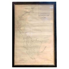
Chart of the Harbour of Liverpool
Located in Cheshire, GB
PL Burdett A Chart of the Harbour of Liverpool hand coloured. Encased in an ebonised frame.
Dimensions
Height 23.5 Inches
Width 28 Inches
Depth 1 Inches
Category
Early 20th Century British Maps
Materials
Paper

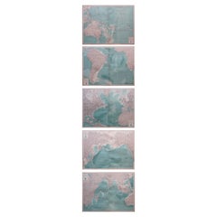
Set of 5 Large Original Vintage Sea Charts, circa 1920
Located in St Annes, Lancashire
5 great maps or charts of the oceans
I particularly like the color of these maps
Unframed
Original color
By John Bartholomew and Co. Edinburgh Geographical Institute
Published, ...
Category
Vintage 1920s British Maps
Materials
Paper
1865 Chart of the Islands of Madeira
Located in Norwell, MA
Rare James Imray chart from 1865 titled "Chart of the Islands of Madeira, Porto Santo and Dezerea" drawn from the survey made by Captain Ate Vidal Royal Navy, London. Published by Ja...
Category
Antique 1860s European Maps
Materials
Paper

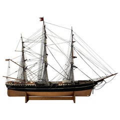
Antique Ships Model "Sovereign of the Seas"
Located in Norwell, MA
Antique ship model of the Donald Mc Kay Clipper Ship "Sovereign of the Seas". Awesome scale model by noted early twentieth century model maker Th...
Category
Vintage 1930s American Models and Miniatures
Materials
Wood
Antique Anatomical Wall Chart Depicting the Human Skeleton
Located in Berghuelen, DE
A rare 19th century anatomical wall chart depicting the human skeleton. On the sides On the sides are detailed description in German language. The wall...
Category
Early 20th Century German Victorian Prints
Materials
Paper

Recently Viewed
View AllMore Ways To Browse
Singapore Antique
Philippines Map
Antique Map Of The Philippines
Taiwan Antique
Antique Maps Singapore
Taiwan Antique Map
Taiwan Map
Antique Map Vietnam
Antique Map Of Venice
Antique Maps Of Canada
Atlas Carrying World
Copper Soldiers
Virginia Map
Antique Maps New Zealand
Scottish Coat Of Arms
Antique Map Of Georgia
California Island Map
Indian Ocean Map