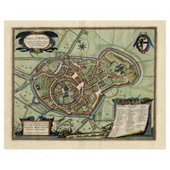
Items Similar to Bird's-Eye View of Blâmont in Lorraine by Braun and Hogenberg, 1597

Want more images or videos?
Request additional images or videos from the seller
1 of 10
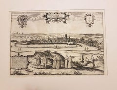
Bird's-Eye View of Blâmont in Lorraine by Braun and Hogenberg, 1597
$401.27
$573.2530% Off
£296.52
£423.6030% Off
€336
€48030% Off
CA$555.88
CA$794.1130% Off
A$607.60
A$867.9930% Off
CHF 320.01
CHF 457.1530% Off
MX$7,470.98
MX$10,672.8230% Off
NOK 3,999.19
NOK 5,713.1330% Off
SEK 3,762.45
SEK 5,374.9330% Off
DKK 2,558.62
DKK 3,655.1730% Off
About the Item
Title: Bird's-Eye View of Blâmont in Lorraine by Braun and Hogenberg, 1597
This copperplate engraving, published in 1597 by Braun and Hogenberg, depicts a bird's-eye view of the town of Blâmont in Lorraine, known as the "Pays de Vague." Drawn by Georg Hoefnagel, the scene highlights the charm and significance of this historical settlement. The cartouche identifies the location, and the commentary by Braun emphasizes the town’s importance due to its large medieval castle, a ducal palace, and its pious and hardworking population.
In the engraving, the 12th-century castle and ducal palace are prominent features. The surrounding countryside and village architecture are detailed with artistic finesse, providing insight into the region’s historical layout. Blâmont’s rich history, including its tenure under the Salm family and the devastation it suffered during the Thirty Years’ War, adds depth to this evocative scene. The engraving showcases Blâmont prior to its destruction by French troops under Richelieu and Louis XIII.
- Cartographers: Georg Braun and Frans Hogenberg
- Artist: Georg Hoefnagel
- Title: Blâmont in Lorraine's Pays de Vague
- Source: *Civitates Orbis Terrarum*
- Date of First Edition: 1575
- Date of This Map: 1597
- Description: Bird’s-eye view of Blâmont, highlighting the castle, ducal palace, and surrounding town. Richly detailed, this engraving captures the historical essence of the town before its destruction during the Thirty Years’ War.
- Technique: Copper engraving
- Condition: Strong impression on aged paper. Vertical centerfold, as issued. Margins show slight toning and minor spotting. No tears or repairs. A tiny hole in the fold. Overall, in excellent condition for a 16th-century engraving.
- Significance: An exceptional piece from *Civitates Orbis Terrarum*, the first comprehensive atlas of city views, blending topographical accuracy with artistic presentation.
- Dimensions:Height: 15.75 in (40 cm)Width: 21.66 in (55 cm)Depth: 0.01 in (0.2 mm)
- Materials and Techniques:Paper,Engraved
- Period:
- Date of Manufacture:1597
- Condition:Good condition: Strong impression with sharp details. Light age-toning and minor handling wear on the edges. No tears or significant staining, with clean margins. A tiny hole in the fold. Overall, in excellent condition for a late 16th-century print.
- Seller Location:Langweer, NL
- Reference Number:Seller: BG-13892-51stDibs: LU3054342438792
About the Seller
5.0
Recognized Seller
These prestigious sellers are industry leaders and represent the highest echelon for item quality and design.
Platinum Seller
Premium sellers with a 4.7+ rating and 24-hour response times
Established in 2009
1stDibs seller since 2017
2,620 sales on 1stDibs
Typical response time: <1 hour
- ShippingRetrieving quote...Shipping from: Langweer, Netherlands
- Return Policy
Authenticity Guarantee
In the unlikely event there’s an issue with an item’s authenticity, contact us within 1 year for a full refund. DetailsMoney-Back Guarantee
If your item is not as described, is damaged in transit, or does not arrive, contact us within 7 days for a full refund. Details24-Hour Cancellation
You have a 24-hour grace period in which to reconsider your purchase, with no questions asked.Vetted Professional Sellers
Our world-class sellers must adhere to strict standards for service and quality, maintaining the integrity of our listings.Price-Match Guarantee
If you find that a seller listed the same item for a lower price elsewhere, we’ll match it.Trusted Global Delivery
Our best-in-class carrier network provides specialized shipping options worldwide, including custom delivery.More From This Seller
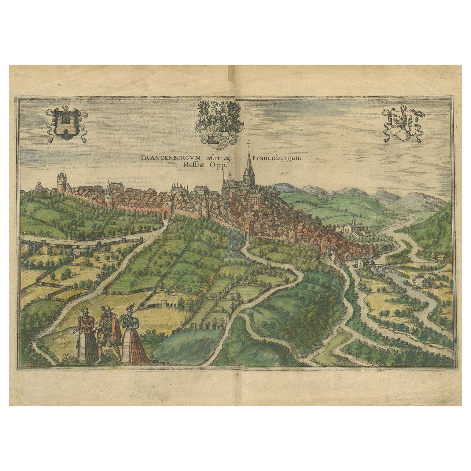
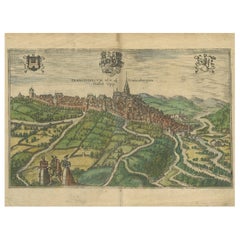
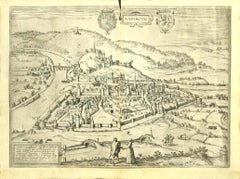
View AllView of Frankenberg: Braun & Hogenberg's Historic Bird's-Eye Map, 1599
Located in Langweer, NL
The antique print titled 'Francenbergum, vel ut alij Francoburgum Hassiae Opp', published by Braun & Hogenberg around 1599, is a remarkable historical ...
Category
Antique 16th Century Prints
Materials
Paper
$479 Sale Price
20% Off
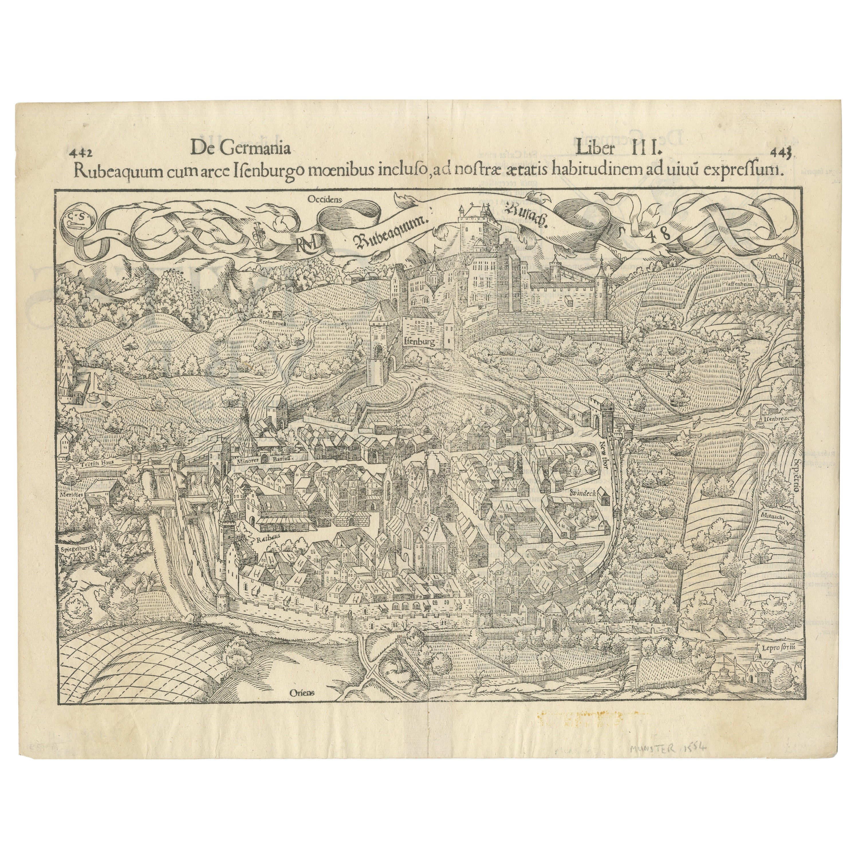
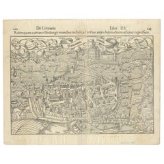
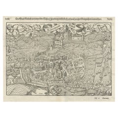
Early Woodcut Bird's Eye View of Rouffach, France, by Sebastian Münster, 1554
Located in Langweer, NL
Early Woodcut Bird's Eye View of Rouffach, France, by Sebastian Münster, 1554
Description: This rare 1554 woodcut is a bird's eye view of Rouffach, a town in the Haut-Rhin departmen...
Category
Antique 16th Century Maps
Materials
Paper
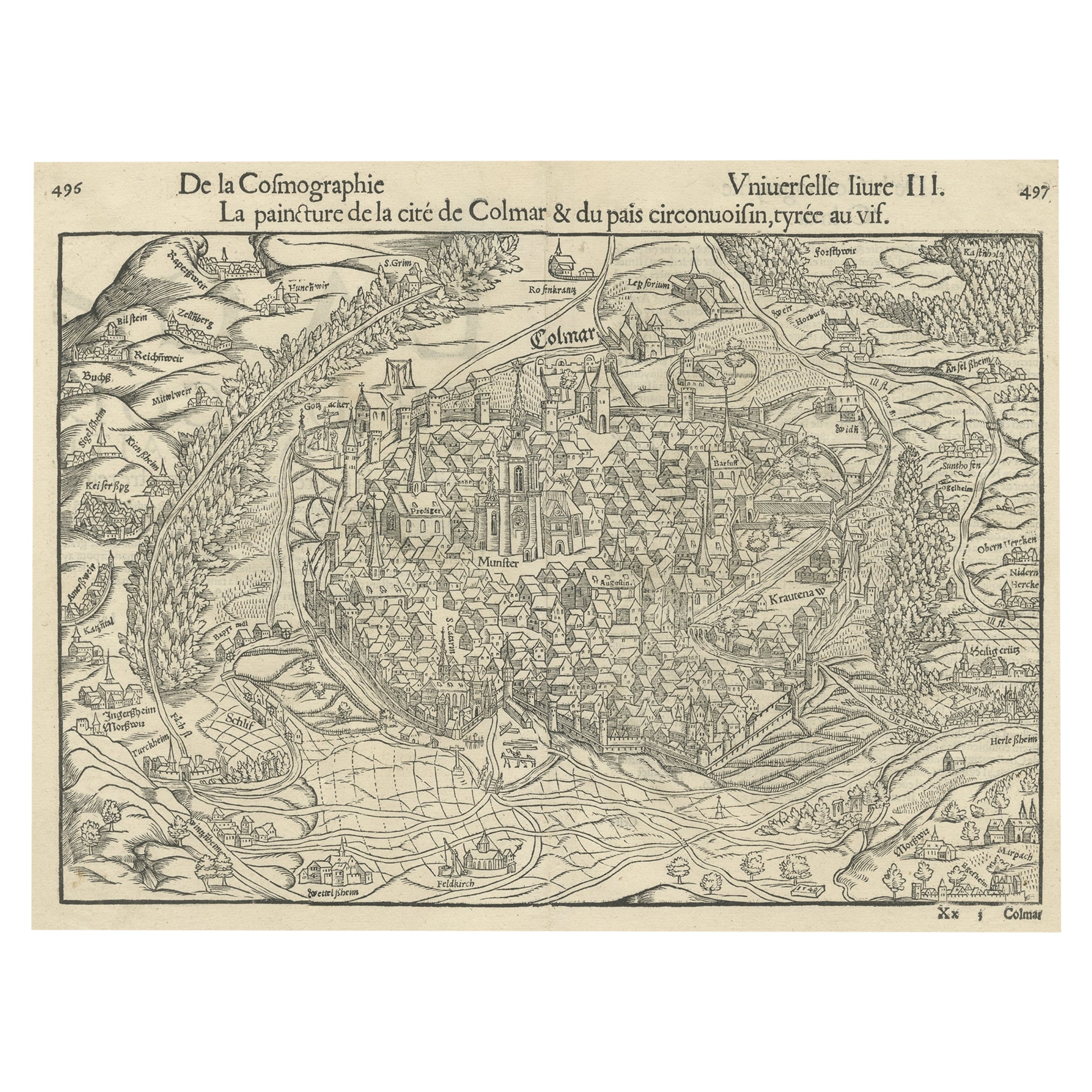
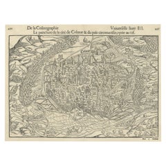
Original Antique Bird's-Eye View of Colmar, Alsace, France, 1552
Located in Langweer, NL
Antique map titled 'La Paincture de la cité de Colmar & du pais circonuoisin'.
Original antique bird's-eye view of Colmar, Alsace, France. This map originates from 'La Cosmograph...
Category
Antique 16th Century Maps
Materials
Paper
$630 Sale Price
20% Off
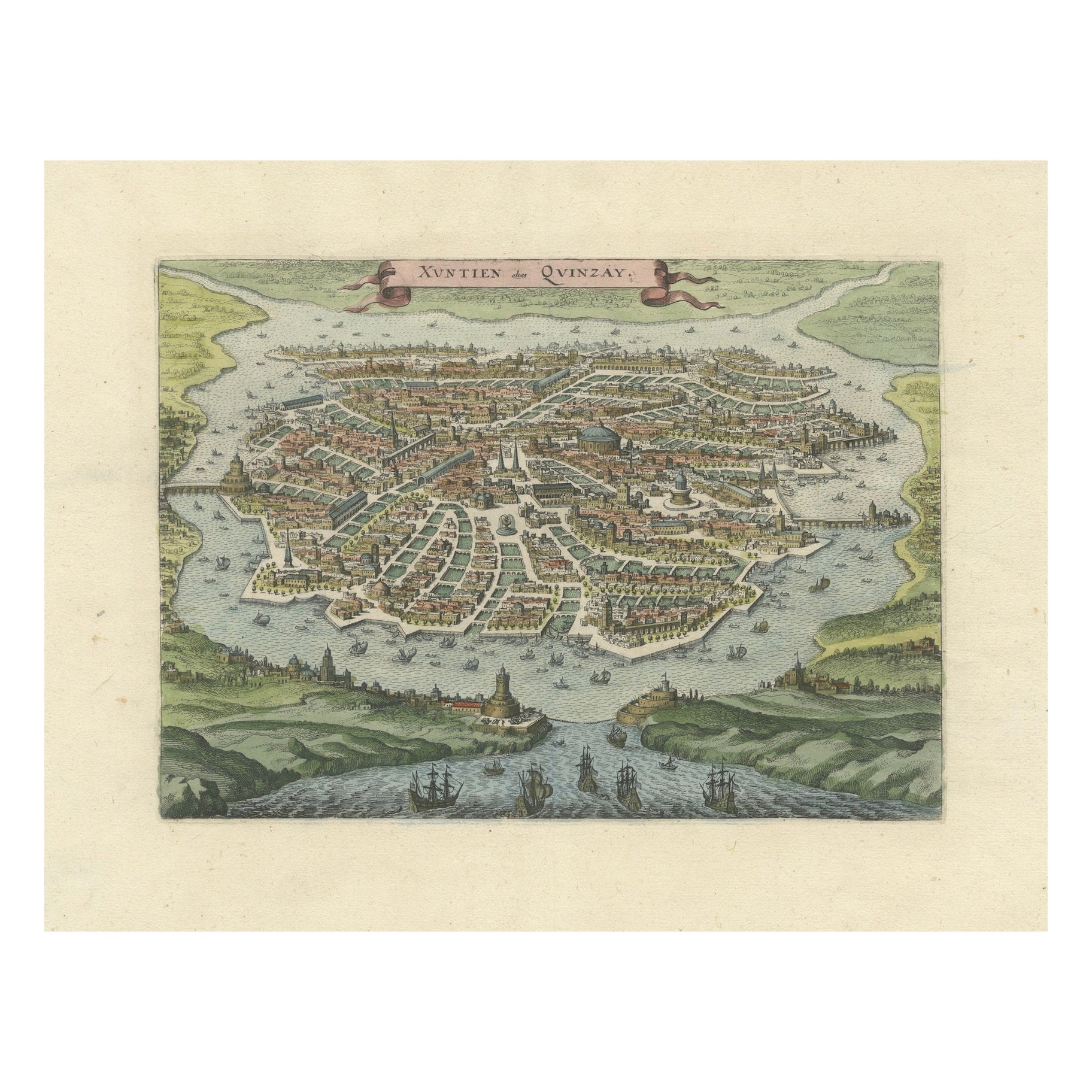
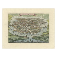
Antique Bird's-Eye View of Hangzhou (China) by Matthäus Merian, 1638
Located in Langweer, NL
This is an exquisite antique bird's-eye view map of Hangzhou, historically referred to as "Xuntien or Quinzay," from the first edition of Matthäus Merian's publication in 1638. This ...
Category
Antique 1630s Maps
Materials
Paper
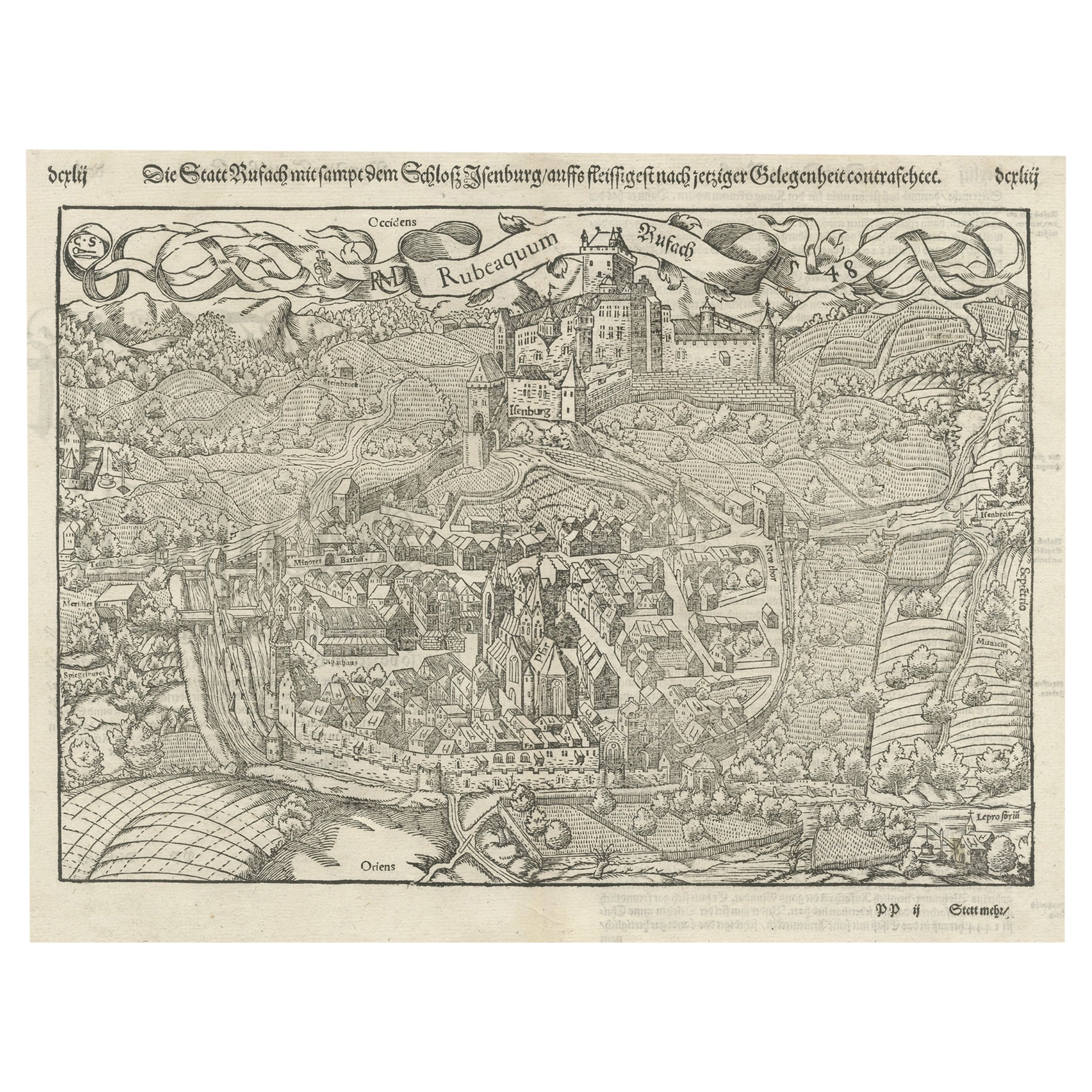
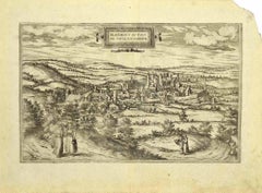
Original Antique Plan of Rouffach, France, with Chateau d'Isenbourgh, 1588
Located in Langweer, NL
Antique map titled 'Die Statt Rufach mit sampt dem Schloss Isenburg (..)'.
Original antique bird's-eye view plan of Rouffach, France, with Chateau d'Isenbourg. This map originate...
Category
Antique 16th Century Maps
Materials
Paper
$458 Sale Price
20% Off
Original Old Bird's-Eye View Plan of Sint-Winoksbergen or Bergen in France, 1649
Located in Langweer, NL
Antique map titled 'Berga Sti Winoci.' - Bird's-eye view plan of Sint-Winoksbergen in France, with key to locations and coats of arms. Text in Dutch on verso. This plan originates from the famous city Atlas: 'Toneel der Steeden' published by Joan Blaeu...
Category
Antique 1640s Maps
Materials
Paper
$1,385 Sale Price
20% Off
You May Also Like
View of Blanmont - Etching by G. Braun and F. Hogenberg - Late 16th Century
By Franz Hogenberg
Located in Roma, IT
This map of Blanmont is an original etching realized by George Braun and Franz Hogenberg as part of the famous Series "Civitates Orbis Terrarum".
The “Civitates Orbis Terrarum” (At...
Category
16th Century Figurative Prints
Materials
Etching
17th Century Topographical Map, Champagne-Ardenne, Marsal, Maubert Iohan Peeters
Located in New York, NY
Fine topographical 17th century map by Iohan Peeters of Marsal and Maubert Fontaine in the Champagne-Ardennes Region of North Eastern France.
Fabulous period engraving for a Wine Ce...
Category
Antique 17th Century Dutch Maps
Materials
Paper

Danzig, Antique Map from "Civitates Orbis Terrarum" - 1572-1617
By Franz Hogenberg
Located in Roma, IT
Braun G., Hogenberg F., Dantziat, from the collection Civitates Orbis Terrarum, Cologne, T. Graminaeus, 1572-1617.
Image dimensions: cm 32.8 x 47.9; dimensions: cm 42 x 55.3; passep...
Category
16th Century Landscape Prints
Materials
Etching
17th Century Topographical Map of Cote D'azur, Avignon, Frejus by Iohan Peeters
Located in New York, NY
Fine topographical 17th century map by Iohan Peeters of the towns of Avignon and Frejus in the Cote d'Azur-Provence-Alpes Region of Southeastern France.
Beautifully suited decorativ...
Category
Antique 17th Century Dutch Maps
Materials
Paper

1640 Joan Bleau Map Entitled"Diocecese de rheims et le pais de rethel, " Eic.a011
Located in Norton, MA
1640 Joan Bleau map entitled
"Diocecese de rheims et le pais de rethel,"
Ric.a011
OAN BLAEU
Diocecese de Rheims, et le pais de Rethel.
Handcolored engraving, c.1640.
...
Category
Antique 17th Century Dutch Maps
Materials
Paper

View of Namur (Belgium) - Etching by G. Braun and F. Hogenberg - Late 1500
By Franz Hogenberg
Located in Roma, IT
This View of Namvrcvm (the ancient city of Namur, Belgium) is an original etching realized by George Braun and Franz Hogenberg, as part of the famous Series "Civitates Orbis Terrarum...
Category
16th Century Figurative Prints
Materials
Etching
More Ways To Browse
Medieval Castle
Vintage Scandinavian Armchairs
1970 Italian Armchair
Chrome Glass Coffee Tables
Environment Furniture
China Silk Rug
Early English Silver
Antique Walnut Bar
Ceramic 1960s Italy
Italian Carved Dining Set
Antique Silver Basket
Black Crystal Glasses
Baker Furniture By
Oak Library
T Chair
Antique Italian Chairs
Antique Victorian Dining Tables
Veneer Dining Tables